<< Our Photo Pages >> Vértesszőlősi Kő - Modern Stone Circle etc in Hungary
Submitted by Izozo on Tuesday, 02 April 2024 Page Views: 61
Modern SitesSite Name: Vértesszőlősi Kő Alternative Name: Vértesszőlős MenhirCountry: Hungary
NOTE: This site is 24.002 km away from the location you searched for.
Type: Modern Stone Circle etc
Nearest Town: Vértesszőlős Nearest Village: Vértesszőlős
Latitude: 47.623361N Longitude: 18.383896E
Condition:
| 5 | Perfect |
| 4 | Almost Perfect |
| 3 | Reasonable but with some damage |
| 2 | Ruined but still recognisable as an ancient site |
| 1 | Pretty much destroyed, possibly visible as crop marks |
| 0 | No data. |
| -1 | Completely destroyed |
| 5 | Superb |
| 4 | Good |
| 3 | Ordinary |
| 2 | Not Good |
| 1 | Awful |
| 0 | No data. |
| 5 | Can be driven to, probably with disabled access |
| 4 | Short walk on a footpath |
| 3 | Requiring a bit more of a walk |
| 2 | A long walk |
| 1 | In the middle of nowhere, a nightmare to find |
| 0 | No data. |
| 5 | co-ordinates taken by GPS or official recorded co-ordinates |
| 4 | co-ordinates scaled from a detailed map |
| 3 | co-ordinates scaled from a bad map |
| 2 | co-ordinates of the nearest village |
| 1 | co-ordinates of the nearest town |
| 0 | no data |
Internal Links:
External Links:
")
Modern Stone
You may be viewing yesterday's version of this page. To see the most up to date information please register for a free account.
Do not use the above information on other web sites or publications without permission of the contributor.
Nearby Images from Flickr
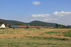
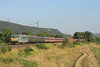
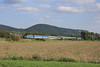
The above images may not be of the site on this page, but were taken nearby. They are loaded from Flickr so please click on them for image credits.
Click here to see more info for this site
Nearby sites
Click here to view sites on an interactive map of the areaKey: Red: member's photo, Blue: 3rd party photo, Yellow: other image, Green: no photo - please go there and take one, Grey: site destroyed
Download sites to:
KML (Google Earth)
GPX (GPS waypoints)
CSV (Garmin/Navman)
CSV (Excel)
To unlock full downloads you need to sign up as a Contributory Member. Otherwise downloads are limited to 50 sites.
Turn off the page maps and other distractions
Nearby sites listing. In the following links * = Image available
5.4km WNW 303° Tatai Kő* Modern Stone Circle etc
50.3km E 97° Aquincumi Museum Museum
51.1km NNW 345° Nitriansky Hrádok Ancient Village or Settlement
52.6km SE 127° Százhalombatta Tell* Ancient Village or Settlement
52.6km SE 127° Százhalombatta Barrow Barrow Cemetery
59.4km S 177° Gorsium Ancient Village or Settlement
86.0km SSE 155° Baracs-Földvar Tell Ancient Village or Settlement
87.0km SSE 150° Dunaujvaros-Koziderpadlas Tell Ancient Village or Settlement
99.9km NNE 21° Štiavnické Menhiry* Standing Stone (Menhir)
103.9km WNW 298° Gerulata Ancient Village or Settlement
105.5km SSE 155° Bölcske-Vörösgyuru Tell Ancient Village or Settlement
116.9km NNE 27° Pusty Hrad* Ancient Village or Settlement
120.2km WNW 302° Villa Rustica Bratislava Dubravka Ancient Village or Settlement
120.5km E 91° Jaszdozsa-Kapolnahalom Tell Ancient Village or Settlement
120.9km ESE 121° Nagykőrös-Földvar Tell Ancient Village or Settlement
121.2km NW 307° Stupavsky hrad* Hillfort
134.1km WNW 284° Donnerskirchen Tumulus* Round Barrow(s)
143.7km N 350° Roman inscription in Trenčín* Carving
144.4km NW 308° Stillfried Zentrum der Urzeit* Museum
144.7km ESE 114° Tószeg-Laposhalom Tell Ancient Village or Settlement
147.4km WSW 258° Hat Rock (Kalapos-kő)* Rock Outcrop
151.0km SSE 158° Érsekhalmi Földvár* Artificial Mound
151.4km NNW 336° Javorníky Menhir Standing Stone (Menhir)
151.5km W 271° Keltenwall Schwarzenbach Hillfort
151.5km W 271° Keltendorf Schwarzenbach Museum
View more nearby sites and additional images


 We would like to know more about this location. Please feel free to add a brief description and any relevant information in your own language.
 Wir möchten mehr über diese Stätte erfahren. Bitte zögern Sie nicht, eine kurze Beschreibung und relevante Informationen in Deutsch hinzuzufügen.
 Nous aimerions en savoir encore un peu sur les lieux. S'il vous plaît n'hesitez pas à ajouter une courte description et tous les renseignements pertinents dans votre propre langue.
 Quisieramos informarnos un poco más de las lugares. No dude en añadir una breve descripción y otros datos relevantes en su propio idioma.