<< Text Pages >> Heidelberg Hut - Ancient Village or Settlement in Switzerland in Graubünden
Submitted by Andy B on Sunday, 27 September 2009 Page Views: 4714
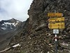
DigsSite Name: Heidelberg HutCountry: Switzerland
NOTE: This site is 25.762 km away from the location you searched for.
Canton: Graubünden Type: Ancient Village or Settlement
Nearest Town: Davos Nearest Village: Sent
Latitude: 46.885540N Longitude: 10.290070E
Condition:
| 5 | Perfect |
| 4 | Almost Perfect |
| 3 | Reasonable but with some damage |
| 2 | Ruined but still recognisable as an ancient site |
| 1 | Pretty much destroyed, possibly visible as crop marks |
| 0 | No data. |
| -1 | Completely destroyed |
| 5 | Superb |
| 4 | Good |
| 3 | Ordinary |
| 2 | Not Good |
| 1 | Awful |
| 0 | No data. |
| 5 | Can be driven to, probably with disabled access |
| 4 | Short walk on a footpath |
| 3 | Requiring a bit more of a walk |
| 2 | A long walk |
| 1 | In the middle of nowhere, a nightmare to find |
| 0 | No data. |
| 5 | co-ordinates taken by GPS or official recorded co-ordinates |
| 4 | co-ordinates scaled from a detailed map |
| 3 | co-ordinates scaled from a bad map |
| 2 | co-ordinates of the nearest village |
| 1 | co-ordinates of the nearest town |
| 0 | no data |
Be the first person to rate this site - see the 'Contribute!' box in the right hand menu.
Internal Links:
External Links:
Ancient Hut in Switzerland. Archaeologists in a remote region of Switzerland have excavated the ruins of the oldest hut in the Alps, a prehistoric discovery that dates back nearly 3,000 years.
The find in the Silvretta mountains near the Austrian border gives scientists the oldest architectural proof that early Iron Age shepherds spent summers living among the rich alpine grasses, tending to herds and using milk to make cheese, in a way much like farmers today.
"It is perhaps a bit of a cliché for Switzerland, but what is interesting is just how old it is," said Thomas Reitmaier, an archaeologist from Zurich University who led the team. "There are lots of interesting spots around here."
Carbon dating shows the hut at 2,264 metres in canton Graubünden was being used as early as 800 BC, hundreds of years before the Roman invasions, when pile dwellings dotted Switzerland's lowland lakes and people were of pre-Celtic tribes.
Not much remains of the hut today but Reitmaier and a team of university archeology students have spent the past three years meticulously excavating its foundation, a dry-stacked stone structure that held wood walls and a roof. The centuries had left the site overgrown with thick mud, roots and grasses. The hut could have held four to six people.
"We've known that people have used these summer pastures for thousands of years but the oldest proof of an actual shelter up until now is medieval," Reitmaier said. "Now we have a site that goes much further back."
More, with photos at Swissinfo
Note: Prehistoric hut gives clues to ancient Alp life
You may be viewing yesterday's version of this page. To see the most up to date information please register for a free account.
Do not use the above information on other web sites or publications without permission of the contributor.
Nearby Images from Flickr


The above images may not be of the site on this page, but were taken nearby. They are loaded from Flickr so please click on them for image credits.
Click here to see more info for this site
Nearby sites
Click here to view sites on an interactive map of the areaKey: Red: member's photo, Blue: 3rd party photo, Yellow: other image, Green: no photo - please go there and take one, Grey: site destroyed
Download sites to:
KML (Google Earth)
GPX (GPS waypoints)
CSV (Garmin/Navman)
CSV (Excel)
To unlock full downloads you need to sign up as a Contributory Member. Otherwise downloads are limited to 50 sites.
Turn off the page maps and other distractions
Nearby sites listing. In the following links * = Image available
35.5km NE 53° Schalenstein Prutz Rock Art
37.4km WSW 254° Davos Schalensteine Rock Art
43.5km ESE 106° Ötzi Memorial* Marker Stone
46.7km ESE 112° ArcheoPark and Museum Val Senales* Museum
47.5km E 97° Kaser Menhir Standing Stone (Menhir)
47.5km E 94° Hohler Stein Kaser Natural Stone / Erratic / Other Natural Feature
48.6km E 93° Mutsbichl Schalensteine Rock Art
50.7km NW 307° Tschengla* Modern Stone Circle etc
52.1km E 87° Heiligkreuz Teufelsfelsen Rock Art
52.6km ENE 66° Innerbergalm Schalenstein Rock Art
53.3km ESE 122° Untere Grübelplatte (Schalenstein)* Rock Art
54.3km SW 218° Druidenstein St. Moritz* Natural Stone / Erratic / Other Natural Feature
55.2km ENE 69° Burgstein Schalenstein Rock Art
55.4km NE 51° Sautens Opferstein Natural Stone / Erratic / Other Natural Feature
55.5km E 80° Sölden menhir* Standing Stone (Menhir)
55.6km E 81° Schlangenfelsen (Snake's rock) Rock Art
56.0km ENE 61° Ötzi Village* Museum
56.8km E 86° Lenzenalm Schalenstein Rock Art
57.5km W 276° Untervaz Druidenstein Rock Art
57.7km W 266° Sietschen Lepontische Stele* Sculptured Stone
57.7km W 266° Präz Lepontische Stele Sculptured Stone
57.7km W 266° Davesco-Soragno Lepontische Stelen* Sculptured Stone
57.7km W 266° Urmein Schalensteine* Rock Art
57.7km W 266° Mesocco-Benabbia Lepontische Stele* Sculptured Stone
57.7km W 266° Stabio Lepontische Stelen Sculptured Stone
View more nearby sites and additional images


 We would like to know more about this location. Please feel free to add a brief description and any relevant information in your own language.
 Wir möchten mehr über diese Stätte erfahren. Bitte zögern Sie nicht, eine kurze Beschreibung und relevante Informationen in Deutsch hinzuzufügen.
 Nous aimerions en savoir encore un peu sur les lieux. S'il vous plaît n'hesitez pas à ajouter une courte description et tous les renseignements pertinents dans votre propre langue.
 Quisieramos informarnos un poco más de las lugares. No dude en añadir una breve descripción y otros datos relevantes en su propio idioma.