<< Our Photo Pages >> Terramara di Montale - Ancient Village or Settlement in Italy in Emilia-Romagna
Submitted by thecaptain on Saturday, 20 September 2008 Page Views: 16055
Multi-periodSite Name: Terramara di MontaleCountry: Italy
NOTE: This site is 38.51 km away from the location you searched for.
Region: Emilia-Romagna Type: Ancient Village or Settlement
Nearest Town: Modena Nearest Village: Montale
Latitude: 44.576100N Longitude: 10.908800E
Condition:
| 5 | Perfect |
| 4 | Almost Perfect |
| 3 | Reasonable but with some damage |
| 2 | Ruined but still recognisable as an ancient site |
| 1 | Pretty much destroyed, possibly visible as crop marks |
| 0 | No data. |
| -1 | Completely destroyed |
| 5 | Superb |
| 4 | Good |
| 3 | Ordinary |
| 2 | Not Good |
| 1 | Awful |
| 0 | No data. |
| 5 | Can be driven to, probably with disabled access |
| 4 | Short walk on a footpath |
| 3 | Requiring a bit more of a walk |
| 2 | A long walk |
| 1 | In the middle of nowhere, a nightmare to find |
| 0 | No data. |
| 5 | co-ordinates taken by GPS or official recorded co-ordinates |
| 4 | co-ordinates scaled from a detailed map |
| 3 | co-ordinates scaled from a bad map |
| 2 | co-ordinates of the nearest village |
| 1 | co-ordinates of the nearest town |
| 0 | no data |
Internal Links:
External Links:
I have visited· I would like to visit
eirrac5 lichen would like to visit
TheCaptain has visited here
")
The economy of these villages was agriculture, and ox drawn ploughs were in use. Corn, vegetables and vines were cultivated, while goats, sheep. pigs and cattle were farmed. Horses were used for transportation and war. High quality products were produced, ceramic vases, worked deer horn, wool and textiles, and highly sophisticated bronze weapons and tools.
The Terramara di Montale was "rediscovered" in the second half of the 19th century, and excavations and investigations have been ongoing since then. It can be found in the modern day village of Montale, a few kilometres to the south of Modena down the SS12 road. There is plenty of free parking, and the park is open to the public on Sundays and public holidays during the summer. Group bookings can be arranged at other times.
In a little park area outside the church, faint remains of the ancient ditch and embankment can be seen, and there is an enclosed area where excavations were carried out in the 1990s, and many of the finds are displayed in here. However, it has a glass front, and so something of what is inside can be seen at all times.
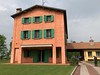
The other thing to be seen here is the open air museum and part of a reconstructed village, with its fortifications and a couple of houses. This is where displays of various aspects of Terramara life are to be found, along with various experimental archaeology displays. The museum put on many activities for children and school parties in here. Outside of the opening times, much of this reconstructed village can be seen from outside, over the top of the fence and through gaps in the gates !
More info can be found at www.parcomontale.it
You may be viewing yesterday's version of this page. To see the most up to date information please register for a free account.
")
")
")
")
Do not use the above information on other web sites or publications without permission of the contributor.
Nearby Images from Flickr
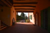
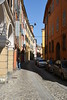
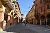

The above images may not be of the site on this page, but were taken nearby. They are loaded from Flickr so please click on them for image credits.
Click here to see more info for this site
Nearby sites
Click here to view sites on an interactive map of the areaKey: Red: member's photo, Blue: 3rd party photo, Yellow: other image, Green: no photo - please go there and take one, Grey: site destroyed
Download sites to:
KML (Google Earth)
GPX (GPS waypoints)
CSV (Garmin/Navman)
CSV (Excel)
To unlock full downloads you need to sign up as a Contributory Member. Otherwise downloads are limited to 50 sites.
Turn off the page maps and other distractions
Nearby sites listing. In the following links * = Image available
52.6km WNW 299° Museo Archeologico Nazionale Museum
65.6km N 352° Museo Archeologico (Mantova)* Museum
84.4km WSW 255° Pontremoli Museum* Museum
85.6km SSE 148° Poggio Colla* Ancient Village or Settlement
89.8km NNE 20° Veronella Alta Stone Fort or Dun
94.9km SW 234° Cattafossi Standing Stone (Menhir)
95.8km SW 236° Canaa Grande Standing Stone (Menhir)
101.0km WSW 239° La Spezia Ethnographic and Civic Museum* Museum
105.2km WSW 239° Tramonti Menhir Standing Stone (Menhir)
105.5km WSW 242° Menhir di Monte Capri Standing Stone (Menhir)
112.1km NNW 347° La Rocca di Manerba* Ancient Temple
112.1km NNW 346° Manerba del Garda Chambered Tombs Chambered Tomb
113.3km N 351° Roccia delle Griselle* Carving
113.7km NNE 22° Sovizzo Round Cairns* Round Cairn
118.9km N 353° Crero* Carving
126.4km N 355° Castelletto* Carving
128.8km WSW 258° Museo Archeologico di Chiavari Museum
138.9km NW 311° Palazzo Pignano Ancient Village or Settlement
141.7km ESE 120° Museo di Stato* Museum
145.0km NNW 335° Pyramids of Zone* Natural Stone / Erratic / Other Natural Feature
145.6km N 358° MAG Museo Alta Garda Museum
148.2km NE 49° Piraeus Lion* Carving
149.3km N 357° Monte San Martino, Campi, Riva Dell Garda* Ancient Temple
156.5km NNW 339° Boario Terme Archeopark Museum
156.8km NNW 339° Luine* Rock Art
View more nearby sites and additional images


 We would like to know more about this location. Please feel free to add a brief description and any relevant information in your own language.
 Wir möchten mehr über diese Stätte erfahren. Bitte zögern Sie nicht, eine kurze Beschreibung und relevante Informationen in Deutsch hinzuzufügen.
 Nous aimerions en savoir encore un peu sur les lieux. S'il vous plaît n'hesitez pas à ajouter une courte description et tous les renseignements pertinents dans votre propre langue.
 Quisieramos informarnos un poco más de las lugares. No dude en añadir una breve descripción y otros datos relevantes en su propio idioma.