<< Our Photo Pages >> Kamui-Kotan stone circle - Stone Circle in Japan in Hokkaidō
Submitted by Aska on Sunday, 03 October 2010 Page Views: 6635
Neolithic and Bronze AgeSite Name: Kamui-Kotan stone circle Alternative Name: 神居古潭Country: Japan Region: Hokkaidō Type: Stone Circle
Nearest Town: Asahikawa (Hokkaidō pref.) Nearest Village: Kamuichō-KamuiKotan 神居
Latitude: 43.727150N Longitude: 142.198960E
Condition:
| 5 | Perfect |
| 4 | Almost Perfect |
| 3 | Reasonable but with some damage |
| 2 | Ruined but still recognisable as an ancient site |
| 1 | Pretty much destroyed, possibly visible as crop marks |
| 0 | No data. |
| -1 | Completely destroyed |
| 5 | Superb |
| 4 | Good |
| 3 | Ordinary |
| 2 | Not Good |
| 1 | Awful |
| 0 | No data. |
| 5 | Can be driven to, probably with disabled access |
| 4 | Short walk on a footpath |
| 3 | Requiring a bit more of a walk |
| 2 | A long walk |
| 1 | In the middle of nowhere, a nightmare to find |
| 0 | No data. |
| 5 | co-ordinates taken by GPS or official recorded co-ordinates |
| 4 | co-ordinates scaled from a detailed map |
| 3 | co-ordinates scaled from a bad map |
| 2 | co-ordinates of the nearest village |
| 1 | co-ordinates of the nearest town |
| 0 | no data |
Internal Links:
External Links:
")
On the top of a mountain close to the scenic valley of Kamui-Kotan, there lie some stone circles. Each stone is so much tiny to recognise.
You may be viewing yesterday's version of this page. To see the most up to date information please register for a free account.
Do not use the above information on other web sites or publications without permission of the contributor.
Nearby Images from Flickr
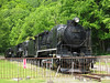
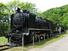
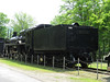
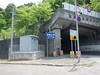


The above images may not be of the site on this page, but were taken nearby. They are loaded from Flickr so please click on them for image credits.
Click here to see more info for this site
Nearby sites
Click here to view sites on an interactive map of the areaKey: Red: member's photo, Blue: 3rd party photo, Yellow: other image, Green: no photo - please go there and take one, Grey: site destroyed
Download sites to:
KML (Google Earth)
GPX (GPS waypoints)
CSV (Garmin/Navman)
CSV (Excel)
To unlock full downloads you need to sign up as a Contributory Member. Otherwise downloads are limited to 50 sites.
Turn off the page maps and other distractions
Nearby sites listing. In the following links * = Image available
14.6km WSW 246° Otoe* Stone Circle
30.3km SSE 169° Nokanan henge* Henge
31.5km SW 223° Hokkaidō Children's Land* Modern Stone Circle etc
87.2km SW 219° Ebetsu Chashi* Hillfort
87.5km SW 219° Ebetsu Kofungun* Round Barrow(s)
101.4km SSW 203° Kiusu* Henge
110.7km WSW 241° ex-Aoyama Bettei residence* Modern Stone Circle etc
112.2km WSW 240° Temiya cave* Carving
112.3km SW 217° Makomanai Takino-Reien cemetery* Modern Stone Circle etc
121.9km WSW 242° Oshoro* Stone Circle
122.2km WSW 242° ChijinYama* Stone Circle
124.4km WSW 242° Fugoppe cave* Carving
124.5km WSW 242° NishizakiYama* Stone Circle
127.2km ESE 103° Yuk'epira Chashi* Hillfort
148.8km ENE 72° Tokoro Iseki* Ancient Village or Settlement
152.5km S 174° Mena Chashi* Hillfort
152.9km ENE 72° SakaeUra Iseki* Ancient Village or Settlement
155.9km S 175° Sibecar Chashi* Hillfort
156.2km S 175° Hoinasir Chashi* Hillfort
156.7km ENE 73° Tokor Chashi* Hillfort
159.1km SW 232° Hokuei* Stone Circle
165.5km E 79° Abashiri prison* Modern Stone Circle etc
166.6km SE 126° Otafunbe Chashi* Hillfort
169.1km ENE 78° Moyoro Kaizuka* Ancient Village or Settlement
169.1km ENE 78° KatsuragaOka Toride* Hillfort
View more nearby sites and additional images


 We would like to know more about this location. Please feel free to add a brief description and any relevant information in your own language.
 Wir möchten mehr über diese Stätte erfahren. Bitte zögern Sie nicht, eine kurze Beschreibung und relevante Informationen in Deutsch hinzuzufügen.
 Nous aimerions en savoir encore un peu sur les lieux. S'il vous plaît n'hesitez pas à ajouter une courte description et tous les renseignements pertinents dans votre propre langue.
 Quisieramos informarnos un poco más de las lugares. No dude en añadir una breve descripción y otros datos relevantes en su propio idioma.