<< Text Pages >> Castro de Riboeira - Castro or Chafurdão in Spain in Galicia
Submitted by holger_rix on Saturday, 12 December 2015 Page Views: 513
Iron Age and Later PrehistorySite Name: Castro de RiboeiraCountry: Spain Region: Galicia Type: Castro or Chafurdão
Nearest Town: Coruña Nearest Village: Ferrol
Latitude: 43.544069N Longitude: 8.06513W
Condition:
| 5 | Perfect |
| 4 | Almost Perfect |
| 3 | Reasonable but with some damage |
| 2 | Ruined but still recognisable as an ancient site |
| 1 | Pretty much destroyed, possibly visible as crop marks |
| 0 | No data. |
| -1 | Completely destroyed |
| 5 | Superb |
| 4 | Good |
| 3 | Ordinary |
| 2 | Not Good |
| 1 | Awful |
| 0 | No data. |
| 5 | Can be driven to, probably with disabled access |
| 4 | Short walk on a footpath |
| 3 | Requiring a bit more of a walk |
| 2 | A long walk |
| 1 | In the middle of nowhere, a nightmare to find |
| 0 | No data. |
| 5 | co-ordinates taken by GPS or official recorded co-ordinates |
| 4 | co-ordinates scaled from a detailed map |
| 3 | co-ordinates scaled from a bad map |
| 2 | co-ordinates of the nearest village |
| 1 | co-ordinates of the nearest town |
| 0 | no data |
Be the first person to rate this site - see the 'Contribute!' box in the right hand menu.
Internal Links:
External Links:
Castro in Galicia
You may be viewing yesterday's version of this page. To see the most up to date information please register for a free account.
Do not use the above information on other web sites or publications without permission of the contributor.
Nearby Images from Flickr
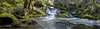
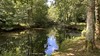
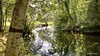
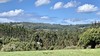
The above images may not be of the site on this page, but were taken nearby. They are loaded from Flickr so please click on them for image credits.
Click here to see more info for this site
Nearby sites
Click here to view sites on an interactive map of the areaKey: Red: member's photo, Blue: 3rd party photo, Yellow: other image, Green: no photo - please go there and take one, Grey: site destroyed
Download sites to:
KML (Google Earth)
GPX (GPS waypoints)
CSV (Garmin/Navman)
CSV (Excel)
To unlock full downloads you need to sign up as a Contributory Member. Otherwise downloads are limited to 50 sites.
Turn off the page maps and other distractions
Nearby sites listing. In the following links * = Image available
804m WSW 259° Castro de A Rubiña Castro or Chafurdão
1.8km NE 46° Castro Croa do Redo Castro or Chafurdão
2.1km ESE 113° Castro das Croas (San Sadurniño) Castro or Chafurdão
3.3km WSW 249° Castro da Ermida Castro or Chafurdão
4.4km W 270° Castro de Pereiruga Castro or Chafurdão
4.6km NE 34° Castro do Coto do Castro (Moeche) Castro or Chafurdão
5.0km ENE 65° Castro de Casablanca Castro or Chafurdão
5.4km WNW 282° Castro de Eiravedra Castro or Chafurdão
5.4km WNW 293° Mámoas Monte dos Nenos Barrow Cemetery
5.6km WNW 300° Mámoas de Porto Novo Barrow Cemetery
5.7km W 279° Castro de Sedes Castro or Chafurdão
6.0km W 280° Castro de San Estevo Castro or Chafurdão
6.2km NNW 339° Castro de A Furada Castro or Chafurdão
6.2km NW 307° Mámoas de Pena Moura Barrow Cemetery
6.3km NE 54° Castro de Abade (Mil de Abaixo) Castro or Chafurdão
6.5km W 272° Castro de Bazón Castro or Chafurdão
6.6km WSW 248° Castro de Ancos Castro or Chafurdão
6.6km W 272° Castro de Calvario Castro or Chafurdão
6.8km W 273° Castro de Trasancos Castro or Chafurdão
7.1km ENE 72° Castro de Labacengos Castro or Chafurdão
7.4km W 266° Castro da Revolta Castro or Chafurdão
7.6km W 262° Castro de Vicás Castro or Chafurdão
8.5km NNW 347° Castro das Ferrerías Castro or Chafurdão
8.8km W 262° Castro de Sequeiro Castro or Chafurdão
8.8km SW 220° Mámoas do Marraxón Barrow Cemetery
View more nearby sites and additional images


 We would like to know more about this location. Please feel free to add a brief description and any relevant information in your own language.
 Wir möchten mehr über diese Stätte erfahren. Bitte zögern Sie nicht, eine kurze Beschreibung und relevante Informationen in Deutsch hinzuzufügen.
 Nous aimerions en savoir encore un peu sur les lieux. S'il vous plaît n'hesitez pas à ajouter une courte description et tous les renseignements pertinents dans votre propre langue.
 Quisieramos informarnos un poco más de las lugares. No dude en añadir una breve descripción y otros datos relevantes en su propio idioma.