<< Text Pages >> Santacris - Castro or Chafurdão in Spain in Navarra
Submitted by TheCaptain on Wednesday, 08 September 2010 Page Views: 1773
Iron Age and Later PrehistorySite Name: SantacrisCountry: Spain
NOTE: This site is 9.707 km away from the location you searched for.
Region: Navarra Type: Castro or Chafurdão
Nearest Town: Pamplona Nearest Village: Eslava
Latitude: 42.564000N Longitude: 1.458W
Condition:
| 5 | Perfect |
| 4 | Almost Perfect |
| 3 | Reasonable but with some damage |
| 2 | Ruined but still recognisable as an ancient site |
| 1 | Pretty much destroyed, possibly visible as crop marks |
| 0 | No data. |
| -1 | Completely destroyed |
| 5 | Superb |
| 4 | Good |
| 3 | Ordinary |
| 2 | Not Good |
| 1 | Awful |
| 0 | No data. |
| 5 | Can be driven to, probably with disabled access |
| 4 | Short walk on a footpath |
| 3 | Requiring a bit more of a walk |
| 2 | A long walk |
| 1 | In the middle of nowhere, a nightmare to find |
| 0 | No data. |
| 5 | co-ordinates taken by GPS or official recorded co-ordinates |
| 4 | co-ordinates scaled from a detailed map |
| 3 | co-ordinates scaled from a bad map |
| 2 | co-ordinates of the nearest village |
| 1 | co-ordinates of the nearest town |
| 0 | no data |
Be the first person to rate this site - see the 'Contribute!' box in the right hand menu.
Internal Links:
External Links:
Castro in Navarra
Santacris is a Castro in the community of Eslava, Province of Navarra, region of Navarra
You may be viewing yesterday's version of this page. To see the most up to date information please register for a free account.
Do not use the above information on other web sites or publications without permission of the contributor.
Nearby Images from Flickr
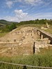

The above images may not be of the site on this page, but were taken nearby. They are loaded from Flickr so please click on them for image credits.
Click here to see more info for this site
Nearby sites
Click here to view sites on an interactive map of the areaKey: Red: member's photo, Blue: 3rd party photo, Yellow: other image, Green: no photo - please go there and take one, Grey: site destroyed
Download sites to:
KML (Google Earth)
GPX (GPS waypoints)
CSV (Garmin/Navman)
CSV (Excel)
To unlock full downloads you need to sign up as a Contributory Member. Otherwise downloads are limited to 50 sites.
Turn off the page maps and other distractions
Nearby sites listing. In the following links * = Image available
16.4km NW 318° Arriurdin Menhir Standing Stone (Menhir)
21.2km W 280° Soplahogueras Menhir Standing Stone (Menhir)
22.3km WNW 282° Karakidoia Dolmen Burial Chamber or Dolmen
22.6km WNW 285° Andiuz Dolmen Burial Chamber or Dolmen
22.9km W 274° San Bartolomé Dolmen Burial Chamber or Dolmen
23.8km N 360° Erroldan Arriya Menhir* Standing Stone (Menhir)
23.8km NE 42° Ugarron Dolmen Burial Chamber or Dolmen
24.0km NE 56° Puyomediano Dolmen* Burial Chamber or Dolmen
24.4km WNW 286° La Mina de Farangortea Dolmen* Burial Chamber or Dolmen
24.6km WNW 286° La Mina Menhir* Standing Stone (Menhir)
24.6km WSW 257° Kandaraitz Cista Cist
24.8km WNW 287° Legastiaga Menhir Standing Stone (Menhir)
24.8km WNW 286° Legastiaga Menhir Standing Stone (Menhir)
24.9km NE 42° Aikoa Dolmen 2 Burial Chamber or Dolmen
24.9km WNW 286° Farangortea Dolmen Burial Chamber or Dolmen
25.0km WNW 286° Farangortea Dolmen* Burial Chamber or Dolmen
25.0km NE 45° Angerta Dolmen* Burial Chamber or Dolmen
25.1km WSW 258° Kandaraitz Dolmen Burial Chamber or Dolmen
25.1km NE 42° Aikoa Dolmen 1 Burial Chamber or Dolmen
25.2km NE 46° Boluntza Dolmen 2* Burial Chamber or Dolmen
25.4km NE 46° Boluntza Dolmen 1* Burial Chamber or Dolmen
25.4km NE 46° Boluntza Dolmen 3 Burial Chamber or Dolmen
25.6km W 270° Genzelaia Menhir Standing Stone (Menhir)
25.6km W 270° Genzelaia Túmulo 1-3 Round Barrow(s)
25.9km NE 47° Ugarra Dolmen 2 Burial Chamber or Dolmen
View more nearby sites and additional images


 We would like to know more about this location. Please feel free to add a brief description and any relevant information in your own language.
 Wir möchten mehr über diese Stätte erfahren. Bitte zögern Sie nicht, eine kurze Beschreibung und relevante Informationen in Deutsch hinzuzufügen.
 Nous aimerions en savoir encore un peu sur les lieux. S'il vous plaît n'hesitez pas à ajouter une courte description et tous les renseignements pertinents dans votre propre langue.
 Quisieramos informarnos un poco más de las lugares. No dude en añadir una breve descripción y otros datos relevantes en su propio idioma.