<< Other Photo Pages >> Monte Santa Croce-Cognolo - Hillfort in Italy in Umbria
Submitted by AKFisher on Wednesday, 30 October 2024 Page Views: 4662
Iron Age and Later PrehistorySite Name: Monte Santa Croce-Cognolo Alternative Name: Monte Santa CroceCountry: Italy
NOTE: This site is 39.752 km away from the location you searched for.
Region: Umbria Type: Hillfort
Nearest Town: Villa Santa Croce
Latitude: 41.183300N Longitude: 14.327160E
Condition:
| 5 | Perfect |
| 4 | Almost Perfect |
| 3 | Reasonable but with some damage |
| 2 | Ruined but still recognisable as an ancient site |
| 1 | Pretty much destroyed, possibly visible as crop marks |
| 0 | No data. |
| -1 | Completely destroyed |
| 5 | Superb |
| 4 | Good |
| 3 | Ordinary |
| 2 | Not Good |
| 1 | Awful |
| 0 | No data. |
| 5 | Can be driven to, probably with disabled access |
| 4 | Short walk on a footpath |
| 3 | Requiring a bit more of a walk |
| 2 | A long walk |
| 1 | In the middle of nowhere, a nightmare to find |
| 0 | No data. |
| 5 | co-ordinates taken by GPS or official recorded co-ordinates |
| 4 | co-ordinates scaled from a detailed map |
| 3 | co-ordinates scaled from a bad map |
| 2 | co-ordinates of the nearest village |
| 1 | co-ordinates of the nearest town |
| 0 | no data |
Internal Links:
External Links:

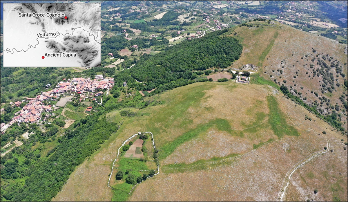
This ancient Samnite hillfort (c. 1st C. BCE) near the town of Villa Santa Croce in the Caserta Province, central Italy, has recently been under scientific scrutiny and surprising findings published in the journal Antiquity by archaeologists Giacomo Fontana from Texas Tech University in the U.S. and Wieke de Neef from the University of Bamberg in Germany.
Ancient Samnite Connections
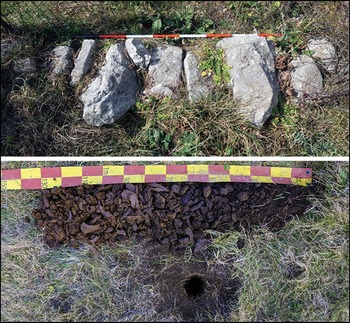
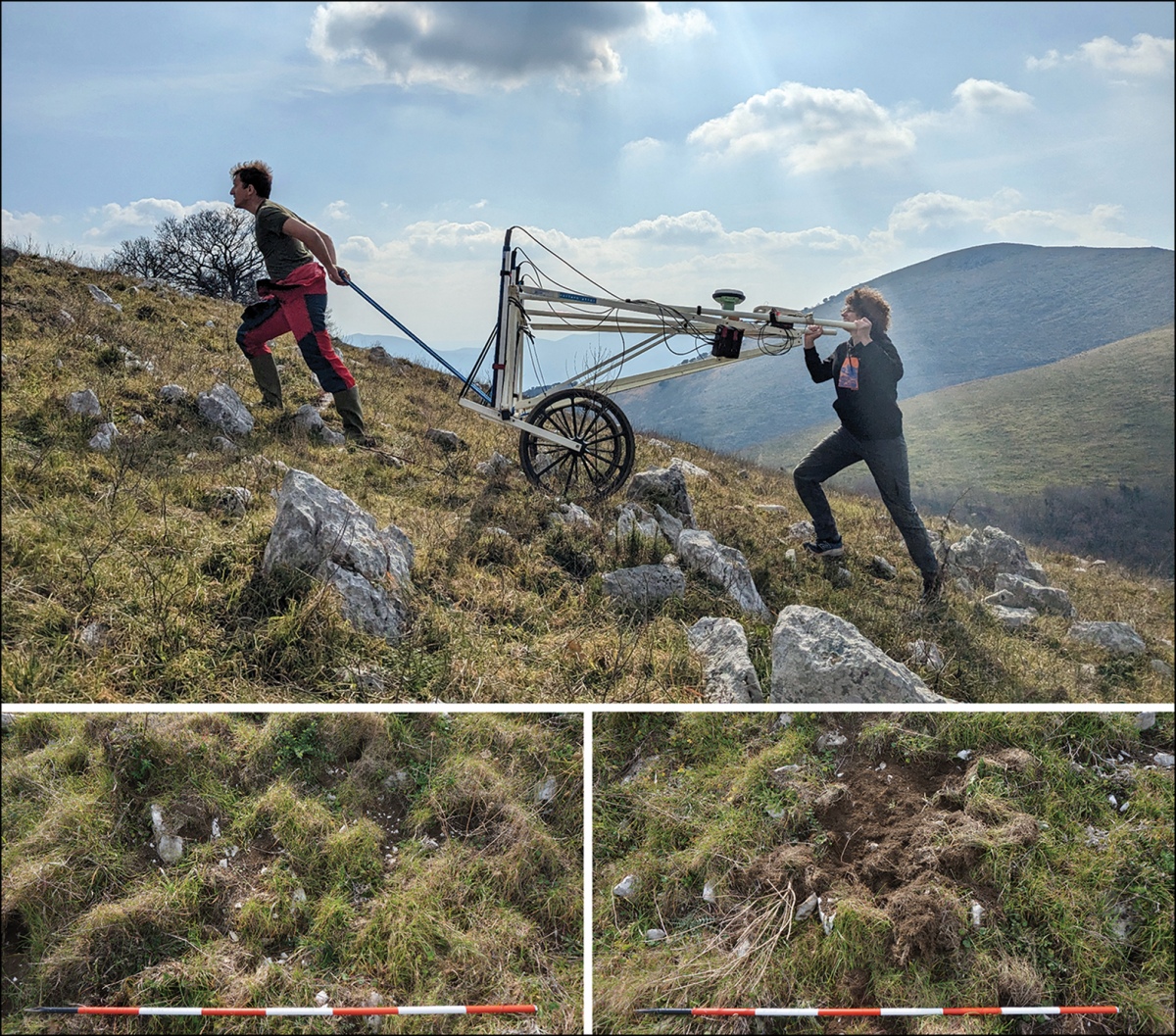
It has been assumed for decades that the ancient Samnite peoples occupying what is now peninsular Italy, known for their conflicts with early Romans, had constructed numerous hillforts ostensibly to protect their populations and livestock from attack by neighboring tribes. This assumption has now been called into question based on findings by the two archaeologists[1]. Using LIDAR, photogrammetry and ground penetrating radar to map the site, their recent findings indicate these hillforts were most probably used as livestock pens and for agricultural activities, not constructed as proto-cities. The archaeologists found little evidence of human occupation as a settlement, but instead found evidence of walls and structures consistent with animal husbandry and associated agriculture.
Local Community Inputs
Based on interviews with current local residents the scientists found a long history of agriculture and domestic animal husbandry at the Monte Santa Croce site[2], but lack indications of permanent settlement such as cooking areas, housing foundations and pottery sherds. The findings call into question the use of such hillfort structures as Samnite proto-cities ~ archaeologists must now re-assess assumptions about hillforts' occupation by proto-Italian populations throughout the region.
References:
1. "Italy's empty hillforts: reassessing urban-centric biases through combined non-invasive prospection methods on a Samnite site (fourth–third centuries BC);" Cambridge University Press (online), 21 October 2024.
Read the paper, Open Access at doi.org/10.15184/aqy.2024.157 and there's a good summary here: http://www.threads.net/@antiquity_journal/post/DBbORO9tnHS
2. "Prehistoric Samnite Hillforts Used for Livestock, Not Human Occupation;" Ancient Origins website article, 29 October 2024.
Directions:
Monte Santa Croce is located near the town of Villa Santa Croce, which is approximately 1km from the site on an unnamed road.
Note: Recent research found very little evidence for permanent habitation at this Italian hillfort - which was unexpected. Instead, it seems it was used for pasturing animals.
You may be viewing yesterday's version of this page. To see the most up to date information please register for a free account.


Do not use the above information on other web sites or publications without permission of the contributor.
Nearby Images from Flickr


The above images may not be of the site on this page, but were taken nearby. They are loaded from Flickr so please click on them for image credits.
Click here to see more info for this site
Nearby sites
Click here to view sites on an interactive map of the areaKey: Red: member's photo, Blue: 3rd party photo, Yellow: other image, Green: no photo - please go there and take one, Grey: site destroyed
Download sites to:
KML (Google Earth)
GPX (GPS waypoints)
CSV (Garmin/Navman)
CSV (Excel)
To unlock full downloads you need to sign up as a Contributory Member. Otherwise downloads are limited to 50 sites.
Turn off the page maps and other distractions
Nearby sites listing. In the following links * = Image available
37.7km W 262° Roccia San Sebastiano Cave or Rock Shelter
42.0km S 178° Herculaneum Ancient Village or Settlement
49.9km SSE 165° Pompeii* Ancient Village or Settlement
50.0km SSE 165° Macellum of Pompeii* Modern Stone Circle etc
78.5km NW 311° Arpino Acropolis* Ancient Village or Settlement
90.8km W 277° Temple of Jupiter Anxur Ancient Temple
94.3km SE 145° Foce del Sele Temple of Hera* Ancient Temple
101.7km NW 307° Alatri Acropolis* Hillfort
101.9km SE 146° Poseidonia Temple of Athena* Ancient Temple
102.3km SE 146° Poseidonia Temple of Poseidon* Ancient Temple
102.4km SE 146° Poseidonia Temple of Hera* Ancient Temple
103.0km NW 308° Alatri Temple* Ancient Temple
104.4km W 274° Mura Ciclopiche San Felice Circeo Stone Fort or Dun
110.7km ENE 70° Daunian Arpi Ancient Village or Settlement
114.8km ENE 69° Passo di Corvo* Henge
118.4km ENE 62° Museo Grotta Paglicci e il Paliolitico del Gargano Museum
119.2km ENE 63° Dolmen di Madonna di Cristo Burial Chamber or Dolmen
119.5km ENE 64° Grotta Paglicci Cave or Rock Shelter
122.6km WNW 292° Antica Norba* Ancient Village or Settlement
122.7km WNW 298° Giunone Moneta (Segni)* Ancient Village or Settlement
130.2km NNW 330° Lu Termine* Standing Stone (Menhir)
133.4km SSE 148° Eleia Temple Ancient Temple
134.3km ENE 63° Monte Calvo Ancient Village or Settlement
138.1km ENE 70° Ipogei Capparelli Ancient Village or Settlement
141.1km ENE 68° Scaloria Cavern Cave or Rock Shelter
View more nearby sites and additional images


 We would like to know more about this location. Please feel free to add a brief description and any relevant information in your own language.
 Wir möchten mehr über diese Stätte erfahren. Bitte zögern Sie nicht, eine kurze Beschreibung und relevante Informationen in Deutsch hinzuzufügen.
 Nous aimerions en savoir encore un peu sur les lieux. S'il vous plaît n'hesitez pas à ajouter une courte description et tous les renseignements pertinents dans votre propre langue.
 Quisieramos informarnos un poco más de las lugares. No dude en añadir una breve descripción y otros datos relevantes en su propio idioma.