<< Text Pages >> Campu Perdu Domus de Janas - Rock Cut Tomb in Italy in Sardinia (Sardegna)
Submitted by SolarMegalith on Wednesday, 21 August 2013 Page Views: 1341
Multi-periodSite Name: Campu Perdu Domus de JanasCountry: Italy
NOTE: This site is 9.459 km away from the location you searched for.
Region: Sardinia (Sardegna) Type: Rock Cut Tomb
Latitude: 41.072727N Longitude: 8.291245E
Condition:
| 5 | Perfect |
| 4 | Almost Perfect |
| 3 | Reasonable but with some damage |
| 2 | Ruined but still recognisable as an ancient site |
| 1 | Pretty much destroyed, possibly visible as crop marks |
| 0 | No data. |
| -1 | Completely destroyed |
| 5 | Superb |
| 4 | Good |
| 3 | Ordinary |
| 2 | Not Good |
| 1 | Awful |
| 0 | No data. |
| 5 | Can be driven to, probably with disabled access |
| 4 | Short walk on a footpath |
| 3 | Requiring a bit more of a walk |
| 2 | A long walk |
| 1 | In the middle of nowhere, a nightmare to find |
| 0 | No data. |
| 5 | co-ordinates taken by GPS or official recorded co-ordinates |
| 4 | co-ordinates scaled from a detailed map |
| 3 | co-ordinates scaled from a bad map |
| 2 | co-ordinates of the nearest village |
| 1 | co-ordinates of the nearest town |
| 0 | no data |
Internal Links:
External Links:
Rock Cut Tomb in Sardinia (Sardegna)
Domus de Janas (pre-Nuragic rock cut tomb) located on Asinara island.
You may be viewing yesterday's version of this page. To see the most up to date information please register for a free account.
Do not use the above information on other web sites or publications without permission of the contributor.
Nearby Images from Flickr
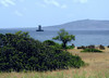
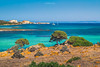

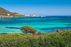
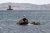
The above images may not be of the site on this page, but were taken nearby. They are loaded from Flickr so please click on them for image credits.
Click here to see more info for this site
Nearby sites
Click here to view sites on an interactive map of the areaKey: Red: member's photo, Blue: 3rd party photo, Yellow: other image, Green: no photo - please go there and take one, Grey: site destroyed
Download sites to:
KML (Google Earth)
GPX (GPS waypoints)
CSV (Garmin/Navman)
CSV (Excel)
To unlock full downloads you need to sign up as a Contributory Member. Otherwise downloads are limited to 50 sites.
Turn off the page maps and other distractions
Nearby sites listing. In the following links * = Image available
19.3km SSW 198° Monte Atene Nuraghe* Broch or Nuraghe
23.4km SSW 193° Unia Nuraghe* Broch or Nuraghe
23.6km SSW 193° Unia Pozzo Nuragico Holy Well or Sacred Spring
25.9km SSW 191° Cuili Ercoli Nuraghe Broch or Nuraghe
25.9km SSW 191° Cuili Ercoli Nuraghe Broch or Nuraghe
26.5km SSW 193° Tana di Lu Mazzoni* Rock Cut Tomb
27.2km S 189° Casteddu Nuraghe (Stintino) Broch or Nuraghe
27.4km S 172° Ferrali Nuraghe Broch or Nuraghe
28.0km S 186° Palaonessa Nuraghe Broch or Nuraghe
28.1km S 170° Nieddu Nuraghe (Porto Torres) Broch or Nuraghe
28.2km S 178° Sant'Elena Nuraghe Broch or Nuraghe
28.8km SSE 162° Monte Aiveghe Nuraghe Broch or Nuraghe
28.8km S 186° Mancini Nuraghe Broch or Nuraghe
28.8km SSE 162° Monte Aiveghe Domus de Janas Rock Cut Tomb
28.9km S 177° Margone Nuraghe Broch or Nuraghe
29.2km S 174° Biunisi Nuraghe Broch or Nuraghe
31.1km SSE 165° Pianu de Olia Nuraghe Broch or Nuraghe
31.8km SSE 162° Estru Nuraghe Broch or Nuraghe
31.9km SSE 156° Su Crocifissu Mannu* Rock Cut Tomb
32.5km SSW 195° Alisparghe Nuraghe Broch or Nuraghe
32.5km SSE 163° Cabula Muntones Nuraghe Broch or Nuraghe
32.5km S 184° Pozzo d'Ussi Nuraghe Broch or Nuraghe
32.6km SSE 160° Luzzana di Cherchi Nuraghe Broch or Nuraghe
32.9km SSW 196° Li Cudineddi Nuraghe Broch or Nuraghe
33.2km SSE 165° Zimboinu Nuraghe Broch or Nuraghe
View more nearby sites and additional images


 We would like to know more about this location. Please feel free to add a brief description and any relevant information in your own language.
 Wir möchten mehr über diese Stätte erfahren. Bitte zögern Sie nicht, eine kurze Beschreibung und relevante Informationen in Deutsch hinzuzufügen.
 Nous aimerions en savoir encore un peu sur les lieux. S'il vous plaît n'hesitez pas à ajouter une courte description et tous les renseignements pertinents dans votre propre langue.
 Quisieramos informarnos un poco más de las lugares. No dude en añadir una breve descripción y otros datos relevantes en su propio idioma.