<< Text Pages >> Museo de las Villas Romanas de Almenara-Puras - Ancient Village or Settlement in Spain in Castilla y León
Submitted by holger_rix on Saturday, 05 December 2015 Page Views: 1273
Multi-periodSite Name: Museo de las Villas Romanas de Almenara-PurasCountry: Spain
NOTE: This site is 16.492 km away from the location you searched for.
Region: Castilla y León Type: Ancient Village or Settlement
Latitude: 41.193910N Longitude: 4.66877W
Condition:
| 5 | Perfect |
| 4 | Almost Perfect |
| 3 | Reasonable but with some damage |
| 2 | Ruined but still recognisable as an ancient site |
| 1 | Pretty much destroyed, possibly visible as crop marks |
| 0 | No data. |
| -1 | Completely destroyed |
| 5 | Superb |
| 4 | Good |
| 3 | Ordinary |
| 2 | Not Good |
| 1 | Awful |
| 0 | No data. |
| 5 | Can be driven to, probably with disabled access |
| 4 | Short walk on a footpath |
| 3 | Requiring a bit more of a walk |
| 2 | A long walk |
| 1 | In the middle of nowhere, a nightmare to find |
| 0 | No data. |
| 5 | co-ordinates taken by GPS or official recorded co-ordinates |
| 4 | co-ordinates scaled from a detailed map |
| 3 | co-ordinates scaled from a bad map |
| 2 | co-ordinates of the nearest village |
| 1 | co-ordinates of the nearest town |
| 0 | no data |
Be the first person to rate this site - see the 'Contribute!' box in the right hand menu.
Internal Links:
External Links:
Ancient Village or Settlement in Castilla y León
You may be viewing yesterday's version of this page. To see the most up to date information please register for a free account.
Do not use the above information on other web sites or publications without permission of the contributor.
Nearby Images from Flickr
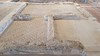
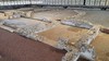
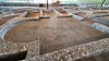
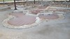
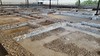
The above images may not be of the site on this page, but were taken nearby. They are loaded from Flickr so please click on them for image credits.
Click here to see more info for this site
Nearby sites
Click here to view sites on an interactive map of the areaKey: Red: member's photo, Blue: 3rd party photo, Yellow: other image, Green: no photo - please go there and take one, Grey: site destroyed
Download sites to:
KML (Google Earth)
GPX (GPS waypoints)
CSV (Garmin/Navman)
CSV (Excel)
To unlock full downloads you need to sign up as a Contributory Member. Otherwise downloads are limited to 50 sites.
Turn off the page maps and other distractions
Nearby sites listing. In the following links * = Image available
26.8km ESE 111° Domingo García Rock Art
47.7km NNW 345° Los Zumacales Ancient Village or Settlement
52.0km S 183° Castro de Las Cogotas* Castro or Chafurdão
58.1km S 174° Prado de las Cruces dolmen* Burial Chamber or Dolmen
58.2km S 175° Dolmen de Bernuy* Passage Grave
58.3km SSW 205° Castro de la Mesa de Miranda* Castro or Chafurdão
60.0km S 183° Vettonia Museum* Museum
62.9km NE 41° Pintia Necropolis Barrow Cemetery
70.3km SSW 207° Necrópolis Medieval de La Coba Ancient Village or Settlement
75.1km NNW 345° Yacimiento arqueológico de Fuenteungrillo Ancient Village or Settlement
76.1km SSW 194° Ulaca* Castro or Chafurdão
76.5km ENE 73° Castroserracín* Cairn
81.2km SSE 164° Necropolis Navaserrada Barrow Cemetery
84.2km WSW 240° Alba de Tormes: El Torrejón Burial Chamber or Dolmen
85.5km WSW 238° Éjeme: El Canturral Round Barrow(s)
90.5km SW 236° La Ermita Round Barrow(s)
92.3km NW 309° El Juncal Round Barrow(s)
94.6km SE 125° Yacimiento Arqueológico de Navalvillar Ancient Village or Settlement
96.5km WNW 291° Castro de Pedroso Castro or Chafurdão
96.5km WNW 291° Pena-Torre Castro or Chafurdão
96.5km WNW 291° Cerco de la Ribera Castro or Chafurdão
100.7km WSW 250° Valmuza: Carrascalino Round Barrow(s)
100.7km WSW 250° Valmuza: túmulo Round Barrow(s)
100.8km WSW 250° Valmuza: Iglesia Round Barrow(s)
100.9km WSW 250° Valmuza: La Torrecilla Burial Chamber or Dolmen
View more nearby sites and additional images


 We would like to know more about this location. Please feel free to add a brief description and any relevant information in your own language.
 Wir möchten mehr über diese Stätte erfahren. Bitte zögern Sie nicht, eine kurze Beschreibung und relevante Informationen in Deutsch hinzuzufügen.
 Nous aimerions en savoir encore un peu sur les lieux. S'il vous plaît n'hesitez pas à ajouter une courte description et tous les renseignements pertinents dans votre propre langue.
 Quisieramos informarnos un poco más de las lugares. No dude en añadir una breve descripción y otros datos relevantes en su propio idioma.