<< Text Pages >> Passaron - Ancient Temple in Greece in Central Greece
Submitted by AlexHunger on Wednesday, 03 October 2007 Page Views: 5422
Neolithic and Bronze AgeSite Name: Passaron Alternative Name: Sanctuary of Zeus AreiosCountry: Greece
NOTE: This site is 11.879 km away from the location you searched for.
Region: Central Greece Type: Ancient Temple
Nearest Town: Radotovi Nearest Village: Ioannina
Latitude: 39.727352N Longitude: 20.730734E
Condition:
| 5 | Perfect |
| 4 | Almost Perfect |
| 3 | Reasonable but with some damage |
| 2 | Ruined but still recognisable as an ancient site |
| 1 | Pretty much destroyed, possibly visible as crop marks |
| 0 | No data. |
| -1 | Completely destroyed |
| 5 | Superb |
| 4 | Good |
| 3 | Ordinary |
| 2 | Not Good |
| 1 | Awful |
| 0 | No data. |
| 5 | Can be driven to, probably with disabled access |
| 4 | Short walk on a footpath |
| 3 | Requiring a bit more of a walk |
| 2 | A long walk |
| 1 | In the middle of nowhere, a nightmare to find |
| 0 | No data. |
| 5 | co-ordinates taken by GPS or official recorded co-ordinates |
| 4 | co-ordinates scaled from a detailed map |
| 3 | co-ordinates scaled from a bad map |
| 2 | co-ordinates of the nearest village |
| 1 | co-ordinates of the nearest town |
| 0 | no data |
Internal Links:
External Links:
Ancient Temple in Attica/Central Greece
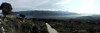
Remains of a Greek Temple measuring 19 metres by 11 metres which had 11 by 6 columns with both Ionic and Doric column capital dating to the 4th Century BCE. The temple was probably destroyed in 167 BCE by the Romans.
You may be viewing yesterday's version of this page. To see the most up to date information please register for a free account.
Do not use the above information on other web sites or publications without permission of the contributor.
Nearby Images from Flickr

The above images may not be of the site on this page, but were taken nearby. They are loaded from Flickr so please click on them for image credits.
Click here to see more info for this site
Nearby sites
Click here to view sites on an interactive map of the areaKey: Red: member's photo, Blue: 3rd party photo, Yellow: other image, Green: no photo - please go there and take one, Grey: site destroyed
Download sites to:
KML (Google Earth)
GPX (GPS waypoints)
CSV (Garmin/Navman)
CSV (Excel)
To unlock full downloads you need to sign up as a Contributory Member. Otherwise downloads are limited to 50 sites.
Turn off the page maps and other distractions
Nearby sites listing. In the following links * = Image available
16.5km N 4° Vitsa Ancient Village or Settlement
20.7km SSE 167° Dodona Sanctuary* Ancient Temple
35.5km SSW 206° Elea.* Ancient Village or Settlement
50.6km S 169° Asprochaliko Cave or Rock Shelter
53.4km SSE 162° Orraon Ancient Village or Settlement
57.2km SSW 197° Necromanteion* Ancient Temple
60.9km W 272° Butrint* Ancient Village or Settlement
64.9km S 184° Cassope* Ancient Village or Settlement
66.6km SSE 161° Ambracia Temple of Apollo* Ancient Temple
70.4km W 261° Corfu Archeological Museum Museum
70.5km W 259° Corfu Medusa and Artemis Temple Ancient Temple
70.9km W 261° Kardaki Temple Ancient Temple
71.0km W 261° Corfu Doric Temple Ancient Temple
76.9km E 91° Metéora* Natural Stone / Erratic / Other Natural Feature
77.8km S 180° Nicopolis temple of Apollo* Ancient Temple
78.3km S 180° Nicopolis stadium* Ancient Village or Settlement
79.0km S 180° Nicopolis necropolis boreia* Ancient Village or Settlement
79.7km S 180° Nikopolis* Ancient Village or Settlement
81.4km E 93° Theopetra Cave Cave or Rock Shelter
90.8km N 360° Kamenicë Tumulus Round Barrow(s)
99.3km S 181° Archaeological Museum of Lefkada* Museum
99.4km S 175° Palairos* Ancient Village or Settlement
102.3km S 177° Sterna Kastro Hillfort
102.5km S 181° Nyrikos* Ancient Village or Settlement
103.1km ESE 115° Mitropoli Temple Ancient Temple
View more nearby sites and additional images


 We would like to know more about this location. Please feel free to add a brief description and any relevant information in your own language.
 Wir möchten mehr über diese Stätte erfahren. Bitte zögern Sie nicht, eine kurze Beschreibung und relevante Informationen in Deutsch hinzuzufügen.
 Nous aimerions en savoir encore un peu sur les lieux. S'il vous plaît n'hesitez pas à ajouter une courte description et tous les renseignements pertinents dans votre propre langue.
 Quisieramos informarnos un poco más de las lugares. No dude en añadir una breve descripción y otros datos relevantes en su propio idioma.