<< Other Photo Pages >> Ely Mound - Artificial Mound in United States in The South
Submitted by AKFisher on Wednesday, 16 August 2023 Page Views: 207
Pre-ColumbianSite Name: Ely Mound Alternative Name: Ely Mound Archaeological SiteCountry: United States
NOTE: This site is 67.22 km away from the location you searched for.
Region: The South Type: Artificial Mound
Nearest Town: Rose Hill, Lee County, VA
Latitude: 36.653450N Longitude: 83.40052W
Condition:
| 5 | Perfect |
| 4 | Almost Perfect |
| 3 | Reasonable but with some damage |
| 2 | Ruined but still recognisable as an ancient site |
| 1 | Pretty much destroyed, possibly visible as crop marks |
| 0 | No data. |
| -1 | Completely destroyed |
| 5 | Superb |
| 4 | Good |
| 3 | Ordinary |
| 2 | Not Good |
| 1 | Awful |
| 0 | No data. |
| 5 | Can be driven to, probably with disabled access |
| 4 | Short walk on a footpath |
| 3 | Requiring a bit more of a walk |
| 2 | A long walk |
| 1 | In the middle of nowhere, a nightmare to find |
| 0 | No data. |
| 5 | co-ordinates taken by GPS or official recorded co-ordinates |
| 4 | co-ordinates scaled from a detailed map |
| 3 | co-ordinates scaled from a bad map |
| 2 | co-ordinates of the nearest village |
| 1 | co-ordinates of the nearest town |
| 0 | no data |
Internal Links:
External Links:
")
The mound dates to the Late Woodland-Mississippian Period (AD 1200–1650)[2], during which more complex societies and practices evolved, including chiefdoms and religious ceremonies. Often, temples, elite residences, and council buildings stood atop substructure or townhouse mounds such as Ely Mound. (Decaying cedar posts remained in the ground in the late 1800s, and were frequently struck by plows). Lucien Carr, assistant curator of the Peabody Museum of Archaeology and Ethnology in Boston, led an excavation here in 1877. At that time, the mound measured 300 feet in circumference, and 19 feet in height. Excavation lasted a little over two weeks, with skeletons, pottery, and arrowheads of white flint being unearthed. Unfortunately, one man was killed within a few feet of the bottom of the mound when the shaft he had been digging in collapsed. Several other men were injured. The mound has remained undisturbed until a 2019 excavation led by Maureen Meyers, a professor at the University of Mississippi.[3]
It was listed on the National Register of Historic Places in 1983.[1]
References:
1. National Register Information System. National Register of Historic Places. National Park Service. July 9, 2010.
2. Virginia Landmarks Register. Virginia Department of Historic Resources. Archived from the original on September 21, 2013. Retrieved June 5, 2013.
3. Virginia's First Peoples Past and Present: Ely Mound. Prince William Network / Virginia Department of Education. 2013. Archived from the original on May 11, 2013.
Further reading and information:
Wikipedia
Encyclopedia Virginia
Directions:
From Rose Hill, Lee County, VA via Dr. Thomas Walker Rd., US 58, south 2.3 mi.
You may be viewing yesterday's version of this page. To see the most up to date information please register for a free account.
Do not use the above information on other web sites or publications without permission of the contributor.
Nearby Images from Flickr
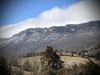
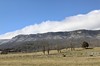
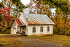
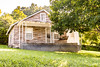
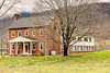
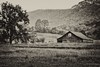
The above images may not be of the site on this page, but were taken nearby. They are loaded from Flickr so please click on them for image credits.
Click here to see more info for this site
Nearby sites
Click here to view sites on an interactive map of the areaKey: Red: member's photo, Blue: 3rd party photo, Yellow: other image, Green: no photo - please go there and take one, Grey: site destroyed
Download sites to:
KML (Google Earth)
GPX (GPS waypoints)
CSV (Garmin/Navman)
CSV (Excel)
To unlock full downloads you need to sign up as a Contributory Member. Otherwise downloads are limited to 50 sites.
Turn off the page maps and other distractions
Nearby sites listing. In the following links * = Image available
64.3km NNW 330° Red Bird Petroglyphs Rock Art
91.2km SSW 211° McClung Museum of Natural History and Culture* Museum
92.2km SSW 212° University of Tennessee Agriculture Farm Mound* Barrow Cemetery
98.9km SSE 149° Hot Springs (North Carolina)* Holy Well or Sacred Spring
125.8km NW 324° Indian Fort Mountain* Hillfort
129.4km E 91° Cornelius Ancient Village or Settlement
130.0km S 177° Museum of the Cherokee Indian* Museum
135.1km S 180° Kituwah* Ancient Village or Settlement
145.3km NW 322° Round Hill Mound Site* Artificial Mound
145.4km SSE 148° Biltmore Mound Artificial Mound
151.9km SSW 194° Sculptured Stone near Robbinsville* Sculptured Stone
152.5km S 170° Judaculla Rock* Rock Art
153.4km ESE 114° Split Rock / Sphinx Rock* Natural Stone / Erratic / Other Natural Feature
154.4km S 181° Cowee Mound Artificial Mound
163.3km S 179° Nikwasi Mound* Artificial Mound
165.3km ESE 110° The Blowing Rock* Natural Stone / Erratic / Other Natural Feature
167.1km SE 142° Chimney Rock (North Carolina)* Natural Stone / Erratic / Other Natural Feature
176.2km WSW 252° Monterey Standing Stone* Standing Stone (Menhir)
188.8km NNW 340° Gaitskill Mound Site* Artificial Mound
192.0km NNW 331° Mt. Horeb Earthworks Complex* Misc. Earthwork
197.8km SW 227° Hiwassee Island Mounds* Artificial Mound
201.3km SSW 192° Track Rock* Rock Art
201.6km SSE 162° South Carolina Rock Art Center* Rock Art
201.7km SSW 192° Track Rock Gap Archaeological Area* Stone Row / Alignment
201.7km NNE 20° Stone Serpent Mound* Hill Figure or Geoglyph
View more nearby sites and additional images


 We would like to know more about this location. Please feel free to add a brief description and any relevant information in your own language.
 Wir möchten mehr über diese Stätte erfahren. Bitte zögern Sie nicht, eine kurze Beschreibung und relevante Informationen in Deutsch hinzuzufügen.
 Nous aimerions en savoir encore un peu sur les lieux. S'il vous plaît n'hesitez pas à ajouter une courte description et tous les renseignements pertinents dans votre propre langue.
 Quisieramos informarnos un poco más de las lugares. No dude en añadir una breve descripción y otros datos relevantes en su propio idioma.