<< Text Pages >> Tel al-Abar 3 - Ancient Village or Settlement in Syria
Submitted by DrewParsons on Sunday, 23 May 2010 Page Views: 3156
Multi-periodSite Name: Tel al-Abar 3Country: Syria
NOTE: This site is 33.041 km away from the location you searched for.
Type: Ancient Village or Settlement
Nearest Town: Aleppo Nearest Village: Aleppo
Latitude: 36.214000N Longitude: 37.147000E
Condition:
| 5 | Perfect |
| 4 | Almost Perfect |
| 3 | Reasonable but with some damage |
| 2 | Ruined but still recognisable as an ancient site |
| 1 | Pretty much destroyed, possibly visible as crop marks |
| 0 | No data. |
| -1 | Completely destroyed |
| 5 | Superb |
| 4 | Good |
| 3 | Ordinary |
| 2 | Not Good |
| 1 | Awful |
| 0 | No data. |
| 5 | Can be driven to, probably with disabled access |
| 4 | Short walk on a footpath |
| 3 | Requiring a bit more of a walk |
| 2 | A long walk |
| 1 | In the middle of nowhere, a nightmare to find |
| 0 | No data. |
| 5 | co-ordinates taken by GPS or official recorded co-ordinates |
| 4 | co-ordinates scaled from a detailed map |
| 3 | co-ordinates scaled from a bad map |
| 2 | co-ordinates of the nearest village |
| 1 | co-ordinates of the nearest town |
| 0 | no data |
Be the first person to rate this site - see the 'Contribute!' box in the right hand menu.
Internal Links:
External Links:
Tel al-Abar 3 is a site on the left bank of the Euphrates River near Aleppo in northern Syria and dates back to the 10th millennium BC
Excavations at Tel al-Abar 3 reveal two different areas that include three communal buildings and dozens of circular houses built from limestone and paved with pebbles from the river. Finds include flint tools such as blades, knives, sickles, arrow tips and hatchets, and tools used for leatherwork and crafting straw mats, stone mills, pestles, pot sherds, animal bones and horns. The site illustrates the emerging specialisation in ancient times having various buildings serving farming, hunting and the production of stone impliments.
More at: http://www.english.globalarabnetwork.com/201004205583/Related-news-from-Syria/archaeological-sites-mark-location-of-farming-in-syria-from-10th-millennium-bc.html
You may be viewing yesterday's version of this page. To see the most up to date information please register for a free account.
Do not use the above information on other web sites or publications without permission of the contributor.
Nearby Images from Flickr

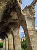
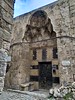
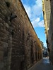
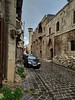

The above images may not be of the site on this page, but were taken nearby. They are loaded from Flickr so please click on them for image credits.
Click here to see more info for this site
Nearby sites
Click here to view sites on an interactive map of the areaKey: Red: member's photo, Blue: 3rd party photo, Yellow: other image, Green: no photo - please go there and take one, Grey: site destroyed
Download sites to:
KML (Google Earth)
GPX (GPS waypoints)
CSV (Garmin/Navman)
CSV (Excel)
To unlock full downloads you need to sign up as a Contributory Member. Otherwise downloads are limited to 50 sites.
Turn off the page maps and other distractions
Nearby sites listing. In the following links * = Image available
1.2km S 169° Aleppo Museum* Museum
1.6km SE 140° Djade al-Mughara Ancient Village or Settlement
2.2km SE 140° Aleppo Tell* Ancient Village or Settlement
32.3km NW 309° Bit-Agusi Ancient Village or Settlement
40.3km NW 323° Ain Dara* Ancient Temple
46.8km SW 222° Neirab* Ancient Village or Settlement
47.6km SSW 202° Ur-Schu Ancient Village or Settlement
49.9km E 100° Tell Umm el-Marra Ancient Village or Settlement
50.9km E 93° Tal Om al-Mara Burial Chamber or Dolmen
54.0km N 3° Oylum Hoyuk Ancient Village or Settlement
55.8km SW 214° Ebla Temple of Ishtar* Ancient Temple
55.8km SW 214° Ebla.* Ancient Village or Settlement
55.9km SW 214° Ebla Palace* Ancient Palace
68.7km W 273° Alalakh* Ancient Village or Settlement
69.2km W 273° Tell Ta’yinat* Ancient Village or Settlement
73.1km WSW 246° Karkara Stone Fort or Dun
84.7km NNW 335° Yesemek Ancient Mine, Quarry or other Industry
86.4km W 271° Antakya Museum Museum
87.9km W 269° Antioch on the Orontes Ancient Village or Settlement
88.2km E 89° Ekalte Ancient Village or Settlement
90.4km ESE 106° Barbalissos Ancient Village or Settlement
98.1km E 93° Jebel Aruda Ancient Temple
99.9km NE 54° Mureybet Ancient Village or Settlement
103.4km NE 49° Carchemish, Syrian* Ancient Village or Settlement
103.5km NE 48° Carchemish* Ancient Village or Settlement
View more nearby sites and additional images


 We would like to know more about this location. Please feel free to add a brief description and any relevant information in your own language.
 Wir möchten mehr über diese Stätte erfahren. Bitte zögern Sie nicht, eine kurze Beschreibung und relevante Informationen in Deutsch hinzuzufügen.
 Nous aimerions en savoir encore un peu sur les lieux. S'il vous plaît n'hesitez pas à ajouter une courte description et tous les renseignements pertinents dans votre propre langue.
 Quisieramos informarnos un poco más de las lugares. No dude en añadir una breve descripción y otros datos relevantes en su propio idioma.