<< Our Photo Pages >> Vrysi - Ancient Village or Settlement in Cyprus
Submitted by smallblueplanet on Friday, 01 October 2004 Page Views: 9359
Multi-periodSite Name: Vrysi Alternative Name: Ayios Epiktitos Vrysi, ÇatalköyCountry: Cyprus
NOTE: This site is 17.044 km away from the location you searched for.
Type: Ancient Village or Settlement
Nearest Town: Girne/Kyrenia Nearest Village: Acapulco Beach Hotel
Latitude: 35.332407N Longitude: 33.422333E
Condition:
| 5 | Perfect |
| 4 | Almost Perfect |
| 3 | Reasonable but with some damage |
| 2 | Ruined but still recognisable as an ancient site |
| 1 | Pretty much destroyed, possibly visible as crop marks |
| 0 | No data. |
| -1 | Completely destroyed |
| 5 | Superb |
| 4 | Good |
| 3 | Ordinary |
| 2 | Not Good |
| 1 | Awful |
| 0 | No data. |
| 5 | Can be driven to, probably with disabled access |
| 4 | Short walk on a footpath |
| 3 | Requiring a bit more of a walk |
| 2 | A long walk |
| 1 | In the middle of nowhere, a nightmare to find |
| 0 | No data. |
| 5 | co-ordinates taken by GPS or official recorded co-ordinates |
| 4 | co-ordinates scaled from a detailed map |
| 3 | co-ordinates scaled from a bad map |
| 2 | co-ordinates of the nearest village |
| 1 | co-ordinates of the nearest town |
| 0 | no data |
Internal Links:
External Links:
")
The houses were built half-sunk, their walls made of stone and wet clay and roofed with reeds covered with mud and wet clay. The inner walls were also plastered with wet clay. Rush mats were used on the floor. Narrow, covered passages linked the houses.
The people cultivated cereals and herded animals, and buried their dead outside their settlements. Olive and grape remains from Vrysi indicate the colonists introduced specialized horticulture to Cyprus soon after it had originated on the mainland. Their innovation was pottery - Red-on-White at Vrysi. Amongst the finds unearthed were polished stone axes and chisels, and stone idols.
Following the earthquake around the year 3000 B.C. the people of Vrysi abandoned this place.
Easy to find when you know where to look -on the headland, behind the restaurant on the Acapulco Beach Hotel complex. Take the coast road east, about 6km from Girne.
You may be viewing yesterday's version of this page. To see the most up to date information please register for a free account.
")
")
")
")
Do not use the above information on other web sites or publications without permission of the contributor.
Nearby Images from Flickr

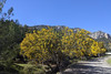


The above images may not be of the site on this page, but were taken nearby. They are loaded from Flickr so please click on them for image credits.
Click here to see more info for this site
Nearby sites
Click here to view sites on an interactive map of the areaKey: Red: member's photo, Blue: 3rd party photo, Yellow: other image, Green: no photo - please go there and take one, Grey: site destroyed
Download sites to:
KML (Google Earth)
GPX (GPS waypoints)
CSV (Garmin/Navman)
CSV (Excel)
To unlock full downloads you need to sign up as a Contributory Member. Otherwise downloads are limited to 50 sites.
Turn off the page maps and other distractions
Nearby sites listing. In the following links * = Image available
15.2km W 264° Karmi.* Chambered Tomb
31.5km SSW 197° Tseri-Angali Ancient Village or Settlement
35.2km S 180° Idalion Ancient Village or Settlement
39.4km S 185° Ayia Varvara Asprokremnos Ancient Village or Settlement
40.2km SSW 195° Kataliondas Kourvellos* Ancient Village or Settlement
41.5km SE 144° Pyla (Cyprus)* Ancient Temple
42.5km SSW 201° Tamassos Ancient Village or Settlement
46.4km SE 145° Pyla-Kokkinokremos Ancient Village or Settlement
46.6km ESE 110° Salamis* Ancient Village or Settlement
49.3km SSE 157° Kition* Ancient Village or Settlement
49.3km SSE 157° Temple of Paphian Aphrodite* Ancient Temple
52.2km SSE 161° Dromolaxia Vizatzia Ancient Village or Settlement
60.0km S 187° Choirokoitia* Ancient Village or Settlement
62.1km SE 129° Makronissos Tombs Rock Cut Tomb
65.4km S 190° Tenta at Kalavasos Ancient Village or Settlement
65.6km S 189° Kalavasos-Ayios Dhimitrios Ancient Village or Settlement
71.0km SSW 198° Pyrgos-Mavrorachi Ancient Village or Settlement
73.7km SSW 202° Amathus* Ancient Village or Settlement
88.0km SW 215° Ancient Millstone Ancient Mine, Quarry or other Industry
88.8km SSW 214° Kurion* Ancient Village or Settlement
88.8km SW 214° Kourion Stadium* Ancient Trackway
89.2km SW 215° Apollo Hylates Temple Ancient Temple
95.2km NW 324° Anemurium* Ancient Village or Settlement
96.3km WSW 250° Marion Settlement Ancient Village or Settlement
96.3km WSW 250° Polis Archeological Museum Museum
View more nearby sites and additional images


 We would like to know more about this location. Please feel free to add a brief description and any relevant information in your own language.
 Wir möchten mehr über diese Stätte erfahren. Bitte zögern Sie nicht, eine kurze Beschreibung und relevante Informationen in Deutsch hinzuzufügen.
 Nous aimerions en savoir encore un peu sur les lieux. S'il vous plaît n'hesitez pas à ajouter une courte description et tous les renseignements pertinents dans votre propre langue.
 Quisieramos informarnos un poco más de las lugares. No dude en añadir una breve descripción y otros datos relevantes en su propio idioma.