<< Our Photo Pages >> Ikada Castle - Modern Stone Circle etc in Japan in Honshū
Submitted by Aska on Thursday, 13 February 2020 Page Views: 422
Modern SitesSite Name: Ikada Castle Alternative Name: 池田城 Ikeda-jō Ikeda-joCountry: Japan
NOTE: This site is 0.596 km away from the location you searched for.
Region: Honshū Type: Modern Stone Circle etc
Nearest Town: Ikeda (Ōsaka prefecture) Nearest Village: Shiroyama-chō 城山Ĭ
Latitude: 34.827080N Longitude: 135.428380E
Condition:
| 5 | Perfect |
| 4 | Almost Perfect |
| 3 | Reasonable but with some damage |
| 2 | Ruined but still recognisable as an ancient site |
| 1 | Pretty much destroyed, possibly visible as crop marks |
| 0 | No data. |
| -1 | Completely destroyed |
| 5 | Superb |
| 4 | Good |
| 3 | Ordinary |
| 2 | Not Good |
| 1 | Awful |
| 0 | No data. |
| 5 | Can be driven to, probably with disabled access |
| 4 | Short walk on a footpath |
| 3 | Requiring a bit more of a walk |
| 2 | A long walk |
| 1 | In the middle of nowhere, a nightmare to find |
| 0 | No data. |
| 5 | co-ordinates taken by GPS or official recorded co-ordinates |
| 4 | co-ordinates scaled from a detailed map |
| 3 | co-ordinates scaled from a bad map |
| 2 | co-ordinates of the nearest village |
| 1 | co-ordinates of the nearest town |
| 0 | no data |
Internal Links:
External Links:
")
Ikeda Castle was a medieval (1334-1580) hillfort, and it was reconstructed along with its garden in 2000.
Open 9:00-19:00(-17:00 Nov.-Mar.), closed on Tuesday and the days around the New Years Day, admission free.
Official site in Japanese
You may be viewing yesterday's version of this page. To see the most up to date information please register for a free account.
Do not use the above information on other web sites or publications without permission of the contributor.
Nearby Images from Flickr
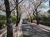
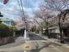
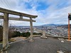
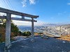
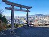

The above images may not be of the site on this page, but were taken nearby. They are loaded from Flickr so please click on them for image credits.
Click here to see more info for this site
Nearby sites
Click here to view sites on an interactive map of the areaKey: Red: member's photo, Blue: 3rd party photo, Yellow: other image, Green: no photo - please go there and take one, Grey: site destroyed
Download sites to:
KML (Google Earth)
GPX (GPS waypoints)
CSV (Garmin/Navman)
CSV (Excel)
To unlock full downloads you need to sign up as a Contributory Member. Otherwise downloads are limited to 50 sites.
Turn off the page maps and other distractions
Nearby sites listing. In the following links * = Image available
6.0km W 263° Nakayama Sōen Kofun* Passage Grave
7.8km ENE 57° Hatten Ishigura* Pyramid / Mastaba
12.2km S 186° Honkō-ji temple* Modern Stone Circle etc
14.3km ENE 78° Shin-ike Haniwa Kōba Kōen* Ancient Mine, Quarry or other Industry
15.0km E 88° Fumon-ji temple* Modern Stone Circle etc
15.4km E 80° Imashirozuka Kofun* Long Barrow
18.3km SSE 150° Hōkoku-jinja shrine* Modern Stone Circle etc
20.0km SSE 162° Gansen-ji temple* Modern Stone Circle etc
20.4km E 100° Iraku Park* Modern Stone Circle etc
20.8km SSE 157° Shitennō-ji temple* Ancient Temple
21.2km SE 132° Kōnoike Shinden hall* Modern Stone Circle etc
22.6km ESE 112° Ishi-no-Hōden Kofun* Passage Grave
24.3km NNW 344° Chōsan-ji temple* Modern Stone Circle etc
24.6km ENE 58° Jūrin-ji temple* Modern Stone Circle etc
25.2km NE 55° Shōhō-ji temple* Modern Stone Circle etc
25.4km SE 134° Hanazono Rugby Stadium* Modern Stone Circle etc
25.5km ENE 77° Iwashimizu Hachimangū shrine* Modern Stone Circle etc
25.7km ENE 61° Kōmyō-ji temple (in Kyōto)* Modern Stone Circle etc
26.4km ENE 68° IgenoYama Kofun* Long Barrow
27.8km ENE 62° Motoinari Kofun* Long Barrow
28.2km NNW 345° Sumiyoshi Jinja shrine (in Sasayama city)* Modern Stone Circle etc
28.5km SE 137° Shionjiyama Kofun* Long Barrow
28.9km S 173° Nanshū-ji temple* Modern Stone Circle etc
29.0km NNW 345° Honkyū-ji temple* Modern Stone Circle etc
29.7km NE 52° Jizō-in temple (in Kyoto, Ukyo-ku ward)* Modern Stone Circle etc
View more nearby sites and additional images


 We would like to know more about this location. Please feel free to add a brief description and any relevant information in your own language.
 Wir möchten mehr über diese Stätte erfahren. Bitte zögern Sie nicht, eine kurze Beschreibung und relevante Informationen in Deutsch hinzuzufügen.
 Nous aimerions en savoir encore un peu sur les lieux. S'il vous plaît n'hesitez pas à ajouter une courte description et tous les renseignements pertinents dans votre propre langue.
 Quisieramos informarnos un poco más de las lugares. No dude en añadir una breve descripción y otros datos relevantes en su propio idioma.