<< Text Pages >> Antelope Hill - Ancient Mine, Quarry or other Industry in United States in The Southwest
Submitted by bat400 on Wednesday, 03 February 2010 Page Views: 3794
Multi-periodSite Name: Antelope Hill Alternative Name: Cerro de Santa Cecilla del MetateCountry: United States Region: The Southwest Type: Ancient Mine, Quarry or other Industry
Nearest Town: Yuma, AZ
Latitude: 32.706000N Longitude: 114.0139W
Condition:
| 5 | Perfect |
| 4 | Almost Perfect |
| 3 | Reasonable but with some damage |
| 2 | Ruined but still recognisable as an ancient site |
| 1 | Pretty much destroyed, possibly visible as crop marks |
| 0 | No data. |
| -1 | Completely destroyed |
| 5 | Superb |
| 4 | Good |
| 3 | Ordinary |
| 2 | Not Good |
| 1 | Awful |
| 0 | No data. |
| 5 | Can be driven to, probably with disabled access |
| 4 | Short walk on a footpath |
| 3 | Requiring a bit more of a walk |
| 2 | A long walk |
| 1 | In the middle of nowhere, a nightmare to find |
| 0 | No data. |
| 5 | co-ordinates taken by GPS or official recorded co-ordinates |
| 4 | co-ordinates scaled from a detailed map |
| 3 | co-ordinates scaled from a bad map |
| 2 | co-ordinates of the nearest village |
| 1 | co-ordinates of the nearest town |
| 0 | no data |
Be the first person to rate this site - see the 'Contribute!' box in the right hand menu.
Internal Links:
External Links:
Ancient quarry in Yuma County, Arizona.This hill on the Gila River was the quarry for arkosic sandstone grinding stones found at multiple sites in the southwest. There are also petroglyphs.
The hill was a historic camping place for the explorer Juan Bautista de Anza.
You may be viewing yesterday's version of this page. To see the most up to date information please register for a free account.
Do not use the above information on other web sites or publications without permission of the contributor.
Nearby Images from Flickr

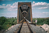
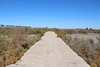

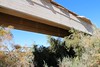
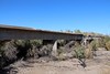
The above images may not be of the site on this page, but were taken nearby. They are loaded from Flickr so please click on them for image credits.
Click here to see more info for this site
Nearby sites
Click here to view sites on an interactive map of the areaKey: Red: member's photo, Blue: 3rd party photo, Yellow: other image, Green: no photo - please go there and take one, Grey: site destroyed
Download sites to:
KML (Google Earth)
GPX (GPS waypoints)
CSV (Garmin/Navman)
CSV (Excel)
To unlock full downloads you need to sign up as a Contributory Member. Otherwise downloads are limited to 50 sites.
Turn off the page maps and other distractions
Nearby sites listing. In the following links * = Image available
65.4km ENE 68° Sears Point* Rock Art
96.8km ENE 68° Painted Rock Petroglyph Site* Rock Art
96.9km ENE 68° Chamber of the Sun* Rock Art
130.9km NNW 339° Blythe Intaglios* Hill Figure or Geoglyph
159.3km NW 310° Corn Springs* Rock Art
170.7km NE 55° White Tank Mountains Petroglyphs* Rock Art
194.4km ENE 68° South Mountain Rock Art
200.9km NE 56° Palo Verde Ancient Village or Settlement
204.1km ENE 58° Deer Valley Petroglyph Preserve* Rock Art
206.0km ENE 66° Pueblo Grande - Park of Four Waters Ancient Village or Settlement
206.2km ENE 66° Pueblo Grande* Ancient Village or Settlement
206.3km ENE 66° Pueblo Grande - Ball Court* Ancient Village or Settlement
209.7km ENE 67° Hayden Butte* Rock Art
209.7km ENE 67° Loma del Rio Ruins* Ancient Village or Settlement
210.3km ENE 66° Desert Botanical Gardens* Museum
217.7km ENE 68° Mesa Grande Ancient Village or Settlement
218.0km ENE 68° Arizona Museum of Natural History* Museum
220.7km ENE 68° Park of the Canals Ancient Village or Settlement
227.9km N 349° Topock Maze* Misc. Earthwork
233.5km E 81° Casa Grande - The Great House* Ancient Palace
233.6km E 81° Casa Grande - Village* Ancient Village or Settlement
233.6km E 81° Casa Grande - Ball Court* Ancient Village or Settlement
237.8km NE 54° Skull Mesa* Ancient Village or Settlement
245.3km NE 45° Agua Fria National Monument* Rock Art
245.4km NE 46° Agua Fria National Monument - Badger Springs Wash* Rock Art
View more nearby sites and additional images


 We would like to know more about this location. Please feel free to add a brief description and any relevant information in your own language.
 Wir möchten mehr über diese Stätte erfahren. Bitte zögern Sie nicht, eine kurze Beschreibung und relevante Informationen in Deutsch hinzuzufügen.
 Nous aimerions en savoir encore un peu sur les lieux. S'il vous plaît n'hesitez pas à ajouter une courte description et tous les renseignements pertinents dans votre propre langue.
 Quisieramos informarnos un poco más de las lugares. No dude en añadir una breve descripción y otros datos relevantes en su propio idioma.