<< Text Pages >> The Gilgal associated violently with Joshua - Stone Circle in Israel
Submitted by Andy B on Wednesday, 03 February 2010 Page Views: 4335
Neolithic and Bronze AgeSite Name: The Gilgal associated violently with JoshuaCountry: Israel
NOTE: This site is 5.075 km away from the location you searched for.
Type: Stone Circle
Nearest Town: Antipatris Nearest Village: Jiljulieh
Latitude: 32.155833N Longitude: 34.952778E
Condition:
| 5 | Perfect |
| 4 | Almost Perfect |
| 3 | Reasonable but with some damage |
| 2 | Ruined but still recognisable as an ancient site |
| 1 | Pretty much destroyed, possibly visible as crop marks |
| 0 | No data. |
| -1 | Completely destroyed |
| 5 | Superb |
| 4 | Good |
| 3 | Ordinary |
| 2 | Not Good |
| 1 | Awful |
| 0 | No data. |
| 5 | Can be driven to, probably with disabled access |
| 4 | Short walk on a footpath |
| 3 | Requiring a bit more of a walk |
| 2 | A long walk |
| 1 | In the middle of nowhere, a nightmare to find |
| 0 | No data. |
| 5 | co-ordinates taken by GPS or official recorded co-ordinates |
| 4 | co-ordinates scaled from a detailed map |
| 3 | co-ordinates scaled from a bad map |
| 2 | co-ordinates of the nearest village |
| 1 | co-ordinates of the nearest town |
| 0 | no data |
Internal Links:
External Links:
Stone Circle in The Bible. A Gilgal (stone circle) is mentioned in the Bible, in a list of conquests under the leadership of Joshua (Joshua 12:7). There are scholars who believe that this is not the same location as the one where the Israelites had encamped. Some scholars believe that this may be the result of a scribal error, and instead should really refer to Galilee.
It may also have been the place marked by the modern village Jiljulieh, southwest of Antipatris, and northeast of Joppa. But another Gilgal, under the slightly different form of Kilkilieh, lies about two miles east of Antipatris.
Source: Wikepedia.
You may be viewing yesterday's version of this page. To see the most up to date information please register for a free account.
Do not use the above information on other web sites or publications without permission of the contributor.
Nearby Images from Flickr

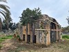
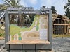
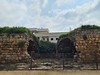
The above images may not be of the site on this page, but were taken nearby. They are loaded from Flickr so please click on them for image credits.
Click here to see more info for this site
Nearby sites
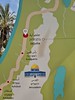
Click here to view sites on an interactive map of the areaKey: Red: member's photo, Blue: 3rd party photo, Yellow: other image, Green: no photo - please go there and take one, Grey: site destroyed
Download sites to:
KML (Google Earth)
GPX (GPS waypoints)
CSV (Garmin/Navman)
CSV (Excel)
To unlock full downloads you need to sign up as a Contributory Member. Otherwise downloads are limited to 50 sites.
Turn off the page maps and other distractions
Nearby sites listing. In the following links * = Image available
5.7km SSE 153° Qesem Cave* Cave or Rock Shelter
6.0km SSW 201° Antipatris* Ancient Village or Settlement
7.2km SSE 153° Ancient Farm near Rosh Ha'ayin * Ancient Village or Settlement
14.4km WNW 288° Apollonia (Israel)* Ancient Village or Settlement
16.1km WSW 248° Tel Qasile* Artificial Mound
17.6km WSW 251° Tel Qudadi Ancient Village or Settlement
17.8km S 181° Mosaic and Stone structure near Shoham Ancient Village or Settlement
22.8km SSW 192° Lod Mosaic Ancient Palace
28.9km ESE 120° The Gilgal associated with Elijah and Elisha Stone Circle
31.2km ENE 78° Jacob's Well (Bir Ya'Qub)* Holy Well or Sacred Spring
31.8km ENE 74° Mount 'Ebal Ancient Temple
33.2km S 186° Tel Gezer* Ancient Village or Settlement
33.5km ESE 109° Tel Shiloh Ancient Village or Settlement
35.5km S 174° Emmaus Ancient Village or Settlement
35.6km SW 223° Yavne Yam Ancient Village or Settlement
36.8km N 10° Tel Esur Ancient Village or Settlement
39.1km N 352° Caesarea Maritima* Ancient Village or Settlement
39.3km N 353° The Bird Mosaic, Caesarea, Israel* Ancient Palace
39.4km NNE 22° El-ahwat near kibuts Katsir-Harish* Ancient Village or Settlement
43.1km N 358° Horvat 'Aqev* Ancient Village or Settlement
43.1km SSW 193° Tel 'Ekron Ancient Village or Settlement
43.8km SSE 156° Motza Neolithic City* Ancient Village or Settlement
44.8km N 358° Kebara Cave Cave or Rock Shelter
45.5km SSE 153° Tel Motza* Ancient Village or Settlement
46.0km S 175° Tel Beth-Shemesh* Artificial Mound
View more nearby sites and additional images


 We would like to know more about this location. Please feel free to add a brief description and any relevant information in your own language.
 Wir möchten mehr über diese Stätte erfahren. Bitte zögern Sie nicht, eine kurze Beschreibung und relevante Informationen in Deutsch hinzuzufügen.
 Nous aimerions en savoir encore un peu sur les lieux. S'il vous plaît n'hesitez pas à ajouter une courte description et tous les renseignements pertinents dans votre propre langue.
 Quisieramos informarnos un poco más de las lugares. No dude en añadir una breve descripción y otros datos relevantes en su propio idioma.