<< Our Photo Pages >> Khasab Fort Museum - Museum in Oman
Submitted by DrewParsons on Thursday, 01 May 2014 Page Views: 2833
MuseumsSite Name: Khasab Fort MuseumCountry: Oman
NOTE: This site is 81.578 km away from the location you searched for.
Type: Museum
Nearest Town: Khasab
Latitude: 26.198190N Longitude: 56.249140E
Condition:
| 5 | Perfect |
| 4 | Almost Perfect |
| 3 | Reasonable but with some damage |
| 2 | Ruined but still recognisable as an ancient site |
| 1 | Pretty much destroyed, possibly visible as crop marks |
| 0 | No data. |
| -1 | Completely destroyed |
| 5 | Superb |
| 4 | Good |
| 3 | Ordinary |
| 2 | Not Good |
| 1 | Awful |
| 0 | No data. |
| 5 | Can be driven to, probably with disabled access |
| 4 | Short walk on a footpath |
| 3 | Requiring a bit more of a walk |
| 2 | A long walk |
| 1 | In the middle of nowhere, a nightmare to find |
| 0 | No data. |
| 5 | co-ordinates taken by GPS or official recorded co-ordinates |
| 4 | co-ordinates scaled from a detailed map |
| 3 | co-ordinates scaled from a bad map |
| 2 | co-ordinates of the nearest village |
| 1 | co-ordinates of the nearest town |
| 0 | no data |
Internal Links:
External Links:
I have visited· I would like to visit
DrewParsons has visited here
")
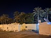
There is an excellent display on local petroglyphs in the museum. As well as the section on prehistoric rock art the other displays in the museum are outstanding. There is car parking right in front of the fort.
You may be viewing yesterday's version of this page. To see the most up to date information please register for a free account.
")
")
Do not use the above information on other web sites or publications without permission of the contributor.
Nearby Images from Flickr


The above images may not be of the site on this page, but were taken nearby. They are loaded from Flickr so please click on them for image credits.
Click here to see more info for this site
Nearby sites
Click here to view sites on an interactive map of the areaKey: Red: member's photo, Blue: 3rd party photo, Yellow: other image, Green: no photo - please go there and take one, Grey: site destroyed
Download sites to:
KML (Google Earth)
GPX (GPS waypoints)
CSV (Garmin/Navman)
CSV (Excel)
To unlock full downloads you need to sign up as a Contributory Member. Otherwise downloads are limited to 50 sites.
Turn off the page maps and other distractions
Nearby sites listing. In the following links * = Image available
3.8km SW 234° Tawi Petroglyphs* Rock Art
46.0km SSW 205° Shimal Tomb Chambered Tomb
52.2km SSW 212° Ras Al Khaimah Tombs* Chambered Tomb
63.2km S 179° Dibba Tomb Chambered Tomb
94.4km SW 225° Akab Ritual Site and Settlement Ancient Village or Settlement
100.6km SW 224° Umm al-Quwain 2* Ancient Village or Settlement
105.4km SW 222° Tell Abraq* Stone Fort or Dun
112.1km SW 220° Mowaihat Chambered Cairn
125.5km SSW 198° Mleiha Umm an-Nar tomb* Chambered Tomb
125.5km SSW 198° Mleiha Archaeological Centre* Museum
126.0km SSW 198° Mleiha Fort Stone Fort or Dun
126.1km SSW 199° FAY-NE-15* Ancient Village or Settlement
126.2km SSW 199° Jebel Faya tomb 1* Chambered Tomb
126.2km SSW 199° Jebel Faya tomb 2 Chambered Tomb
126.2km SSW 199° Wadi Caves* Cave or Rock Shelter
126.2km SSW 199° Jebel Faya tomb 3 Chambered Tomb
126.6km SSW 199° Jebel Faya Rock Shelter Cave or Rock Shelter
126.6km SW 222° Sharjah Archaeological Museum* Museum
139.6km SSW 199° Al-Buhais 18 Ancient Village or Settlement
141.0km SW 223° Dubai Museum* Museum
154.8km SW 220° al-Sufouh* Chambered Cairn
211.4km SSW 195° Bida Bint Saud Burial Chamber or Dolmen
216.8km SSW 192° Al Hili Archaeological park* Museum
243.7km S 191° Jebel Hafit Cairn Tombs* Burial Chamber or Dolmen
245.9km S 186° Mezyad graves Burial Chamber or Dolmen
View more nearby sites and additional images


 We would like to know more about this location. Please feel free to add a brief description and any relevant information in your own language.
 Wir möchten mehr über diese Stätte erfahren. Bitte zögern Sie nicht, eine kurze Beschreibung und relevante Informationen in Deutsch hinzuzufügen.
 Nous aimerions en savoir encore un peu sur les lieux. S'il vous plaît n'hesitez pas à ajouter une courte description et tous les renseignements pertinents dans votre propre langue.
 Quisieramos informarnos un poco más de las lugares. No dude en añadir una breve descripción y otros datos relevantes en su propio idioma.