<< Other Photo Pages >> Inca-Caranqui - Ancient Village or Settlement in Ecuador
Submitted by davidmorgan on Saturday, 12 January 2013 Page Views: 4779
Multi-periodSite Name: Inca-CaranquiCountry: Ecuador
NOTE: This site is 59.209 km away from the location you searched for.
Type: Ancient Village or Settlement
Nearest Town: Ibarra
Latitude: 0.322352N Longitude: 78.121452W
Condition:
| 5 | Perfect |
| 4 | Almost Perfect |
| 3 | Reasonable but with some damage |
| 2 | Ruined but still recognisable as an ancient site |
| 1 | Pretty much destroyed, possibly visible as crop marks |
| 0 | No data. |
| -1 | Completely destroyed |
| 5 | Superb |
| 4 | Good |
| 3 | Ordinary |
| 2 | Not Good |
| 1 | Awful |
| 0 | No data. |
| 5 | Can be driven to, probably with disabled access |
| 4 | Short walk on a footpath |
| 3 | Requiring a bit more of a walk |
| 2 | A long walk |
| 1 | In the middle of nowhere, a nightmare to find |
| 0 | No data. |
| 5 | co-ordinates taken by GPS or official recorded co-ordinates |
| 4 | co-ordinates scaled from a detailed map |
| 3 | co-ordinates scaled from a bad map |
| 2 | co-ordinates of the nearest village |
| 1 | co-ordinates of the nearest town |
| 0 | no data |
Internal Links:
External Links:
I have visited· I would like to visit
Andy B has visited here
")
Ethnohistoric accounts regarding who ordered the construction of this site and why are conflicting, with some attributing it to the ruler Huayna Capac for commemorative purposes, and others to his son, Atahualpa, in preparation for his coronation as the new Sapa Inca.
Source: Wayne State University excavation website which has lots more information on the site.
Note: The Water Temple of Inca-Caranqui - was hydraulic engineering the key to winning the hearts and minds of a conquered people?
You may be viewing yesterday's version of this page. To see the most up to date information please register for a free account.
Do not use the above information on other web sites or publications without permission of the contributor.
Nearby Images from Flickr
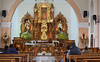
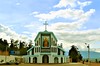

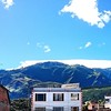

The above images may not be of the site on this page, but were taken nearby. They are loaded from Flickr so please click on them for image credits.
Click here to see more info for this site
Nearby sites
Click here to view sites on an interactive map of the areaKey: Red: member's photo, Blue: 3rd party photo, Yellow: other image, Green: no photo - please go there and take one, Grey: site destroyed
Download sites to:
KML (Google Earth)
GPX (GPS waypoints)
CSV (Garmin/Navman)
CSV (Excel)
To unlock full downloads you need to sign up as a Contributory Member. Otherwise downloads are limited to 50 sites.
Turn off the page maps and other distractions
Nearby sites listing. In the following links * = Image available
14.6km SSE 159° Pyramids of Zuleta Pyramid / Mastaba
36.1km SW 215° Cochasqui Ancient Village or Settlement
48.6km SW 225° Rumicucho Pucara Hillfort
49.5km SW 224° Catequilla* Stone Circle
143.2km SW 217° Malqui-Machay* Ancient Village or Settlement
253.5km S 172° Cueva de los Tayos Cave or Rock Shelter
268.7km NE 49° San Agustin Parque Arqueologico* Sculptured Stone
269.3km NE 49° El Purutal* Burial Chamber or Dolmen
269.3km NE 49° La Pelota* Sculptured Stone
269.4km NE 49° Petroglifos del Estrecho* Rock Art
269.8km NE 49° El Tablon (San Agustin)* Sculptured Stone
270.9km NE 48° Obando* Rock Cut Tomb
270.9km NE 50° La Chaquira* Rock Art
272.8km NE 50° Alto del Tigre* Rock Art
273.3km NE 50° Alto de las Guacas* Burial Chamber or Dolmen
274.1km NE 50° Alto de los Idolos* Artificial Mound
330.0km SSW 195° Ingapirca* Ancient Village or Settlement
340.0km NE 43° El Aguacate* Rock Cut Tomb
341.4km NE 43° Alto de Segovia* Rock Cut Tomb
342.2km NE 43° El Tablon (Tierradentro)* Sculptured Stone
372.1km SSW 195° Pumapungo Ancient Village or Settlement
394.2km NNE 27° Deportivo Cali Tombs Barrow Cemetery
562.7km SSW 191° Santa Ana - La Florida Ancient Village or Settlement
633.4km ENE 67° Angosturas II Rock Art
633.7km ENE 67° Cerro Azul Rock Art
View more nearby sites and additional images


 We would like to know more about this location. Please feel free to add a brief description and any relevant information in your own language.
 Wir möchten mehr über diese Stätte erfahren. Bitte zögern Sie nicht, eine kurze Beschreibung und relevante Informationen in Deutsch hinzuzufügen.
 Nous aimerions en savoir encore un peu sur les lieux. S'il vous plaît n'hesitez pas à ajouter une courte description et tous les renseignements pertinents dans votre propre langue.
 Quisieramos informarnos un poco más de las lugares. No dude en añadir una breve descripción y otros datos relevantes en su propio idioma.