<< Text Pages >> The Lost World Stonehenge. Cangkringan, Sleman. - Modern Stone Circle etc in Indonesia
Submitted by Aluta on Thursday, 27 September 2018 Page Views: 1351
Modern SitesSite Name: The Lost World Stonehenge. Cangkringan, Sleman. Alternative Name: Stonehenge YogyakartaCountry: Indonesia Type: Modern Stone Circle etc
Nearest Village: Kepuharjo
Latitude: 7.601438S Longitude: 110.448065E
Condition:
| 5 | Perfect |
| 4 | Almost Perfect |
| 3 | Reasonable but with some damage |
| 2 | Ruined but still recognisable as an ancient site |
| 1 | Pretty much destroyed, possibly visible as crop marks |
| 0 | No data. |
| -1 | Completely destroyed |
| 5 | Superb |
| 4 | Good |
| 3 | Ordinary |
| 2 | Not Good |
| 1 | Awful |
| 0 | No data. |
| 5 | Can be driven to, probably with disabled access |
| 4 | Short walk on a footpath |
| 3 | Requiring a bit more of a walk |
| 2 | A long walk |
| 1 | In the middle of nowhere, a nightmare to find |
| 0 | No data. |
| 5 | co-ordinates taken by GPS or official recorded co-ordinates |
| 4 | co-ordinates scaled from a detailed map |
| 3 | co-ordinates scaled from a bad map |
| 2 | co-ordinates of the nearest village |
| 1 | co-ordinates of the nearest town |
| 0 | no data |
Internal Links:
External Links:
Modern Stone Circle / Monolith in Indonesia
This is a Stonehenge replica in Indonesia. Seems to be very popular for dates and families and posting pictures to Instagram and Twitter.
It is near the base of Mount Merapi, a recently active volcano, and one site, translated from the Indonesian assures us: "Stonehenge building is actually also located in KRB III (disaster prone area) but not to worry because the manager also provides evacuation routes.”
So visit at your own risk, I guess.
As far as I can tell, this was built in the last eight years or so. It is part of a tourist complex that also includes The Lost World Castle and some other goodies.
You may be viewing yesterday's version of this page. To see the most up to date information please register for a free account.
Do not use the above information on other web sites or publications without permission of the contributor.
Nearby Images from Flickr

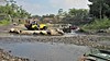

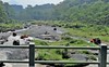
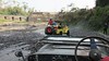
The above images may not be of the site on this page, but were taken nearby. They are loaded from Flickr so please click on them for image credits.
Click here to see more info for this site
Nearby sites
Click here to view sites on an interactive map of the areaKey: Red: member's photo, Blue: 3rd party photo, Yellow: other image, Green: no photo - please go there and take one, Grey: site destroyed
Download sites to:
KML (Google Earth)
GPX (GPS waypoints)
CSV (Garmin/Navman)
CSV (Excel)
To unlock full downloads you need to sign up as a Contributory Member. Otherwise downloads are limited to 50 sites.
Turn off the page maps and other distractions
Nearby sites listing. In the following links * = Image available
13.4km NW 308° Asu Temple Ancient Temple
13.5km NW 308° Candi Pendem Sengi Ancient Temple
16.7km SSE 158° Plaosan Temple Ancient Temple
17.4km SSE 164° Prambanan Ancient Temple
18.2km W 270° Gunungsari Temple Ancient Temple
18.5km SSE 163° Sojiwan Temple Ancient Temple
19.4km W 269° Ngawen Temple Ancient Temple
20.0km SSE 164° Candi Dawangsari Mōṭhā Baud'dha Stūpa Ancient Temple
20.1km SSE 164° Barong Temple Ancient Temple
20.3km SSE 166° Candi Banyunibo Ancient Temple
21.2km SSE 161° Situs Sumur Bandung Sambirejo Ancient Temple
21.2km SSE 165° Situs Gupolo Prambanan Ancient Temple
21.5km SSE 161° Ijo Temple Ancient Temple
24.0km W 269° Mendut Temple Ancient Temple
25.2km W 269° Pawon Temple Ancient Temple
26.9km W 270° Dieng Plateau Temple* Ancient Temple
26.9km W 268° Borobudur temple* Ancient Temple
36.6km WNW 302° Selogriyo Temple Ancient Temple
42.2km SE 127° Candi Risan Ancient Temple
73.3km NW 306° Candi Bima Ancient Temple
74.0km NW 306° Candi Gatotkaca Ancient Temple
74.2km NW 306° Candi Arjuna Ancient Temple
75.3km E 92° Sukuh Temple Ancient Temple
228.7km WNW 288° Cipari Ancient Village or Settlement
269.5km W 280° Mount Sadahurip* Natural Stone / Erratic / Other Natural Feature
View more nearby sites and additional images


 We would like to know more about this location. Please feel free to add a brief description and any relevant information in your own language.
 Wir möchten mehr über diese Stätte erfahren. Bitte zögern Sie nicht, eine kurze Beschreibung und relevante Informationen in Deutsch hinzuzufügen.
 Nous aimerions en savoir encore un peu sur les lieux. S'il vous plaît n'hesitez pas à ajouter une courte description et tous les renseignements pertinents dans votre propre langue.
 Quisieramos informarnos un poco más de las lugares. No dude en añadir una breve descripción y otros datos relevantes en su propio idioma.