<< Other Photo Pages >> Taboco - Rock Art in Brazil
Submitted by bat400 on Thursday, 27 February 2014 Page Views: 19363
Rock ArtSite Name: TabocoCountry: Brazil
NOTE: This site is 669.923 km away from the location you searched for.
Type: Rock Art
Nearest Town: Campo Grande Nearest Village: Corguinho
Latitude: 19.827S Longitude: 54.839W
Condition:
| 5 | Perfect |
| 4 | Almost Perfect |
| 3 | Reasonable but with some damage |
| 2 | Ruined but still recognisable as an ancient site |
| 1 | Pretty much destroyed, possibly visible as crop marks |
| 0 | No data. |
| -1 | Completely destroyed |
| 5 | Superb |
| 4 | Good |
| 3 | Ordinary |
| 2 | Not Good |
| 1 | Awful |
| 0 | No data. |
| 5 | Can be driven to, probably with disabled access |
| 4 | Short walk on a footpath |
| 3 | Requiring a bit more of a walk |
| 2 | A long walk |
| 1 | In the middle of nowhere, a nightmare to find |
| 0 | No data. |
| 5 | co-ordinates taken by GPS or official recorded co-ordinates |
| 4 | co-ordinates scaled from a detailed map |
| 3 | co-ordinates scaled from a bad map |
| 2 | co-ordinates of the nearest village |
| 1 | co-ordinates of the nearest town |
| 0 | no data |
Be the first person to rate this site - see the 'Contribute!' box in the right hand menu.
Internal Links:
External Links:
")
Some of the figures resemble ancient art from the central Brazilian plateau, but others appear to follow the artistic tradition of northeastern Brazil. Three distinct styles are seen. Estimating the date of the art based on it's style, researchers believe it to be at least 4000 years old.
The location given is general and does not reflect the exact location of the caves.
Source: Rodrigo Luiz Simas de Agular and Keny Marques Lima, "Quantos Estilos Pode Haver em um Mesmo Complexo Rupestre? Consideracoes Acerca das Pinturas Rupestres do Distrito de Taboco, Municipio de Corginho (MS, )" Revista Clio Arqueológica.
Note: Peccaries lead the way to discovery of Cave Art in Brazil's Mato Grosso do Sul
You may be viewing yesterday's version of this page. To see the most up to date information please register for a free account.
Do not use the above information on other web sites or publications without permission of the contributor.
Nearby Images from Flickr
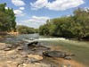
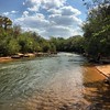
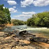
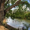


The above images may not be of the site on this page, but were taken nearby. They are loaded from Flickr so please click on them for image credits.
Click here to see more info for this site
Nearby sites
Click here to view sites on an interactive map of the areaKey: Red: member's photo, Blue: 3rd party photo, Yellow: other image, Green: no photo - please go there and take one, Grey: site destroyed
Download sites to:
KML (Google Earth)
GPX (GPS waypoints)
CSV (Garmin/Navman)
CSV (Excel)
To unlock full downloads you need to sign up as a Contributory Member. Otherwise downloads are limited to 50 sites.
Turn off the page maps and other distractions
Nearby sites listing. In the following links * = Image available
547.5km NNW 336° Santa Elina (Brazil)* Rock Art
781.4km SE 141° Vila Velha* Rock Outcrop
961.7km W 279° El Fuerte de Samaipata Pyramid / Mastaba
977.6km W 280° Mairana Circular Pyramid Pyramid / Mastaba
1055.0km SSE 151° Avencal 1* Rock Art
1095.9km W 273° Sucre Museum of Anthropology Museum
1131.5km E 90° Lapa do Santo Rock shelter* Cave or Rock Shelter
1139.2km SSE 150° Jabuticabeira II Barrow Cemetery
1141.9km WSW 249° Coctaca Ancient Village or Settlement
1142.1km W 269° Cerro Rico* Ancient Mine, Quarry or other Industry
1147.8km W 270° Tarapaya* Natural Stone / Erratic / Other Natural Feature
1148.6km WSW 249° Pucará de Peñas Blancas Hillfort
1154.4km WSW 248° Pucará de Yacoraite Hillfort
1155.3km WSW 248° La Huerta Ancient Village or Settlement
1156.7km WSW 248° Pucará de Campo Morado Hillfort
1158.2km WSW 248° Los Armarillos Ancient Village or Settlement
1161.1km WSW 248° Pucará del Angosto de Perchel Hillfort
1165.4km WSW 247° Pucará de Juella Hillfort
1168.2km WSW 247° Pucará de Tilcara* Ancient Village or Settlement
1173.1km NE 49° Baixao-Tocantins rock art* Rock Art
1182.2km NW 309° Loma Chacolatalito Artificial Mound
1218.9km WSW 241° MAAM* Museum
1226.8km WSW 249° Barrancas Rock Art
1238.5km ENE 67° Peruaçu* Rock Art
1279.0km WSW 242° Potrero de Payogasta* Ancient Village or Settlement
View more nearby sites and additional images


 We would like to know more about this location. Please feel free to add a brief description and any relevant information in your own language.
 Wir möchten mehr über diese Stätte erfahren. Bitte zögern Sie nicht, eine kurze Beschreibung und relevante Informationen in Deutsch hinzuzufügen.
 Nous aimerions en savoir encore un peu sur les lieux. S'il vous plaît n'hesitez pas à ajouter une courte description et tous les renseignements pertinents dans votre propre langue.
 Quisieramos informarnos un poco más de las lugares. No dude en añadir una breve descripción y otros datos relevantes en su propio idioma.