<< Our Photo Pages >> Makgadikgadi - Ancient Village or Settlement in Botswana
Submitted by C_Michael_Hogan on Friday, 05 December 2008 Page Views: 52576
Multi-periodSite Name: MakgadikgadiCountry: Botswana Type: Ancient Village or Settlement
Nearest Town: Maun Nearest Village: Jacks Camp
Latitude: 20.56525S Longitude: 25.160980E
Condition:
| 5 | Perfect |
| 4 | Almost Perfect |
| 3 | Reasonable but with some damage |
| 2 | Ruined but still recognisable as an ancient site |
| 1 | Pretty much destroyed, possibly visible as crop marks |
| 0 | No data. |
| -1 | Completely destroyed |
| 5 | Superb |
| 4 | Good |
| 3 | Ordinary |
| 2 | Not Good |
| 1 | Awful |
| 0 | No data. |
| 5 | Can be driven to, probably with disabled access |
| 4 | Short walk on a footpath |
| 3 | Requiring a bit more of a walk |
| 2 | A long walk |
| 1 | In the middle of nowhere, a nightmare to find |
| 0 | No data. |
| 5 | co-ordinates taken by GPS or official recorded co-ordinates |
| 4 | co-ordinates scaled from a detailed map |
| 3 | co-ordinates scaled from a bad map |
| 2 | co-ordinates of the nearest village |
| 1 | co-ordinates of the nearest town |
| 0 | no data |
Internal Links:
External Links:
I have visited· I would like to visit
C_Michael_Hogan has visited here
")
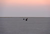
Recovery of Early Stone Age tools at the Makgadikgadi shores and lakebed reveals vestiges of prehistoric habitation by Homo sapiens and Homo habilis. Late Stone Age tools are also present, representing more refined designs of recent man. The Sua and Nwetwe Pans are two of the largest elements of the Makgadikgadi, although the Nxai Pan has been added to the Makgadikgadi Pans National Park to form an enlarged natural area. Today the arid cracked lakebed stretches vast distances and is totally dry until the rainy season induces seasonal flooding.
GEOLOGY/HYDROLOGY. Millions of years ago one of the largest rivers of Africa collected the Zambezi and other rivers rising in the north, flowing through this region of the Kalahari. Geologic uplift around 800,000 years ago blocked this flow from reaching the Orange and Limpopo basins, forming a gigantic prehistoric lake at Makgadikgadi. Subsequently tectonic uplift in the extreme north of Botswana diverted the Zambezi and greatly restricted inflow to the Makgadikgadi area; as a result the Makgadikadi Pans are presently strictly a seasonal wetland with the Okavango alluvial fan to the north receiving the residual flow from historic drainages; however the summer wet season finds the Boteti River delivering copious flows here, producing a miracle of emergence of vegetation and wildlife amid the Kalihari Desert. Today's annual flow reaching the Makgadikgadi is less than two percent of the Pleistocene value. (Gieske, 1996)
The large pans Sua and Nwetwe are composed of saline clays and efflorescence approximately 50 to 100 metres deep. Equilibrium between stabilised dunes and pans is driven by aeolian forces. Fluctuation in groundwater levels during interpluvials has led to hardpan (paedogenic) formation of calcretes and silcretes with resulting low permeability. Annual rainfall accrues here averaging 50cm (McCulloch, 2003) The highly saline water table is quite near the surface for such a semi-arid region, resulting from the fact that these pans are actually the termini of a large endorheic basin. The Sua Pan actually recieves input from five distinct rivers: the Semowane, Mosetse, Lepashe, Mosope and Nata, the last of which drains part of southwest Zimbabwe.
ARCHAEOLOGY. Akin to the origins of man in the Waterberg region and Transvaal to the south, (Hogan, 2006) significant recovery of Early Stone Age tools has derived from Makgadikgadi as vestiges of habitation by Homo sapiens and even Homo habilis. Much of the extant collection is exhibited at Jack's Camp Museum located in the north end of the pans. Field reconnaissance in the dry lakebeds conducted in the present investigation yielded further surficial specimens of early stone tools and later projectile points.
Late Stone Age man would have lived here in huts made of sticks and grass in nomadic groups of 15 to 60 individuals .The women would have concentrated on gathering fruits and nuts, while men created snares of twine to catch springhares emerging from their burrows. Springbok and eland were hunted by spear and arrow, as the Later Stone Age tools had become quite sophisticated. Although no rock paintings are found in the pans, somewhat north in the Tsodillo Hills there is a wealth of animal and human subject rock art, some dating as early as 24,000 years before present.
ETHNOGRAPHY. The Late Stone Age people here were the ancestors of the Khoesan people who inhabited the Kalahari. These hunter gatherers lived here at least as late as the Time of Christ. (Tlou, 1984) Modern Botswana tribal populations are related to the Khoesan, but DNA evidence shows a closer relationship to the later Bantu immigrants. who entered the Kalahari aggressively and likely pushed the Khoesan into less favourable environments such as the Makgadikgadi. It is probable that the Khoesan would have at that time begun to keep livestock, although the Deti people deriving from the Boteti River region slightly north have cultural and linguistic evidence of earlier livestock tending. The implied time gap of grazing in the pans area may be explained by the greater occurrence of non-palatable grasses in the Makgadigadi. The Khoesan people have a legacy of deep spirituality, including abiding respect for animals and plants and the belief that no living creature should be killed without a specific need. They also practise rituals in which a trance state is entered to communicate with the supernatural.
WATER QUALITY. Wet season Makgadikgadi waters are characterised by very high salinity resulting from the endorheic terminus location. Sodium is the chief anion, with carbonate, bicarbonate, chloride and sulfate the principal cations. Magnesium and calcium have largely precipiated out. The dry pan surfaces have halite and trona (NaCO3 + NaHCO + 2H20) crusts. Phosphorus is abundant, but nitrate is the limiting soluble nutrient. Electircal conductivity in the north of the Makgadikgadi has tested as low as 320, while southern reaches have measured as high as 125,000 micro-siemens per centimetre. The pH levels typically range from 8.5 to 10.1, while total dissolved solids range from 30 grams per litre in the south to less than one gram per litre in the north.
ECOLOGY. High nutrient content makes the seasonal Makgadikgadi Pan wetland high in bioproductivity. In the year 2000 much of the Makgadikgadi was proposed as Botswana's second Ramsar site. When the Boteti River and other tributaries to the Makgadikgadi provide their wet season flow, the pans come alive, fostering large scale animal migration, major primary productivity of algae including cyanophyta, as well as the extraordinary congregation of breeding Greater and Lesser Flamingos, who feed on brine shrimp, which survive in a state of cryptobiosis over the arid winter and thrive when algal blooms appear. In Sua Pan the population of the Lesser Flamingo has been estimated at 150,000, while that of the Greater Flamingo is above 50,000 in Sua Pan alone. The total Flamingo count at Makgadikgadi exceeds estimates for the total African population, implying many of these species are here on trans-continental migrations. In addition the pans provide important habitat for numerous intra-African as well as palaearctic migrating birds.
Algal productivity is low in most Southern African compared to East African lakes; however, compared to other saline lakes of Africa, the Makgadikgadi basin realises the highest level of phytoplankton production. Sua Pan is noted for its high abundance of cyanobacteria and diatoms. These productivity levels are generated by high mineral concentrations in the suspended sediments and the high insolation levels of this high plateau. As a result dense benthic mats of periphyton result. The most abundant diatom genus at Makgadikgadi being Nitzchia, whose levels can exceed 4,000,000 cells per milliliter. Chlorophyll A concentrations reach their highest levels at the northern pans, with maximum levels exceeding 1400 mg/m3 in the latter part of the wet season. In the northern pans, nodularia and gloeocapsa are dominant phytoplankters, with nodularia concentrations reaching values of 40,000 filaments per milliliter.Generally periphyton production exceeds phytoplankton, likely due to high turbidity.
Dominant crustaceans at Makgadikgadi are"Branchinella spinosa", "Branchinella ornata", "Moina belli", "Daphnia barbata", "Lovenula africana". Other small invertebrates are dragonfly larvae, nematode worms, genus "Sigara" and several species of "Dytiscus". Species richness of crustaceans is higher in the north end of the pans. "M. Belli" is the most abundant crustacean with concentrations of 600,000 organisms per cubic metre occurring in April and seasonal production of up to 80 grams per cubic metre. "B. spinosa" biomass production can attain levels of two grams per cubic metre.
CURRENT ENVIRONMENTAL ISSUES. Botswana as a whole has performed well in environmental conservation in comparison to other African countries. The low human population, coupled with remoteness, has provided a formula for wildlife stewardship. One of the most significant threats to environmental quality and biodiversity in Botswana is overgrazing of livestock, which reduces natural habitat and animal migration, (Onalenna, 2006) although the arid conditions combined with prevalence of non-palatable grasses has provided the Makgadikgadi with additional protection from livestock destruction.
REFERENCES.
* C. Michael Hogan, Mark Cooke and Helen Murray (2006) "The Waterberg Massif ", published by Lumina Technologies, May 22, 2006.
* A.Gieske (1996) "Modelling of the surface overflow of the Okavango delta'‘, Botswana Notes and Records, vol. 28, pp 165-192
* Graham McCulloch (2003) "The ecology of Sua Pan and its flamingo populations, PhD thesis, University of Dublin, Ireland
* Thomas Tlou and Alec Campbell (1984) "History of Botswana", MacMillan ISBN 99912-74-08-7
* Onalenna Doo Selowane (2006) "Botswana's Commonage: A Recipe for Environmental Disaster or Conservation?"
The author thanks Cyrus Dar, my guide in this region, for expert ecological assistance and for access to the Jacks Camp archaeological collection.
You may be viewing yesterday's version of this page. To see the most up to date information please register for a free account.
")
")
")
Do not use the above information on other web sites or publications without permission of the contributor.
Nearby Images from Flickr
The above images may not be of the site on this page, but were taken nearby. They are loaded from Flickr so please click on them for image credits.
Click here to see more info for this site
Nearby sites
Click here to view sites on an interactive map of the areaKey: Red: member's photo, Blue: 3rd party photo, Yellow: other image, Green: no photo - please go there and take one, Grey: site destroyed
Download sites to:
KML (Google Earth)
GPX (GPS waypoints)
CSV (Garmin/Navman)
CSV (Excel)
To unlock full downloads you need to sign up as a Contributory Member. Otherwise downloads are limited to 50 sites.
Turn off the page maps and other distractions
Nearby sites listing. In the following links * = Image available
338.0km E 89° Bambata Cave* Cave or Rock Shelter
348.5km E 90° Inanke Cave Cave or Rock Shelter
349.3km E 89° World's View Matobo National Park* Natural Stone / Erratic / Other Natural Feature
410.4km WNW 299° Tsodilo Hills* Rock Art
431.8km SSE 167° Matsieng Footprints Rock Art
447.6km NNE 16° Sikaunda petroglyphs Rock Art
466.6km ESE 114° Machete I Rock Art
481.0km SE 139° Palala River Bluffs San Rock Paintings* Rock Art
602.5km E 88° Great Zimbabwe* Ancient Village or Settlement
651.3km SSE 156° Malapa* Cave or Rock Shelter
654.4km SSE 152° African Window* Museum
660.5km SSE 157° Sterkfontein* Cave or Rock Shelter
742.4km S 174° Wolmaransstad Rock Art Rock Art
803.1km SE 136° Bantu stone circles* Standing Stones
816.2km S 180° Stowlands Rock art Rock Art
821.7km SSW 195° Kathu Pan* Ancient Mine, Quarry or other Industry
825.7km S 191° Wonderwerk Cave* Cave or Rock Shelter
866.0km SE 137° Lion Cavern Ngwenya Ancient Mine, Quarry or other Industry
893.9km SW 219° The Lost City of Kalahari* Ancient Village or Settlement
895.1km S 183° Nooitgedacht Rock art Rock Art
902.4km S 183° Wildebeestkuil* Rock Art
907.3km W 260° Oropoko* Rock Art
910.9km S 182° McGregor Museum Museum
937.0km S 185° Driekopseiland Rock Art Rock Art
952.4km N 0° Nyambwezu Rock Shelter Rock Art
View more nearby sites and additional images


 We would like to know more about this location. Please feel free to add a brief description and any relevant information in your own language.
 Wir möchten mehr über diese Stätte erfahren. Bitte zögern Sie nicht, eine kurze Beschreibung und relevante Informationen in Deutsch hinzuzufügen.
 Nous aimerions en savoir encore un peu sur les lieux. S'il vous plaît n'hesitez pas à ajouter une courte description et tous les renseignements pertinents dans votre propre langue.
 Quisieramos informarnos un poco más de las lugares. No dude en añadir una breve descripción y otros datos relevantes en su propio idioma.