Contributory members are able to log private notes and comments about each site
Sites theCaptain has logged on trip number: 202 (View all trips)
View this log as a table or view the most recent logs from everyone
Vielle Cote Dolmen
Trip No.202 Entry No.95 Date Added: 30th Mar 2020
Site Type: Passage Grave
Country: France (Ile-de-France:Val-d'Oise (95))
Visited: Yes on 4th May 2005. My rating: Condition 2 Ambience 3 Access 3
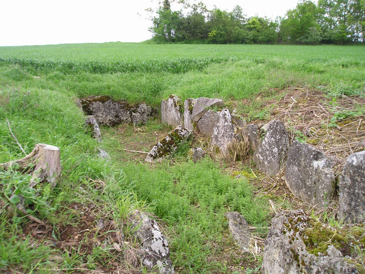
Vielle Cote Dolmen submitted by thecaptain on 23rd Oct 2005. Vielle Cote Dolmen
A much ruined trench grave about 10 metres in length.
(View photo, vote or add a comment)
Log Text: A much ruined trench grave about 10 metres long and 2 metres wide with an orientation of 292° looking down the hill can be found dug into the hillside in a field of crops along a lane at the top of a ridge about 400 metres south from the little lane which climbs eastwards from the village. Although marked on my ign map there are no signs or any other items to suggest its presence. Parking is available at the junction of the lane and track.
Tumulus des Hogues
Trip No.202 Entry No.63 Date Added: 29th Mar 2020
Site Type: Round Barrow(s)
Country: France (Normandie:Orne (61))
Visited: Yes on 2nd May 2005. My rating: Condition 2 Ambience 3 Access 4
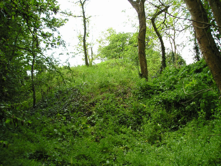
Tumulus des Hogues submitted by thecaptain on 1st Nov 2005. Tumulus des Hogues.
The second of the two round burial mounds here, this one has no obvious megalithic chamber to be seen, but its probably still inside.
(View photo, vote or add a comment)
Log Text: There are the remains of two burial mounds here the second one being about 50 metres to the southeast of the Dolmen des Bignes. The mound is much less disturbed than its neighbour but it has been dug into from its western side although there are no signs of any stones forming a chamber. Perhaps its still all in place underneath the mound ? The remains of the mound are about 3 metres high and again it has a diameter of about 15 metres.
The ambience of these burial mounds is spoiled by it obviously used as a place where the local youth (or others) go to have a drink leaving all their detritus behind. There are broken bottles and other rubbish all over the place.
Trun menhir
Trip No.202 Entry No.66 Date Added: 29th Mar 2020
Site Type: Standing Stone (Menhir)
Country: France (Normandie:Orne (61))
Visited: Couldn't find on 2nd May 2005
Log Text: There is a menhir somehow incorporated into a southern corner of the church tower of this village where I stopped right by it to buy food and look at the village maps. How stupid I was to miss this one forgetting its existence only while I was there. Its why I went there ! Guess the lateness of getting my lunch was taking its toll.
St-Etienne-du-Vouvray burial chamber
Trip No.202 Entry No.92 Date Added: 30th Mar 2020
Site Type: Burial Chamber or Dolmen
Country: France (Normandie:Eure (27))
Visited: Yes on 4th May 2005. My rating: Condition -1
St-Etienne-du-Vouvray burial chamber submitted by theCaptain on 14th Jan 2011. any remains of this once fine trench grave, similar to Dampsnesnil, are now underneath the railway line.
(View photo, vote or add a comment)
Log Text: There are no remains of this gallery grave as it is destroyed and underneath the railway line. It was once a fine trench grave like Dampsnesnil and had many finds.
Saint-Etienne-du-Vauvray Menhir
Trip No.202 Entry No.91 Date Added: 30th Mar 2020
Site Type: Standing Stone (Menhir)
Country: France (Normandie:Eure (27))
Visited: Yes on 4th May 2005. My rating: Condition 3 Ambience 3 Access 5
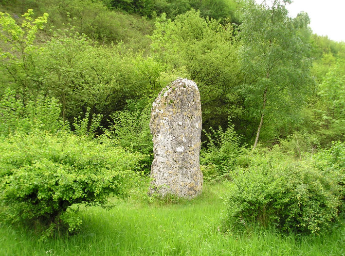
Saint-Etienne-du-Vauvray menhir submitted by thecaptain on 23rd Oct 2005. Saint-Etienne-du-Vauvray menhir, 3.5 metrws tall.
(View photo, vote or add a comment)
Log Text: About a 3.5 metre tall menhir found right beside the roadside between St Etienne and Louviers. Once the road is found the menhir is easy ! The menhir has been moved from its original position which was where the railway now is on the other side of the road.
Pierres Pouquelées
Trip No.202 Entry No.30 Date Added: 26th Mar 2020
Site Type: Passage Grave
Country: France (Normandie:Manche (50))
Visited: Yes on 26th Apr 2005. My rating: Condition 3 Ambience 5 Access 4
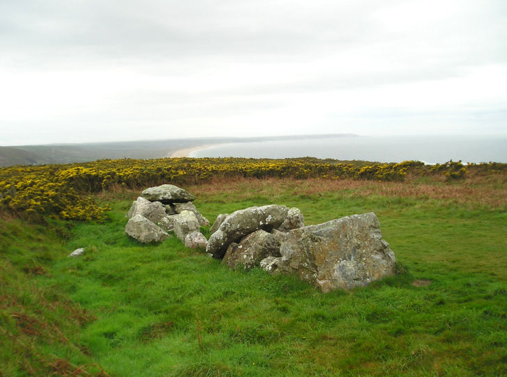
Pierres Pouquelées submitted by thecaptain on 29th Apr 2005. Pierres Pouquelées View looking southish at this much ruined allée couverte on top of the hilly downs to the northwest of the village of Vauville, where the wonderful long beach can just be made out.
(View photo, vote or add a comment)
Log Text: Much ruined allée couverte on top of the hilly downs to the northwest of the village of Vauville. I measured the remains out to about 12 metres in length but I have seen in a guidebook that the remains are said to be 17 metres long. Perhaps there are more stones under the undergrowth than I saw in the flattened grassy area.
There is only any remains of the central chamber of which can be seen about 9 pairs of stones and 2 remaining capstones in place with a couple more fallen in the middle. There is no sign of any outer peristalith and I could not determine where the entrance would have been. The allée couverte is aligned on about 150° and runs slightly downhill with a large perpendicular endstone still in place at the upper end. Looking along the tomb and it seems to align on the top of the large hill over the other side of the valley above the wonderful beach upon which I believe a menhir once stood.
Although the monument is much ruined it really is in a lovely position at the top of a big hill overlooking the sea with the rocky cliffs of Cap de la Hague stretching away to the northwest and the lovely long beach running south from Vauville. The Island of Alderney can be seen out in the sea and the viscious tide race between the mainland and Alderney can be seen in full flow at the right time of day. It can be reached by a longish and steep walk up from Vauville or alternatively it can be driven almost right to by following the road down towards it from the north and then following the unmade tracks from there which are marked on the 1:25000 scale ign maps.
Pierres dit Palais du Diable
Trip No.202 Entry No.41 Date Added: 28th Mar 2020
Site Type: Natural Stone / Erratic / Other Natural Feature
Country: France (Pays de la Loire:Mayenne (53))
Visited: Yes on 30th Apr 2005. My rating: Condition 2 Ambience 4 Access 4

Pierres dit Palais du Diable submitted by TheCaptain on 9th May 2005. Le Palais au Diable, or Pierres Jumelles, Mayenne.
Perhaps the whole thing is one giant burial mound, which it looks more like as seen here from the north.
It is all covered with trees with lots of birds singing, and a woodpecker pecking away with its loud ratatatatattatt.
(View photo, vote or add a comment)
Log Text: 2 kilometres east of the village of Sainte Gemmes- le-Robert are marked two dolmens or megalithic monuments on my ign map one north and the other south of a little crossroads. The northern one consists of a large mound with many large stones scattered about. It looks at first like it may be the top of a natural to type of thing but the stones are too well laid out in unnatural shapes and alignments. There is one pile of stones which has three flat slabs perched on top of other large blocks in a row. Perhaps the whole thing is one giant burial mound. It is all covered with trees with lots of birds singing and a woodpecker pecking away with its loud ratatatatattatt.
Pierre Tourneresse, Cairon
Trip No.202 Entry No.5 Date Added: 25th Mar 2020
Site Type: Chambered Tomb
Country: France (Normandie:Calvados (14))
Visited: Yes on 23rd Apr 2005. My rating: Condition 4 Ambience 4 Access 4
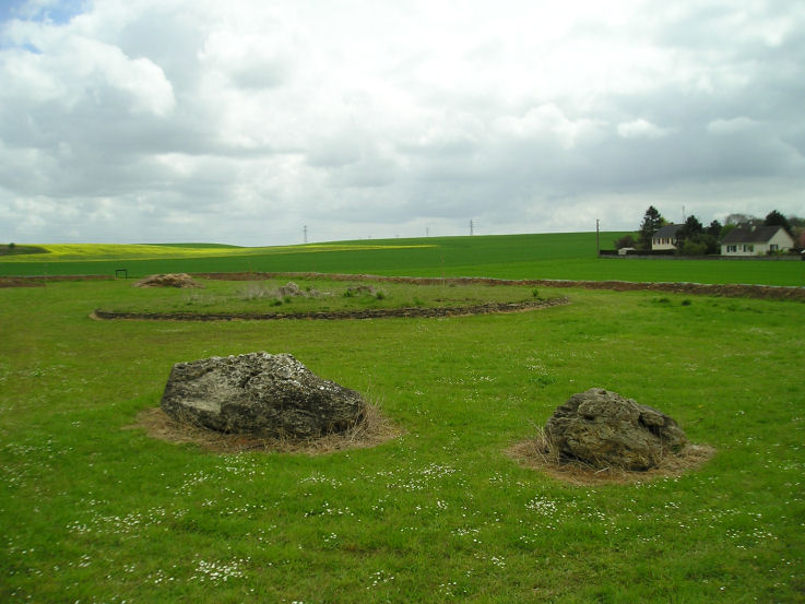
Pierre Tourneresse, Cairon submitted by thecaptain on 28th Apr 2005. Pierre Tourneresse, Cairon. Seen here looking towards the remains of the large round burial mound from beyond the two large stones which are the remains of the capstone from the main chamber - removed and destroyed by the Germans during the '39-45 war.
(View photo, vote or add a comment)
Log Text: I wasn’t expecting to find much here if anything at all as all the information I had of this site was a menhir symbol on my ign map. But as I was passing I decided to have a look anyway and luckily stopped to look at my map right by a little road at the east of the southern end of the village with a sign to “Pierre Tourneresse”. So I followed it down to the end of a little modern housing estate and parked. A further signpost at the end of the road points to Pierre Tourneresse 300 metres distant. Turn left here and stick to the back of the houses rather than go straight on up the hill.
What a lovely site this is. In a little dip down near the stream is a newly made and signposted enclosure which at the time of my visit was still under construction with a ring of trees being planted well around the outside of it. Inside the enclosure is the remains of a large approximately round cairn which has a diameter of about 19 metres and is edged all around with dry stone walling within which are two chambers.
The main chamber is large stone lined chamber in approximately the middle of the cairn which has a seven metre long entrance passage which exits to the east of the cairn at a bearing of 100° magnetic. The chamber is approximately rectangular dimensions about 4 to 5 metres in length by 3 metres in width and is made with large upright slabs with drystone walling between. At various positions around this large chamber there seem to be smaller alcoves or features. The second much smaller chamber opens to the west side and is positioned approximately opposite to the main chamber entrance with an alignment of 269°. It is about 3.5 metres long and opens up to about 2 metres in width at its maximum. It is made with drystone walling only and has a ledge of some sort along its northern side.
Outside the cairn at a distance of about 15 metres in a northwesterly direction are two very large stones. I wondered whether these were once menhirs which marked the position of the cairn (these northern French cairns are often associated with menhirs) and which would explain the marking of menhir on the ign maps. Looking at these stones more closely however suggested that it is much too wide to have been a menhir so I wondered whether the stones were the remains of the chamber capstone. I spent quite a lot of time here the place seemed to give off a nice happy atmosphere which was probably helped by the fact that for once one of these much neglected ancient Normandy monuments is being lovingly cared for and looked after what was probably many years of neglect.
As I was leaving I met a man walking his dog and asked if he knew anything about the site. By an amazing stroke of luck I had met one of the few people in France who has an interest in these ancient sites and who collects flint artefacts ! Despite the language problems we talked for about half an hour about things. He told me that the cairn had been much more complete up until the war during which the Germans had used it as a shelter and gun emplacement. As they were leaving after the D-Day invasion they went about destroying it and the two large stones are indeed the remains of the capstone to the main chamber. He also told me that an excavation of the site was done 5 years ago and the restoration has been going on since then.
We got on to discussing other sites in the region and other than the various sites I knew about (he was surprised indeed to find an Englishman who knew anything about any of these places and seemed very interested when I told him I intended to write a book) and he told me of a menhir nearby he knew which was destroyed only a couple of years ago by a farmer who didn’t want it in the middle of one of his fields. He also showed me on my map a couple of places where he goes to find flint items one of which he called a quarry. He said that if I went to one of these places he showed me then if the fields were recently ploughed I would almost certainly find some worked flint items and that he had a collection of over 700 items. He also then told me in detail how to find the two polisher stones near Mont Joly which was of great interest as I would probably not have even looked if I had no detailed information to go on. It was very nice to meet a man like this particularly on my first real day of French stonehunting and it made me think that the whole trip is going to go well.
Pierre Tourneresse (Gouvix)
Trip No.202 Entry No.8 Date Added: 25th Mar 2020
Site Type: Standing Stone (Menhir)
Country: France (Normandie:Calvados (14))
Visited: Couldn't find on 23rd Apr 2005
Pierre Tourneresse (Gouvix) submitted by Rida on 29th Jan 2011. Site in Normandie:Calvados (14) France
(View photo, vote or add a comment)
Log Text: Not marked on my ign map and finding no map within the village I gave up without really trying to find the supposed menhir near here. I believe it is in the grounds of the local chateau and wasn’t going to spend a lot of time being unable to find it.
Pierre Tournante (Bosgouet)
Trip No.202 Entry No.97 Date Added: 30th Mar 2020
Site Type: Burial Chamber or Dolmen
Country: France (Normandie:Eure (27))
Visited: Couldn't find on 4th May 2005
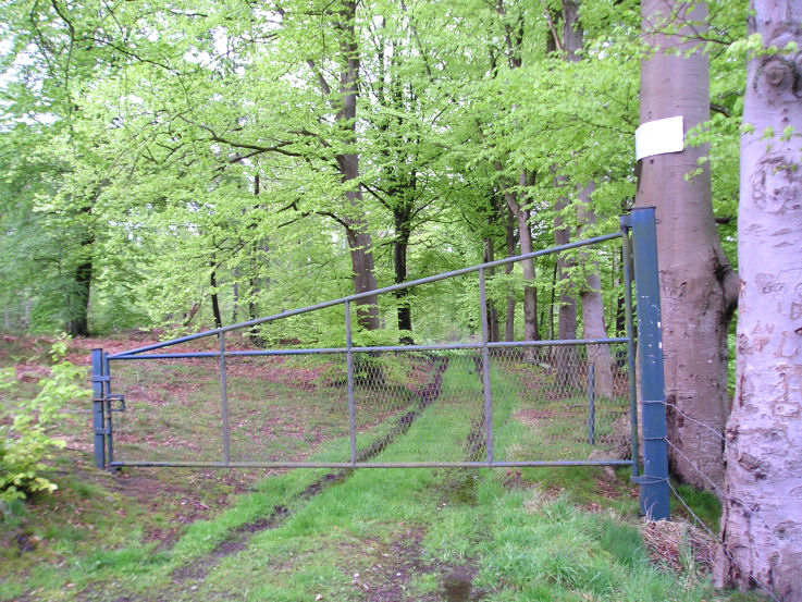
Pierre Tournante (Bosgouet) submitted by TheCaptain on 6th May 2005. Pierre Tournante, Bosgouet, Eure.
When I got there I found that the track through the forest to get to it had been gated off, with lots of barbed wire and keep out notices everywhere, so I didn’t get to visit this one.
(View photo, vote or add a comment)
Log Text: Marked on my ign map as a megalithic monument. When I got there I found that the track through the forest to get to it had been gated off with lots of barbed wire and keep out notices everywhere so I didn’t get to investigate.
Pierre Frite de Breuilpont
Trip No.202 Entry No.88 Date Added: 30th Mar 2020
Site Type: Standing Stone (Menhir)
Country: France (Normandie:Eure (27))
Visited: Couldn't find on 3rd May 2005
Log Text: As for the other menhirs in this river valley I could find no evidence of this menhir. The roads are terribly kept and there are almost no places to turn a campervan so I travelled over much more roads than I would have otherwise done.
Pierre Aigue, Richebourg
Trip No.202 Entry No.43 Date Added: 28th Mar 2020
Site Type: Passage Grave
Country: France (Pays de la Loire:Mayenne (53))
Visited: Yes on 30th Apr 2005

Pierre Aigue, Richebourg submitted by TheCaptain on 9th May 2005. Pierre Aigue, Richebourg Mayenne.
A nice looking allée couverte down near a stream seen across a large field. There were no signs and I couldn’t see how to get to it without crossing fences and fields.
(View photo, vote or add a comment)
Log Text: Allée couverte down near a stream seen across a large field near Richebourg farmhouse. There were no signs and I couldn’t see how to get to it. The remains of what I saw looked quite long and made from large rounded brown stones.
Petit-Vieux-Sou
Trip No.202 Entry No.31 Date Added: 26th Mar 2020
Site Type: Passage Grave
Country: France (Pays de la Loire:Mayenne (53))
Visited: Yes on 29th Apr 2005. My rating: Condition 5 Ambience 4 Access 4
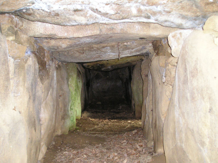
Petit-Vieux-Sou submitted by TheCaptain on 10th May 2005. Le Petit-Vieux-Sou allée couverte, Brecé, Mayenne.
Looking along the inside of this splendid monument, the entrance can be seen on the right where the light is coming in.
(View photo, vote or add a comment)
Log Text: A little Mayenne Allée Couverte 2.5 km southeast of Brecé village which was has been restored. It is found in a little wooded area a few hundred metres south of the country lane by the farm of the same name and is sort of built into the side of a little hillock just above a little stream.
The main chamber consists of 9 capstones on 10 pairs of stones aligned on a bearing of 316° with the lateral entrance central on the south western side. The external dimensions are about 12 m by 4 m with the internal chamber about 1.5 metres in width and height and fully contained within its mound which is built of stone blocks with drystone walling on the SW side and the two ends.
There are quite a few other large stones scattered around in the pleasant little glade full of bluebells and other flowers at the time of my visit which was my first megalithic site in my new campervan. The first of many.
Perron Menhir
Trip No.202 Entry No.20 Date Added: 26th Mar 2020
Site Type: Standing Stone (Menhir)
Country: France (Normandie:Orne (61))
Visited: Yes on 24th Apr 2005. My rating: Condition 3 Ambience 3 Access 5
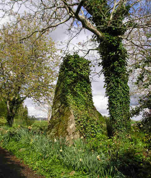
Perron menhir submitted by TheCaptain on 7th May 2005. Perron menhir, Passais, Orne.
At least 3 metres high, this menhir is found signposted about 30 metres from the road in a private garden, although access to the stone is allowed up a driveway.
(View photo, vote or add a comment)
Log Text: At least 3 metres high this menhir is found signposted about 30 metres from the road in a private garden although access to the stone is allowed up a driveway. There are at least two other large stones laying nearby and I wondered if one of these pieces was broken from the top of the menhir but the owner of the was in the garden and assured me that these had been put there as a garden feature by the previous owner.
Mont Joly
Trip No.202 Entry No.13 Date Added: 26th Mar 2020
Site Type: Ancient Village or Settlement
Country: France (Normandie:Calvados (14))
Visited: Yes on 23rd Apr 2005. My rating: Condition 2 Ambience 4 Access 5
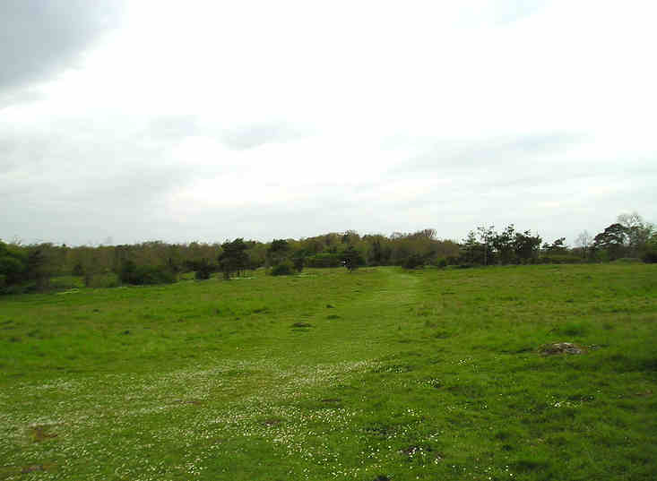
Mont Joly submitted by TheCaptain on 7th May 2005. Mont Joly, Soumont-Saint-Quentin, Calvados.
This is a promontory site surrounded on three sides by the steep gorge of the river Laizon. The site has been inhabited and defended since Paleolithic times, and artefacts have been found from all times since this. It is said that although little ancient remains can be seen, they are everywhere underfoot, and every molehill will contain several flints and pottery sherds.
(View photo, vote or add a comment)
Log Text: This is a promontory site surrounded on three sides by the steep gorge of the river Laizon and the eastern end has been defended by ramparts little of which can now be seen between the church and water tower. The site has been inhabited and defended since Paleolithic times and artefacts have been found from all times since this. It is said that although little ancient remains can be seen they are everywhere underfoot and every molehill will contain several flints and pottery sherds. This region was a major supplier of flint tools in the past and there is much to be found here.
Menhirs dits Les Croûtes
Trip No.202 Entry No.68 Date Added: 29th Mar 2020
Site Type: Standing Stones
Country: France (Normandie:Orne (61))
Visited: Yes on 2nd May 2005. My rating: Condition 3 Ambience 3 Access 4
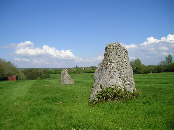
Menhirs dits Les Croûtes submitted by thecaptain on 4th Nov 2005. Les Croûtes are a couple of large (3 metres plus) menhirs stood in a damp field near to the village of Echauffour in Orne.
(View photo, vote or add a comment)
Log Text: A couple of kilometres south of the village of Echauffour can be found a signpost pointing to menhirs along a small track to the east of the road. There is a place to park on this track near the main road and after a couple of hundred metres walk down this track the two menhirs can be seen standing in a field.
Both stones are about 3 metres tall and are spaced about 30 metres apart from each other on an alignment of 055° running down the hill (235° uphill). There is supposed to be a third stone in this alignment and I think I saw it laying under deep undergrowth in the hedge at the top of the field on about an equal spacing although I could not be 100% sure.
Menhir du Faix du Diable
Trip No.202 Entry No.38 Date Added: 28th Mar 2020
Site Type: Standing Stone (Menhir)
Country: France (Pays de la Loire:Mayenne (53))
Visited: Yes on 30th Apr 2005. My rating: Condition 4 Ambience 3 Access 5
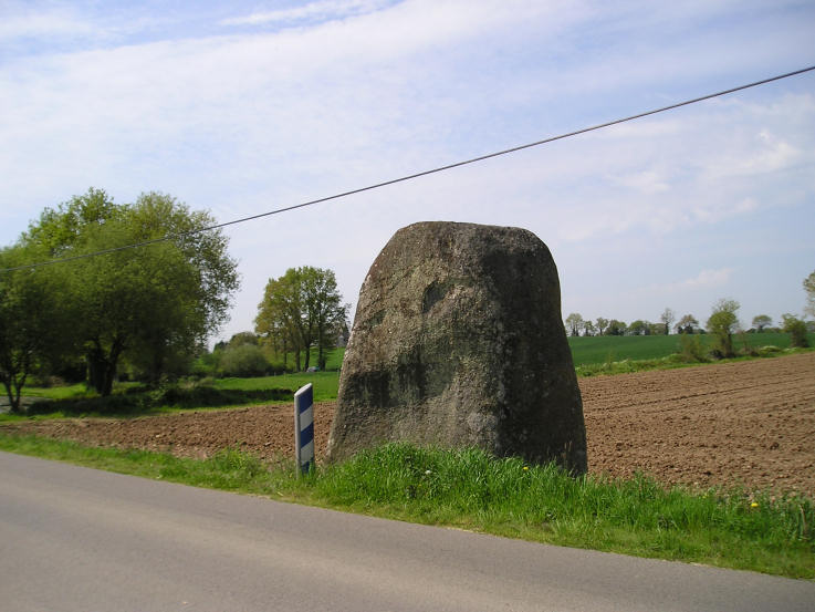
Menhir du Faix du Diable submitted by TheCaptain on 8th May 2005. Faix du Diable, Mayenne.
A massive menhir right beside the road, and standing in the ditch.
(View photo, vote or add a comment)
Log Text: A massive menhir right beside the road and standing in the ditch. It must be well over 4 metres tall 3 metres wide and over a metre thick and it looks to have been smoothed.
Menhir dit Pierre Debout (Reviers)
Trip No.202 Entry No.3 Date Added: 25th Mar 2020
Site Type: Standing Stone (Menhir)
Country: France (Normandie:Calvados (14))
Visited: Couldn't find on 29th Dec 2005

Menhir dit Pierre Debout (Reviers) submitted by thecaptain on 29th Dec 2005. Reviers menhir.
Just inland from the D-Day beaches can be found (when the crops are down) the sad remains of this menhir.
(View photo, vote or add a comment)
Log Text: Despite being marked on the ign map and having a good look all around I could find no sign of any menhir here. Perhaps it is fallen and somewhere within a field of oilseed Rape.
Later note. Having seen the 1:25000 ign map of the area the menhir is marked fairly close to the corner of the road and farm track right where I was looking originally. As I suspected the menhir must be fallen and hidden within the crop.
Menhir dit Pierre de la Hoberie
Trip No.202 Entry No.15 Date Added: 26th Mar 2020
Site Type: Standing Stone (Menhir)
Country: France (Normandie:Calvados (14))
Visited: Couldn't find on 23rd Apr 2005
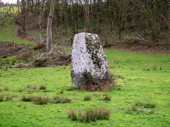
Menhir dit Pierre de la Hoberie submitted by Rida on 27th Feb 2011. Site in Normandie:Calvados (14) France
Menhir dit Pierre de la Hoberie
(View photo, vote or add a comment)
Log Text: This 3.1 metre tall menhir is said to be in the field downhill from the Ferme de Hoberie southwest of the village of Ussy. I could find nowhere to park and see no way through the farm without going through fields of cows so didn’t bother as I was in a rush to get back.
Menhir dit le Caillou de Gargantua
Trip No.202 Entry No.89 Date Added: 30th Mar 2020
Site Type: Standing Stone (Menhir)
Country: France (Normandie:Eure (27))
Visited: Couldn't find on 3rd May 2005
Log Text: I spent ages driving round all the roads of this hilltop village high above the river Eure (mostly because I could never find anywhere to turn a campervan) but could find no evidence of this menhir. The double village has no signs or anything to signify the presence of a menhir but hey are obviously very proud of their water tower and a bit of roman road.
