Contributory members are able to log private notes and comments about each site
Sites theCaptain has logged. View this log as a table or view the most recent logs from everyone
Menhir dit la Pierre de Gargantua (Neaufles)
Trip No.202 Entry No.78 Date Added: 30th Mar 2020
Site Type: Standing Stone (Menhir)
Country: France (Normandie:Eure (27))
Visited: Saw from a distance on 3rd May 2005
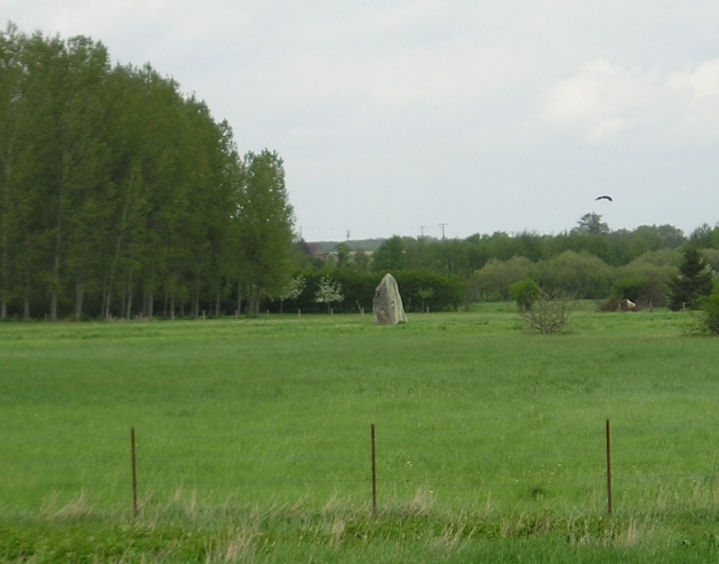
Menhir dit la Pierre de Gargantua (Neaufles) submitted by thecaptain on 19th Oct 2005. Pierre de Gargantua, Neauffles-Auvergny.
Seen at a distance of about 250 metres across fields from the little bridge across the Risle river.
(View photo, vote or add a comment)
Log Text: Seen at a distance of about 200 metres across fields from the little bridge across the Risle river. There wasn’t really anywhere to park and there looked no way to get to the menhir so I contented myself with a long distance shot. It must be nearly 4 metres tall in a large flat pasture beside the river.
Dolmen de la Forge
Trip No.202 Entry No.77 Date Added: 29th Mar 2020
Site Type: Burial Chamber or Dolmen
Country: France (Normandie:Eure (27))
Visited: Yes on 3rd May 2005
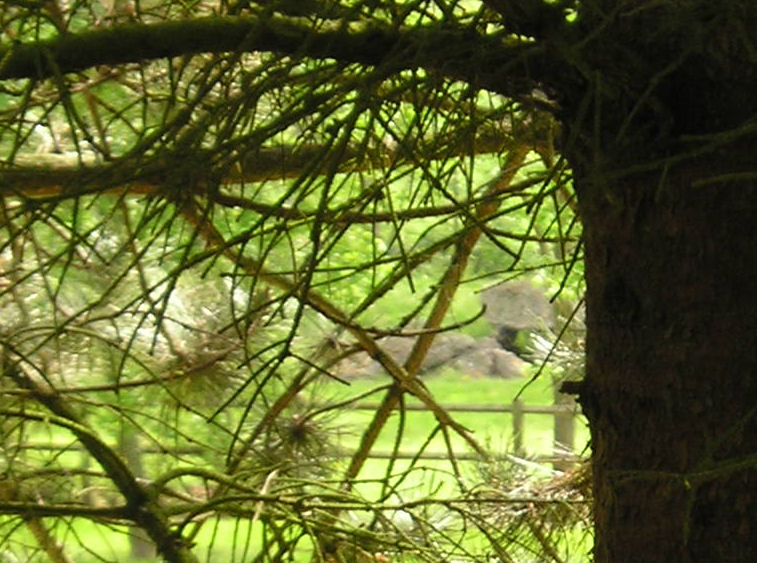
Dolmen de la Forge submitted by thecaptain on 6th Nov 2005. Dolmen de la Forge, Rugles.
This dolmen was a nightmare to find. It took me 3 or 4 attempts to negotiate the one way system in the town before finding the right road alongside the river. Then, after I eventually found somewhere to park and walked back about a kilometre, the dolmen was nigh on impossible to spot.
But it is there in a very private garden with double barbed wire fences, a large hedge and guard dogs.
(View photo, vote or add a comment)
Log Text: Having failed to find this after several attempts yesterday, the next day I checked out the position of this dolmen on the ign 1:25000 map in the supermarket and it looked simple to find so thought I’d have another go. Its north of the town on the little road that runs on the west side of the Risle river. Just past the hamlet of La Forge it should be between the very small road and the river.
After I eventually found somewhere to park and walked back about a kilometre the dolmen is nigh on impossible to spot. But there it is in a very private garden with double barbed wire fences a large hedge and guard dogs the dolmen can be spotted through the trees about 70 metres away from the road.
Getting a picture is a different matter! It looks a bit like the one at Verneusses with a large capstone on several supports.
Dolmen de la Ferme Brûlée
Trip No.202 Entry No.82 Date Added: 30th Mar 2020
Site Type: Burial Chamber or Dolmen
Country: France (Centre:Eure-et-Loire (28))
Visited: Yes on 3rd May 2005

Dolmen de la Ferme Brûlée submitted by thecaptain on 10th Nov 2005. La Ferme Brûlée dolmen.
Just to the south of Fort Harrouard neolithic settlement, on the banks of the river Eure, is another of these dolmens inside a private garden with lots of keep out signs and security fences. However, it can be seen over the gate, down at the end of the driveway.
(View photo, vote or add a comment)
Log Text: Down by the banks of the river Eure are marked on my map a dolmen and polissoir. I couldn’t park close so parked and walked back from some distance away during which time I got soaked by a torrential downpour. I eventually found a house called Le Dolmen but with lots of keep out signs and security devices. Down the far end of the driveway I could see the dolmen and managed a long distance photo of it part hidden by a van. There was no way I could get any sight of the polissoir which was a shame.
Fort Harrouard
Trip No.202 Entry No.84 Date Added: 30th Mar 2020
Site Type: Ancient Village or Settlement
Country: France (Centre:Eure-et-Loire (28))
Visited: Saw from a distance on 3rd May 2005
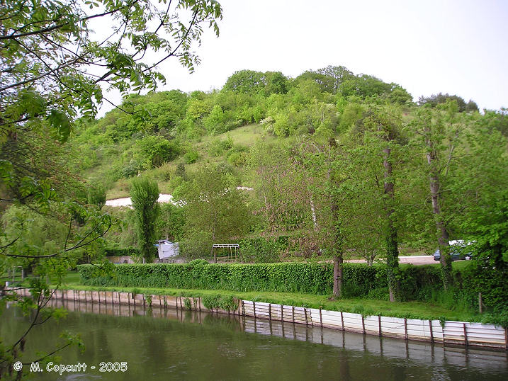
Fort Harrouard submitted by thecaptain on 10th Nov 2005. Fort Harrouard seen above the river Eure.
(View photo, vote or add a comment)
Log Text: This ancient defended settlement is positioned on a steep hillside high above the river Eure near the village of Marcilly-sur-Eure.
St-Etienne-du-Vouvray burial chamber
Trip No.202 Entry No.92 Date Added: 30th Mar 2020
Site Type: Burial Chamber or Dolmen
Country: France (Normandie:Eure (27))
Visited: Yes on 4th May 2005. My rating: Condition -1
St-Etienne-du-Vouvray burial chamber submitted by theCaptain on 14th Jan 2011. any remains of this once fine trench grave, similar to Dampsnesnil, are now underneath the railway line.
(View photo, vote or add a comment)
Log Text: There are no remains of this gallery grave as it is destroyed and underneath the railway line. It was once a fine trench grave like Dampsnesnil and had many finds.
Allée Couverte de Pinterville
Trip No.202 Entry No.90 Date Added: 30th Mar 2020
Site Type: Passage Grave
Country: France (Normandie:Eure (27))
Visited: Couldn't find on 4th May 2005
Log Text: Despite driving around this village and its environs thoroughly and looking at the village map and having the ign 1:25000 map I could find no signs of this.
Allée Couverte de Dampsmesnil
Trip No.202 Entry No.94 Date Added: 30th Mar 2020
Site Type: Passage Grave
Country: France (Normandie:Eure (27))
Visited: Yes on 4th May 2005. My rating: Condition 4 Ambience 4 Access 3

Allée Couverte de Dampsmesnil submitted by TheCaptain on 6th May 2005. A picture of the female figure stone carving at the entrance to Dampsmesnil Allée Couverte, Eure, France.
Difficult to make out in the picture, but the necklaces and breasts are clear enough.
(View photo, vote or add a comment)
Log Text: It’s easy enough to find the pathway that leads into the woods to this its signed allée couverte from several places from several miles around. However the tiny roads with cropped fields make it almost impossible to park anywhere (certainly a camper van) so it was a long walk. From the lane where the signposted track ascends into the woods its about a half kilometre walk following the main trackway up and keeping left. There is another little sign at a junction of woodland tracks where you turn left and about a further 100 metres along is this nice trench grave along with a little notice board which states that its over 4000 years old and gives descriptions of the various features. When you get there it’s a bit of a corker although falling into disrepair and in need of some affection.
The main chamber is about 10 metres long cut 2 metres deep into the hillside on an orientation of 218° looking down into the valley. There are three massive capstones each more than 3 metres long still in place and the remains of 2 more on this 2 metre wide Allée. The walls consist of large upright slabs with drystone walling between them and the whole thing ends with a massive block at the north-eastern end.
What makes this place a bit special are two features not often found elsewhere. The most obvious is the remains of the lower half of the entrance stone positioned across the chamber with it’s finely cut circular porthole entrance. The top half of the stone is missing but there is enough left to see the fine work which went into creating this entrance. It is very circular with a diameter of about 50 cm made using not just a single cut through the thick stone but a sort of double circular stepped and lipped edge.
The other special feature of this grave is found on the stone just outside the main chamber on the left hand side in front of the porthole stone and with half a capstone sat on it. On this stone has been carved the likeness of a lady (or goddess) and her two breasts can clearly be made out (although in some distant time her left one has been largely hammered away) above which are the remains of four arcs representing necklaces. I thought I could also make out some of her outline and a representation of a belt or other such item. Much of this stone is very worn and indeed I guess its only survived at all due to the presence of the half capstone and I think it said on the notice board that her face could be made out in the past. I wonder who it was.
A few other stones lie scattered about including what was probably one of the capstones which has been removed and lies partway down a steep slope several yards in front of the grave behind the notice board.
After visiting this monument I saw another one marked nearby on the map so set off to look for that. Unfortunately there was a little old narrow bridge between the two places and although my van fitted on to the bridge easily enough I had a lot of trouble getting off the other side and there was no way I was going to be able to reverse back off. After about 6 or 7 attempts to get between the protective bollards in the roadside presumably put there to protect the much wider bridge with a few scrapes down the side of my van and a broken sidelight I had discovered that the gap between the bollards was only an inch wider than the width of my van. I was obviously getting too confident about driving it around all these narrow places and will have to take more care in future.
Pierre Tournante (Bosgouet)
Trip No.202 Entry No.97 Date Added: 30th Mar 2020
Site Type: Burial Chamber or Dolmen
Country: France (Normandie:Eure (27))
Visited: Couldn't find on 4th May 2005
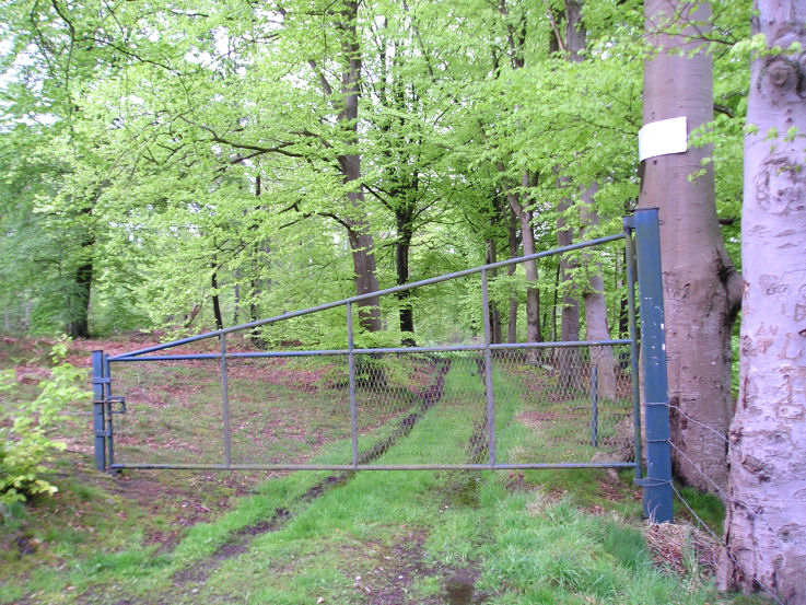
Pierre Tournante (Bosgouet) submitted by TheCaptain on 6th May 2005. Pierre Tournante, Bosgouet, Eure.
When I got there I found that the track through the forest to get to it had been gated off, with lots of barbed wire and keep out notices everywhere, so I didn’t get to visit this one.
(View photo, vote or add a comment)
Log Text: Marked on my ign map as a megalithic monument. When I got there I found that the track through the forest to get to it had been gated off with lots of barbed wire and keep out notices everywhere so I didn’t get to investigate.
Allée Couverte de Mauny
Trip No.202 Entry No.96 Date Added: 30th Mar 2020
Site Type: Passage Grave
Country: France (Normandie:Seine-Maritime (76))
Visited: Yes on 4th May 2005. My rating: Condition 2 Ambience 2 Access 3
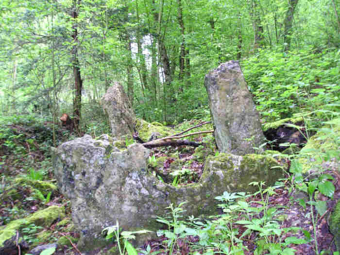
Allée Couverte de Mauny submitted by TheCaptain on 6th May 2005. Mauny Allée Couverte, Eure.
Almost lost in the woods, there is however a very nice half porthole stone which can still be made out.
(View photo, vote or add a comment)
Log Text: A much ruined allée couverte which can be found in woodland beside the D265 road as it climbs the hill from the riverbank below and to the east of Mauny. Almost lost in the woods and currently being used as a junk store it almost looks like its been bulldozed. There is however a very nice half porthole stone which can still be made out. The main chamber is probably about 10 metres long 1.5 metres wide and faces down the valley but most of the remaining stone slabs are just a jumble. Its very much in need of some TLC.
Saint-Etienne-du-Vauvray Menhir
Trip No.202 Entry No.91 Date Added: 30th Mar 2020
Site Type: Standing Stone (Menhir)
Country: France (Normandie:Eure (27))
Visited: Yes on 4th May 2005. My rating: Condition 3 Ambience 3 Access 5
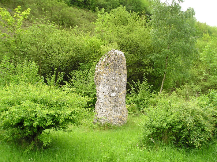
Saint-Etienne-du-Vauvray menhir submitted by thecaptain on 23rd Oct 2005. Saint-Etienne-du-Vauvray menhir, 3.5 metrws tall.
(View photo, vote or add a comment)
Log Text: About a 3.5 metre tall menhir found right beside the roadside between St Etienne and Louviers. Once the road is found the menhir is easy ! The menhir has been moved from its original position which was where the railway now is on the other side of the road.
Vielle Cote Dolmen
Trip No.202 Entry No.95 Date Added: 30th Mar 2020
Site Type: Passage Grave
Country: France (Ile-de-France:Val-d'Oise (95))
Visited: Yes on 4th May 2005. My rating: Condition 2 Ambience 3 Access 3
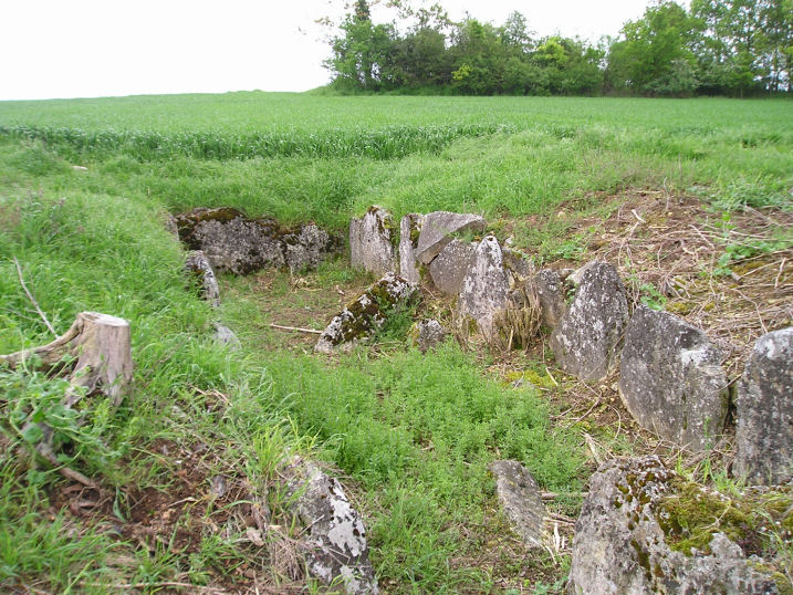
Vielle Cote Dolmen submitted by thecaptain on 23rd Oct 2005. Vielle Cote Dolmen
A much ruined trench grave about 10 metres in length.
(View photo, vote or add a comment)
Log Text: A much ruined trench grave about 10 metres long and 2 metres wide with an orientation of 292° looking down the hill can be found dug into the hillside in a field of crops along a lane at the top of a ridge about 400 metres south from the little lane which climbs eastwards from the village. Although marked on my ign map there are no signs or any other items to suggest its presence. Parking is available at the junction of the lane and track.
Menhir dit Gravier de Gargantua (Chateau-Neuf)
Trip No.202 Entry No.93 Date Added: 30th Mar 2020
Site Type: Standing Stone (Menhir)
Country: France (Normandie:Eure (27))
Visited: Yes on 4th May 2005

Menhir dit Gravier de Gargantua (Chateau-Neuf) submitted by thecaptain on 23rd Oct 2005. The Gravier de Gargantua is a big (3.5 metre tall, 2.5 m wide, 0.5 m thick) flinty chalky lump standing beside the road, near the village of Port-Mort in Eure
(View photo, vote or add a comment)
Log Text: A big (3.5 metre tall 2.5 m wide 0.5 m thick) flinty chalky lump stood right beside the roadside in a little fenced enclosure. It was moved here when the road was widened and a metre or so was broken off the top while doing so.
Demoiselles Piquées
Trip No.203 Entry No.4 Date Added: 30th Mar 2020
Site Type: Stone Row / Alignment
Country: France (Bretagne:Ille-et-Vilaine (35))
Visited: Yes on 13th May 2005. My rating: Condition 3 Ambience 3 Access 4
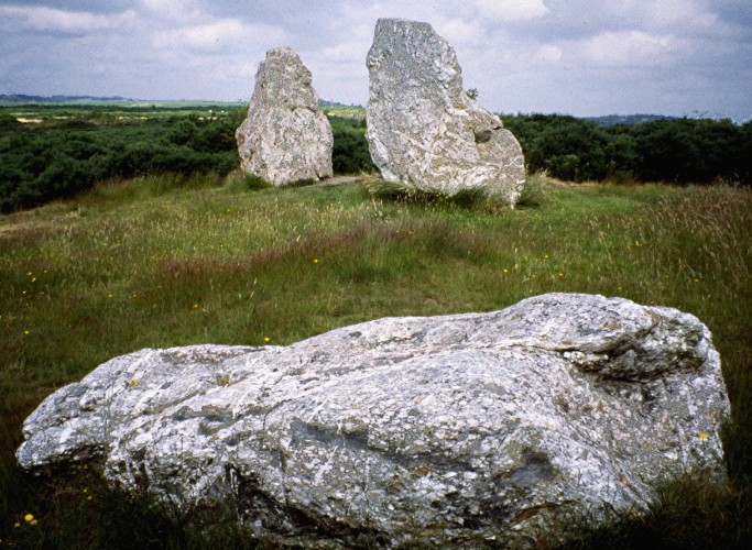
Demoiselles Piquées submitted by greywether on 27th Jun 2005. Showing all three stones.
(View photo, vote or add a comment)
Log Text: Three large white quartz menhirs one now fallen. The stone of the westernmost menhir is a really lovely thing with all sorts of coloured patterns and swirls within it.
Croix St Pierre tertre
Trip No.203 Entry No.7 Date Added: 30th Mar 2020
Site Type: Long Barrow
Country: France (Bretagne:Ille-et-Vilaine (35))
Visited: Yes on 13th May 2005. My rating: Condition 3 Ambience 3 Access 4
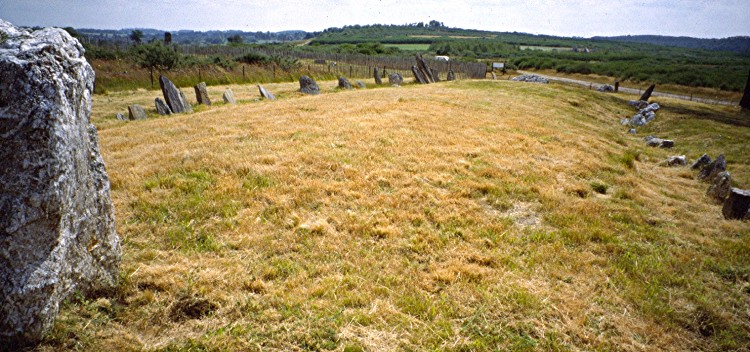
Croix St Pierre tertre submitted by greywether on 27th Jun 2005. Tetre tumulaire from W
(View photo, vote or add a comment)
Log Text: Another long mound this time in an east west alignment with a sort of rectangular arrangement of stones sticking up from within it rather like the peristalith stones from an allée couverte. There is a single larger block of stone near the western end.
Croix Madame
Trip No.203 Entry No.11 Date Added: 30th Mar 2020
Site Type: Barrow Cemetery
Country: France (Bretagne:Ille-et-Vilaine (35))
Visited: Yes on 13th May 2005. My rating: Condition 2 Ambience 3 Access 4
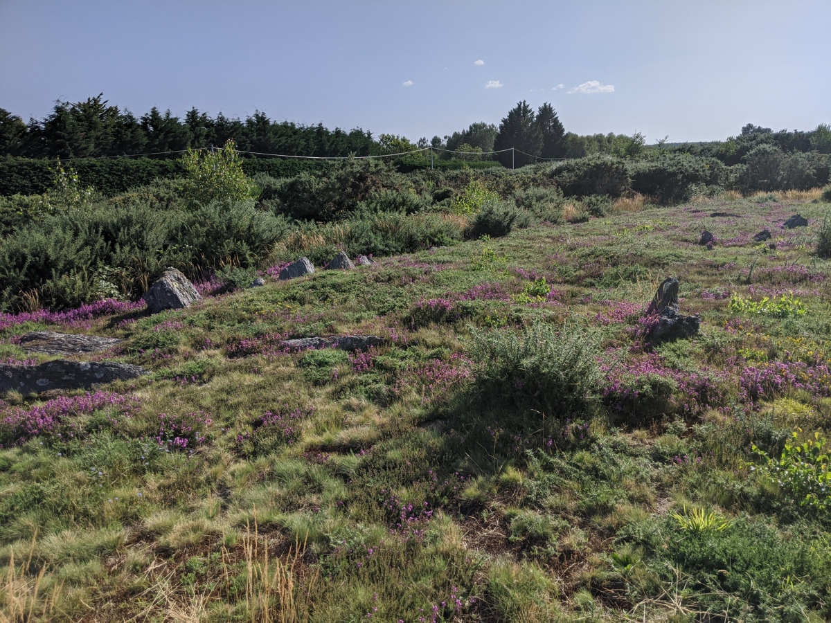
Croix Madame submitted by aolson on 3rd Aug 2020. Croix Madame tumulus 1 is rectangular, about 22 by 10 meters. Tumulus 2 is circular with a diameter of about 10 meters, the edge of which is just visible in the bottom of this picture. They are located on the south side of the path at 47.76436, -1.96858.
More information at t4t35.fr
(View photo, vote or add a comment)
Log Text: At the western end of the village to the east of the Alignements du Moulin are the remains of some some bronze age burial chambers. At least four mounds are known, some of which have the remains of stone chambers within.
I did not find them initially and didn’t spend a lot of time looking for them on the way back as it was by now pouring with rain and everything was getting soaked. I expect that the humps and bumps seen in the ground here are the remains of these, with nothing spectacular to be seen.
Alignement dit le Rocher
Trip No.203 Entry No.12 Date Added: 30th Mar 2020
Site Type: Stone Row / Alignment
Country: France (Bretagne:Ille-et-Vilaine (35))
Visited: Saw from a distance on 13th May 2005

Alignement dit le Rocher submitted by johnstone on 10th Mar 2018. This menhir stands at the beginning of the road “Le Rocher” almost hidden in the bushes.
It may be the first stone belonging to the alignment further on, June 26, 2013
(View photo, vote or add a comment)
Log Text: To the east of Saint Just village I spent no time looking for this menhir as it was by now pouring with rain, although I thought I saw something near a farmhouse as I drove past.
Grotte-aux-Fées (Tréal)
Trip No.203 Entry No.13 Date Added: 30th Mar 2020
Site Type: Burial Chamber or Dolmen
Country: France (Bretagne:Ille-et-Vilaine (35))
Visited: Yes on 13th May 2005. My rating: Condition 4 Ambience 4 Access 4

Grotte-aux-Fées (Tréal) submitted by greywether on 27th Jun 2005. From NW. June 1994 - shortly after it was restored.
(View photo, vote or add a comment)
Log Text: A fine lateral entry allée couverte at the top of a hill just to the northwest of the Saint Just megaliths and signposted from there. The main chamber is about 13 metres long 1.2 m wide and oriented 102°. The entrance is on the south side with a couple of laterally set portal stones near the east end. There are 8 capstones in place and all the stones get larger to the west end. The stones are made from the strange lumpy local Schist.
Alignements du Moulin W
Trip No.203 Entry No.3 Date Added: 30th Mar 2020
Site Type: Stone Row / Alignment
Country: France (Bretagne:Ille-et-Vilaine (35))
Visited: Yes on 13th May 2005. My rating: Condition 3 Ambience 3 Access 4
Alignements du Moulin W submitted by TheCaptain on 13th Apr 2011. The third row I found consists of about 5 white quartz blocks to the west of the ends of the two main rows and running in a north south direction.
(View photo, vote or add a comment)
Log Text: There are two long roughly parallel lines running east west with a third less well defined row to the southwest running in a north south direction. The first row reached is the northernmost and consists of at least 14 large white quartz blocks with a few grey stones in it as well with an alignment of 099°. One of the large stones towards the western end has been used at some later stage as a part of a burial chamber with at least two burial cists to be seen adjacent to it.
Just to the south of this row is another row, with an alignment of 111° but this time consisting of taller thinner stones of various types and colours, which get bigger in size towards the middle where the row runs over a cairn and then get smaller again. The stones start off about a metre high but the stones in the middle are up to 5 metres tall. These central stones alternate between white blocks and black blocks of stone with various other colours and shapes being mixed in as well. I absolutely love this row. It is completely bonkers. So weird. The whole place is odd and not like anything else I have seen. Large white blocks and tall thin black stones. All mixed up and running across this ridge.
The third row I found consists of about 5 white quartz blocks to the west of the ends of the two main rows and running in a north south direction. I am not sure if this is the third row considered to be a part of these same alignments. All three rows appear to converge on a point to the northwest. They have started to clear the gorse away from these stones and I disturbed a large vividly coloured green lizard at one point here.
Demoiselles de Langon
Trip No.203 Entry No.14 Date Added: 30th Mar 2020
Site Type: Stone Row / Alignment
Country: France (Bretagne:Ille-et-Vilaine (35))
Visited: Yes on 13th May 2005. My rating: Condition 3 Ambience 4 Access 5
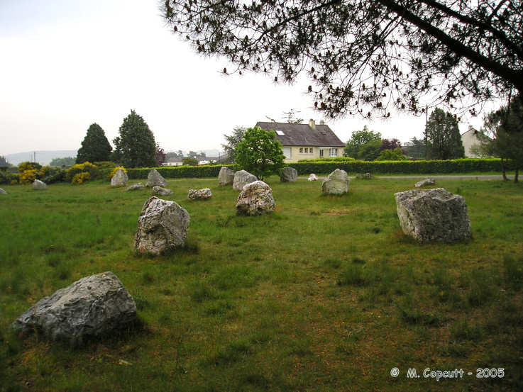
Demoiselles de Langon submitted by thecaptain on 17th Nov 2005. Les Demoiselles de Langon.
Near to the stadium in the village of Langon, these alignements consist of between 30 and 40 white quartz stone blocks in a field.
(View photo, vote or add a comment)
Log Text: Found near to the stadium in the village of Langon and signposted from the main street These alignements consist of between 30 and 40 white quartz stone blocks in a field. Though I have read somewhere about them being arranged in two rows this most definitely isn’t the case. I have also read about them being astronomically aligned but to me they seem quite randomly scattered about! Many intersecting lines of 4 or 5 stones perhaps but nothing obvious. It would be nice to see a plan of this place to see if I could make more sense of the stones. There are probably many more stones that have been removed or are hiding in people’s gardens or under hedges.
Gaudinais megalithes
Trip No.203 Entry No.15 Date Added: 30th Mar 2020
Site Type: Long Barrow
Country: France (Bretagne:Ille-et-Vilaine (35))
Visited: Yes on 13th May 2005. My rating: Condition 3 Ambience 3 Access 4
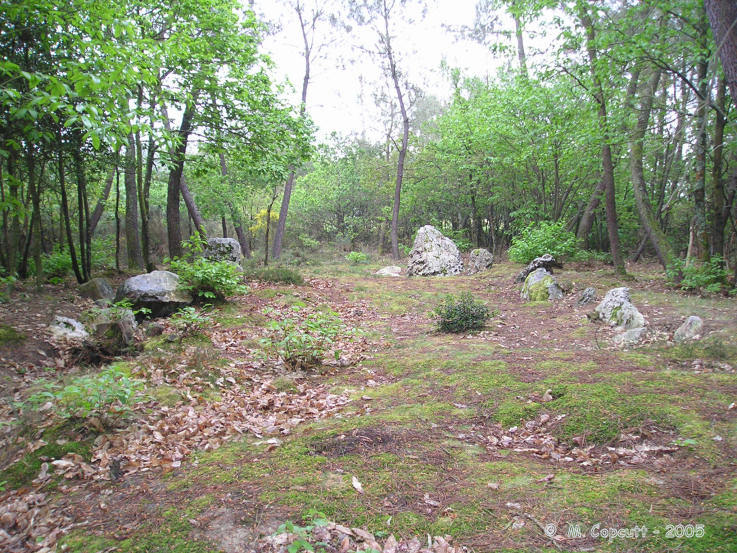
Gaudinais megalithes submitted by thecaptain on 18th Nov 2005. Gaudinais megalithes, near to the village of Langon.
Remains of a rectangular tumulus, with embanked stones set around the outside, which reminded me of a small version of King Arthurs Hall.
(View photo, vote or add a comment)
Log Text: A signpost to Vestiges Megalithiques de La Gaudinais points down a gravel track to this from the main street on the west side of the village of Langon so I just had to go and have a look. I have no idea what I found or even whether it is the proper megalithic remains but I had a good look around.
What I found was a sort of embanked rectangle of stones in woodland a bit like a small version of King Arthur’s Hall on Bodmin Moor. The dimensions of this rectangle are about 16 metres by 6 metres with the long axis on an alignment of 090°. I later found that this is the remains of a rectangular tumulus, with stones set around the outside, similar to that at Les Demoiselles. There are also the remains of two further tumulus mounds here, but in muxch less well preserved condition.
