Contributory members are able to log private notes and comments about each site
Sites theCaptain has logged. View this log as a table or view the most recent logs from everyone
King Arthur's Cave
Date Added: 30th May 2025
Site Type: Cave or Rock Shelter
Country: England (Herefordshire)
Visited: Yes on 4th May 2025. My rating: Condition 4 Ambience 4 Access 4
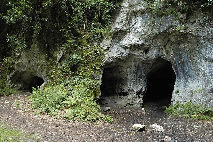
King Arthur's Cave submitted by sem on 23rd Aug 2006.
This cave was inhabited from the Upper Palaeolithic to the Bronze Age, a period of over 50,000 years. Finds here include bone, flint and "imported" pebbles. Caves nearby have also yielded Beaker and Roman pottery, but as this cave was also used to extract iron in the 18th and 19th centuries much archaeological evidence has been destroyed.
(View photo, vote or add a comment)
Log Text: We walk on through the Lords Wood and arrive at a car park just above King Arthurs caves, to which we wander down. The caves are very interesting and we spend a fair while exploring in them, a longish cave to the right with a smaller separate entrance on the left, with a connection between them. Up in the car park is a noticeboard with all sorts of historical detail and stories about them.
Madawg Rockshelter
Date Added: 23rd May 2025
Site Type: Cave or Rock Shelter
Country: England (Herefordshire)
Visited: Yes on 4th May 2025. My rating: Condition 2 Ambience 3 Access 3

Madawg Rockshelter submitted by TheCaptain on 23rd May 2025. Heading upstream along the northern side along the river Wye, and on the left the left a bare rockface with various small cave entrances and overhangs.
(View photo, vote or add a comment)
Log Text: Heading upstream along the northern side along the river Wye, and on the left the left a bare rockface with various small cave entrances and overhangs.
Cavall's Cave
Date Added: 23rd May 2025
Site Type: Cave or Rock Shelter
Country: England (Herefordshire)
Visited: Yes on 4th May 2025. My rating: Condition 2 Ambience 3 Access 3

Cavall's Cave submitted by TheCaptain on 23rd May 2025. From King Arthur's Cave head down a steep valley path covered in wild garlic to the river Wye again. To the left are what appear to be quarries with various cave entrances in the lower face.
(View photo, vote or add a comment)
Log Text: From King Arthur's Cave head down a steep valley path covered in wild garlic to the river Wye again. To the left are what appear to be quarries with various cave entrances in the lower face. From here we head back to Symonds Yat crossing the Biblins wire rope bridge.
Symonds Yat West
Date Added: 23rd May 2025
Site Type: Cave or Rock Shelter
Country: England (Herefordshire)
Visited: Yes on 4th May 2025. My rating: Condition 3 Ambience 3 Access 3
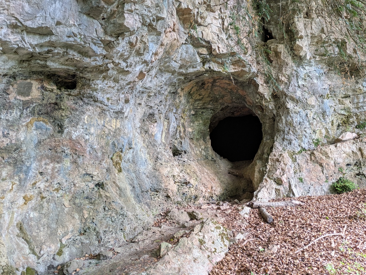
Symonds Yat West submitted by TheCaptain on 23rd May 2025. A circular walk from Symonds Yat, crossing the Wye on the hand ferry, then it’s a slog up forest trails through the woods and get to these caves. They were tentatively fenced off, but easy to get to and have a look in. On the right looking at them is a decent sized cave
(View photo, vote or add a comment)
Log Text: May bank holiday circular walk from Symonds Yat, crossing the Wye on the hand ferry, then it’s a slog up forest trails through the woods and get to these caves. They were tentatively fenced off, but easy to get to and have a look in. On the right looking at them is a decent sized cave, with a smaller one to the left. There are plenty of other small cave entrances and mine shafts about, so be careful !
Metheral Hill boundary stones
Date Added: 7th May 2025
Site Type: Marker Stone
Country: England (Devon)
Visited: Yes on 8th Apr 2025. My rating: Condition 4 Ambience 4 Access 2
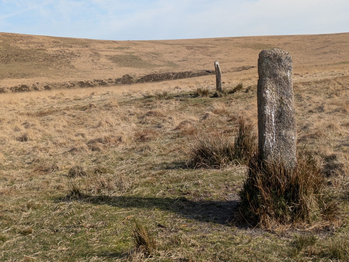
Metheral Hill boundary stones submitted by TheCaptain on 11th Apr 2025. I note that they are lined up side on to each other, and that they are aligned on to the position of the White Moor stone circle. Is this some kind of ancient alignment, or just my imagination running wild? More probably they are aligned along the boundary, of which a further marker is the Whit Moor Stone. I like to think its more ancient than that.
(View photo, vote or add a comment)
Log Text: Walking back to Belstone from Hund Tor, I notice two stones standing, marked on the map as Boundary Stones. They are both about 5 foot tall, and have a T carved in them. They have obviously been here a long time as they are all weather worn, so much so that I wonder whether they were ever anything else. I then note that they are lined up side on to each other, and that they are aligned on to the position of the White Moor stone circle. Is this some kind of ancient alignment, or just my imagination running wild? More probably they are aligned along the boundary, of which the next marker is the Whit Moor Stone. I like to think its more ancient than that.
White Moor Cairn
Date Added: 7th May 2025
Site Type: Cairn
Country: England (Devon)
Visited: Yes on 8th Apr 2025. My rating: Condition 2 Ambience 5 Access 2

White Moor Cairn submitted by TheCaptain on 12th Jun 2004. White Moor Cairn, Dartmoor, Devon SX634895
Situated between the stone circle and the Whit Moor Stone are the remains of a cairn.
This is seen here as the darker area in the heather.
(View photo, vote or add a comment)
Log Text: Between the Whit Moor stone and the stone circle is a clear cairn to be seen. With it being so dry and the new years growth yet to happen, it's looking more significant than I remember from 21 years ago.
White Moor Stone
Date Added: 7th May 2025
Site Type: Standing Stone (Menhir)
Country: England (Devon)
Visited: Yes on 8th Apr 2025. My rating: Condition 4 Ambience 5 Access 2

White Moor Stone submitted by TheCaptain on 12th Jun 2004. White Moor Stone, Dartmoor, Devon SX634895
150 metres southeast of White Moor Stone Circle is the Whit Moor Stone, which is more than 5 feet in height, and has been adapted as a parish boundary stone, with its parish marks cut into it. This stone is almost certainly much older than just a boundary stone, and is likely to be associated in some way with the circle.
(View photo, vote or add a comment)
Log Text: Before setting off to Hound Tor, I firstly head southeast to the White Moor stone and the whole of the northeastern moor opens up in front of me, right over to Hamel Down and Hay Tor, which I was not expecting to see.
White Moor Down
Date Added: 24th Apr 2025
Site Type: Stone Circle
Country: England (Devon)
Visited: Yes on 8th Apr 2025. My rating: Condition 4 Ambience 5 Access 2
White Moor Down submitted by cazzyjane on 20th May 2014. A beautiful circle probably more impressive after doing such a long hike to get here! My first two attempts were aborted after firstly being shrouded in fog and secondly after getting stuck in very boggy marshland!
(View photo, vote or add a comment)
Log Text: Approaching the top of the hill, I was expecting the stone circle to come into view much sooner than it actually did. In fact it is not to be seen until it is fairly close. It’s a lovely circle and on a superb sunny and clear day like today this is a most fabulous place, with extensive views all around. I spend a fair bit of time here taking lots of pictures, including full 360 degree panoramas from within the circle.
White Hill, Devon
Date Added: 19th Apr 2025
Site Type: Ancient Village or Settlement
Country: England (Devon)
Visited: Yes on 8th Apr 2025. My rating: Condition 3 Ambience 4 Access 3
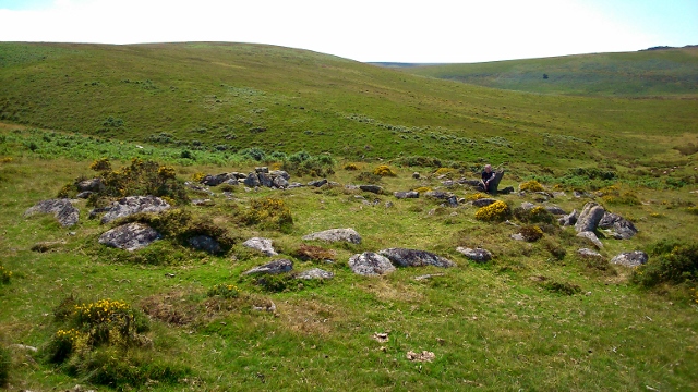
White Hill, Devon submitted by graemefield on 11th Aug 2014. Large hut circle within enclosure.
(View photo, vote or add a comment)
Log Text: I now head northeast to cross the Small Brook running down from the moor, which requires finding a suitable place to jump across, and thankfully it isnt too boggy here today. Now I can head southeast up the hillside towards White Moor stone circle along a fairly reasonable path, which passes the remains of a couple of settlements, with clear hut circles and other features.
Metheral Kerb Cairn
Date Added: 19th Apr 2025
Site Type: Cairn
Country: England (Devon)
Visited: Yes on 8th Apr 2025. My rating: Condition 3 Ambience 3 Access 3

Metheral Kerb Cairn submitted by Bladup on 30th Dec 2024. Metheral Kerb Cairn, showing a couple of still standing kerb stones and a couple of fallen kerb stones, with the possible ruined cist in the center
(View photo, vote or add a comment)
Log Text: So the boundary stone isnt the kerb cairn, so I still need to find that. With a bit of searching around, it becomes clear a short distance over to the southeast. There are a couple of reasonably sized slabs set on their sides and still upright, with several more forming a circular feature, around a clear cairn of stones. Are the side slabs the remnants of a cist?
Taw Marsh cairnfield
Date Added: 18th Apr 2025
Site Type: Barrow Cemetery
Country: England (Devon)
Visited: Yes on 8th Apr 2025. My rating: Condition 2 Ambience 4 Access 3

Taw Marsh cairnfield submitted by TheCaptain on 18th Apr 2025. I find the boundary stone standing proud of the long grass, and it seems to have been mounted on a large stony area.
Viewed looking northwest, Belstone Tor beyond.
(View photo, vote or add a comment)
Log Text: Before heading up to White Moor, I look for the kerbed cairn Paul has made a sitepage for, over by the marked Boundary Stone. I firstly find the boundary stone, standing proud of the long grass, and it seems to have been mounted on a large stony area. I read later that this has been declared as one of several cairns located in this area, and it makes sense to me.
Metheral circle
Date Added: 17th Apr 2025
Site Type: Stone Circle
Country: England (Devon)
Visited: Yes on 8th Apr 2025. My rating: Condition 2 Ambience 4 Access 2
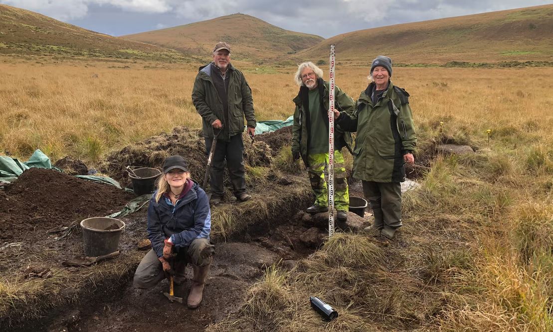
Metheral circle submitted by TheCaptain on 15th Nov 2024. Alan Endacott (second from left) with dig volunteers at the newly discovered Metheral stone circle on Dartmoor.
Photograph: Chris Walpole, borrowed from http://www.theguardian.com/science/2024/nov/15/two-newly-discovered-stone-circles-dartmoor-sacred-arc-theory
(View photo, vote or add a comment)
Log Text: From Belstone I head south, crossing the river Taw at the large shallow ford, then keep heading south along the east side of the river, following a simple track along a line of waterworks drains and features, then keep going some more. I don't think I would have been able to find the stone circle without an accurate grid ref and my gps, as it was not a clear thing to see, and not at all obvious. I was only sure I had found it when I walked across the remains of one of the filled in trenches, with its post stating "trench 5". My thoughts. I was initially not sure of there being anything making up a stone circle, but then I got my eye in and saw an arc of about three or four equispaced stones. They seem to be just natural boulders rather than shaped stones, although some have been set on their sides. Further exploration and I was able to find other stones which may have formed part of the circle, which seems to be much bigger than most of the Dartmoor rings. As I sat having my lunch, the circle seemed to take its place in front of me, with stones and shadows making their presence known around me, all seemingly equispaced. OK, yes I believe this to be a stone circle, although quite different to the normal Dartmoor stone circle, in both size, stone selection, and of course its flat valley bottom position, which to me seems unusual.
Belstone Dolmen
Date Added: 14th Apr 2025
Site Type: Burial Chamber or Dolmen
Country: England (Devon)
Visited: Yes on 8th Apr 2025. My rating: Condition 3 Ambience 3 Access 3

Belstone Dolmen submitted by Bladup on 30th Dec 2024. Belstone Dolmen, found near the eastern end of the Irishman’s Wall
(View photo, vote or add a comment)
Log Text: Heading down towards the river and on the south side of the Irishmans Wall, a couple of large slab like stones can be seen. One of these reveals itself to be a good sized slab leaning atop a couple of side stones, with a few more nearby possibly a couple more slabs once holding up what is now a moved capstone.
Irishman’s Wall circle
Date Added: 13th Apr 2025
Site Type: Stone Circle
Country: England (Devon)
Visited: Yes on 8th Apr 2025. My rating: Condition 3 Ambience 3 Access 3
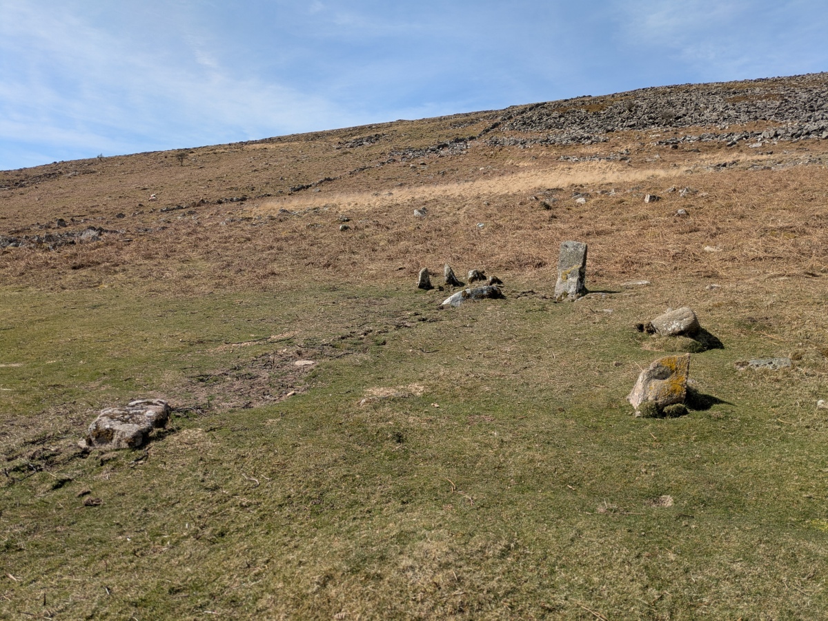
Irishman’s Wall circle submitted by TheCaptain on 13th Apr 2025. There were a few upright stones making an arc, with a small sector of about three very close together. Note the filled in excavation trench
(View photo, vote or add a comment)
Log Text: Fabulous sunny day to Dartmoor to check out the "new" Taw Marsh stone circle etc. This one is easily found by walking along the trackway south from Belstone, and then heading off the track to the west, just before reaching the Irishmans Wall. Its position was notable for the flattened area of short grass, and remnants of the filled in excavation trenches. There were a few upright stones making an arc, with a small sector of about three very close together. I think that this would be some remnants of a cairn circle rather like the nine stones, rather than a true stone circle.
Carn y Defaid (N)
Date Added: 4th Apr 2025
Site Type: Cairn
Country: Wales (Monmouthshire)
Visited: Yes on 26th Mar 2025. My rating: Condition 3 Ambience 4 Access 3
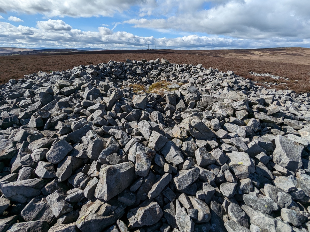
Carn y Defaid (N) submitted by PBertson on 1st May 2023. Looking across the cairn to show the dip in the middle. Blorenge TV masts in background.
(View photo, vote or add a comment)
Log Text: From the hilltop southern cairn, the northern cairn can be seen about 100m away down the slight slope with Blorenge and Ysgyryd in the distance. But the ground underfoot up here is so bad for walking across, no path, knee deep heather, broken stone, muddy holes and adders, that I didn't risk my ankles in going over to it.
Carn y Defaid (S)
Date Added: 31st Mar 2025
Site Type: Cairn
Country: Wales (Monmouthshire)
Visited: Yes on 26th Mar 2025. My rating: Condition 3 Ambience 5 Access 3
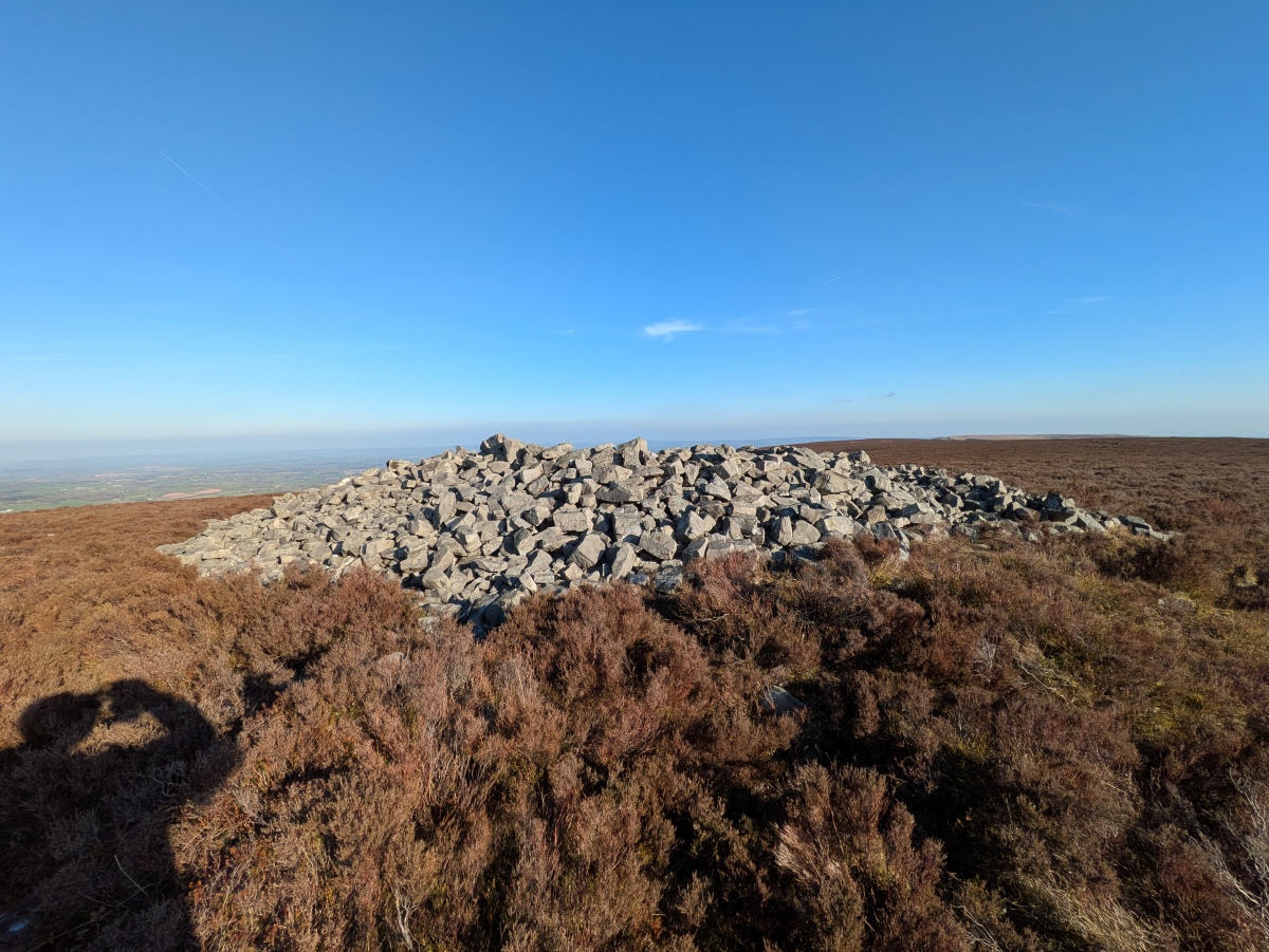
Carn y Defaid (S) submitted by TheCaptain on 31st Mar 2025. Carn y Defaid (S) viewed looking east.
(View photo, vote or add a comment)
Log Text: A visit Raglan Castle, and as it's such a lovely day and seeing the hills on the horizon, I just had to go up top of Blorenge and walk along to the highly visible Carn y Defaid. It's a terrible path underfoot from the Foxhunter car park, all a jumble of rocks, bog and heather. The hilltop southern cairn can be seen from miles around, and equally, on a day like today, can see for miles from it. To the north is the great whaleback moutain Blorenge, while to the northeast, over Abergavenny, can be seen the broken hill of Ysgyryd. Superb, but I do remember being here in the past, all cold and wet with about 10 yards visibility!
House Crag (Howl Moor)
Date Added: 11th Dec 2024
Site Type: Stone Circle
Country: England (Yorkshire (North))
Visited: Yes on 20th Sep 2024. My rating: Condition 2 Ambience 4 Access 3
House Crag (Howl Moor) submitted by johndhunter on 5th Sep 2019. See my comment in comments section at the bottom of the site page. This is a partial view of the area in question. The large stone centre left in the image is at SE 81654 98214,It is viewed looking northerly, August 2019.
(View photo, vote or add a comment)
Log Text: I had an hour or so to spare, but it was foggy on the moor so had to be careful where I went. Decided that having a look for the stones beside the road from Goathland was sensible, then maybe over to the roman road. A closer look at the Mega Portal map showed this (possible) stone circle fairly near, and not far from what appeared to be a decent path, so I gave it a go. Perhaps stupidly, as I had deemed it not far, I went without my bag, therefore no paper map or compass, relying on the phone app alone in the fog, something I would never have done in the past. Anyways, it was a decent track up to the top of the hill, so then came time to hunt for the stones, as seen on the portal. I proceeded across the open moor from the path to where marked on the portal map, but nothing. So call up the portal site page and see that the accuracy rating was not good, but that comments from JohndHunter did give a better reference. Now a fair distance from the track which would lead me back, and in very limited visibility, I was unsure of proceeding in case my battery went flat or I lost the signal, but my curiosity got the better of me, aided by the thought that all I needed to do was head back in the direction I had come, keeping the hill edge to my right and at some point I would get to the track. Anyways, all worked out just fine, and I found the stones as seen in the pictures. At first they just seemed like a jumble of mostly large stones laying on the ground, but then I got to a point where a good arc of stones could be made out, or maybe several arcs. A few of the stones were definitely once standing and set into the ground. Having seen the Bridestones, and in the past Commondale, I personally decided that this indeed could once have been a stone circle. The fog was getting thicker, not aided by it starting to get dark, so I decided to head back, across the moor to the track and then back down to the car, all in taking about an hour. All was good, and I had a real feeling of achievement, so went for a well deserved pint at the Mallyan Spout Hotel.
Hunt House Road Waymarkers
Date Added: 9th Dec 2024
Site Type: Marker Stone
Country: England (Yorkshire (North))
Visited: Yes on 20th Sep 2024. My rating: Condition 3 Ambience 2 Access 5

Hunt House Road Waymarkers submitted by johndhunter on 12th Jun 2022. Stone 2 at NZ 81833 00076 – East Face, September 2019.
(View photo, vote or add a comment)
Log Text: Had an hour or so to spare, but it was foggy on the moor so had to be careful where I went. Decided that having a look for the stones beside the road from Goathland was sensible, then maybe walk over to the roman road. First one was easy, but nowhere obvious to park on the single track road out past the next two.
Hunt House Road Standing Stone
Date Added: 9th Dec 2024
Site Type: Marker Stone
Country: England (Yorkshire (North))
Visited: Yes on 20th Sep 2024. My rating: Condition 3 Ambience 3 Access 5

Hunt House Road Standing Stone submitted by johndhunter on 18th Oct 2019. Stone at NZ 81929 00430 – Viewed looking north easterly, July 2019. The village on the right in the distance is Goathland , The arrow on the left in the distance indicates the area known as Allan Tofts, there are ancient fields and numerous pieces of rock art located here.
(View photo, vote or add a comment)
Log Text: Had an hour or so to spare, but it was foggy on the moor so had to be careful where I went. Decided that having a look for the stones beside the road from Goathland was sensible, then maybe walk over to the roman road. First one was easy, but nowhere obvious to park on the single track road out past the next two.
Low Bridestones (S) (Yorks)
Date Added: 7th Dec 2024
Site Type: Stone Row / Alignment
Country: England (Yorkshire (North))
Visited: Yes on 17th Sep 2024. My rating: Condition 4 Ambience 4 Access 3

Low Bridestones (S) (Yorks) submitted by Bladup on 14th Oct 2014. Low Bridestones.
(View photo, vote or add a comment)
Log Text: The sun is getting low and I consider giving up at this point, but I wisely decide that I do still have time to go and have a quick look for the southern of the three marked groups of stones, and I am very glad that I did. Walking southwards through some initially very difficult boggy ground with long couch grass, I find easier going up the hill a bit and then along what was presumably a sheep track. Then I see in the distance a row of about half a dozen stones standing proud of the moorland, showing clearly as shadows with the golden light of the settng sun behind. They look magnificent. Feeling good now that I have found them, I head over with a spring in my step, and not worrying about the boggy ground underfoot. Thank goodness I have my boots on! When I get there, the five or six large stones are clearly standing in an approximate straight line, but with many other smaller stones also with them. In the middle it seems to be a double row of stones about three or four feet apart, reminding me a bit of a Dartmoor double row. At the lower, southern end, any real form sort of disintegrates into a bit of raised ground with lots of stones almost in a heap. The light here is now just beautiful, all golden with a blue sky and green/brown moorland underfoot. Time to head back, and there looks to be a boggy stream between me and the bridle way back, but after a good look around I find a sheep track which leads me through the marsh ground and across to get me back to the bridleway. All my years of training on Dartmoor have paid off, as it is much easier going than much of that! Walking back to the north along the bridleway I see many large stones laying between the stony track and the nearby field wall. Could these possiby be the remnants of anther row of stones, or are they just large stones which have been moved and dumped out of the way of the track? Its hard to know. Back to the car and time to go for a celebratory pint. It has been another great day, with some grade 1 stone hunting this early evening, and I have a real feeling of achievement.
