Contributory members are able to log private notes and comments about each site
Sites theCaptain has logged. View this log as a table or view the most recent logs from everyone
Museo Archeologico (Mantova)
Date Added: 18th Sep 2010
Site Type: Museum
Country: Italy (Lombardia)
Visited: Yes on 3rd Aug 2007

Museo Archeologico (Mantova) submitted by TheCaptain on 3rd Aug 2007. In a part of the Palazzo Ducale, on Piazza Castello, in the lovely ancient city of Mantova, is a branch of the Italian Museo Archeologico Nazionale.
(View photo, vote or add a comment)
Log Text: None
Lanacombe 5
Date Added: 18th Sep 2010
Site Type: Multiple Stone Rows / Avenue
Country: England (Somerset)
Visited: Yes on 5th Aug 2007

Lanacombe 5 submitted by TheCaptain on 5th Aug 2007. On the south facing slopes of Lanacombe Hill on Exmoor, are the remains of this fairly recently found stone setting.
I found many stones and stumps of stones standing proud of the ground.
The book I have says 9 stones in 3 rows, but to be honest, it could be anything.
(View photo, vote or add a comment)
Log Text: None
Foamhenge (Natural Bridge)
Date Added: 18th Sep 2010
Site Type: Modern Stone Circle etc
Country: United States (Mid Atlantic)
Visited: Yes on 7th Aug 2007
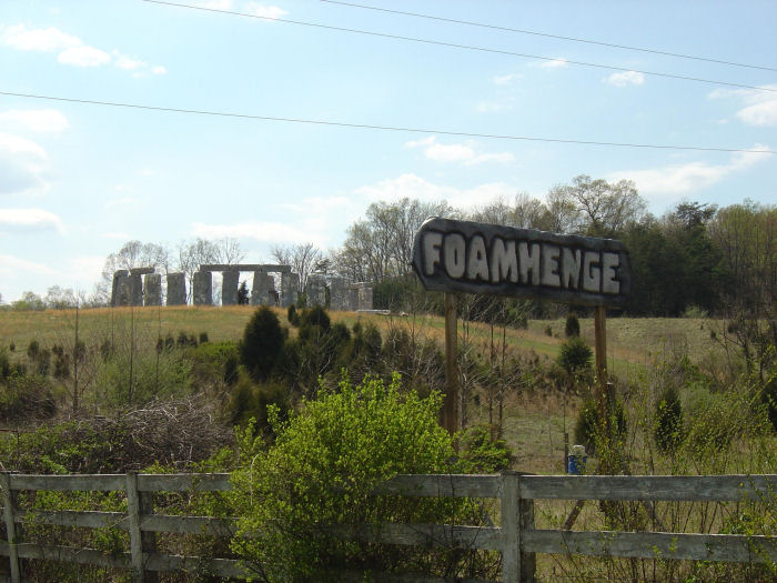
Foamhenge (Natural Bridge) submitted by thecaptain on 7th Aug 2007. Foamhenge, in Virginia, USA.
Photo sent to me by a friend, who's brother passed by here a year or so ago, and knew a photo would be appreciated.
(View photo, vote or add a comment)
Log Text: None
Lanacombe 2
Date Added: 18th Sep 2010
Site Type: Stone Row / Alignment
Country: England (Somerset)
Visited: Yes on 17th Aug 2007

Lanacombe 2 submitted by TheCaptain on 17th Aug 2007. The third stone I found, I would estimate to be about 20–30 metres further up the hill, but it is leaning over or fallen, and well hidden in some marsh grass.
(View photo, vote or add a comment)
Log Text: None
Meacombe Cist
Date Added: 18th Sep 2010
Site Type: Burial Chamber or Dolmen
Country: England (Devon)
Visited: Yes on 26th Aug 2007

Meacombe Cist submitted by TheCaptain on 26th Aug 2007. This is a nice little monument, with a relatively large and chunky capstone sitting on two side supports.
(View photo, vote or add a comment)
Log Text: None
Merrivale Menhir
Date Added: 18th Sep 2010
Site Type: Standing Stone (Menhir)
Country: England (Devon)
Visited: Yes on 4th Sep 2007
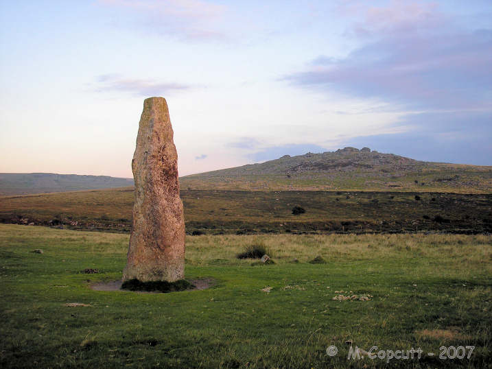
Merrivale Menhir submitted by TheCaptain on 4th Sep 2007. The last rays of an August setting sun light up the Merrivale longstone.
The little stone row (4) and Kings Tor behind it.
(View photo, vote or add a comment)
Log Text: None
Langstone Moor circle
Date Added: 18th Sep 2010
Site Type: Stone Circle
Country: England (Devon)
Visited: Yes on 7th Sep 2007
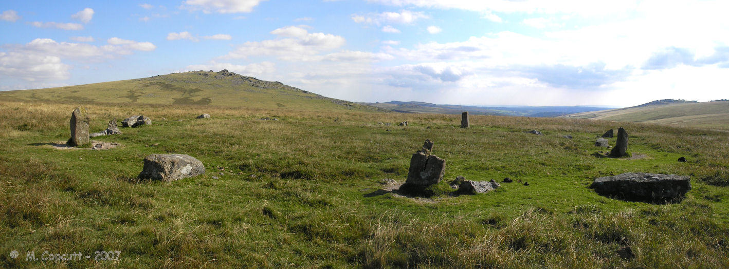
Langstone Moor circle submitted by TheCaptain on 7th Sep 2007. The fractured remains of Langstone Moor stone circle, seen here looking towards the south.
Great Mis Tor on the left, Great Staple Tor in the distance to the right.
(View photo, vote or add a comment)
Log Text: None
Fox Covert NW
Date Added: 28th Aug 2023
Site Type: Chambered Tomb
Country: England (Wiltshire)
Visited: Yes on 9th Sep 2007

Fox Covert NW submitted by TheCaptain on 18th Sep 2007. Overgrown Long Barrow which has been cut in two by a hedge.
The eastern part of the barrow in the eastern field has now been completely ploughed out. The part in the western field is now about 30 metres in length, about 20 metres wide and up to 2 metres in height.
(View photo, vote or add a comment)
Log Text: A badly damaged overgrown Long Barrow with possible Chambered Tomb in a field, which has been cut in two by a hedge. The eastern part of the barrow in the eastern field has now been completely ploughed out. The part in the western field is now about 30 metres in length, about 20 metres wide and up to 2 metres in height. There are one or two big stones, which are almost certainly field clearance, dumped on top, otherwise there were no noticeable features that I could see. There are a few other tumuli marked on maps in neighbouring fields, but as far as I could see, these have no all been completely ploughed out, including the Tormarton 1 (Gloucestershire) long barrow in the field just to the north of the lane here.
Dyrham Camp
Date Added: 17th Oct 2020
Site Type: Hillfort
Country: England (Gloucestershire)
Visited: Yes on 9th Sep 2007
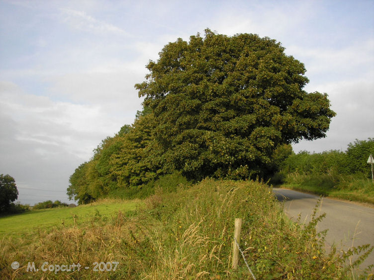
Dyrham Camp submitted by thecaptain on 28th Aug 2008. The western "point" of Hinton Hillfort, where it is cut into two by the little road up the hillside from the village of Hinton below.
(View photo, vote or add a comment)
Log Text: Dyrham Camp, otherwise known as Hinton Hillfort, is not so much a hillfort, but more a promontary fort, on a southwest facing spur of the Cotswold Hills north of Bath. Basically triangular in shape, it is cut into two by the little road up the hillside from the village of Hinton below. The northern part is mostly in woodland, and seems to be used as a rubbish dump these days. The hill edge has been shaped, and in places the bank and ditch is in fine condition, perhaps kept in shape in more recent times for drainage. The southern half of the fort is open pasture with a public footpath running through, and the steep southern slopes are sort of terraced, with several almost cliff like ramparts, below which are quite spectacular remains of ancient field systems. The eastern edge of the fort, where the land is flat on top of the Cotswold plateau, has a large ditch and bank in place across the headland. The ditch is about 10 metres wide and 2 metres deep, with a bank up to 4 metres high on the inside, which even these days is a fairly good barrier to entry.
Langstone Moor settlement
Date Added: 18th Sep 2010
Site Type: Ancient Village or Settlement
Country: England (Devon)
Visited: Yes on 10th Sep 2007
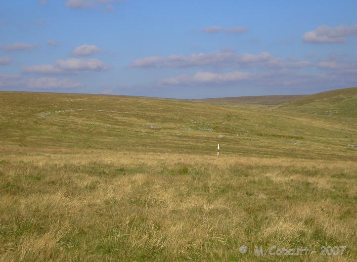
Langstone Moor settlement submitted by TheCaptain on 10th Sep 2007. Remains of a large ancient settlement, on the south facing slopes of Langstone moor above the Walkham valley.
The settlement consists of at least seven enclosures and more than 50 huts.
(View photo, vote or add a comment)
Log Text: None
Sourton Green Saxon Cross
Date Added: 18th Sep 2010
Site Type: Ancient Cross
Country: England (Devon)
Visited: Yes on 10th Sep 2007
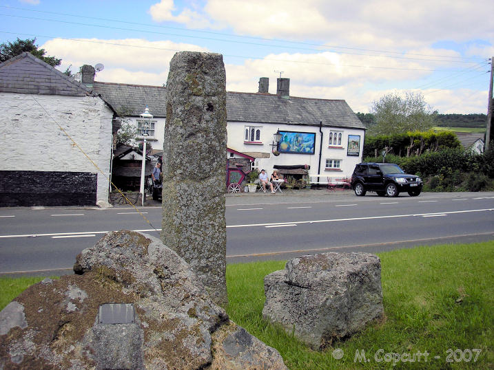
Sourton Green Saxon Cross submitted by TheCaptain on 10th Sep 2007. Saxon cross shaft standing on the Sourtn village green, opposite the bizarre Highwayman Inn.
(View photo, vote or add a comment)
Log Text: None
Cox Tor north east
Date Added: 18th Sep 2010
Site Type: Ancient Village or Settlement
Country: England (Devon)
Visited: Yes on 12th Sep 2007
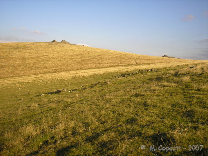
Cox Tor north east submitted by TheCaptain on 12th Sep 2007. at the southern, most uphill end of the settlement are a couple of good huts.
(View photo, vote or add a comment)
Log Text: None
Devils Den
Date Added: 8th Oct 2020
Site Type: Burial Chamber or Dolmen
Country: England (Wiltshire)
Visited: Yes on 16th Sep 2007. My rating: Condition 3 Ambience 3 Access 4
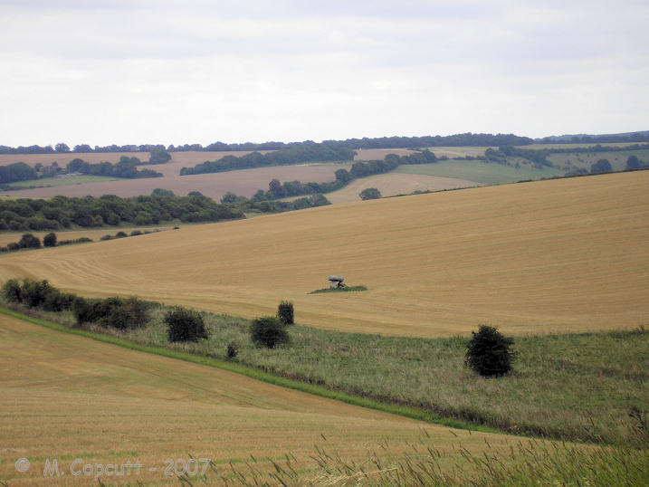
Devils Den submitted by thecaptain on 18th Sep 2007. The view of Devil's Den in its landscape.
As seen from the pathway down from the ridge from the northeast.
(View photo, vote or add a comment)
Log Text: As I was driving westwards along the A4 Sunday afternoon, I decided to stop in at the Devils Den for a look round, having not been there for many years - the stony delights a bit further west usually taking my attention. Knowing it is difficult to park on the A4 in order to walk up the track from Clatford Bottom, I decided to take the little road to the north, I believe towards Manstone farm, where there is a fairly large car park near to the racing stables. From there it is a pleasant walk along the ridge before dropping down into the valley where the Devils Den resides, with some nice views over the site as a whole to be had on the way (it always strikes me what a strange place this is for such a monument, low down in the valley like it is).
Unfortunately, when down on the overgrown trackway along the sarsen scattered valley bottom, there was no way into the field of the dolmen, with fences, nettles and much scrub preventing access to its field. Even getting to a point quite close by is not recommended in shorts - quite a painful experience ! I can only assume that the landowners are perhaps letting a fairly large strip of land become completely overgrown in order to deter people from clambering over the fences to go for a closer look.
Langstone Moor row 2
Date Added: 18th Sep 2010
Site Type: Stone Row / Alignment
Country: England (Devon)
Visited: Yes on 18th Sep 2007
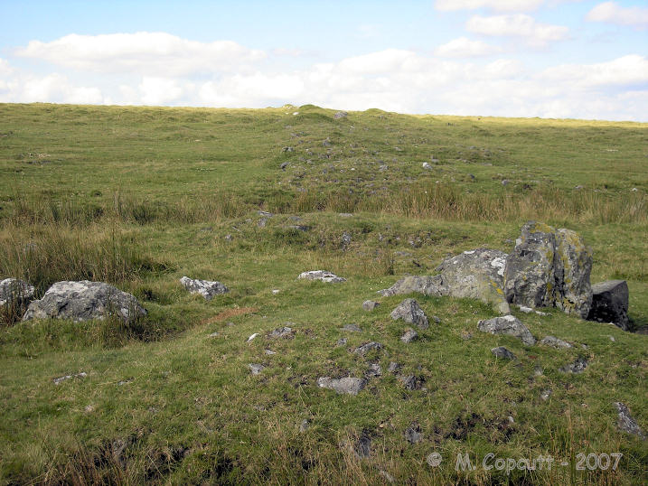
Langstone Moor row 2 submitted by TheCaptain on 18th Sep 2007. There is possibly a cairn to be found at the upper, northern end, and the remains of some sort of structure made with larger stones at a southern position, just about 70 metres from the Langstone.
(View photo, vote or add a comment)
Log Text: None
Langstone Moor stone row
Date Added: 18th Sep 2010
Site Type: Stone Row / Alignment
Country: England (Devon)
Visited: Yes on 18th Sep 2007
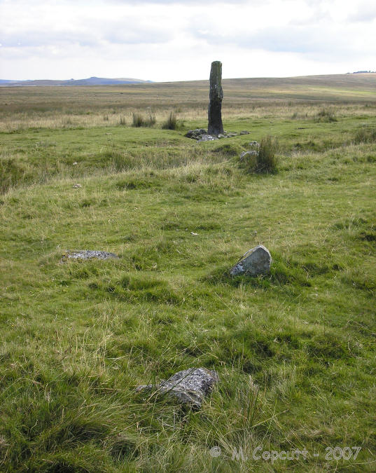
Langstone Moor stone row submitted by TheCaptain on 18th Sep 2007. Running off to the north from the Langstone is the remains of a stone row, which can be followed for about 100 metres before it runs out.
(View photo, vote or add a comment)
Log Text: None
St-Malo-de-la-Lande menhir
Date Added: 18th Sep 2010
Site Type: Standing Stone (Menhir)
Country: France (Normandie:Manche (50))
Visited: Yes on 30th Sep 2007

St-Malo-de-la-Lande menhir submitted by TheCaptain on 30th Sep 2007. Beside a track near the top of the hill above the stream, a kilometre or so to the south of St Malo-de-le-Lande, can be found this menhir.
(View photo, vote or add a comment)
Log Text: None
The Langstone
Date Added: 18th Sep 2010
Site Type: Standing Stone (Menhir)
Country: England (Devon)
Visited: Yes on 1st Oct 2007
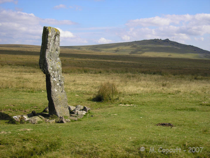
The Langstone submitted by TheCaptain on 1st Oct 2007. The Langstone, with Great Mis Tor in the background.
(View photo, vote or add a comment)
Log Text: None
White Tor (Peter Tavy)
Date Added: 18th Sep 2010
Site Type: Ancient Village or Settlement
Country: England (Devon)
Visited: Yes on 1st Oct 2007
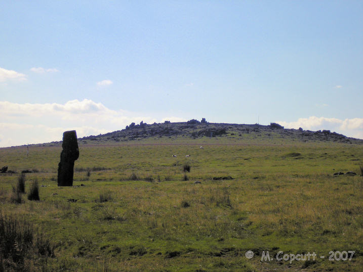
White Tor (Peter Tavy) submitted by thecaptain on 1st Oct 2007. View of White Tor, from the Langstone.
It was once thought to be an iron age hillfort, but study of the structures has shown it to be a Neolithic enclosure, adapted over the millennia.
(View photo, vote or add a comment)
Log Text: None
Bwlch Bach a'r Grib cairns
Date Added: 18th Sep 2010
Site Type: Cairn
Country: Wales (Powys)
Visited: Yes on 2nd Nov 2007
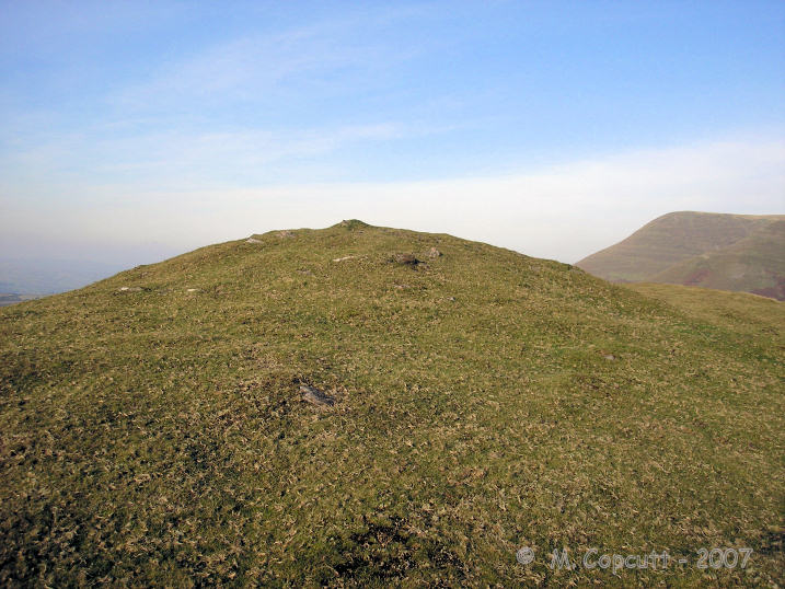
Bwlch Bach a'r Grib cairns submitted by TheCaptain on 2nd Nov 2007. On top of the second hilltop on the Y Grib ridge, at SO18503073, is a stonebuilt round cairn about 10 metres in diameter.
(View photo, vote or add a comment)
Log Text: None
Craig-Y-Fan Ddu
Date Added: 18th Sep 2010
Site Type: Multiple Stone Rows / Avenue
Country: Wales (Powys)
Visited: Yes on 14th Nov 2007

Craig-Y-Fan Ddu submitted by TheCaptain on 14th Nov 2007. On the southern slopes of Craig-Y-Fan Ddu are marked Stones on the 1:25000 OS map. They reminded me very much of the Exmoor stone settings.
View downhill towards the east.
(View photo, vote or add a comment)
Log Text: None
