Contributory members are able to log private notes and comments about each site
Sites theCaptain has logged. View this log as a table or view the most recent logs from everyone
Pierre Levée dolmen 2 (Villedieu)
Trip No.205 Entry No.253 Date Added: 13th Dec 2020
Site Type: Burial Chamber or Dolmen
Country: France (Auvergne:Cantal (15))
Visited: Yes on 26th Sep 2005. My rating: Condition 2 Ambience 4 Access 3
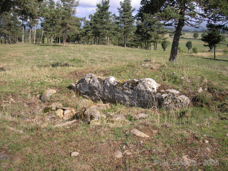
Pierre Levée dolmen 2 (Villedieu) submitted by thecaptain on 19th Dec 2008. The dolmen is in very poor condition, basically one large side slab in a hollow in the centre of its tumulus.
(View photo, vote or add a comment)
Log Text: Unfortunately, this cannot be reached from its near neighbours, and instead it has to be walked to quite a distance (about 1 km) from a point where you start the walk to the Tombe du Capitaine. It's a pleasant walk along a well signposted track, and then across a hilltop field.
The dolmen is in very poor condition, basically one large side slab in a hollow in the centre of its tumulus. However, the tumulus is in fine condition, about 15 metres in diameter and up to 1.5 metres in height. Around the outside at certain places it seems to be encircled with a sort of stone slab walling. This is in a lovely spot, and was well worth the effort to get to. I wouldn't be surprised if there was once another dolmen in this mound.
Plateau de Mons
Trip No.205 Entry No.259 Date Added: 13th Dec 2020
Site Type: Barrow Cemetery
Country: France (Auvergne:Cantal (15))
Visited: Saw from a distance on 26th Sep 2005
Log Text: On top of the plateau is a large collection of earthen barrows dating to the iron age which can be seen from the track.
Lou Couraus Cromlechs
Trip No.205 Entry No.59 Date Added: 25th Oct 2020
Site Type: Stone Circle
Country: France (Aquitaine:Pyrénées-Atlantiques 64)
Visited: Yes on 7th Sep 2005. My rating: Condition 4 Ambience 5 Access 3

Lou Couraus Cromlechs submitted by thecaptain on 22nd Dec 2005. Lou Couraus Cromlechs.
I counted 16 circles up here of varying sizes. This is one of the smaller, but more complete examples.
(View photo, vote or add a comment)
Log Text: High up above the Ossau valley above the village of Bielle can be found several circles of stones, on a little shelf of land halfway up the mountainside, and in a wonderful viewpoint above the valley. From the village take the road up towards Col de Marie Blanc, and park at the Chapelle de Houndas after about 5 kilometres, and about 8 km before the Col. From here the cromlechs are easily reached, on a signposted walk along mountain trackways. Allow three hours for the return visit round the signposted footpath.
Unfortunately, the day I am here is not good for the weather, and I am mostly enveloped in cloud, so I am not getting the fantastic views, in fact most of my walk up the visibility is only 50 metres, which is a pity, because the big mountains around Col D'Aubisque should all be visible from here. After following the trackway for a couple of kilometres, the cromlechs are found a short distance up a steepish path to the left, and after lots of exploring, I counted what I thought to be 16 circles of various sizes.
The first cromlech I found, which I shall call Cromlech A (4), is right beside the track, and has a diameter of 6 metres, with 26 stones still in position, mostly contiguous around the outside, but with about 4 or 5 gaps. Within the circle are lots more stones, and perhaps the remnants of a central burial area, circular and about one metre in diameter. It is of course possible that these stones are the remains of a cairn, and the circular structure is a fluke (although after seeing more of these Pyrenean cromlechs later on my tour, the remains of burial cairns and cists in the centre of these circles is fairly common). A further look suggests that it may have had an entrance to the east, on 065°, between two larger white stones, with a dark one in between. This circle reminded me in many ways of that at Belstone on Dartmoor.
Cromlech B (2). This is a smaller circle, but very well formed, 4 metres in diameter, consisting of about 20 stones, with many more smaller pieces in place. The largest stone is about 0.7 metres high.
Cromlech C (1). This is about 9 metres in diameter with about 18 stones in place, with many more fallen. Some of these stones stand over a metre in height. The ground within is stony and slightly raised, suggesting the remains of a cairn. This circle is just 3 metres away from circle B at the closest point.
Cromlech D and more (6 to 15). Walking eastwards along the shelf of land from Cromlech A for 50 metres, and in a place where some of the vegetation has been cleared back can be seen many more circles of stone. It is not easy to count them, as although some are complete, several are partial, and many are buried in the undergrowth. Suffice to say that there are about a dozen circles here, made with smaller stones, and ranging in diameter from 2.5 metres to 5 metres. What I shall call circle 8 is a nicely formed circle 5 metres in diameter and with about 24 readily identifiable stones. It doesn't photograph well as it is underneath some bushes.
At last, after sitting and spending ages up here, the cloud has risen above me, and in fact there are patches of blue sky, although not as yet above the mountains. Its really beautiful up here, with birdies tweeting and bells ringing all around. How much longer should I stay though ? Perhaps its better to be getting back now, its gone 3:00pm. Ahhh, the cows have arrived. I can go back now the cows have come home ! Take many more pictures with the cows n them, the stones make good scratching posts. I get down to the van at 4:00, and its now mostly sunny. Time to tackle Aubisque and Soulor.
Calhau de Teberno Dolmen
Trip No.205 Entry No.57 Date Added: 25th Oct 2020
Site Type: Burial Chamber or Dolmen
Country: France (Aquitaine:Pyrénées-Atlantiques 64)
Visited: Yes on 6th Sep 2005. My rating: Condition 4 Ambience 4 Access 4
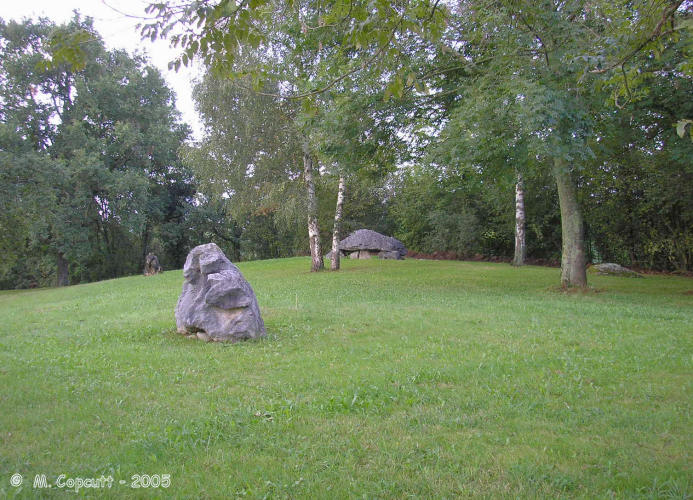
Calhau de Teberno Dolmen submitted by thecaptain on 8th Feb 2006. This nice dolmen can be found in a little landscaped bit of parkland, sandwiched between the D.920 road and the railway line.
It sits on top of a little hillock, which I wonder whether this is the remains of a large tumulus.
(View photo, vote or add a comment)
Log Text: This dolmen can be found in a nice little landscaped bit of parkland, sandwiched between the D.920 road and the railway line at the outskirts of the village of Buzy a couple of kilometres to the north of Arudy. There are many other rocks in the park, which have probably all been placed as features, but perhaps one or two are related to the dolmen.
It sits on top of a little hillock, which I wonder whether these are the remains of a large tumulus ? The chamber is largely below the level of the surrounding ground. The dolmen has a lovely curvy capstone sitting on top of a chamber 4 metres long by 1,5 metres wide, with nicely positioned side slabs each side (3 one side, 4 the other). There is a well fitted backstone, and the chamber opens to the southeast on an alignment of 135°, but perhaps more importantly this is looking directly towards the big gap in the mountains, which is the entry to the Ossau valley.
If it wasn't for the bad weather, and all the trees around, this dolmen would have superb views. I think that I later learn that the dolmen was possibly moved to its current position when the railway was constructed.
Dolmen de Barzun
Trip No.205 Entry No.56 Date Added: 25th Oct 2020
Site Type: Burial Chamber or Dolmen
Country: France (Aquitaine:Pyrénées-Atlantiques 64)
Visited: Couldn't find
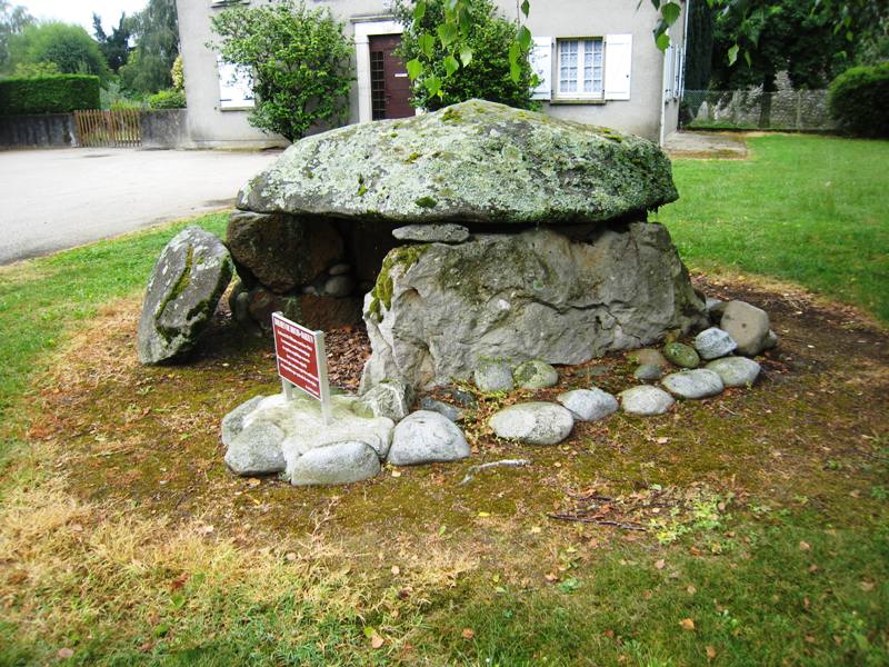
Dolmen de Barzun submitted by irundarra on 24th Jul 2010. in Bearn
(View photo, vote or add a comment)
Log Text: My maps have nothing marked in detail as to the whereabouts of this dolmen, and I could find no details or signs to it in the village. Somehow I didn’t find this dolmen which I learned later is pretty much in the centre of the village in a little square. Doh !
Turoum-Bouchous Dolmen
Trip No.205 Entry No.58 Date Added: 25th Oct 2020
Site Type: Burial Chamber or Dolmen
Country: France (Aquitaine:Pyrénées-Atlantiques 64)
Visited: Couldn't find on 7th Sep 2005
Turoum-Bouchous dolmen submitted by irundarra on 1st Aug 2008. Site in Laruns (Bearn)
(View photo, vote or add a comment)
Log Text: I couldn’t find any evidence on any maps I had, and asked at the tourist information office and national park centre, but nobody knew anything about this dolmen.
Grotte du Pape
Date Added: 18th Sep 2010
Site Type: Cave or Rock Shelter
Country: France (Aquitaine:Landes (40))
Visited: Yes on 1st Apr 2007
Grotte du Pape submitted by thecaptain on 1st Apr 2007. The "Dame de Brassempouy".
A female head carved from ivory, found in the Grotte du Pape near to the village of Brassempouy in 1894.
The figure is only 3.6 cm big, and is thought to be the oldest representation of a human face, dating to almost 30,000 years ago.
The figure normally resides in the St Germain-en-Laye prehistory museum, but is seen here in an exhibition of Women in Art throughout history, which I saw at the Bougon Tumuli in 2005.
(View photo, vote or add a comment)
Log Text: None
Pierre Levée (Salles-de-Castillon)
Trip No.203 Entry No.221 Date Added: 21st Apr 2020
Site Type: Standing Stone (Menhir)
Country: France (Aquitaine:Gironde (33))
Visited: Yes on 2nd Jun 2005. My rating: Condition 3 Ambience 2 Access 5
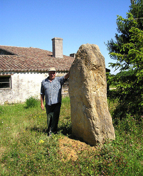
Pierre Levée (Salles-de-Castillon) submitted by thecaptain on 4th Jul 2005. La Pierre Levée, Salles-de-Castillon, Gironde.
This was one of the more interesting sites I found in my last session in France. It comes with its own wine, made by the chap in the picture, in his "chateau" at which this menhir is at the entrance.
(View photo, vote or add a comment)
Log Text: This one comes with its own wine! While driving from Peyre Lebade towards Clotte I saw this stone standing at the entrance to a farmhouse wine producer and noticed that the farm was called Chateau de la Pierre Levée.
I stopped to have a better look and a man on his tractor in the vineyard came over to me so I tried to ask him about the stone. Apparently somewhere in his garage he has an archaeological panel with some information on it which he intends to get erected by the stone but he couldn’t find it. He called his wife who told him it was in the garage and went to look for herself also to no avail ! At this point I enquired of their wine and got taken on a little tour of the place and a tasting or two (how could I refuse?) so of course bought a case of mixed vintages for a very reasonable price as a souvenir.
The menhir at the entrance is just over 2 metres tall but I have to say looks fairly recently erected there although the stone looks as old as the hills. I think I saw somewhere that the menhir after which the wine is named was in a corner of a field. Perhaps it has been fairly recently moved here. It’s a pity I couldn’t fully converse with the chap he had a thick accent which didn’t help and although we chatted well about simple things the details were missed.
Peyre Lebade
Trip No.203 Entry No.220 Date Added: 21st Apr 2020
Site Type: Standing Stone (Menhir)
Country: France (Aquitaine:Gironde (33))
Visited: Yes on 2nd Jun 2005. My rating: Condition 2 Ambience 2 Access 5
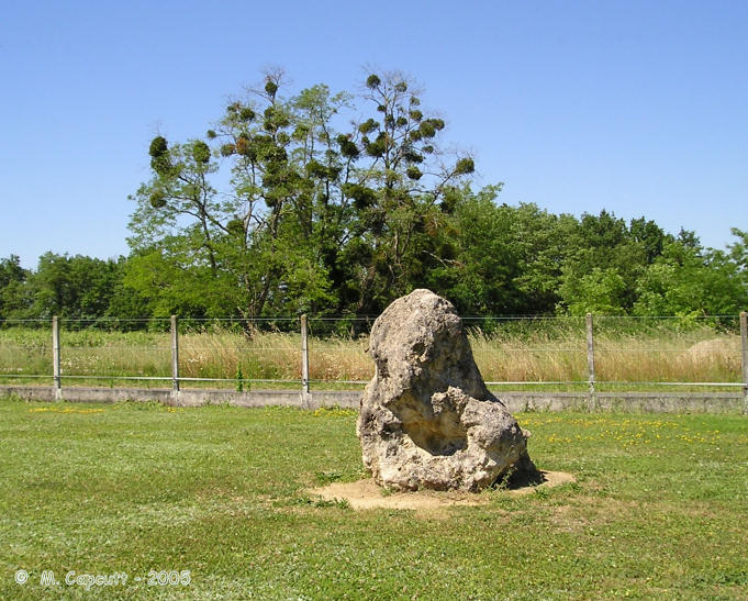
Peyre Lebade submitted by thecaptain on 9th Jan 2006. Peyre Lebade near the village of Salles-de-Castillon in Gironde.
In the corner of the road junction to the west of the village centre can be seen a small standing stone fenced in to a little grassy garden area.
(View photo, vote or add a comment)
Log Text: While looking at the village map by the Mairie to see if it marked any of the supposedly local ancient stones I noted an area called Peyre Lebade so of course I went to have a look. In the corner of the road junction here to the west of the village centre can be seen a small standing stone fenced in to a little grassy garden area. It cant be much more than a metre tall and is well weathered so I assume it’s a proper menhir.
Dolmen de Puy Landry
Trip No.203 Entry No.222 Date Added: 21st Apr 2020
Site Type: Burial Chamber or Dolmen
Country: France (Aquitaine:Gironde (33))
Visited: Yes on 2nd Jun 2005. My rating: Condition 2 Ambience 4 Access 3
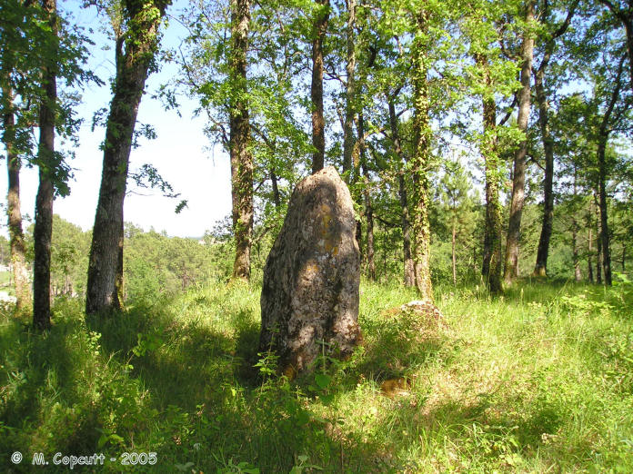
Dolmen de Puy Landry submitted by thecaptain on 9th Jan 2006. Close inspection shows the main stone to be about 1.5 metres tall with a fallen companion about a metre away to the north. These stones are on top of a mound running in an easterly direction and there are several other stones lying about in the vicinity, which leads me to suspect that this is indeed the remains of a dolmen or allée couverte, rather than a menhir.
(View photo, vote or add a comment)
Log Text: The old chap at Chateau Pierre Levée knew of this dolmen's existence but the chap at Puy Landry winery didn’t but he pointed me in the direction of a menhir on the top of Puy Landry hill about a kilometre to the north but ce n’est pas grand.. I initially thought it was too far to go walking to in the intense heat and suspected he was pointing me to the Clotte menhir on the ridge but having driven nearby to have a better look it didn’t seem so far. About 400 metres from the D21E road up a track between the vineyards to the top of the ridge and in the woodland can be seen a standing stone.
Closer inspection shows the stone to be about 1.5 metres tall with a fallen companion about a metre away to the north. These stones are on top of a mound running in an easterly direction and there are several other stones lying about in the vicinity which leads me to suspect that this is indeed the remains of a dolmen or allée couverte.
Pitray Allée couverte
Trip No.203 Entry No.224 Date Added: 21st Apr 2020
Site Type: Passage Grave
Country: France (Aquitaine:Gironde (33))
Visited: Yes on 2nd Jun 2005. My rating: Condition 3 Ambience 3 Access 1
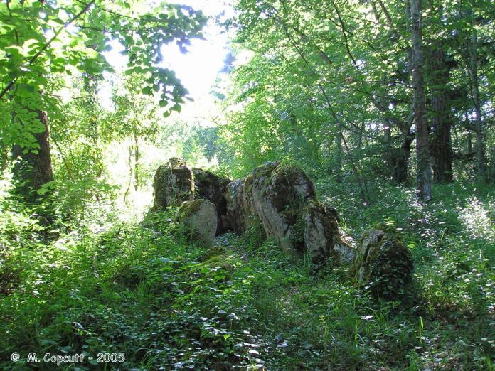
Pitray Allée couverte submitted by thecaptain on 9th Jan 2006. Pitray Allée couverte.
The remains are 10 metres in length with large side slabs up to 1.7 metres high placed about 1.2 metres apart making a chamber with an orientation of 074° but there are no cover stones.
(View photo, vote or add a comment)
Log Text: Well what a find this was. I found Pitray on the village map outside the Mairie and when I got there I found a long driveway up to a chateau with a couple of men working logging in the woodland who told me that they knew of the dolmen and that I should go and ask at the chateau. In the grounds surrounding the chateau a charming lady looking after her baby grandson came to talk to me who spoke good English and told me that she knew of the dolmen well and that she had known of it for many years but hadn’t seen it in a while and that we had best go ask her son in law the master of the chateau if I could go and see it. Another very pleasant man who seemed pleased that somebody was interested in the dolmen in his grounds. I was taken to the remains of the dolmen and on the way it was spoken about that they thought that they should probably clear them up as they are getting very overgrown and crumbling but they were not sure what they are allowed or are supposed to do with them. They are quite difficult to find being as overgrown as they are in some dense woodland and it took a while to find it. I was told that a couple of men from CNES had been round and taken measurements about 20 years ago and had told the owners that there was probably nothing of interest to be found as it would have been fully dug out last century.
The remains are 10 metres in length with large side slabs up to 1.7 metres high placed about 1.2 metres apart making a chamber with an orientation of 074° but there are no cover stones. The back stone is about 2.3 metres in width and the side stones are graded in height with the tallest at the back. There are 3 big and 2 medium sized stones on the northern side and 3 big 3 medium sized stones along the southern side with some smaller stones curving away towards the path into the woods. Some of the stones have strange holes in them which seem to be perhaps more than just weathering. Not far away towards the northeast is a strange arrangement of smaller stones in a double parallel row which align directly to the entrance of the allée couverte.
The owner has no idea what these are or whether they are related or not but interesting nevertheless. These stones are even more overgrown. I was told that the chateau often has Scouts stay within the grounds and that recently a lot of girl scouts had been staying there had found the allée couverte and had rigged up a shower within the chamber complete with makeshift shower curtain! They had not been too impressed when told that they had made their shower within an ancient tomb !
These megalithic remains are on very private land and I was privileged to be allowed into the woods and shown them. A visit should not be attempted without permission.
Pierre du Maine du Prieuré
Trip No.203 Entry No.228 Date Added: 22nd Apr 2020
Site Type: Standing Stone (Menhir)
Country: France (Aquitaine:Gironde (33))
Visited: Yes on 3rd Jun 2005. My rating: Condition 2 Ambience 2 Access 5
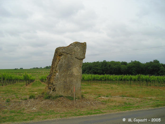
Pierre du Maine du Prieuré submitted by thecaptain on 9th Jan 2006. Menhir, one of possibly several within the Lugasson community.
(View photo, vote or add a comment)
Log Text: This is a big menhir stood at the edge of the roadside, at least 3.5 metres tall, and the top has been broken off. Not very well looked after, it is surrounded by junk, although by the marks on it, it looks to have been fairly recently re-erected.
Dolmens de Bignon
Trip No.203 Entry No.231 Date Added: 10th Jul 2024
Site Type: Burial Chamber or Dolmen
Country: France (Aquitaine:Gironde (33))
Visited: Saw from a distance on 3rd Jun 2005
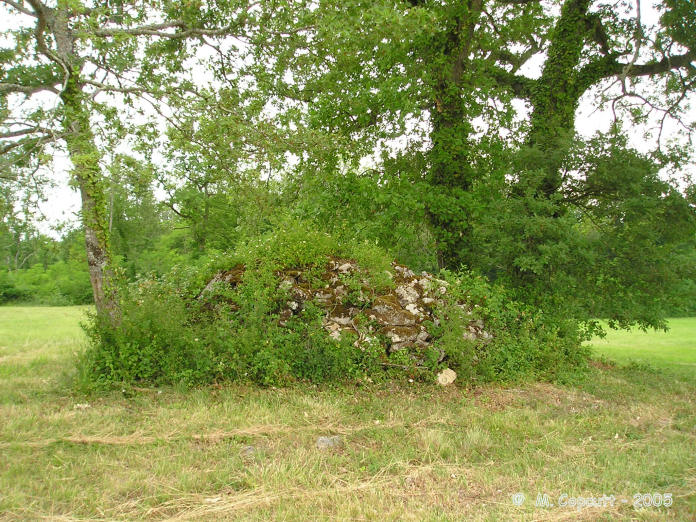
Dolmens de Bignon submitted by thecaptain on 9th Jan 2006. Supposedly there is one large allée-couverte and two simple dolmens to be found, and I must have spent over an hour looking along all tracks and in all fields here.
The best I found is this pile of stones in the middle of a field - could it be one of the small dolmens under there ?
(View photo, vote or add a comment)
Log Text: I knew things were going too well this morning. I found Frontenac, and from there I eventually found Bignon, but after much searching and some very difficult to understand directions from an old lady living near the farm (they are very big, and only 800 metres away) I could find no signs of the three dolmens here. Supposedly there is one large allée-couverte and two simple dolmens to be found, and I must have spent over an hour looking along all tracks and in all fields. Perhaps they are deep in some woods beside the stream.
Curton Dolmen
Trip No.203 Entry No.225 Date Added: 21st Apr 2020
Site Type: Burial Chamber or Dolmen
Country: France (Aquitaine:Gironde (33))
Visited: Yes on 2nd Jun 2005. My rating: Condition 3 Ambience 3 Access 4
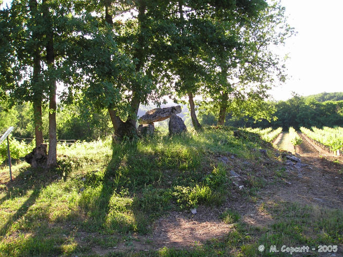
Curton Dolmen submitted by thecaptain on 10th Jan 2006. This is a little allée couverte on the reducing remains of its mound, which has been ploughed right up to the edges and surrounded by vines.
(View photo, vote or add a comment)
Log Text: As I was driving towards Bellefond I saw a sign to Dolmen de Curton so I had to follow it but it’s a pity the large signs do not follow the one at the road junction up. There are one or two very small signs after this which I at first missed and these lead into a vineyard before they give up totally. Following the track on by foot for about 600 metres and you eventually reach the dolmen.
It is a little allée couverte on the reducing remains of its mound which has been ploughed right up to the edges and surrounded by vines. There are some nasty crackling power lines right overhead. One capstone remains on the two rows of sidestones which can be traced for about 8 metres facing an orientation of 110°. The end stone has some strange markings on it several short straight lines and a few horseshoe shapes but they are difficult to make out. Apparently 8 bodies were found within it when the chamber was excavated in 1904.
Roquefort Allée couverte
Trip No.203 Entry No.229 Date Added: 22nd Apr 2020
Site Type: Passage Grave
Country: France (Aquitaine:Gironde (33))
Visited: Yes on 3rd Jun 2005. My rating: Condition 3 Ambience 4 Access 1
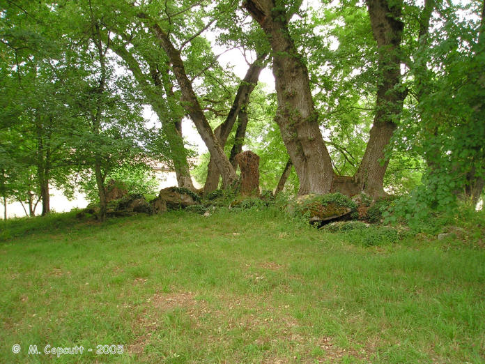
Roquefort Allée couverte submitted by thecaptain on 10th Jan 2006. Roquefort allée couverte can be found in the grounds of Roquefort Chateau near to the village of Lugasson in Gironde.
Its a very big allée-couverte, especially for round here, still contained mostly within its long mound, but in a fairly ruinous condition. As with many of these monuments, the mound has got many big trees growing on it, with their roots digging in to the remains, and unfortunately several of these trees were blown down in the big storm of 19XX, substantially damaging the on...
(View photo, vote or add a comment)
Log Text: This is a fantastic find, in the grounds of Roquefort Chateau, which is a very private area. I asked at the village about the allée-couverte, and got directed to the Chateau, which is still a very busy wine producer, so I went and asked there. I got taken by the owner to see the monument, and he also found and let me photocopy some documents and details they had about it.
Its a very big allée-couverte, especially for round here, still contained mostly within its long mound, but in a fairly ruinous condition. As with many of these monuments, the mound has got many big trees growing on it, with their roots digging in to the remains, and unfortunately several of these trees were blown down in the big storm of 19XX, substantially damaging the once fine chamber. It is 18 metres in length, with 22 support stones, with an east west orientation at 104°. Only 4 capstones now remain in place, and the end stone has cupules carved into it. Excavations were carried out in 1922 and again in 1977.
Peyrefitte
Trip No.203 Entry No.233 Date Added: 22nd Apr 2020
Site Type: Standing Stone (Menhir)
Country: France (Aquitaine:Gironde (33))
Visited: Yes on 3rd Jun 2005. My rating: Condition 5 Ambience 3 Access 5
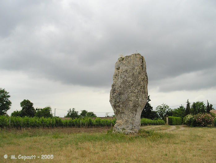
Peyrefitte submitted by thecaptain on 15th Jan 2006. Large menhir near to the Dordogne river in the commune of St-Sulpice-de-Faleyrens in Gironde. Signposted from all around, and with a little parking area, this huge and nicely shaped menhir stands in a little field amongst the vines.
(View photo, vote or add a comment)
Log Text: Signposted from all around, and with a little parking area, this huge and nicely shaped menhir stands in a little field amongst the vines. This is the largest standing stone in southwest France, and it is 5.2 metres tall, 3 metres wide and less than a metre thick, with the bottom part of it chipped away to make the distinctive shape. There is a little hollow in the bottom of it, apparently made for offerings to be placed in during the middle ages.
Estimated to weigh 50 tonnes, the stone has been brought to this position from at least 2.5 kilometres away. It has been dated to 2500 BC, contemporary with the various allée-couvertes to be found in the region.
It is said by legend to mark an entry to the subterranean world, can cure rheumatism, and is good for curing a limp. But while I am here, a massive thunderstorm has arrived, and I must rush back to the van quickly.
Cromlech de Lervaut
Date Added: 29th Oct 2019
Site Type: Stone Circle
Country: France (Aquitaine:Gironde (33))
Visited: Yes on 8th Feb 2011
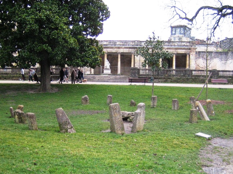
Cromlech de Lervaut submitted by TheCaptain on 8th Feb 2011. In le jardin public de Bordeaux, is a cromlech from Lervaut near Lesparre-Medoc, which was moved here in 1875.
Picture taken Feb 2011 sent to me by a friend.
(View photo, vote or add a comment)
Log Text: None
Menhir de Clotte
Trip No.203 Entry No.223 Date Added: 21st Apr 2020
Site Type: Standing Stone (Menhir)
Country: France (Aquitaine:Gironde (33))
Visited: Couldn't find on 2nd Jun 2005
Log Text: I found both a Chateau de Clotte and a Moulin de Clotte but not the menhir.
Sabatey Dolmen 1
Trip No.203 Entry No.227 Date Added: 22nd Apr 2020
Site Type: Burial Chamber or Dolmen
Country: France (Aquitaine:Gironde (33))
Visited: Yes on 3rd Jun 2005. My rating: Condition 3 Ambience 5 Access 4
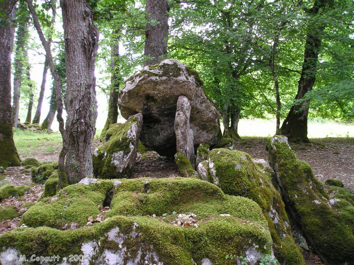
Sabatey Dolmen 1 submitted by thecaptain on 9th Jan 2006. Remains of two dolmens near to the village of Bellefond in Gironde.
Sabatey dolmen 1 is in the woods, and the remains of the allée-couverte on top are much more recogniseable tan its neighbour.
(View photo, vote or add a comment)
Log Text: Not the easiest dolmens to find, but they are signposted from the village of Bellefond to some degree, although a fair bit of guesswork is needed at certain junctions. Just to the left of Sabatey Farm, a gate opens into a field, from where you walk across to the woods, where the two dolmens can be seen on the right.
Sabatey dolmen 1 is about 25 metres into the woods, and although it at first appears to be a similar jumble of stones, the remains of the allée-couverte on top are much more recogniseable. It is about 6 metres long by 1.5 metres wide, with one capstone in place and a couple more fallen, with the chamber oriented eastwards at 094°. The end closing stone has some cupules carved into it.
Sabatey Dolmen 2
Trip No.203 Entry No.226 Date Added: 22nd Apr 2020
Site Type: Burial Chamber or Dolmen
Country: France (Aquitaine:Gironde (33))
Visited: Yes on 3rd Jun 2005. My rating: Condition 2 Ambience 4 Access 4
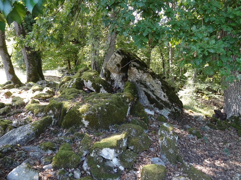
Sabatey Dolmen 2 submitted by johnstone on 18th Jan 2018. Sabatey-2 the sad remains on Sep 8, 2015
(View photo, vote or add a comment)
Log Text: Not the easiest dolmens to find, but they are signposted from the village of Bellefond to some degree, although a fair bit of guesswork is needed at certain junctions. Just to the left of Sabatey Farm, a gate opens into a field, from where you walk across to the woods, where the two dolmens can be seen on the right.
The first you find is Sabatey dolmen 2, which seems to mostly consist of a large pile of moss covered stones, with the remains of an allée-couverte sitting on top. A single remaining capstone has fallen, and the rest of the chamber is difficult to make out, but there are lots of large edge on stones present, possibly aligned on about 050°.
