Contributory members are able to log private notes and comments about each site
Sites theCaptain has logged. View this log as a table or view the most recent logs from everyone
La Roche Blanche
Trip No.204 Entry No.4 Date Added: 22nd Jun 2020
Site Type: Round Cairn
Country: France (Bretagne:Morbihan (56))
Visited: Yes on 9th Jul 2005. My rating: Condition 3 Ambience 3 Access 3
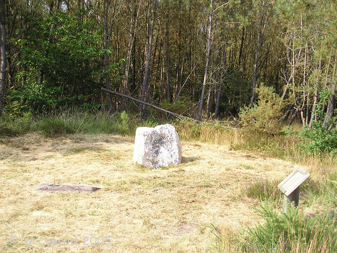
La Roche Blanche submitted by TheCaptain on 2nd Jun 2007. This is a nice shining white quartz block within a circle of local schist stones.
It is thought to probably mark the grave of an individual, rather than being a collective grave.
(View photo, vote or add a comment)
Log Text: This is a nice shining white quartz block within a sort of circle of local schist stones. It is thought to probably mark the grave of an individual, rather than being a collective grave. It can be found about a kilometres walk from the Monteneuf visitors centre, through the forests along a marked trail.
La Loge Morinais
Trip No.204 Entry No.6 Date Added: 22nd Jun 2020
Site Type: Passage Grave
Country: France (Bretagne:Morbihan (56))
Visited: Yes on 9th Jul 2005. My rating: Condition 3 Ambience 4 Access 3

La Loge Morinais submitted by TheCaptain on 3rd Jun 2007. La Loge Morinais, near Monténeuf.
(View photo, vote or add a comment)
Log Text: This is the remains of an allée couverte made of the local purple schist, and can be found in the forest to the north east of the Monteneuf visitors centre, about a kilometre away along a signposted trail. It is about 13 metres long and has an orientation of due east to west. There is an entrance lobby at the east end, and an antichamber at the west, but no capstones remain in place.
It can be easily found from several places with signposted forest walks. The day I was here, there was a nearby target set up for the prehistoric shooting championships.
La Verrie menhir
Trip No.204 Entry No.10 Date Added: 4th Jul 2020
Site Type: Standing Stone (Menhir)
Country: France (Bretagne:Morbihan (56))
Visited: Yes on 10th Jul 2005. My rating: Condition 4 Ambience 2 Access 5
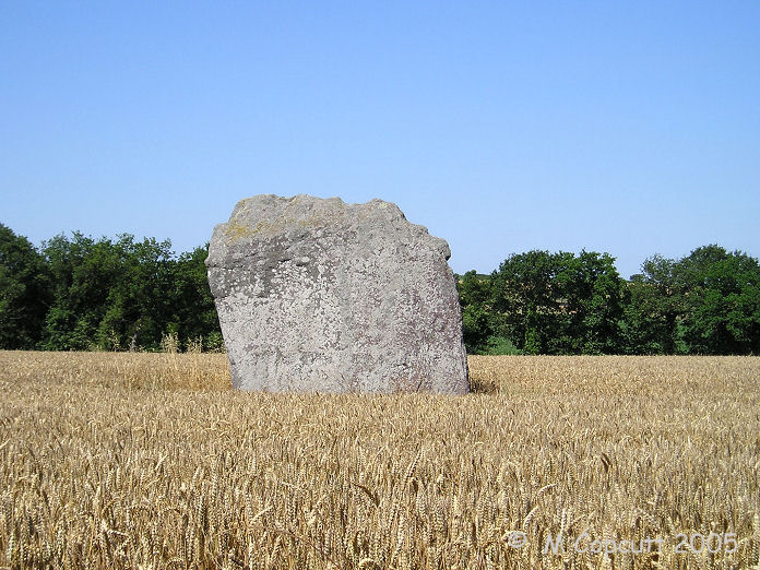
La Verrie menhir submitted by TheCaptain on 5th Jun 2007. The stone is nearly 5 metres tall and 4.5 metres in width, but is less than 0.5 metre thick.
It resembles the comb of a cockerel from some angles the way the top edge has become serrated.
(View photo, vote or add a comment)
Log Text: This is a nice stone, fairly easily found near to the farm of La Verrie a kilometre or so to the northeast of Monteneuf. The stone is nearly 5 metres tall and 4.5 metres in width, but is less than 0.5 metre thick. It resembles the comb of a cockerel the way the top edge has become serrated. The stone is near to the corner of a field, only 20 metres from the lane, but also only 30 metres from the farm, with all sorts of buildings and machinery around, which detracts from the atmosphere of the stone.
Rocher Maheux
Trip No.204 Entry No.8 Date Added: 4th Jul 2020
Site Type: Passage Grave
Country: France (Bretagne:Morbihan (56))
Visited: Yes on 10th Jul 2005. My rating: Condition 2 Ambience 3 Access 3
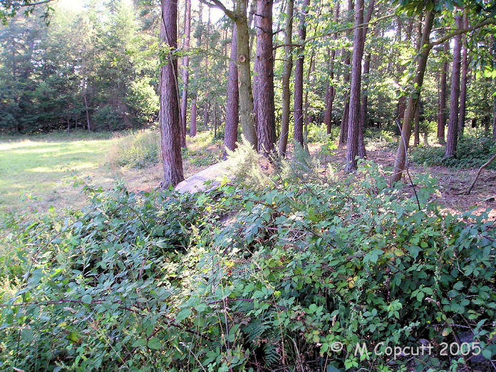
Rocher Maheux submitted by TheCaptain on 6th Jun 2007. What a terrible state the remains of this allée couverte are in. It is now not much more than a row of stones in the edge of a wood, and very overgrown.
(View photo, vote or add a comment)
Log Text: What a terrible state the remains of this allée couverte are in. It seems to have been pushed about to the edge of the field, and is now not much more than a row of stones in the edge of a wood. The remains are about a dozen slabs, roughly lined up, but probably only in line with the edge of the field. It is however signposted and on the megalithic trail walk from Monteneuf, but it is not worth the detour.
Tombeau des Géants
Trip No.204 Entry No.11 Date Added: 4th Jul 2020
Site Type: Passage Grave
Country: France (Bretagne:Morbihan (56))
Visited: Yes on 10th Jul 2005. My rating: Condition 3 Ambience 4 Access 3
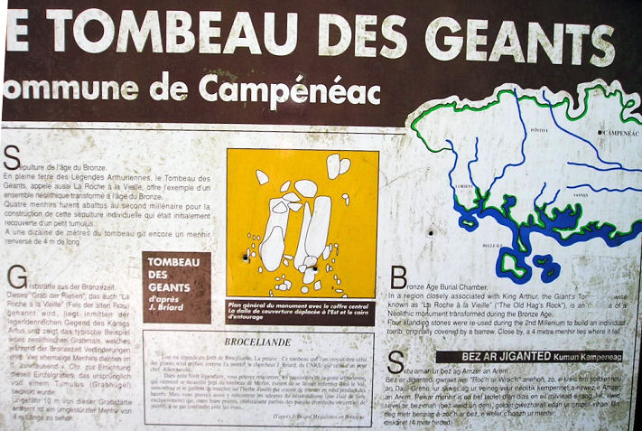
Tombeau des Géants submitted by TheCaptain on 8th Jun 2007. The signboard near the site.
(View photo, vote or add a comment)
Log Text: Also known as "Roche a la Vieille", or "Old Hag's Rock", this is a strange little monument high up in the hills by the GR37 footpath, a kilometre or so from a large parking area. What it is now is a 4 metre long, 1 metre wide coffre type grave, made using 4 large stone slabs and many other smaller stone bits making up the ends.
It is supposedly a bronze age burial tomb, but constructed from some previous megalithic standing stones from the area. Not far from the tomb is a fallen 4 metre long menhir, and several other pieces of rock. There was probably a line of large menhirs here in long distant times, which have been re used.
Centre Les Landes
Trip No.204 Entry No.2 Date Added: 22nd Jun 2020
Site Type: Museum
Country: France (Bretagne:Morbihan (56))
Visited: Yes on 9th Jul 2005. My rating: Condition 4 Ambience 4 Access 5
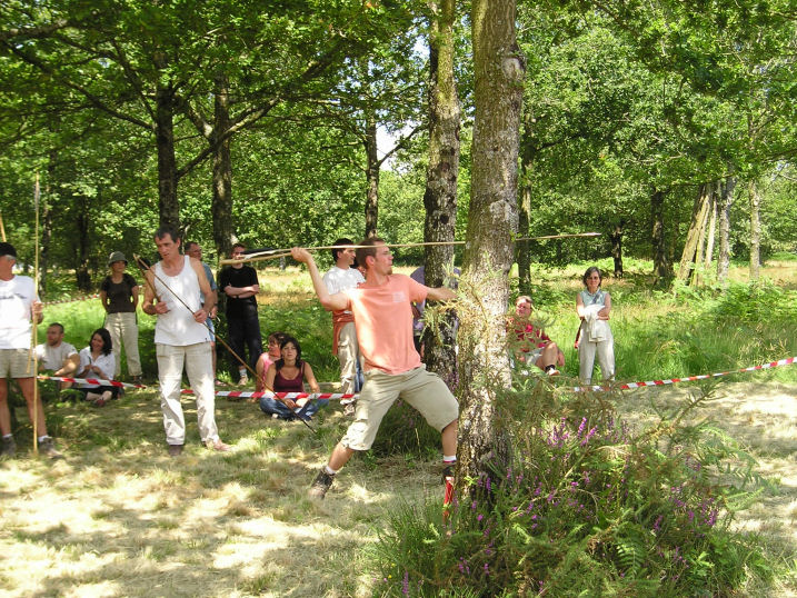
Centre Les Landes submitted by TheCaptain on 18th Jun 2007. The Monteneuf visitor centre, at the Pierres Droites, has many activities days.
This is a competitor in the prehistoric spear thrower (Propulseur, or Atlatl)competition.
(View photo, vote or add a comment)
Log Text: A visitor centre has been set up amongst the Pierres Droites near to the village of Monténeuf, which has interactive displays which show erection of menhirs, building of neolithic homes, crop growing, archaeological excavations etc etc. Around the centre have been found several hundred megaliths, with most of the stones was only discovered in the last 20 years after a forest fire.
When I visited in July 2005, they were holding a round of the world "prehistoric shooting" championships, which included both bow and propulseur categories. On the hot sunny Sunday afternoon of this weekend event, the whole place was very busy, with all sorts of demonstrations in full swing. There was basket weaving, corn grinding, pottery making, stone polishing, mud wall making, flint knapping, fire making, cookery, archery, spear throwing and many other things, all of which the public was invited to have a go at, especially the children. What an excellent place this is.
The Atlatl (propulseur) competition is very impressive. i wondered just how much better than a plain spear it is, and was well impressed with both the power and accuracy achieved by many of the competitors. There was one chap that not only nearly hit the bull every time, but launched his spear so hard it went halfway through the target. I got lots of pictures of this, including the organiser with whom I had conducted a little interview with yesterday. Well worth going back for.
Piprais menhir
Trip No.204 Entry No.15 Date Added: 4th Jul 2020
Site Type: Standing Stone (Menhir)
Country: France (Bretagne:Morbihan (56))
Visited: Yes on 10th Jul 2005. My rating: Condition 4 Ambience 3 Access 4

Piprais menhir submitted by TheCaptain on 29th Jun 2007. This 4.5 metre tall menhir can be found in a field just to the northeast of the village of Monterrein.
(View photo, vote or add a comment)
Log Text: This 4.5 metre tall menhir can be found in a field of sweetcorn just to the northeast of the village of Monterrain, near to a roadside cross. The menhir, a white quartz looking stone, seems to be splitting into two. Apparently there is another fallen stone nearby, but hidden from view by the maize.
Maison Neuve menhir
Trip No.204 Entry No.16 Date Added: 4th Jul 2020
Site Type: Standing Stone (Menhir)
Country: France (Bretagne:Morbihan (56))
Visited: Yes on 10th Jul 2005. My rating: Condition 4 Ambience 4 Access 5
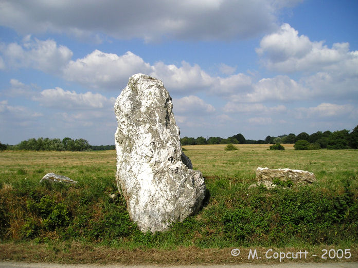
Maison Neuve menhir submitted by TheCaptain on 2nd Jul 2007. Maison Neuve menhir is about 3.5 metres high, and there are several other blocks of quartz beside it.
I could not tell whether these are bits which have fallen off it, another broken menhir, or simple field clearance stones. The menhir is nicely shaped at the top which seems to rule out the first option.
(View photo, vote or add a comment)
Log Text: This is a beautiful white quartz menhir standing beside the road to Morhannais to the northeast of Monterrain. It is about 3.5 metres high, and there are several other blocks of quartz beside it, which are either bits which have fallen off it, another broken menhir, or simple field clearance stones. The menhir is nicely shaped at the top which seems to rule out the first option. Even in the bright hot sunshine of the day I visited, the stone felt nice and cool. Lovely.
Menhir de Men Bihan
Trip No.204 Entry No.54 Date Added: 11th Jul 2020
Site Type: Standing Stone (Menhir)
Country: France (Bretagne:Morbihan (56))
Visited: Yes on 13th Jul 2005. My rating: Condition 3 Ambience 4 Access 3
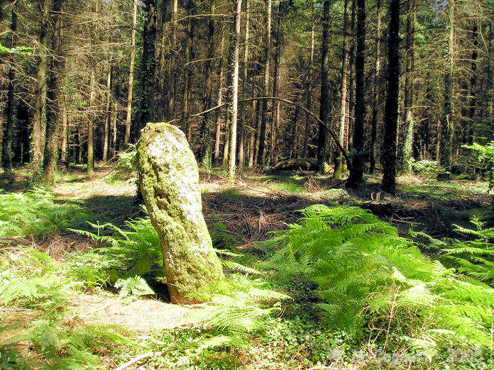
Men Bihan submitted by TheCaptain on 12th Aug 2007. Men Bihan, the "little stone", is about 1.8 metres tall, and a nice white granite all covered in moss. It is well hidden deep in the forest.
(View photo, vote or add a comment)
Log Text: The "little stone" is well hidden deep in the forest. I found it as much by luck as by good navigation using a detailed map and asking people. There are no signs or anything to help you, and it is 100 metres away from the nearest footpath. The menhir is about 1.8 metres tall, and a nice white granite all covered in moss. Its a nice stone to find, partially because of the difficulty in getting to it, with no gps or anything to go by.
Men-Bihan Allée Couverte
Trip No.204 Entry No.55 Date Added: 11th Jul 2020
Site Type: Passage Grave
Country: France (Bretagne:Morbihan (56))
Visited: Yes on 13th Jul 2005. My rating: Condition 2 Ambience 4 Access 3
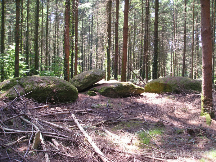
Men-Bihan allée couverte submitted by TheCaptain on 12th Aug 2007. About 50 metres from Men-Bihan is a line of 5 flat stones, looking very much like they have been placed there, although I am not 100% sure that this is a "proper" allée couverte.
There are many ruined allée couvertes hiding in this forest, and often the menhirs are marker stones for them.
(View photo, vote or add a comment)
Log Text: About 50 metres from Men-Bihan is a line of 5 flat stones, looking very much like they have been placed there. There might be remnants of stones underneath. The line is about 10 metres long, and is oriented roughly east to west. Is this the remains of an allée couverte, or just natural ?
Petit-Resto menhir
Trip No.204 Entry No.53 Date Added: 11th Jul 2020
Site Type: Standing Stone (Menhir)
Country: France (Bretagne:Morbihan (56))
Visited: Yes on 13th Jul 2005. My rating: Condition 3 Ambience 2 Access 5
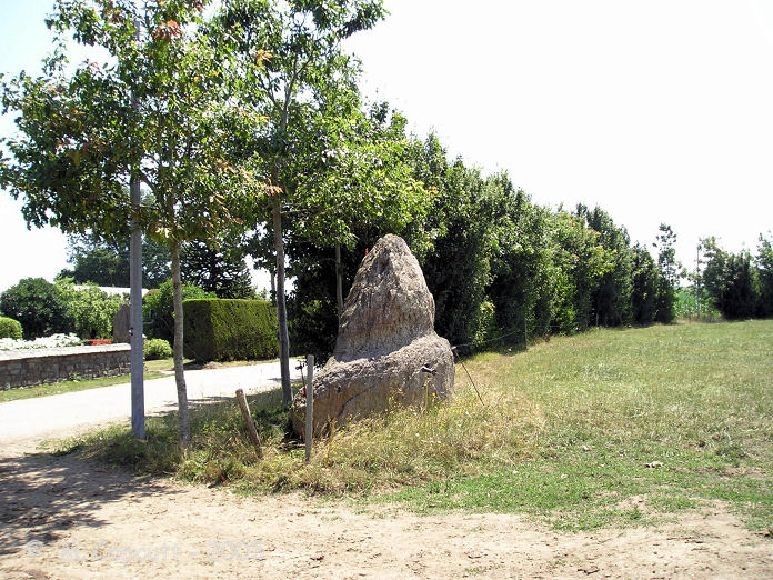
Petit-Resto menhir submitted by TheCaptain on 12th Aug 2007. This menhir can be seen at the edge of the road, and has weird weathering, looking like it has got a tide mark on it.
(View photo, vote or add a comment)
Log Text: This menhir can be seen at the edge of the road, but it is difficult to stop or turn round here. It is a sort of triangular stone, perhaps 2 metres high, just at the edge of a field. It has weird weathering, and looks like it has got a tide mark on it.
Dolmen de la Maison-Trouvée
Trip No.204 Entry No.14 Date Added: 4th Jul 2020
Site Type: Burial Chamber or Dolmen
Country: France (Bretagne:Morbihan (56))
Visited: Yes on 10th Jul 2005. My rating: Condition 4 Ambience 4 Access 3

Dolmen de la Maison-Trouvée submitted by thecaptain on 8th Aug 2007. Dolmen de la Maison-Trouvée - the sign board.
(View photo, vote or add a comment)
Log Text: This is an Angevin type dolmen with a massive rectangular chamber still mostly buried within its tree covered mound. The chamber is about 4.5 metres by 2.5 metres and is topped by a massive 6 metres by 3 metres capstone. As often seems to be the case with the Angevin dolmens I have seen, the side slabs are accurately shaped so that they fit together extremely well, and the whole chamber is very straight sided and regular. Unusually, the portal doorway opens towards the west. I cannot tell how high the chamber is, or whether there is a floor, as the thing is still half buried. The circular mound, about 20 metres in diameter, has lots and lots of white quartz stones in its makeup. It has been dated to about 3000 BC. It is signposted and easily found from the village of Monterrein.
Grand Village allée couverte
Trip No.204 Entry No.17 Date Added: 4th Jul 2020
Site Type: Passage Grave
Country: France (Bretagne:Morbihan (56))
Visited: Yes on 10th Jul 2005. My rating: Condition 3 Ambience 3 Access 4

Grand Village allée couverte submitted by TheCaptain on 9th Aug 2007. allée couverte du Grand-Village signboard.
(View photo, vote or add a comment)
Log Text: To the southeast of the village of Caro, and signposted with a little parking area, can be found this allée couverte, a few hundred metres walk from the parking. It is one of the longest allée couvertes around, at about 25 metres, but apart from the two large end stones, not much is left standing or in its proper place. The chamber is oriented at 145°, and is neither along the ridge or across it. The entrance is a lateral entrance, about in the middle of the southern side, and two side stones for the entrance porch can be made out. It would appear that as well as the stones for the main chamber, there are also many for the peristalith of its oval mound, which would not be very much bigger than the chamber itself. This is one site that would benefit enormously from a bit of restoration.
It has been a very hot day, and since the spear throwing competition I have been lacking inspiration. I have looked in my books, and driven about quite a lot, looking for sites not marked on the maps, but unless they have had signs, or I have been lucky, I have not been able to find many of them. Perhaps I should stop early and chill out a bit.
Men Braz menhir
Trip No.204 Entry No.56 Date Added: 11th Jul 2020
Site Type: Standing Stone (Menhir)
Country: France (Bretagne:Morbihan (56))
Visited: Yes on 13th Jul 2005. My rating: Condition 3 Ambience 5 Access 4
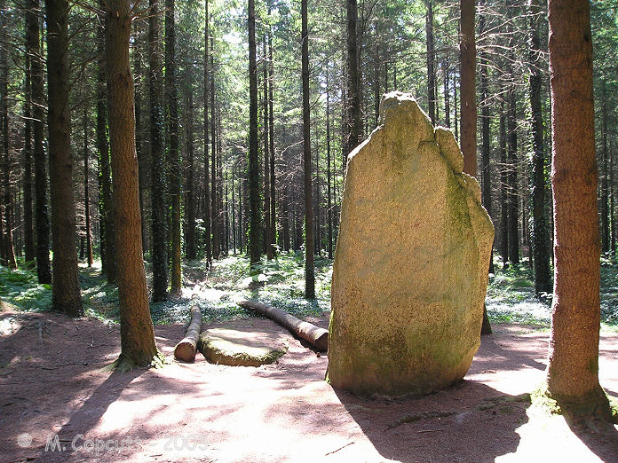
Men Braz menhir submitted by TheCaptain on 13th Aug 2007. Men Bras, the "big stone", is easy to find from the L'Etoiles roundabout. Take the forest track south for a couple of hundred metres, and then turn right at the signpost down a footpath, from where it is about 80 metres into the forest between the rows of trees.
(View photo, vote or add a comment)
Log Text: I wasted best part of an hour for this stone to clear of about 30 to 40 scouts having lunch and playing games here. Eventually they left so I could look at the stone on my own. It is easy to find from the L'Etoiles roundabout, where there is a few parking places. Take the forest track south for a couple of hundred metres, and then turn right at the signpost down a footpath, from where it is about 80 metres into the forest between the rows of trees. The "big stone" is about 3.8 metres tall, and looks lovely. Beside it is another fallen stone, perhaps even bigger.
Dolmen de Kerourang 1
Trip No.203 Entry No.347 Date Added: 10th May 2020
Site Type: Burial Chamber or Dolmen
Country: France (Bretagne:Morbihan (56))
Visited: Yes on 11th Jun 2005. My rating: Condition 2 Ambience 2 Access 3
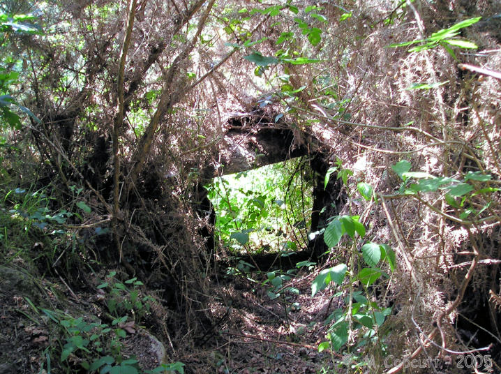
Dolmen de Kerourang 2 submitted by TheCaptain on 7th Nov 2007. I couldn’t find this dolmen marked on my map on my way to Luffang, but stopped for another look on the way back. It was very difficult to find, but it is still there to be seen, well hidden under very thick undergrowth.
I later found out that there are in fact two dolmens a couloir to be found here, within 20 metres of each other.
It's a great shame they are so overgrown and neglected.
(View photo, vote or add a comment)
Log Text: I couldn’t find this dolmen marked on my map on my way to Luffang, but stopped for another look on the way back, after another look at the map. It was very difficult to find, but it is still there to be seen, well hidden under very thick undergrowth. What I eventually found was, near to the trackway a couple of capstones sit on top of a little passageway completely surrounded and covered by gorse.
I later find out that there are in fact two monuments to be found here, within 20 metres of each other, and that they are both dolmen a couloir with large circular chambers, still fairly well preserved inside their mounds, still with some of their capstones. It's a great shame they are so overgrown and neglected.
While here looking about in the woods before I found this, I was approached by two offroad cyclists, who thought I was lost. I said no, I was searching for a dolmen, but they insisted that there was no dolmen here. I had left my map in the van, but they had one with them, so we compared notes, and I pointed to the clearly marked dolmen. No, they said, we are over here, pointing elsewhere. Well, I was pretty sure where I thought I was, as were they, so we agreed to differ, and go our different ways.
I decided to go back to the van, with just one more look in the woods where their map had confirmed that I should find something, and there it was - extremely well hidden. I called over to the cyclists, who had been standing about arguing and pointing at the map. They came, and I pointed out the stones. Oui, c'est vrai, c'est un dolmen! Turns out it was them that were lost ! They thanked me, and there was lots more bickering between them, then they parted with some very cheerful words and waving. As they cycled off, and they cycled off into the distance, the bickering turning to shouting and cursing, and a full scale argument ! I felt glad to have helped them out, as indeed they had helped me, by making me look just one more time for that damned dolmen !
Mané Bras
Trip No.203 Entry No.367 Date Added: 11th May 2020
Site Type: Burial Chamber or Dolmen
Country: France (Bretagne:Morbihan (56))
Visited: Yes on 12th Jun 2005. My rating: Condition 3 Ambience 3 Access 3

Mané Bras submitted by TheCaptain on 7th Nov 2007. According to a signpost at the roadside, it is only a 500 metre walk along a bridlepath to this monument.
However, in practice for me in June 2005 it involved crossing a swamp, negotiating woodland full of brambles and nettles, then crossing an open tract of heather, and last but by no means least, somehow getting through a gorse jungle.
(View photo, vote or add a comment)
Log Text: According to a signpost at the roadside, it is only a 500 metre walk along a bridlepath to this monument. However, in practice it involved crossing a swamp, negotiating woodland full of brambles and nettles, then crossing an open tract of heather, and last but by no means least, somehow getting through a gorse jungle.
Its a nice monument to find though, as two passagewayed dolmens look out of their mound at you upon finally reaching it. On the right, the northern chamber is about 3m by 3 metres rectangular with a 4 metres passageway to the east. On the left, a 4 m by 3 metre oval chamber, without capstone, has about a 6 metre passage leading out to the edge of the mound. It was all far too overgrown though, and getting photograps was nearly impossible.
Many of these lesser known sites need a good dose of TLC. I later found that there are more dolmens and cjambers to be found here in th hilltop mound. Obviously one for another visit it some time.
Kermarquer Dolmen
Trip No.203 Entry No.368 Date Added: 11th May 2020
Site Type: Burial Chamber or Dolmen
Country: France (Bretagne:Morbihan (56))
Visited: Yes on 12th Jun 2005. My rating: Condition 3 Ambience 3 Access 4

Kermarquer dolmen submitted by TheCaptain on 8th Nov 2007. This dolmen is much easier to find than its neighbour Mané Bras, but still involves 100 metres of fighting a way through gorse and bramble filled woodland.
(View photo, vote or add a comment)
Log Text: This one is much easier to find than its neighbour, but still involves 100 metres of fighting a way through gorse and bramble filled woodland. The monument is a strange one, with two chambers off of a single entry corridor. The main chamber, a rectangular 2.5 metres by 2.5 metres has no capstone, and leads straight off of the corridor. The second chamber is off to the side of this, with its entry at the side of chamber 1, and is about 1.5 m by 1.5 m, and is covered by a capstone. The corridor has two large capstones still in place. This monument is still mostly contained within its mound, and all very overgrown, making photographs very difficult.
Mané Roullarde
Trip No.203 Entry No.365 Date Added: 11th May 2020
Site Type: Burial Chamber or Dolmen
Country: France (Bretagne:Morbihan (56))
Visited: Yes on 12th Jun 2005. My rating: Condition 2 Ambience 3 Access 4

Mané Roullarde submitted by TheCaptain on 10th Nov 2007. The informative multilingual signboard.
(View photo, vote or add a comment)
Log Text: The remains of this monument are to be found on a hilltop site overlooking the yachting and seaside town of La Trinité-sur-Mer, now surrounded by expensive looking flats. There is an 18 metre long Allée Couverte known as Er-Groh, with only 4 capstones remaining in place, which faces southeast at 150°. Some of the side support stones have Pierres-Plates style engravings on them, but being exposed in this external situation, they are very difficult to make out amongst the lichens and moss etc.
At some point in the past it has had a wall built into it. There are also said to be several underground passages to be found here, which date back to Gallic iron age times, and of which the description reminds me of the Cornish Fougous. However, I found it impossible to find any of these to be seen amongst the undergrowth of the area.
Crucuno Cromlech
Trip No.203 Entry No.397 Date Added: 14th May 2020
Site Type: Stone Circle
Country: France (Bretagne:Morbihan (56))
Visited: Yes on 13th Jun 2005. My rating: Condition 5 Ambience 4 Access 4
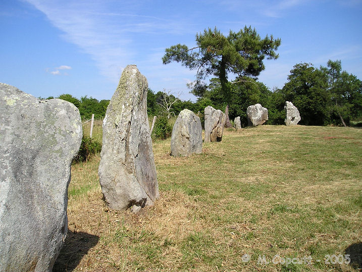
Crucuno cromlech submitted by thecaptain on 21st Dec 2007. There are 22 remaining stones, on average 2 metres in height, arranged in a rectangle measuring about 33 metres by 25 metres.
(View photo, vote or add a comment)
Log Text: What a lovely and unexpected find this was, not so much the expected semi-circular cromlech, but an almost complete rectangle of large stones. There are 22 remaining stones, on average 2 metres in height, arranged in a rectangle measuring about 33 metres by 25 metres. The long sides are aligned just about due east - west, with the shorter sides north - south.
It has been "restored" in 1882, but is supposedly a very accurate restoration job, and matches earlier plans well. It is thought that this could have been set up for astronomical observations, as not only do the east - west sides align to the equinox sunrise and sunset, but perhaps more importantly, the diagonals align to the both the solstice sunrise and sunset positions, rather like the four station stones at stonehenge. It has also been suggested that the positions of various major moon rise and moonset positions are indicated.
It is easy enough to find, a few hundred metres to the east of the village centre. From here follow the track which passes in front of the house with the dolmen for a few hundred metres, then turn right when the track splits for another 50 metres, and you arrive at the field within which the monument resides.
Thankfully, when I visited, the whole field had recently been cleared of all the gorse and brambles, and was nicely open. Remarkably, for somewhere so close to the busy Crucuno dolmen, and possibly such an important site, hardly anybody seems to know its here, and it seems all the tourists visit the dolmen, but miss this. I dont cease to be amazed by all the Breton megalithic sites, it truly is a wonderland - whatever will be next.
Crucuno Dolmen
Trip No.203 Entry No.396 Date Added: 14th May 2020
Site Type: Burial Chamber or Dolmen
Country: France (Bretagne:Morbihan (56))
Visited: Yes on 13th Jun 2005. My rating: Condition 5 Ambience 3 Access 5
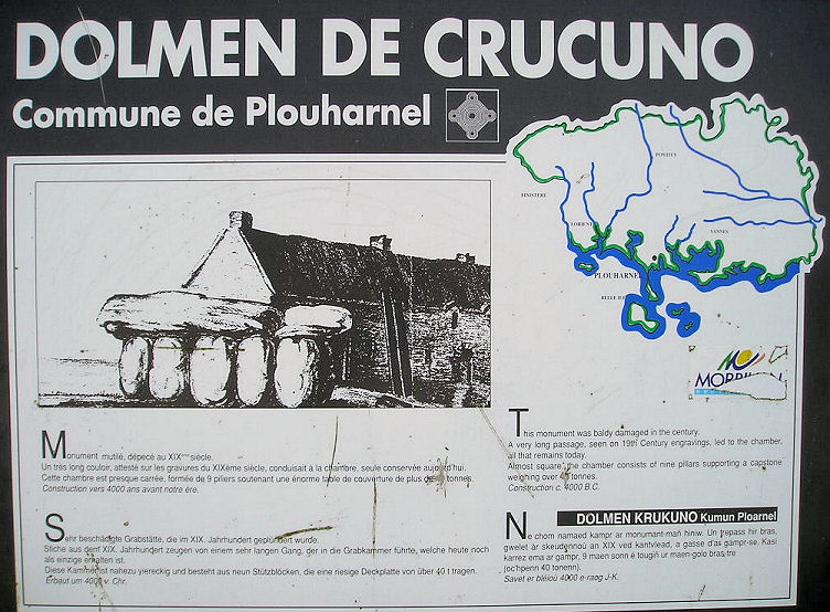
Crucuno dolmen submitted by thecaptain on 22nd Dec 2007. The noticeboard at Crucuno dolmen is not very informative, unlike many of those in the region.
(View photo, vote or add a comment)
Log Text: Right in the middle of Crucuno hamlet is to be found this tremendous and much visited and photographed dolmen. The rectangular chamber is about 4 metres by 3.5 metres, covered by a single massive capstone which measures over 7 metres in length, perched on top of 9 support stones, with easily enough room to stand upright inside.
Unfortunately, a century or so ago, a house was built right next to it, and this has destroyed all but the last pair of entrance passageway uprights and their capstone. This passageway was recorded in the last century as being at least 20 metres in length, leading away towards the southeast.
In its past, it has been used for many things, including a stable, a home for the village idiot (*Burl) and a shelter for German soldiers during the last war. Despite seeing lots of pictures of this one before visiting, and there being a steady stream of visitors passing through (its obviously one of the sites on all the tourist trails) it was much more impressive than I was expecting. Excellent.
