Contributory members are able to log private notes and comments about each site
Sites stonetracker has logged. View this log as a table or view the most recent logs from everyone
Mesa Verde - Spruce Tree House
Date Added: 13th Jul 2025
Site Type: Ancient Village or Settlement
Country: United States (The Southwest)
Visited: Yes on 1st May 2025. My rating: Condition 4 Ambience 5 Access 4
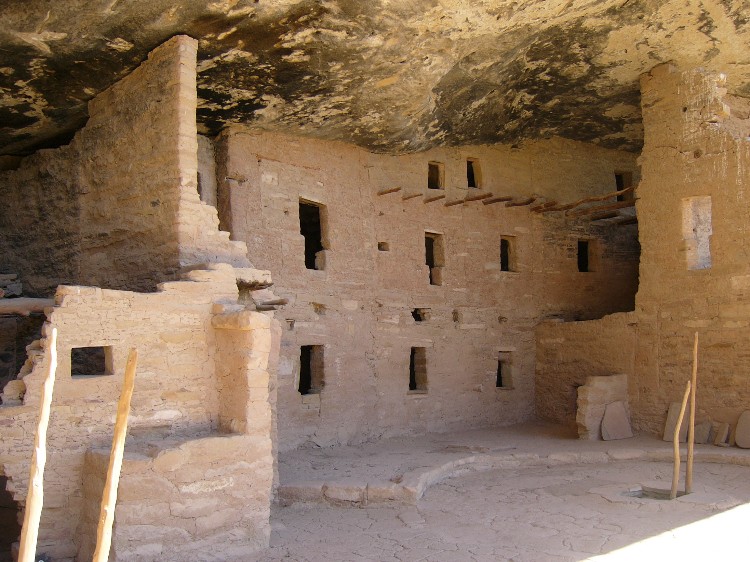
Mesa Verde - Spruce Tree House submitted by DrewParsons on 19th Oct 2008. Site in United States: Mesa Verde - Spruce Tree House photographed in September 2005
(View photo, vote or add a comment)
Log Text: Visited in May 2025. Unfortunately, this cliff dwelling from the Pueblo 3 period, probably the best preserved of all the cliff dwellings at Mesa Verde, has been closed to visitation since 2015. A portion of the alcove overhang collapsed, creating a serious safety issue, and forcing the closure ever since. There have been ongoing efforts to determine how to best stabilize the site for future visitation.
Meanwhile an overlook behind the Chapin Museum provides excellent views and interpretation of the cliff dwelling. The area is still well worth a visit. The short 100-200 yd path to the overlook is paved and I believe is wheel chair accessible.
Edge of the Cedars State Park and Museum
Date Added: 10th Jun 2025
Site Type: Ancient Village or Settlement
Country: United States (The Southwest)
Visited: Yes on 1st May 2025. My rating: Condition 3 Ambience 4 Access 4
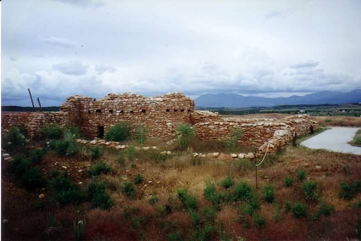
Edge of the Cedars State Park and Museum submitted by AKFisher on 14th Sep 2023. Edge of Cedars Indian Ruin. Photo credit: Wiki (Pma03).
(View photo, vote or add a comment)
Log Text: This site is a combination museum and partially excavated Ancestral Pueblo Great House. It has been designated Edge of the Cedars State Park. The museum and grounds have outstanding displays describing the prehistory of not only southeastern Utah but the surrounding regions. Excavated artifacts, especially pottery and ceramics, are a standout feature of the facility.
I believe the museum has access for disabled visitors. The excavated great house is in the rear of the building. The major structures are connected by paved pathways and excellent interpretation. It also features a small kiva that you can climb into and that has been restored to nearly original condition.
The site is in Blanding UT. To get there from Route 191 which goes through the city center, drive west on West Center St for about 0.5 mile. Turn right onto N 600 W St. In 0.4 mile, turn left onto W 400 N St. In 200 ft, turn right. The museum is another 200 ft on the left.
Mesa Verde - Cedar Tree Tower
Date Added: 14th Jul 2025
Site Type: Ancient Village or Settlement
Country: United States (The Southwest)
Visited: Yes on 1st May 2025. My rating: Condition 3 Ambience 4 Access 4
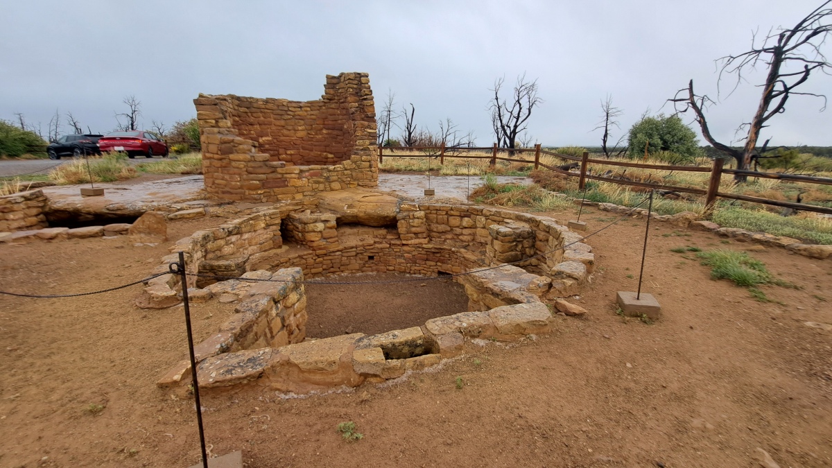
Mesa Verde - Cedar Tree Tower submitted by stonetracker on 14th Jul 2025. The multi-story tower in the background and Mesa Verdean-style kiva in the foreground. There is no site interpretation, but my guess is the complex was built sometime in the 1100 to early 1200 CE period.
(View photo, vote or add a comment)
Log Text: This site is at the end of a paved side road heading east from the main park road. The side road is approximately 5 miles south of the Far View Community site and a 1/2 mile north of the Spruce Tree House overlook and Chapin Mesa Museum.
The side road leads in about 1/2 mile to a dead end loop with on-street parking. The tower and kiva are located right next to the parking loop.
Hovenweep - Settlement
Date Added: 12th May 2025
Site Type: Ancient Village or Settlement
Country: United States (The Southwest)
Visited: Yes on 1st May 2025. My rating: Condition 3 Ambience 5 Access 4
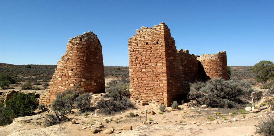
Hovenweep - Hovenweep Castle submitted by jeffrep on 9th Nov 2012. Hovenweep Castle.
(View photo, vote or add a comment)
Log Text: Only was able to visit Stronghold House and another ruin nearby. The rest were remote viewing only. See Hovenweep - Stronghold House for more details.
Hovenweep - Stronghold House
Date Added: 13th May 2025
Site Type: Ancient Village or Settlement
Country: United States (The Southwest)
Visited: Yes on 1st May 2025. My rating: Condition 3 Ambience 5 Access 4
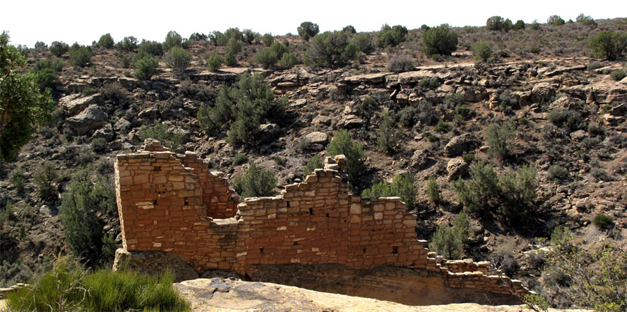
Hovenweep - Stronghold House submitted by jeffrep on 9th Nov 2012. Hovenweep. Remains of Stronghold House.
(View photo, vote or add a comment)
Log Text: Only had time to see Stronghold House and its tower, plus a nearby ruin. Everything else in the Square Tower Group was remote viewing from the edge of Little Ruin Canyon, only due to my time constraints.
Access to Stronghold House is via a handicapped accessible paved trail about 300 yds from the visitor center.
Mesa Verde - Pithouse
Date Added: 18th Jul 2025
Site Type: Ancient Village or Settlement
Country: United States (The Southwest)
Visited: Yes on 1st May 2025. My rating: Condition 3 Ambience 4 Access 4
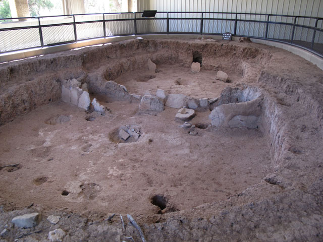
Mesa Verde - Pithouses and Pueblos submitted by jeffrep on 14th Nov 2012. Pit house.
(View photo, vote or add a comment)
Log Text: This is the first stop on the Mesa Top Loop, a one-way driving loop featuring actual excavated sites with interpretation that cover Basketmaker 3 through Pueblo 3 cultural periods.
The Pithouse stop is about a mile south of Chapin Museum and Spruce Tree House overlook. The actual pithouse is less than 100 ft south of the parking pulloff under a shelter, accessible via a paved foot path.
Mesa Verde - Square Tower House
Date Added: 18th Jul 2025
Site Type: Ancient Village or Settlement
Country: United States (The Southwest)
Visited: Yes on 1st May 2025. My rating: Condition 3 Ambience 5 Access 4

Mesa Verde - Square Tower House submitted by DrewParsons on 18th Oct 2008. Detail of the Square Tower House site at Mesa Verde
(View photo, vote or add a comment)
Log Text: This is a cliff dwelling from the Ancestral Pueblo 3 period featuring the tallest tower structure still standing in the park. There are two ways to see the cliff dwelling. Remotely, from an overlook at the canyon rim. Or much closer, via periodically scheduled ranger-led hikes into the cliff dwelling complex itself. I opted for the overlook view, as they were just starting the guided tours (around the end of the first week in May in 2025).
Parking at the trailhead is available about 1/2 mile south of the Pithouse stop on the Mesa Top Loop road. The paved trail to the overlook is about 600 ft long and provides a nice view of the complex.
Mesa Verde - Sunset House
Date Added: 11th Aug 2025
Site Type: Ancient Village or Settlement
Country: United States (The Southwest)
Visited: Saw from a distance on 1st May 2025. My rating: Condition 3 Ambience 3
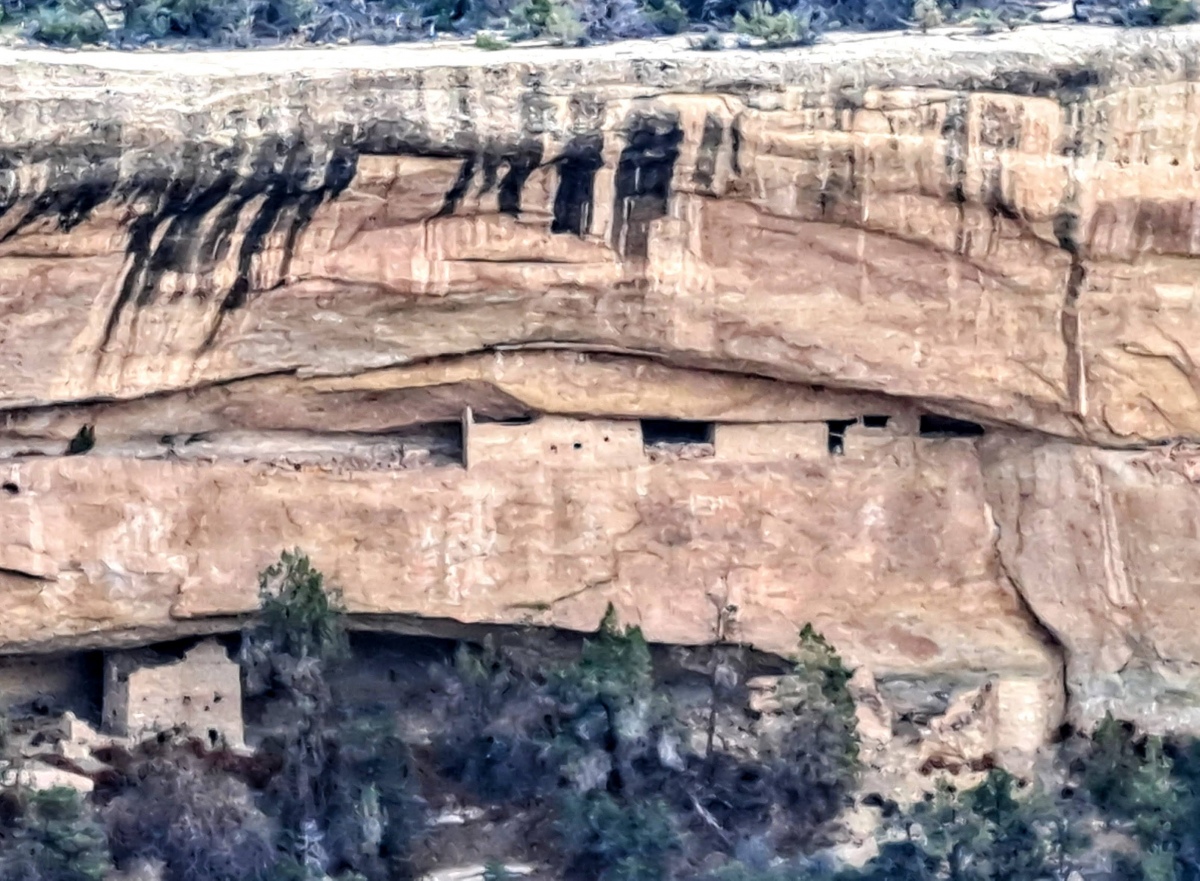
Mesa Verde - Sunset House submitted by stonetracker on 10th Aug 2025. View of the two-level Sunset House from the Sun Point overlook
(View photo, vote or add a comment)
Log Text: A Pueblo 3 cliff dwelling site in Cliff Canyon. As far as I know, public visitation is not allowed, but the site can be viewed from the Sun Point Overlook across the canyon.
Mesa Verde - Fire Temple
Date Added: 11th Aug 2025
Site Type: Ancient Village or Settlement
Country: United States (The Southwest)
Visited: Saw from a distance on 1st May 2025. My rating: Condition 3 Ambience 4
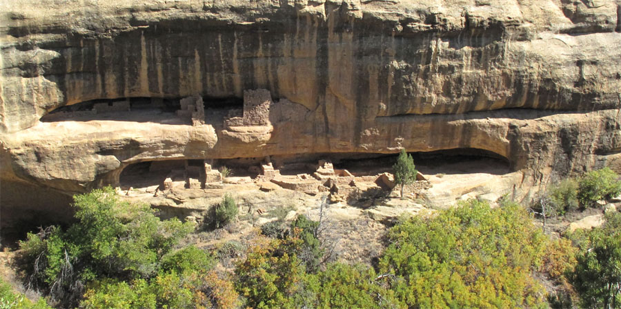
Mesa Verde - Fire Temple submitted by jeffrep on 14th Nov 2012. Fire Temple from the overlook across the canyon.
(View photo, vote or add a comment)
Log Text: This is actually two sites. The Fire Temple is what is believed to be a purely ceremonial structure. The New Fire House is adjacent and thought to be a cliff dwelling site for the caretakers of the temple. Both are late Pueblo 3 structures and not open to public visitation. However, they can be viewed remotely from the Fire Temple and New Fire House Overlook on the Mesa Top Loop drive.
Hovenweep - Unit Type House
Date Added: 14th May 2025
Site Type: Ancient Village or Settlement
Country: United States (The Southwest)
Visited: Yes on 1st May 2025. My rating: Condition 2 Ambience 4 Access 3
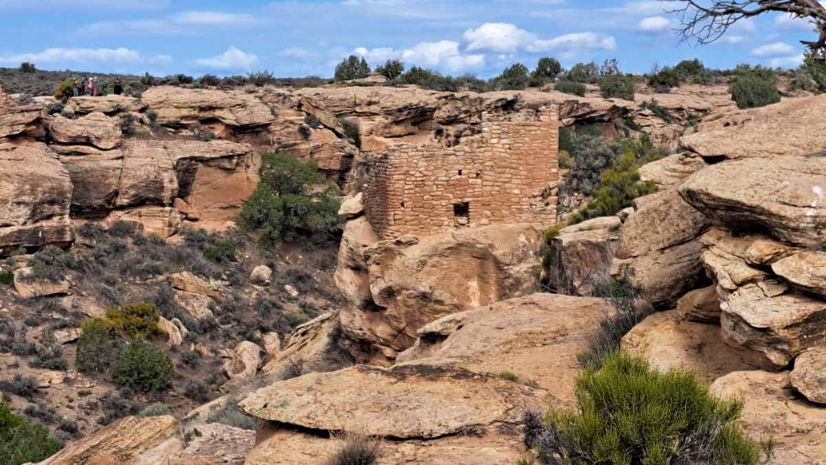
Hovenweep - Unit Type House submitted by stonetracker on 13th May 2025. A remote view of Unit Type House from Stronghold House
(View photo, vote or add a comment)
Log Text: I viewed this site at 200-300 yds away from Stronghold House. Someday I'll return to visit this and the other structures in the Square Tower Group more closely. My understanding is that you can get a much closer view of Unit Type House from the trail that circles the canyon.
Cave Pueblo Ruin
Date Added: 14th May 2025
Site Type: Ancient Village or Settlement
Country: United States (The Southwest)
Visited: Yes on 1st May 2025. My rating: Condition 2 Ambience 4
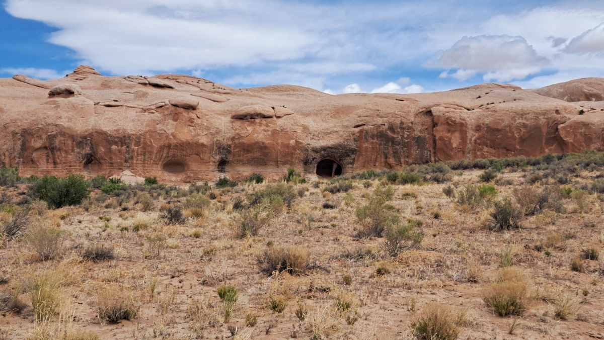
Cave Pueblo Ruin submitted by stonetracker on 14th May 2025. The ruin is in the large cave just to the right of the center in the photo.
(View photo, vote or add a comment)
Log Text: There is no close access to the site due to a barbed wire fence and wired off gate. But you can easily spot the cave and ruin from a parking pulloff ~ 3 miles east of Bluff UT. There are also a number of rock art sites along the same route west from this point to Bluff. I was able to visit some, not all.
Mesa Verde - Mesa Top Sites
Date Added: 1st Sep 2025
Site Type: Ancient Village or Settlement
Country: United States (The Southwest)
Visited: Yes on 1st May 2025. My rating: Condition 3 Ambience 5 Access 4
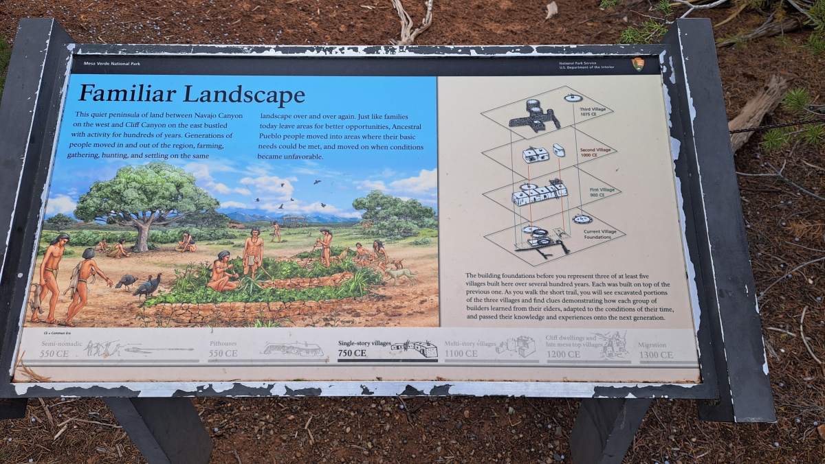
Mesa Verde - Mesa Top Sites submitted by stonetracker on 28th Aug 2025. Site interpretation showing the layers of each village
(View photo, vote or add a comment)
Log Text: One of the better outdoor exhibits at Mesa Verde describing how Ancestral Pueblo architectural styles evolved between 900 and 1075 CE on mesa top sites. This is a stop on the Mesa Top loop drive with a parking pull-off and handicapped-accessible paved walkway to the excavated sites with interpretation.
Ghost Rock Art Panel
Date Added: 15th May 2025
Site Type: Rock Art
Country: United States (The Southwest)
Visited: Yes on 1st May 2025. My rating: Condition 2 Ambience 4 Access 4
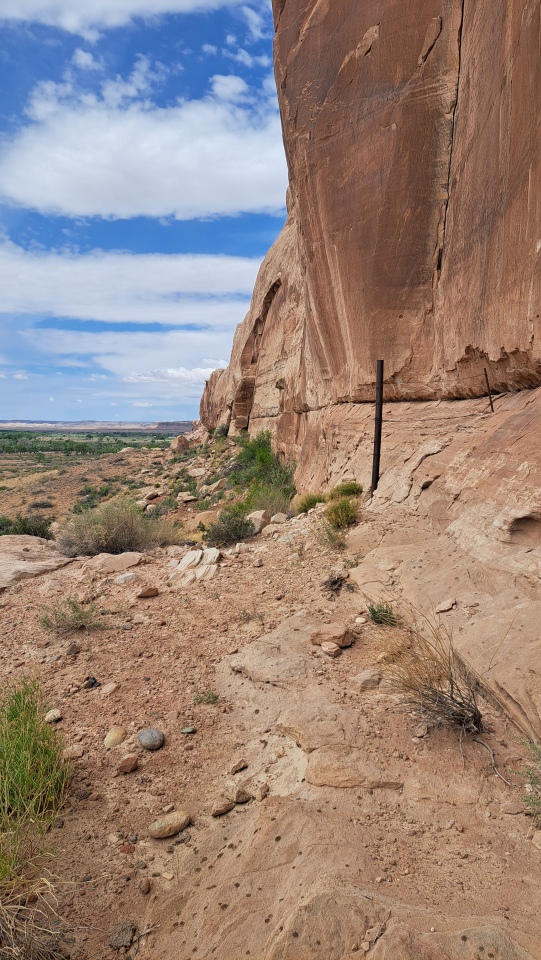
Ghost Rock Art Panel submitted by stonetracker on 14th May 2025. Cliff face where the petros are located
(View photo, vote or add a comment)
Log Text: A mixed modern and ancient petroglyph site about 2.3 miles east of Bluff UT accessible from Route 162.
There is a parking pulloff at 37.282579,-109.505201 and an 800 ft dirt road leads north from there. Suitable for SUVs or lower clearance vehicles (with care). Follow the dirt road north and stay right at the first fork. The road ends in a small turnaround circle. Park here. The rock art is mostly to the left and just a short walk to the cliff face.
You can also park at Route 162 and hike in.
Horse Rock Art Panels
Date Added: 15th May 2025
Site Type: Rock Art
Country: United States (The Southwest)
Visited: Yes on 1st May 2025. My rating: Condition 4 Ambience 4 Access 5
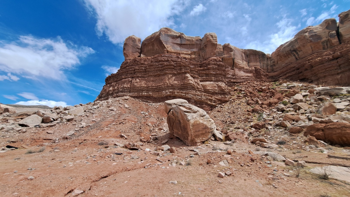
Horse Rock Art Panels submitted by stonetracker on 15th May 2025. The main rock art panel is on the boulder at photo center. The corral is out of view to the right.
(View photo, vote or add a comment)
Log Text: The main rock art panel is just 100-200 ft north of Route 162 about 0.2 miles east of Bluff. Parking is in a dirt lot next to a corral and a fenced utility building. For the mobility impaired, the panel is pretty visible with the naked eye from a vehicle if you park as far north as you can get and scan the central boulder.
I've been told there are more panels of a single horse and multiple animals behind the utility building fence and higher up the cliff slope.
Bluff Great House
Date Added: 15th May 2025
Site Type: Ancient Village or Settlement
Country: United States (The Southwest)
Visited: Yes on 1st May 2025. My rating: Condition 2 Ambience 4 Access 4
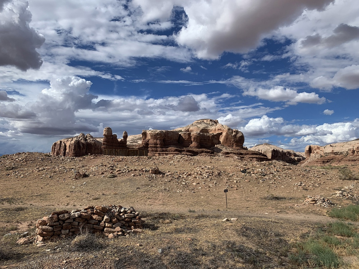
Bluff Great House submitted by KaiHofmann on 29th Sep 2022. Bluff Great House, the large mound with the wooden excavation hut.
(View photo, vote or add a comment)
Log Text: This is a so-called Chacoan outlier great house near the San Juan River, likely built during the Pueblo 2 period ca. 1100 CE. The site overlooks the town of Bluff UT on a high hill with a stunning backdrop of canyons to the north. It has been excavated in the past and subsequently backfilled to preserve the room blocks and kivas within.
There is an interpretive kiosk and parking loop just south of the main access road (N. Pioneer Drive). The buried great house and related structures are about 100-200 yds north of the kiosk via an easy foot trail.
To get to the parking area from Main St, take 3rd East St north to its end. Turn left onto Mulberry and follow it about 1000 ft until it turns right sharply onto N. Pioneer and heads up hill towards the Bluff Cemetery. The gravel parking lot is another 800-1000 ft on the right.
Mesa Verde - Sun Temple
Date Added: 12th Aug 2025
Site Type: Ancient Temple
Country: United States (The Southwest)
Visited: Yes on 1st May 2025. My rating: Condition 3 Ambience 4 Access 4
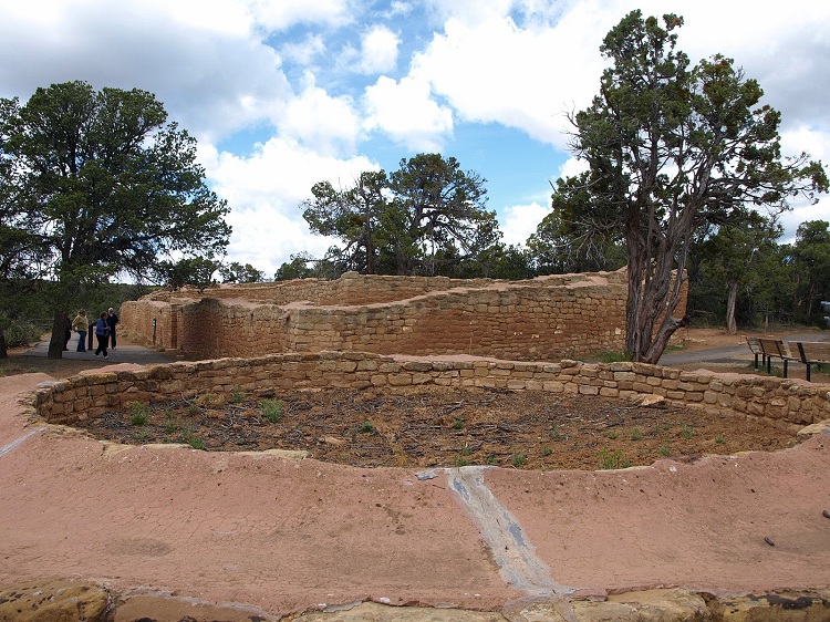
Mesa Verde - Sun Temple submitted by bat400 on 2nd Jun 2012. The eastern end of the Sun Temple. Photo taken over the separate associated round structure.
Photo by bat400, April 2012.
(View photo, vote or add a comment)
Log Text: This and one of the Cliff Palace overlooks are the last stops on the Mesa Top Loop drive. This structure is unique within Mesa Verde as far as I know and there are many theories as to its purpose. Unfortunately there is no access to the interior of the complex, so you have to stand on a ledge outside the wall to get any view at all of the inside. However, there is a standalone circular structure outside the main building that you can approach at close range. The mortar capping on the tops of the walls was done by the NPS, presumably as part of the preservation effort, and is not prehistoric.
There is a very large parking pulloff and the temple is no more than a 100 yd walk from there.
Mesa Verde - Pithouses and Pueblos
Date Added: 4th Sep 2025
Site Type: Ancient Village or Settlement
Country: United States (The Southwest)
Visited: Yes on 1st May 2025. My rating: Condition 3 Ambience 4 Access 4
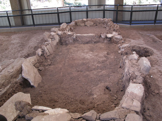
Mesa Verde - Pithouses and Pueblos submitted by jeffrep on 14th Nov 2012. Ruins of early pueblo.
(View photo, vote or add a comment)
Log Text: This is a stop on the Mesa Top loop drive that comprises two excavation sites. It explores the deevelopment of late Basketmaker pithouses into jacal dwellings and eventually into masonry room blocks with proto-kivas.
Access is via a parking pull-off and handicapped-accessible paved walkway.
Sand Island petroglyph Panel
Date Added: 18th May 2025
Site Type: Rock Art
Country: United States (The Southwest)
Visited: Yes on 1st May 2025. My rating: Condition 3 Ambience 4 Access 4
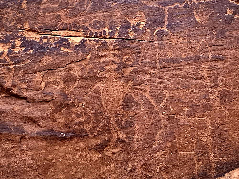
Sand Island petroglyph Panel submitted by KaiHofmann on 11th Sep 2022. Sand Island petroglyph Panel
(View photo, vote or add a comment)
Log Text: This is one of the better-known and most frequently visited rock art sites in southeastern Utah. The site is a very short walk (< 100 ft) up to the cliff face from a dirt parking pulloff with interpretive signage. The panels are in a relatively compact area, maybe 100 yds in total. And although they are protected by a fence and can only be viewed from a distance, you can still get fairly close for photography as long as the sun cooperates (it mostly did not for me). An overcast day or a low sun angle are preferred as full direct sunlight tends to wash out the images,
To get there, take Route 191 west out of Bluff UT for approximately 4 miles. Turn left onto a gravel road with signage that indicates the Sand Island Recreational Area and boat ramp. At the bottom of the hill, take your first right onto another gravel road. This road leads straight to a couple of parking pulloffs on the right in about 0.25 miles, plus some petroglyph signage. A short trail leads up to the cliff base and the panels. The panels are surrounded by a fence to discourage defacement and further damage.
Upper Sand Island Rock Art
Date Added: 19th May 2025
Site Type: Rock Art
Country: United States (The Southwest)
Visited: Yes on 1st May 2025. My rating: Condition 3 Ambience 4 Access 3
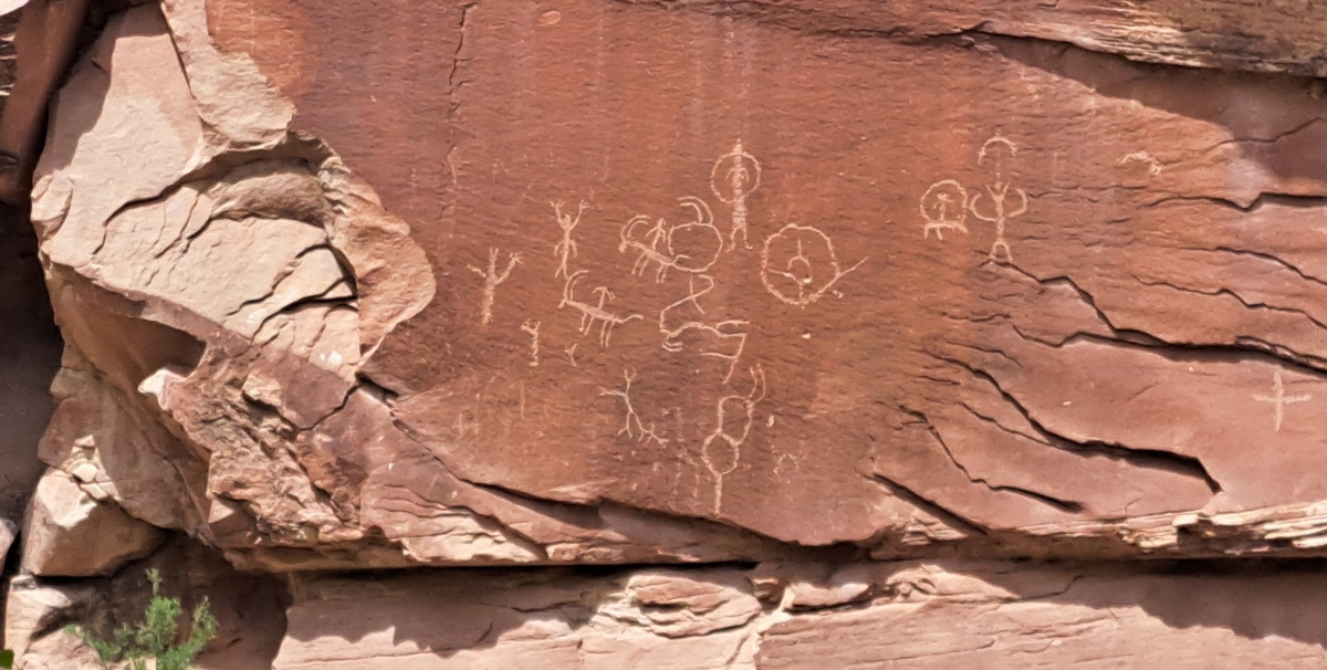
Upper Sand Island Rock Art submitted by stonetracker on 18th May 2025. One of the first panels you see along the trail. These look like typical Ancestral Pueblo or Fremont images of stick figures and bighorn sheep.
(View photo, vote or add a comment)
Log Text: A half mile's worth of intermittent ancient petroglyph panels, connected by a trail along the cliff face. To access the trailhead, take Route 191 west out of Bluff UT for approximately 4 miles. Turn left onto a gravel road with signage that indicates the Sand Island Recreational Area and boat ramp. At the bottom of the hill, take your first left onto another gravel road. This road leads 100-200 yds past the ranger buildings to a large parking lot next to a restroom. Unless you are an authorized camper, park here and walk another 200 yds east down the road to its end at the campground loop.
A trail leads from here to the cliff base and the panels. The panels are in some cases fenced off from the trail by as much as 80-100 feet to discourage defacement and further damage. Many are high up on the cliff face and much easier to see with binoculars.
Newspaper Rock State Park
Date Added: 23rd May 2025
Site Type: Rock Art
Country: United States (The Southwest)
Visited: Yes on 1st May 2025. My rating: Condition 3 Ambience 4 Access 4
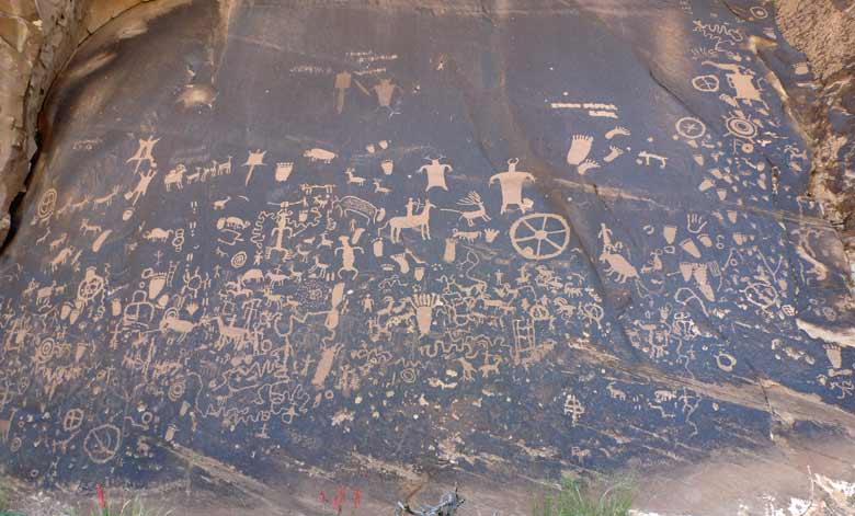
Newspaper Rock State Park submitted by baz on 5th Jun 2011. Newspaper Rock
(View photo, vote or add a comment)
Log Text: Probably the most accessible of all the petroglyph sites in SE Utah....once you get there. It is not near any towns of size so prepare accordingly.
To get there, either drive north 14 miles from Monticello or south 40 miles from Moab on Route 191. Then head west on Route 211 about 12 miles to the site. All the roads are paved and there is a restroom onsite.
From the paved parking area it is just steps away to the rock art panel on a flat dirt path. Might even be wheelchair accessible.
One plus: from that point on Route 211 to the Needles District of Canyonlands there are a lot of rock art sites...and the scenery is stunning !
