
Contributory members are able to log private notes and comments about each site
Sites crediblywitless has logged. View this log as a table or view the most recent logs from everyone
Allt an Duin (Skelpick)
Date Added: 26th Jul 2022
Site Type: Broch or Nuraghe
Country: Scotland (Sutherland)
Visited: Yes on 25th Jul 2022. My rating: Condition 2 Ambience 4 Access 3
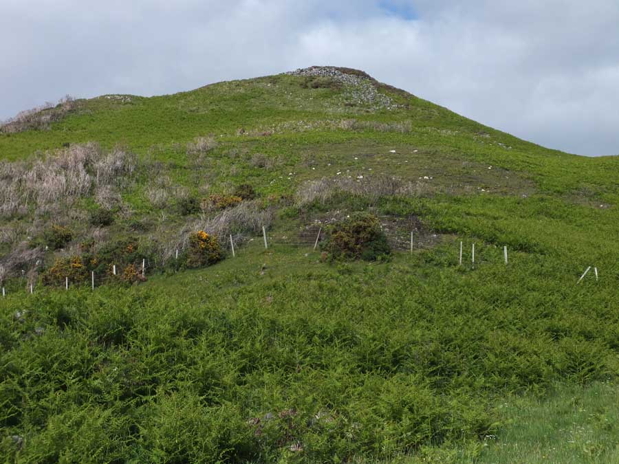
Allt an Duin (Skelpick) submitted by hamilton on 30th Jun 2017. Allt an Duin stands on the top of this steep conical knoll, some 85 metres in altitude and about a mile east of the River Naver.
(View photo, vote or add a comment)
Log Text: Now that there's a tractor/4x4 track that takes off up the front of the hillside from the far edge of the second field back from the road, access is relatively straightforward. When the track starts to bend left at the top of the hill, the easiest way in is just at the _second_ turn left. Then you have a fairly flat place to make it over a not-too-nasty barb-topped fence. It is definitely worth the trip!
Witches' Stone, Monzie
Date Added: 7th Feb 2022
Site Type: Standing Stone (Menhir)
Country: Scotland (Perth and Kinross)
Visited: Yes on 6th Feb 2022. My rating: Condition 3 Ambience 5 Access 4

Witches' Stone, Monzie submitted by cosmic on 18th Jun 2006. Viewed from East
(View photo, vote or add a comment)
Log Text: This stone leans just about perfectly north, as far as I could figure it out, and due south of it is the pretty symmetrical "Kate McNeiven's Crag" (as the OS labels it). This means that seen from the stone, the sun takes a pretty symmetrical path over the crag, every day. I don't think this can possibly be a chance thing. Also, the lean of the stone due north means that it looks remarkably like a sundial and could well function that way pretty effectively.
Edinchip
Date Added: 14th Nov 2021
Site Type: Chambered Cairn
Country: Scotland (Perth and Kinross)
Visited: Yes on 13th Nov 2021. My rating: Condition 3 Ambience 5 Access 3

Edinchip submitted by crediblywitless on 14th Nov 2021. Close-up of the capped chamber
(View photo, vote or add a comment)
Log Text: You can either park at Kingshouse ("Mhor 84") and then go under the A84 and walk north up the Rob Roy Way and then "Old Military Road for about 1km each - this second half can be pretty muddy with pop-up burns; or you can carry on a little further on the Rob Roy Way and walk up "Dismantled Railway". This second route is better walking, but when you get level with the cairn there's farm-related stuff about and there may be a locked gate to climb over.