Contributory members are able to log private notes and comments about each site
Sites cliffrich has logged. View this log as a table or view the most recent logs from everyone
Afton Down
Date Added: 18th Mar 2019
Site Type: Barrow Cemetery
Country: England (Isle of Wight)
Visited: Yes on 3rd Feb 2019. My rating: Condition 3 Ambience 3 Access 3
Afton Down submitted by RingPaw on 25th Jul 2006. Close-up of central barrows of group. On golfcourse fairway.
(View photo, vote or add a comment)
Log Text: There are two sites listed elsewhere which refer to Freshwater Golf Club site, and the Afton Down site. In effect they both make up one barrow cemetery. The round/bowl barrows are mostly very well preserved and some of the best that I have seen on the Island so far. There is also a disc barrow, bell barrow, and a long-barrow. The Afton Down site is a further little walk to the East. Many of the barrows had been excavated so have the tell-tale sunken parts. The barrows themselves are part of the golf course fairways so if visiting them be aware of air-born golf balls (and of being shouted at by golfers!). Well worth a visit! If the golf course was not there I think the their would be far more ambience at the sites.
See video of the eastern end (Afton Cemetery) - https://youtu.be/XHcAYN4AqGk
See video of Freshwater Golf Club barrows - https://youtu.be/d5Or2x9aAqM.
See also: https://historicengland.org.uk/listing/the-list/list-entry/1007794.
See also: https://historicengland.org.uk/sitesearch?searchType=Site&search=afton%20down%20cemetery&page=&filterOption=&facetValues=&pageId=38601
Arreton Bowl Barrow II
Date Added: 18th Mar 2019
Site Type: Barrow Cemetery
Country: England (Isle of Wight)
Visited: Yes on 7th Dec 2018
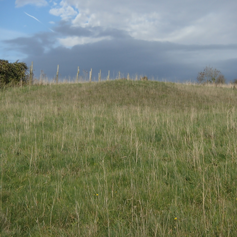
Arreton Bowl Barrow II submitted by cliffrich on 7th Dec 2018. In a field next to the chalk pit but footpaths traverse the field so appears to have public access
(View photo, vote or add a comment)
Log Text: This one wasn't marked on this site so I asked the site owner to add it. This barrow is situated at the end of the chalk pit in the adjacent field, literally a few meters from the chalk pit. It is listed with Historic England: https://historicengland.org.uk/listing/the-list/list-entry/1010009.
See video - https://youtu.be/gYPKFJpOmhw
See also: https://historicengland.org.uk/listing/the-list/list-entry/1010009
Arreton Downs
Date Added: 18th Mar 2019
Site Type: Round Barrow(s)
Country: England (Isle of Wight)
Visited: Yes on 6th Nov 2018. My rating: Condition 3 Ambience 4 Access 4
Arreton Downs submitted by RingPaw on 16th Jul 2006. Large barrow just to the east of Hare & Hounds PH, a few yards south of the ridge-top road to Brading. Short walk from the pub (watch the traffic).
(View photo, vote or add a comment)
Log Text: Once you have found the site the barrow is easy to see. Roughly 3mtrs high and approx 10mtrs diameter. Hidden behind a roadside hedge on the chalk pit side of the road, near the Hare and Hounds pub. There is another barrow several hundred yards away towards the end of the chalk pit and in a field, but this is difficult to see at first. Also known as Michael Morey's Hump. A gallows used to be placed in the center of the Hump from which a grandfather was hanged for killing his grandson C19.
See video - https://youtu.be/zVpFduukZqo?t=21.
See also: https://historicengland.org.uk/listing/the-list/list-entry/1010008
Ashey Down Cemetery
Date Added: 13th Jul 2020
Site Type: Barrow Cemetery
Country: England (Isle of Wight)
Visited: Yes on 16th Oct 2018. My rating: Condition 3 Ambience 4 Access 2
Ashey Down Cemetery submitted by RingPaw on 18th Jul 2006. The site from the west, showing 'avenue' effect of the grouping.
(View photo, vote or add a comment)
Log Text: After a long walk I found that it was all worth it. The barrows are good examples and easily recognised. To walk through them gives a good feeling, almost though as if you are trespassing! Well worth the effort. Once you are there it is a short walk to the Seamark where you will find other, less obvious, barrows and further suspicious lumps in adjacent fields the other side of the roads.
See: https://historicengland.org.uk/sitesearch?searchType=Site&search=ashey%20down%20cemetery&page=&filterOption=&facetValues=&pageId=38601&searchResultsPerPage=20.
UPDATE 10.07.20): have just found several other barrows at the same site. All-in-all there 19 barrows listed with Historic England!
Map ref's: SZ 57191 87626; SZ 57692 87734; SZ 57384 87641; SZ 57210 87700; SZ 57335 87517; SZ 57903 87779; SZ 57227 87513, amongst others! All ref's from Historic England's listings.
See videos - https://youtu.be/VDNMetj0lwI
https://youtu.be/TlH3Oibtvp4?t=7
You will also find a Medieval field system, as you will a very noticeable two-sided enclosure banks and ditches (another page). There are also two sites of Medieval settlements but these are scarcely visible.
Black Barrow
Date Added: 18th Mar 2019
Site Type: Round Barrow(s)
Country: England (Isle of Wight)
Visited: Yes on 6th Feb 2019. My rating: Condition 3 Ambience 4 Access 4
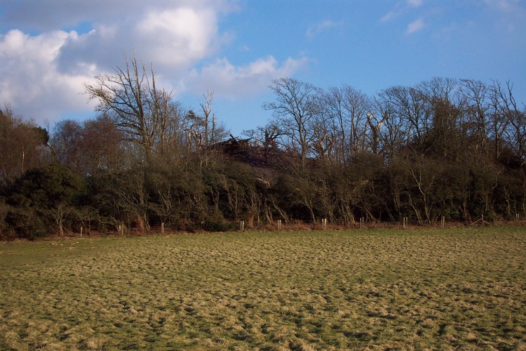
Black Barrow submitted by RingPaw on 8th Mar 2006. Black Barrow from Strawberry Lane, looking east.
(View photo, vote or add a comment)
Log Text: Just got back from visiting Black Barrow. Tried going to St Catherine's barrows but the hill was shrouded in fog right down to the car park/viewing area!
Well, as RingPaw mentioned this barrow certainly has some ambience. I've put a 4 for ambience but as mentioned by RingPaw 'Good' ambience is not my preffered description. This site has an eerie and sinister feel to it - perhaps that's why it's called BLACK Barrow? It was a short walk from where I parked the car but not via a recognized footpath. The map co-ordinates using phone GPS are spot on but you'll have to search for the barrow as it is obscured by lots of young trees on the approach to it. It is a large barrow and reasonably well preserved but, as with many barrows on the Island, it had been excavated, the tell-tale dip/holes in the top give it away. I would say that it was roughly the same size as Mottistone Common barrow (not far from the Longstone).There was a trodden path through bracken over the top leading to the woods behind. Today terra-firma was well obscured by dead bracken. You can't really see it from Strawberry Lane now as it's behind tallish trees. Worth a visit to experience it though! See: https://ancientmonuments.uk/106020-bowl-barrow-known-as-black-barrow-670m-nne-of-longstone-farmhouse-brighstone#.XFrBL6DLd9O. See my page for videos.
See also: https://historicengland.org.uk/listing/the-list/list-entry/1007805
Bowcombe Down
Date Added: 31st Dec 2019
Site Type: Round Barrow(s)
Country: England (Isle of Wight)
Visited: Yes on 29th Dec 2019. My rating: Condition 2 Ambience 3 Access 2
Bowcombe Down submitted by RingPaw on 10th Feb 2006. Views of Solent from this Barrow site.
(View photo, vote or add a comment)
Log Text: Nothing really to see here. A slight rise in the ground is all to notice.
Brighstone Forest 1
Date Added: 25th Mar 2019
Site Type: Barrow Cemetery
Country: England (Isle of Wight)
Visited: Yes on 20th Mar 2019. My rating: Condition 3 Ambience 4 Access 3
Brighstone Forest 1 submitted by RingPaw on 11th Feb 2006. Large round barrow.
(View photo, vote or add a comment)
Log Text: Good examples of round barrows. Quite large ones which give an imposing presence. The ambience is almost welcoming so a pleasure to walk between them :). Sadly they have been excavated in the past so un-repaired damage on the top is evident
Brighstone Forest 2
Date Added: 12th May 2019
Site Type: Barrow Cemetery
Country: England (Isle of Wight)
Visited: Yes on 12th Feb 2019. My rating: Condition 3 Ambience 4 Access 2
Brighstone Forest 2 submitted by RingPaw on 11th Feb 2006. Southern barrow close to Tennyson Trail.
(View photo, vote or add a comment)
Log Text: None
Brighstone Forest Enclosure / Moot
Date Added: 25th Mar 2019
Site Type: Misc. Earthwork
Country: England (Isle of Wight)
Visited: Yes on 19th Mar 2019. My rating: Condition 3 Ambience 3 Access 2
Brighstone Forest Enclosure / Moot submitted by ringpaw on 24th Feb 2008. External ditch & bank.
(View photo, vote or add a comment)
Log Text: None
Brook Down Five Barrows
Date Added: 7th May 2019
Site Type: Barrow Cemetery
Country: England (Isle of Wight)
Visited: Yes on 6th May 2019. My rating: Condition 3 Ambience 4 Access 3
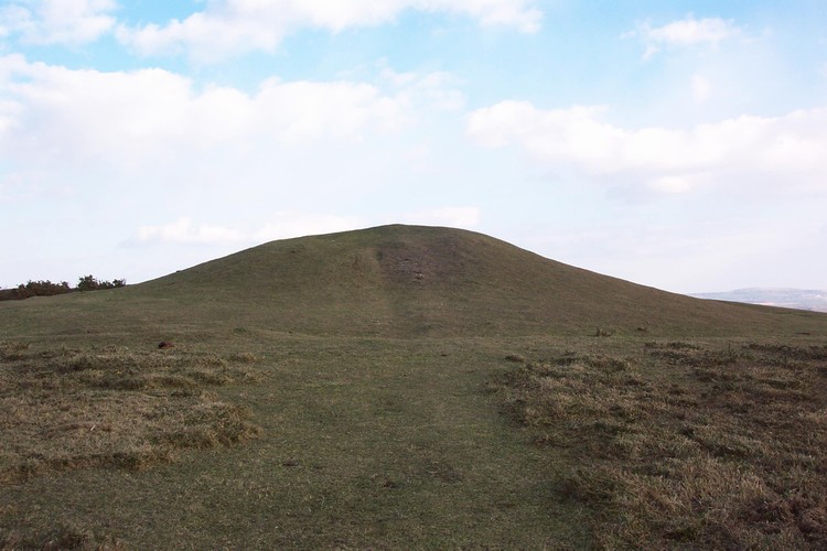
Brook Down Five Barrows submitted by RingPaw on 4th Mar 2006. Largest, western, barrow at Five Barrows.
(View photo, vote or add a comment)
Log Text: A large cemetery (and probably the most populated one on the Island) of up to 30 round/bell/disc/flat barrows. A clump of approx eight visible barrows at this site, however many more have disappeared/been ruined or flattened. An imposing site when you get closer with a very welcoming ambience and a feeling of community. Sadly, as often the case on the Island, these barrows have been excavated and not returned to their original condition :(. There are lots of lumps and bumps in the surrounding area which may be the lost/flattened/flat barrows. The lost barrows may extend to the Compton barrows, to the West.
Please see: https://historicengland.org.uk/listing/the-list/list-entry/1007804
Castle Hill, Mottistone
Date Added: 17th Mar 2019
Site Type: Hillfort
Country: England (Isle of Wight)
Visited: Yes on 9th Jan 2019. My rating: Condition 2 Ambience 3 Access 3
Castle Hill, Mottistone submitted by ringpaw on 27th Aug 2007. View from below - perhaps gives an idea of the squared-off nature of the fort. The fencing on the horizon is related to a small modern reservoir at the south-east corner of the feature.
(View photo, vote or add a comment)
Log Text: If you know what you're looking for it can be recognised, however it could be confused with farm earth movements. A distinctive square-ish earth structure comprising of built up earth mounds around perimeter, but nothing else to identify it. Look out for the fenced manhole cover at the South East corner.
See video - https://youtu.be/xESs83VUFaU?t=1
Chessell Down - Coombe Plantation
Date Added: 21st Jun 2019
Site Type: Round Barrow(s)
Country: England (Isle of Wight)
Visited: Yes on 26th Mar 2019. My rating: Condition 2 Ambience 3 Access 2
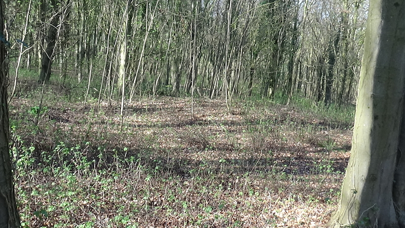
Chessell Down - Coombe Plantation submitted by cliffrich on 26th Mar 2019. SZ 40276 84964
(View photo, vote or add a comment)
Log Text: None
Cheverton Farm
Date Added: 18th Mar 2019
Site Type: Round Barrow(s)
Country: England (Isle of Wight)
Visited: Yes on 2nd Mar 2019. My rating: Condition 3 Ambience 3 Access 3
Cheverton Farm submitted by RingPaw on 10th Feb 2006. Long distance view of area, barrows are in middle distance on the ridge by the tongue of woodland.
(View photo, vote or add a comment)
Log Text: There are two round barrows at this site. One of them is quite noticeable albeit around a meter high at highest point. Roughly 20mtr diameter with quite a distinctive circumference. The second barrow is approx seven meters to the East. Just recognisable if you know what to look for. Again this one is roughly 20mtr diameter but only approx half a meter high. They have probably been ploughed out in the past. Little evidence of excavation. The ambience is ordinary and not much to experience.
These two barrows are part of a larger cemetery on the Downs. There are another five barrows here. The most Westward barrows take 25minutes to reach on foot. The other two clumps of barrows are at map ref: SZ4411 8420, and SZ4453 8415.
IMPORTANT: all the barrows are on private farm land. I had permission to visit.
See videos - Site I, Brighstone end: https://youtu.be/oJ_D-opFkhs
Site II, middle barrows: https://youtu.be/m_MAgye1Zo4?t=2
Site III, nearest barrows to Cheverton Farm: https://youtu.be/VVpkwAwbvx8
See also:
https://historicengland.org.uk/sitesearch?searchType=Site&search=shorwell%20round%20barrow&page=&filterOption=&facetValues=&pageId=38601&searchResultsPerPage=20
Chillerton Fort
Date Added: 6th Jan 2020
Site Type: Promontory Fort / Cliff Castle
Country: England (Isle of Wight)
Visited: Yes on 30th Dec 2019. My rating: Condition 3 Ambience 4 Access 2
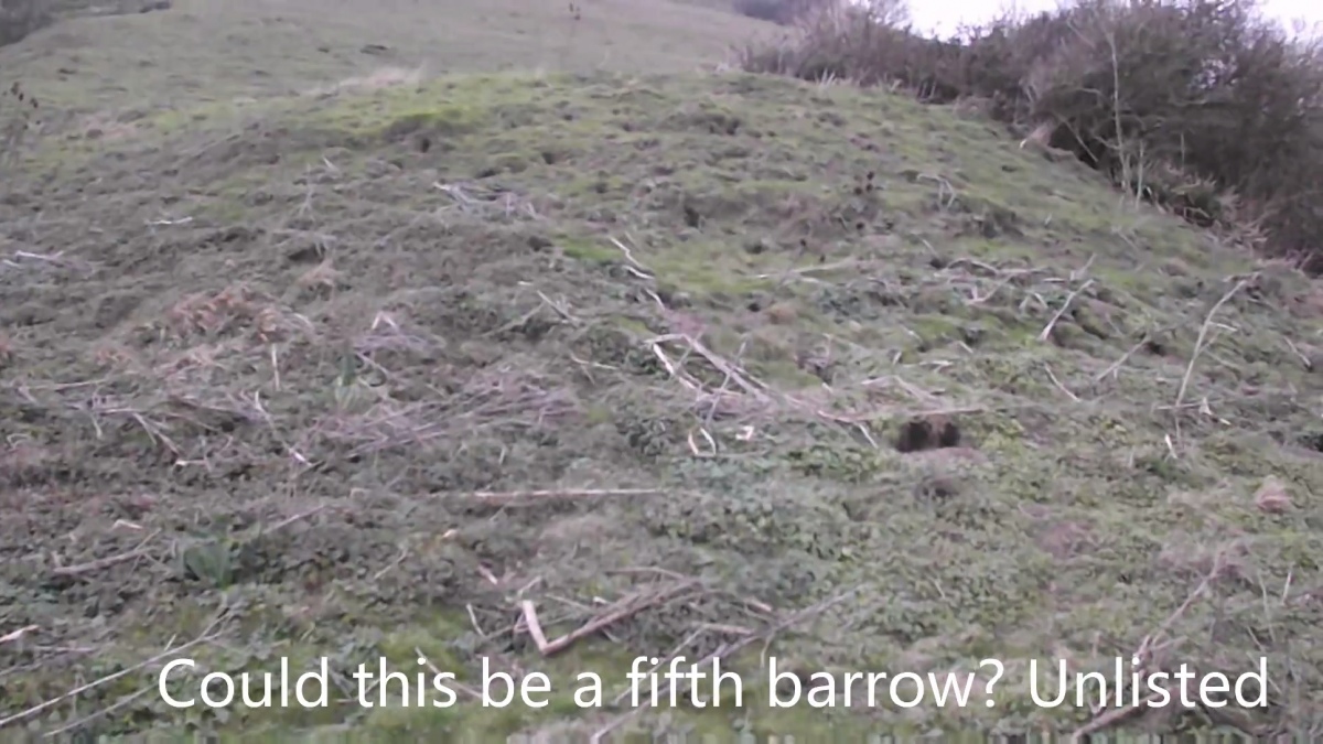
Chillerton Fort submitted by cliffrich on 6th Jan 2020. A lone barrow a distance away from the fort and other barrows
(View photo, vote or add a comment)
Log Text: Chillerton Fort and round barrows. Historic England ref: 1010012. Map ref: SZ4799 8388. Historic England state an 'unfinished' fort/promontory. Also known as 'Five Barrows', not to be confused with another Isle of Wight site called 'Five Barrows' at Brooke. Three barrows found and possibly another two (at least) in uneven ground. A pleasant ambience
Chillerton Fort
Date Added: 20th May 2020
Site Type: Promontory Fort / Cliff Castle
Country: England (Isle of Wight)
Visited: Yes. My rating: Condition 2 Ambience 4 Access 3
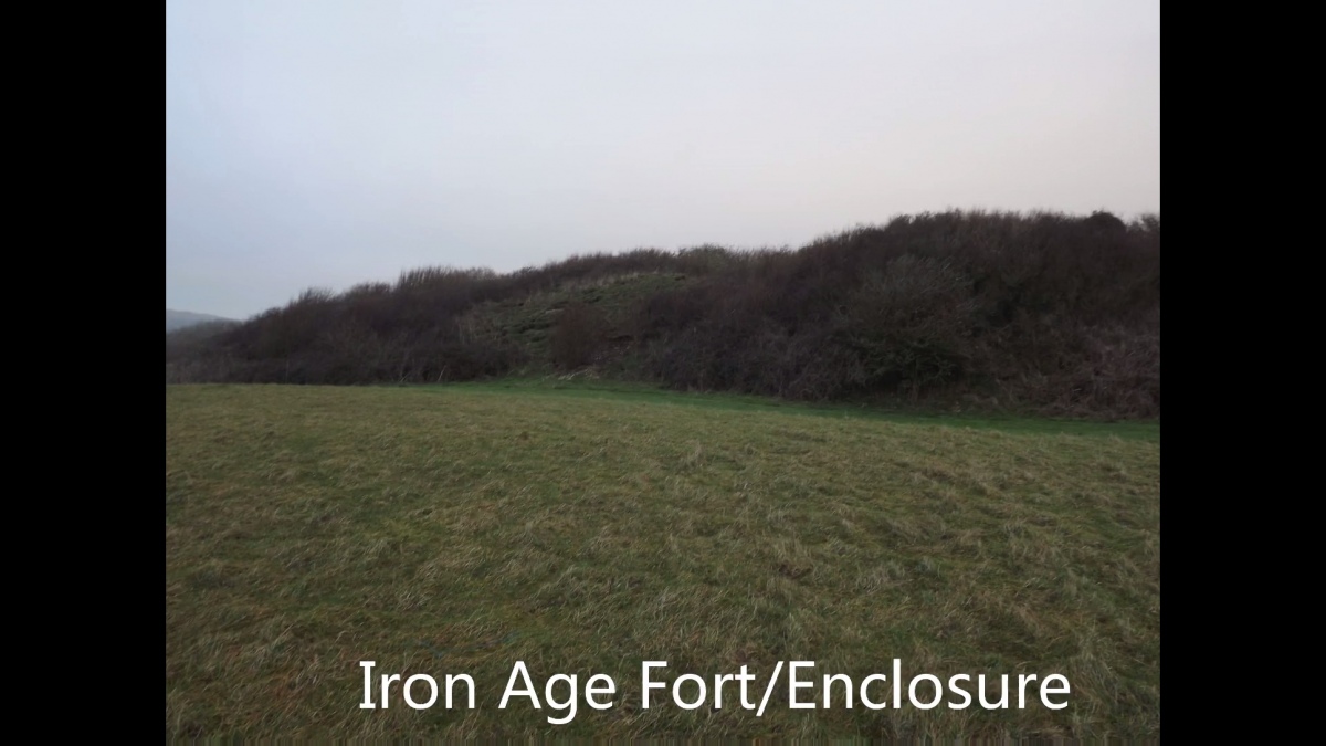
Chillerton Fort submitted by cliffrich on 6th Jan 2020. The only surviving bank of the fort earthwork
(View photo, vote or add a comment)
Log Text: None
Compton Down (IOW)
Date Added: 7th May 2019
Site Type: Barrow Cemetery
Country: England (Isle of Wight)
Visited: Yes on 6th May 2019. My rating: Condition 2 Ambience 3 Access 3
Compton Down (IOW) submitted by RingPaw on 25th Jul 2006. Ditch of largest barrow, second-largest in background.
(View photo, vote or add a comment)
Log Text: This barrow is between Five Barrows and the Eastern end of Freshwater Golf Course
Culver Down I
Date Added: 18th Mar 2019
Site Type: Round Barrow(s)
Country: England (Isle of Wight)
Visited: Yes on 11th Nov 2018. My rating: Condition 3 Ambience 4 Access 4
Culver Down I submitted by PaulM on 29th Aug 2003. By the gun battery - see main site entry.
(View photo, vote or add a comment)
Log Text: A short walk from the lower car park at the end of Culver Down. This barrow is quite noticeable if you look where you wouldn't expect to see it! It was overgrown and hidden away by some trees and brambles when I visited. It is situated adjacent to a concrete wartime gun emplacement. The video include other lumps and bumps and a listed barrow next to the monument.
See video - https://youtu.be/zfY5iaxRgMQ?t=2
See also: https://historicengland.org.uk/listing/the-list/list-entry/1012716
Eaglehead Copse I.
Date Added: 21st Jun 2019
Site Type: Round Barrow(s)
Country: England (Isle of Wight)
Visited: Yes on 21st Jun 2019. My rating: Condition 1 Ambience 3 Access 3
Eaglehead Copse I. submitted by RingPaw on 20th Jul 2006. The barrows as marked on the map should be on top of this small hill; perhaps visible when the crops have come in. They would have formed part of a visual ridgeway network, as with so many prehistoric features on the Isle of Wight.
(View photo, vote or add a comment)
Log Text: Private land so permission is required to visit. Eaglehead Copse I, II, and III are all in one field not far from the Ashey Sea Mark. All of the barrows are hardly visible, the highest one around 0.5mtr high. If you don't know the tell-tale signs you won't find them! I noticed several other suspicious mounds which may be more barrows than the six already listed elsewhere. I have taken pictures at the GPS co-ordinates of the barrows which show little evidence, if any that they are there. As is sadly normal on the Island these barrows are not protected by physical boundaries :(
Eaglehead Copse II.
Date Added: 21st Jun 2019
Site Type: Round Barrow(s)
Country: England (Isle of Wight)
Visited: Yes on 21st Jun 2019. My rating: Condition 1 Ambience 3 Access 3
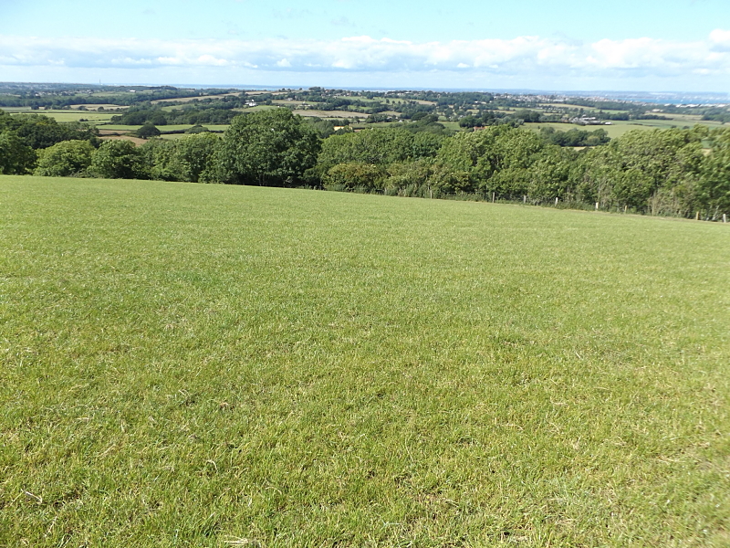
Eaglehead Copse II. submitted by cliffrich on 21st Jun 2019. Slight undulations in the ground
(View photo, vote or add a comment)
Log Text: Private land so permission is required to visit. Eaglehead Copse I, II, and III are all in one field not far from the Ashey Sea Mark. All of the barrows are hardly visible, the highest one around 0.5mtr high. If you don't know the tell-tale signs you won't find them! I noticed several other suspicious mounds which may be more barrows than the six already listed elsewhere. I have taken pictures at the GPS co-ordinates of the barrows which show little evidence, if any that they are there. As is sadly normal on the Island these barrows are not protected by physical boundaries :(
