Contributory members are able to log private notes and comments about each site
Sites Tomb has logged. View this log as a table or view the most recent logs from everyone
Dun Choinichean
Date Added: 17th Jun 2024
Site Type: Stone Fort or Dun
Country: Scotland (Isle of Mull)
Visited: Yes on 11th Jun 2024. My rating: Condition 3 Ambience 5 Access 3
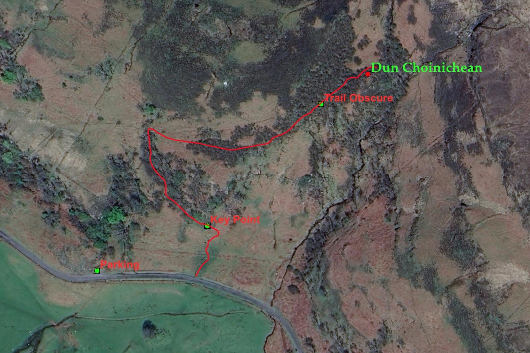
Dun Choinichean submitted by tomb on 12th Jun 2024. Access route to the Dun. 12% constant gradient to Dun entrance, now maintained by sheep.
PARKING is a pullout with a large additional uphill space where one can park without obstructing the use of pullout by traffic. This is very important! The residents of Mull are right tired of us tourists parking IN pullouts.
KEY POINT is a pass thru rock formation / start of trail. How you get to this point is up to you.
TRAIL OBSCURE is a place were the sheep loose the plot for 35 meters and the ...
(View photo, vote or add a comment)
Log Text: Well preserved small dun in beautiful setting with good, sheep maintained, access trail rising up hillside to Dun. 400 m from road to Dun. Worth the visit to admire old stonework and site, and take in a lovely view of Loch Tuath and Ulva.
Visited in 2013 and 2024.
Torr A'mhanaich
Date Added: 9th Jun 2024
Site Type: Hillfort
Country: Scotland (Isle of Mull)
Visited: Yes on 8th Jun 2024. My rating: Condition 1 Ambience 4 Access 4
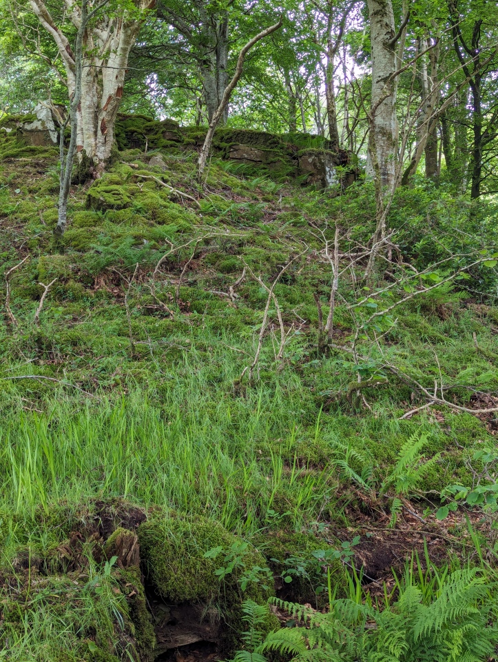
Torr A'mhanaich submitted by tomb on 9th Jun 2024. Looking up slope to south east rock terrace and site of fort wall remains. I imagine I can see traces of an old switchback access path on the slope. June 8, 2024
(View photo, vote or add a comment)
Log Text: Access is an easy stroll down a house driveway, then a short climb through beautiful open woodland to the fort site. However, access route is IMHO at the limit of acceptability under the Scotland right to roam code.
The fort itself is reduced to low lines of rocks and rubble that demarcate the boundaries of the old walls. The site has apparently been stone robbed to almost invisibility. Without the invaluable help of the Canmore ID: 22102 sketch site plan and notes, I would not have found it.
Additional site features that I found of interest were:
(1) the flat rock terrace on the southeast end of the crest immediately adjacent to the old fort. Would have been part of used area.
(2) traces of an old switchbacking access trail up the south east slope to reach the flat rock space and the fort itself. Commonly seen feature, but always interesting to find.
Current ambiance on the site is a beautiful beech woodland and low shrubbery on the ridgecrest. These features are highly unlikely to be representative of conditions when the fort was in use, but they are beautiful. Also, occupied homes within chatting distance....
In summary, there is no structure to see here, just a site of an ancient feature that was used by people at the time.
The site itself is too close to actively used dwellings to be comfortable to visit.
Torr A'chlachain, Mull
Date Added: 9th Jun 2024
Site Type: Hillfort
Country: Scotland (Isle of Mull)
Visited: Yes on 1st Jun 2024. My rating: Condition 2 Ambience 2 Access 3
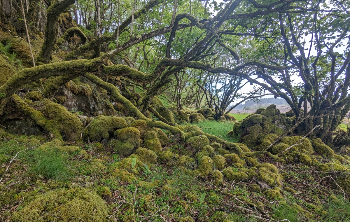
Torr A'chlachain, Mull submitted by tomb on 9th Jun 2024. Steep east face of the fort ridge. Also many stones likely cast down from above, with some refashioned in later stone walls. June 8, 2024
(View photo, vote or add a comment)
Log Text: Relatively easy to access site. Has vast parking area at junction of forestry track and road just south west of site.
Little remains of the hill fort except the site and immediate surrounds. I am reasonably certain I found the site of the Hill fort using the site plan sketch from Canmore (Canmore ID: 22097) as a reference. All that remains are a large boggy flat filling in with peat and some lines of stone rubble from the old walls on the appropriate portion of the ridge.
The most prominent stone feature on the ridge is the dyke (stone wall) identified by Coleman slightly to the north of the fort itself. This dyke is not part of the original Hill fort, but I speculate that it and other nearby stone features were largely built by stonerobbing the hill fort.
Just north of the dike is a very pleasant gently sloping access trail approaching from the Northeast which likely was a main route up to the Hill fort by the people who used this facility.
Proceeding further to the north west on the ridge leads to a lovely series of flat ridgetop flats with excellent views over the surrounding countryside.
Ambiance in the surrounding area is currently significantly impacted by a fresh timber harvest = fresh crispy brown logging slash. This will change over the next few years as vegetation regrows. The ridge itself outside of the fort is occupied with a lovely birch hazel forest. The ridge top forest would not likely have been here during human use of the fort but adds a charming touch of old mystique to the site.
The area inside the fort "walls" is being encroached on from the southeast by the birchwood and has a substantial amount of young coniferous natural regeneration from the recently logged plantation forest inside of it. It's not clear how fast the rate of afforestation is, but the site could be significantly obscured by trees at some time in the future.
Summary: Not a place to visit to see large standing walls but a charming short walk to stand where people lived and/or took refuge many centuries ago. Great landscape location and a chance to reflect on their lives.
Dun Aisgain
Date Added: 6th Jun 2024
Site Type: Stone Fort or Dun
Country: Scotland (Isle of Mull)
Visited: Yes on 3rd Jun 2024. My rating: Condition 3 Ambience 5 Access 3
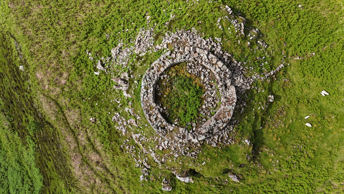
Dun Aisgain submitted by tomb on 6th Jun 2024. Vertical aerial of the Dun today. Remains of entrance visible at 2:30 on the circumference.
June 2024
(View photo, vote or add a comment)
Log Text: Visited in 2006, 2008, 2010, 2013, 2017, 2024. It was originally a fence free ramble across a few very deep gullies to get to the Dun. The way is now obstructed by 8 foot high ag fences. Use gates directly in front of Burg house to pass thru the 2 fences and then work your way down to Dun. There are also lower gates adjacent to main road and thru second fence much further out. Good luck finding them if it is your first visit. The raised beach seaside walk out past Dun is fabulous as well.
Dun Aisgain
Date Added: 6th Jun 2024
Site Type: Stone Fort or Dun
Country: Scotland (Isle of Mull)
Visited: Yes on 3rd Jun 2024. My rating: Condition 3 Ambience 5 Access 3

Dun Aisgain submitted by tomb on 6th Jun 2024. Vertical aerial of the Dun today. Remains of entrance visible at 2:30 on the circumference.
June 2024
(View photo, vote or add a comment)
Log Text: None
Dun Chruban
Date Added: 28th May 2024
Site Type: Stone Fort or Dun
Country: Scotland (Argyll)
Visited: Yes on 20th May 2024. My rating: Condition 3 Ambience 4 Access 4

Dun Chruban submitted by SolarMegalith on 28th Oct 2023. Dun Chruban - view from the west (photo taken on February 2023).
(View photo, vote or add a comment)
Log Text: Have also visited in 2008, 2010, 2013, 2017. Road to Dalnarrow takes one to within 175 m of Dun, but road condition has declined severely due to use by heavy agricultural tractors. Road has almost no pullouts over several km, and tractor rutting means there is no way for a 2 WD vehicle to get off road if required. Dalnarrow buildings and small plot have also been sold to a private holder who is restoring the buildings. Future vehicle access doubtful.
Kilcheran Dun
Date Added: 28th May 2024
Site Type: Stone Fort or Dun
Country: Scotland (Argyll)
Visited: Yes on 27th May 2024. My rating: Condition 2 Ambience 4 Access 4
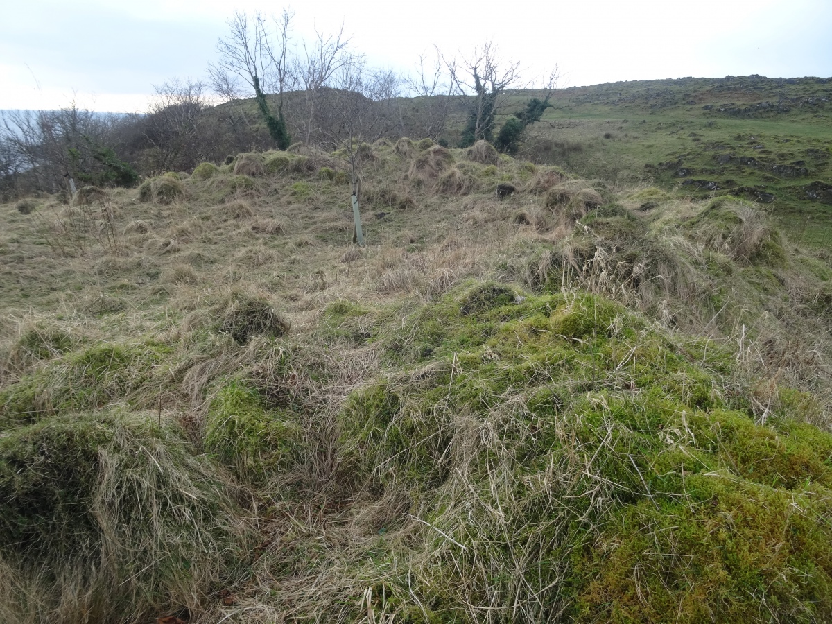
Kilcheran Dun submitted by SolarMegalith on 31st Oct 2023. Kilcheran dun with visible outline of the tumbled wall (photo taken on February 2023).
(View photo, vote or add a comment)
Log Text: Very easy stroll across smooth pasture from road. Parking places on roadside. Stile over fence adjacent to Dun a bit sketchy, but held up. Beautiful views of Lynne of Lorn and small islands from Dun site. Setting and relative tranquility allow one to ponder the ancient past in peace. Visited in 2010 as well.
