Contributory members are able to log private notes and comments about each site
Sites TimPrevett has logged. View this log as a table or view the most recent logs from everyone
The Knockin Hoarstone
Date Added: 18th Sep 2010
Site Type: Natural Stone / Erratic / Other Natural Feature
Country: England (Shropshire)
Visited: Yes on 23rd Sep 2006

The Knockin Hoarstone submitted by TimPrevett on 23rd Sep 2006. Last recorded in 1930, protruding from an earthen bank, this lost Shropshire stone should be in bank / hedgerow on the right hand side, somewhere just either side of the gate. Had a good look around, but no success. A stone further into the field along the footpath (just left of the tree on the skyline) initially got me excited, but should be about 5 feet by 2 feet. This was not. Will visit again when vegetation is down.
This is just off the A5, on a bend, so take care. It's rather obvious her...
(View photo, vote or add a comment)
Log Text: None
The Hurlers
Date Added: 18th Sep 2010
Site Type: Stone Circle
Country: England (Cornwall)
Visited: Yes on 11th May 2003

The Hurlers submitted by TimPrevett on 11th May 2003. SX258713
(View photo, vote or add a comment)
Log Text: None
The Horestone (Sullivan)
Date Added: 2nd Jan 2025
Site Type: Standing Stone (Menhir)
Country: England (Gloucestershire)
Visited: Would like to visit
The Horestone (Sullivan) submitted by 4clydesdale7 on 21st Oct 2011. The Sullivan Horestone/Milestone on the main road by Ridgmont
(View photo, vote or add a comment)
The Horestone (Rodborough)
Date Added: 3rd Jan 2025
Site Type: Standing Stone (Menhir)
Country: England (Gloucestershire)
Visited: Yes on 3rd Jan 2025. My rating: Condition 4 Ambience 4 Access 4
The Horestone (Rodborough) submitted by 4clydesdale7 on 21st Oct 2011. The Davis/Forbes Horestone - 1
(View photo, vote or add a comment)
Log Text: Visited on a bright winter day, the stone is slightly up from what has become a parking bay, well outside the last of the three properties in this cul-de-sac. The laurel seen in photos quite a few years back has been kept from swallowing seeing the stone. 10 digit grid reference from the OS app while leaning on the stone is SO 85742 02389, and I know some find it helpful, what3words is alongside.tame.forgot . The stone is well outside private property boundaries, but nevertheless one feels very conspicuous poking around!
The Hindwell Stone
Date Added: 18th Sep 2010
Site Type: Standing Stone (Menhir)
Country: Wales (Powys)
Visited: Yes on 22nd Sep 2008
The Hindwell Stone submitted by TimPrevett on 22nd Sep 2008. Possible standing stone in a field in the Walton Basin. Given the context of the area, and that it's a matter of metres outside of the northern line of the Hindwell Pallisaded Enclosure, it seems a credible assumption to think it of significance and a part of the amazing ancient landscape now largely lost. Look to the NW for The Whimble hill and to the E for Burfa Bank which are of similar shape to the stone in their outline.
(View photo, vote or add a comment)
Log Text: None
The Hemlock Stone
Date Added: 18th Sep 2010
Site Type: Rock Outcrop
Country: England (Nottinghamshire)
Visited: Yes on 22nd Aug 2007

The Hemlock Stone submitted by TimPrevett on 22nd Aug 2007. The Hemlock Stone - a towering natural outcrop with myths and legends, west of Nottingham. A good page for more information is here
http://www.broxtowe.gov.uk/staplefordhill_hemlock.htm
(View photo, vote or add a comment)
Log Text: None
The Giant's Stone (Gloucestershire)
Date Added: 2nd Mar 2025
Site Type: Chambered Cairn
Country: England (Gloucestershire)
Visited: Yes on 2nd Mar 2025. My rating: Condition 2 Ambience 2 Access 3
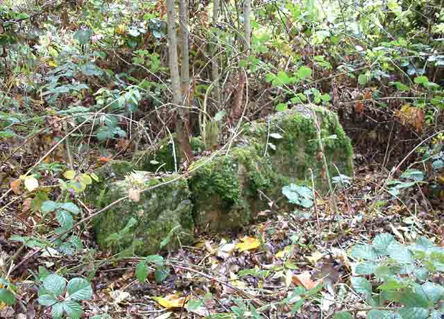
The Giant's Stone (Gloucestershire) submitted by baz on 15th Mar 2004. The Giant's Stone, well hidden in the undergrowth at the corner of a field. GPS: SO 91783 06122.
(View photo, vote or add a comment)
Log Text: From previous photos, it’s less overgrown than many of those - but early spring vegetation was already reaching over the stones. The ambience reflects the condition of the stones’ presentation - but also seeing them on a blue-sky March day.
The Devil's Mouth Cross Dyke
Date Added: 18th Sep 2010
Site Type: Misc. Earthwork
Country: England (Shropshire)
Visited: Yes on 25th Apr 2004
The Devil's Mouth Cross Dyke submitted by TimPrevett on 25th Apr 2004. The Devil's Mouth Cross Dyke is the shortest and most accessible cross dyke on the archaeologically rich Long Mynd. It is over 400 feet long, with a 100 feet section missing where the Burway Road cuts through the feature as the road moves away from the precipitous drop into Carding Mill Valley. The whole area is under the management of The National Trust.
It is important to point out that the road is very narrow, with many passing places. In peak season it can take some time to make a journey...
(View photo, vote or add a comment)
Log Text: None
The Dasses
Date Added: 4th Jan 2025
Site Type: Ancient Village or Settlement
Country: Scotland (Midlothian)
Visited: Saw from a distance on 4th Aug 2024. My rating: Condition 1 Ambience 4 Access 3
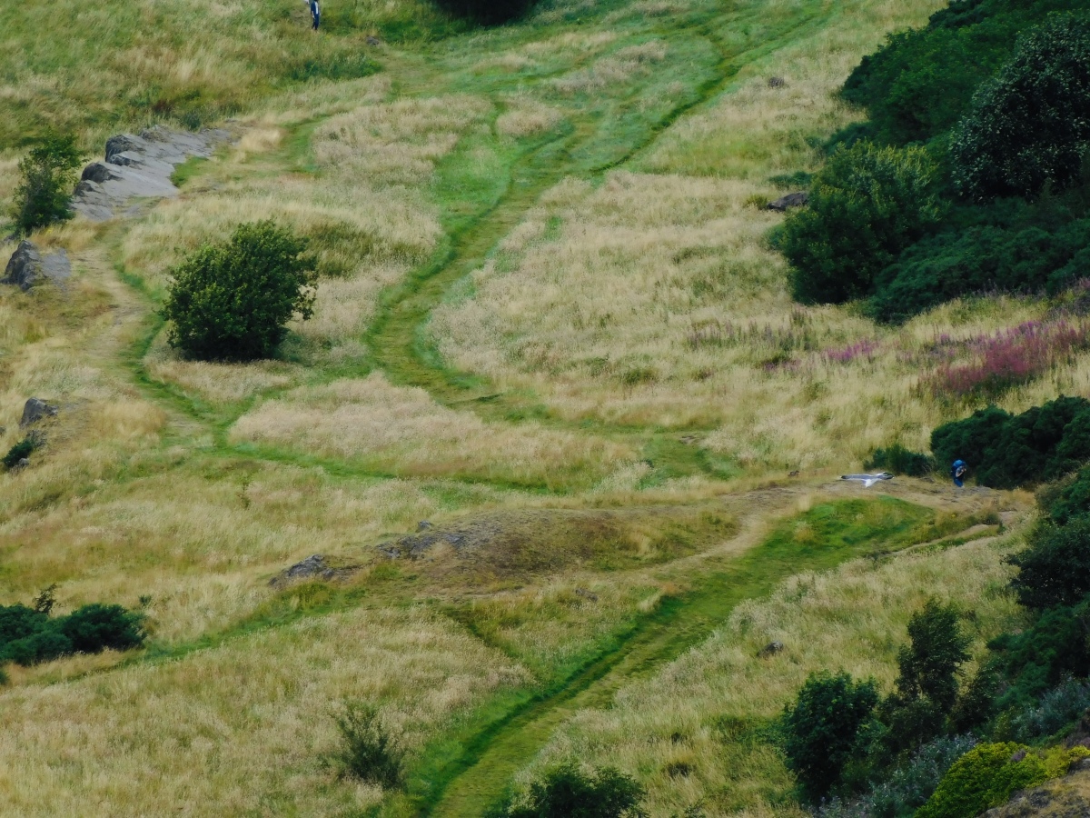
The Dasses submitted by TimPrevett on 4th Jan 2025. Six possible hut circles in this area, see person to the right for scale. The OS map denotes hut circles but the Canmore record becomes increasingly unsure as to their prehistoric origin. Can be seen looking north from Arthur’s Seat.
(View photo, vote or add a comment)
Log Text: The OS map denotes hut circles but the Canmore record becomes increasingly unsure as to their prehistoric origin. Can be seen looking north from Arthur’s Seat.
The Cobstone
Date Added: 7th May 2025
Site Type: Holed Stone
Country: England (Gloucestershire)
Visited: Yes on 9th Mar 2025. My rating: Condition 2 Ambience 3 Access 5
The Cobstone submitted by 4clydesdale7 on 12th Oct 2011. Here they are - the guardians at the gate of Lammas House
(View photo, vote or add a comment)
Log Text: Visible through the gates at Lammas House.
The Burgs
Date Added: 18th Sep 2010
Site Type: Hillfort
Country: England (Shropshire)
Visited: Yes on 13th Feb 2006
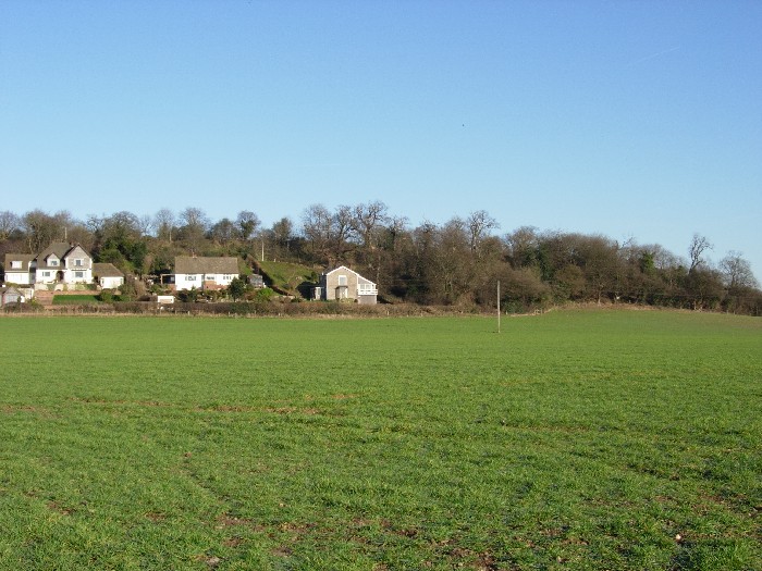
The Burgs submitted by TimPrevett on 13th Feb 2006. The Burgs viewed from the south east. February 2006. The upper (back) line of trees delineates the inner rampart, the outer being less easy to make out. This visit did not permit a closer look, but hopefully a future visit will help find more.
(View photo, vote or add a comment)
Log Text: None
The Bulwarks (Breedon on the Hill)
Date Added: 18th Sep 2010
Site Type: Hillfort
Country: England (Leicestershire and Rutland)
Visited: Yes on 23rd Sep 2007
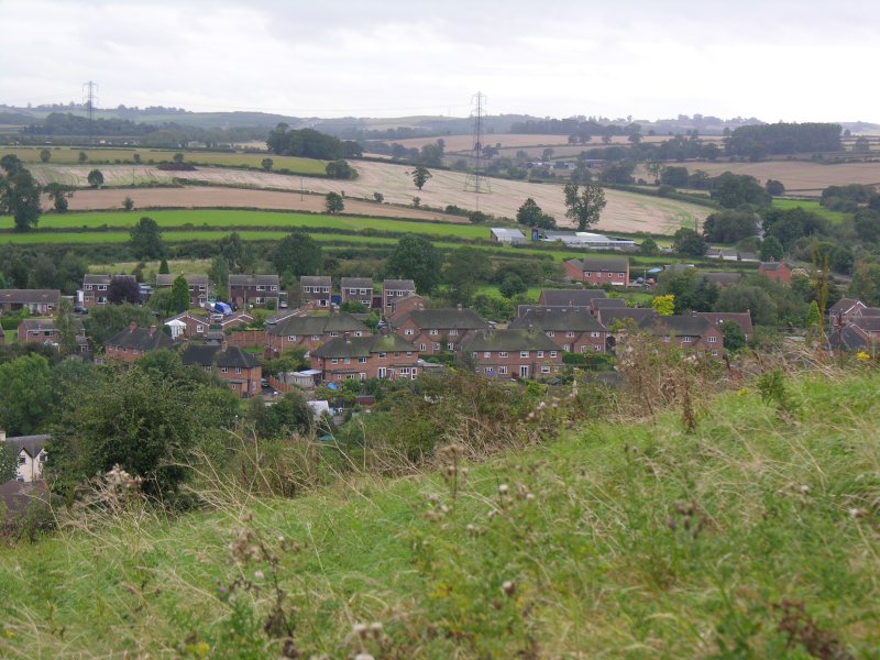
The Bulwarks (Breedon on the Hill) submitted by TimPrevett on 23rd Sep 2007. This is on the southern end of the hill, ramparts survive better, IIRC, on the western side, but time and incoming heavy rain were against me on this visit. Take in the church, too, which heaves with history from Anglo-Saxon, Norman, and beyond!
(View photo, vote or add a comment)
Log Text: None
The Bridestones (Cheshire)
Date Added: 18th Sep 2010
Site Type: Chambered Tomb
Country: England (Cheshire)
Visited: Yes on 7th Dec 2003
The Bridestones (Cheshire) submitted by TimPrevett on 7th Dec 2003. The northernmost stone at The Bridestones, which was helped to be revealed again when rhododendron was cleared last year! I am sure there are more smaller stones under the remaining rhododenrdon...
(View photo, vote or add a comment)
Log Text: None
The Bloody Stone
Date Added: 21st Feb 2023
Site Type: Marker Stone
Country: England (Merseyside)
Visited: Yes on 21st Feb 2023. My rating: Condition 2 Ambience 2 Access 5
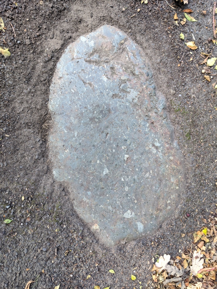
The Bloody Stone submitted by MonumentMen on 21st Sep 2020. The Bloody Stone - as seen tarmacked into the pavement on the Warrington Warrington bound A49 (close to Whitefield Avenue).
Google Maps reference: https://goo.gl/maps/YXYBdk52625zME977
(View photo, vote or add a comment)
Log Text: The adjoining hedge has been trimmed back, so The Bloody Stone is visible on the pavement on the east side of the north part of the bridge and descent over the railway.
The Berth
Date Added: 18th Sep 2010
Site Type: Hillfort
Country: England (Shropshire)
Visited: Yes on 26th Mar 2006

The Berth submitted by TimPrevett on 26th Mar 2006. Iron Age Slave Chains. A gathering of the Berth Archaeological Group on Saturday 25th March had the enormous pleasure of a guided talk by Ernie Jenks (right) who carried out the dig here in 1962/3.
One of the most unusual finds here at that time were some slave chains like those found at Llyn Cerrig Bach on Anglesey, showing the slave trade was alive and well in pre Roman Britain.
Here Ernie demonstrates with his own reconstruction of the chains, using himself and Portal Contributor VirtHist...
(View photo, vote or add a comment)
Log Text: None
The Bear Stone
Date Added: 18th Sep 2010
Site Type: Natural Stone / Erratic / Other Natural Feature
Country: England (Cheshire)
Visited: Yes on 18th Oct 2006
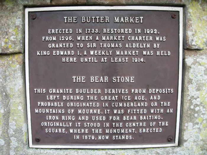
The Bear Stone submitted by TimPrevett on 18th Oct 2006. The sign giving information about The Bear Stone.
(View photo, vote or add a comment)
Log Text: None
The Bargain Stone
Date Added: 18th Sep 2010
Site Type: Holed Stone
Country: England (West Midlands)
Visited: Yes on 28th Jul 2007

The Bargain Stone submitted by TimPrevett on 28th Jul 2007. The holed Bargain Stone outside St Peter's in Wolverhampton City Centre. It is believed bargains, probably deals on wool traded from the Welsh Marches, would have been sealed with a handshake through this stone. It is thought to be a well weathered and broken gargoyle, with the hole having been the drainage. Don't miss the huge Anglo Saxon cross shaft nearby.
(View photo, vote or add a comment)
Log Text: None
The Bald Stone
Date Added: 18th Sep 2010
Site Type: Natural Stone / Erratic / Other Natural Feature
Country: England (Staffordshire)
Visited: Yes on 5th Apr 2007
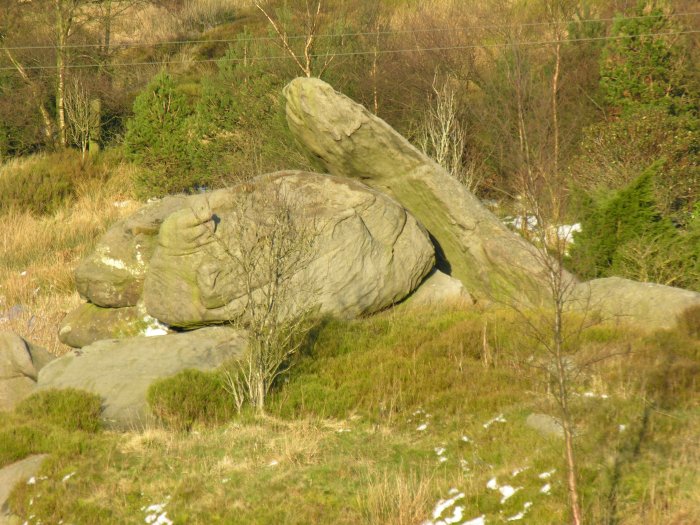
The Bald Stone submitted by TimPrevett on 5th Apr 2007. A striking natural outcrop resembling a vast collapsed dolmen, on private land with no access, to the east of the road. Easily visible from there.
(View photo, vote or add a comment)
Log Text: None
The Avenue
Date Added: 18th Sep 2010
Site Type: Ancient Trackway
Country: England (Wiltshire)
Visited: Yes on 10th Oct 2006

The Avenue submitted by TimPrevett on 10th Oct 2006. One of the National Trust interpretive signs for The Avenue. Such a small percentage of the visitors to Stonehenge actually get to see there. In a 4 hour walk from Stonehenge, taking in the Cursus, Old and New King Barrow, Cuckoo Stone, to Woodhenge and Durrington Walls, returning along some of the Avenue, I met 1 other person. If you want some solitude near Stonehenge (I was going to say peace, but helicopters were buzzing around very often), explore the wider landscape. It's a treat.
(View photo, vote or add a comment)
Log Text: None
Tenants Hill enclosure
Date Added: 18th Sep 2010
Site Type: Ancient Village or Settlement
Country: England (Dorset)
Visited: Yes on 18th Jan 2007

Tenants Hill enclosure submitted by TimPrevett on 18th Jan 2007. A composite of the curious enclosure on Tenants Hill. A beautiful, peaceful spot. Said to be Bronze Age, one wonders what sort of monument this may have been apart from the ambiguous term 'enclosure'. Looking NWW. Boxing day 2006.
(View photo, vote or add a comment)
Log Text: None
