Contributory members are able to log private notes and comments about each site
Sites TimPrevett has logged. View this log as a table or view the most recent logs from everyone
The Bulwarks (Breedon on the Hill)
Date Added: 18th Sep 2010
Site Type: Hillfort
Country: England (Leicestershire and Rutland)
Visited: Yes on 23rd Sep 2007
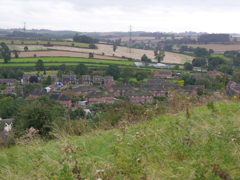
The Bulwarks (Breedon on the Hill) submitted by TimPrevett on 23rd Sep 2007. This is on the southern end of the hill, ramparts survive better, IIRC, on the western side, but time and incoming heavy rain were against me on this visit. Take in the church, too, which heaves with history from Anglo-Saxon, Norman, and beyond!
(View photo, vote or add a comment)
Log Text: None
The Burgs
Date Added: 18th Sep 2010
Site Type: Hillfort
Country: England (Shropshire)
Visited: Yes on 13th Feb 2006
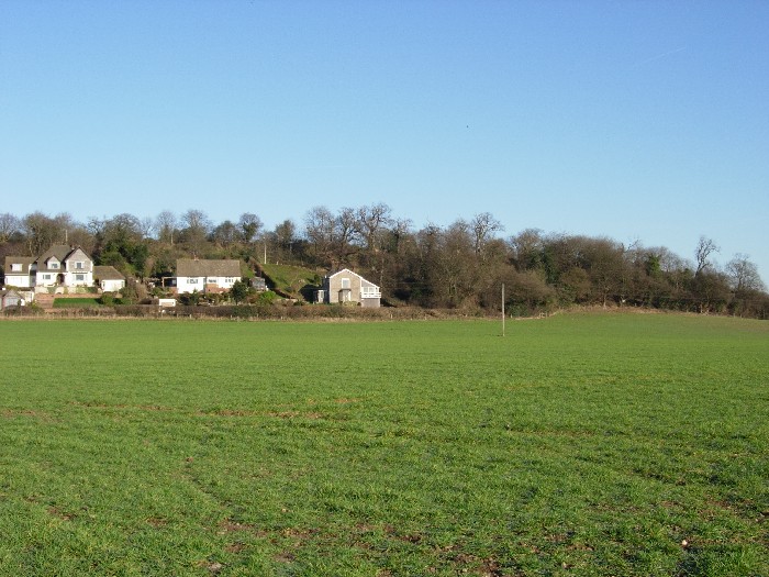
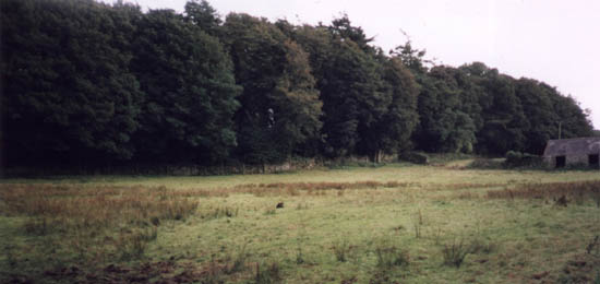
The Burgs submitted by TimPrevett on 13th Feb 2006. The Burgs viewed from the south east. February 2006. The upper (back) line of trees delineates the inner rampart, the outer being less easy to make out. This visit did not permit a closer look, but hopefully a future visit will help find more.
(View photo, vote or add a comment)
Log Text: None
The Cobstone
Date Added: 7th May 2025
Site Type: Holed Stone
Country: England (Gloucestershire)
Visited: Yes on 9th Mar 2025. My rating: Condition 2 Ambience 3 Access 5
The Cobstone submitted by 4clydesdale7 on 12th Oct 2011. Here they are - the guardians at the gate of Lammas House
(View photo, vote or add a comment)
Log Text: Visible through the gates at Lammas House.
The Dasses
Date Added: 4th Jan 2025
Site Type: Ancient Village or Settlement
Country: Scotland (Midlothian)
Visited: Saw from a distance on 4th Aug 2024. My rating: Condition 1 Ambience 4 Access 3
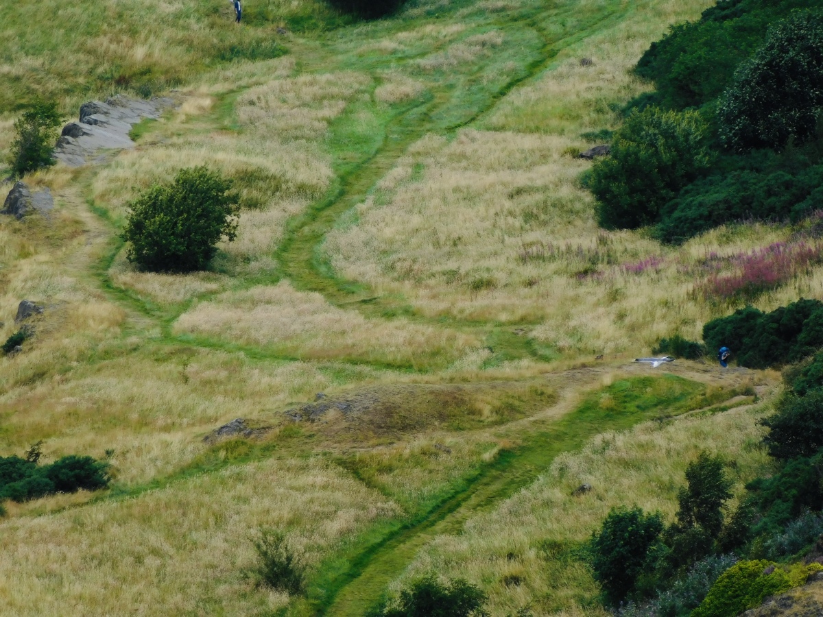
The Dasses submitted by TimPrevett on 4th Jan 2025. Six possible hut circles in this area, see person to the right for scale. The OS map denotes hut circles but the Canmore record becomes increasingly unsure as to their prehistoric origin. Can be seen looking north from Arthur’s Seat.
(View photo, vote or add a comment)
Log Text: The OS map denotes hut circles but the Canmore record becomes increasingly unsure as to their prehistoric origin. Can be seen looking north from Arthur’s Seat.
The Devil's Mouth Cross Dyke
Date Added: 18th Sep 2010
Site Type: Misc. Earthwork
Country: England (Shropshire)
Visited: Yes on 25th Apr 2004
The Devil's Mouth Cross Dyke submitted by TimPrevett on 25th Apr 2004. The Devil's Mouth Cross Dyke is the shortest and most accessible cross dyke on the archaeologically rich Long Mynd. It is over 400 feet long, with a 100 feet section missing where the Burway Road cuts through the feature as the road moves away from the precipitous drop into Carding Mill Valley. The whole area is under the management of The National Trust.
It is important to point out that the road is very narrow, with many passing places. In peak season it can take some time to make a journey...
(View photo, vote or add a comment)
Log Text: None
The Giant's Stone (Gloucestershire)
Date Added: 2nd Mar 2025
Site Type: Chambered Cairn
Country: England (Gloucestershire)
Visited: Yes on 2nd Mar 2025. My rating: Condition 2 Ambience 2 Access 3
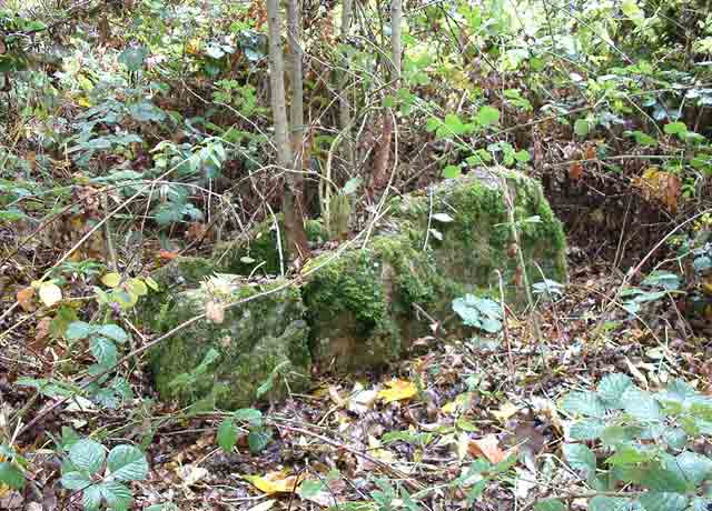
The Giant's Stone (Gloucestershire) submitted by baz on 15th Mar 2004. The Giant's Stone, well hidden in the undergrowth at the corner of a field. GPS: SO 91783 06122.
(View photo, vote or add a comment)
Log Text: From previous photos, it’s less overgrown than many of those - but early spring vegetation was already reaching over the stones. The ambience reflects the condition of the stones’ presentation - but also seeing them on a blue-sky March day.
The Hemlock Stone
Date Added: 18th Sep 2010
Site Type: Rock Outcrop
Country: England (Nottinghamshire)
Visited: Yes on 22nd Aug 2007

The Hemlock Stone submitted by TimPrevett on 22nd Aug 2007. The Hemlock Stone - a towering natural outcrop with myths and legends, west of Nottingham. A good page for more information is here
http://www.broxtowe.gov.uk/staplefordhill_hemlock.htm
(View photo, vote or add a comment)
Log Text: None
The Hindwell Stone
Date Added: 18th Sep 2010
Site Type: Standing Stone (Menhir)
Country: Wales (Powys)
Visited: Yes on 22nd Sep 2008
The Hindwell Stone submitted by TimPrevett on 22nd Sep 2008. Possible standing stone in a field in the Walton Basin. Given the context of the area, and that it's a matter of metres outside of the northern line of the Hindwell Pallisaded Enclosure, it seems a credible assumption to think it of significance and a part of the amazing ancient landscape now largely lost. Look to the NW for The Whimble hill and to the E for Burfa Bank which are of similar shape to the stone in their outline.
(View photo, vote or add a comment)
Log Text: None
The Horestone (Rodborough)
Date Added: 3rd Jan 2025
Site Type: Standing Stone (Menhir)
Country: England (Gloucestershire)
Visited: Yes on 3rd Jan 2025. My rating: Condition 4 Ambience 4 Access 4
The Horestone (Rodborough) submitted by 4clydesdale7 on 21st Oct 2011. The Davis/Forbes Horestone - 1
(View photo, vote or add a comment)
Log Text: Visited on a bright winter day, the stone is slightly up from what has become a parking bay, well outside the last of the three properties in this cul-de-sac. The laurel seen in photos quite a few years back has been kept from swallowing seeing the stone. 10 digit grid reference from the OS app while leaning on the stone is SO 85742 02389, and I know some find it helpful, what3words is alongside.tame.forgot . The stone is well outside private property boundaries, but nevertheless one feels very conspicuous poking around!
The Horestone (Sullivan)
Date Added: 2nd Jan 2025
Site Type: Standing Stone (Menhir)
Country: England (Gloucestershire)
Visited: Would like to visit
The Horestone (Sullivan) submitted by 4clydesdale7 on 21st Oct 2011. The Sullivan Horestone/Milestone on the main road by Ridgmont
(View photo, vote or add a comment)
The Hurlers
Date Added: 18th Sep 2010
Site Type: Stone Circle
Country: England (Cornwall)
Visited: Yes on 11th May 2003

The Hurlers submitted by TimPrevett on 11th May 2003. SX258713
(View photo, vote or add a comment)
Log Text: None
The Knockin Hoarstone
Date Added: 18th Sep 2010
Site Type: Natural Stone / Erratic / Other Natural Feature
Country: England (Shropshire)
Visited: Yes on 23rd Sep 2006

The Knockin Hoarstone submitted by TimPrevett on 23rd Sep 2006. Last recorded in 1930, protruding from an earthen bank, this lost Shropshire stone should be in bank / hedgerow on the right hand side, somewhere just either side of the gate. Had a good look around, but no success. A stone further into the field along the footpath (just left of the tree on the skyline) initially got me excited, but should be about 5 feet by 2 feet. This was not. Will visit again when vegetation is down.
This is just off the A5, on a bend, so take care. It's rather obvious her...
(View photo, vote or add a comment)
Log Text: None
The Ringses Fort
Date Added: 18th Sep 2010
Site Type: Hillfort
Country: England (Northumberland)
Visited: Yes on 20th May 2010
The Ringses Fort submitted by TimPrevett on 20th May 2010. This was an unplanned visit to Doddington Moor at the end of a surprisingly superb weather day. It would have been a travesty to miss the late evening sun, so en route back to the campsite, we decided to have a plod around this moor.
We decided not to investigate The Ringses: livestock, wanting to bag some more rock art, tiredness, need for food and failing light all conspired. However, I did go near enough to get this image of the rings.
(View photo, vote or add a comment)
Log Text: None
The Roveries
Date Added: 18th Sep 2010
Site Type: Hillfort
Country: England (Shropshire)
Visited: Yes on 22nd Dec 2004
The Roveries submitted by TimPrevett on 22nd Dec 2004. The Roveries hillfort, now covered by trees, viewed from the east, Midwinter Solstice 2004.
See main entry (click on blue text to left of picture) for more information.
(View photo, vote or add a comment)
Log Text: None
The Sanctuary.
Date Added: 18th Sep 2010
Site Type: Stone Circle
Country: England (Wiltshire)
Visited: Yes on 28th Jun 2007

The Sanctuary. submitted by TimPrevett on 28th Jun 2007. Part of the information board, depicting an artist's impression of what one of the phases of The Sanctuary would have looked like.
(View photo, vote or add a comment)
Log Text: None
The Stiperstones
Date Added: 18th Sep 2010
Site Type: Cairn
Country: England (Shropshire)
Visited: Yes on 28th Jun 2004
The Stiperstones submitted by TimPrevett on 28th Jun 2004. A cairn just north east of Manstone Rock.
"The Stiperstones" is the name for a hill on the far west reaches of Shropshire, well into The Welsh Marches, overlooking the Welsh border. It is the second highest hill in Shropshire, affording superb views in all directions, and having several bronze age cairns along its ridge.
The cairns themselves, excepting the largest, can be quite hard to locate. At a very reductionist level, they are basically piles of stone amidst a whole ridge of piles of...
(View photo, vote or add a comment)
Log Text: None
The Temple, Llandrindod Wells
Date Added: 18th Sep 2010
Site Type: Stone Circle
Country: Wales (Powys)
Visited: Yes on 8th Sep 2005
The Temple, Llandrindod Wells submitted by TimPrevett on 8th Sep 2005. Where are the stones now? Extensive information added to the site entry - click on the blue text to the top left of the picture for more information.
(View photo, vote or add a comment)
Log Text: None
The Three Leaps
Date Added: 18th Sep 2010
Site Type: Stone Row / Alignment
Country: Wales (Anglesey)
Visited: Yes on 3rd Jul 2002
The Three Leaps submitted by TimPrevett on 3rd Jul 2002. The Three Leaps SH528784
Visited Friday 22nd September 2000
Just east of Pentraeth; off B5109 Pentraeth to Beaumaris Road. These three stones were in a quagmire of a field when I visited shortly after several days of unusually heavy rain (even for Anglesey 2 inches in 24 hours!). The Three Leaps are visible over a wall decorated with barbed wire; and The Three Leaps is somewhat of a misnomer The Three Hardly Visibles would be more appropriate! If anything, the stones are no more than knee h...
(View photo, vote or add a comment)
Log Text: None
The Tingle Stone
Date Added: 18th Sep 2010
Site Type: Long Barrow
Country: England (Gloucestershire)
Visited: Yes on 29th Dec 2009
The Tingle Stone submitted by TimPrevett on 29th Dec 2009. The Tingle Stone - sole remaining slab of a chamber upon the chambered long barrow. Apparently off a footpath.
(View photo, vote or add a comment)
Log Text: None
The Whet Stone (Hergest Ridge)
Date Added: 18th Sep 2010
Site Type: Natural Stone / Erratic / Other Natural Feature
Country: England (Herefordshire)
Visited: Yes on 22nd Sep 2008
The Whet Stone (Hergest Ridge) submitted by TimPrevett on 22nd Sep 2008. Text from Hanterman: This is not a standing stone as such but a large (2.0m by 1.8m) lump of stone, probably naturaly deposited. From its position atop Hergest Ridge it aquires the most magnificent views to all the known Neolithic and Bronze Age sites in the Walton Basin and Barrows on the surrounding hillsides. though distant some may be. It has many folk tales attached to it from down the centuries. My reason for its inclusion is its alignment with other standing stones on Hergest Ridge and ac...
(View photo, vote or add a comment)
Log Text: None
