Contributory members are able to log private notes and comments about each site
Sites TimPrevett has logged. View this log as a table or view the most recent logs from everyone
Sainter's Dolmen
Date Added: 18th Sep 2010
Site Type: Rock Outcrop
Country: England (Staffordshire)
Visited: Yes on 5th Apr 2007

Sainter's Dolmen submitted by TimPrevett on 5th Apr 2007. In 1878, JD Sainter recorded a number of antiquities in the area. Besides the Bawdstone further east, was this rock outcrop, which he regarded as a dolmen having a robbed out cist. The rocks look nearly identical now, as they did 130 years ago in his sketch of the stones.
(View photo, vote or add a comment)
Log Text: None
Tunstall Park
Date Added: 18th Sep 2010
Site Type: Natural Stone / Erratic / Other Natural Feature
Country: England (Staffordshire)
Visited: Yes on 5th Apr 2007
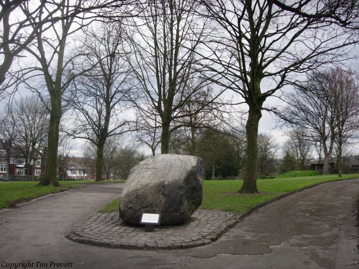
Tunstall Park submitted by TimPrevett on 5th Apr 2007. A large glacial erratic near the clock tower at the south west end of the park. Much of the nearby rockery is stone robbed from the Bridestones Neolithic Chambered Tomb near Congleton.
(View photo, vote or add a comment)
Log Text: None
National Memorial Arboretum
Date Added: 18th Sep 2010
Site Type: Henge
Country: England (Staffordshire)
Visited: Yes on 28th May 2007

National Memorial Arboretum submitted by TimPrevett on 28th May 2007. Looking east between two of the many regimental monuments at the National Memorial Arboretum. The area of unmown grass, yarrow, cow parsley etc between the two is the site of a triple ditched barrow, or maybe even a henge, not far from the River Tame.
(View photo, vote or add a comment)
Log Text: None
Alrewas Cursus
Date Added: 18th Sep 2010
Site Type: Cursus
Country: England (Staffordshire)
Visited: Yes on 28th May 2007

Alrewas Cursus submitted by TimPrevett on 28th May 2007. Looking from Croxall Lane, next to the railway signal box, the end of a rectilinear feature can be made out, arguably. See the Flash Earth image close up. This was part of a cursus... now bisected by the imperious A38, running along the course of the Roman Ryknild St. Cursus now descheduled.
(View photo, vote or add a comment)
Log Text: None
Alrewas Causewayed Enclosure
Date Added: 18th Sep 2010
Site Type: Causewayed Enclosure
Country: England (Staffordshire)
Visited: Yes on 28th May 2007

Alrewas Causewayed Enclosure submitted by TimPrevett on 28th May 2007. Looking SE on the dog leg of the road where Sale Lane and Daisy Lane meet. Evidence suggests a Neolithic Causewayed Enclosure at this site. NMR records: "The enclosure is situated on fairly level ground 2km south of the River Trent and 3.25km east of its tributaries, the Rivers Tame and Mease. The innermost circuit measures 168 metres by 215 metres, while the outermost is 205 metres by circa 250 metres. The circuits are generally around 10 metres apart."
(View photo, vote or add a comment)
Log Text: None
Devil's Ring and Finger
Date Added: 18th Sep 2010
Site Type: Holed Stone
Country: England (Staffordshire)
Visited: Yes on 14th Jun 2007

Devil's Ring and Finger submitted by TimPrevett on 14th Jun 2007. The Devil's Ring & Finger as they appear across the field beneath the oak.
(View photo, vote or add a comment)
Log Text: None
Bunbury Hillfort (Alton Towers)
Date Added: 18th Sep 2010
Site Type: Hillfort
Country: England (Staffordshire)
Visited: Yes on 26th Jul 2007
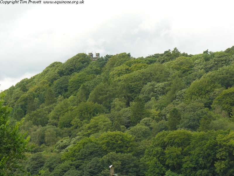
Bunbury Hillfort (Alton Towers) submitted by TimPrevett on 26th Jul 2007. People have been coming to the site of Alton Towers since at least the Iron Age. Within the grounds of the now Theme Park survive the slight earthworks of univallate hillfort, which makes use of the spur above the Churnet Valley. This view shows the site from the south, in Alton.
(View photo, vote or add a comment)
Log Text: None
Kinver
Date Added: 18th Sep 2010
Site Type: Promontory Fort / Cliff Castle
Country: England (Staffordshire)
Visited: Yes on 4th Aug 2007
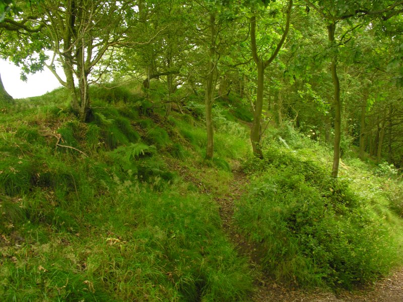
Kinver submitted by TimPrevett on 4th Aug 2007. The northwestern ramparts at Kinver Edge hillfort.
(View photo, vote or add a comment)
Log Text: None
Boltstone
Date Added: 18th Sep 2010
Site Type: Standing Stone (Menhir)
Country: England (Staffordshire)
Visited: Yes on 4th Aug 2007
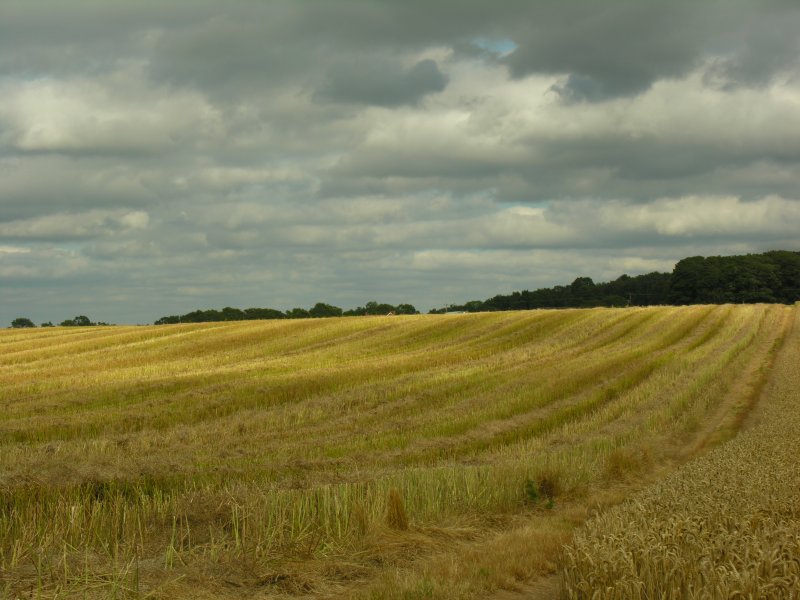
Boltstone submitted by TimPrevett on 4th Aug 2007. Within the view presented of this field once stood The Boltstone. No trace survives, it seems, as the farmer destroyed it looking for fabled treasure beneath it in 1839 - so the story goes. Not far to the NW of Kinver hillfort, off Bannut Tree Lane, near the footpath shown cutting across the field.
(View photo, vote or add a comment)
Log Text: None
Hill Ridware
Date Added: 18th Sep 2010
Site Type: Cursus
Country: England (Staffordshire)
Visited: Yes on 12th Sep 2007

Hill Ridware submitted by TimPrevett on 12th Sep 2007. The site of the neolithic cursus at Hill Ridware; nothing to see apart from the field now, unlike the other cursus near Alrewas - see
http://www.megalithic.co.uk/article.php?sid=14868
(View photo, vote or add a comment)
Log Text: None
Mavesyn Ridware
Date Added: 18th Sep 2010
Site Type: Causewayed Enclosure
Country: England (Staffordshire)
Visited: Yes on 12th Sep 2007
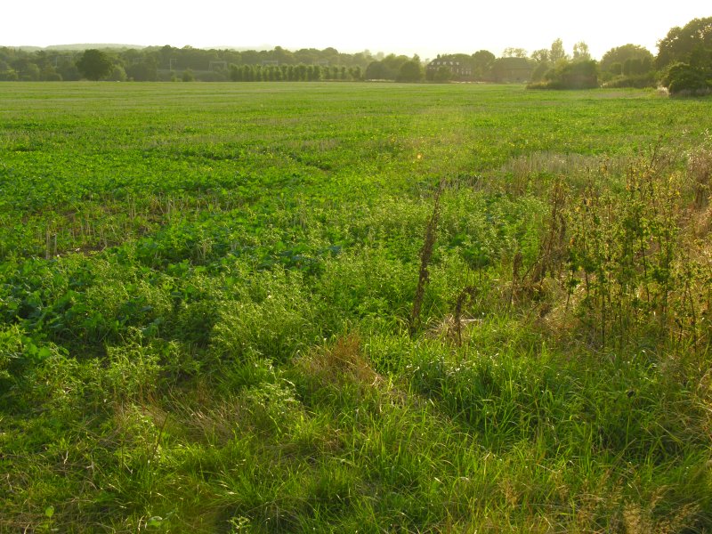
Mavesyn Ridware submitted by TimPrevett on 12th Sep 2007. The site of the neolithic Causewayed Enclosure near the River Trent at Mavesyn Ridware. Just a field visible now.
(View photo, vote or add a comment)
Log Text: None
Stanton Drew Great Circle
Date Added: 18th Sep 2010
Site Type: Stone Circle
Country: England (Somerset)
Visited: Yes on 5th Jul 2002

Stanton Drew Great Circle submitted by TimPrevett on 5th Jul 2002. Sheep having fun at Stanton Drew Great Circle
(View photo, vote or add a comment)
Log Text: None
Trout Hill 2
Date Added: 18th Sep 2010
Site Type: Standing Stones
Country: England (Somerset)
Visited: Yes on 5th Jul 2002
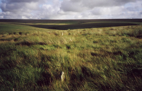
Trout Hill 2 submitted by TimPrevett on 5th Jul 2002. Trout Hill Stone Rows
SS794432
Two stones visible in this photograph.
Photo & visit by Roger Gay, South Molton, Devon. Text, scanning & editing by Tim Prevett.
(View photo, vote or add a comment)
Log Text: None
Almsworthy
Date Added: 18th Sep 2010
Site Type: Stone Circle
Country: England (Somerset)
Visited: Yes on 5th Jul 2002
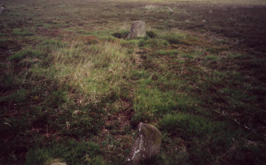
Almsworthy submitted by TimPrevett on 5th Jul 2002. Almsworthy Stone Circle
SS844417
A fine setting this, with 12 stones. No row alignments but potentially circular in shape.
Photo, visit & text by Roger Gay, South Molton, Devon. Scanning & editing by Tim Prevett.
(View photo, vote or add a comment)
Log Text: None
Porlock Circle
Date Added: 18th Sep 2010
Site Type: Stone Circle
Country: England (Somerset)
Visited: Yes on 5th Jul 2002

Porlock Circle submitted by TimPrevett on 5th Jul 2002. Porlock Allotment Stone Circle and Stone Row
(View photo, vote or add a comment)
Log Text: None
Whit Stones
Date Added: 18th Sep 2010
Site Type: Standing Stones
Country: England (Somerset)
Visited: Yes on 5th Jul 2002

Whit Stones submitted by TimPrevett on 5th Jul 2002. Whit Stones
SS854463
Date Visited Wednesday 3rd May 2000
These two sizeable stones, likely barrow remnants, situated a couple miles west of Porlock, and several miles east of Lynton, are easily accessible.
Heading west from Porlock (the hill coming out of Porlock is VERY steep and not for the faint hearted!), keep an eye out for a fork in the A39. When you see the fork, keep going along the A39; to the right there are two car parks; take the second car park, as this puts you within one ...
(View photo, vote or add a comment)
Log Text: None
Withypool Circle
Date Added: 18th Sep 2010
Site Type: Stone Circle
Country: England (Somerset)
Visited: Yes on 5th Jul 2002
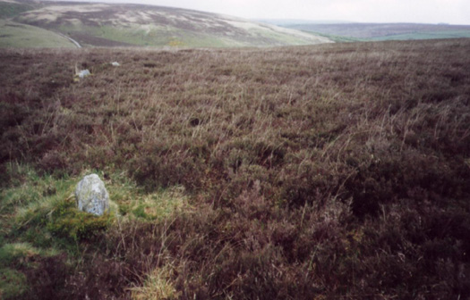
Withypool Circle submitted by TimPrevett on 5th Jul 2002. Withypool Hill Stone Circle
SS836343
Counted 30 stones, many under the heather & some lying loose on the ground. It is a large diameter circle making it impossible to photograph as a whole. There are four larger stones at the top end of the circle and four more the same at the bottom end.
Photo, visit & text by Roger Gay, South Molton, Devon. Scanning & editing by Tim Prevett.
(View photo, vote or add a comment)
Log Text: None
Culbone Hill
Date Added: 18th Sep 2010
Site Type: Stone Row / Alignment
Country: England (Somerset)
Visited: Yes on 5th Jul 2002
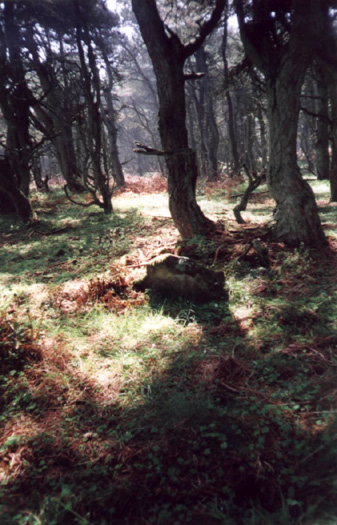
Culbone Hill submitted by TimPrevett on 5th Jul 2002. Culbone Hill Stone Row
SS832473
Date Visited Sunday 7th May 2000
Due to the explicit request not to go off the path, I did not get much evidence of the stone row. This was maddeningly frustrating, given its imminent proximity! However, having studied the map, I went back to where the car was parked, turned left further up the track, and then left up another track, where it intersects the stone row (fenced off with barbed wire). Two stones were just visible to my left through the dense ov...
(View photo, vote or add a comment)
Log Text: None
Lanacombe 3
Date Added: 18th Sep 2010
Site Type: Multiple Stone Rows / Avenue
Country: England (Somerset)
Visited: Yes on 7th Jul 2002
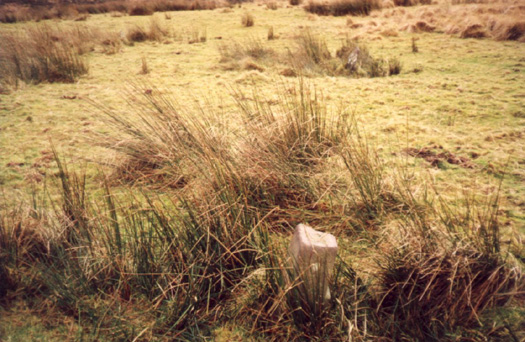
Lanacombe 3 submitted by TimPrevett on 7th Jul 2002. Lanacombe Centre E Multiple Stone Rows / Avenue ?
SS785428
[Possibly this location as the GR given for Lanacombe Centre E Multiple Stone Rows / Avenue on the Megalith Map is SS786430. Tim]
Three stones in a triangle and quite small.
Photo, visit & text by Roger Gay, South Molton, Devon. Scanning & editing by Tim Prevett.
(View photo, vote or add a comment)
Log Text: None
Lanacombe 1
Date Added: 18th Sep 2010
Site Type: Multiple Stone Rows / Avenue
Country: England (Somerset)
Visited: Yes on 7th Jul 2002

Lanacombe 1 submitted by TimPrevett on 7th Jul 2002. Lanacombe Centre W Stone Row / Alignment
SS783428
An impressive setting of at least eleven stones.
Photo, visit & text by Roger Gay, South Molton, Devon. Scanning & editing by Tim Prevett.
(View photo, vote or add a comment)
Log Text: None
