Contributory members are able to log private notes and comments about each site
Sites TheCaptain has logged. View this log as a table or view the most recent logs from everyone
Trout Hill 1
Date Added: 18th Sep 2010
Site Type: Standing Stones
Country: England (Somerset)
Visited: Yes on 20th Jun 2008

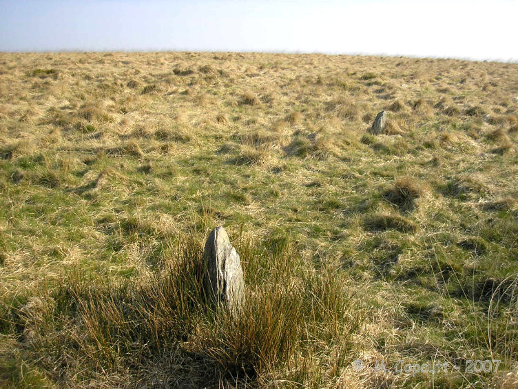
Trout Hill 1 submitted by thecaptain on 20th Jun 2008. Trout Hill 1. Looking uphill towards the south showing stones 2 and 1.
(View photo, vote or add a comment)
Log Text: None
Bristol City Museum
Date Added: 18th Sep 2010
Site Type: Museum
Country: England (Somerset)
Visited: Yes on 11th Aug 2009

Bristol City Museum submitted by thecaptain on 11th Aug 2009. As a part of the fabulous Banksy vs Bristol Museum exhibition this summer, a part of "Boghenge" (originally done at Glastonbury Festival in 2007) has been erected in the museum entrance.
(View photo, vote or add a comment)
Log Text: None
West Hill Fort, Portishead
Date Added: 16th Aug 2019
Site Type: Hillfort
Country: England (Somerset)
Visited: Yes on 13th Aug 2019. My rating: Condition 1 Ambience 2 Access 4

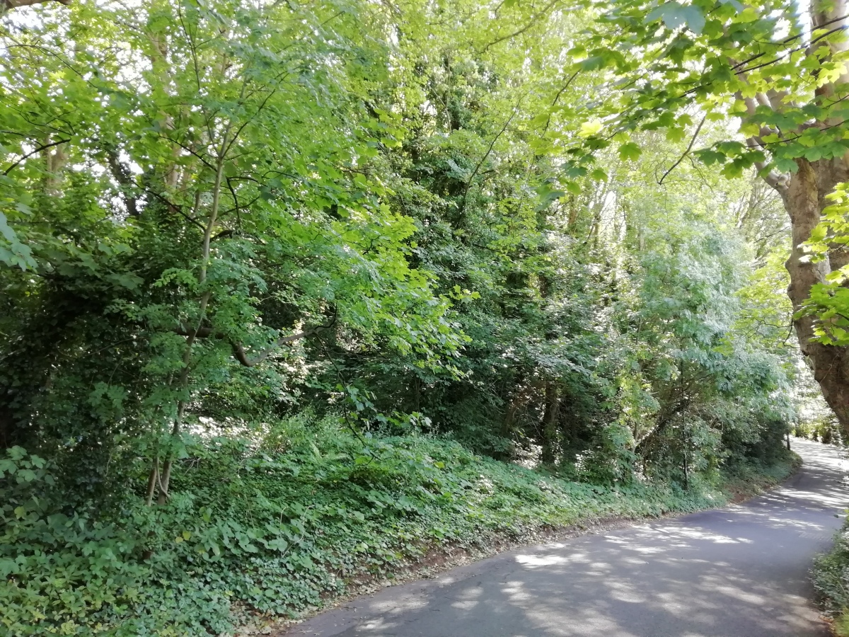
West Hill Fort, Portishead submitted by TheCaptain on 16th Aug 2019. Possible remnants of the ramparts remain in the little wooded area below Wood Hill Park
(View photo, vote or add a comment)
Log Text: Possible remnants of the ramparts remain in the little wooded area below Wood Hill Park
Felton Hill Long Barrow T26
Date Added: 29th Oct 2019
Site Type: Chambered Tomb
Country: England (Somerset)
Visited: Yes on 26th Apr 2004

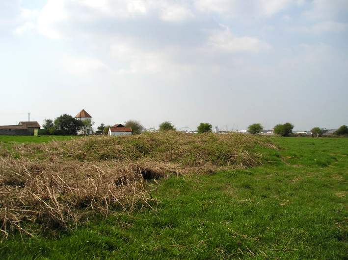
Felton Hill Long Barrow T26 submitted by TheCaptain on 26th Apr 2004. Felton Hill chambered Cairn, Somerset, ST516649.
Having read the description of this site again, it became obvious that the described cairn was the oval barrow near to the west end of the common by the round house. So I went to have another look, with more determination to get pictures.
This oval barrow is approx 20m by 15m, and has a north south axis. It is very overgrown, and as can be seen in the picture, lies right at the end of the runway of Bristol airport.
(View photo, vote or add a comment)
Log Text: None
Hoaroak stones
Date Added: 29th Oct 2019
Site Type: Standing Stones
Country: England (Somerset)
Visited: Yes on 21st Feb 2011
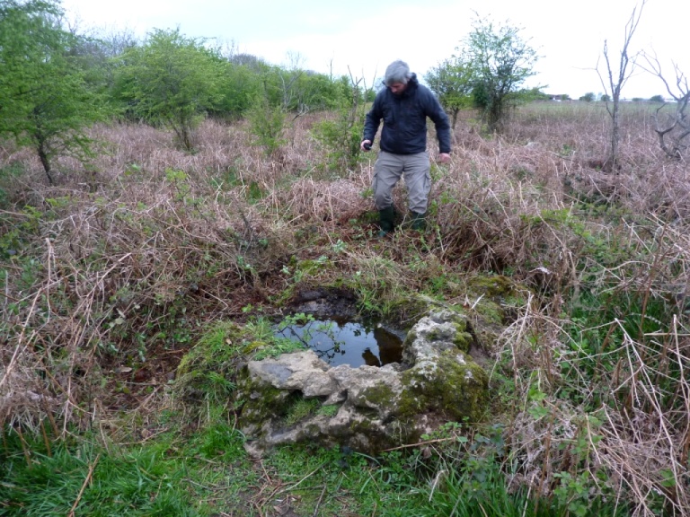
Hoaroak stones submitted by TheCaptain on 21st Feb 2011. After a long while searching around, I found a couple of stones which looked like they might be placed in position, although now broken and fallen.
(View photo, vote or add a comment)
Log Text: None
Cheriton Ridge Boundary stones
Date Added: 29th Oct 2019
Site Type: Modern Stone Circle etc
Country: England (Somerset)
Visited: Yes on 1st Apr 2011
Cheriton Ridge Boundary stones submitted by TheCaptain on 1st Apr 2011. These two lovely old standing stones are each about 5 feet tall, and look very gnarled. However, they are not prehistoric, although many hundreds of years old.
If you are out on this part of Exmoor, do go and have a look at them - they are far more impressive and beautiful than any of the remaining prehistoric stone setting stones to be found in the vicinity!
(View photo, vote or add a comment)
Log Text: None
Priddy Circles S
Date Added: 29th Oct 2019
Site Type: Henge
Country: England (Somerset)
Visited: Yes on 19th Jun 2011
Priddy Circles S submitted by TheCaptain on 19th Jun 2011. The field where the southern of the Priddy Circles should be.
Here viewed over the hedge from the B3135 near Harptree Lodge, Sunday June 19th, and there is no immediate sign of the henge at all.
(View photo, vote or add a comment)
Log Text: None
Castle Farm Long Barrow
Date Added: 29th Oct 2019
Site Type: Long Barrow
Country: England (Somerset)
Visited: Yes on 23rd Jun 2011
Castle Farm Long Barrow submitted by TheCaptain on 23rd Jun 2011. Looking south from the busy B3134 to the strip of trees within which the remains of Castle Farm Long Barrow are.
(View photo, vote or add a comment)
Log Text: None
Pool Farm Cist
Date Added: 29th Oct 2019
Site Type: Rock Art
Country: England (Somerset)
Visited: Yes on 23rd Jun 2011
Pool Farm Cist submitted by TheCaptain on 23rd Jun 2011. I was walking through the field with the public footpath through it, when I heard a commotion and looked around to see about 50 bullocks running over to me, snorting and grunting as they ran.
Rather quickly, I legged it to the nearest gate, and fairly quickly vaulted it (remarkably so for a 50 year old with a still damaged shoulder)!
I guess they were only curious, but as I walked along the adjoining field they kept following me, and would not go away. Trip to Pool Farm Cist abandoned...
(View photo, vote or add a comment)
Log Text: None
Barrow House Farm Long Barrow
Date Added: 29th Oct 2019
Site Type: Chambered Tomb
Country: England (Somerset)
Visited: Yes on 29th Jun 2011
Barrow House Farm Long Barrow submitted by TheCaptain on 29th Jun 2011. Just to the west of the A39, on the top of the hill just before it descends southwards into Chewton Mendip, there are some lumps and bumps which can be seen in the field.
It looks to be two or three round barrows with a fairly large long barrow in between them.
(View photo, vote or add a comment)
Log Text: None
Lime House Long Barrow
Date Added: 29th Oct 2019
Site Type: Long Barrow
Country: England (Somerset)
Visited: Yes on 29th Jun 2011
Lime House Long Barrow submitted by TheCaptain on 29th Jun 2011. Just to the southwest of central Chewton Mendip, up onto the higher meadows, there is a large and overgrown lumpy and bumpy area, which was once a fairly large long barrow.
(View photo, vote or add a comment)
Log Text: None
Priddy Circles Unfinished N
Date Added: 29th Oct 2019
Site Type: Henge
Country: England (Somerset)
Visited: Yes on 4th Jul 2011
Priddy Circles Unfinished N submitted by TheCaptain on 4th Jul 2011. The eastern arc of the fourth Priddy Circle, seen over the top of the hedge from the roadside, June 2011.
The fence helps to give a good idea off the size of the remaining bank and external ditch.
(View photo, vote or add a comment)
Log Text: None
Stokeleigh Camp
Date Added: 6th Nov 2023
Site Type: Promontory Fort / Cliff Castle
Country: England (Somerset)
Visited: Yes on 28th Aug 2011. My rating: Condition 4 Ambience 4 Access 4

Stokeleigh Camp submitted by TheCaptain on 19th Aug 2011. Plan of Stokeleigh Camp from
Notes on the Clifton, Burwalls and Stokeleigh Camps
by Professor C. Lloyd Morgan,
Clifton Antiquarian Club 1900.
(View photo, vote or add a comment)
Log Text: Iron age promontary hillfort on a spur overlooking the Avon Gorge from the high plateau at the western side of the Gorge, now a part of the large Leigh Woods nature reserve. This is one of three iron age forts here probably guarding a ford crossing of the river Avon at the bottom of the Avon Gorge, below where is now the Clifton Suspension Bridge. The promontary points towards the east, with the steep sided Nightingale valley marking the southern edge, where the hillside has been sculpted, with another smaller steep sided valley making the northeastern edges of the camp. The camp is completed around its northwestern sides by a double arc of massive ditch and bank ramparts, both once topped with stone walling. The main entrance was probably at the northern edge of the plateau, beside the steep cliff edge, where there is a third row of ditch and bank to help gaurd. I decided on a walk round Leigh Woods and to take in Stokeleigh Camp, on a showery bank holiday afternoon. Several things took my notice since my last visit here many years ago, firstly that it has all been tidied up by National Trust and much of the woodland cleared around the ramparts, making them very visible (I wasn't expecting to really be able to see them or get any decent pictures at all). I was most impressed with the massive size of the main ramparts, the inner bank being about 5 metres above the ground level inside, while the ditch outside must be almost of equal depth, making a top to bottom height of between 8 and 10 metres! Massive! Outside the inner bank and ditch is a second ring of bank and ditch, this time the relative heights and depth being about +/- 2 metres. At places around the top of the major rampart, there are places where stretches of vertical stone walling can be seen. In order to keep the vegetation down, NT and English Nature have decided to graze half a dozen Devon Red cattle around the camp.
Burwalls Camp
Date Added: 6th Nov 2023
Site Type: Promontory Fort / Cliff Castle
Country: England (Somerset)
Visited: Yes on 28th Aug 2011. My rating: Condition 2 Ambience 4 Access 5
Burwalls Camp submitted by theCaptain on 15th Sep 2011. View of the site of Burwalls Camp, as seen from Clifton Down Camp across the Avon Gorge.
In the woods to the right, the steep sided Nightingale Valley, which separates Burwalls Camp from Stokeleigh Camp.
(View photo, vote or add a comment)
Log Text: The Burwalls Camp hillfort is one of three iron age forts here probably guarding a ford crossing of the river Avon at the bottom of the Avon Gorge, below where is now the Clifton Suspension Bridge. Now mostly destroyed, with the western end of the Clifton Bridge and massive houses built all over it, a few remnants of the original ramparts can still be seen among the gardens of Burwalls. The neighbouring forts are Stokeleigh camp, just across Nightingale Valley, also on the western side of the Avon Gorge, and Clifton Down Camp on the eastern, Clifton side.
Priddy Circles C
Date Added: 29th Oct 2019
Site Type: Henge
Country: England (Somerset)
Visited: Yes on 22nd Oct 2011
Priddy Circles C submitted by theCaptain on 22nd Oct 2011. Priddy Central circle, June 2011.
Looking north at the eastern edge where the wall cuts the circle
(View photo, vote or add a comment)
Log Text: None
Priddy Circles N
Date Added: 29th Oct 2019
Site Type: Henge
Country: England (Somerset)
Visited: Yes on 25th Oct 2011
Priddy Circles N submitted by theCaptain on 25th Oct 2011. Priddy Northern circle, June 2011.
Seen here looking west from the B3134, it is quite difficult to make the circle out, but it is mostly to be seen. Look over the three foreground fences, then you see lumps and bumps of the eastern arc. The next wall and fence cut the circle pretty much in half, and the western arc is quite clear beyond that as it is where all the dark bushes are growing.
(View photo, vote or add a comment)
Log Text: None
Portbury
Date Added: 29th Oct 2019
Site Type: Standing Stone (Menhir)
Country: England (Somerset)
Visited: Yes on 1st Nov 2011
Portbury submitted by theCaptain on 1st Nov 2011. The little plaque mounted near the top of the stone, telling its recent history.
(View photo, vote or add a comment)
Log Text: None
Stanton Drew - Avenue
Date Added: 29th Oct 2019
Site Type: Multiple Stone Rows / Avenue
Country: England (Somerset)
Visited: Yes on 29th Apr 2012

Stanton Drew - Avenue submitted by theCaptain on 29th Apr 2012. Sem tried to connect with the repulsive stone at the end of the avenue, but either his batteries were flat, or being from Wales his connections were of the wrong kind.
Whatever, he was not thrown into the next field.
(View photo, vote or add a comment)
Log Text: None
Stanton Drew SSW
Date Added: 29th Oct 2019
Site Type: Stone Circle
Country: England (Somerset)
Visited: Yes on 29th Apr 2012

Stanton Drew SSW submitted by theCaptain on 29th Apr 2012. Terence Meaden telling us of the only excavations done here in living memory - by a badger.
(View photo, vote or add a comment)
Log Text: None
Felton Common Suck Stone
Date Added: 29th Oct 2019
Site Type: Natural Stone / Erratic / Other Natural Feature
Country: England (Somerset)
Visited: Yes on 29th Apr 2012

Felton Common Suck Stone submitted by theCaptain on 29th Apr 2012. Hamish F giving the remaining overgrowth a seeing to, after finding what we thought was probably the Suck Stone
(View photo, vote or add a comment)
Log Text: None
