Contributory members are able to log private notes and comments about each site
Sites TheCaptain has logged. View this log as a table or view the most recent logs from everyone
Horton Camp
Date Added: 9th Sep 2020
Site Type: Hillfort
Country: England (Gloucestershire)
Visited: Yes on 31st Jul 2020. My rating: Condition 3 Ambience 5 Access 4

Horton Camp submitted by TheCaptain on 29th Mar 2004. Horton Camp Hillfort, South Gloucestershire, ST765845, March 2004.
View looking northwest along the remaining bank across the top of the hill. There is no sign of a ditch. The "inside" of the camp is to the left.
I may well be wrong, but I think that this bank may be a former internal division of what was once a much bigger camp taking in the entire promontary, not just the southern end.
(View photo, vote or add a comment)
Log Text: Friday afternoon 10k walk, north from Old Sodbury along the Cotswold Edge through two ancient forts, past three old churches and lots of big houses to Horton Court. Back over fields through Little Sodbury. Stopped for a pint at the Dog afterwards.
Old Sodbury
Date Added: 9th Sep 2020
Site Type: Hillfort
Country: England (Gloucestershire)
Visited: Yes on 31st Jul 2020. My rating: Condition 4 Ambience 3 Access 4
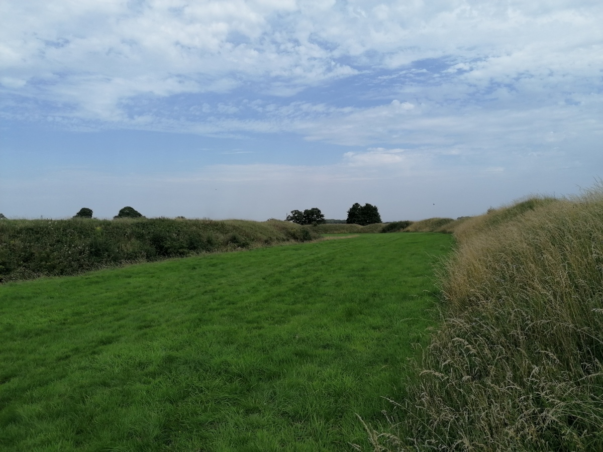
Old Sodbury submitted by TheCaptain on 4th Aug 2020. View east between the fortifications from the outer bank of Old Sodbury Camp
(View photo, vote or add a comment)
Log Text: Friday afternoon 10k walk, north from Old Sodbury along the Cotswold Edge through two ancient forts, past three old churches and lots of big houses to Horton Court. Back over fields through Little Sodbury. Stopped for a pint at the Dog afterwards.
Drakestone Camp
Date Added: 9th Sep 2020
Site Type: Misc. Earthwork
Country: England (Gloucestershire)
Visited: Yes on 23rd Aug 2020. My rating: Condition 2 Ambience 5 Access 3
Drakestone Camp submitted by 4clydesdale7 on 6th Jul 2011. One of the middle banks and ditches
(View photo, vote or add a comment)
Log Text: Walk round the Korea Friendship Trail from Dursley on a bright and breezy Sunday afternoon with a pint in the Old Spot afterwards. The views up here are tremendous, and with various other nearby viewpoints you get a full 360 degrees. Even on this not very clear day, as well as almost the entire length of the Cotswold Edge, I could make out the Mendip Hills, Bristol Channel, Black Mountains, Malvern Hills.
Hawkesbury Knoll
Date Added: 9th Sep 2020
Site Type: Long Barrow
Country: England (Gloucestershire)
Visited: Saw from a distance on 7th Aug 2020
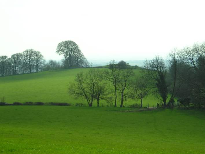
Hawkesbury Knoll submitted by TheCaptain on 15th Apr 2004. Hawksbury Knoll, Chambered Tomb, South Gloucestershire, ST768872.
The view of the barrow atop Hawkesbury Knoll from the Somerset Monument.
(View photo, vote or add a comment)
Log Text: Seen up on the top of the Cotswold Edge during a hot and humid Friday afternoon 11k walk, north from Hawkesbury Upton to the monument, then down the Cotswold Edge to Inglestone Common, south to Hawkesbury Common and on to Horton Court before going back up the Cotswold Edge and along the Cotswold Way andd "Yellow Brick Road" to Hawkesbury and a pint at the Beaufort Arms afterwards.
Haresfield Beacon and Ring
Date Added: 9th Sep 2020
Site Type: Hillfort
Country: England (Gloucestershire)
Visited: Yes on 31st Aug 2020. My rating: Condition 3 Ambience 5 Access 4
Haresfield Beacon and Ring submitted by 4clydesdale7 on 24th Jun 2011. From the same spot looking NNW over the inside of the Fort
(View photo, vote or add a comment)
Log Text: Walk around the Bruce Friendship Trail, which takes in the superb Haresfield Beacon with its remnants of promontory hillfort with a round tumulus at the western point, with a trig point on the top. Superb views over the Severn Vale
Haresfield Beacon tumulus
Date Added: 9th Sep 2020
Site Type: Round Barrow(s)
Country: England (Gloucestershire)
Visited: Yes on 31st Aug 2020. My rating: Condition 3 Ambience 5 Access 4

Haresfield Beacon tumulus submitted by TheCaptain on 3rd Sep 2020. The tumulus with trig point on top, at the western end of Haresfield Beacon.
(View photo, vote or add a comment)
Log Text: Walk around the Bruce Friendship Trail, which takes in the superb Haresfield Beacon with its remnants of promontory hillfort with a round tumulus at the western point, with a trig point on the top. Superb views over the Severn Vale
The Toots (Oldbury)
Date Added: 9th Sep 2020
Site Type: Hillfort
Country: England (Gloucestershire)
Visited: Yes on 3rd Jun 2020. My rating: Condition 3 Ambience 3 Access 4
The Toots (Oldbury) submitted by 4clydesdale7 on 4th Jul 2011. The best evidence of the Fort - the NNE rampart looking SE
(View photo, vote or add a comment)
Log Text: At the end of a walk along the Severn estuary and all round the old Oldbury Nuclear Powerstation, I walked back to Oldbury-on-Severn right through the Toots camp. Nice roadsign leading to it, and some information boards have now been put up in the village.
Oldbury-on-Severn Submerged Forest
Date Added: 9th Sep 2020
Site Type: Natural Stone / Erratic / Other Natural Feature
Country: England (Gloucestershire)
Visited: Saw from a distance on 3rd Jun 2020
Oldbury-on-Severn Submerged Forest submitted by 4clydesdale7 on 4th Jul 2011. As I stated like Atlantis risng
(View photo, vote or add a comment)
Log Text: It is now possible to walk all the way up the Severn Estuary past the tidal pool, and through the ex nuclear power station. Looking out at the tidal pool at low tide, all sorts of lumpy bumpy bits can be seen below the wall, quite possibly the remains of the petrified forest.
Shortwood Hill barrow
Date Added: 9th Sep 2020
Site Type: Round Barrow(s)
Country: England (Gloucestershire)
Visited: Yes on 30th May 2020. My rating: Condition 2 Ambience 2 Access 4

Shortwood Hill barrow submitted by TheCaptain on 30th May 2020. A long walk during the supposed lockdown (end May 2020) took me through this field and over the barrow for the first time in many years. Despite the field being cleared and shorn of vegetation, the barrow was more disappointing to see than I remembered.
(View photo, vote or add a comment)
Log Text: A long walk during the lockdown (end May 2020) took me through this field and over the barrow for the first time in many years. Despite the field being cleared and shorn of vegetation, the barrow was more disappointing to see than I remembered.
St Anne’s well (Siston)
Date Added: 9th Sep 2020
Site Type: Holy Well or Sacred Spring
Country: England (Gloucestershire)
Visited: Yes on 30th May 2020. My rating: Condition 2 Ambience 2 Access 5

St Anne’s well (Siston) submitted by TheCaptain on 30th May 2020. St Anne’s well (Siston), an open stone trough with a covering grate, right at the edge of the road. On the day of my visit, this was largely dry.
(View photo, vote or add a comment)
Log Text: Not to be confused with the hexagonal gothic wellhouse tower to the north of Siston Court, the real St Anne's well is found down by the stream beside the road, just to the north of the old bridge and on a very dangerous bend. Amongst other things, the water was supposed to be good for healing poor eyesight, and people travelled for miles to try the cure, which was still being publicised into the 1930's.
What there is to see today is an open stone trough, about 4 feet by 18 inches with a covering grate, right at the edge of the road rather like a big drain. On the day of my visit, this was largely dry.
Offa's Dyke at Tidenham Chase
Date Added: 9th Sep 2020
Site Type: Misc. Earthwork
Country: England (Gloucestershire)
Visited: Yes on 22nd Nov 2019. My rating: Condition 4 Ambience 4 Access 4
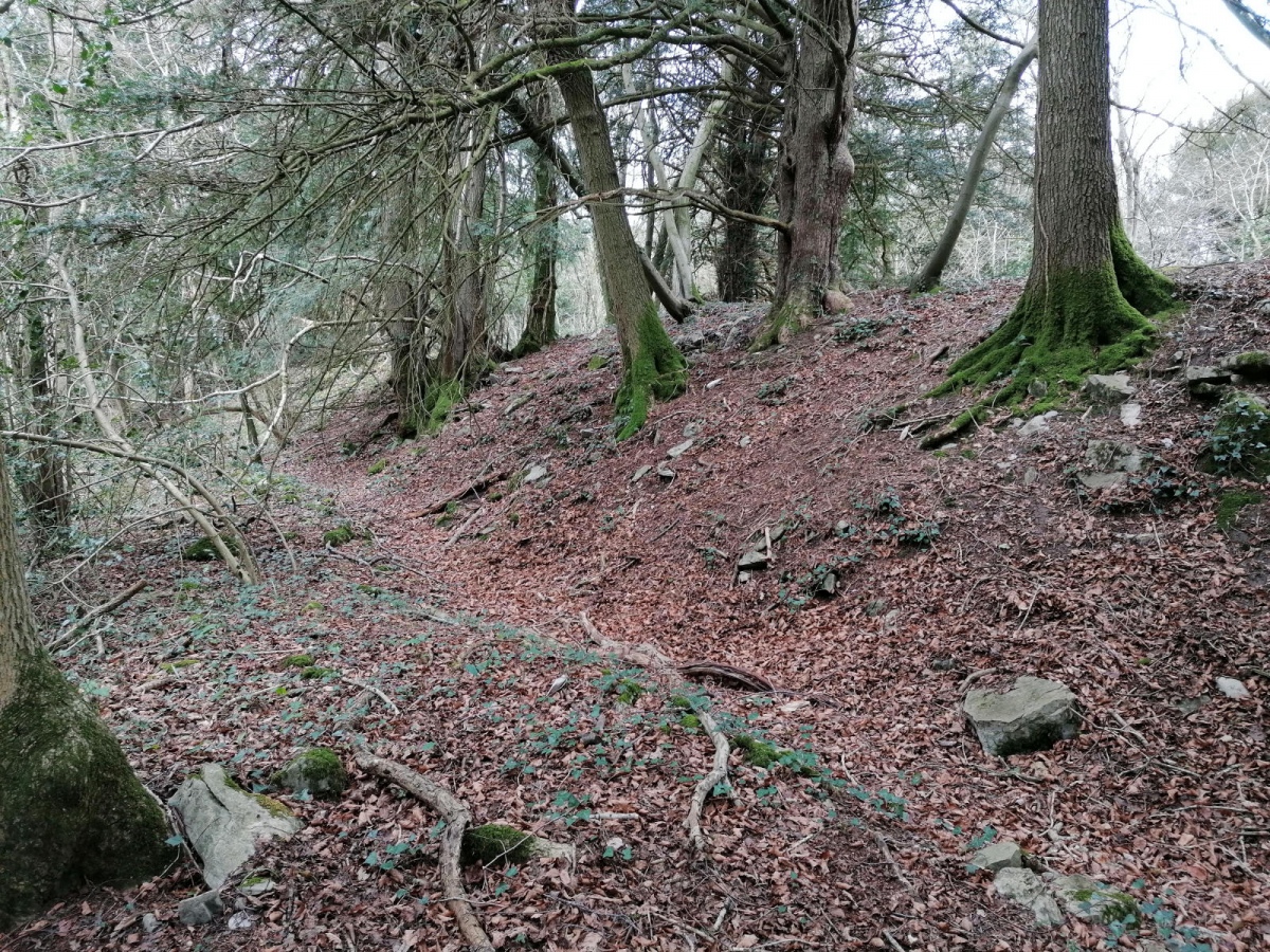
Offa's Dyke at Tidenham Chase submitted by TheCaptain on 7th Apr 2022. A walk up Offas Dyke from Chepstow to Brockweir, and not hammering down with rain this time, so I got a few snaps. The banks are not built as big as further north, but there is a lot of stone in the construction here, looking more like a wall in places.
(View photo, vote or add a comment)
Log Text: Well preserved and significantly built section of Offa's Dyke high up on the eastern side of the River Wye at Tidenham Chase. The Offa's Dyke path is well used here, and in places offers splendid views over the river to Wales, with options to walk north to the well known "Devil's Pulpit" rock stack allowing intrepid visitors a superb vista of Tintern Abbey. South leads to the rocky cliffs above the River Wye at Wintour's Leap.
Blackquarries Hill
Date Added: 13th Sep 2020
Site Type: Chambered Tomb
Country: England (Gloucestershire)
Visited: Yes on 13th Sep 2020. My rating: Condition 3 Ambience 3 Access 3
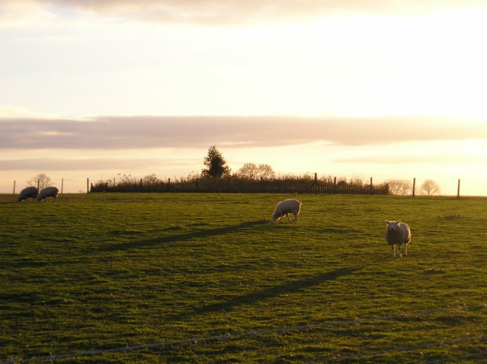
Blackquarries Hill submitted by thecaptain on 17th Nov 2004. Blackquarries Hill Long Barrow, seen here in the November evening sunlight from the northeast.
(View photo, vote or add a comment)
Log Text: Revisiting this part of the Cotswold Way, and the field around the long barrow has been opened up to the public with a stile, and an information board has been placed in front of the barrow. The fence and old tree stumps have been removed, although it is all still a very untidy heap!
Dyrham Camp
Date Added: 17th Oct 2020
Site Type: Hillfort
Country: England (Gloucestershire)
Visited: Yes on 9th Oct 2020
Dyrham Camp submitted by Thorgrim on 22nd Aug 2003. Dyrham Camp, otherwise known as Hinton Hillfort, is best seen from high land in Dyrham Park (National Trust) Dating from the Iron Age, it was the likely site of the Battle of Dyrham in 577 AD when the Anglo-Saxon Chronicle tells us that the invading Saxons under "Cuthwine and Ceawlin fought against the Britons and slew three kings, Coinmail, Condidan and Farimail at the place which is called Dyrham; and they captured three cities, Gloucester, Cirencester and Bath"
(View photo, vote or add a comment)
Log Text: Walking a loop on the Cotswold Way around Dyrham and Tormarton, see Hinton Hillfort from the southern side in the fading autumn sunlight.
Brackenbury Ditches
Date Added: 25th Apr 2021
Site Type: Promontory Fort / Cliff Castle
Country: England (Gloucestershire)
Visited: Yes on 24th Apr 2021. My rating: Condition 3 Ambience 5 Access 3
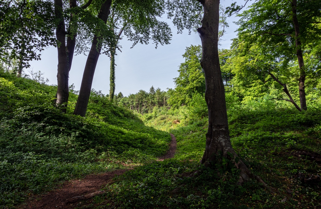
Brackenbury Ditches submitted by Humbucker on 16th Jun 2020. The footpath along the ridge of The West Woods follows the ramparts to Brackenbury Ditches on this section from North Nibley to Wotton Under Edge.
(View photo, vote or add a comment)
Log Text: Beautiful sunny morning walk from Wotton-under-Edge, up and over to Waterley Bottom down the valley to join the Cotswold Way and head up through North Nibley and up the steep Cotswold Edge to the Tyndale Monument. Then all along the edge of the hills, through beautiful bluebell, wild garlic and anemone filled woods, taking in the atmospheric old iron age fort of Brackenbury Ditches before out into the open above Wotton, dropping steeply down into the town for a pint in The Star.
Cranham Corner Earthworks
Date Added: 10th Jun 2021
Site Type: Misc. Earthwork
Country: England (Gloucestershire)
Visited: Yes on 31st May 2021. My rating: Condition 3 Ambience 3 Access 4
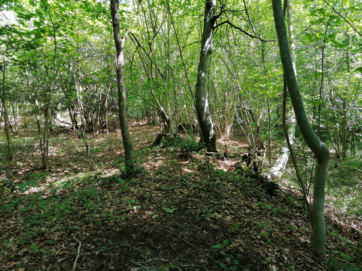
Cranham Corner Earthworks submitted by TheCaptain on 10th Jun 2021. Small earthworks within the woodland at Cranham Corner.
I am not convinced they would have been of much use defensively, being on a slight slope not at the top of the hill, and not very large.
(View photo, vote or add a comment)
Log Text: Walking a Cooper's Hill Circuit of the Cotswold Way from Cranham, and first off had a look at these small earthworks. I am not convinced they would have been of much use defensively, being on a slight slope not at the top of the hill, and not very large.
Tile Well
Date Added: 10th Jun 2021
Site Type: Holy Well or Sacred Spring
Country: England (Gloucestershire)
Visited: Yes on 31st May 2021. My rating: Ambience 4 Access 3
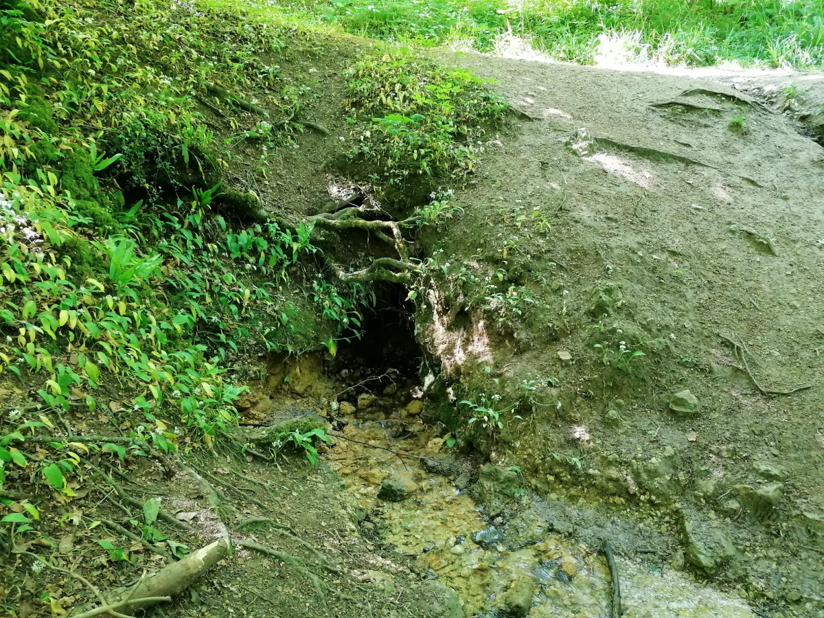
Tile Well submitted by TheCaptain on 10th Jun 2021. Partway down the north facing hillside above the Roman Villa, is found this gushing source of crystal clear water, seemingly appearing from under the tree roots.
(View photo, vote or add a comment)
Log Text: Walking a Cooper's Hill Circuit of the Cotswold Way from Cranham, and partway down the north facing scarp, above the Roman Villa, is found this gushing source of crystal clear water, which can be heard from a fairly large distance today.
High Brotheridge
Date Added: 10th Jun 2021
Site Type: Misc. Earthwork
Country: England (Gloucestershire)
Visited: Yes on 31st May 2021. My rating: Condition 2 Ambience 3 Access 3
High Brotheridge submitted by 4clydesdale7 on 7th Jul 2014. Inturned Banks at S Entrance
(View photo, vote or add a comment)
Log Text: Walking a Cooper's Hill Circuit of the Cotswold Way from Cranham, and passed around the western edge of this massive hilltop settlement with various bits and pieces of defensive ramparts to be seen.
West Tump
Date Added: 10th Jun 2021
Site Type: Long Barrow
Country: England (Gloucestershire)
Visited: Yes on 31st May 2021. My rating: Condition 3 Ambience 4 Access 4
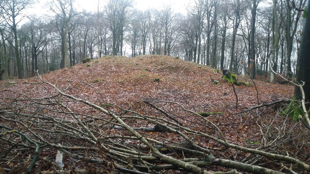
West Tump submitted by Dabberdave on 15th Jan 2017. West Tump long barrow after recent tree clearance.
(View photo, vote or add a comment)
Log Text: Walking a Cooper's Hill Circuit of the Cotswold Way from Cranham, and on the way back to Cranham I made a diversion into the woods to find this long barrow. It’s a massive lump, now mostly cleared of trees, and built in an east to west sense, significantly bigger at the eastern end, which was no doubt the main entrance.
Crippet's Barrow
Date Added: 11th Jun 2021
Site Type: Chambered Tomb
Country: England (Gloucestershire)
Visited: Yes on 8th Jun 2021. My rating: Condition 3 Ambience 3 Access 3
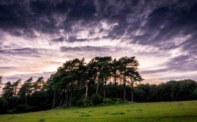
Crippet's Barrow submitted by Humbucker on 17th Mar 2018. Crippet's / Shurdington Long Barrow from the south east. I visited late afternoon in the Autumn of 2017. I had heard of very inquisitive horses in the field, but it was empty when I visited.
(View photo, vote or add a comment)
Log Text: Walking the Cotswold Way north from Crickley Hill, and I forgot to keep a look out for Crippet's Long Barrow, but at this point the footpath and separate bridleway are well fenced in, so I wouldn't have been able to get to the edge of the woodlands at the top of the hill to have a look anyway. I later got a long distance view from near the radio masts and reservoir entrance, just about making out the large barrow in its tree covered setting.
Birdlip Camp
Date Added: 11th Jun 2021
Site Type: Hillfort
Country: England (Gloucestershire)
Visited: Yes on 8th Jun 2021. My rating: Condition 2 Ambience 4 Access 3
Birdlip Camp submitted by 4clydesdale7 on 30th Apr 2013. S end of the Outer Bank and Ditch - the line is just discernible and proceeds from middle foreground towards the skyline and then off to the top left corner
(View photo, vote or add a comment)
Log Text: Walking the Cotswold Way north from Birdlip and the sharply pointed headland has slight remnants of a ditch and banks across the neck in these beautiful woodlands.
