Contributory members are able to log private notes and comments about each site
Sites TheCaptain has logged. View this log as a table or view the most recent logs from everyone
Crucuny Cromlech
Trip No.203 Entry No.373 Date Added: 11th May 2020
Site Type: Stone Circle
Country: France (Bretagne:Morbihan (56))
Visited: Yes on 12th Jun 2005. My rating: Condition 3 Ambience 3 Access 5
Crucuny Cromlech submitted by TheCaptain on 9th Nov 2010. To the south of the hamlet of Crucuny, this ancient cromlech is now incorporated into a semicircular wall.
There are several big stones to be seen, with smaller ones in between them, which in places are almost contiguous.
(View photo, vote or add a comment)
Log Text: To the south of the hamlet of Crucuny, and marked on my map as a menhir, this ancient cromlech is now incorporated into a semicircular wall. There are several big stones to be seen, with smaller ones in between them, which in places are almost contiguous.
Crucuny tumulus
Trip No.203 Entry No.371 Date Added: 11th May 2020
Site Type: Long Barrow
Country: France (Bretagne:Morbihan (56))
Visited: Yes on 12th Jun 2005. My rating: Condition 3 Ambience 3 Access 5

Crucuny tumulus submitted by thecaptain on 10th Jun 2006. This is a large mound, over 50 metres long, 25 metres wide and 13 metres high, to be seen just to the north of the Crucuny hamlet, but all very overgrown and covered in gorse.
The road partially goes over the mound.
(View photo, vote or add a comment)
Log Text: There is a large mound, 50 metres long and 13 metres high, to be seen just to the north of the hamlet, but all very overgrown and covered in gorse. On top of the tumulus is a menhir, 2.8 metres tall, with axes carved on it.
Crug Hywel
Date Added: 18th Sep 2010
Site Type: Hillfort
Country: Wales (Powys)
Visited: Yes on 7th May 2004

Crug Hywel submitted by TheCaptain on 7th May 2004. Crug Hywel, Hillfort in Powys, SO226207
While on a stone hunting day in and around the Black Mountains, the murk on the hills cleared enough for me to get this picture of the Crug Hywel, or Table Mountain fort from near the Llangenny Stones - which I didnt find.
(View photo, vote or add a comment)
Log Text: None
Cruz Menquen dolmen
Trip No.203 Entry No.384 Date Added: 11th May 2020
Site Type: Burial Chamber or Dolmen
Country: France (Bretagne:Morbihan (56))
Visited: Yes on 12th Jun 2005. My rating: Condition 3 Ambience 3 Access 5
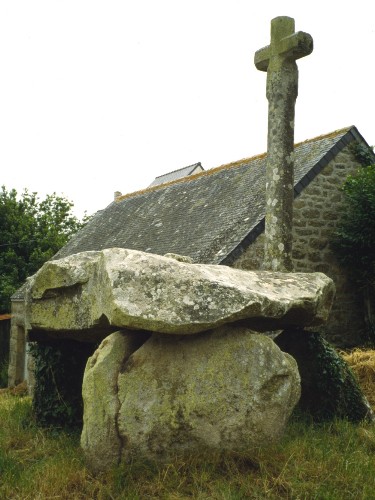
Cruz Menquen dolmen submitted by greywether on 28th Jun 2005.
(View photo, vote or add a comment)
Log Text: In amongst the homes near to the sports facilities to the north of the town is Carnac's own dolmen. It is a small affair, with a 2.5 m by 2 metre capstone mounted on three support stones. On top of the capstone has been mounted a large, 2.5 metre tall cross.
Cul Blanc Dolmens
Trip No.204 Entry No.205 Date Added: 27th Aug 2020
Site Type: Burial Chamber or Dolmen
Country: France (Bourgogne:Saône-et-Loire (71))
Visited: Yes on 3rd May 2005. My rating: Condition 3 Ambience 3 Access 5
Cul Blanc dolmens submitted by thecaptain on 16th Sep 2006. Cul Blanc dolmen 2.
The second dolmen is about 40 metres further down the hillside, and still completely within its mound, making it very difficult to see amongst the bushes.
(View photo, vote or add a comment)
Log Text: Cul Blanc 1: Still within most of its tumulus, this dolmen is on the northern slopes of Mont des Troix Croix, high up above the village of Dezize-les-Maranges at a junction of the tracks. The circular mound is about 15 metres in diameter, and the dolmen is in the middle. The chamber is about 2.5 metres in length by 1.3 metres wide, open to the south and covered with a triangular limestone capstone, of dimensions 3m by 3m by 3m. It was very difficult to find my way to, lots of roads shut for maintenance, and a complete absence of any signs except for all the local vineyards. Supposedly one of two dolmens here.
Cul Blanc 2: Ah, yes, here it is. The second one is about 40 metres further down the hillside, and still completely within its mound, making it very difficult to see amongst the bushes. Probably similar to the first dolmen, the chamber cannot be seen, just the top of the capstone is exposed.
Cullerlie
Date Added: 29th Oct 2019
Site Type: Stone Circle
Country: Scotland (Aberdeenshire)
Visited: Yes on 3rd Aug 2017
Cullerlie submitted by TheCaptain on 3rd Aug 2017. Cullerlie. There is a little parking area with noticeboard, and a tree lined avenue leading out to the circle
(View photo, vote or add a comment)
Log Text: None
Curton Dolmen
Trip No.203 Entry No.225 Date Added: 21st Apr 2020
Site Type: Burial Chamber or Dolmen
Country: France (Aquitaine:Gironde (33))
Visited: Yes on 2nd Jun 2005. My rating: Condition 3 Ambience 3 Access 4
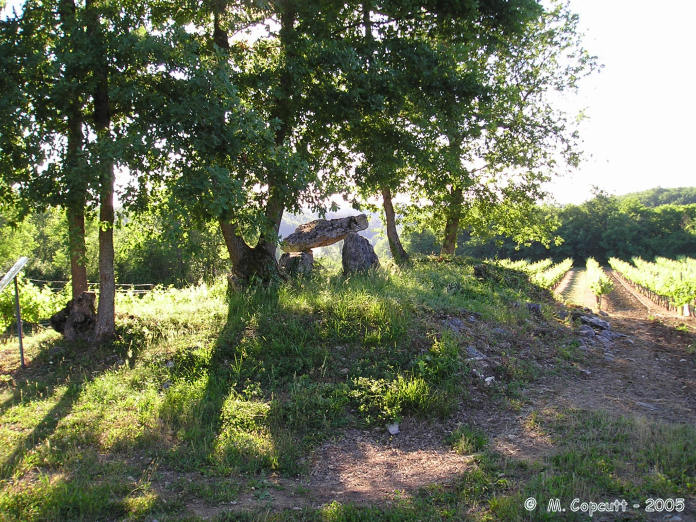
Curton Dolmen submitted by thecaptain on 10th Jan 2006. This is a little allée couverte on the reducing remains of its mound, which has been ploughed right up to the edges and surrounded by vines.
(View photo, vote or add a comment)
Log Text: As I was driving towards Bellefond I saw a sign to Dolmen de Curton so I had to follow it but it’s a pity the large signs do not follow the one at the road junction up. There are one or two very small signs after this which I at first missed and these lead into a vineyard before they give up totally. Following the track on by foot for about 600 metres and you eventually reach the dolmen.
It is a little allée couverte on the reducing remains of its mound which has been ploughed right up to the edges and surrounded by vines. There are some nasty crackling power lines right overhead. One capstone remains on the two rows of sidestones which can be traced for about 8 metres facing an orientation of 110°. The end stone has some strange markings on it several short straight lines and a few horseshoe shapes but they are difficult to make out. Apparently 8 bodies were found within it when the chamber was excavated in 1904.
Custalou Dolmen
Trip No.203 Entry No.146 Date Added: 10th Apr 2020
Site Type: Burial Chamber or Dolmen
Country: France (Midi:Lot (46))
Visited: Yes on 24th May 2005. My rating: Condition 3 Ambience 3 Access 3
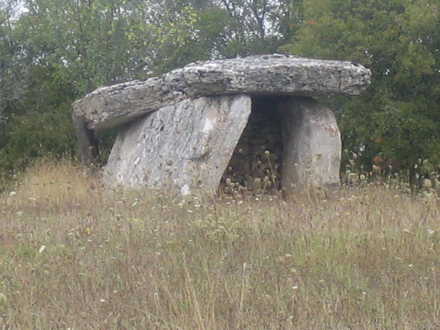
Custalou Dolmen submitted by MichelDRN on 12th Oct 2005. Custalou Dolmen France Mid-Lot (46) 610m SW from Grezes Church.
(View photo, vote or add a comment)
Log Text: This is a nice looking dolmen in a field beside a farm near the village of Grèzes, although there was no obvious way in to the field to the dolmen itself. It looks quite large compared to most dolmens in this area, the capstone is unfortunately broken into three pieces, held up on two large side slabs. It has a back stone and the chamber opens to the east.
Cut Hill Stone Row
Date Added: 30th Apr 2022
Site Type: Stone Row / Alignment
Country: England (Devon)
Visited: Would like to visit
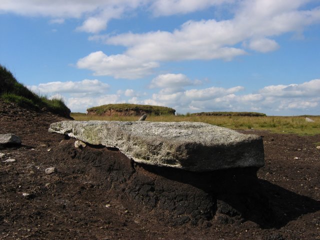
Cut Hill Stone Row submitted by Andy B on 10th Apr 2010. Granite Stone Row
Here is the roof of Dartmoor, from the top you can see right all across Dartmoor. In the picture is a piece of granite probably Megalithic in age and is in a series of stones running along the top of this hill. This row is unique within Dartmoor as it the only one with equal spacing within the row and above 600m, 100m above any other row in Dartmoor. The peat has washed away from around the stone but not from underneath, meaning the granite sticks out above the ground.
C...
(View photo, vote or add a comment)
Cwrt-y-Gollen
Date Added: 18th Sep 2010
Site Type: Standing Stone (Menhir)
Country: Wales (Powys)
Visited: Yes on 6th May 2004
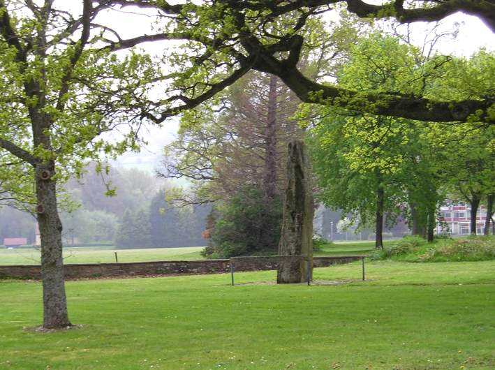
Cwrt-y-Gollen submitted by thecaptain on 6th May 2004. Cwrt-y-Gollen, Standing Stone in Powys, SO232168
This magnificent standing stone lives beside the busy A40 just inside the entrance to the Welsh Brigade army camp just to the south of Crickhowell. Over 4 metres high, “The Growing Stone” looks most impressive, and has a pleasant grass and trees area around it.
(View photo, vote or add a comment)
Log Text: None
Danbury
Date Added: 29th Oct 2019
Site Type: Hillfort
Country: England (Essex)
Visited: Yes on 4th Nov 2016
Danbury submitted by TheCaptain on 4th Nov 2016. Upon visiting the site, there is a noticeboard giving some details, including the information that there is very little of the earthworks left to be seen.
(View photo, vote or add a comment)
Log Text: None
Dane John Mound
Date Added: 29th Oct 2019
Site Type: Artificial Mound
Country: England (Kent)
Visited: Yes on 12th Oct 2018
Dane John Mound submitted by TheCaptain on 12th Oct 2018. At the southern corner of the Canterbury city walls is a large mound, known as the Dane John Mound.
When the Romans built the Canterbury City walls, they were arranged to incorporate an ancient mound, thought to be a large burial mound within a barrow cemetary.
(View photo, vote or add a comment)
Log Text: None
Danebury Ring
Date Added: 19th Jul 2012
Site Type: Hillfort
Country: England (Hampshire)
Visited: Yes on 1st Jan 2005. My rating: Condition 4 Ambience 4 Access 4
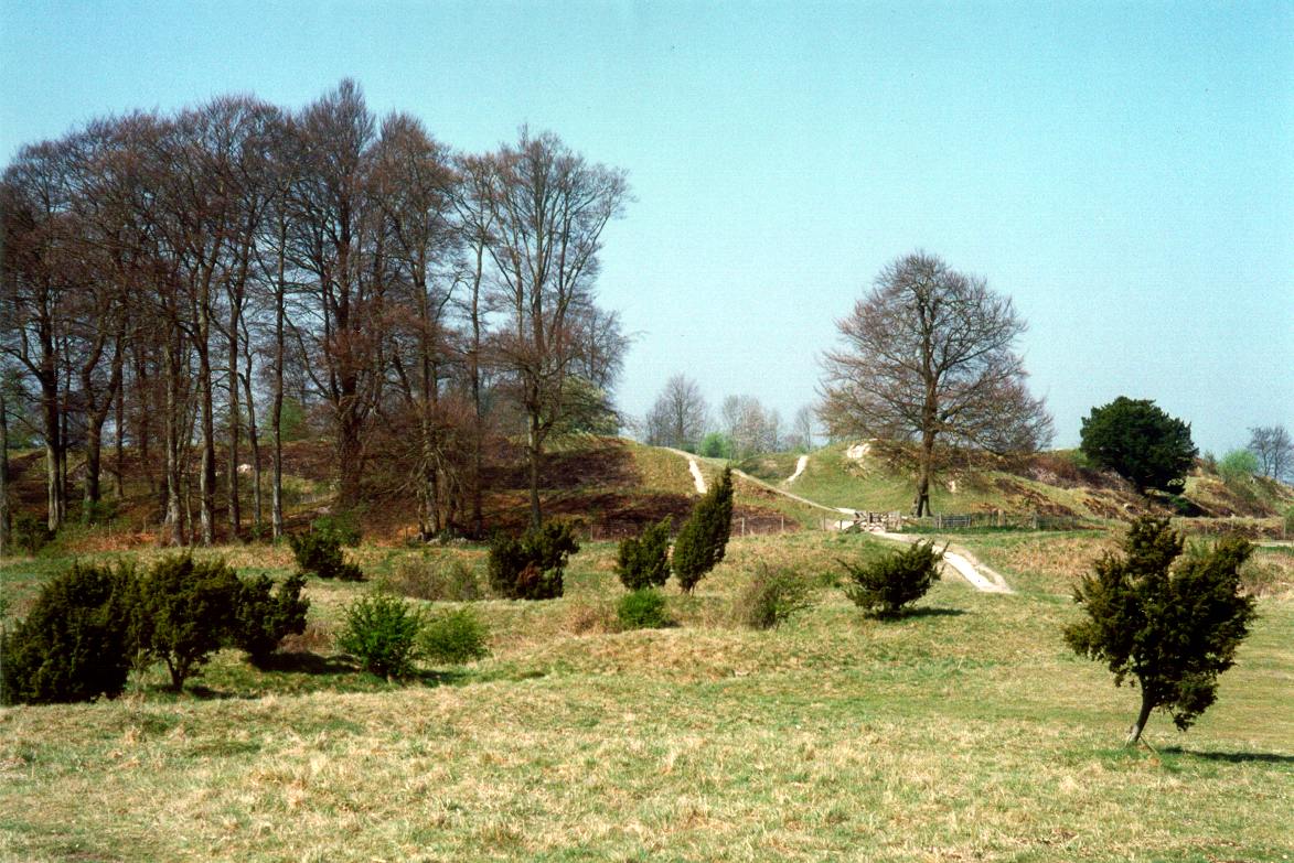
Danebury Ring submitted by Jimit on 19th Feb 2004. Danebury Hill Fort - the main entrance defensive works.
(View photo, vote or add a comment)
Log Text: None
Delford Bridge
Date Added: 29th Oct 2019
Site Type: Standing Stone (Menhir)
Country: England (Cornwall)
Visited: Yes on 23rd Jan 2014

Delford Bridge submitted by theCaptain on 23rd Jan 2014. A stone can be seen standing on top of a small raise in the field to the southwest of the lovely Delford Bridge.
(View photo, vote or add a comment)
Log Text: None
Demoiselles de Langon
Trip No.203 Entry No.14 Date Added: 30th Mar 2020
Site Type: Stone Row / Alignment
Country: France (Bretagne:Ille-et-Vilaine (35))
Visited: Yes on 13th May 2005. My rating: Condition 3 Ambience 4 Access 5
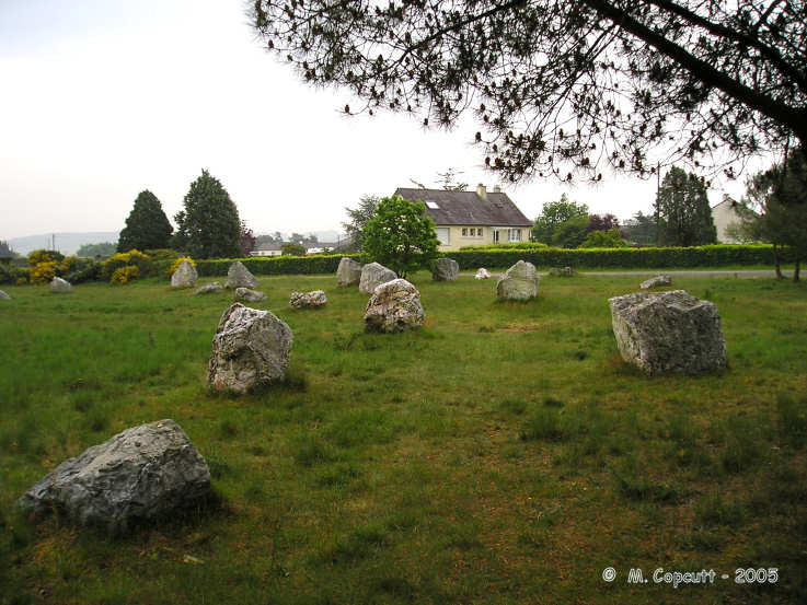
Demoiselles de Langon submitted by thecaptain on 17th Nov 2005. Les Demoiselles de Langon.
Near to the stadium in the village of Langon, these alignements consist of between 30 and 40 white quartz stone blocks in a field.
(View photo, vote or add a comment)
Log Text: Found near to the stadium in the village of Langon and signposted from the main street These alignements consist of between 30 and 40 white quartz stone blocks in a field. Though I have read somewhere about them being arranged in two rows this most definitely isn’t the case. I have also read about them being astronomically aligned but to me they seem quite randomly scattered about! Many intersecting lines of 4 or 5 stones perhaps but nothing obvious. It would be nice to see a plan of this place to see if I could make more sense of the stones. There are probably many more stones that have been removed or are hiding in people’s gardens or under hedges.
Demoiselles Piquées
Trip No.203 Entry No.4 Date Added: 30th Mar 2020
Site Type: Stone Row / Alignment
Country: France (Bretagne:Ille-et-Vilaine (35))
Visited: Yes on 13th May 2005. My rating: Condition 3 Ambience 3 Access 4
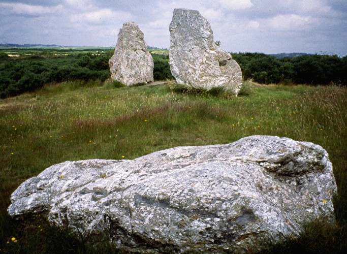
Demoiselles Piquées submitted by greywether on 27th Jun 2005. Showing all three stones.
(View photo, vote or add a comment)
Log Text: Three large white quartz menhirs one now fallen. The stone of the westernmost menhir is a really lovely thing with all sorts of coloured patterns and swirls within it.
Dent de Gargantua
Trip No.208 Entry No.1 Date Added: 10th Jun 2020
Site Type: Standing Stone (Menhir)
Country: France (Bretagne:Ille-et-Vilaine (35))
Visited: Yes on 20th Mar 2008. My rating: Condition 4 Ambience 3 Access 5
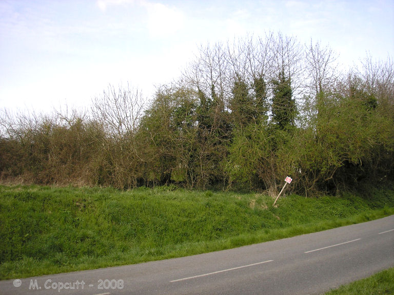
Dent de Gargantua submitted by thecaptain on 6th Apr 2008. Le Dent de Gargantua. The view from the roadside. It's in there, honestly !
(View photo, vote or add a comment)
Log Text: This 4 or 5 metre tall white quartz menhir is contained within a private orchard near to Chablé in the community of St Suliac, near the Rance estuary south of St Malo. Although it is very close to the road, getting to see it through the hedges which surround it is not easy. Not too long ago, there was an allée couverte nearby which has now been destroyed by the farmer, and also another menhir, Le Gravier de Gargantua.
Desborough Castle
Date Added: 18th Sep 2010
Site Type: Hillfort
Country: England (Buckinghamshire)
Visited: Yes on 29th Mar 2004
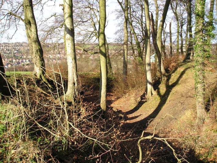
Desborough Castle submitted by TheCaptain on 29th Mar 2004. Desborough Castle, High Wycombe, Buckinghamshire, SU846934.
View of the main ramparts, thought to have been much modified, or constructed during medieval times.
(View photo, vote or add a comment)
Log Text: None
Devil's Arrows
Date Added: 7th Jun 2022
Site Type: Stone Row / Alignment
Country: England (Yorkshire (North))
Visited: Yes on 13th May 2022. My rating: Condition 5 Ambience 4 Access 5
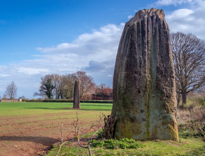
Devil's Arrows submitted by Humbucker on 27th Apr 2019. All three Devils Arrows looking from the north. The light improved for a brief few minutes & the sun made a brief appearance while I was there before turning into a flat, grey evening.
(View photo, vote or add a comment)
Log Text: Its not too far from York, so I went for a look at the Devil's Arrows, which were easy to find. Despite a new housing estate now encroaching and the very nearby A1 and A1(M), these are still at large in fields and feel wild and free. All three stones are magnificent and monsters with interesting rainules running down them. Magnificent.
Devils Den
Date Added: 8th Oct 2020
Site Type: Burial Chamber or Dolmen
Country: England (Wiltshire)
Visited: Yes on 16th Sep 2007. My rating: Condition 3 Ambience 3 Access 4
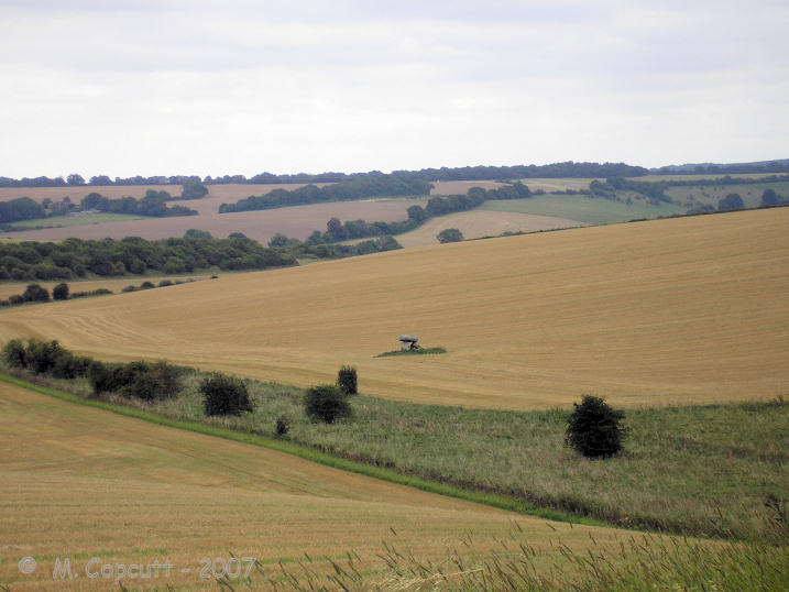
Devils Den submitted by thecaptain on 18th Sep 2007. The view of Devil's Den in its landscape.
As seen from the pathway down from the ridge from the northeast.
(View photo, vote or add a comment)
Log Text: As I was driving westwards along the A4 Sunday afternoon, I decided to stop in at the Devils Den for a look round, having not been there for many years - the stony delights a bit further west usually taking my attention. Knowing it is difficult to park on the A4 in order to walk up the track from Clatford Bottom, I decided to take the little road to the north, I believe towards Manstone farm, where there is a fairly large car park near to the racing stables. From there it is a pleasant walk along the ridge before dropping down into the valley where the Devils Den resides, with some nice views over the site as a whole to be had on the way (it always strikes me what a strange place this is for such a monument, low down in the valley like it is).
Unfortunately, when down on the overgrown trackway along the sarsen scattered valley bottom, there was no way into the field of the dolmen, with fences, nettles and much scrub preventing access to its field. Even getting to a point quite close by is not recommended in shorts - quite a painful experience ! I can only assume that the landowners are perhaps letting a fairly large strip of land become completely overgrown in order to deter people from clambering over the fences to go for a closer look.
