Contributory members are able to log private notes and comments about each site
Sites TheCaptain has logged. View this log as a table or view the most recent logs from everyone
Laughter Tor Longstone
Date Added: 27th Sep 2020
Site Type: Standing Stone (Menhir)
Country: England (Devon)
Visited: Yes on 18th Sep 2020. My rating: Condition 4 Ambience 4 Access 3
Laughter Tor Longstone submitted by cazzyjane on 24th Jul 2014. Laughter Man on Laughter Tor.
(View photo, vote or add a comment)
Log Text: The longstone is a lovely thing, although it has supposedly been re-erected facing the wrong way, as it does not aligned either with or against the row. Its almost 2.5 metres tall, and the views south are gorgeous, and I can see my car from here, so not far back now. Checking on the time, and I decide not to go to the top of Laughter tor, as it is lower than Bellever Tor, and the views from there cannot be much better than from here.
Laughter Tor row 2
Date Added: 27th Sep 2020
Site Type: Multiple Stone Rows / Avenue
Country: England (Devon)
Visited: Yes on 18th Sep 2020. My rating: Condition 2 Ambience 3 Access 3
Laughter Tor row 2 submitted by SandyG on 25th Jan 2019. View from above and north west of the row and standing stone at the top of Laughter Tor 1 (Scales 1m).
(View photo, vote or add a comment)
Log Text: Before leaving, I remember that there is supposedly the small remnants of another double stone row to be found a bit west of the longstone, but am not expecting to find them under the vegetation. However, before I even start my search, there they are, much nearer than I expected, and once again the ground around them has been roughly cleared. I find about half a dozen pairs of tiny stones, clearly not in alignment with either the longstone or the other stone row. Their size and spacing reminds me of Porlock row on Exmoor more than a typical Dartmoor avenue. Well that was an unexpected positive result!
Dunnabridge Pound
Date Added: 27th Sep 2020
Site Type: Ancient Village or Settlement
Country: England (Devon)
Visited: Yes on 18th Sep 2020. My rating: Condition 4 Ambience 3 Access 5
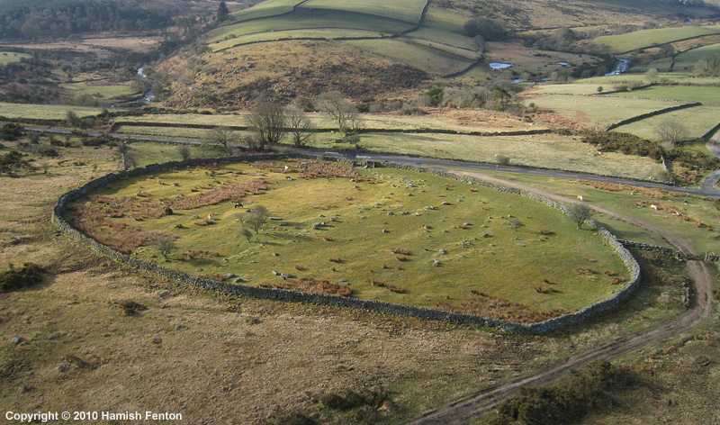
Dunnabridge Pound submitted by h_fenton on 27th Apr 2010. Dunnabridge Pound from the air.
Kite Aerial Photograph
7 April 2010 @ 9am
(View photo, vote or add a comment)
Log Text: Now I can head back down the hillside on a decent track to Dunnabridge, passing what are probably interesting remains of Brimpts Mine, which on another less tired time I would go and explore! Once down and before walking up the road to the car park, I decide for a quick look in Dunnabridge Pound with the Judge's Chair, which once more is in dark shadow.
I get back to the car at 5:15 after walking 14.3 km and ascending 337 m of vertical, now slightly regretting cutting off the northernmost part of the walk to Postbridge, as it is so much easier on the made tracks. A damn good day out, my back and legs have been working well. Now for a pint at the Warren House Inn where I sit taking in the beautiful views over to Grimspound. Thats a walk for another day.
Blackquarries Hill
Date Added: 13th Sep 2020
Site Type: Chambered Tomb
Country: England (Gloucestershire)
Visited: Yes on 13th Sep 2020. My rating: Condition 3 Ambience 3 Access 3
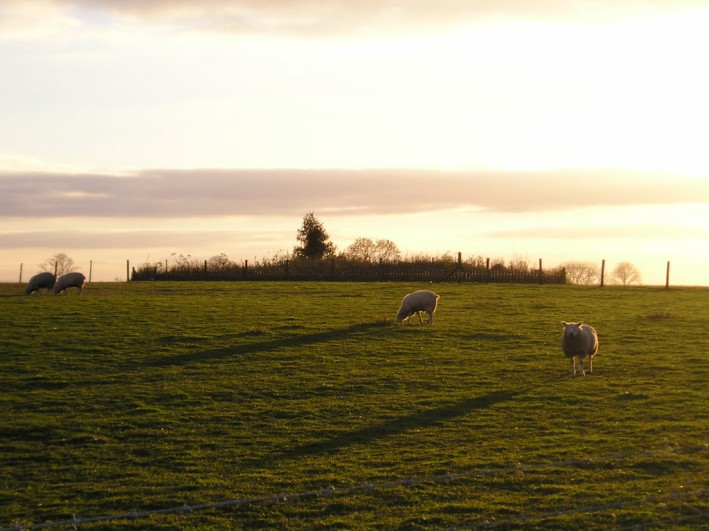
Blackquarries Hill submitted by thecaptain on 17th Nov 2004. Blackquarries Hill Long Barrow, seen here in the November evening sunlight from the northeast.
(View photo, vote or add a comment)
Log Text: Revisiting this part of the Cotswold Way, and the field around the long barrow has been opened up to the public with a stile, and an information board has been placed in front of the barrow. The fence and old tree stumps have been removed, although it is all still a very untidy heap!
Forresters' Oaks Round Barrow
Date Added: 9th Sep 2020
Site Type: Round Barrow(s)
Country: Wales (Monmouthshire)
Visited: Yes on 5th Sep 2020. My rating: Condition 2 Ambience 3 Access 4
Forresters' Oaks Round Barrow submitted by thehappydruid on 11th Aug 2020. Forresters' Oaks Round Barrow
(View photo, vote or add a comment)
Log Text: Breezy but sunny afternoon walk up Gray Hill to check out the old stones, then a walk around Wentwood Forest. Just before the end of the walk, this round barrow can be found, with views up to Gray Hill.
Gray Hill circle
Date Added: 9th Sep 2020
Site Type: Stone Circle
Country: Wales (Monmouthshire)
Visited: Yes on 5th Sep 2020. My rating: Condition 3 Ambience 4 Access 3
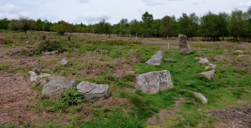
Gray Hill circle submitted by SandyG on 6th Jan 2019. Kerbed cairn/stone circle and stone 6. View from south west (Scale 1m).
(View photo, vote or add a comment)
Log Text: Breezy but sunny afternoon walk up Gray Hill to check out the old stones, then a walk around Wentwood Forest. Much of the top of the hill has become very overgrown, and it was initially difficult to find the stone row leading down to the circle. I disturbed at least three fallow deer on my way through. However, the bracken and gorse on the slopes around the stones is mostly cleared, so it was easy to find the big stones of the row, and the circle beside the lower of the big stones, although most of the circle is well overgrown with brambles bracken and gorse, and my legs got ripped to shreds.
Gray Hill stone row
Date Added: 9th Sep 2020
Site Type: Standing Stone (Menhir)
Country: Wales (Monmouthshire)
Visited: Yes on 5th Sep 2020. My rating: Condition 3 Ambience 4 Access 3
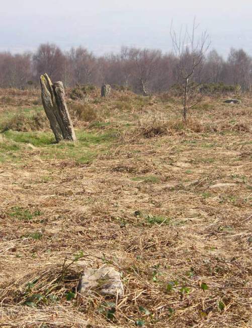
Gray Hill stone row submitted by TheCaptain on 2nd Apr 2004. Grey Hill or Gray Hill Stone Row, Monmouthshire, ST437936 - ST438935
Looking to the south down the hill, is a fairly reasonable alignment of 5 stones in a row, which sort of joins between the jumbled stone remains on the top of the hill and the stone circle.
(View photo, vote or add a comment)
Log Text: Breezy but sunny afternoon walk up Gray Hill to check out the old stones, then a walk around Wentwood Forest. Much of the top of the hill has become very overgrown, and it was initially difficult to find the stone row leading down to the circle. I disturbed at least three fallow deer on my way through. However, the bracken and gorse on the slopes around the stones is mostly cleared, so it was easy to find the big stones of the row, and two of the stumps.
Gray Hill summit cairn
Date Added: 9th Sep 2020
Site Type: Round Cairn
Country: Wales (Monmouthshire)
Visited: Yes on 5th Sep 2020. My rating: Condition 2 Ambience 5 Access 3
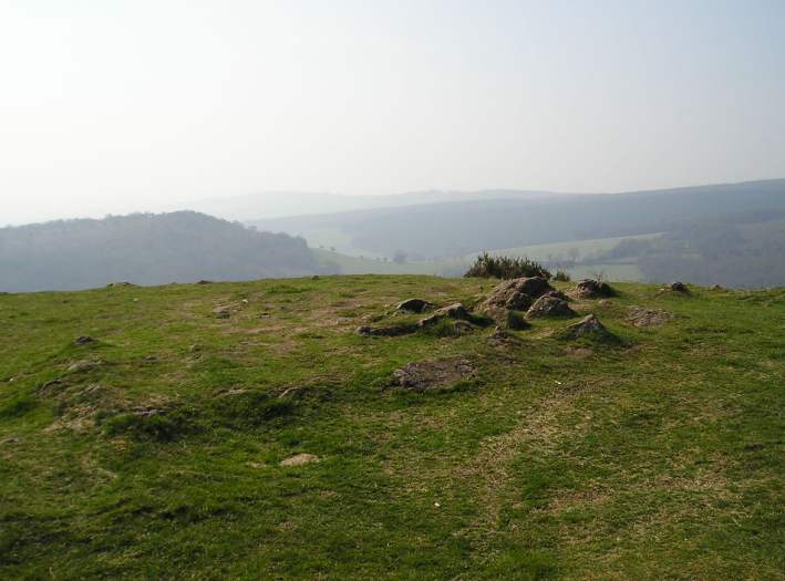
Gray Hill summit cairn submitted by TheCaptain on 2nd Apr 2004. Grey Hill or Gray Hill, Monmouthshire. Cairn atop hill at ST434936
Right on the top of the hill, with spectacular views all around is the remains of an ancient, but well worn cairn. I could have been imagining it, but did this cairn once have a kerbed ring around it, and some internal structures ?
(View photo, vote or add a comment)
Log Text: Breezy but sunny afternoon walk up Gray Hill to check out the old stones, then a walk around Wentwood Forest. Beautiful views all around from the cairn at the top of the hill
Haresfield Beacon and Ring
Date Added: 9th Sep 2020
Site Type: Hillfort
Country: England (Gloucestershire)
Visited: Yes on 31st Aug 2020. My rating: Condition 3 Ambience 5 Access 4
Haresfield Beacon and Ring submitted by 4clydesdale7 on 24th Jun 2011. From the same spot looking NNW over the inside of the Fort
(View photo, vote or add a comment)
Log Text: Walk around the Bruce Friendship Trail, which takes in the superb Haresfield Beacon with its remnants of promontory hillfort with a round tumulus at the western point, with a trig point on the top. Superb views over the Severn Vale
Haresfield Beacon tumulus
Date Added: 9th Sep 2020
Site Type: Round Barrow(s)
Country: England (Gloucestershire)
Visited: Yes on 31st Aug 2020. My rating: Condition 3 Ambience 5 Access 4

Haresfield Beacon tumulus submitted by TheCaptain on 3rd Sep 2020. The tumulus with trig point on top, at the western end of Haresfield Beacon.
(View photo, vote or add a comment)
Log Text: Walk around the Bruce Friendship Trail, which takes in the superb Haresfield Beacon with its remnants of promontory hillfort with a round tumulus at the western point, with a trig point on the top. Superb views over the Severn Vale
Drakestone Camp
Date Added: 9th Sep 2020
Site Type: Misc. Earthwork
Country: England (Gloucestershire)
Visited: Yes on 23rd Aug 2020. My rating: Condition 2 Ambience 5 Access 3
Drakestone Camp submitted by 4clydesdale7 on 6th Jul 2011. One of the middle banks and ditches
(View photo, vote or add a comment)
Log Text: Walk round the Korea Friendship Trail from Dursley on a bright and breezy Sunday afternoon with a pint in the Old Spot afterwards. The views up here are tremendous, and with various other nearby viewpoints you get a full 360 degrees. Even on this not very clear day, as well as almost the entire length of the Cotswold Edge, I could make out the Mendip Hills, Bristol Channel, Black Mountains, Malvern Hills.
Hawkesbury Knoll
Date Added: 9th Sep 2020
Site Type: Long Barrow
Country: England (Gloucestershire)
Visited: Saw from a distance on 7th Aug 2020
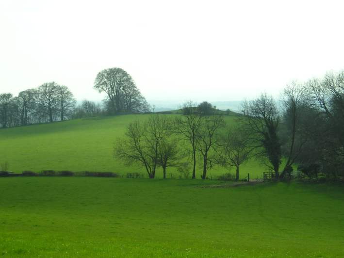
Hawkesbury Knoll submitted by TheCaptain on 15th Apr 2004. Hawksbury Knoll, Chambered Tomb, South Gloucestershire, ST768872.
The view of the barrow atop Hawkesbury Knoll from the Somerset Monument.
(View photo, vote or add a comment)
Log Text: Seen up on the top of the Cotswold Edge during a hot and humid Friday afternoon 11k walk, north from Hawkesbury Upton to the monument, then down the Cotswold Edge to Inglestone Common, south to Hawkesbury Common and on to Horton Court before going back up the Cotswold Edge and along the Cotswold Way andd "Yellow Brick Road" to Hawkesbury and a pint at the Beaufort Arms afterwards.
Horton Camp
Date Added: 9th Sep 2020
Site Type: Hillfort
Country: England (Gloucestershire)
Visited: Yes on 31st Jul 2020. My rating: Condition 3 Ambience 5 Access 4

Horton Camp submitted by TheCaptain on 29th Mar 2004. Horton Camp Hillfort, South Gloucestershire, ST765845, March 2004.
View looking northwest along the remaining bank across the top of the hill. There is no sign of a ditch. The "inside" of the camp is to the left.
I may well be wrong, but I think that this bank may be a former internal division of what was once a much bigger camp taking in the entire promontary, not just the southern end.
(View photo, vote or add a comment)
Log Text: Friday afternoon 10k walk, north from Old Sodbury along the Cotswold Edge through two ancient forts, past three old churches and lots of big houses to Horton Court. Back over fields through Little Sodbury. Stopped for a pint at the Dog afterwards.
Old Sodbury
Date Added: 9th Sep 2020
Site Type: Hillfort
Country: England (Gloucestershire)
Visited: Yes on 31st Jul 2020. My rating: Condition 4 Ambience 3 Access 4
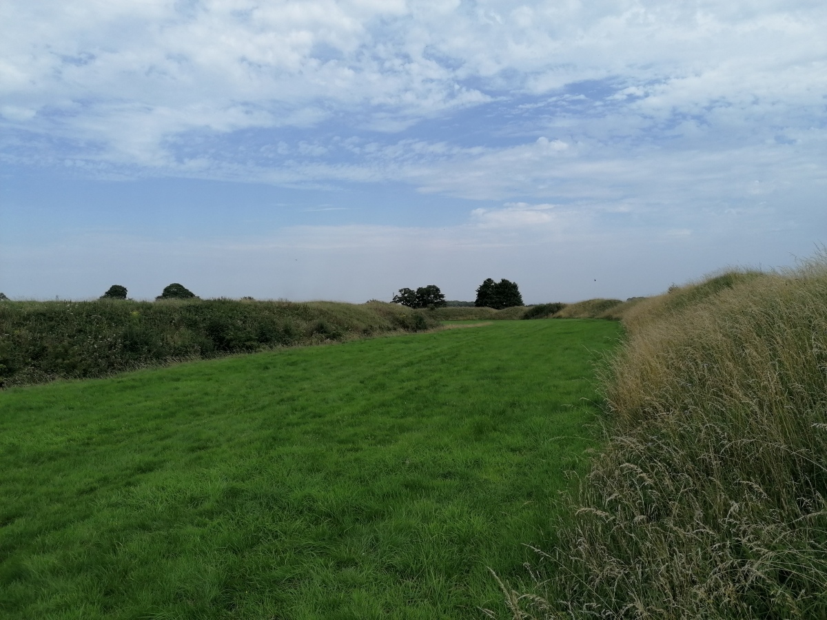
Old Sodbury submitted by TheCaptain on 4th Aug 2020. View east between the fortifications from the outer bank of Old Sodbury Camp
(View photo, vote or add a comment)
Log Text: Friday afternoon 10k walk, north from Old Sodbury along the Cotswold Edge through two ancient forts, past three old churches and lots of big houses to Horton Court. Back over fields through Little Sodbury. Stopped for a pint at the Dog afterwards.
The Toots (Oldbury)
Date Added: 9th Sep 2020
Site Type: Hillfort
Country: England (Gloucestershire)
Visited: Yes on 3rd Jun 2020. My rating: Condition 3 Ambience 3 Access 4
The Toots (Oldbury) submitted by 4clydesdale7 on 4th Jul 2011. The best evidence of the Fort - the NNE rampart looking SE
(View photo, vote or add a comment)
Log Text: At the end of a walk along the Severn estuary and all round the old Oldbury Nuclear Powerstation, I walked back to Oldbury-on-Severn right through the Toots camp. Nice roadsign leading to it, and some information boards have now been put up in the village.
Oldbury-on-Severn Submerged Forest
Date Added: 9th Sep 2020
Site Type: Natural Stone / Erratic / Other Natural Feature
Country: England (Gloucestershire)
Visited: Saw from a distance on 3rd Jun 2020
Oldbury-on-Severn Submerged Forest submitted by 4clydesdale7 on 4th Jul 2011. As I stated like Atlantis risng
(View photo, vote or add a comment)
Log Text: It is now possible to walk all the way up the Severn Estuary past the tidal pool, and through the ex nuclear power station. Looking out at the tidal pool at low tide, all sorts of lumpy bumpy bits can be seen below the wall, quite possibly the remains of the petrified forest.
Oldbury Standing Stone
Date Added: 9th Sep 2020
Site Type: Standing Stone (Menhir)
Country: England (Gloucestershire)
Visited: Yes on 3rd Jun 2020. My rating: Condition 3 Ambience 3 Access 4
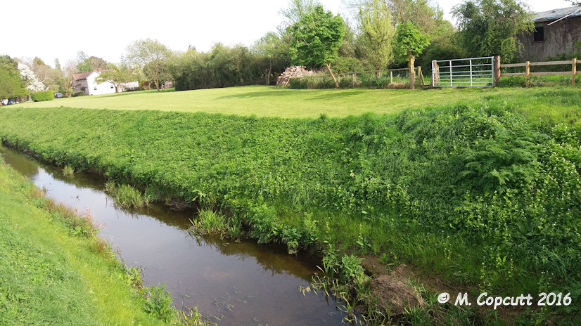
Oldbury Standing Stone submitted by TheCaptain on 8th May 2016. On a warm sunny afternoon, I went for a good look for this, but found nothing to match the description. In fact, at some time in the past (since 1953) a whole load of drainage and seawall flood protection work has been done, which now contains the Oldbury Naite Rhine within substantial banks, with any of its little tributaries in the area now in underground culverts emptying through flap doors into the Rhine. The height of the banking is now well above what it would have been.
(View photo, vote or add a comment)
Log Text: Went for a look for this stone on a hot sunny June afternoon as part of a walk around Oldbury. Despite being 99% sure where it was to be found, I initially didn't find it as it was totally overgrown, and not under the new footpath gate, but an old wooden bit of fence to the side. With a bit of trampling on the long grass, I got to see the whole stone. Great to see it, it would be a splendid standing stone.
Shortwood Hill barrow
Date Added: 9th Sep 2020
Site Type: Round Barrow(s)
Country: England (Gloucestershire)
Visited: Yes on 30th May 2020. My rating: Condition 2 Ambience 2 Access 4

Shortwood Hill barrow submitted by TheCaptain on 30th May 2020. A long walk during the supposed lockdown (end May 2020) took me through this field and over the barrow for the first time in many years. Despite the field being cleared and shorn of vegetation, the barrow was more disappointing to see than I remembered.
(View photo, vote or add a comment)
Log Text: A long walk during the lockdown (end May 2020) took me through this field and over the barrow for the first time in many years. Despite the field being cleared and shorn of vegetation, the barrow was more disappointing to see than I remembered.
St Anne’s well (Siston)
Date Added: 9th Sep 2020
Site Type: Holy Well or Sacred Spring
Country: England (Gloucestershire)
Visited: Yes on 30th May 2020. My rating: Condition 2 Ambience 2 Access 5

St Anne’s well (Siston) submitted by TheCaptain on 30th May 2020. St Anne’s well (Siston), an open stone trough with a covering grate, right at the edge of the road. On the day of my visit, this was largely dry.
(View photo, vote or add a comment)
Log Text: Not to be confused with the hexagonal gothic wellhouse tower to the north of Siston Court, the real St Anne's well is found down by the stream beside the road, just to the north of the old bridge and on a very dangerous bend. Amongst other things, the water was supposed to be good for healing poor eyesight, and people travelled for miles to try the cure, which was still being publicised into the 1930's.
What there is to see today is an open stone trough, about 4 feet by 18 inches with a covering grate, right at the edge of the road rather like a big drain. On the day of my visit, this was largely dry.
Mynydd Bach Cairn 2
Date Added: 22nd Mar 2020
Site Type: Round Barrow(s)
Country: Wales (Monmouthshire)
Visited: Yes on 21st Mar 2020. My rating: Condition 2 Ambience 2 Access 4
Mynydd Bach Cairn 2 submitted by TheCaptain on 25th Mar 2020. Found the remains of this cairn fairly easily, making a circular patch of green grass amongst the gorse and other growth. It is not a great monument being very flattened and destroyed, and also the whole area is absolutely covered with rubbish of all sorts.
(View photo, vote or add a comment)
Log Text: First cairn of four marked on the OS Map during a walk from the Sirhowy Country Park around the Cwmfelinfach valley, up the Sirhowy River and back along the Rhymney Ridgeway path. Found the remains of this cairn fairly easily, making a circular patch of green grass amongst the gorse and other growth. It is not a great monument being very flattened and destroyed, and also the whole area is absolutely covered with rubbish of all sorts. The whole area is used by people for offroading and all sorts of other activities, some not so wholesome.
