Contributory members are able to log private notes and comments about each site
Sites TheCaptain has logged. View this log as a table or view the most recent logs from everyone
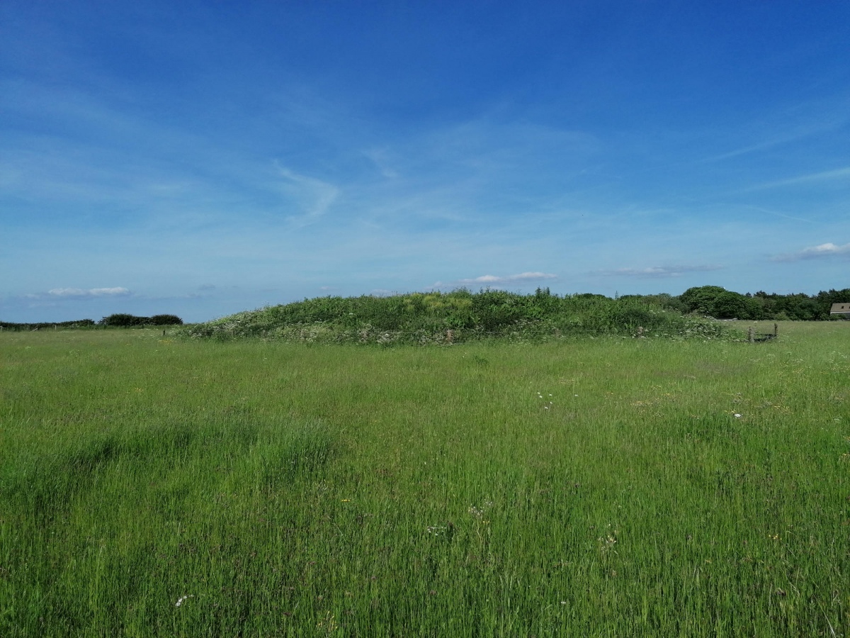
Maiden Hill
Date Added: 23rd Sep 2021
Site Type: Cairn
Country: England (Devon)
Visited: Yes on 20th Sep 2021. My rating: Condition 2 Ambience 4 Access 2
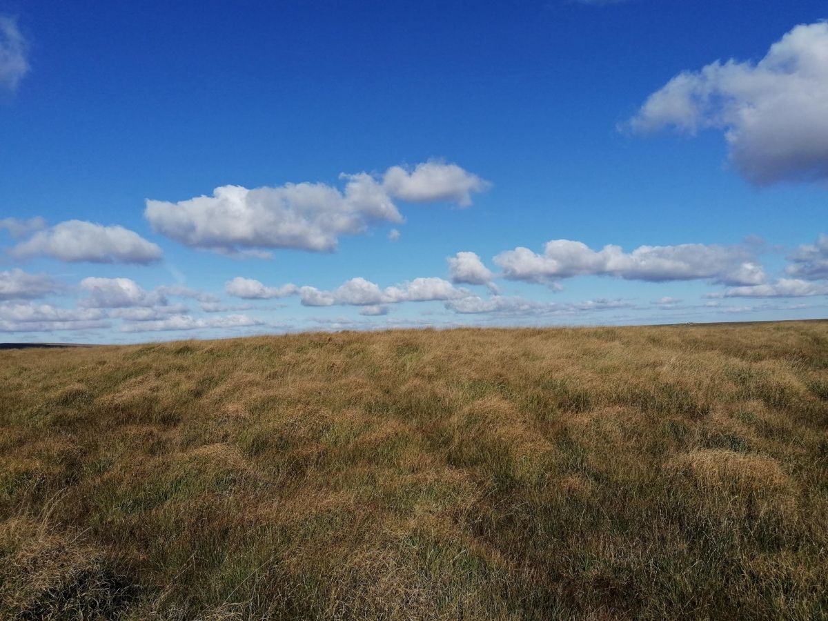
Maiden Hill submitted by TheCaptain on 23rd Sep 2021. A large raised area of grass which quite possibly does have a cairn underneath
(View photo, vote or add a comment)
Log Text: Day down to Dartmoor for a pilgrimmage to Beardown Man. From Devils Tor, looking to head on to Conies Down there seems two choices, either down and up the steep and deep Cowsic valley, or a longer route round the head of the valley further north, which I decide to take. The path is fairly good, and obviously used a fair bit by people on quad bikes, so is easy going except for the odd bit of bog. Onto the top of Maiden Hill, avoiding a large herd of ponies, and look for the cairn in the featureless long grass, finding only a large raised area of grass which quite possibly does have a cairn underneath.
Beardown Man
Date Added: 23rd Sep 2021
Site Type: Standing Stone (Menhir)
Country: England (Devon)
Visited: Yes on 20th Sep 2021. My rating: Condition 4 Ambience 5 Access 2
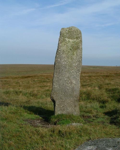
Beardown Man submitted by Brian Byng on 7th Feb 2002. Beardown Man looking north
(View photo, vote or add a comment)
Log Text: Day down to Dartmoor for a pilgrimmage to Beardown Man. Now at Rough Tor I have now learned (remembered) that when walking on the open moor, any sort of path in roughly the right direction is easier than trying to cross the untamed and boggy moor, so standing on the top of the tor taking in the magnificent vista all around in the sun, decide on a route across to Devil's Tor on a pathway which heads to the south of it to start with, but looks mostly fairly easy going. Then up to the top of the hill, and Beardown Man peeks its top over the horizon and grows taller as I approach. It's not at the top of the hill, just below the summit on the west side, but magnificent, twice my height, a lovely thin flat stone with views from north to south over the deep Cowsic valley on the west side, but nothing to the east, which I think odd. Its fabulous out here.
Crow Tor
Date Added: 23rd Sep 2021
Site Type: Cairn
Country: England (Devon)
Visited: Yes on 20th Sep 2021. My rating: Condition 4 Ambience 4 Access 2
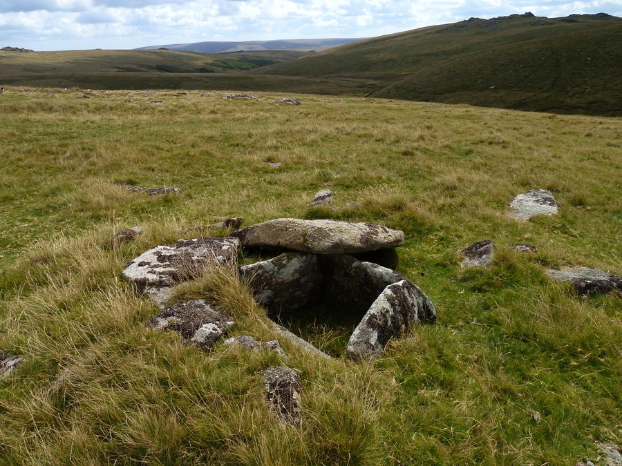
Crow Tor submitted by Bladup on 10th Dec 2017. Crow Tor Cairn and Cist.
(View photo, vote or add a comment)
Log Text: Day down to Dartmoor for a pilgrimmage to Beardown Man. From Beardown Cairn, and now back on the planned route but behind time, I see another chap out on the moor nearby, an old looking chap dressed in what looks like tweeds, and we exchange greetings. Head north towards Crow Tor, crossing a wall and small stream. Looking for the cairn below Crow Tor which is not marked on the map, and having an initial look where I think it is, I again resort to gps and there it is about 20 metres away. A lovely stone cairn with a fairly large cist inside, the capstones shifted off to one side. Up to Crow Tor to find somewhere to sit and have lunch, during which time a couple walking the other direction pass by and we exchange waves. I now head north across the featureless boggy high moorland to Rough Tor, with firing range huts, double checking it is the right one a couple of times!
Beardown Cairn and Cist
Date Added: 21st Sep 2021
Site Type: Cist
Country: England (Devon)
Visited: Yes on 20th Sep 2021. My rating: Condition 2 Ambience 3 Access 2

Beardown Cairn and Cist submitted by TheCaptain on 5th Mar 2017. Beardown Cairn and Cist, near the Lich Way on the heights between the Cowsic and West Dart rivers.
My friend Antony tries out the cist for size, during a memorable walk along the Lich Way across the moor at Easter 1988.
(View photo, vote or add a comment)
Log Text: Beautiful sunny day forecast, and the Army firing range not in use today, so head down to Dartmoor for a pilgrimmage to Beardown Man. Park at Holming Beam at 12:00 after a busy journey down, and I am the only one there. Start by walking over to the first Beardown Tor with its Army firing post observation huts. Making a schoolboy error I head off to what I think is the next Beardown Tor across grassy open moorland, not checking as I go. Once at the top I realise I have walked much further to Lydford Tor, and already passed the cairn and cist I wanted to visit again after the Antony trousers episode in 1988. Doh! Dartmoor lesson, concentrate on navigation and double check everything. Its now a complex task to get across the rough moor to the cist, which was a nightmare to find, eventually resorting to the gps only to find I was about 10 feet away, it has now become totally overgrown and I almost fall in. No way I could sit in the cist, could hardly see it!
Beardown Cairn and Cist
Date Added: 21st Sep 2021
Site Type: Cist
Country: England (Devon)
Visited: Yes on 3rd Apr 1988. My rating: Condition 3 Ambience 4 Access 2

Beardown Cairn and Cist submitted by TheCaptain on 5th Mar 2017. Beardown Cairn and Cist, near the Lich Way on the heights between the Cowsic and West Dart rivers.
My friend Antony tries out the cist for size, during a memorable walk along the Lich Way across the moor at Easter 1988.
(View photo, vote or add a comment)
Log Text: Visited while on walk across Dartmoor on the Lich Way Easter 1988. Walked right by Beardown Cairn and Cist, on the heights between the Cowsic and West Dart rivers. My friend Antony tries out the cist for size. It certainly was the start of a funny event. It was very damp down the bottom of the cist. Sometime later along the walk towards Wistman's Wood, Antony was bringing up the rear, and it was noticed he was walking along with his trousers round his neck, hoping for them to dry out in the sun, wondering how long it would be until anyone noticed... However, we later all ended trouserless with very wet and mucky lower limbs, due to a bog near the Powder Mills.
Kiftsgate Stone
Date Added: 16th Sep 2021
Site Type: Holed Stone
Country: England (Gloucestershire)
Visited: Yes on 6th Sep 2021. My rating: Condition 2 Ambience 3 Access 5
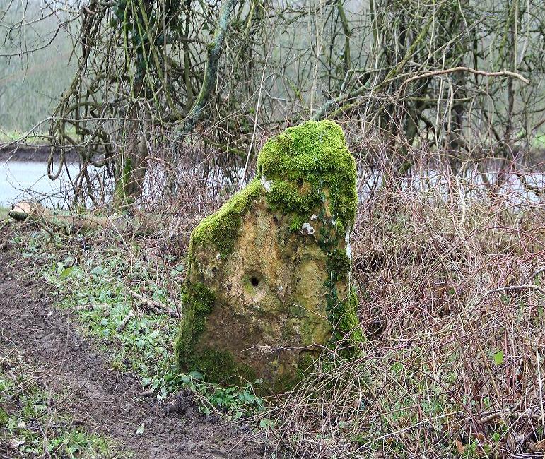
Kiftsgate Stone submitted by geraldaf on 15th Mar 2013. Stone fett warm
(View photo, vote or add a comment)
Log Text: Cotswold Way walk from Chipping Campden to Broadway, making sure to have a look at the Kiftsgate Stone, which was well hidden amongst undergrowth, despite being just to the side of the road. Looked to me like it might possibly have once been part of a longbarrow chamber.
Beckbury Camp
Date Added: 16th Sep 2021
Site Type: Hillfort
Country: England (Gloucestershire)
Visited: Yes on 15th Sep 2021. My rating: Condition 3 Ambience 4 Access 3
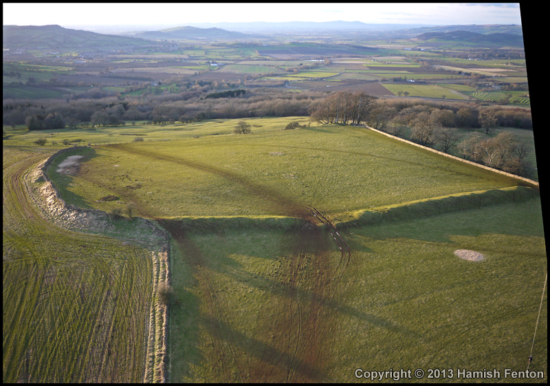
Beckbury Camp submitted by h_fenton on 2nd Feb 2013. Beckbury Camp, viewed from the east.
Kite Aerial Photograph
2 February 2013
(View photo, vote or add a comment)
Log Text: Cotswold Way walk starting by taking the steam train from Toddington to Winchcombe, then walk back northeast to Toddington stopping at Hailes Abbey and Beckbury hillfort. Lovely
Shenberrow Hillfort
Date Added: 11th Sep 2021
Site Type: Hillfort
Country: England (Gloucestershire)
Visited: Yes on 1st Sep 2021. My rating: Condition 3 Ambience 4 Access 3
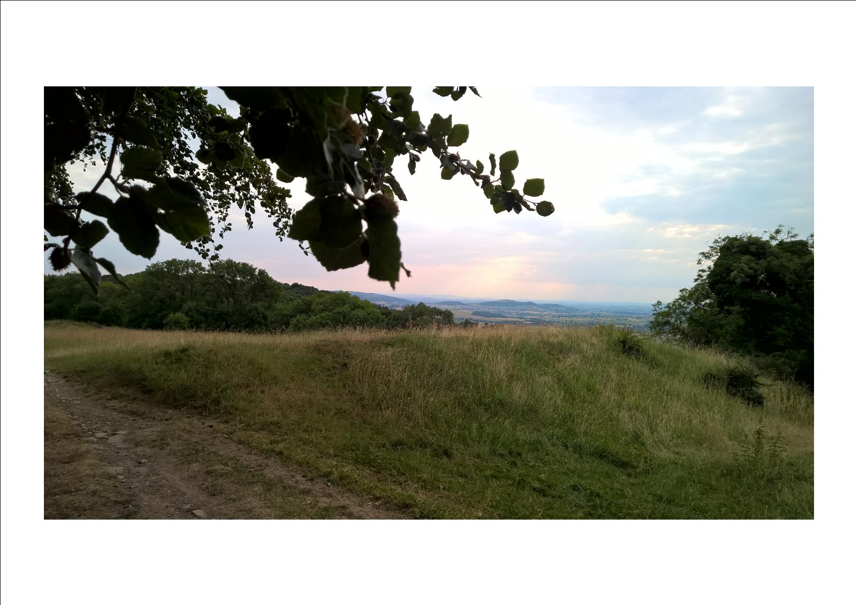
Shenberrow Hillfort submitted by HarryTwenty on 12th Jul 2018. Looking over the northern ramparts towards the west.
(View photo, vote or add a comment)
Log Text: Cotswold Way walk starting with the steam train from Toddington to Broadway, a beer at the Crown & Trumpet, then walk back south along the Cotswold Way to Stanway, stopping for further refreshment at the Mount Inn, Stanton, below the fortified encampment of Shenberrow Hillfort where I ate my lunch admiring the view.
Tytherington Camp
Date Added: 16th Aug 2021
Site Type: Promontory Fort / Cliff Castle
Country: England (Gloucestershire)
Visited: Yes on 14th Aug 2021. My rating: Condition 3 Ambience 3 Access 3
Tytherington Camp submitted by 4clydesdale7 on 6th Sep 2011. The Inner Camp looking towards the NW entrance
(View photo, vote or add a comment)
Log Text: Afternoon wander around Tytherington village and up to and around the old hillfort / castle. Chap in his garden nearby told me he part owned the land and I could go and have a proper look if I wanted, so I did. There is a lot of broken rock in the remaining ramparts, which surprised me by their completeness (those which hadn't been lost due to the quarrying). Saw a couple of foxes and loads of rabbits.
Seven Springs (Gloucestershire)
Date Added: 7th Aug 2021
Site Type: Holy Well or Sacred Spring
Country: England (Gloucestershire)
Visited: Yes on 4th Aug 2021. My rating: Condition 3 Ambience 3 Access 5
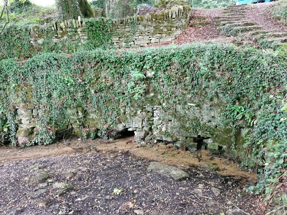
Seven Springs (Gloucestershire) submitted by TheCaptain on 6th Aug 2021. Seven Springs can claim to be the true source of the River Thames. Clear water gushes through several gaps underneath a large drystone wall in a pleasant wooded hollow.
(View photo, vote or add a comment)
Log Text: Cotswold Way walk around Leckhampton Hill from Seven Springs. Seven Springs, just 4 miles from central Cheltenham up on the Cotswold Hills, can claim to be the true source of the River Thames. Clear water gushes through several gaps underneath a large drystone wall in a pleasant wooded hollow beside the busy A436, under which it then flows in a pipe into a small lake the other side of the road.
Coberley
Date Added: 7th Aug 2021
Site Type: Chambered Tomb
Country: England (Gloucestershire)
Visited: Yes on 4th Aug 2021. My rating: Condition 3 Ambience 4 Access 4
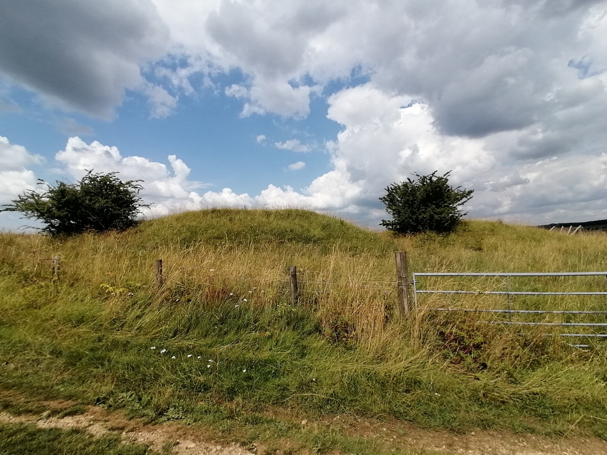
Coberley submitted by TheCaptain on 7th Aug 2021. Substantial remains of a longbarrow beside a lovely old green trackway partway down a ridge on the downslope from the top of the Cotswold Hills above the small village of Coberley
(View photo, vote or add a comment)
Log Text: Cotswold Way walk around Leckhampton Hill from Seven Springs, south to Ullenwood, turning east past Cuckoopen Farm and then down past the substantial remains of a longbarrow beside a lovely old green trackway partway down a ridge on the downslope from the top of the Cotswold Hills above the small village of Coberley.
Leckhampton Hill
Date Added: 7th Aug 2021
Site Type: Hillfort
Country: England (Gloucestershire)
Visited: Yes on 4th Aug 2021. My rating: Condition 3 Ambience 4 Access 4
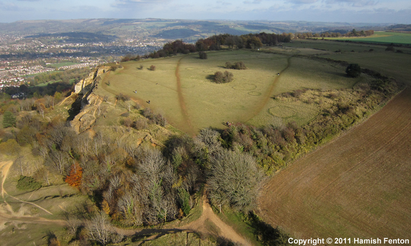
Leckhampton Hill submitted by h_fenton on 10th Nov 2011. Leckhampton Hill hillfort / promontory fort, Gloucestershire. Viewed from the south-west.
Kite Aerial Photograph
6 November 2011
(View photo, vote or add a comment)
Log Text: Cotswold Way walk around Leckhampton Hill from Seven Springs, wonderful views all over Cheltenham and the Severn valley all the way round, with an exploration of the hillfort, trig point and quarry with the Devil's Chimney. Then south to Ullenwood, turning east past Cuckoopen Farm and then down past the big old longbarrow to Coberley and heading back north to the Seven Springs for a pint.
Painswick Beacon
Date Added: 19th Jul 2021
Site Type: Hillfort
Country: England (Gloucestershire)
Visited: Yes on 14th Jul 2021. My rating: Condition 4 Ambience 4 Access 4
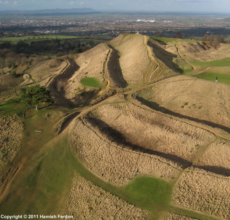
Painswick Beacon submitted by h_fenton on 3rd Mar 2011. Looking northwards over the ramparts of Painswick Beacon (hillfort), with Gloucester beyond and the Malvern Hills on the horizon (the other side of the Severn Valley).
Kite Aerial Photograph
12 February 2011
(View photo, vote or add a comment)
Log Text: Cotswold Way loop walk north from Painswick, across the golf course and through woods to Cranham Corner before turning back for a pint at the Royal William. Then over the hill and west before turning back to the top of Painswick Beacon, before descending to the east through Paradise along the Wysis Way, and then back to Painswick along the river and up the hill for a pint at the Royal Oak.
The Ring (Gloucestershire)
Date Added: 20th Jun 2021
Site Type: Ancient Village or Settlement
Country: England (Gloucestershire)
Visited: Yes on 14th Jun 2021. My rating: Ambience 3 Access 3

The Ring (Gloucestershire) submitted by h_fenton on 19th Nov 2011. The Ring, enclosure on Cleeve Hill (Cleeve Common) Gloucestershire.
Kite Aerial Photograph from the north west.
13 November 2011 @ 2.35pm
(View photo, vote or add a comment)
Log Text: Cotswold Way walk from Seven Springs to Cleeve Hill. After visiting the trig point, dropped down to the carpark and golf club for a beer. Walked right by The Ring and forgot to have a look and take note. Beer was needed!
Cleeve Hill Cross Dyke
Date Added: 20th Jun 2021
Site Type: Misc. Earthwork
Country: England (Gloucestershire)
Visited: Yes on 14th Jun 2021. My rating: Condition 3 Ambience 3 Access 3
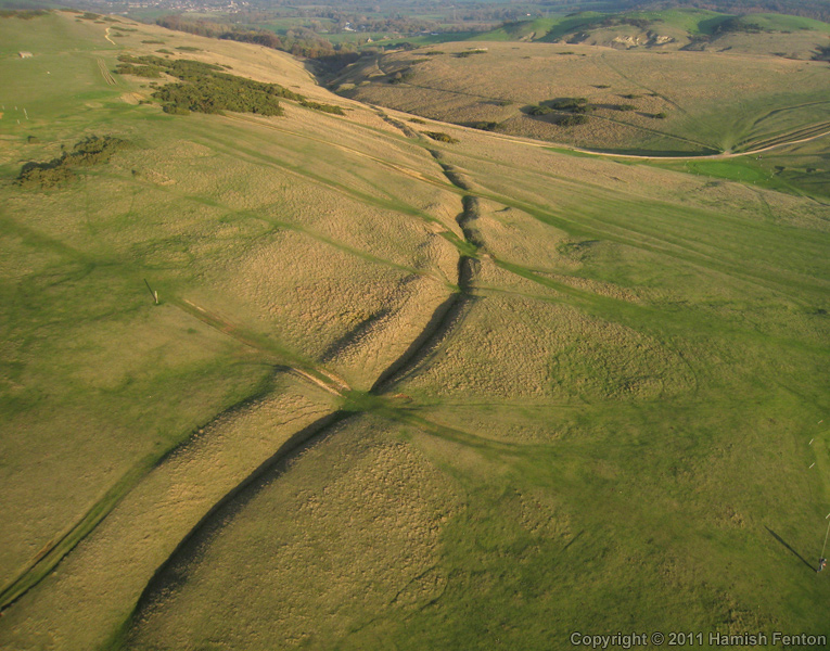
Cleeve Hill Cross Dyke submitted by h_fenton on 19th Nov 2011. Cleeve Hill Cross Dyke, photographed from the east.
Kite Aerial Photograph
13 November 2011
(View photo, vote or add a comment)
Log Text: Cotswold Way walk north around Cheltenham from Seven Springs to Cleeve Hill. Walk through and have a quick look at the cross dyke, around the southern edge of the peak with the trig point.
Cleeve Hill (Gloucestershire)
Date Added: 20th Jun 2021
Site Type: Hillfort
Country: England (Gloucestershire)
Visited: Yes on 14th Jun 2021. My rating: Condition 3 Ambience 4 Access 3
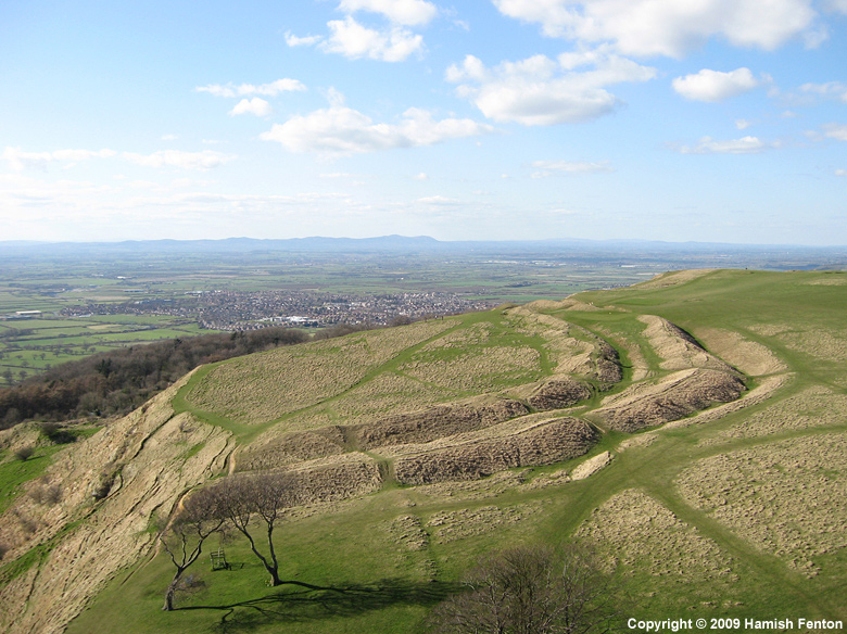
Cleeve Hill (Gloucestershire) submitted by h_fenton on 29th Mar 2009. Cleeve Hill - Hillfort.
Kite Aerial Photograph, 29 March 2009
(View photo, vote or add a comment)
Log Text: Cotswold Way walk north around Cheltenham from Seven Springs to Cleeve Hill. Walk all around the ramparts of what is left of this hillfort, much of the western side of which has been quarried away. Fabulous views over Cheltenham.
Lineover
Date Added: 16th Jun 2021
Site Type: Chambered Tomb
Country: England (Gloucestershire)
Visited: Yes on 14th Jun 2021. My rating: Condition 2 Ambience 3 Access 4
Lineover submitted by 4clydesdale7 on 17th Nov 2011. The Barrow from the South (taken from the N verge of the A436)
(View photo, vote or add a comment)
Log Text: Cotswold Way walk north around Cheltenham from Seven Springs to Cleeve Hill. Small detour for a look at the remains of Lineover longbarrow, in a field of cows
Starveall
Date Added: 11th Jun 2021
Site Type: Chambered Tomb
Country: England (Gloucestershire)
Visited: Yes on 7th Aug 2015. My rating: Condition 2 Ambience 3 Access 4
Starveall submitted by TheCaptain on 11th Jun 2021. Now all shorn of the trees a decade ago, all we have now is an elongated mound in the field, but it is at least fenced off for protection.
(View photo, vote or add a comment)
Log Text: I revisited this barrow August 2015 to see what sort of state it is now in. What a disappointment and disgrace. The poor thinghas been shorn of all growth on it and looks to be much smaller than the pictures of 4clydesdale7 from 2011. It's no doubt slowly (or rapidly on a longbarrow lifespan timescale) just becoming a part of the field here and will soon be all gone.
Starveall
Date Added: 11th Jun 2021
Site Type: Chambered Tomb
Country: England (Gloucestershire)
Visited: Yes on 8th Mar 2009. My rating: Condition 3 Ambience 3 Access 5

Starveall submitted by TheCaptain on 11th Jun 2021. Now all shorn of the trees a decade ago, all we have now is an elongated mound in the field, but it is at least fenced off for protection.
(View photo, vote or add a comment)
Log Text: Looking in much better condition than in the past, the surrounding field is still pasture, and has a new fence around it. There is now a little parking area beside the little lane, and a gate through which you can walk to go visit the barrow.
Starveall
Date Added: 11th Jun 2021
Site Type: Chambered Tomb
Country: England (Gloucestershire)
Visited: Yes on 26th Mar 2006

Starveall submitted by TheCaptain on 11th Jun 2021. Now all shorn of the trees a decade ago, all we have now is an elongated mound in the field, but it is at least fenced off for protection.
(View photo, vote or add a comment)
Log Text: I revisited this barrow March 2006. The field it is in has now been fenced, and a gate with parking area situated near to the barrow. The field is no longer ploughed, and looks to be made ready for livestock. The rubbish which was piled on top of the barrow has been cleared and it all looks nicely tidied up. Pity that so much of it has been recently lost to the surrounding field, but things look less bleak for the barrow. I saw no signs of any chambers.
