Contributory members are able to log private notes and comments about each site
Sites TheCaptain has logged. View this log as a table or view the most recent logs from everyone
Broomend of Crichie Avenue
Date Added: 29th Oct 2019
Site Type: Multiple Stone Rows / Avenue
Country: Scotland (Aberdeenshire)
Visited: Yes on 27th Jul 2017
Broomend of Crichie Avenue submitted by TheCaptain on 27th Jul 2017. Just a couple of stones remain of this 500m long stone avenue, which once lead away to the south from the henge, and also northwards from the henge to the now destroyed stone circle. There are supposedly a couple more stones and some burial cists to be found at the southern end of the avenue, but this appeared to be within the grounds of a private complex.
(View photo, vote or add a comment)
Log Text: None
Broomend of Crichie Pictish Symbol Stone
Date Added: 29th Oct 2019
Site Type: Class I Pictish Symbol Stone
Country: Scotland (Aberdeenshire)
Visited: Yes on 27th Jul 2017
Broomend of Crichie Pictish Symbol Stone submitted by TheCaptain on 27th Jul 2017. The pictish stone now erected within the henge is a splendid stone, the carvings on which can clearly be made out.
(View photo, vote or add a comment)
Log Text: None
Broomend Of Crichie Stone Circle / Henge
Date Added: 29th Oct 2019
Site Type: Henge
Country: Scotland (Aberdeenshire)
Visited: Yes on 27th Jul 2017
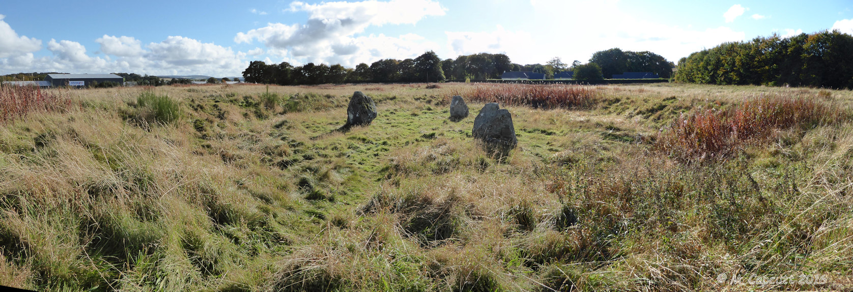
Broomend Of Crichie Stone Circle / Henge submitted by TheCaptain on 27th Jul 2017. Composite panorama of the henge and stones looking south
(View photo, vote or add a comment)
Log Text: None
Broussardière Menhir
Trip No.202 Entry No.36 Date Added: 26th Mar 2020
Site Type: Standing Stone (Menhir)
Country: France (Pays de la Loire:Mayenne (53))
Visited: Yes on 29th Apr 2005. My rating: Condition 4 Ambience 3 Access 4
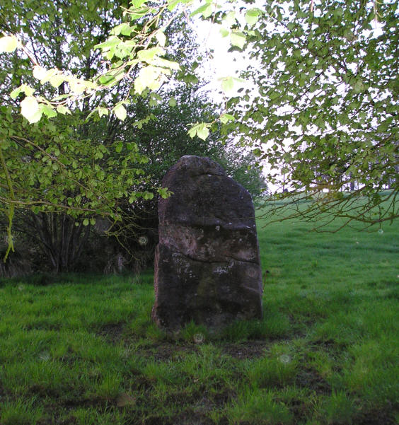
Broussardière Menhir submitted by TheCaptain on 8th May 2005. La Broussardière menhir, Montaudin, Mayenne.
It is found near the the road from Larchamp to Montflaux, near a little pond beside a stream.
(View photo, vote or add a comment)
Log Text: This menhir is about 2.5 to 3 metres in height and about 1.5 metres in width. It is found just a few yards away from the side of the road from Larchamp to Montflaux near a little pond beside a stream and is easy to see despite the very frisky bullocks in the adjacent field trying to get at me!
Brown Willy Barrow Cemetery
Date Added: 24th Jul 2022
Site Type: Barrow Cemetery
Country: England (Cornwall)
Visited: Yes on 13th Jun 2022. My rating: Condition 3 Ambience 4 Access 2
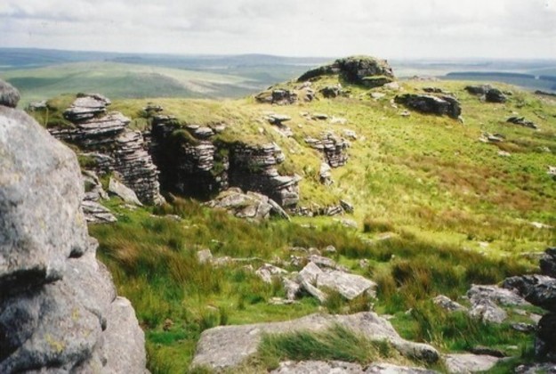
Brown Willy Barrow Cemetery submitted by Bladup on 13th Feb 2014. Brown Willy. This view is taken from near the summit cairn and is looking south towards the other cairn.
(View photo, vote or add a comment)
Log Text: Up to the top of Brown Willy, where there is a large cairn, with trig point and modern rearrangements on the northern top, where I eat my pasty. Walk south along the ridgetop, and there is a really splendid cairn at the southern top.
Brown Willy Cairn S
Date Added: 24th Jul 2022
Site Type: Cairn
Country: England (Cornwall)
Visited: Yes on 13th Jun 2022. My rating: Condition 4 Ambience 5 Access 2

Brown Willy Cairn S submitted by TheCaptain on 24th Jul 2022. On a lesser summit at the southern end of the ridgetop is a large round cairn
(View photo, vote or add a comment)
Log Text: Walk south along the Brown Willy ridgetop, and there is a really splendid cairn at the southern top.
Bruniquel Cave
Trip No.200 Entry No.70 Date Added: 18th Jun 2020
Site Type: Cave or Rock Shelter
Country: France (Midi:Tarn-et-Garonne (82))
Visited: Saw from a distance on 27th Aug 2000

Bruniquel Cave submitted by TheCaptain on 26th Mar 2019. From Portail des Mégalithes de la Francophonie
At The 11Ème Festival International du Film d'Archéologie de Nyon, archaeological news will be in the spotlight with the presentation, in preview, of the film "the mystery of the cave of bruniquel". this documentary presents the recent research that allowed the dating of a structure made by neanderthal man in a cave 175 000 years ago: it would therefore be the oldest human construction known to this day.
Director Luc-Henri Fage will b...
(View photo, vote or add a comment)
Log Text: Drive north from Toulouse to explore Bruniquel, Penne, Gorges d’Aveyron, Caussade
Bruyère d'Usclas
Trip No.205 Entry No.143 Date Added: 11th Nov 2020
Site Type: Burial Chamber or Dolmen
Country: France (Languedoc:Hérault (34))
Visited: Yes on 17th Sep 2005. My rating: Condition 5 Ambience 4 Access 4
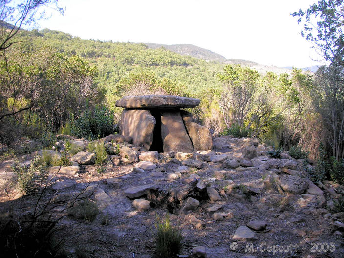
Bruyère d'Usclas submitted by TheCaptain on 27th Oct 2007. This is a lovely dolmen, up on the forested hill near to the St Michel de Grandmont Priory.
It has much in common with the nearby dolmen de Coste-Rouge, a similar sized (but not so high) chamber set in a circle of stones, many of which are the red volcanic rock.
(View photo, vote or add a comment)
Log Text: This is a lovely dolmen, but was a bit of a bugger to find, despite a large signpost. Taking the road from Lodeve east to Saint-Michel-de-Grandmont, travel 800 metres further than the entrance to the priory. Here there is a junction with two large forest tracks and a parking area, with a large sign pointing down the first forest track to "Dolmen Bruyère d'Usclas".
I walked miles, and saw no evidence of the dolmen, but found three ladies sitting in the forest. I asked them and they pointed out the error of my ways - I had gone way too far and walked round in much of a big circle around the hilltop. From the parking at the junction, only walk about 200 metres (about 150m past a big tank), then look for a little path down the hillside into the forest on the left. It is marked with a little pile of stones, but I do mean little ! Fifty metres down this path through the trees is the dolmen.
It has much in common with the nearby dolmen de Coste-Rouge, a similar sized (but not so high) chamber set in a circle of stones, many of which are the red volcanic rock. The capstone, which is unfortunately broken at the back, sits on four perfectly fitted support stones, with the side stones angled inwards. The front stone does not have the oven door, but the entrance is to one side, which shows evidence of a carved and enlarged opening area. The chamber is about 2.5 m long by 2 m in width. The stones are fitted so well that almost no light gets in apart from through the entrance.
Bryn Cader Faner
Date Added: 18th Sep 2010
Site Type: Ring Cairn
Country: Wales (Gwynedd)
Visited: Yes on 9th Mar 2004
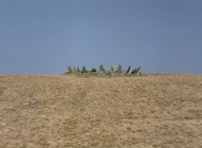
Bryn Cader Faner submitted by thecaptain on 9th Mar 2004. Bryn Cader Faner.
This is the truly wonderful sight as you approach this cracking circle up the hillside.
On a nice day, there is a lovely walk from Harlech, past Moel Goedog to Llyn Trawsfynydd along an ancient trackway, which passes several standing stones, several cairns and a few circles. This is the pick of them all.
(View photo, vote or add a comment)
Log Text: None
Buckholt Wood
Date Added: 23rd Oct 2021
Site Type: Chambered Tomb
Country: England (Gloucestershire)
Visited: Saw from a distance on 14th Mar 2009. My rating: Condition 2 Ambience 2 Access 4
Buckholt Wood submitted by 4clydesdale7 on 17th Jun 2011. Fairly easy to find - near entrance to overspill car park for Woodchester Mansion - if you miss the Barrow which is not that conspicuous then look for the Glider Winch at the W end of the Airfield
(View photo, vote or add a comment)
Log Text: The remains of this badly damaged Long Barrow with possible Chambered Tomb can today be seen as a slight raise in the ground at the end of the Nympsfield Gliding Club – today to be seen just behind the winching equipment. This site has been badly damaged in the past by ploughing. I found nowhere obvious to park while driving north, and thought I’d come back later in the day, but didn’t. There seems to be a trackway nearby from where a better look could be had.
Buffletizion Dolmen
Trip No.203 Entry No.245 Date Added: 22nd Apr 2020
Site Type: Burial Chamber or Dolmen
Country: France (Poitou:Charente-Maritime (17))
Visited: Couldn't find on 4th Jun 2005
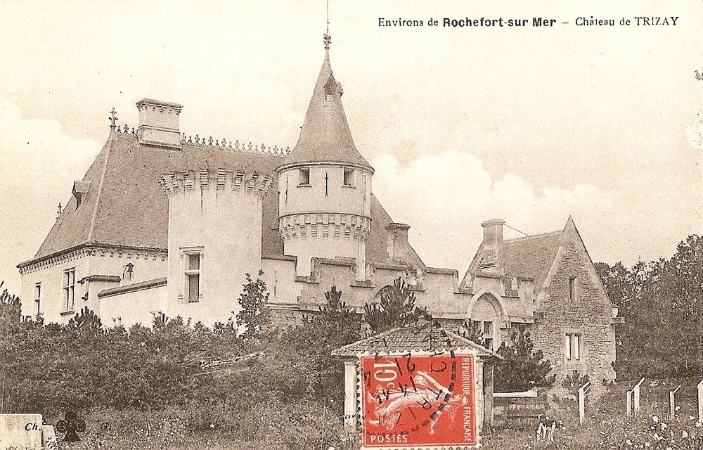
Buffletizion dolmen submitted by Rubis on 16th Aug 2010. The dolmen can be found in the park of this castle.
It has been excavated in 1903 and pulled up at the same time because it was ruined.
Site in Poitou:Charente-Maritime (17) France
(View photo, vote or add a comment)
Log Text: I found Buffetision just to the southeast of trizay, but there were no signs of any dolmen. Perhaps it is in the grounds of the chateau.
Bullring
Date Added: 29th Oct 2019
Site Type: Henge
Country: England (Derbyshire)
Visited: Yes on 4th Aug 2011

Bullring submitted by TheCaptain on 4th Aug 2011. Panoramic view of the Bullring Henge, taken early evening of the open day, and stitched together using ICE.
Not sure how this will work when uploaded to the Portal, but can only try!
(View photo, vote or add a comment)
Log Text: None
Bullstones
Date Added: 30th Aug 2025
Site Type: Stone Circle
Country: England (Cheshire)
Visited: Would like to visit
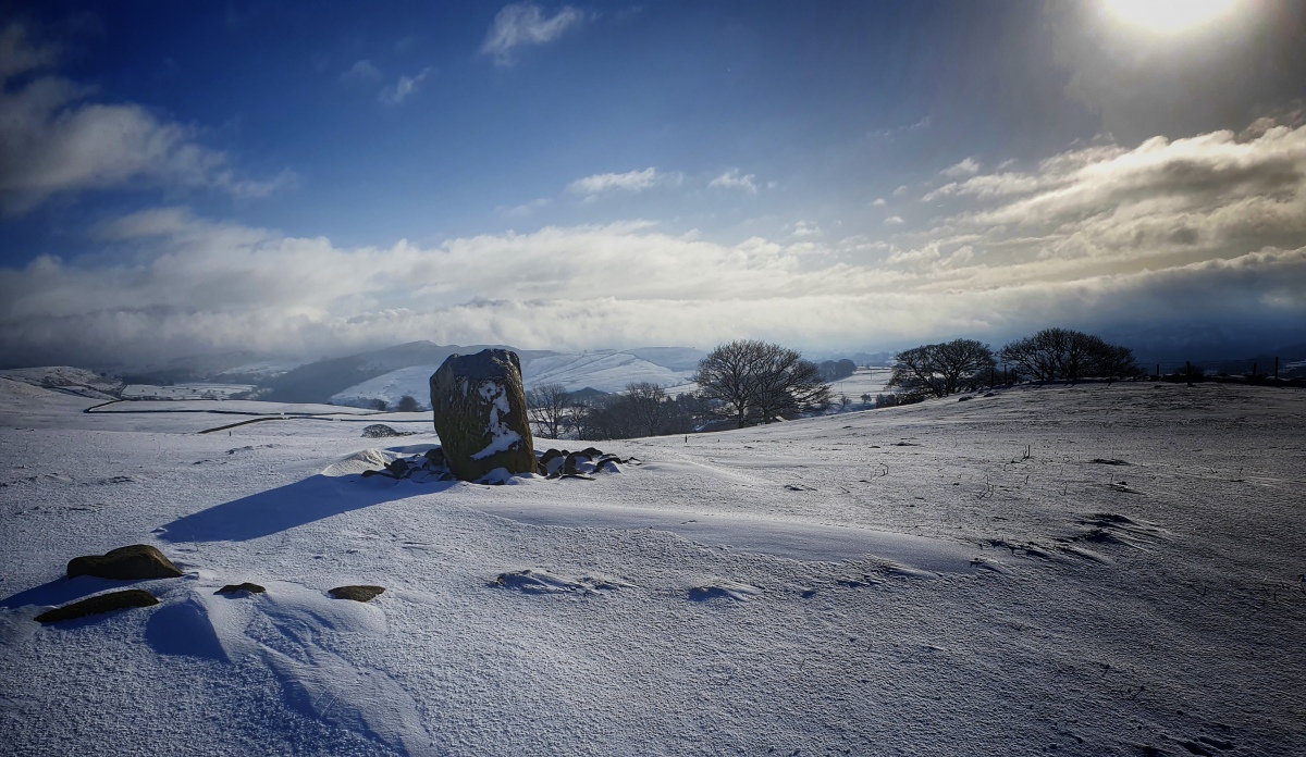
Bullstones submitted by gritstone on 25th Jan 2021. Bullstones, highlighting its stone circle in late January snows, 2021.
(View photo, vote or add a comment)
Burderop Down Disc Barrow
Date Added: 24th Apr 2022
Site Type: Round Barrow(s)
Country: England (Wiltshire)
Visited: Yes on 17th Apr 2022. My rating: Condition 4 Ambience 4 Access 3

Burderop Down Disc Barrow submitted by HarryTwenty on 4th Jan 2019. Looking NE at the barrow across the ditch. The trees on the right are growing along the top of the bank. The shadow of the nearest one falls down into the ditch and up the other side onto the barrow showing you the slope.
(View photo, vote or add a comment)
Log Text: Eventually finding my way back west and up the hill through the recently diverted and fenced pathways, I pass by the large circular ring barrow, now getting a bit overgrown from the other pictures I have seen. Up to the top of the hill and a good view over the site is had.
Burford Down Stone Row
Date Added: 30th Apr 2022
Site Type: Stone Row / Alignment
Country: England (Devon)
Visited: Would like to visit
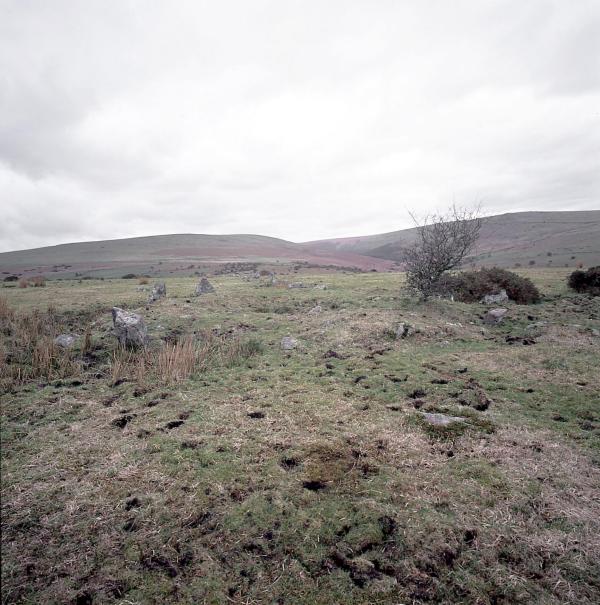
Burford Down Stone Row submitted by Tom_Bullock on 9th Jul 2002. The Burford Down stone row, one of the finest in
Dartmoor, shows evidence of recent damage by whatever farmer is running
huge tractors across the fields. S(he) has been driving right through
the rows (perpendicular to them) along several tracks. I saw evidence of
at least 3 stones that had been dislodged and pushed aside by the wheels
of the tractor. I don't know if there is a procedure for reporting such
damage, or even if the farmer is liable for such damage. I have never, in my 12 year...
(View photo, vote or add a comment)
Burry Lesser
Date Added: 29th Oct 2019
Site Type: Standing Stone (Menhir)
Country: Wales (West Glamorgan)
Visited: Yes on 18th Jun 2013

Burry Lesser submitted by TheCaptain on 18th Jun 2013. Burry Lesser standing stone, seen here approaching from the north along the field edge, viewed looking southwest.
(View photo, vote or add a comment)
Log Text: None
Burry Menhir
Date Added: 29th Oct 2019
Site Type: Standing Stone (Menhir)
Country: Wales (West Glamorgan)
Visited: Yes on 17th Jun 2013

Burry Menhir submitted by TheCaptain on 17th Jun 2013. Approaching the stone from the north, heading south along the field edge.
(View photo, vote or add a comment)
Log Text: None
Burwalls Camp
Date Added: 6th Nov 2023
Site Type: Promontory Fort / Cliff Castle
Country: England (Somerset)
Visited: Yes on 28th Aug 2011. My rating: Condition 2 Ambience 4 Access 5
Burwalls Camp submitted by theCaptain on 15th Sep 2011. View of the site of Burwalls Camp, as seen from Clifton Down Camp across the Avon Gorge.
In the woods to the right, the steep sided Nightingale Valley, which separates Burwalls Camp from Stokeleigh Camp.
(View photo, vote or add a comment)
Log Text: The Burwalls Camp hillfort is one of three iron age forts here probably guarding a ford crossing of the river Avon at the bottom of the Avon Gorge, below where is now the Clifton Suspension Bridge. Now mostly destroyed, with the western end of the Clifton Bridge and massive houses built all over it, a few remnants of the original ramparts can still be seen among the gardens of Burwalls. The neighbouring forts are Stokeleigh camp, just across Nightingale Valley, also on the western side of the Avon Gorge, and Clifton Down Camp on the eastern, Clifton side.
Bury Hill Camp (Winterbourne)
Date Added: 18th Sep 2010
Site Type: Hillfort
Country: England (Gloucestershire)
Visited: Yes on 27th Mar 2004
Bury Hill Camp (Winterbourne) submitted by TheCaptain on 27th Mar 2004. Bury Hill Camp, near Winterbourne Down, South Gloucestershire.
View of the ditch and ramparts of the eastern side. The inside of the fort is to the right of this picture
(View photo, vote or add a comment)
Log Text: None
Butcombe Barrow
Date Added: 18th Sep 2010
Site Type: Round Barrow(s)
Country: England (Somerset)
Visited: Yes on 15th Apr 2004

Butcombe Barrow submitted by TheCaptain on 15th Apr 2004. Butcombe Barrow, Butcombe, North Somerset. ST516627
This impressively situated bowl barrow lies just below the top of a hillock near Bicknell Farm, with splendid views south over Blagdon Lake to the Mendip Hills, and west to the sea. The barrow is about 25 metres in diameter, and traces of its external ditch are still clearly visible. Excavations have obviously been made in the past here, and there is the usual hollow in the top.
(View photo, vote or add a comment)
Log Text: None
