Contributory members are able to log private notes and comments about each site
Sites TheCaptain has logged. View this log as a table or view the most recent logs from everyone
Kerider stèle
Trip No.203 Entry No.537 Date Added: 29th May 2020
Site Type: Standing Stone (Menhir)
Country: France (Bretagne:Finistère (29))
Visited: Yes on 22nd Jun 2005. My rating: Condition 3 Ambience 3 Access 4
Kerider stèle submitted by theCaptain on 22nd Jun 2012. This octagonal section tapered Iron Age stèle can be found near the hamlet of Kerider, a few kilometres to the east of Plouescat.
(View photo, vote or add a comment)
Log Text: This is a nice tapered Iron Age stèle which can be found near the hamlet of Kerider, a few kilometres to the east of Plouescat. It is easy to find, just to the north of the D.10 road to St Pol-de-Léon near to the roundabout. It is about 2 metres tall, and nicely octagonal in section.
Guinivrit
Trip No.203 Entry No.529 Date Added: 28th May 2020
Site Type: Passage Grave
Country: France (Bretagne:Finistère (29))
Visited: Yes on 21st Jun 2005. My rating: Condition 3 Ambience 4 Access 4
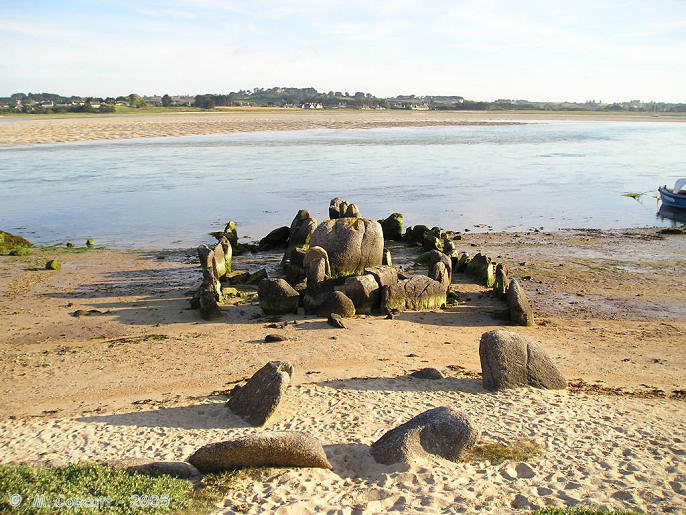
Guinivrit submitted by thecaptain on 25th Mar 2006. Guinivrit allée couverte.
The remains of this allée couverte clearly show the rise in sea level over the past 4000 odd years. Twice a day it gets a wash.
(View photo, vote or add a comment)
Log Text: This really is a nice place to visit, certainly when its quiet and the sun is out. I had hoped to see it with the tide well in tonight, but one thing and another and its now gone 8:00, and the tide is already gone out for two hours, and the water has gone from around it. However, there is still a lot of water flooding out of the bay, and I certainly wouldn't want to try and get a boat in here, as its going at running speed.
The allée couverte is easily found down beside the little harbour, and nowadays is signposted. Its not far at all from the little campsite where I stayed. Despite the fact that it has no capstones, and that some of the large side stones have been broken so it could act as a mole in the water for mooring and protecting boats in the past, it really is surprisingly complete. Most of the stones are still in place, not only of the main chamber, but also the peristalith, which is suitably boat shaped. In fact the whole thing looks rather like a boat pulled up onto the shoreline.
The main chamber is about eleven metres long and 1.5 metres in width, but with the outer stones the full size of the monument is more than double that, perhaps 30 metres by 6 metres. There is both a forward and aft extension to the compartmentalised chamber. Fantastic.
While here, I met a chap out for a bike ride, and we got talking about why I was here and ancient stones. He said he has always lived in the area, and as a boy used to play in the Goazvenn dolmen. He went on to tell me about a large fallen menhir that is almost forgotten, and that nobody ever talks about, and which seems to be in no historical records. He told me how to find it by walking around the coast path, and showed me where it was on my map, fallen onto the rocky shore. I decided that this was one place I had to visit, finding these forgotten stones has much more of a thrill than seeing the well known ones.
Ile Guénioc
Trip No.203 Entry No.519 Date Added: 28th May 2020
Site Type: Chambered Tomb
Country: France (Bretagne:Finistère (29))
Visited: Saw from a distance on 21st Jun 2005. My rating: Condition 5 Ambience 5 Access 1

Ile Guénioc submitted by thecaptain on 17th Jun 2006. This island, which is difficult to get to, has on it three massive cairns with their multitude of chambers and dolmens within them.
This is the best picture I could get on my little camera, taken on full zoom from Ile Tariec, which can be walked to at very low tide.
(View photo, vote or add a comment)
Log Text: Just offshore from Presqu'ile Ste-Marguerite near the town of Landéda, and due west of Ile Tariec, can be seen Ile Guénioc (Ile Gaignog). This island, which is difficult to get to, has on it three massive cairns with their multitude of chambers and dolmens within them. In order to get here a boat is needed, and I think that landing on the island is controlled, so I am not going to manage it now, as there is nobody about with a boat who I can try and persuade!
Through my binoculars from where I am sat on Ile Tariec it looks superb. The southernmost cairn seems to have about half a dozen entrances in the eastern side and facing towards me, but it isn't a very high cairn. The middle cairn is even larger, but it is slightly obscured by a rise in the land in front of it. Several large dolmenic structures can be seen, with slabs of rock in places. The northern cairn is even higher, and looks to have about 4 entrances.
I feel that I really need to get out onto the island to have a proper look. I must come back one day with a small boat. Oh well, the tide has turned half an hour ago, I'd better start making my way back, I don't want to be stuck out on this little island for the next ten hours !
Ilot Roc'h-Avel
Trip No.203 Entry No.515 Date Added: 28th May 2020
Site Type: Chambered Cairn
Country: France (Bretagne:Finistère (29))
Visited: Yes on 21st Jun 2005. My rating: Condition 2 Ambience 4 Access 3
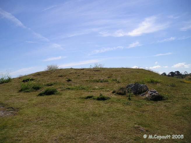
Ilot Roc'h-Avel submitted by thecaptain on 18th Jun 2006. Ilot Roc'h-Avel is a small island just offshore from Presqu'ile Ste-Marguerite, which can be easily walked to from the beach at Kerennoc when not high tide.
Just inland and up a bit from the cairn cut in half by the sea is another cairn, again of which certain edge set stones suggest remains of a chamber.
(View photo, vote or add a comment)
Log Text: Just offshore from Presqu'ile Ste-Marguerite near the town of Landéda are a few small islands which can be reached at low tide, upon which there are stone monuments. Ilot Roc'h-Avel is one of these, which can be easily walked to from the beach at Kerennoc when not high tide tide.
Towards the western tip of the islet is the fascinating remains of a cairn which is now half on the island with the other half now taken by the sea. At the seaward edge can be seen a drystone walled chamber - only the northern half of which remains. A few large stones lie dotted about on the shoreline, which with a bit of imagination can be placed into position for some sort of chamber.
Just inland and up a bit from the cairn cut in half by the sea is another cairn, again of which certain edge set stones suggest remains of a chamber.
There are lots of children out on the beach below, obviously a school visit. All sorts of fun and games are going on, girls shreiking when their feet touch weed or shells! Brilliant. AAaaaaaaarggghhhh - its a crab !!!!!!
Île Tariec menhir
Trip No.203 Entry No.517 Date Added: 28th May 2020
Site Type: Standing Stone (Menhir)
Country: France (Bretagne:Finistère (29))
Visited: Yes on 21st Jun 2005. My rating: Condition 2 Ambience 5 Access 2
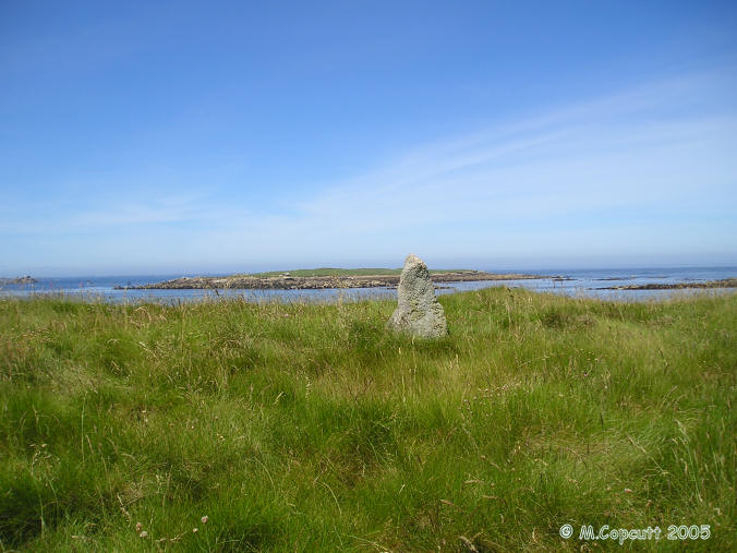
Île Tariec menhir submitted by thecaptain on 20th Jun 2006. On the seaward part of the island are the remains of a chambered cairn and a small menhir. The menhir is only about a metre high, a rock tapered towards the top, but in its position near the top of the island it can be clearly seen from all around.
This is the view to the west, with the reknowned island of Ile Guénioc and its cairns seen in the background.
(View photo, vote or add a comment)
Log Text: Just offshore from Presqu'ile Ste-Marguerite near the town of Landéda are a few small islands which can be reached at low tide, upon which there are stone monuments.
Ile Tariec is one of these, which can only be walked to for a short while each side of low tide, and the island became split into two parts in about 1876. The part of the island nearest to the mainland has the remains of a twelfth century hermitage on it, and the island was used to house dead and ill people in the past when suffering from plague, cholera etc.
On the outward part of the island are the remains of a dolmen and a small menhir. The menhir is only about a metre high, a rock tapered towards the top, but in its position near the top of the island it can be clearly seen from all around.
I was told by the camp site man that the midsummer solstice sun rise, when seen from here with your chin resting on the top of the menhir, supposedly rises between the legs of a dolmen on the main headland, but which has now unfortunately fallen in the dunes. Its a pity I wasn't here 4 or 5 hours ago, as I could have checked the theory. However, from a quick bit of reckoning and I don't think so, the mainland doesn't seem to stretch far enough to the north, but who am I to question the story? The northernmost tip of the mainland is at a bearing of about 075° from here.
Dolmen de Vourch
Trip No.203 Entry No.520 Date Added: 28th May 2020
Site Type: Burial Chamber or Dolmen
Country: France (Bretagne:Finistère (29))
Visited: Couldn't find on 21st Jun 2005
Dolmen de Vourch submitted by regina on 1st Oct 2019. Site in Bretagne:Finistère (29) France
(View photo, vote or add a comment)
Log Text: Supposedly the remains of this dolmen can be found near to the coast path just outside the municipal camping. It is said that if you stand with your chin resting on the menhir out on Ile Tariec, then the solstice sunrise used to rise between the legs of this dolmen. It is not marked on any of my maps, and despite now being fallen, I was told that I should be able to find it. However, despite spending well over an hour looking (and enjoying the walk) I could find no sign of this. It could easily be there somewhere in amongst the bracken and the dunes, which are all up and down, and riddled with wartime bunkers.
Île Tariec cairn
Trip No.203 Entry No.518 Date Added: 28th May 2020
Site Type: Cairn
Country: France (Bretagne:Finistère (29))
Visited: Yes on 21st Jun 2005. My rating: Condition 2 Ambience 5 Access 2
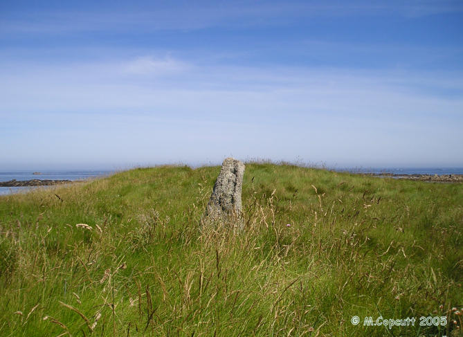
Île Tariec cairn submitted by thecaptain on 20th Jun 2006. On the seaward part of the island are the remains of a chambered cairn and a small menhir.
(View photo, vote or add a comment)
Log Text: Just to the north of the menhir on this little island which can be reached at low tide, is the slight mound of a cairn. Its about 15 metres in diameter and 2 metres in height. I could see nothing in the way of structure under all the grass and stuff.
Créac'h Gallic
Trip No.203 Entry No.528 Date Added: 28th May 2020
Site Type: Passage Grave
Country: France (Bretagne:Finistère (29))
Visited: Yes on 21st Jun 2005. My rating: Condition 4 Ambience 3 Access 5
Créac'h Gallic submitted by TheCaptain on 17th Apr 2011. Here are the remains of a fairly large megalithic structure, but it looks to be in a bit of a precarious state. Warning signs and a fence warn of climbing on or near to the stones.
(View photo, vote or add a comment)
Log Text: Here are the remains of a fairly large dolmen, but it looks to be in a bit of a precarious state. Warning signs and a fence warn of climbing on or near to the stones. The basic chamber is about 4 metres by 2 metres and 2 metres high, with a single capstone resting (just) on three support stones. It looks like a fourth support has recently broken and fallen, and it looks most precarious and that it could fall at any time.
Strangely there are many large slabs around the outside, making a sort of wall, I cannot really make this out at all. Seems it was once a large allée couverte with a peristalith surrounding its mound, some of which still survives. But its a bit difficult to fully make out and understand, and has no doubt been damaged in the past with the construction of the farms and the lanes.
There are many other large stones laying around, I need to try and look this one up. Now I know what it is, it seems obvious what the remains are.
Croazou chapel stèles
Trip No.203 Entry No.525 Date Added: 28th May 2020
Site Type: Standing Stone (Menhir)
Country: France (Bretagne:Finistère (29))
Visited: Yes on 21st Jun 2005. My rating: Condition 3 Ambience 2 Access 5
Log Text: This is an odd little place where many thousands of years of ritual and worship can all be seen together. In the middle of a fairly busy road junction is built a little chapel which is said to be the smallest in Finistère.
This chapel has been built onto a stèle with it still standing there at one of the back corners about 2 metres tall. Outside the back wall are three medieval crosses positioned on top of a fallen menhir supposedly in all being in their original positions. Around the outside of the chapel is also a fairly recent collection of other crosses from the region which includes one intriguing cross which has been mounted on the top portion of what was obviously once a lovely iron age stele with wonderful shaping and patterns carved into it.
Croazou chapel menhir
Trip No.203 Entry No.526 Date Added: 28th May 2020
Site Type: Standing Stone (Menhir)
Country: France (Bretagne:Finistère (29))
Visited: Yes on 21st Jun 2005. My rating: Condition 3 Ambience 3 Access 5
Croazou chapel menhir submitted by regina on 1st Oct 2019. Site in Bretagne:Finistère (29) France
(View photo, vote or add a comment)
Log Text: This is an odd little place where many thousands of years of ritual and worship can all be seen together. In the middle of a fairly busy road junction is built a little chapel which is said to be the smallest in Finistère. This chapel has been built onto a stèle with it still standing there at one of the back corners about 2 metres tall.
Outside the back wall are three medieval crosses positioned on top of a fallen menhir supposedly in all being in their original positions. Around the outside of the chapel is also a fairly recent collection of other crosses from the region which includes one intriguing cross which has been mounted on the top portion of what was obviously once a lovely iron age stele with wonderful shaping and patterns carved into it.
Croazou chapel
Trip No.203 Entry No.524 Date Added: 28th May 2020
Site Type: Ancient Cross
Country: France (Bretagne:Finistère (29))
Visited: Yes on 21st Jun 2005. My rating: Condition 3 Ambience 3 Access 5
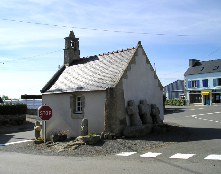
Croazou chapel submitted by thecaptain on 3rd Jul 2005. The little chapel at Croazou in its modern road junction.
The cornerstone is an Iron Age Stele, and the three medieval crosses by the back wall are sitting on a fallen menhir.
How much more continuity of somewhere being a sacred place can you get.
(View photo, vote or add a comment)
Log Text: This is an odd little place where many thousands of years of ritual and worship can all be seen together. In the middle of a fairly busy road junction is built a little chapel which is said to be the smallest in Finistère. This chapel has been built onto a stèle with it still standing there at one of the back corners about 2 metres tall.
Outside the back wall are three medieval crosses positioned on top of a fallen menhir supposedly in all being in their original positions. Around the outside of the chapel is also a fairly recent collection of other crosses from the region which includes one intriguing cross which has been mounted on the top portion of what was obviously once a lovely iron age stele with wonderful shaping and patterns carved into it.
Trouble is while I was there it must have been going home time and the junction was very busy and stopping and getting pictures was very difficult having enough time to stand in the road and get a photo without getting run down.
Men-Marz
Trip No.203 Entry No.527 Date Added: 28th May 2020
Site Type: Standing Stone (Menhir)
Country: France (Bretagne:Finistère (29))
Visited: Yes on 21st Jun 2005. My rating: Condition 5 Ambience 4 Access 5
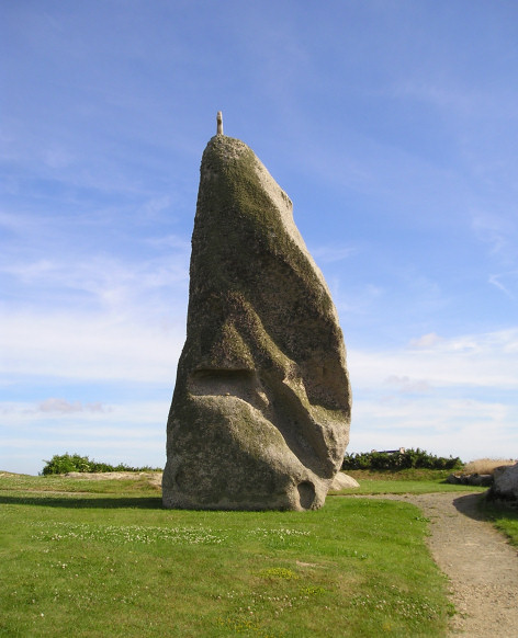
Men-Marz submitted by thecaptain on 3rd Jul 2005. Men-Marz (the Miracle Stone) seen from the north side in all its 8.5 metre glory.
(View photo, vote or add a comment)
Log Text: What a wonderful and fantastic menhir this is easily found to the north of Brignogan-Plage village by following plentiful signs. Men-Marz (the Miracle Stone in Breton) or Men-Bras (Grand Stone) is now set in a nice little area a previously close built house having been bought and demolished by the state and has a good information centre across the road with lots of informative boards.
At between 8.2 and 8.5 metres high depending upon where it is measured on the sloping ground it is said to be the fourth largest menhir still standing in France. It is a strange shaped beast as are the natural rocks around here and looks to be a thin and straight beast when seen from front and back but is a sort of triangular shape when seen from the sides with multiple cavities and ledges in the sides.
The stone has suffered from Christianising vandalism on at least two occasions as it not only has a granite cross mounted on the top but there is also an engraved cross on the south-eastern corner about 1.5 metres from the ground.
This stone has many legends attached to it which seem to get a bit mixed up and confused. There is a fairly flat ledge high up on the south side with several loose stones sitting on it. There seems to be two stories attached to this and the habit of throwing up pebbles onto it. One of the stories has it that young girls wanting to get married go to the stone and throw up a pebble. If the stone lands on the ledge and doesn’t fall down then she will be married within the year. This story is also told in a slightly different form in that young newly wed couples go to the stone and throw up a pebble and if the pebble lands and stays on the ledge then they will have an heir before the year is out. One throw only obviously. To this day newly wed couples come to this stone straight after the service.
While there I took my chances and threw a stone up and it did indeed stay up on the ledge. I do not know what this now has in store for me !
Goarivan Menhir
Trip No.203 Entry No.523 Date Added: 28th May 2020
Site Type: Standing Stone (Menhir)
Country: France (Bretagne:Finistère (29))
Visited: Yes on 21st Jun 2005. My rating: Condition 3 Ambience 4 Access 5
Goarivan menhir submitted by TheCaptain on 21st Jun 2011. This is a nice 3.6 metre tall menhir in a field just to the north of the hamlet of Goarivan, which can be reached along a farm track round the back of the houses.
(View photo, vote or add a comment)
Log Text: This is a nice 4 metre tall menhir in a field just to the north of the hamlet of Goarivan, which can be reached along a farm track round the back of the houses. It's got a very curious thing near the base of its northern side, which looks like a marble in a case. There is a rounded white quartz lump which has been worn away from the grey surrounding granite and smoothed spherical. It looks like it should rattle around in the hole, but unfortunately it doesn't. I have no doubt that there are some stories and legends associated with this, but I do not know of any.
Grouanec stèle
Trip No.203 Entry No.521 Date Added: 28th May 2020
Site Type: Standing Stone (Menhir)
Country: France (Bretagne:Finistère (29))
Visited: Yes on 21st Jun 2005. My rating: Condition 4 Ambience 3 Access 5
Grouanec stèle submitted by theCaptain on 20th Feb 2012. This is a fantastic iron age stèle by the D.32 roadside just to the east of the village of St Groanec, which has been christainised and turned into a roadside cross.
(View photo, vote or add a comment)
Log Text: This is a fantastic iron age stèle by the D.32 roadside just to the east of the village of St Groanec, which has been christainised and turned into a roadside cross. The stèle is about 3.5 metres tall with an extra metre on top for the cross. It is tapered towards the top and carved into an octagonal shape, with each of the faces concave. What a super find.
St Grouanec well
Trip No.203 Entry No.522 Date Added: 28th May 2020
Site Type: Holy Well or Sacred Spring
Country: France (Bretagne:Finistère (29))
Visited: Yes on 21st Jun 2005. My rating: Condition 4 Ambience 4 Access 5
St Grouanec well submitted by theCaptain on 21st Jun 2012. One of several little well houses at the site of the St Groanec chapel, where there are many wells and springs gushing forth.
(View photo, vote or add a comment)
Log Text: At the site of the St Groanec chapel there are many wells and springs gushing forth. The water is just flowing out of the ground here. It is no wonder the ancient chapel was built here.
Île Carn cairn
Trip No.203 Entry No.514 Date Added: 27th May 2020
Site Type: Chambered Cairn
Country: France (Bretagne:Finistère (29))
Visited: Saw from a distance on 20th Jun 2005. My rating: Access 2
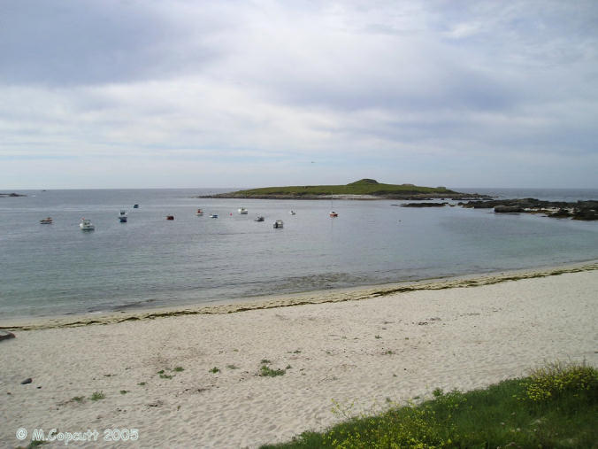
Île Carn cairn submitted by thecaptain on 15th Jun 2006. Île Carn, just off the northwestern coast of Brittany.
Unfortunately, when I was passing here the tide was not fully out, and rising, so I could not get out onto the little island with its massive and spectacular cairn.
I tried stopping nearby for the night, which would have let me get out onto the island next morning, but the local campsite was closed and deserted, and I had worldly needs, so had to move on elsewhere, still hoping to come back the next morning.......
(View photo, vote or add a comment)
Log Text: Just offshore is this little island which can be reached a low tide, with a massive cairn containing three dolmenic chambers. There are also some WW2 gun emplacements and lookouts which spoil it a bit. The cairn is massive, and looks like its been quarried into, and from the shore the entry to one of the chambers can be seen. Its a pity I cannot get out to have a look. Should I borrow a boat ?
Île Melon Dolmen
Trip No.203 Entry No.501 Date Added: 27th May 2020
Site Type: Burial Chamber or Dolmen
Country: France (Bretagne:Finistère (29))
Visited: Saw from a distance on 20th Jun 2005. My rating: Condition 3 Ambience 4 Access 2
Île Melon dolmen submitted by rw1 on 6th Mar 2008. 09/2007
(View photo, vote or add a comment)
Log Text: This is frustrating. There is only 15 metres of water between me and the island from where I sit, but the tide is coming in and the island is not going to get any nearer. The dolmen is on top of the island and looks a nice one, its capstone sitting on at least four support stones. There are also at least two menhirs further down to the south of the island, and looking towards the shore. Perhaps a swim is needed !
Kergadiou Menhirs
Trip No.203 Entry No.500 Date Added: 27th May 2020
Site Type: Standing Stones
Country: France (Bretagne:Finistère (29))
Visited: Yes on 20th Jun 2005. My rating: Condition 5 Ambience 4 Access 4

Kergadiou menhirs submitted by thecaptain on 8th Jul 2006. Kergadiou menhir 2 is another king sized menhir, 11 metres long, which unfortunately is not standing upright, but leaning at a very shallow angle.
It is perfectly smoothed into an extremely flat face on its upper surface, while the lower surface is still rough
(View photo, vote or add a comment)
Log Text: The two menhirs of Kergadiou are a fine place to visit, and fairly easily found in a field a couple of kilometres north of the Aber Ildut estuary. From these two giant menhirs, it is possible to see the Kerloas menhir when the modern trees are not in leaf, and the sightline over the Kerloas menhir is perpendicular to the midsummer sunrise. Coincidence ?
Kergadiou menhir 1 is a really magnificent monster menhir, 8.8 metres tall, and the most beautifully and perfectly smoothed and shaped menhir there is. Just 80 metres away to the northeast is its neighbour, another king sized menhir which unfortunately is not standing upright, but leaning at a very shallow angle. It is perfectly smoothed into an extremely flat face on its upper surface, while the lower surface is still rough, which leads to conjecture that it has perhaps never stood, and is left here unfinished. An alternate viewpoint is that it stood as a rough stone, and fell while being pounded into its smoothed and flattened shape, perhaps in preparation for some carvings. This menhir is 11 metres in length, so would have probably stood to the same height as its neighbour.
What a tremendous place.
Pointe de Guilligui allée couverte
Trip No.203 Entry No.512 Date Added: 27th May 2020
Site Type: Passage Grave
Country: France (Bretagne:Finistère (29))
Visited: Yes on 20th Jun 2005. My rating: Condition 4 Ambience 4 Access 4
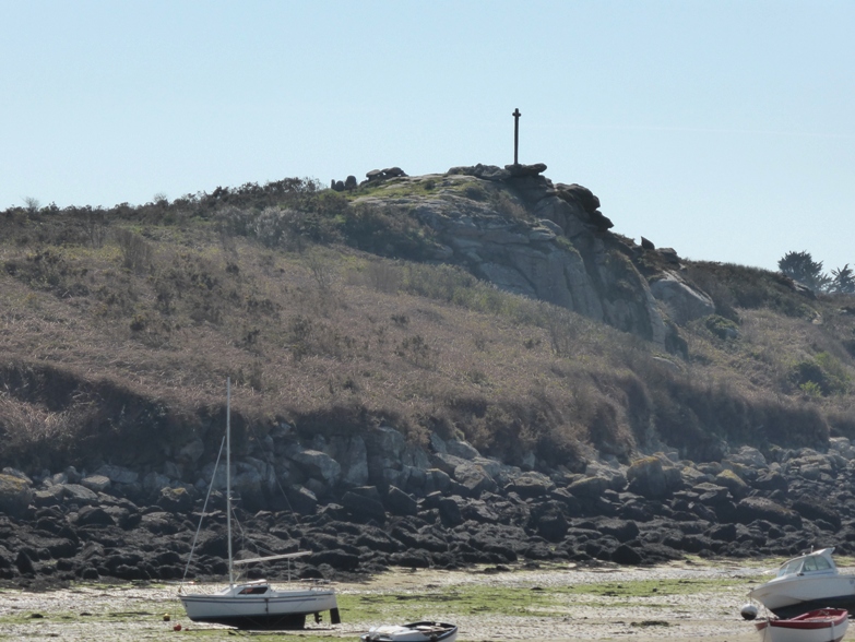
Pointe de Guilligui allée couverte submitted by theCaptain on 21st Apr 2014. Pointe de Guilligui allée couverte seen in its hilltop position from across the bay, on the quay at Portsall.
(View photo, vote or add a comment)
Log Text: This is an unusual allée couverte, not quite at the top of the Guilliguy headland, overlooking the ocean where the Amoco Cadiz was wrecked, and the little port of Portsall. This is a place which has been revered over the millennia, and still serves as a place for thought by the big cross, and the views are fantastic.
The allée couverte was built in the neolithic, but much altered during the bronze age. It is now an L shaped tomb, the main part being 6 metres long by 2 metres wide with a couple of capstones still in place. At the eastern end an extra chamber has been built onto the south side, about 4 metres in length and still with one capstone. There is a nicely carved entrance stone between the two. It looks to me like the main chamber has been shortened here when this extra chamber was made, and a couple of stones still survive to the east.
Kerivoret Menhir
Trip No.203 Entry No.503 Date Added: 27th May 2020
Site Type: Standing Stone (Menhir)
Country: France (Bretagne:Finistère (29))
Visited: Yes on 20th Jun 2005. My rating: Condition 3 Ambience 3 Access 4
Kerivoret menhir submitted by theCaptain on 20th Jun 2014. About 50 metres away from the Kerivoret dolmen is a nice menhir, which looks to have been shaped with a slanted top. It's about 3.5 metres tall.
(View photo, vote or add a comment)
Log Text: About 50 metres away from the Kerivoret dolmen is a nice menhir, which looks to have been shaped with a slanted top. It's about 3.5 metres tall.
