Contributory members are able to log private notes and comments about each site
Sites TheCaptain has logged. View this log as a table or view the most recent logs from everyone
Oppidum de Pech de Maho
Trip No.205 Entry No.96 Date Added: 8th Nov 2020
Site Type: Ancient Village or Settlement
Country: France (Languedoc:Aude (11))
Visited: Saw from a distance on 14th Sep 2005
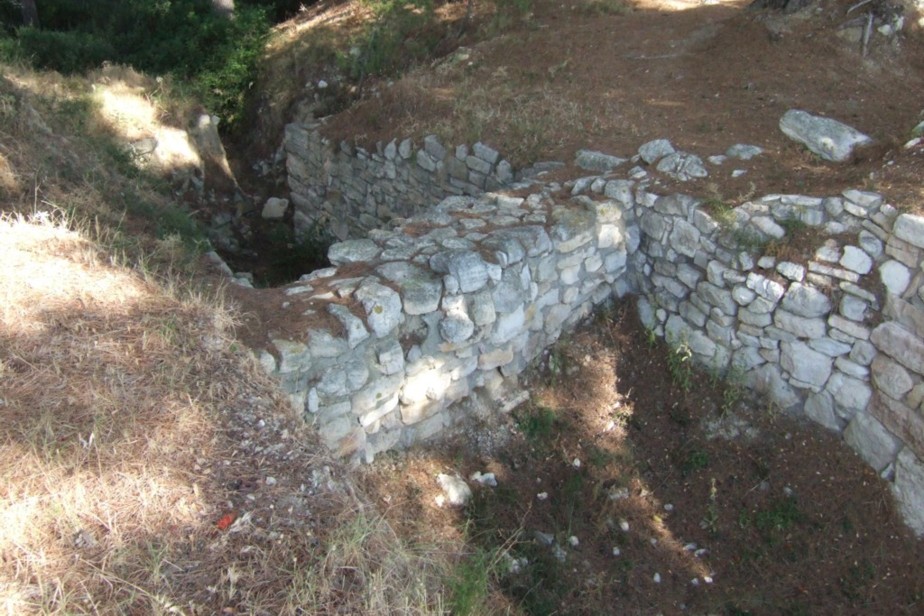
Oppidum de Pech de Maho submitted by catweasel11 on 30th Jul 2006. I believe, when they rebuilt this, they forgot the gate that would allow for a flow of water.
Oppidum at village of Sigean
(View photo, vote or add a comment)
Log Text: A large hill, but I got distracted while trying to have a proper look, as there was a large accident being cleared up, and I couldn’t turn down the small road to have a close look.
Tombeau de Roland
Trip No.205 Entry No.101 Date Added: 9th Nov 2020
Site Type: Burial Chamber or Dolmen
Country: France (Languedoc:Aude (11))
Visited: Yes on 14th Sep 2005. My rating: Condition 2 Ambience 4 Access 4
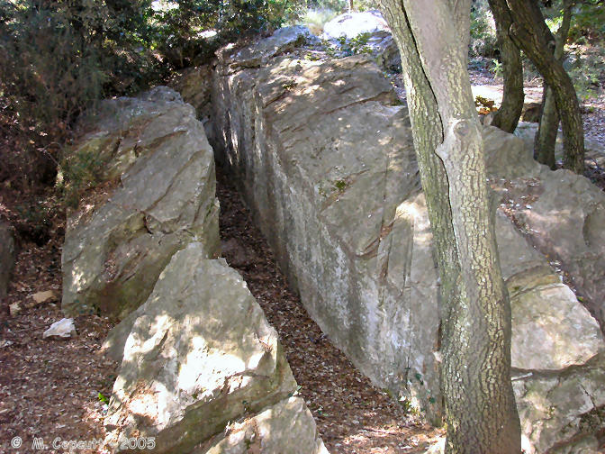
Tombeau de Roland submitted by thecaptain on 12th Mar 2006. Just up the hillside a bit from Dolmen de La Jagartière can be found the Tombeau de Roland.
Once thought to be a megalithic tomb, the latest thoughts are that it is nothing more than a place from where a large rock has been quarried. But why up here ?
(View photo, vote or add a comment)
Log Text: Just up the hillside a bit from Dolmen de La Jagartière can be found the Tombeau de Roland. Once thought to be a megalithic tomb, the latest thoughts are that it is nothing more than a place from where a large rock has been quarried. But quite why somebody would come to such a place, far away from any buildings up a hillside, which has several other tombs nearby, I do not know. Surely a source of rock more convenient could have been found.
Menhir dit la Pierre Droite (Villeneuve-Minervois)
Trip No.205 Entry No.102 Date Added: 9th Nov 2020
Site Type: Standing Stone (Menhir)
Country: France (Languedoc:Aude (11))
Visited: Couldn't find on 14th Sep 2005
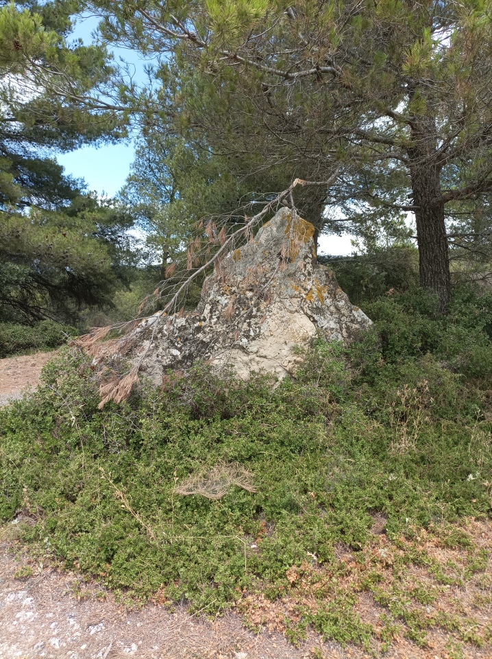
Menhir dit la Pierre Droite (Villeneuve-Minervois) submitted by Mick_Connor on 24th Jul 2025. Site in Languedoc:Aude (11) France This the view from the field on the other side from the road, it is rougher on the other side.
(View photo, vote or add a comment)
Log Text: I failed to find this stone on the way down the hill. It is supposedly about 1.5 kilometres from the village of Villeneuve-Minervois, at the side of the road.
Dolmen de la Jagartière
Trip No.205 Entry No.100 Date Added: 9th Nov 2020
Site Type: Burial Chamber or Dolmen
Country: France (Languedoc:Aude (11))
Visited: Yes on 14th Sep 2005. My rating: Condition 5 Ambience 5 Access 4
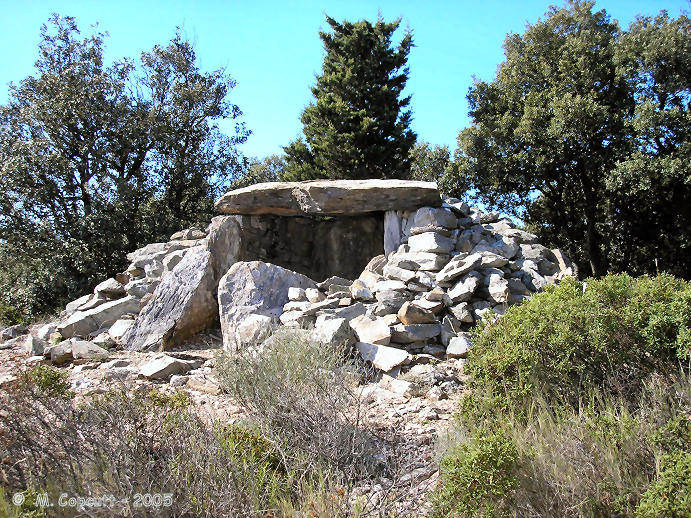
Dolmen de la Jagartière submitted by thecaptain on 20th Mar 2006. The slab sided chamber, 3 metres by 2 metres, is covered with a single large capstone, and has an entry looking over the Aude valley to the southeast at 160°. There is a small cairn surrounding the chamber, of which the excavations showed it to be of diameter only 8.5 metres, with an encircling circle of stones.
(View photo, vote or add a comment)
Log Text: From the wine village of Villeneuve-Minervois, follow the little windy road northwards for about 4 kilometres into the hills towards Pujol-du-Bosc. This road up into the mountains is now a properly made up road, rather than the dirt track it was 6 years ago. Eventually you will find a parking area and a dolmen sign. Two little signposted walks are arranged, with all sorts of items of interest to see along the way, such as limestone ovens, shepherds huts, and many signs pointing out the various types of vegetation.
From the parking area, take the path to the right from the car park, and after a few hundred metres you will find this splendidly restored dolmen, sitting with wondrous views over the Minervois countryside and the Aude valley to the south. As I sit and write this, theres lots of shouting and horns blowing, is there a hunt on, or is it just shepherds moving their flocks ? The slab sided chamber, 3 metres by 2 metres, is covered with a single large capstone, and has an entry looking over the valley to the southeast at 160°. There is a small cairn surrounding the chamber, of which the excavations showed it to be of diameter only 8.5 metres, with an encircling circle of stones.
It really is superb up here! There's Canigou in the distance to the southeast, and the Meditterranean sea can be seen shimmering on the horizon.
Roque Traoucado
Trip No.205 Entry No.99 Date Added: 9th Nov 2020
Site Type: Burial Chamber or Dolmen
Country: France (Languedoc:Aude (11))
Visited: Yes on 14th Sep 2005. My rating: Condition 2 Ambience 4 Access 4

Roque Traoucado submitted by thecaptain on 13th Mar 2006. Roque Traoucado, up on the southern slopes of the Montagne Noire in Minervois wine country.
The views from up here, over the plain of the Aude river are truly spectacular. On a clear day, the Mediterranean sea and the sacred mountain of Canigou in the Pyrénées are clearly visible.
(View photo, vote or add a comment)
Log Text: From the wine village of Villeneuve-Minervois, follow the little windy road northwards for about 4 kilometres into the hills towards Pujol-du-Bosc. This road up into the mountains is now a properly made up road, rather than the dirt track it was 6 years ago. Eventually you will find a parking area and a dolmen sign. Two little signposted walks are arranged, with all sorts of items of interest to see along the way, such as limestone ovens, shepherds huts, and many signs pointing out the various types of vegetation.
From the parking area take the short path to the left of the road, and you soon come to the remains of this dolmen, excavated in 1972. What you find is the remains of a round stone cairn, diameter about 18 metres and encircled by several large upright stones, with the remains of a chamber in the middle. The chamber is 4 metres in length, by 1 metre wide, and slab lined, but there are no capstones. There is an entry corridor, strangely oriented towards the southwest. Amongst items found here during the excavations were copper and bronze bracelets. Dating showed that the tomb was in use for a long time during the third millennium BC.
Morrel das Fadas
Trip No.205 Entry No.106 Date Added: 9th Nov 2020
Site Type: Passage Grave
Country: France (Languedoc:Aude (11))
Visited: Yes on 15th Sep 2005. My rating: Condition 4 Ambience 5 Access 4
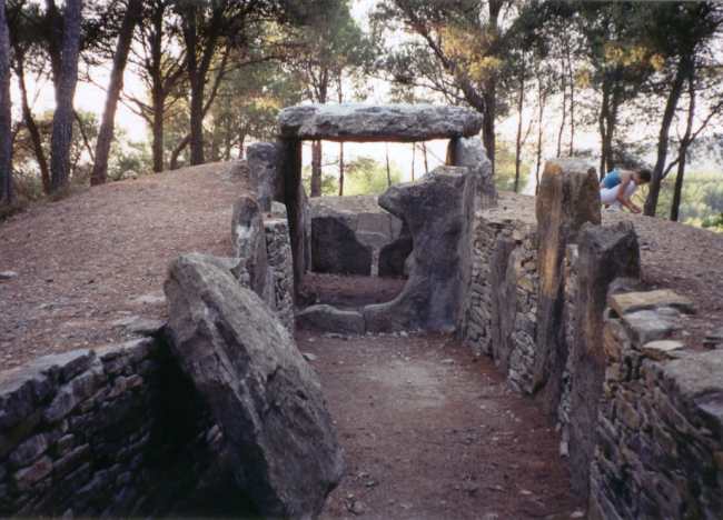
Morrel das Fadas submitted by thecaptain on 6th Dec 2003. The Morrel das Fadas, near to the village of Pepieux, in the Minervois region of Aude, southwest France
(View photo, vote or add a comment)
Log Text: Visited again to get some pictures in the bright morning sun, although the sun doesn’t make it through the trees.
Morrel das Fadas replica
Trip No.205 Entry No.105 Date Added: 9th Nov 2020
Site Type: Modern Stone Circle etc
Country: France (Languedoc:Aude (11))
Visited: Yes on 15th Sep 2005. My rating: Condition 4 Ambience 3 Access 5
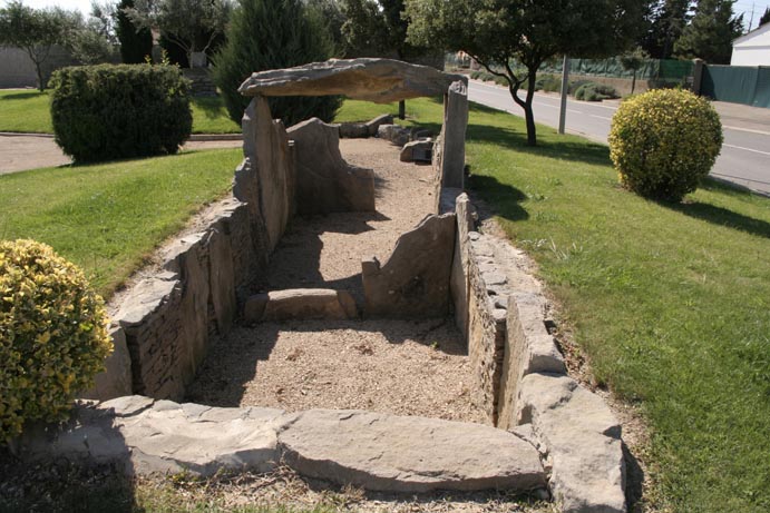
Morrel das Fadas replica submitted by shamrockstone on 6th Jul 2008. A replica of the dolmen, in the nearby village of Pepieux
(View photo, vote or add a comment)
Log Text: A small representation of the dolmen des Fades has been built near the roundabout outside the campsite at Pepieux. Excellent.
Lacam de Peyrarines
Trip No.205 Entry No.162 Date Added: 15th Nov 2020
Site Type: Stone Circle
Country: France (Languedoc:Gard (30))
Visited: Yes on 19th Sep 2005. My rating: Condition 5 Ambience 5 Access 4
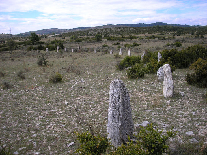
Lacam de Peyrarines submitted by thecaptain on 6th Oct 2005. Lacam de Peyrarines. A fantastic proper stone circle in France.
The stones arcing away in the southwest sector
(View photo, vote or add a comment)
Log Text: Take the road towards Blandas from Montdardier, and after a few kilometres there is a big junction of ways. About 600 metres down the road towards Blandas from the junction, and in the field to the right can be seen this tremendous cromlech.
This is a proper circle of stones, with 52 standing stones up to about 1.8 metres high making a circle of about 120 metres diameter. At the centre is a large menhir, well over two metres high. There are gaps in the circle, and several more stones which were possibly part of the circle are laying down. The stones which make up the circle are all different shapes and sizes, of this fragile and pockmarked limestone. There are tall thin ones, big rectangular stumps, short squat blocks, diamonds, triangles, slanted top stones and a few almonds.
Just sat at the centre of this circle looking at all the stones around me it feels wonderful. One of the stones has like a giant finger pointing upwards. One of them is full of holes (number 35 in my counting !). Most of them are very evenly spaced, but it is not all that way. This really is a special place. Most of the stones are of the local crumbly flaky pale limestone, but not all, as a few of the large stones are a dark brown gritty sort of rock.
La Pierre Bamboche 2
Trip No.205 Entry No.210 Date Added: 30th Nov 2020
Site Type: Standing Stone (Menhir)
Country: France (Languedoc:Gard (30))
Visited: Yes on 24th Sep 2005. My rating: Condition 2 Ambience 2 Access 5
La Pierre Bamboche 2 submitted by thecaptain on 8th Aug 2006. Nearby to the La Pierre Bamboche can be found the remains of another menhir, now fallen and broken. The remains can be found about 30 metres away, in the direction of Sanilhac.
(View photo, vote or add a comment)
Log Text: Nearby to the La Pierre Bamboche can be found the remains of another menhir, now fallen and broken. The remains can be found about 30 metres away, in the direction of Sanilhac.
La Pierre Bamboche 1
Trip No.205 Entry No.209 Date Added: 30th Nov 2020
Site Type: Standing Stone (Menhir)
Country: France (Languedoc:Gard (30))
Visited: Yes on 24th Sep 2005. My rating: Condition 3 Ambience 3 Access 5
La Pierre Bamboche 1 submitted by thecaptain on 8th Aug 2006. La Pierre Bamboche stands at over 2 metres tall, but has been cemented back together from several pieces, the top having been broken off in the past.
(View photo, vote or add a comment)
Log Text: This stone is easy to find, driving west along the D.112 towards Sanilhac, and after a couple of kilometres there it is, standing right beside the road at a corner. It stands at over 2 metres tall, but has been cemented back together from several pieces, the top having been broken off in the past.
Oppidum de Nages
Trip No.205 Entry No.196 Date Added: 26th Nov 2020
Site Type: Ancient Village or Settlement
Country: France (Languedoc:Gard (30))
Visited: Saw from a distance on 21st Sep 2005
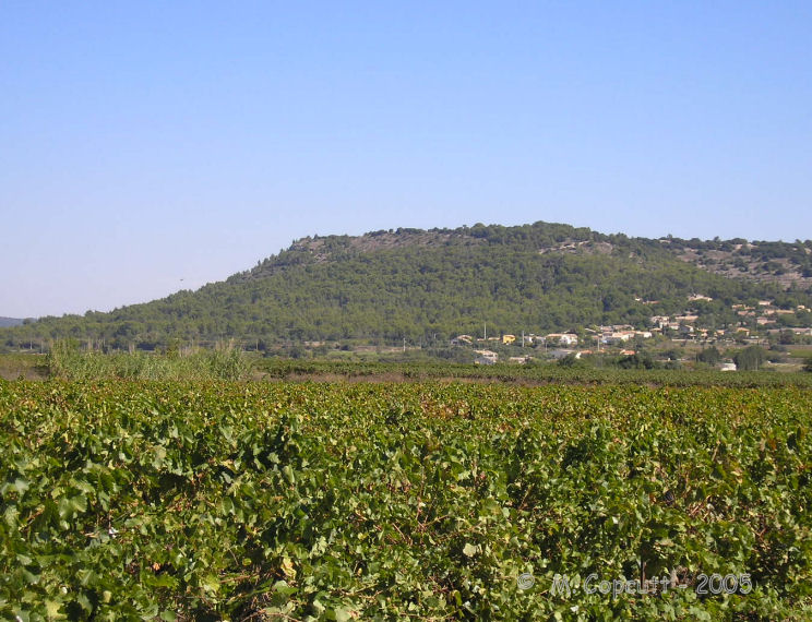
Oppidum de Nages submitted by thecaptain on 19th Apr 2008. On the top of the hill to the north of Nages are the remains of an oppidum.
This is a nice looking hill rising steeply from the plains, and with what looks to be a sculpted top.
Viewed here from the southwest.
(View photo, vote or add a comment)
Log Text: On the top of the hill to the north of Nages are the remains of an oppidum. This is a nice looking hill rising steeply from the plains, and with what looks to be a sculpted top.
Menhir de Landre 1
Trip No.205 Entry No.163 Date Added: 24th Nov 2020
Site Type: Standing Stone (Menhir)
Country: France (Languedoc:Gard (30))
Visited: Saw from a distance on 19th Sep 2005
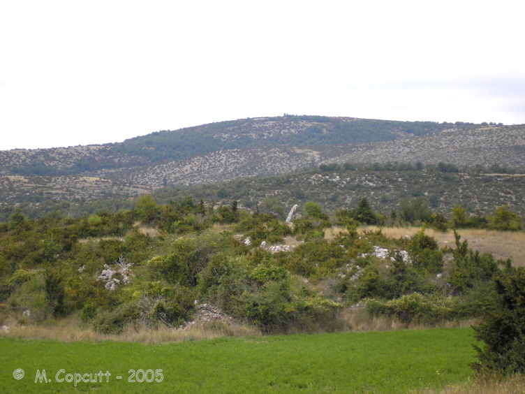
Menhir de Landre 1 submitted by thecaptain on 1st Aug 2008. This menhir stands up on top of its little hillock, about 70 metres to the side of the road.
(View photo, vote or add a comment)
Log Text: From the Planas junction, take the small road towards Le Landre. After a couple of kilometres, just after passing over the brow of a hill, and you can see this menhir up on top of its little hillock, about 70 metres to the left of the road. It was all well fenced in when I visited, behind a little cropped field, so I couldn't get to the stone. It looks about 2.5 metres tall, and leans at quite an angle. Splendid views from here to the north, and the Cevennes.
Lacam de Rogues 1
Trip No.205 Entry No.174 Date Added: 24th Nov 2020
Site Type: Stone Circle
Country: France (Languedoc:Gard (30))
Visited: Yes on 19th Sep 2005. My rating: Condition 1 Ambience 2 Access 4

Lacam de Rogues 1 submitted by thecaptain on 3rd Dec 2009. The first Cromlech de Rogues.
There is not much here to be seen, but there are a few large lumps of stone laying around, and with an eye of faith, an arc can possibly be made out with some of them.
(View photo, vote or add a comment)
Log Text: From the main road passing the village of Rogues, take the dirt track leading northwest from near the electrical transformer, opposite the road to the village. After 300 metres walking down this track, there is a little mound on the right side, of which the centre has been dug out. To the other side of the track here are the remains of the first Cromlech de Rogues. There is not much here to be seen, but there are a few larger lumps of stone laying around, and with an eye of faith, an arc can possibly be made out with some of them.
Oppidum de la Blacarède
Trip No.205 Entry No.176 Date Added: 24th Nov 2020
Site Type: Ancient Village or Settlement
Country: France (Languedoc:Gard (30))
Visited: Saw from a distance on 19th Sep 2005

Oppidum de la Blacarède submitted by thecaptain on 3rd Dec 2009. To the northeast of the village of Rogues is a large rounded hill with remains of an Oppidum on the top.
(View photo, vote or add a comment)
Log Text: Just to the northeast of the village of Rogues is a large rounded hill with remains of an Oppidum on the top.
Ciste de Lacam
Trip No.205 Entry No.173 Date Added: 24th Nov 2020
Site Type: Burial Chamber or Dolmen
Country: France (Languedoc:Gard (30))
Visited: Yes on 19th Sep 2005. My rating: Condition 2 Ambience 3 Access 4
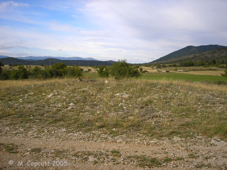
Ciste de Lacam submitted by thecaptain on 5th Dec 2009. After 300 metres walking down this track, there is a little mound on the right side, of which the centre has been dug out.
(View photo, vote or add a comment)
Log Text: From the main road passing the village of Rogues, take the dirt track leading northwest from near the electrical transformer, opposite the road to the village. After 300 metres walking down this track, there is a little mound on the right side, of which the centre has been dug out. Inside can be seen the slab stone remains of a central burial cist. Probably never a full dolmen, but maybe a later iron age burial. None of the slabs are more than 50cm in length.
Lacam de Rogues 2
Trip No.205 Entry No.175 Date Added: 24th Nov 2020
Site Type: Stone Circle
Country: France (Languedoc:Gard (30))
Visited: Yes on 19th Sep 2005. My rating: Condition 2 Ambience 5 Access 3

Lacam de Rogues 2 submitted by thecaptain on 6th Dec 2009. The central pillar is the only stone of this circle still standing, and it is not much more than a metre high.
The circle of stones around it is about 90 metres in diameter, and there are many stones remaining, but all fallen and crumbling, as is the wont of this fragile pale limestone.
(View photo, vote or add a comment)
Log Text: From the main road passing the village of Rogues, take the dirt track leading northwest from near the electrical transformer, opposite the road to the village. Walk about 600 metres along this track, always keeping to the right when there is a choice. There is then a little cultivated field in the valley to the right, go around this and to the top of the higher ground beyond it, and continue for another 300 metres.
At the highest point is a little tree growing, with the central pillar for this cromlech standing beside it. This central pillar is the only stone of this circle still standing, and it is not much more than a metre high. The circle of stones around it is about 90 metres in diameter, and there are many stones remaining, but all fallen and crumbling, as is the wont of this fragile pale limestone. I would imagine there to be bits of at least 30 stones still in evidence, most of them being in the northern half of the circle. The southern half is practically barren, and there has been a wall, or field clearance line of stones created where a big one of the circle would have been.
Apart from the cold wind blowing across this plateau, the clouds have now mostly cleared, and it is becoming a clear blue sky with great visibility. It really is special up here, with magnificent views all around over the Causse, with hills and mountains in the distance all around. The Cevennes to the north look particularly enchanting in the low golden sunlight.
Dolmen de Barral
Trip No.205 Entry No.170 Date Added: 24th Nov 2020
Site Type: Burial Chamber or Dolmen
Country: France (Languedoc:Gard (30))
Visited: Yes on 19th Sep 2005. My rating: Condition 3 Ambience 3 Access 4
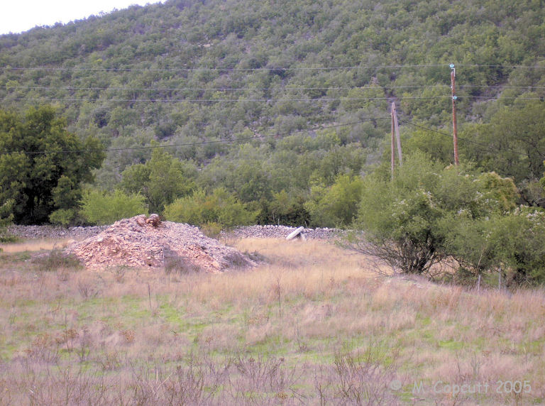
Dolmen de Barral submitted by thecaptain on 9th Dec 2009. The dolmen is visible from the road, although a visit is not readily possible as it is on private property.
(View photo, vote or add a comment)
Log Text: At the eastern edge of the hamlet of Barral, built into a wall to the north of the road, across a field, can be seen this little dolmen. The stones are easily visible from the road, although a visit was not really possible.
Trivalle menhir
Trip No.205 Entry No.172 Date Added: 24th Nov 2020
Site Type: Standing Stone (Menhir)
Country: France (Languedoc:Gard (30))
Visited: Yes on 19th Sep 2005. My rating: Condition 3 Ambience 3 Access 5

Trivalle menhir submitted by thecaptain on 9th Dec 2009. Named Trivalle since Roman times, because it is situated at the junction of three ancient trackways, this menhir stands about 1.7 metres tall, just outside the ancient village of Rogues.
(View photo, vote or add a comment)
Log Text: Named Trivalle since Roman times, because it is situated at the junction of three ancient trackways, this menhir stands about 1.7 metres tall, just outside the ancient village of Rogues, on the road west towards Blandas, not far from the church.
Arques Dolmen
Trip No.205 Entry No.165 Date Added: 24th Nov 2020
Site Type: Burial Chamber or Dolmen
Country: France (Languedoc:Gard (30))
Visited: Yes on 19th Sep 2005. My rating: Condition 3 Ambience 3 Access 4
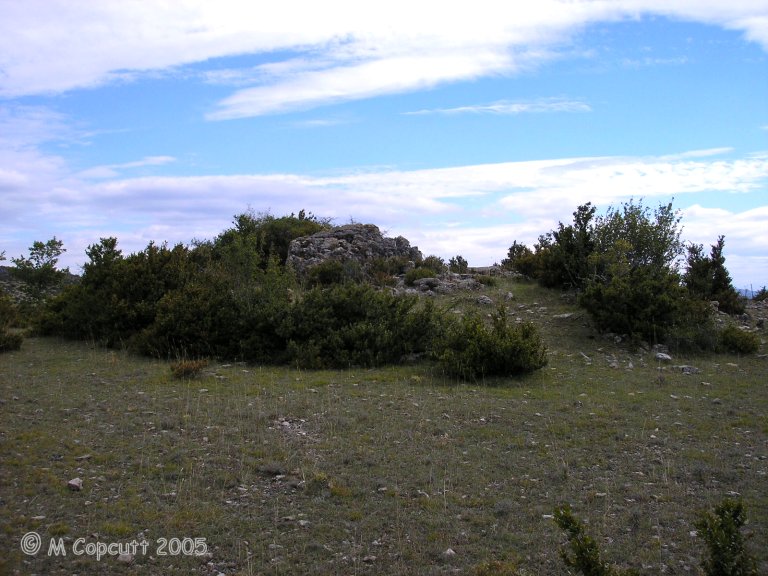
Arques Dolmen submitted by thecaptain on 9th Dec 2009. The remains of this fairly large dolmen are just off the road, and still mostly within a fairly large tumulus.
(View photo, vote or add a comment)
Log Text: This dolmen can be found just to the left of the road west from Planas towards Le Quintanel, turning left just before you reach Le Landre and continuing for about a kilometre until you pass the brow of a hill.
The remains of this fairly large dolmen are just off the road, and still mostly within a fairly large tumulus. The back stone and two side slabs are in position, but the capstone is dislodged to one side. The chamber is 3 metres long by 2.5 metres wide, and would probably have been large enough to stand in. There is the remains of a 7 metre long by 0.7 metre wide entry passage through the tumulus, which opens, as they all seem to do round here, towards the southwest, at 237°.
Lacam de la Rigalderie 2
Trip No.205 Entry No.169 Date Added: 24th Nov 2020
Site Type: Stone Circle
Country: France (Languedoc:Gard (30))
Visited: Yes on 19th Sep 2005. My rating: Condition 1 Access 3
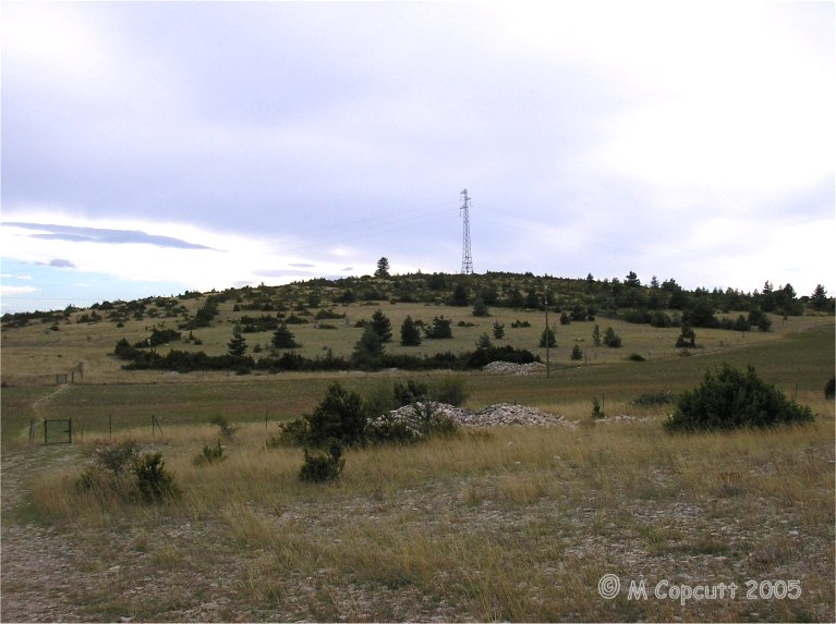
Lacam de la Rigalderie 2 submitted by thecaptain on 10th Dec 2009. There is supposedly another stone circle near to the top of the hill, but in a ruinous state.
I had a good look around, but with all the bushes and undergrowth growing near the top of the hill, there was nothing that I could find which could be said to be the remains of a stone circle.
(View photo, vote or add a comment)
Log Text: There is supposedly another stone circle near to the top of the hill, but in a ruinous state. I had a good look around, but with all the bushes and undergrowth growing here near the top of the hill, there was nothing that I could find which could be said to be the remains of a stone circle.
