Contributory members are able to log private notes and comments about each site
Sites TheCaptain has logged. View this log as a table or view the most recent logs from everyone
Beacon Hill Platform Cairn
Date Added: 29th Oct 2019
Site Type: Barrow Cemetery
Country: England (Somerset)
Visited: Yes on 17th Nov 2017
Beacon Hill Platform Cairn submitted by TheCaptain on 17th Nov 2017. Approaching the summit cairn of Beacon Hill, near the northwestern end of the Quantock Hills ridge
(View photo, vote or add a comment)
Log Text: None
Bearah Common Long Cairn
Date Added: 18th Sep 2010
Site Type: Chambered Cairn
Country: England (Cornwall)
Visited: Yes on 26th Sep 2009
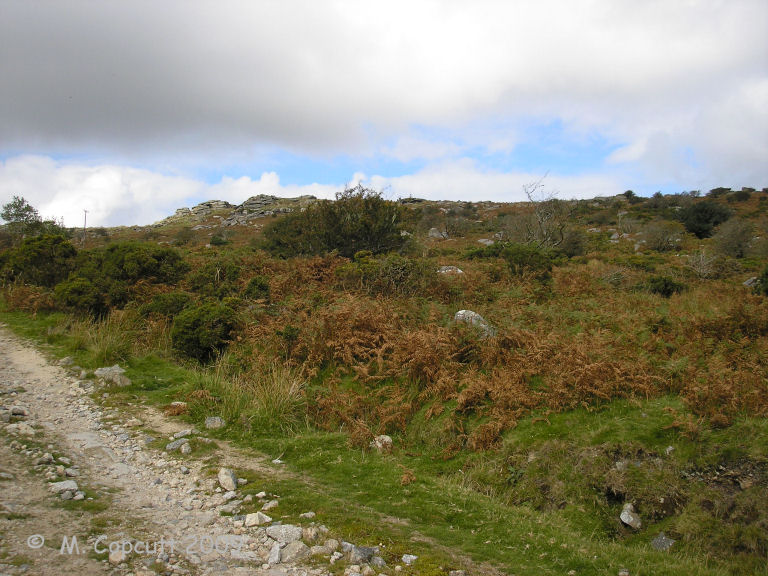
Bearah Common Long Cairn submitted by thecaptain on 26th Sep 2009. Although the long cairn is right beside the trackway, it is difficult to see as you approach unless you are really looking !
(View photo, vote or add a comment)
Log Text: None
Beardown Cairn and Cist
Date Added: 21st Sep 2021
Site Type: Cist
Country: England (Devon)
Visited: Yes on 3rd Apr 1988. My rating: Condition 3 Ambience 4 Access 2

Beardown Cairn and Cist submitted by TheCaptain on 5th Mar 2017. Beardown Cairn and Cist, near the Lich Way on the heights between the Cowsic and West Dart rivers.
My friend Antony tries out the cist for size, during a memorable walk along the Lich Way across the moor at Easter 1988.
(View photo, vote or add a comment)
Log Text: Visited while on walk across Dartmoor on the Lich Way Easter 1988. Walked right by Beardown Cairn and Cist, on the heights between the Cowsic and West Dart rivers. My friend Antony tries out the cist for size. It certainly was the start of a funny event. It was very damp down the bottom of the cist. Sometime later along the walk towards Wistman's Wood, Antony was bringing up the rear, and it was noticed he was walking along with his trousers round his neck, hoping for them to dry out in the sun, wondering how long it would be until anyone noticed... However, we later all ended trouserless with very wet and mucky lower limbs, due to a bog near the Powder Mills.
Beardown Cairn and Cist
Date Added: 21st Sep 2021
Site Type: Cist
Country: England (Devon)
Visited: Yes on 20th Sep 2021. My rating: Condition 2 Ambience 3 Access 2

Beardown Cairn and Cist submitted by TheCaptain on 5th Mar 2017. Beardown Cairn and Cist, near the Lich Way on the heights between the Cowsic and West Dart rivers.
My friend Antony tries out the cist for size, during a memorable walk along the Lich Way across the moor at Easter 1988.
(View photo, vote or add a comment)
Log Text: Beautiful sunny day forecast, and the Army firing range not in use today, so head down to Dartmoor for a pilgrimmage to Beardown Man. Park at Holming Beam at 12:00 after a busy journey down, and I am the only one there. Start by walking over to the first Beardown Tor with its Army firing post observation huts. Making a schoolboy error I head off to what I think is the next Beardown Tor across grassy open moorland, not checking as I go. Once at the top I realise I have walked much further to Lydford Tor, and already passed the cairn and cist I wanted to visit again after the Antony trousers episode in 1988. Doh! Dartmoor lesson, concentrate on navigation and double check everything. Its now a complex task to get across the rough moor to the cist, which was a nightmare to find, eventually resorting to the gps only to find I was about 10 feet away, it has now become totally overgrown and I almost fall in. No way I could sit in the cist, could hardly see it!
Beardown Man
Date Added: 23rd Sep 2021
Site Type: Standing Stone (Menhir)
Country: England (Devon)
Visited: Yes on 20th Sep 2021. My rating: Condition 4 Ambience 5 Access 2
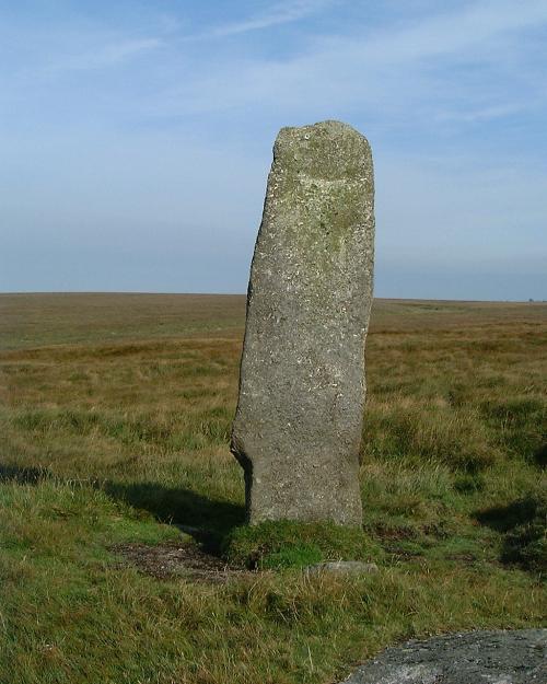
Beardown Man submitted by Brian Byng on 7th Feb 2002. Beardown Man looking north
(View photo, vote or add a comment)
Log Text: Day down to Dartmoor for a pilgrimmage to Beardown Man. Now at Rough Tor I have now learned (remembered) that when walking on the open moor, any sort of path in roughly the right direction is easier than trying to cross the untamed and boggy moor, so standing on the top of the tor taking in the magnificent vista all around in the sun, decide on a route across to Devil's Tor on a pathway which heads to the south of it to start with, but looks mostly fairly easy going. Then up to the top of the hill, and Beardown Man peeks its top over the horizon and grows taller as I approach. It's not at the top of the hill, just below the summit on the west side, but magnificent, twice my height, a lovely thin flat stone with views from north to south over the deep Cowsic valley on the west side, but nothing to the east, which I think odd. Its fabulous out here.
Beaupréau Dolmen
Trip No.204 Entry No.72 Date Added: 16th Jul 2020
Site Type: Burial Chamber or Dolmen
Country: France (Pays de la Loire:Maine-et-Loire 49)
Visited: Yes on 14th Jul 2005. My rating: Condition 4 Ambience 4 Access 4

Beaupréau Dolmen submitted by DrewParsons on 4th May 2010. View from the end of the lane leading to a small farming community to the NE of the village. Two furious dogs chased my car the length of that lane.
(View photo, vote or add a comment)
Log Text: About 600 metres walk round the back of the farm can be found this dolmen and its outlying menhir, which can clearly be seen from the road. The farmer was only too pleased to point it out to me. It's a fairly large Angevine dolmen, with chamber 4 metres by 3 metres, with a single capstone sitting on 2 large sidestones and a backstone. It opens to the east, and there are the usual couple of entry portals, although the northern one has fallen. Out the back is another smaller chamber, but this is falling down a bit, so it is difficult to make out where it would open to, probably to the south. Thirty metres to the west of the dolmen is a nice pointed menhir, probably about 3 metres high, but in a fenced off field with cows in, so I left it alone.
Beaupréau Menhir
Trip No.204 Entry No.73 Date Added: 16th Jul 2020
Site Type: Standing Stone (Menhir)
Country: France (Pays de la Loire:Maine-et-Loire 49)
Visited: Yes on 14th Jul 2005. My rating: Condition 3 Ambience 3 Access 4
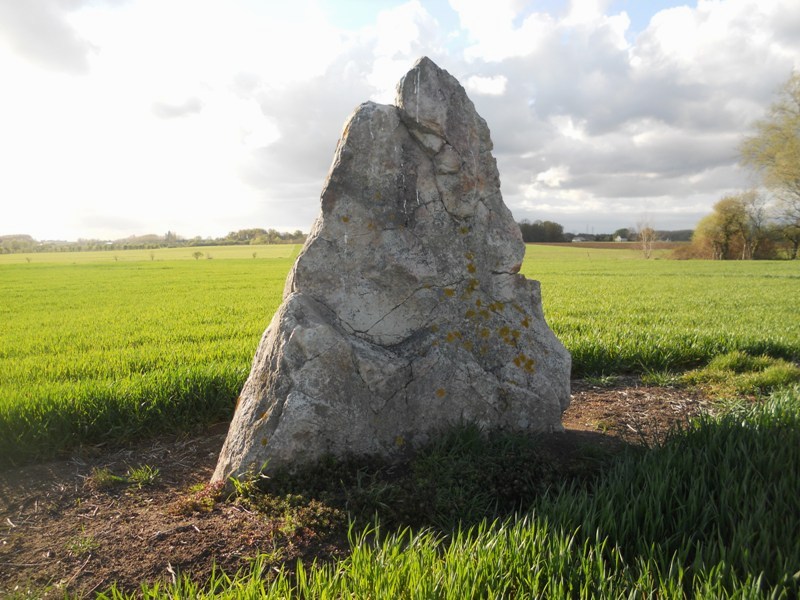
Beaupréau menhir submitted by irundarra on 19th Apr 2012. Site in Pays de la Loire:Maine-et-Loire 49 France
April 2012.
(View photo, vote or add a comment)
Log Text: Thirty metres to the west of the dolmen is a nice pointed menhir, probably about 3 metres high, but in a fenced off field with cows in, so I left it alone.
Beauroulet Dolmen
Trip No.203 Entry No.61 Date Added: 5th Apr 2020
Site Type: Burial Chamber or Dolmen
Country: France (Aquitaine:Dordogne (24))
Visited: Yes on 17th May 2005. My rating: Condition 2 Ambience 2 Access 5
Beauroulet dolmen submitted by theCaptain on 18th May 2012. A capstone of strange dark reddish brown/black rock sits slightly off the ground on top of some fallen grey limestone support stones.
(View photo, vote or add a comment)
Log Text: A 4 metres by 2.5 metre capstone of strange dark reddish brown/black rock sits slightly off the ground on top of some fallen grey limestone support stones. Its in a field just opposite a factory near a roadside restaurant at a junction with the busy D939 Brantôme to Périgueux road. Despite being in such a busy noisy and unsightly place it somehow felt calm as I sat here on the stone eating my lunch.
Beckbury Camp
Date Added: 16th Sep 2021
Site Type: Hillfort
Country: England (Gloucestershire)
Visited: Yes on 15th Sep 2021. My rating: Condition 3 Ambience 4 Access 3
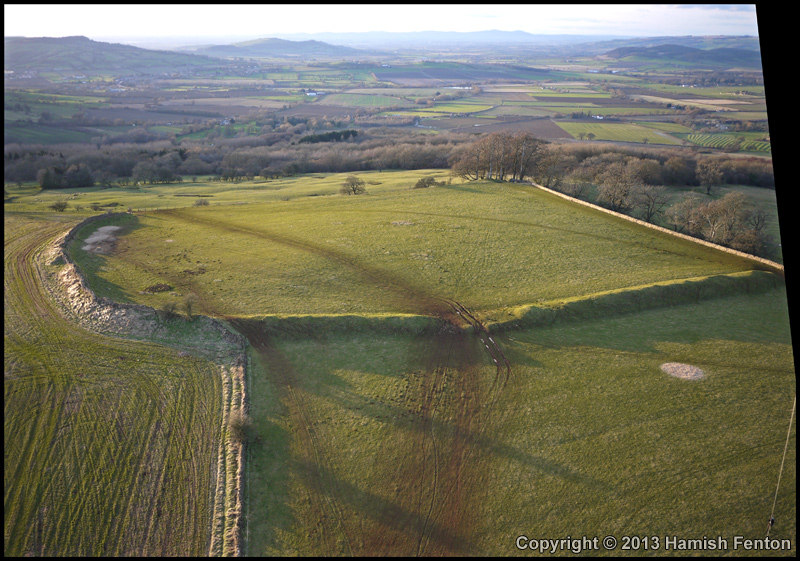
Beckbury Camp submitted by h_fenton on 2nd Feb 2013. Beckbury Camp, viewed from the east.
Kite Aerial Photograph
2 February 2013
(View photo, vote or add a comment)
Log Text: Cotswold Way walk starting by taking the steam train from Toddington to Winchcombe, then walk back northeast to Toddington stopping at Hailes Abbey and Beckbury hillfort. Lovely
Beckham Hill
Date Added: 18th Sep 2010
Site Type: Multiple Stone Rows / Avenue
Country: England (Somerset)
Visited: Yes on 30th Apr 2007
Beckham Hill submitted by thecaptain on 30th Apr 2007. Baa Baa Baa, Baa Baa Baa Lambs.
Spring lambs on Exmoor, April 29 2007.
Beckham Hill with its stone setting in the right background of this picture.
(View photo, vote or add a comment)
Log Text: None
Beg-er-Goalennec 1
Trip No.203 Entry No.420 Date Added: 21st May 2020
Site Type: Standing Stone (Menhir)
Country: France (Bretagne:Morbihan (56))
Visited: Yes on 14th Jun 2005. My rating: Condition 4 Ambience 4 Access 4
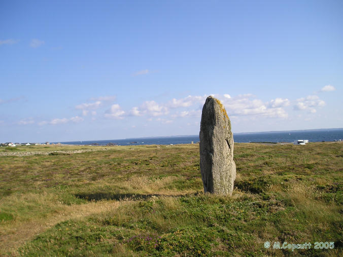
Beg-er-Goalennec 1 submitted by thecaptain on 6th Jun 2006. This is a nice menhir, less than 3 metres tall, standing in heathland just beside the Cote Sauvage road and cliffs on the Quiberon peninsular. A splendid position.
(View photo, vote or add a comment)
Log Text: This is a nice menhir, less than 3 metres tall, standing in heathland just beside the Cote Sauvage road and cliffs. A splendid position. It probably gets covered in sea spray in rough weather from the blow hole nearby.
Beg-er-Goalennec Menhirs
Trip No.203 Entry No.421 Date Added: 21st May 2020
Site Type: Standing Stones
Country: France (Bretagne:Morbihan (56))
Visited: Yes on 14th Jun 2005. My rating: Condition 3 Ambience 4 Access 5

Beg-er-Goalennec menhirs submitted by thecaptain on 5th Jun 2006. Beg er Goalennec menhir A is a sadly broken menhir beside the Cote Sauvage roadside.
It's 4 metres tall with another 2 metres broken from the top laying beside it.
(View photo, vote or add a comment)
Log Text: The first menhir is a sadly broken menhir right beside a restaurant on the Cote Sauvage roadside. It's 4 metres high with another 2 metres broken from the top laying beside it. It is over 2 metres wide and only 30cm thick. It has a strangely shaped neighbour between it and the sea.
The second menhir is a sort of heart shaped menhir (no doubt due to breakage) which stands 3 metres high right beside the Cote Sauvage road opposite a little restaurant and near to a car park. It is splendidly situated to sit and watch the waves break over this spectacular coastline.
Belas Knap
Date Added: 23rd Oct 2021
Site Type: Long Barrow
Country: England (Gloucestershire)
Visited: Yes on 6th Jul 1986
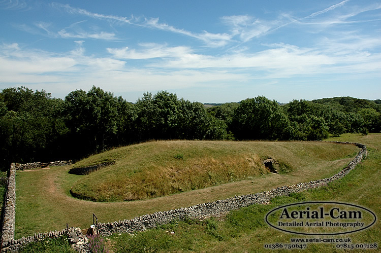
Belas Knap submitted by Adam Stanford on 19th Jul 2006. Taken with Aerial-Cam, at aprox 10M above ground level on a telescopic mast with remote control Nikon D70s camera system. This image shows the tapering of the mound from front to back (left to right). The camera was pointing in an Easterly direction. Cheers AS.
(View photo, vote or add a comment)
Log Text: A visit to Belas Knap following a visit to the fledgling Glos Warwicks Railway
Belas Knap
Date Added: 23rd Oct 2021
Site Type: Long Barrow
Country: England (Gloucestershire)
Visited: Yes on 2nd Apr 2006

Belas Knap submitted by Adam Stanford on 19th Jul 2006. Taken with Aerial-Cam, at aprox 10M above ground level on a telescopic mast with remote control Nikon D70s camera system. This image shows the tapering of the mound from front to back (left to right). The camera was pointing in an Easterly direction. Cheers AS.
(View photo, vote or add a comment)
Log Text: A visit to Belas Knap after a day with megalithic portal people starting at Rollright
Belas Knap
Date Added: 23rd Oct 2021
Site Type: Long Barrow
Country: England (Gloucestershire)
Visited: Yes on 10th Aug 2021. My rating: Condition 5 Ambience 4 Access 3

Belas Knap submitted by Adam Stanford on 19th Jul 2006. Taken with Aerial-Cam, at aprox 10M above ground level on a telescopic mast with remote control Nikon D70s camera system. This image shows the tapering of the mound from front to back (left to right). The camera was pointing in an Easterly direction. Cheers AS.
(View photo, vote or add a comment)
Log Text: A long Cotswold Way loop walk from Winchcombe, up to Belas Knap then over to Cleeve Hill via Postlip. A pint at the golf club, then up to the trig point and back to Winchcombe down the Isbourne valley.
Bélesta Museum of prehistory
Trip No.205 Entry No.88 Date Added: 28th Oct 2020
Site Type: Museum
Country: France (Languedoc:Pyrénées-Orientales 66)
Visited: Saw from a distance on 12th Sep 2005

Bélesta Museum of prehistory submitted by thecaptain on 3rd Mar 2006. Supposedly excellent museum located in the chateau in centre of the village of Bélesta in Pyrénées-Orientales.
(View photo, vote or add a comment)
Log Text: Blimey, the roads round here are twisty and tight. There was no way I was able to park the van anywhere near the village for a look at this. So I had to give up totally on any thoughts of a visit to this supposedly excellent museum.
Beleven allée couverte
Trip No.209 Entry No.11 Date Added: 13th Jun 2020
Site Type: Passage Grave
Country: France (Bretagne:Côtes-D'Armor (22))
Visited: Yes on 12th Jun 2009. My rating: Condition 3 Ambience 2 Access 4

Beleven allée couverte submitted by thecaptain on 24th Jun 2009. There is even a sign here, but unfortunately while holding my camera above my head to get the picture, I have chopped off the bottom and left side a bit.
Still, it shows a plan and good artistic reconstruction of the place.
(View photo, vote or add a comment)
Log Text: Remains of a fairly disturbed but mostly complete allée couverte can be found in dark woodland to the northwest of the village of Plouer-sur-Rance, to the north of the magnificent ancient city of Dinan. Although the quartz block stones of this 14 metre long allée couverte are fairly well disturbed, it is in fact mostly complete, with a well defined terminal cella, and even with traces of its mound still to be seen. It is possible that it once had a lateral entrance.
Remarkably, it is stated that this monument was only discovered in 1972, which I find hard to believe, and it was classified as a monument historique as recently as 1981.
The poor thing is very close to a busy express highway, the N176, which runs along this northern edge of Brittany, but although the noise from the traffic is constant, the dense woodlands do a good job of hiding it all.
Despite looking on maps as if it would be very difficult to access, its on a wooded hillside right next to the dual carriageway road , there is in fact an emergency phone and layby nearby on the northbound carriageway, where it is possible to park and visit the monument. From the layby, hop over a little fence and follow a well worn path to the left for about 100 metres, and there it is ! Brilliant, its like the layby is deliberately put there for us stonehunters !
Belinac Menhir
Trip No.203 Entry No.139 Date Added: 10th Apr 2020
Site Type: Standing Stone (Menhir)
Country: France (Midi:Lot (46))
Visited: Yes on 24th May 2005. My rating: Condition 4 Ambience 3 Access 5
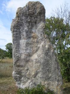
Belinac Menhir submitted by MichelDRN on 20th Oct 2005. I suggest to rename Livernon Menhir as Belinac Menhir, its local name.
From Livernon (Lot, 46), heading SE towards the road joining Cahors and Figeac towns, a sign indicates Belinac Menhir on the right side. 600 meters and this outstanding monolith appears.
It is 3.50 meters high, 0.40 m wide, and large from 1.50m (base), to 1.90 m (middle) and 1.00m (top).
(View photo, vote or add a comment)
Log Text: Three and a half metres tall, but only about 30 cm thick, this menhir can be found signposted to the southeast from the village of Livernon. It leans at a slight angle and has some strange markings on it. There are several horizontal lines, and many weird circular shapes. Signposted just off the large road up a small track, there is a little parking area nearby.
Bellever Tor 10
Date Added: 27th Sep 2020
Site Type: Cist
Country: England (Devon)
Visited: Yes on 18th Sep 2020. My rating: Condition 2 Ambience 3 Access 3
Bellever Tor 10 submitted by davep on 5th Apr 2020. Photo taken 23/07/2019 at grid reference SX 64086 75691 (N50.56506 W3.92048)
(View photo, vote or add a comment)
Log Text: Second cain I looked for first had the challenge of getting across the wall into the eastern area. I found the cairn in what I thought was a most unlikely place on a slope, the remains being largely a single cist sideslab, with a few other stones laying nearby.
Bellever Tor 2
Date Added: 27th Sep 2020
Site Type: Cairn
Country: England (Devon)
Visited: Yes on 18th Sep 2020. My rating: Condition 2 Ambience 3 Access 3
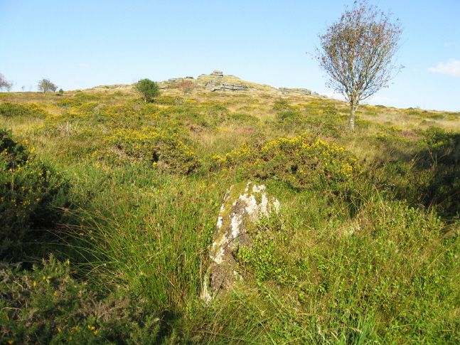
Bellever Tor 2 submitted by AngieLake on 25th Nov 2009. This is a possible candidate for the 'circle' at SW of Bellever Tor. It's hard to tell, but this looked as if it was placed upright deliberately, and probably part of a cairn circle or hut circle.
10 Sept 09.
(View photo, vote or add a comment)
Log Text: Making it over the northern wall into the area where the forest has recently been cleared, and look for the next "Cairn" marked on my map. Even with gps I struggle to find what could be considered to be a cairn, although there were several contenders. I suspect that what I found as a single standing stone was its last remains.
