Contributory members are able to log private notes and comments about each site
Sites Stonetracker has logged. View this log as a table or view the most recent logs from everyone
Ismay Rock Shelter Petroglyphs
Date Added: 9th May 2025
Site Type: Rock Art
Country: United States (The Southwest)
Visited: Yes on 1st Apr 2025. My rating: Condition 3 Ambience 5 Access 3
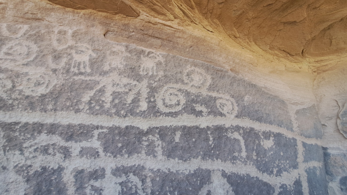
Ismay Rock Shelter Petroglyphs submitted by stonetracker on 8th May 2025. Spirals and sheep
(View photo, vote or add a comment)
Log Text: Site contains a possibly prehistoric Pueblo ruin and both modern and ancient rock art. Access is via a short but steep foot trail up a slope to a large boulder and the site.
I parked at the junction of County Road G and H near the old trading post. I then walked north on Road H (an unmarked dirt rd) about 200 yds north over a cattle guard and a slight rise. A trail leads east straight up a hill to the only obvious big boulder and the site. It may be possible to park at the trail head itself but the road is rough.
Hawkins Preserve Pueblo Ruins
Date Added: 9th May 2025
Site Type: Ancient Village or Settlement
Country: United States (The Southwest)
Visited: Yes on 1st Apr 2025. My rating: Condition 2 Ambience 3 Access 3

Hawkins Preserve Pueblo Ruins submitted by stonetracker on 9th May 2025. Some of the room blocks in the Hawkins Preserve Ruins, built on a rectangular floor plan. My guess is this is a unit pueblo for an extended family and not a so-called Great House. It's unclear whether the rooms were made of jacal (wattle-and-daub construction) on a stone foundation or 100% masonry and mortar. Judging by the sandstone block remains littering the ground, I would guess the latter.
(View photo, vote or add a comment)
Log Text: An Ancestral Pueblo site at least partially excavated, consisting of a few room blocks, a midden, and two mostly backfilled kivas. Other archaeological sites exist at the preserve, but as far as I know this is the only one that is protected and open to the public.
Parking and the main trailhead is located in a paved lot at 1490 S Cedar St in Cortez CO. Take the Mesa View Trail west about 0.3 miles to Ruins Road trail. The ruins are another 0.3 miles south down this trail.
Aztec Ruins National Monument
Date Added: 10th May 2025
Site Type: Ancient Village or Settlement
Country: United States (The Southwest)
Visited: Yes on 1st Apr 2025. My rating: Condition 3 Ambience 5 Access 4

Aztec Ruins National Monument submitted by Creative Commons on 22nd Dec 2018. Aztec Ruins National Monument is located in Northern New Mexico. It was home to the Ancestral Puebloans, who built and lived in the great houses here beginning in the mid 11th century until the late 13th century. The West Ruin, also called the Aztec West Great House, was three stories tall and contained over 500 rooms. Image copyright: Jaspe...
(View photo, vote or add a comment)
Log Text: An outstanding example of a partially excavated Chaco Canyon outlier great house site. The West Ruin is mostly excavated with a great kiva completely restored to the way it likely looked originally. The East Ruin is not excavated and is currently off limits to site visitors other than professional researchers. It can be glimpsed (not easily) from the West Ruin.
The National Monument also includes a visitor center and excellent interpretive exhibits on ancestral pueblo history and development in the Four Corners region.
The site is conveniently located a mile north of State Route 550 at the end of Ruins Rd. The parking lot accommodates at least 20 vehicles. Most of the ruins can be self-toured via short foot paths, guided tours not required. Some of the rooms are open to visitation as well as the restored great kiva. Only the tri-walled Hubbard structure is separate from the main complex, about a 200 yd walk north.
Cannon Ball Mesa Pueblo Ruins
Date Added: 9th May 2025
Site Type: Ancient Village or Settlement
Country: United States (The Southwest)
Visited: Yes on 1st Apr 2025. My rating: Condition 2 Ambience 5 Access 3

Cannon Ball Mesa Pueblo Ruins submitted by stonetracker on 8th May 2025. The largest ruin under a boulder. Looks like a single room structure.
(View photo, vote or add a comment)
Log Text: This site actually consists of 4 or 5 separate ruins along a trail that ascends Cannon Ball Mesa to the north. The location given in the general description is for the first and most intact ruin. The trail head begins about 1/2 mile east of the Colorado-Utah border at a roadside pullout on County Road G. The location of this pullout is 37.325785, -109.034079.
The trail starts up a rocky gully and later becomes a bit indistinct as it approaches the rock bench where most of the ruins are located. However, this is mostly an open ledge area with some rocky areas near the boulders requiring a little easy climbing. I've provided some coordinates in the comments for a few other ruins beyond the first one, for those who enjoy exploring these areas.
Dominguez Pueblo
Date Added: 10th May 2025
Site Type: Ancient Village or Settlement
Country: United States (The Southwest)
Visited: Yes on 1st Apr 2025. My rating: Condition 2 Ambience 3 Access 4

Dominguez Pueblo submitted by stonetracker on 7th May 2025. Remains of the four rooms of the unit pueblo
(View photo, vote or add a comment)
Log Text: The ruin is right next to the Canyons of the Ancients Visitor Center/Museum and just steps away from the parking lot and building. I believe wheelchair access is possible from the sidewalk about 50 ft from the site.
Salmon Ruins
Date Added: 10th May 2025
Site Type: Ancient Village or Settlement
Country: United States (The Southwest)
Visited: Yes on 1st Apr 2025. My rating: Condition 2 Ambience 4 Access 3
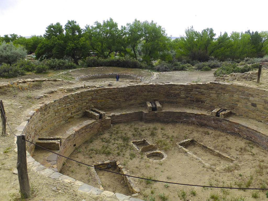
Salmon Ruins submitted by Flickr on 11th Jan 2019. Salmon Ruins, Bloomfield, New Mexico. View looking southward across the elevated kiva, with the detached Great Kiva behing the man standing at left center. Image copyright: Hiker Bob (Bob Cates), hosted on Flickr and displayed under the terms of their API.
(View photo, vote or add a comment)
Log Text: This an Ancestral Pueblo Chacoan outlier great house site located about 10 miles W of Aztec Ruins National Monument. It is similar in construction to the latter and was more than likely built by either immigrants from Chaco Canyon or by local cultures emulating Chaco-style great house complexes. It was built slightly earlier than Aztec Ruins.
The site consists of the ruins, a museum, and a heritage park with replicas of Native American dwellings such as hogans, wikiups, and pithouses. I only had time to visit the ruins in depth, although I checked the museum briefly.
The ruins are a steep walk about 200-300 yds down a paved walkway or driveway from the museum. I believe there is also some limited parking available at the heritage park at the bottom of the hill, which would allow closer access. A ruins guide is available to borrow from the museum, and as far as I know there are no print versions available for sale. It is very helpful and I would recommend referring to it during the visit. The entire site is owned and operated by San Juan County.
Castle Rock Pueblo
Date Added: 12th May 2025
Site Type: Ancient Village or Settlement
Country: United States (The Southwest)
Visited: Yes on 1st Apr 2025. My rating: Condition 2 Ambience 4 Access 4

Castle Rock Pueblo submitted by stonetracker on 12th May 2025. The only intact remains I was able to find along the spur trail. The wall still has some mortar holding it together.
This was a late Pueblo 3 village ruin, likely built around 1250 CE and abandoned 30 years later. From the Crow Canyon archaeological center website:
"Castle Rock Pueblo was a village in the Mesa Verde region of southwestern Colorado that was constructed during the late Pueblo III period. The village was home to 75 to 150 people from the A.D. 1260s until sometime during t...
(View photo, vote or add a comment)
Log Text: This site is accessible via a short 1/4 mile hike on the Sand Canyon Pueblo Trail and is the first ancestral pueblo village site north of of the trail head on County Rd G, west of Cortez CO. There are approximately five other village ruins along the trail beyond it, but I did not have time to visit them.
The Castle Rock formation itself is very obvious from County Rd G but there are no obvious pueblo remains in front of it. Instead, walk the flat ledge to the left (west) around the rock formation and behind it. There is a sign with a short spur trail to the right at this point leading to the ruins.
Hovenweep - Settlement
Date Added: 12th May 2025
Site Type: Ancient Village or Settlement
Country: United States (The Southwest)
Visited: Yes on 1st May 2025. My rating: Condition 3 Ambience 5 Access 4
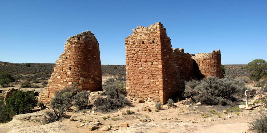
Hovenweep - Hovenweep Castle submitted by jeffrep on 9th Nov 2012. Hovenweep Castle.
(View photo, vote or add a comment)
Log Text: Only was able to visit Stronghold House and another ruin nearby. The rest were remote viewing only. See Hovenweep - Stronghold House for more details.
Hovenweep - Stronghold House
Date Added: 13th May 2025
Site Type: Ancient Village or Settlement
Country: United States (The Southwest)
Visited: Yes on 1st May 2025. My rating: Condition 3 Ambience 5 Access 4
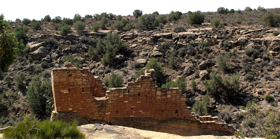
Hovenweep - Stronghold House submitted by jeffrep on 9th Nov 2012. Hovenweep. Remains of Stronghold House.
(View photo, vote or add a comment)
Log Text: Only had time to see Stronghold House and its tower, plus a nearby ruin. Everything else in the Square Tower Group was remote viewing from the edge of Little Ruin Canyon, only due to my time constraints.
Access to Stronghold House is via a handicapped accessible paved trail about 300 yds from the visitor center.
Hovenweep - Unit Type House
Date Added: 14th May 2025
Site Type: Ancient Village or Settlement
Country: United States (The Southwest)
Visited: Yes on 1st May 2025. My rating: Condition 2 Ambience 4 Access 3
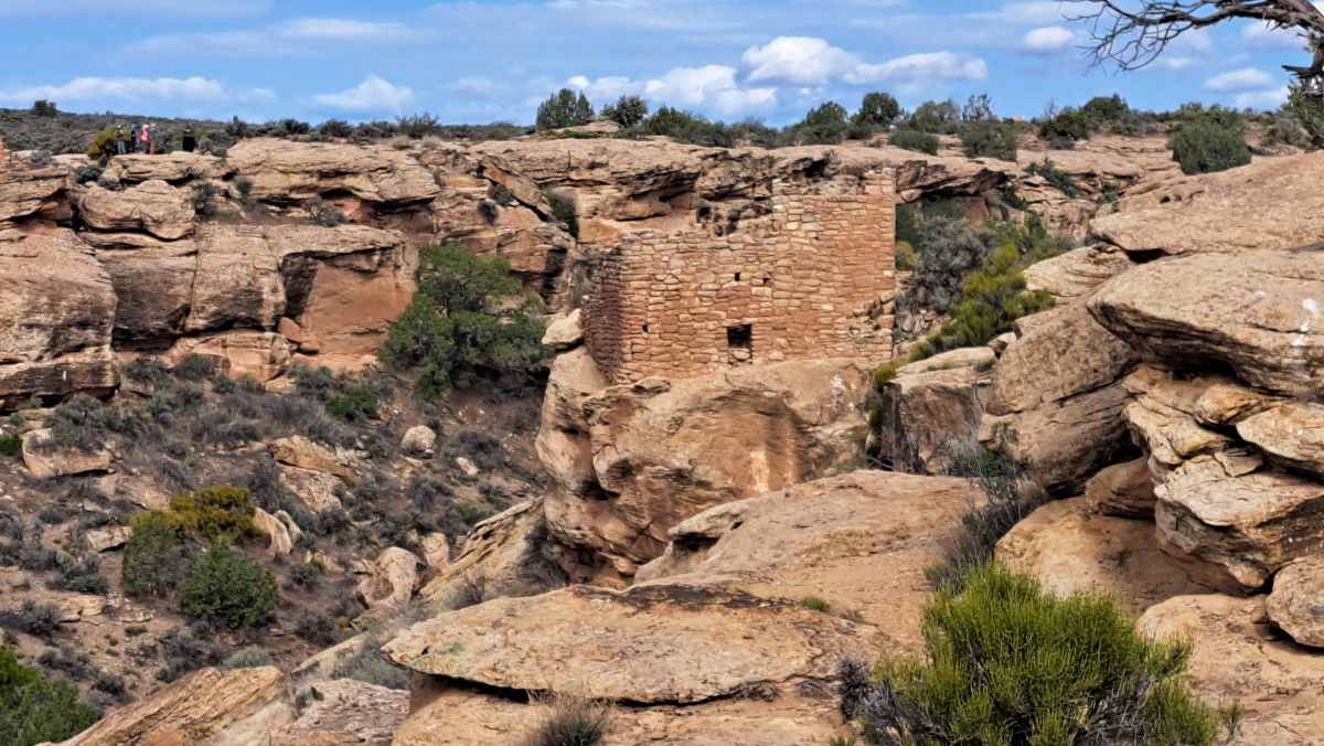
Hovenweep - Unit Type House submitted by stonetracker on 13th May 2025. A remote view of Unit Type House from Stronghold House
(View photo, vote or add a comment)
Log Text: I viewed this site at 200-300 yds away from Stronghold House. Someday I'll return to visit this and the other structures in the Square Tower Group more closely. My understanding is that you can get a much closer view of Unit Type House from the trail that circles the canyon.
Cave Pueblo Ruin
Date Added: 14th May 2025
Site Type: Ancient Village or Settlement
Country: United States (The Southwest)
Visited: Yes on 1st May 2025. My rating: Condition 2 Ambience 4
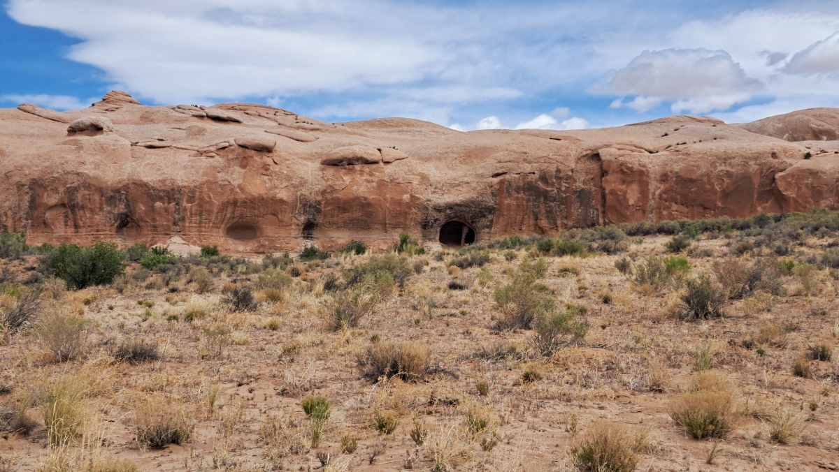
Cave Pueblo Ruin submitted by stonetracker on 14th May 2025. The ruin is in the large cave just to the right of the center in the photo.
(View photo, vote or add a comment)
Log Text: There is no close access to the site due to a barbed wire fence and wired off gate. But you can easily spot the cave and ruin from a parking pulloff ~ 3 miles east of Bluff UT. There are also a number of rock art sites along the same route west from this point to Bluff. I was able to visit some, not all.
Ghost Rock Art Panel
Date Added: 15th May 2025
Site Type: Rock Art
Country: United States (The Southwest)
Visited: Yes on 1st May 2025. My rating: Condition 2 Ambience 4 Access 4
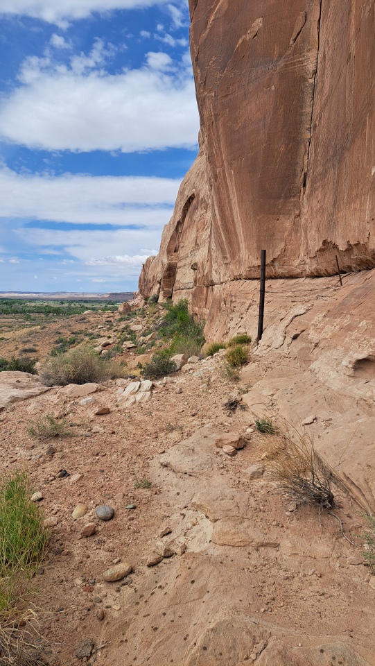
Ghost Rock Art Panel submitted by stonetracker on 14th May 2025. Cliff face where the petros are located
(View photo, vote or add a comment)
Log Text: A mixed modern and ancient petroglyph site about 2.3 miles east of Bluff UT accessible from Route 162.
There is a parking pulloff at 37.282579,-109.505201 and an 800 ft dirt road leads north from there. Suitable for SUVs or lower clearance vehicles (with care). Follow the dirt road north and stay right at the first fork. The road ends in a small turnaround circle. Park here. The rock art is mostly to the left and just a short walk to the cliff face.
You can also park at Route 162 and hike in.
Horse Rock Art Panels
Date Added: 15th May 2025
Site Type: Rock Art
Country: United States (The Southwest)
Visited: Yes on 1st May 2025. My rating: Condition 4 Ambience 4 Access 5
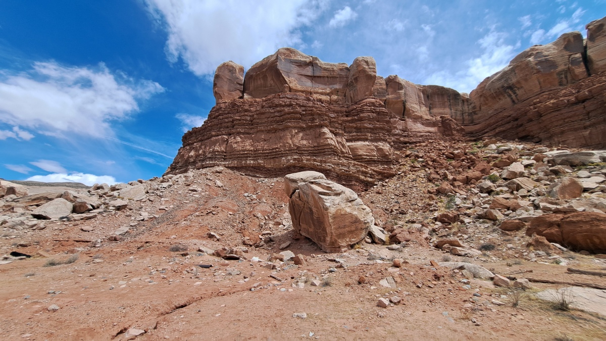
Horse Rock Art Panels submitted by stonetracker on 15th May 2025. The main rock art panel is on the boulder at photo center. The corral is out of view to the right.
(View photo, vote or add a comment)
Log Text: The main rock art panel is just 100-200 ft north of Route 162 about 0.2 miles east of Bluff. Parking is in a dirt lot next to a corral and a fenced utility building. For the mobility impaired, the panel is pretty visible with the naked eye from a vehicle if you park as far north as you can get and scan the central boulder.
I've been told there are more panels of a single horse and multiple animals behind the utility building fence and higher up the cliff slope.
Bluff Great House
Date Added: 15th May 2025
Site Type: Ancient Village or Settlement
Country: United States (The Southwest)
Visited: Yes on 1st May 2025. My rating: Condition 2 Ambience 4 Access 4
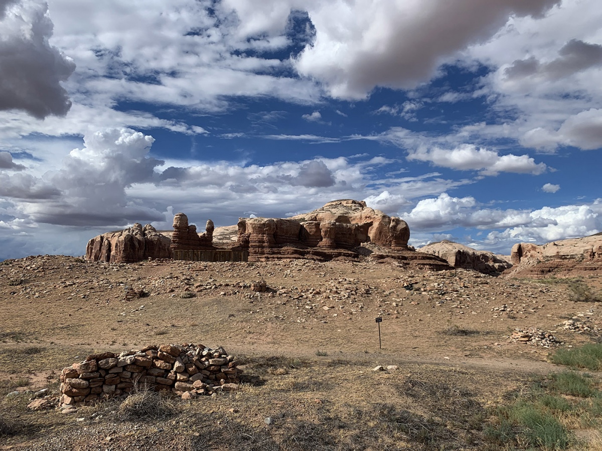
Bluff Great House submitted by KaiHofmann on 29th Sep 2022. Bluff Great House, the large mound with the wooden excavation hut.
(View photo, vote or add a comment)
Log Text: This is a so-called Chacoan outlier great house near the San Juan River, likely built during the Pueblo 2 period ca. 1100 CE. The site overlooks the town of Bluff UT on a high hill with a stunning backdrop of canyons to the north. It has been excavated in the past and subsequently backfilled to preserve the room blocks and kivas within.
There is an interpretive kiosk and parking loop just south of the main access road (N. Pioneer Drive). The buried great house and related structures are about 100-200 yds north of the kiosk via an easy foot trail.
To get to the parking area from Main St, take 3rd East St north to its end. Turn left onto Mulberry and follow it about 1000 ft until it turns right sharply onto N. Pioneer and heads up hill towards the Bluff Cemetery. The gravel parking lot is another 800-1000 ft on the right.
Sand Island petroglyph Panel
Date Added: 18th May 2025
Site Type: Rock Art
Country: United States (The Southwest)
Visited: Yes on 1st May 2025. My rating: Condition 3 Ambience 4 Access 4
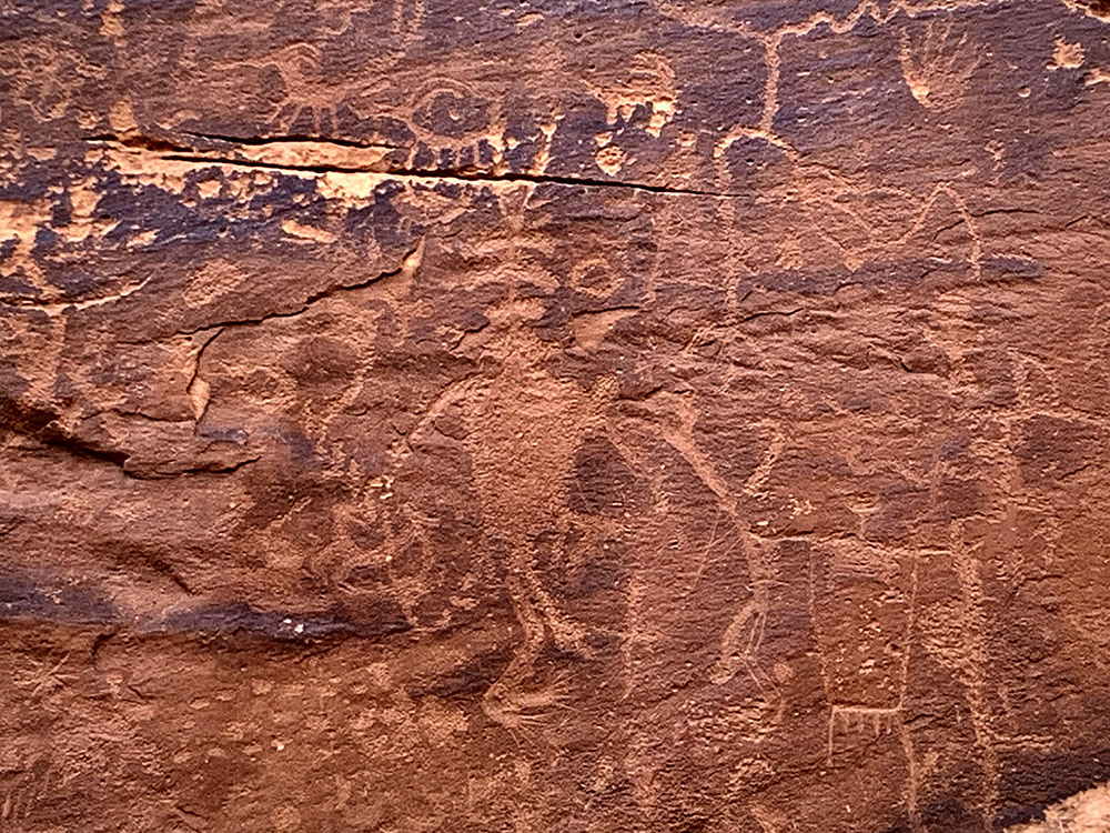
Sand Island petroglyph Panel submitted by KaiHofmann on 11th Sep 2022. Sand Island petroglyph Panel
(View photo, vote or add a comment)
Log Text: This is one of the better-known and most frequently visited rock art sites in southeastern Utah. The site is a very short walk (< 100 ft) up to the cliff face from a dirt parking pulloff with interpretive signage. The panels are in a relatively compact area, maybe 100 yds in total. And although they are protected by a fence and can only be viewed from a distance, you can still get fairly close for photography as long as the sun cooperates (it mostly did not for me). An overcast day or a low sun angle are preferred as full direct sunlight tends to wash out the images,
To get there, take Route 191 west out of Bluff UT for approximately 4 miles. Turn left onto a gravel road with signage that indicates the Sand Island Recreational Area and boat ramp. At the bottom of the hill, take your first right onto another gravel road. This road leads straight to a couple of parking pulloffs on the right in about 0.25 miles, plus some petroglyph signage. A short trail leads up to the cliff base and the panels. The panels are surrounded by a fence to discourage defacement and further damage.
Upper Sand Island Rock Art
Date Added: 19th May 2025
Site Type: Rock Art
Country: United States (The Southwest)
Visited: Yes on 1st May 2025. My rating: Condition 3 Ambience 4 Access 3
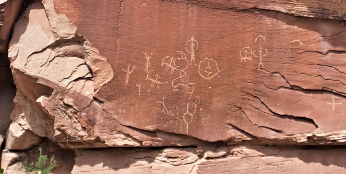
Upper Sand Island Rock Art submitted by stonetracker on 18th May 2025. One of the first panels you see along the trail. These look like typical Ancestral Pueblo or Fremont images of stick figures and bighorn sheep.
(View photo, vote or add a comment)
Log Text: A half mile's worth of intermittent ancient petroglyph panels, connected by a trail along the cliff face. To access the trailhead, take Route 191 west out of Bluff UT for approximately 4 miles. Turn left onto a gravel road with signage that indicates the Sand Island Recreational Area and boat ramp. At the bottom of the hill, take your first left onto another gravel road. This road leads 100-200 yds past the ranger buildings to a large parking lot next to a restroom. Unless you are an authorized camper, park here and walk another 200 yds east down the road to its end at the campground loop.
A trail leads from here to the cliff base and the panels. The panels are in some cases fenced off from the trail by as much as 80-100 feet to discourage defacement and further damage. Many are high up on the cliff face and much easier to see with binoculars.
Newspaper Rock State Park
Date Added: 23rd May 2025
Site Type: Rock Art
Country: United States (The Southwest)
Visited: Yes on 1st May 2025. My rating: Condition 3 Ambience 4 Access 4
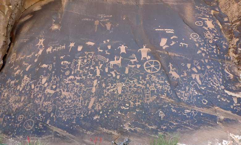
Newspaper Rock State Park submitted by baz on 5th Jun 2011. Newspaper Rock
(View photo, vote or add a comment)
Log Text: Probably the most accessible of all the petroglyph sites in SE Utah....once you get there. It is not near any towns of size so prepare accordingly.
To get there, either drive north 14 miles from Monticello or south 40 miles from Moab on Route 191. Then head west on Route 211 about 12 miles to the site. All the roads are paved and there is a restroom onsite.
From the paved parking area it is just steps away to the rock art panel on a flat dirt path. Might even be wheelchair accessible.
One plus: from that point on Route 211 to the Needles District of Canyonlands there are a lot of rock art sites...and the scenery is stunning !
Intestine Man rock paintings
Date Added: 24th May 2025
Site Type: Rock Art
Country: United States (The Southwest)
Visited: Yes on 1st May 2025. My rating: Condition 3 Ambience 4 Access 4
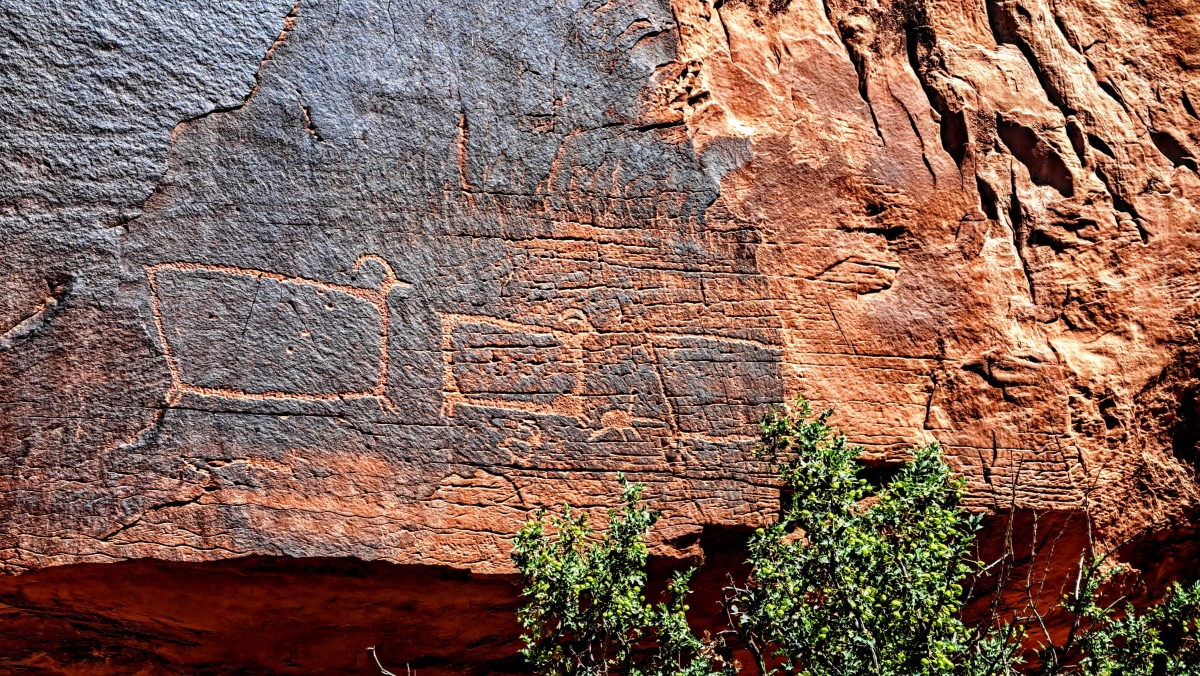
Intestine Man rock paintings submitted by stonetracker on 28th May 2025. These petroglyphs have been nicknamed the "box" or "TV" sheep, for obvious reasons. These are to the right of the main trail.
(View photo, vote or add a comment)
Log Text: This is a combination petroglyph and Archaic period pictograph (rock painting) site on Route 313, which is about 10 miles north of Moab. To get there, head west on Route 313 to about mile marker 2.7. There is a paved parking pullout there, big enough for 2-3 vehicles.
There is some limited interpretation signage and a short trail that leads in about 100 yds to the cliff face. The titular Intestine Man and other pictographs are to the left along a short trail. The mostly Ancestral Pueblo and Fremont petroglyphs are also a similar length trail to the right.
There are a few large boulders and rocks to wend your way around, but they shouldn't require any serious scrambling.
One plus of this site is that there are a number of other petroglyph sites on Route 313 that you can visit while there, although I had no time to do so.
Moab Golf Course Rock Art Site
Date Added: 5th Jun 2025
Site Type: Rock Art
Country: United States (The Southwest)
Visited: Yes on 1st May 2025. My rating: Condition 3 Ambience 4 Access 5
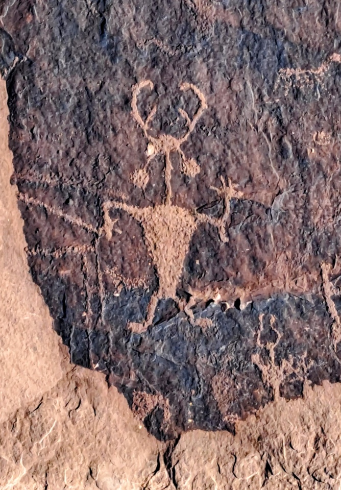
Moab Golf Course Rock Art Site submitted by stonetracker on 5th Jun 2025. This is the so-called Moab Man, a Fremont era petroglyph that has become a sort of unofficial mascot of the Moab prehistoric community. Most of the petroglyphs were created between 0 and 1275 CE.
(View photo, vote or add a comment)
Log Text: This is a small Ancestral Pueblo/Fremont rock art panel on a cliff face across the street from a golf course in suburban Moab UT. Its main virtue is nearly drive-up access - the panels are just steps away from the dirt parking area behind a wooden fence.
To get there, take Route 191 south from Moab city center for about 3 miles. Take a left onto East Spanish Trail Rd and drive a mile or so to a traffic circle (roundabout). Continue around the traffic circle straight onto Westwater Rd. Continue on Westwater for about 0.75 miles. The site is at a sandstone cliff wall on the left with parking available next to the fence.
Sego Canyon Rock Art
Date Added: 5th Jun 2025
Site Type: Rock Art
Country: United States (The Southwest)
Visited: Yes on 1st May 2025. My rating: Condition 3 Ambience 5 Access 4
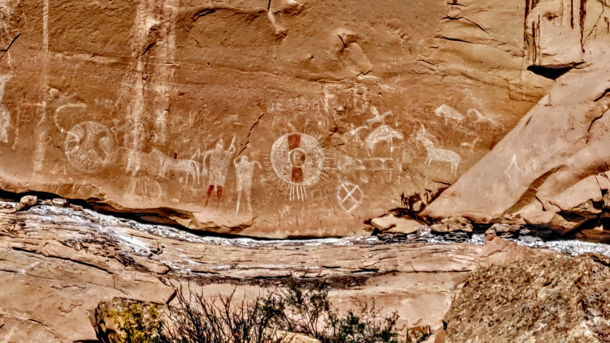
Sego Canyon Rock Art submitted by stonetracker on 29th May 2025. The Ute pictograph panel. Most if not all of these images are painted using white and red pigments.
Because of the presence of horses and riders in some cases, these images likely date from the 1700s.
The white and red disk probably represents a shield used in battle.
(View photo, vote or add a comment)
Log Text: A major prehistoric pictograph and petroglyph site with rock art ranging from Archaic to modern periods. The site is located in Thomspon Springs UT about 45 miles north of Moab UT. The route is 100% paved roads.
To get there, take Route 191 north from Moab for about 30-35 miles to Interstate Route I-70. Drive on I-70 east and take the first exit north to Thompson Springs. Continue on Thompson Canyon Rd for about 6 miles. There will be a parking lot on the left with signage and a restroom. There is a short trail from parking to the first set of panels.
