Contributory members are able to log private notes and comments about each site
Sites Stonetracker has logged. View this log as a table or view the most recent logs from everyone
Norwood Mound
Date Added: 31st Oct 2023
Site Type: Artificial Mound
Country: United States (Great Lakes Midwest)
Visited: Yes. My rating: Condition 4 Ambience 4 Access 5

Norwood Mound submitted by stonetracker on 23rd Feb 2023. Creative Commons photo of mound
(View photo, vote or add a comment)
Log Text: Visited late Oct 2023. In a city park and publicly accessible with some parking. Mound is in good condition.
Nitschke Mounds State Park
Date Added: 6th Aug 2024
Site Type: Artificial Mound
Country: United States (Great Lakes Midwest)
Visited: Yes on 1st Jul 2024. My rating: Condition 2 Ambience 4 Access 4
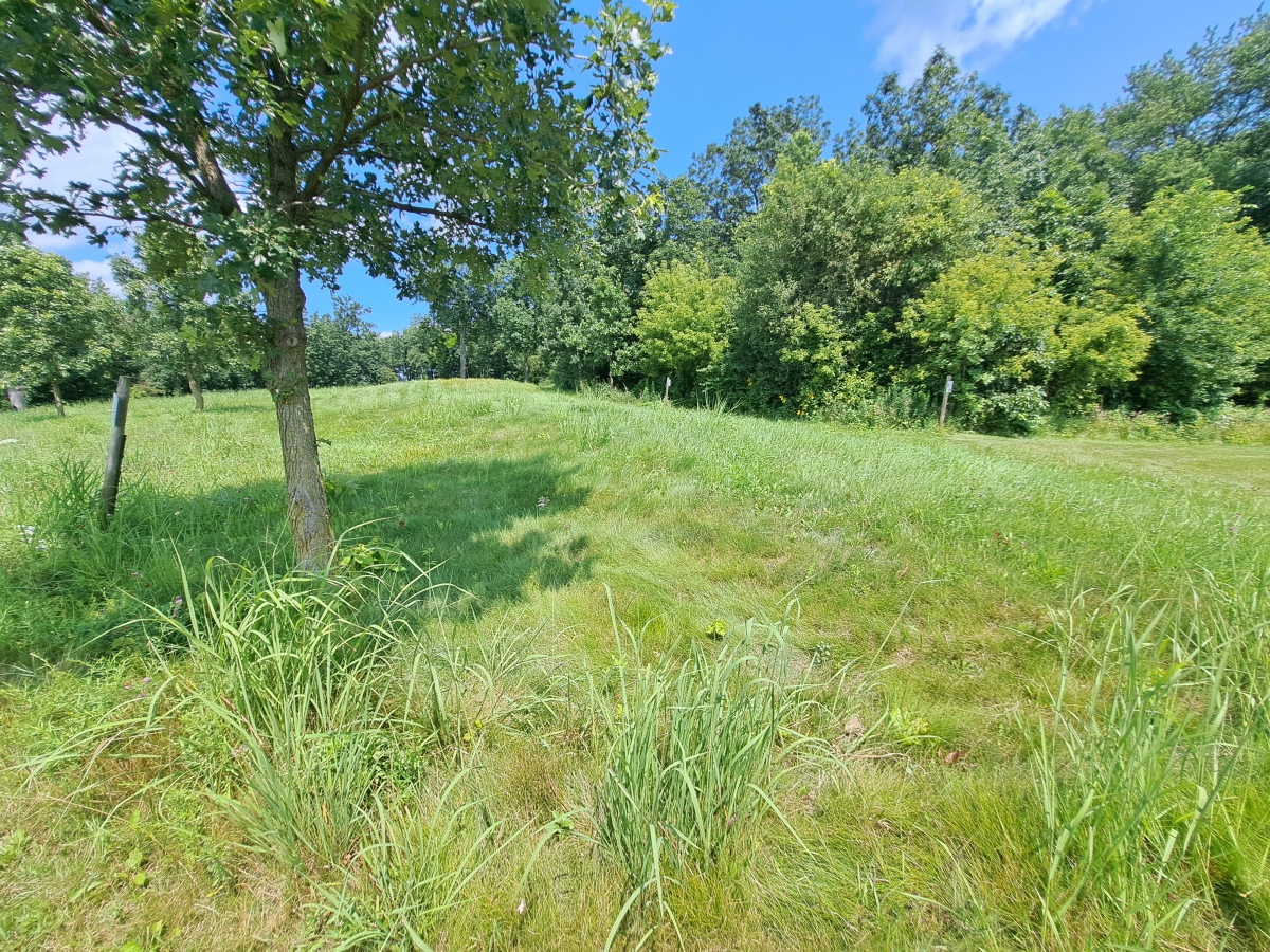
Nitschke Mounds State Park submitted by stonetracker on 7th Aug 2024. Mound 9 - Buffalo or Bear. The head and forelegs are in the foreground.
(View photo, vote or add a comment)
Log Text: The effigy mounds are in a county park just 200 yds north of the paved road. Ample parking in a dirt lot with a picnic shelter and interpretation kiosk.
Considering that the park is maintained mostly by volunteers, the condition of the site is surprisingly good. About 2/3rds of the mounds are at least somewhat visible and cleared of trees and shrubs. Native long grass has been left on the mounds to discourage walking over them. A short trail system weaves in and out among the mounds and is regularly maintained by mowing. The remaining 1/3 of the mounds still need to be cleared off and the trail system extended to include them. They are mostly in a wooded area at present. Interpretation and signage at each mound is sparse, so I assume this is a work in progress. There is a bit more information at the entrance kiosk.
Effigy mounds by their very nature tend to be low profile and hard to photograph. This is particularly the case at Nitschke where erosion has really taken its toll. So my photos and videos are limited to just a few of the biggest and most visible mounds.
Newspaper Rock State Park
Date Added: 23rd May 2025
Site Type: Rock Art
Country: United States (The Southwest)
Visited: Yes on 1st May 2025. My rating: Condition 3 Ambience 4 Access 4
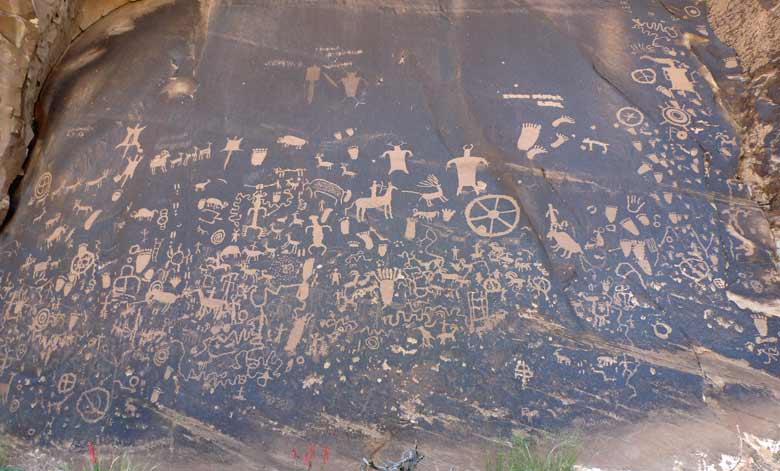
Newspaper Rock State Park submitted by baz on 5th Jun 2011. Newspaper Rock
(View photo, vote or add a comment)
Log Text: Probably the most accessible of all the petroglyph sites in SE Utah....once you get there. It is not near any towns of size so prepare accordingly.
To get there, either drive north 14 miles from Monticello or south 40 miles from Moab on Route 191. Then head west on Route 211 about 12 miles to the site. All the roads are paved and there is a restroom onsite.
From the paved parking area it is just steps away to the rock art panel on a flat dirt path. Might even be wheelchair accessible.
One plus: from that point on Route 211 to the Needles District of Canyonlands there are a lot of rock art sites...and the scenery is stunning !
New Castle Complex
Date Added: 4th Dec 2023
Site Type: Henge
Country: United States (Great Lakes Midwest)
Visited: Yes. My rating: Condition 2 Ambience 2 Access 3
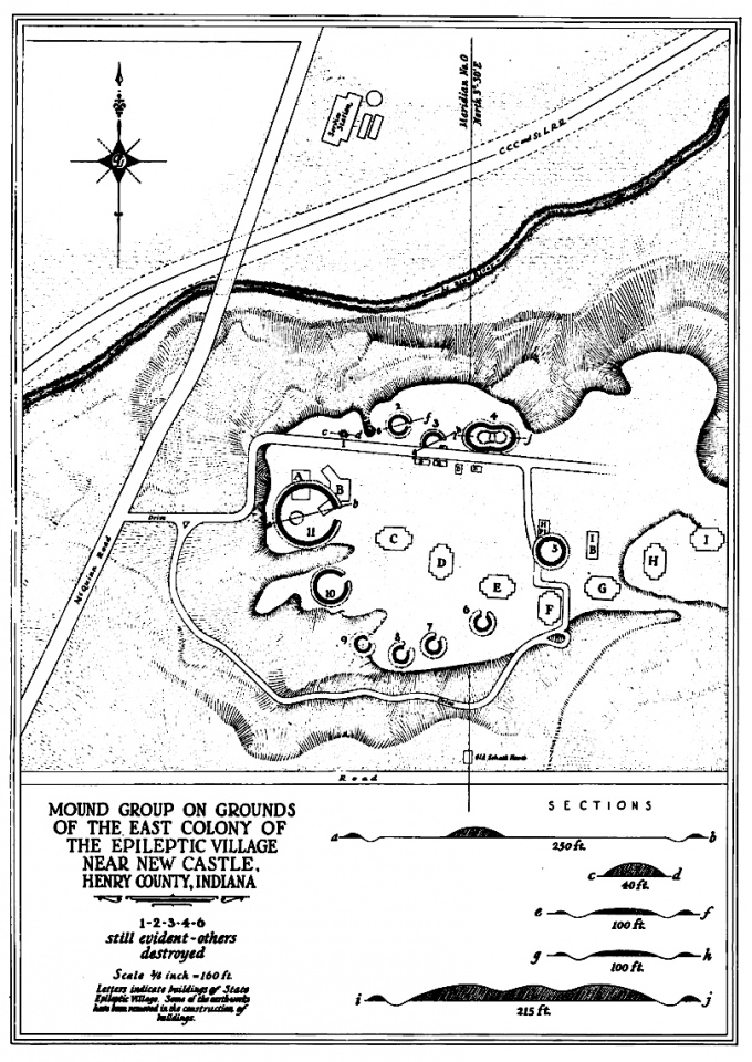
New Castle Complex submitted by AKFisher on 28th Aug 2023. 1937 survey of the New Castle Earthworks and mounds at New Castle, Indiana. There were 9 circular or C-shaped earthworks that had outer earthen walls with inner moats. There were 4 mounds and an odd ovoid earthwork enclosure with an inner moat with three large mounds inside the enclosure. Photo courtesy Dr Greg Little, author of the Illustrated Encyclopedia of Native American Indian Mounds & Earthworks (2016).
(View photo, vote or add a comment)
Log Text: Parking is in a lot on Route 103 south of the Little Blue River just across from the old paved hospital access road, now abandoned and gated, but open to hiking. The grounds comprising the complex are now owned by the Wilbur Wright Fish and Wildlife Area. The old paved hospital road leads to the section containing sites 1-4 and there is a side trail presumably leading south and east to what's left of the remaining sites which I did not try to explore.
In general, anything off of the hospital access road was extremely overgrown in October 2023. I was unable to find sites 2-4, and may only have found a part of the mound at site 1. The only time to find anything here may be in winter when the leaves are off the trees as there are no obvious trails and bushwhacking is required.
Nabers Mound Cemetery Site
Date Added: 16th Dec 2024
Site Type: Artificial Mound
Country: United States (The South)
Visited: Yes on 1st Dec 2024. My rating: Condition 4 Ambience 4 Access 4
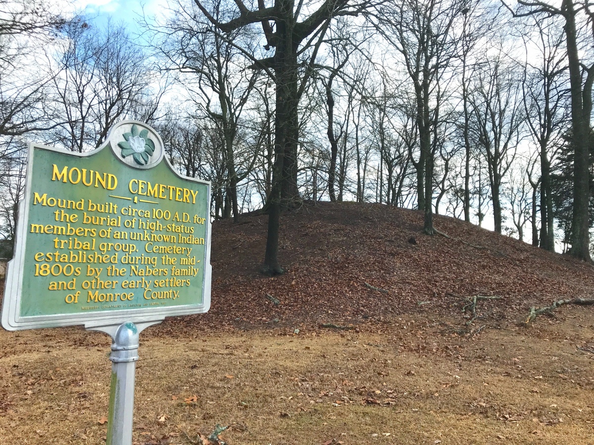
Nabers Mound Cemetery Site submitted by AKFisher on 25th Aug 2023. Obscure Mounds: "Nabors Mound Cemetery Mound" next to a golf course in Amory, Mississippi. Dated to AD 100.
Photo courtesy Dr Greg Little, author of the Illustrated Encyclopedia of Native American Indian Mounds & Earthworks (2016).
(View photo, vote or add a comment)
Log Text: A well-preserved Middle Woodland mound that was later used as a 19th to 20th century cemetery, no doubt benefiting its good condition. The property was acquired by the Archaeological Conservancy recently and it abuts a golf course development.
It's in a residential subdivision but on-street parking is not a problem and you can walk right up the mound. The mound is maybe 100 ft from the road, so the mobility-impaired can easily view it from a vehicle.
Moustoir tumulus
Date Added: 12th Dec 2024
Site Type: Chambered Tomb
Country: France (Bretagne:Morbihan (56))
Visited: Yes on 1st Sep 2024. My rating: Condition 3 Ambience 4 Access 4

Moustoir tumulus submitted by thecaptain on 10th Jun 2006. This massive great mound, 90 metres in length, 40 metres wide and 8 metres high, can be found just to the south of the hamlet of Moustoir, a few kilometres to the north of Carnac.
It has become terribly overgrown.
(View photo, vote or add a comment)
Log Text: One of the huge Carnacean tumuli, with a semi-megalithic burial chamber on the western end and at least two burial cists between the mid-point and eastern end of the tumulus. Currently there is no public access to any of these interior features - they are all blocked.
The tumulus lies just southwest of the village of Moustoir, which itself is a short distance off the D186 on the Quatre Chemins road. There is a large dirt parking lot directly opposite the tumulus, which is no more than 100-200 m away.
Mounds State Park (Indiana) - Earthwork D
Date Added: 31st Oct 2023
Site Type: Misc. Earthwork
Country: United States (Great Lakes Midwest)
Visited: Yes. My rating: Condition 3 Ambience 3 Access 3

Mounds (Indiana) - Earthwork D submitted by bat400 on 23rd Oct 2006. Mounds - Earthwork D.
"Lost" until 1988 when underbrush was removed from the site. Woods now block a clear view between the Great Mound and the center of this smaller, now shallow earthwork. The winter solstice sunset falls beyond the center of this enclosure when viewed from the center of the Great Mound. The forest debris slowly filled in the ditch within the outer embankment ring.
Photo: bat400 Oct 2006.
(View photo, vote or add a comment)
Log Text: Visited in late Oct 2023. This is ~ 150 yds or so southwest of the Great Mound, about 100 ft NE off of a side trail. Requires a bit more walking than the other earthworks closer to the Great Mound.
Mounds (Indiana) - Great Mound
Date Added: 31st Oct 2023
Site Type: Henge
Country: United States (Great Lakes Midwest)
Visited: Yes. My rating: Condition 4 Ambience 5 Access 3
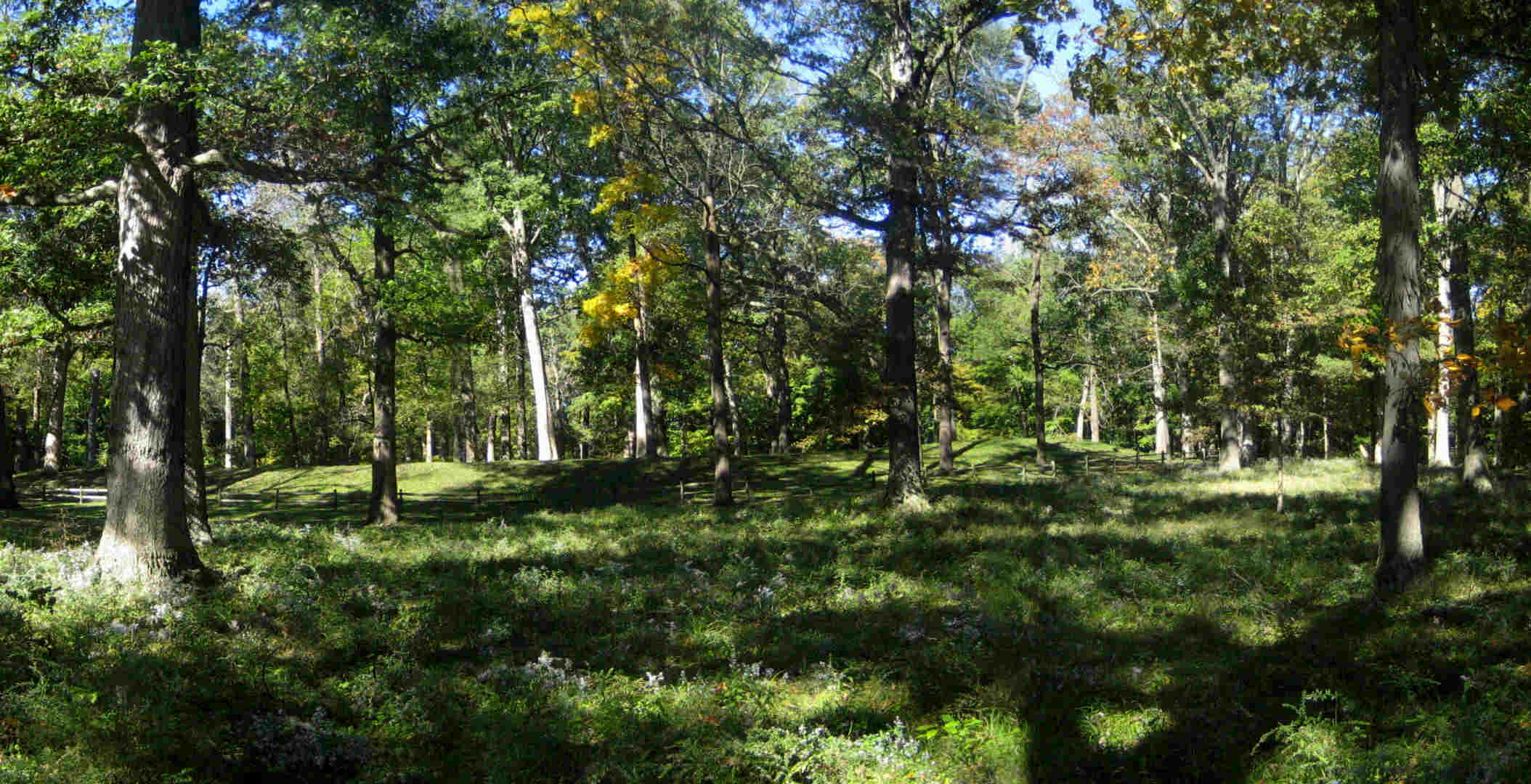
Mounds (Indiana) - Great Mound submitted by bat400 on 22nd Oct 2006. Mounds - The Great Mound.
View from the east with wild asters, the last flower of the season. The outer embankment wall prevents an outside viewer from seeing the central platform within. The exceptions are three dips in the embankment allowing a line of sight to the centers of three smaller earthwork enclosures surrounding the Great Mound.
Photo: bat400 Oct 2006.
(View photo, vote or add a comment)
Log Text: Visited late Oct 2023. This earthwork remains relatively unchanged since the original description was written. See my comments for changes that have taken place and some clarifications.
Mounds (Indiana) - Fiddleback Mound
Date Added: 31st Oct 2023
Site Type: Misc. Earthwork
Country: United States (Great Lakes Midwest)
Visited: Yes. My rating: Condition 3 Ambience 4 Access 3
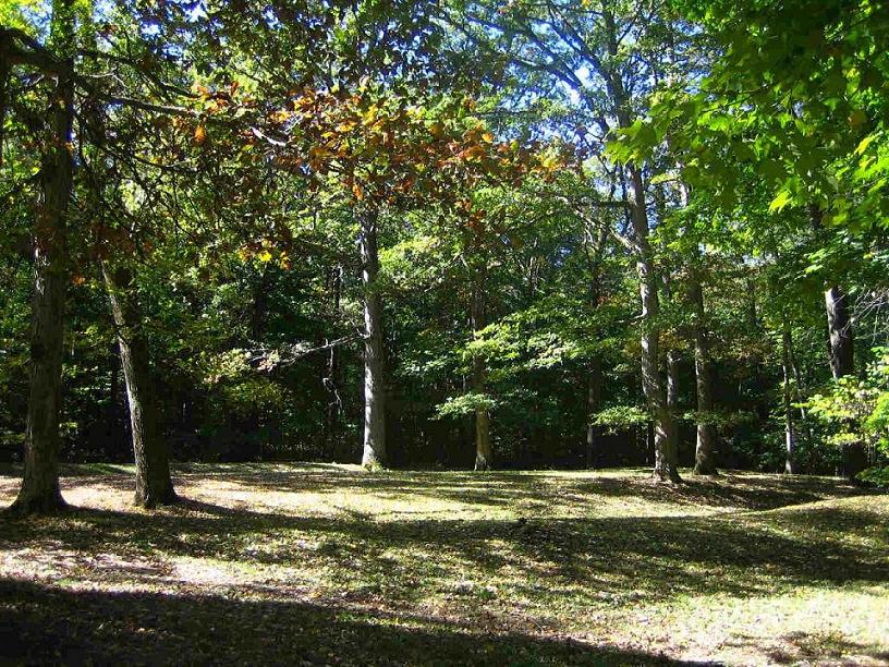
Mounds (Indiana) - Fiddleback Mound submitted by bat400 on 23rd Oct 2006. Mounds - Fiddleback Enclosure
The enclosure is oblong with a constricted middle; it's difficult to see from a single observation point on the ground. The summer solstice sunset falls beyond this enclosure when viewed from the center of the Great Mound.
Photo: bat400 Oct 2006.
(View photo, vote or add a comment)
Log Text: Visited in late Oct 2023. Ditch, embankment, and middle "pinch points" clearly visible. The earthwork is just to the west of the Great Mound and easily accessed via trail.
Mounds (Indiana) - Earthwork B
Date Added: 31st Oct 2023
Site Type: Misc. Earthwork
Country: United States (Great Lakes Midwest)
Visited: Yes. My rating: Condition 2 Ambience 4 Access 3
Mounds (Indiana) - Earthwork B submitted by bat400 on 23rd Oct 2006. Mounds - Earthwork B.
The earthwork is oval, with an "entrance" on each end, and very small, only 8-9 feet long. It is in the immediate foreground, only an indentation. The Great Mound can be seen in the background, behind the rail fence.
Photo: bat400 Oct 2006.
(View photo, vote or add a comment)
Log Text: Visited in late Oct 2023. Just SE of the Great Mound and a 1/4 to 1/2 mile walk via paved trail from the visitor's center.
Mounds (Indiana) - Circle Mound
Date Added: 31st Oct 2023
Site Type: Misc. Earthwork
Country: United States (Great Lakes Midwest)
Visited: Yes. My rating: Condition 4 Ambience 4 Access 4

Mounds (Indiana) - Circle Mound submitted by bat400 on 23rd Oct 2006. Mounds - Circle Mound Enclosure
A stitched photo. The viewer is standing before the entrance, looking due west, into the enclosure.
Photo: bat400 Oct 2006.
(View photo, vote or add a comment)
Log Text: Visited in late Oct 2023. There is parking nearby at the Woodland Shelter (see park map) and a short walk across a mowed field to the site.
Mound at Fort Toulouse - Fort Jackson Park
Date Added: 16th Feb 2023
Site Type: Artificial Mound
Country: United States (The South)
Visited: Would like to visit
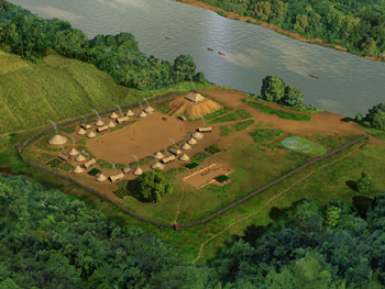
Mound at Fort Toulouse - Fort Jackson Park submitted by stonetracker on 17th Feb 2023. Artist's conception of site and village.
Source: Wikipedia Creative Commons.
(View photo, vote or add a comment)
Moonflower Petroglyphs
Date Added: 3rd Jun 2025
Site Type: Rock Art
Country: United States (The Southwest)
Visited: Yes on 1st May 2025. My rating: Condition 3 Ambience 3 Access 5
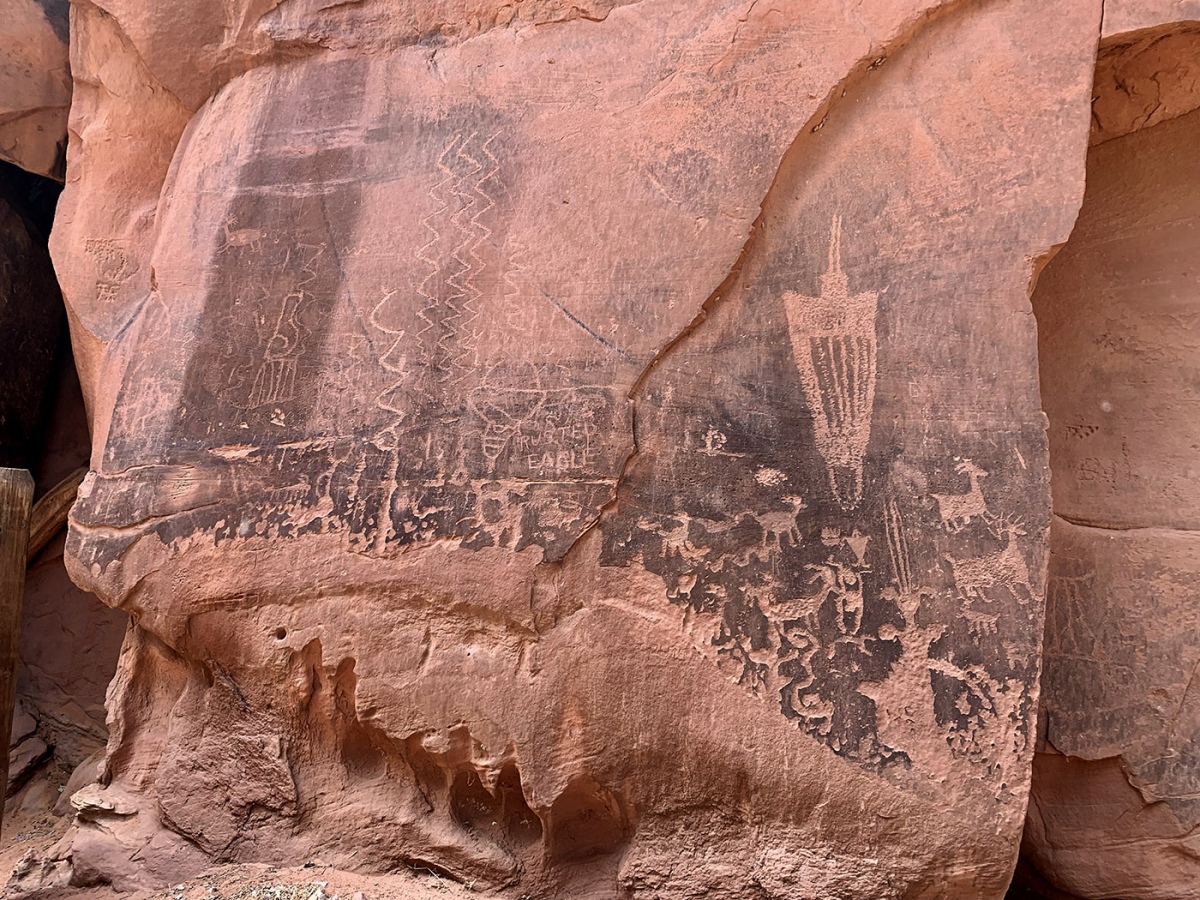
Moonflower Petroglyphs submitted by KaiHofmann on 7th Sep 2022. the Moonflower Petroglyphs.
(View photo, vote or add a comment)
Log Text: This is one of the most easily accessible rock art sites in Moab. The unpaved parking lot serves both a campground and a day use area right next to the rock art panel. You can likely view the panel from inside a vehicle and disabled access shouldn't be a problem. The panel is literally right next to parking and a very short walk.
Unfortunately easy access usually means significant vandalism and graffiti and this site is no exception, as some seem to feel the need to add their tagline to the panel. The least abused of the panels is right next to a huge crack in the canyon wall that kids often climb up. As you go to the right, the damage increases exponentially.
To get there, take Kane Creek Blvd west from the McDonalds on Rte 191 approximately 3 miles to the site on the left. It is signposted.
Mont Helena
Date Added: 4th Feb 2023
Site Type: Artificial Mound
Country: United States (The South)
Visited: Yes on 1st Oct 2022. My rating: Condition 3 Ambience 4 Access 5
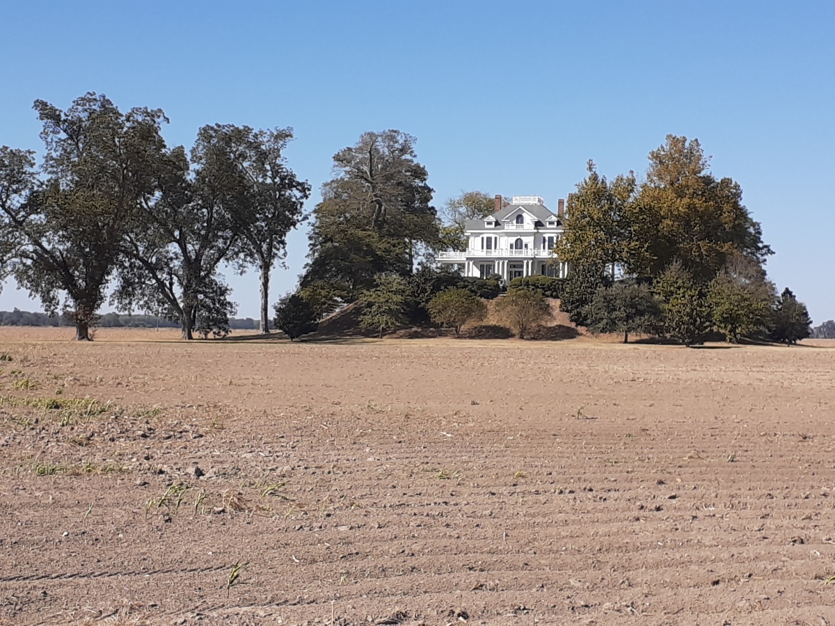
Mont Helena submitted by stonetracker on 6th Feb 2023. Wider view
(View photo, vote or add a comment)
Log Text: The one remaining mound is on private property. There is a Victorian mansion on top. Closest view from a vehicle is a pull-off on Rolling Fork Rd, about 800 ft from the site. Good visibility.
Moab Golf Course Rock Art Site
Date Added: 5th Jun 2025
Site Type: Rock Art
Country: United States (The Southwest)
Visited: Yes on 1st May 2025. My rating: Condition 3 Ambience 4 Access 5
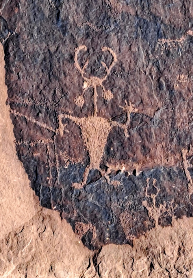
Moab Golf Course Rock Art Site submitted by stonetracker on 5th Jun 2025. This is the so-called Moab Man, a Fremont era petroglyph that has become a sort of unofficial mascot of the Moab prehistoric community. Most of the petroglyphs were created between 0 and 1275 CE.
(View photo, vote or add a comment)
Log Text: This is a small Ancestral Pueblo/Fremont rock art panel on a cliff face across the street from a golf course in suburban Moab UT. Its main virtue is nearly drive-up access - the panels are just steps away from the dirt parking area behind a wooden fence.
To get there, take Route 191 south from Moab city center for about 3 miles. Take a left onto East Spanish Trail Rd and drive a mile or so to a traffic circle (roundabout). Continue around the traffic circle straight onto Westwater Rd. Continue on Westwater for about 0.75 miles. The site is at a sandstone cliff wall on the left with parking available next to the fence.
Metcalfe Mounds
Date Added: 2nd Mar 2025
Site Type: Artificial Mound
Country: United States (The South)
Visited: Saw from a distance on 1st Feb 2025. My rating: Condition 3 Ambience 3
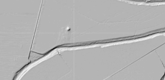
Metcalfe Mounds submitted by stonetracker on 7th Dec 2023. Shaded relief layer of same topo map. Mound is in the upper center of the map.
(View photo, vote or add a comment)
Log Text: This Mississippian mound falls into the same category as a number of others that can only be viewed from long range, e.g. Leland, Stoneville, and Mayersville. All are privately owned and on either agricultural land or large compounds set far back from the nearest public road. Unless permission is secured by the landowner, be prepared to shoot photos or videos from 1/4 to 1/2 mile away.
The best viewing spot I found was about at the midpoint of Metcalf Road which lies about 1000 ft west of the mound. There are no shoulders for safe parking so I had to park on a nearby field (dirt) road and walk about 100 ft.
The mound is on a farm just to the east of a large tan shed (see images). It is in good condition.
Mesa Verde - Square Tower House
Date Added: 18th Jul 2025
Site Type: Ancient Village or Settlement
Country: United States (The Southwest)
Visited: Yes on 1st May 2025. My rating: Condition 3 Ambience 5 Access 4

Mesa Verde - Square Tower House submitted by DrewParsons on 18th Oct 2008. Detail of the Square Tower House site at Mesa Verde
(View photo, vote or add a comment)
Log Text: This is a cliff dwelling from the Ancestral Pueblo 3 period featuring the tallest tower structure still standing in the park. There are two ways to see the cliff dwelling. Remotely, from an overlook at the canyon rim. Or much closer, via periodically scheduled ranger-led hikes into the cliff dwelling complex itself. I opted for the overlook view, as they were just starting the guided tours (around the end of the first week in May in 2025).
Parking at the trailhead is available about 1/2 mile south of the Pithouse stop on the Mesa Top Loop road. The paved trail to the overlook is about 600 ft long and provides a nice view of the complex.
Mesa Verde - Spruce Tree House
Date Added: 13th Jul 2025
Site Type: Ancient Village or Settlement
Country: United States (The Southwest)
Visited: Yes on 1st May 2025. My rating: Condition 4 Ambience 5 Access 4
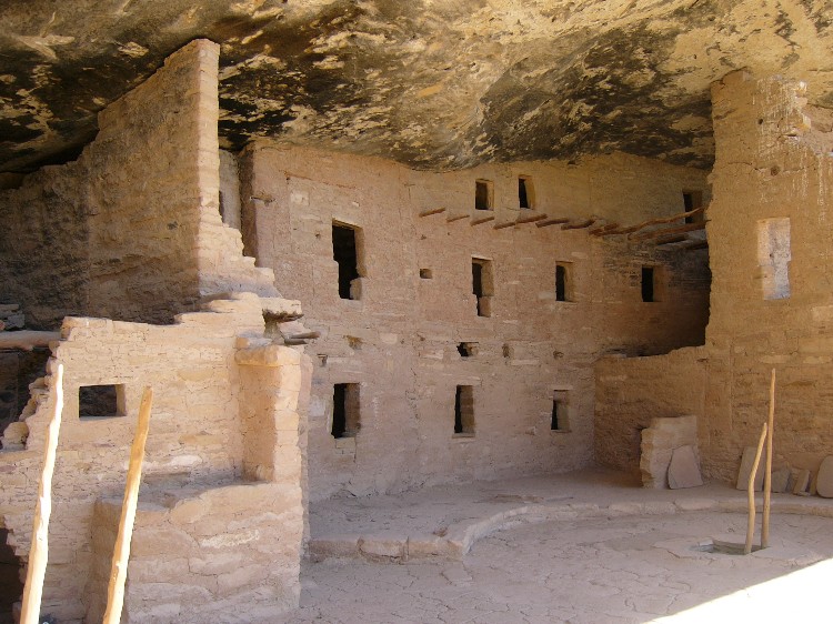
Mesa Verde - Spruce Tree House submitted by DrewParsons on 19th Oct 2008. Site in United States: Mesa Verde - Spruce Tree House photographed in September 2005
(View photo, vote or add a comment)
Log Text: Visited in May 2025. Unfortunately, this cliff dwelling from the Pueblo 3 period, probably the best preserved of all the cliff dwellings at Mesa Verde, has been closed to visitation since 2015. A portion of the alcove overhang collapsed, creating a serious safety issue, and forcing the closure ever since. There have been ongoing efforts to determine how to best stabilize the site for future visitation.
Meanwhile an overlook behind the Chapin Museum provides excellent views and interpretation of the cliff dwelling. The area is still well worth a visit. The short 100-200 yd path to the overlook is paved and I believe is wheel chair accessible.
Mesa Verde - Pithouse
Date Added: 18th Jul 2025
Site Type: Ancient Village or Settlement
Country: United States (The Southwest)
Visited: Yes on 1st May 2025. My rating: Condition 3 Ambience 4 Access 4
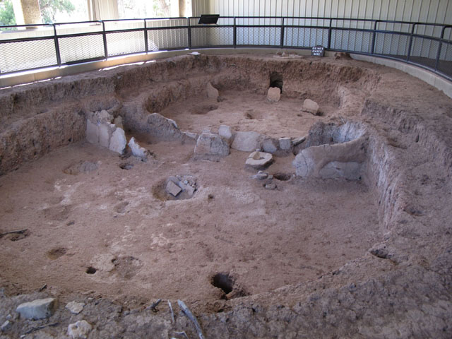
Mesa Verde - Pithouses and Pueblos submitted by jeffrep on 14th Nov 2012. Pit house.
(View photo, vote or add a comment)
Log Text: This is the first stop on the Mesa Top Loop, a one-way driving loop featuring actual excavated sites with interpretation that cover Basketmaker 3 through Pueblo 3 cultural periods.
The Pithouse stop is about a mile south of Chapin Museum and Spruce Tree House overlook. The actual pithouse is less than 100 ft south of the parking pulloff under a shelter, accessible via a paved foot path.
Mesa Verde - Pipe Shrine House
Date Added: 22nd Jun 2025
Site Type: Ancient Village or Settlement
Country: United States (The Southwest)
Visited: Yes on 1st May 2025. My rating: Condition 3 Ambience 4 Access 4
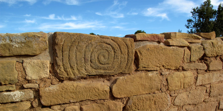
Mesa Verde - Pipe Shrine House submitted by jeffrep on 10th Nov 2012. Spiral Petroglyph on outer wall of Pipe Shrine House in Mesa Verde.
(View photo, vote or add a comment)
Log Text: Pipe Shrine House is an Ancestral Pueblo village built just 100 yds south of the Far View great house and consists of approximately 20 room blocks, a large interior kiva, and what appears to be a circular room next to the kiva that may have been a tower. The village was built and modified between 900 and 1300 CE, so it spans the Pueblo 2 and 3 periods. There is some debate as to whether this site was purely ceremonial or served as a homestead for villagers farming the mesa top. (or both!). More in Comments section.
To get there, see the visit log for Far View House as the directions are the same. Pipe Shrine House is but a 100 yd walk south from the great house. The interior of the room block site is off limits to visitation; however, the surrounding area is at enough of an elevation that you can get a good sense of the overall architecture. The kiva however is difficult to see well given the access restrictions in May of 2025.
