Contributory members are able to log private notes and comments about each site
Sites Stonetracker has logged. View this log as a table or view the most recent logs from everyone
Coker Ford Site
Date Added: 12th Feb 2023
Site Type: Ancient Village or Settlement
Country: United States (The South)
Visited: Would like to visit
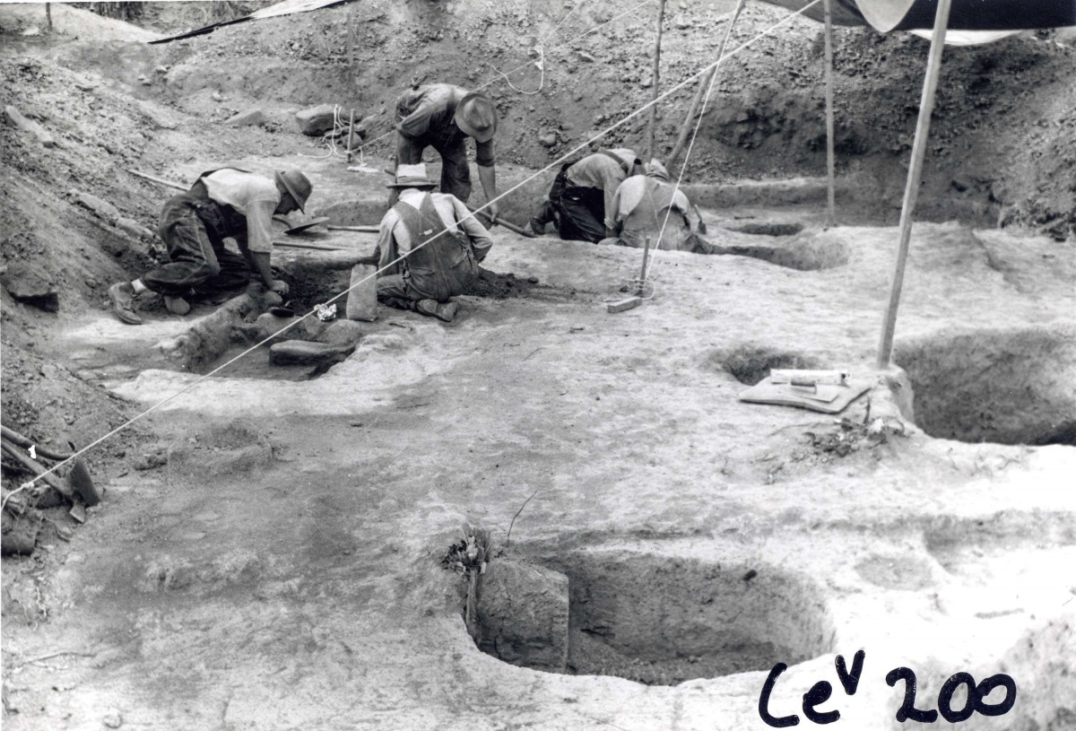
Coker Ford Site submitted by stonetracker on 17th Feb 2023. Archaelogical dig at Coker Ford site, date unknown. Source: https://alabamamoundtrail.org/mound-site/coker-ford-mound/. Sponsor: University of Alabama.
(View photo, vote or add a comment)
Chucalissa Prehistoric Indian Village
Date Added: 8th Mar 2024
Site Type: Museum
Country: United States (The South)
Visited: Yes on 1st Feb 2024. My rating: Condition 4 Ambience 4 Access 4
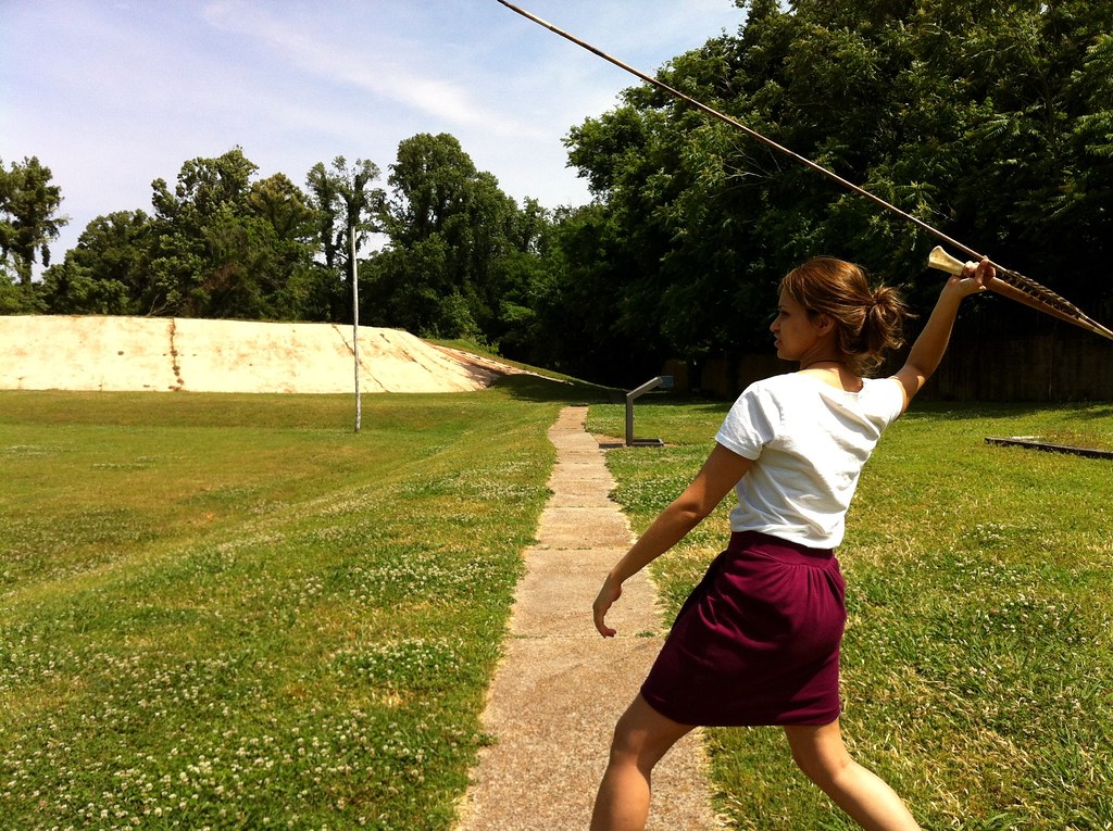
Chucalissa Prehistoric Indian Village submitted by Dodomad on 17th Aug 2023. C.H. Nash Museum employee Kiran Riar demonstrates how to throw a spear with an atlatl at Chucalissa.
Image copyright: ilovememphis (Memphis CVB), hosted on Flickr and displayed under the terms of their API.
(View photo, vote or add a comment)
Log Text: Site is as described including the Nash Museum. Some additional notes:
* The temple mound appears to be partially reconstructed, not unusual for mound builder sites. In particular, a tan clay facing has been applied to the front of the mound. It is thought that this is the way it appeared in late Mississippian times.
* There is another smaller mound adjacent to the temple mound. As far as I can tell, this is the only other extant mound in the park.
* There is a nice replica of a village house behind the temple mound.
* There is also a replica of a segment of palisade enclosure, using wattle and daub construction.
* Nature trails behind the temple mound traverse borrow pits and archeological excavation trenches of habitation sites.
Chrysler Enclosure
Date Added: 31st Oct 2023
Site Type: Henge
Country: United States (Great Lakes Midwest)
Visited: Yes. My rating: Condition 3 Ambience 3 Access 5

Chrysler Enclosure submitted by bat400 on 15th Jan 2007. Chrysler Enclosure, Henry County, IN.
Circular Earthwork Enclosure.
An earthen ring thrown up on the outside of a circular ditch, about 30 ft dia. The ditch is broken by an entry way sited to align the center of the enclosure with the winter solstice sunrise.
Photo by bat400 Oct 2006.
(View photo, vote or add a comment)
Log Text: Visited late Oct 2023. Fairly well preserved earthwork in a traffic circle next to a public school. Lots of parking nearby in a town park, easy access.
Christmas Mound
Date Added: 7th Apr 2024
Site Type: Artificial Mound
Country: United States (The South)
Visited: Yes on 1st Apr 2024. My rating: Condition 3 Ambience 3
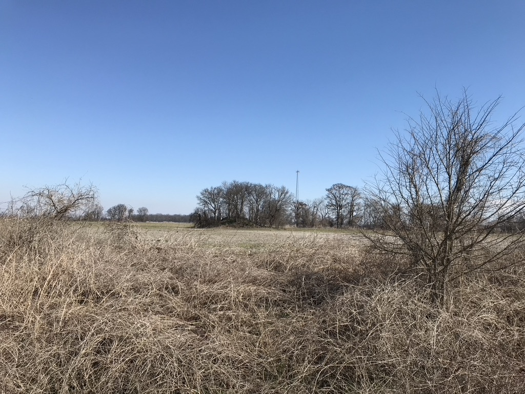
Christmas Mound submitted by AKFisher on 10th Aug 2023. Christmas Mound in Mississippi. It started as a midden mound in AD 400 and was enlarged to 10-feet in height in a small window of time. There are many similar mounds all over the southeast, most of which are unmarked. Photo courtesy Dr Greg Little, author of the Illustrated Encyclopedia of Native American Indian Mounds & Earthworks (2016).
(View photo, vote or add a comment)
Log Text: Mound is as described about 200 yds east of the parking pulloff in a private cultivated area. Only remote viewing is possible.
Choccolocco Creek Mounds
Date Added: 12th Feb 2023
Site Type: Artificial Mound
Country: United States (The South)
Visited: Would like to visit
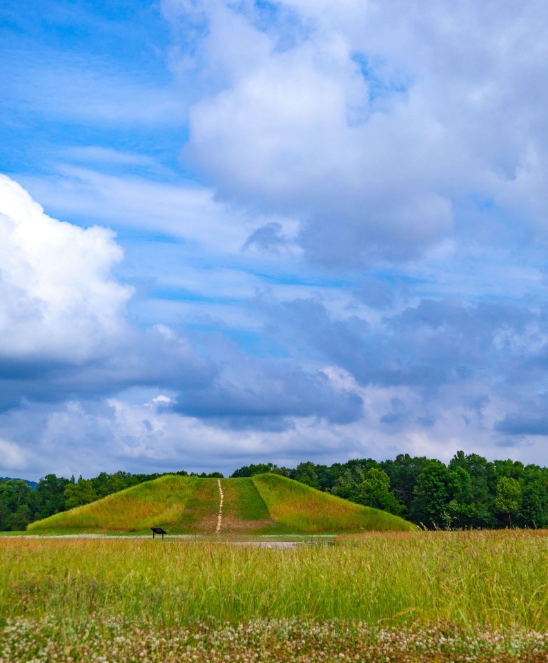
Choccolocco Creek Mounds submitted by stonetracker on 16th Feb 2023. Reconstructed large mound. Same photo source as above.
(View photo, vote or add a comment)
Chickasaw Heritage Park
Date Added: 7th Mar 2024
Site Type: Artificial Mound
Country: United States (The South)
Visited: Yes on 1st Feb 2024. My rating: Condition 4 Ambience 4 Access 4
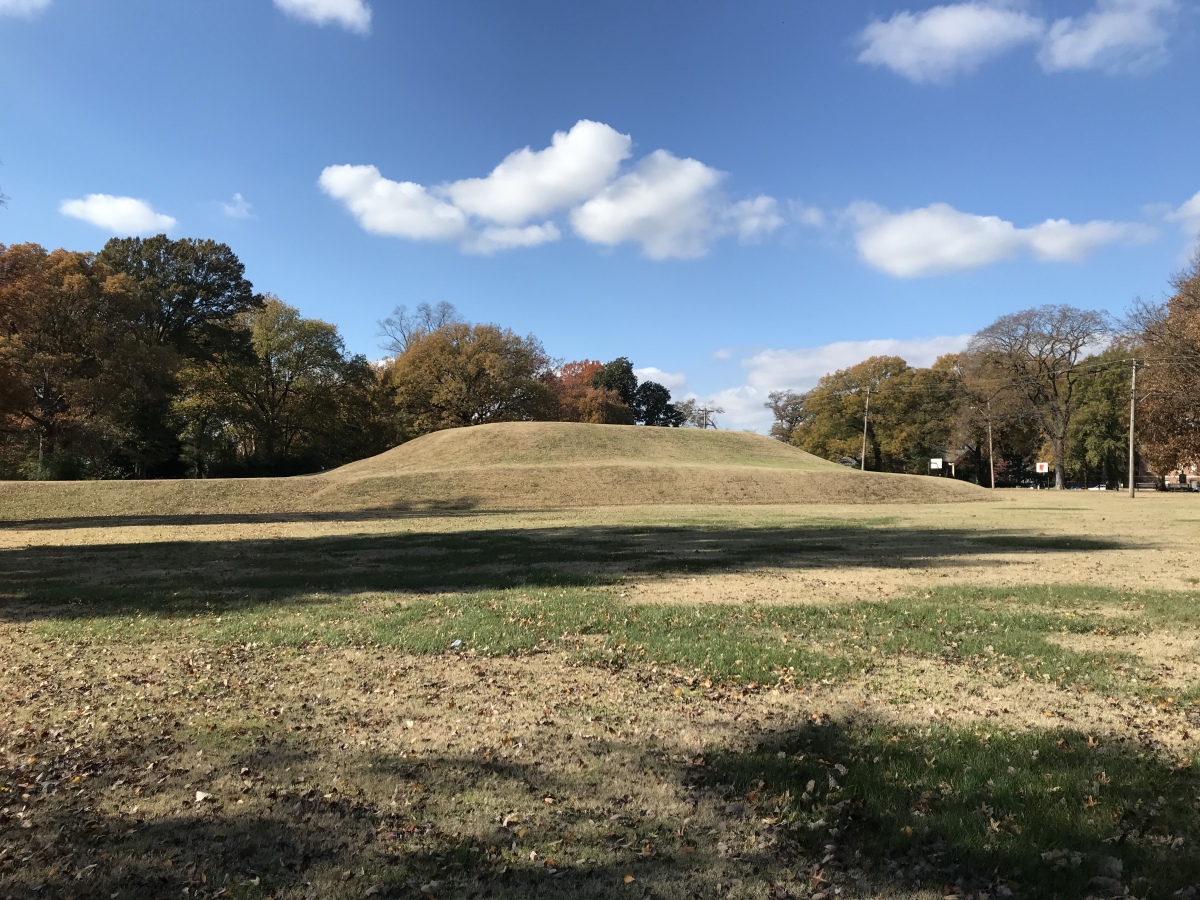
Chickasaw Heritage Park submitted by AKFisher on 14th Aug 2023. This is a really well formed platform mound, one of two at the site, in downtown Memphis, Tennessee next to the Mississippi River. It is thought by some to be the site where Hernando de Soto first saw the Mississippi River. Photo courtesy Dr Greg Little, author of the Illustrated Encyclopedia of Native American Indian Mounds & Earthworks (2016).
(View photo, vote or add a comment)
Log Text: Site remains as described. The only change I noticed was the tunnel leading to the Civil War magazine in the mound next to the river has been bricked up and blocked.
Cheatham Mound
Date Added: 9th Mar 2024
Site Type: Artificial Mound
Country: United States (The South)
Visited: Yes on 1st Feb 2024
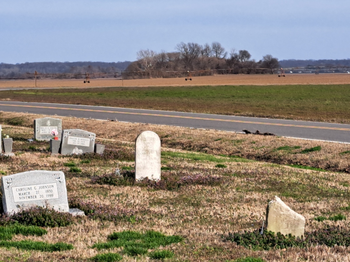
Cheatham Mound submitted by stonetracker on 9th Mar 2024. A cemetery is as close as I could park to this mound. The mound is maybe a 1/2 mile away on a large farm tract.
(View photo, vote or add a comment)
Log Text: Very little information out there, but this is listed as a known single-mound Walls phase site. The only reasonable, safe parking was about 1/2 mile west of the site in a nearby cemetery. The mound appears to be fairly intact but impossible to confirm from this distance.
Cave Pueblo Ruin
Date Added: 14th May 2025
Site Type: Ancient Village or Settlement
Country: United States (The Southwest)
Visited: Yes on 1st May 2025. My rating: Condition 2 Ambience 4
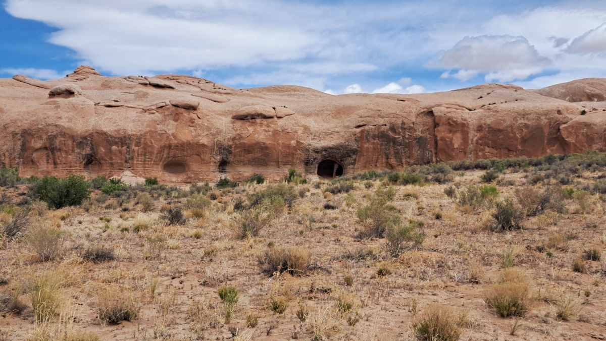
Cave Pueblo Ruin submitted by stonetracker on 14th May 2025. The ruin is in the large cave just to the right of the center in the photo.
(View photo, vote or add a comment)
Log Text: There is no close access to the site due to a barbed wire fence and wired off gate. But you can easily spot the cave and ruin from a parking pulloff ~ 3 miles east of Bluff UT. There are also a number of rock art sites along the same route west from this point to Bluff. I was able to visit some, not all.
Castle Rock Pueblo
Date Added: 12th May 2025
Site Type: Ancient Village or Settlement
Country: United States (The Southwest)
Visited: Yes on 1st Apr 2025. My rating: Condition 2 Ambience 4 Access 4

Castle Rock Pueblo submitted by stonetracker on 12th May 2025. The only intact remains I was able to find along the spur trail. The wall still has some mortar holding it together.
This was a late Pueblo 3 village ruin, likely built around 1250 CE and abandoned 30 years later. From the Crow Canyon archaeological center website:
"Castle Rock Pueblo was a village in the Mesa Verde region of southwestern Colorado that was constructed during the late Pueblo III period. The village was home to 75 to 150 people from the A.D. 1260s until sometime during t...
(View photo, vote or add a comment)
Log Text: This site is accessible via a short 1/4 mile hike on the Sand Canyon Pueblo Trail and is the first ancestral pueblo village site north of of the trail head on County Rd G, west of Cortez CO. There are approximately five other village ruins along the trail beyond it, but I did not have time to visit them.
The Castle Rock formation itself is very obvious from County Rd G but there are no obvious pueblo remains in front of it. Instead, walk the flat ledge to the left (west) around the rock formation and behind it. There is a sign with a short spur trail to the right at this point leading to the ruins.
Cary Mounds
Date Added: 4th Nov 2023
Site Type: Artificial Mound
Country: United States (The South)
Visited: Yes. My rating: Condition 3 Ambience 3 Access 4
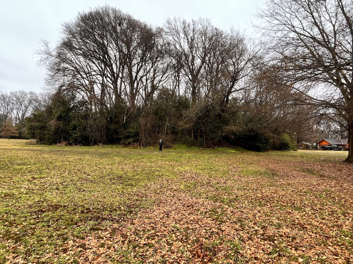
Cary Mounds submitted by AKFisher on 1st Aug 2023. Cary Mound, Mississippi. There were 4 mounds here but only one platform mound exists today.
Photo courtesy Dr Greg Little, author of the Illustrated Encyclopedia of Native American Indian Mounds & Earthworks (2016).
(View photo, vote or add a comment)
Log Text: Mound is in a residential neighborhood. Can park at the historical marker and walk 100 ft to the mound base.
Carter Mounds
Date Added: 2nd Nov 2023
Site Type: Artificial Mound
Country: United States (The South)
Visited: Yes. My rating: Condition 3 Ambience 3 Access 5
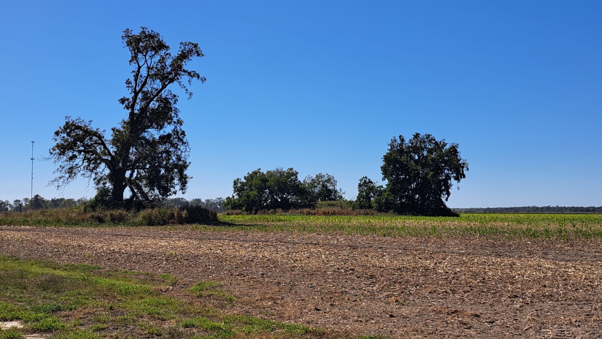
Carter Mounds submitted by stonetracker on 2nd Nov 2023. Mound B on the left and Mound A on the right in Oct 2023
(View photo, vote or add a comment)
Log Text: Can drive to within 100 ft of Mound B (Mound A is 100 ft behind B and to its right). Parking is available in a pulloff next to the historical marker.
Carson Mounds
Date Added: 25th Mar 2024
Site Type: Artificial Mound
Country: United States (The South)
Visited: Yes on 1st Feb 2024. My rating: Condition 3 Ambience 4
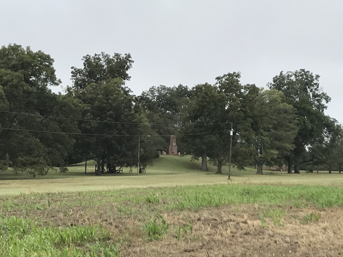
Carson Mounds submitted by AKFisher on 5th Aug 2023. Photo courtesy Dr Greg Little, author of the
Carson Mounds today.
Photo courtesy Dr Greg Little, author of the Illustrated Encyclopedia of Native American Indian Mounds & Earthworks (2016).
(View photo, vote or add a comment)
Log Text: One of the most impressive Early Mississippian sites anywhere in the US, let alone MS. Outside of the Lake George (Holly Bluff) site, it is likely the largest Native American mound site in the state, covering over a mile of terrain that once hosted over 80 mounds, an earthen enclosure, and a large village site. 5 of the largest mounds are the only cultural features that remain visible today. Unfortunately most of them are on private property and can only be viewed legally from the road unless owner permission is obtained (or they are approached with caution and respect). Some are posted No Trespassing.
Only Mound B has an official parking pulloff. The rest can be accessed, but generally require parking in a private area with some short distance walking.
Cannon Ball Mesa Pueblo Ruins
Date Added: 9th May 2025
Site Type: Ancient Village or Settlement
Country: United States (The Southwest)
Visited: Yes on 1st Apr 2025. My rating: Condition 2 Ambience 5 Access 3

Cannon Ball Mesa Pueblo Ruins submitted by stonetracker on 8th May 2025. The largest ruin under a boulder. Looks like a single room structure.
(View photo, vote or add a comment)
Log Text: This site actually consists of 4 or 5 separate ruins along a trail that ascends Cannon Ball Mesa to the north. The location given in the general description is for the first and most intact ruin. The trail head begins about 1/2 mile east of the Colorado-Utah border at a roadside pullout on County Road G. The location of this pullout is 37.325785, -109.034079.
The trail starts up a rocky gully and later becomes a bit indistinct as it approaches the rock bench where most of the ruins are located. However, this is mostly an open ledge area with some rocky areas near the boulders requiring a little easy climbing. I've provided some coordinates in the comments for a few other ruins beyond the first one, for those who enjoy exploring these areas.
Cambridge City Henge Complex
Date Added: 31st Oct 2023
Site Type: Henge
Country: United States (Great Lakes Midwest)
Visited: Yes
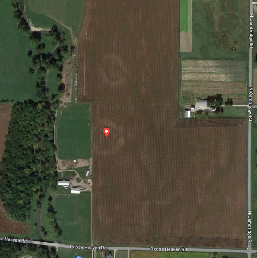
Cambridge City Henge Complex submitted by stonetracker on 30th Oct 2023. A Google Maps satellite view of the two henges. The southern henge's center is marked with a colored pin.
(View photo, vote or add a comment)
Log Text: In a late Oct 2023 visit I was unable to spot the henges at either the stated location or in the general vicinity, which is in a cultivated field on private property approximately 200-300 yds north of Goose Heaven Rd near the junction of N. Cambridge Rd. It has either eroded away to the point of no return or I was in a bad viewing spot.
Update: Later, I did find a satellite view of the site from Google Maps that clearly shows both henges (see photos section). So it's likely that they are very low to the ground and can only be seen from above.
Calvary Cemetery Hilltop Enclosure
Date Added: 1st Mar 2023
Site Type: Hillfort
Country: United States (Great Lakes Midwest)
Visited: Yes on 1st Apr 2021. My rating: Condition 1 Ambience 3 Access 1
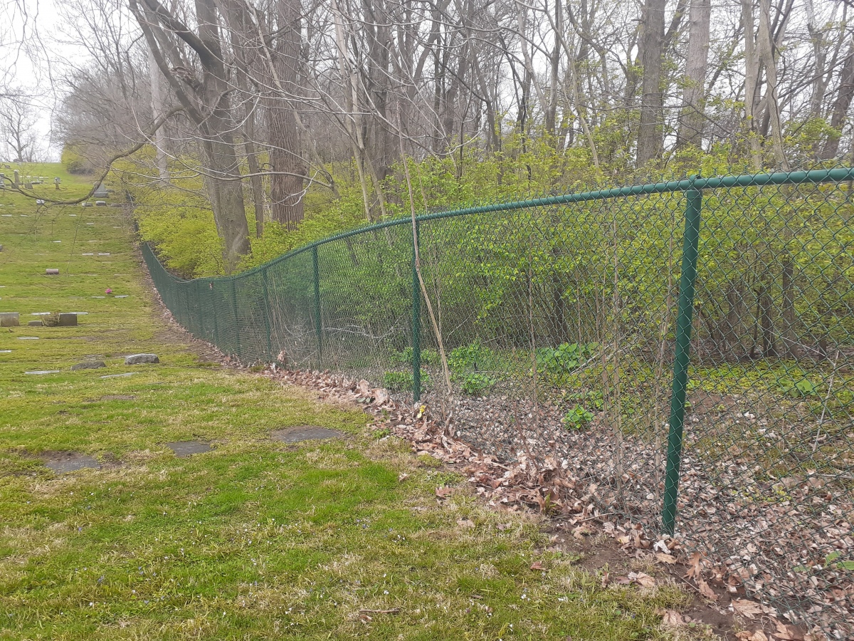
Calvary Cemetery Hilltop Enclosure submitted by stonetracker on 1st Mar 2023. My photo from April 2022 of roughly the same area as the 1895 gully shot. The enclosure wall, if it exists, would be to the right of the fence in heavy brush on Carillon Historical Park property.
(View photo, vote or add a comment)
Log Text: Access to both the cemetery and Carillon Historical Park is open to the public. There is a very steep trail from CHP to nearly the top of the bluff, but if there are any remains of the wall they are in a heavily overgrown, trail-less area along a ravine. It may be easier to spot in winter with less vegetation.
Bynum
Date Added: 7th Dec 2024
Site Type: Barrow Cemetery
Country: United States (The South)
Visited: Yes on 1st Dec 2024. My rating: Condition 3 Ambience 4 Access 4
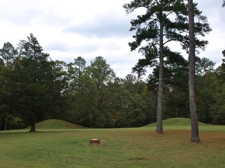
Bynum submitted by bat400 on 6th Sep 2012. Bynum Mounds and Village site. There were originally six burial mounds (the smaller ones much eroded by the plow.) All six were fully excavated and the two largest mounds were reconstructed .
Photo by bat400, Oct 2011.
(View photo, vote or add a comment)
Log Text: Bynum is one of a half dozen or so mound sites spread out along the Natchez Trace, an ancient animal, Native American, and Euro American trail (now a highway) that traverses much of the state of Mississippi and parts of Alabama and Tennessee. The Trace is managed by the National Park Service. Commercial and residential development is prohibited within roughly several hundred yards east and west of the route, resulting in a forever wild strip of land that runs for over 300 miles through the Deep South part of the US.
Access to Bynum is via a short circular driveway that runs to the east at about mile marker 232.4 of the Trace. The two remaining mounds are easily viewed at a distance from the parking area, but I believe a paved walkway gets very close to the mounds. So it's accessible to the mobility impaired. .
Burrows Park Mound
Date Added: 31st Jul 2024
Site Type: Artificial Mound
Country: United States (Great Lakes Midwest)
Visited: Yes on 1st Jul 2024. My rating: Condition 3 Ambience 3 Access 4
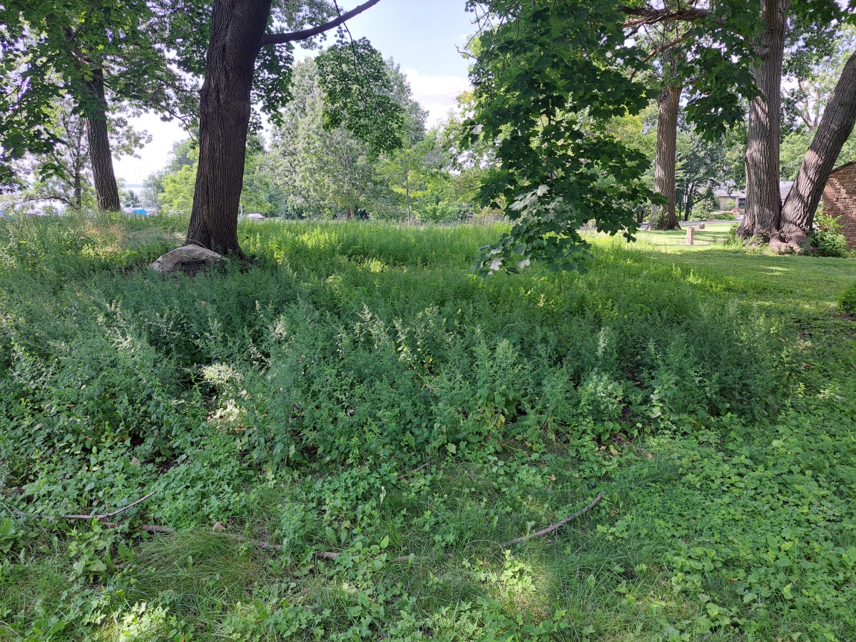
Burrows Park Mound submitted by stonetracker on 30th Jul 2024. As with all effigy mounds, they are hard to photograph. This is the bird's head looking towards the northern wing.
They have finally allowed native grasses to grow on top of the mound, which is good. However, there are still large trees right in the middle of the mound, which isn't so good.
(View photo, vote or add a comment)
Log Text: This is in a public park in Madison on the eastern shore of Lake Mendota. A large parking lot provides easy access and the effigy is situated a short walk up the bluff to the east.
Braddock Mound
Date Added: 19th Feb 2023
Site Type: Artificial Mound
Country: United States (Great Lakes Midwest)
Visited: Would like to visit
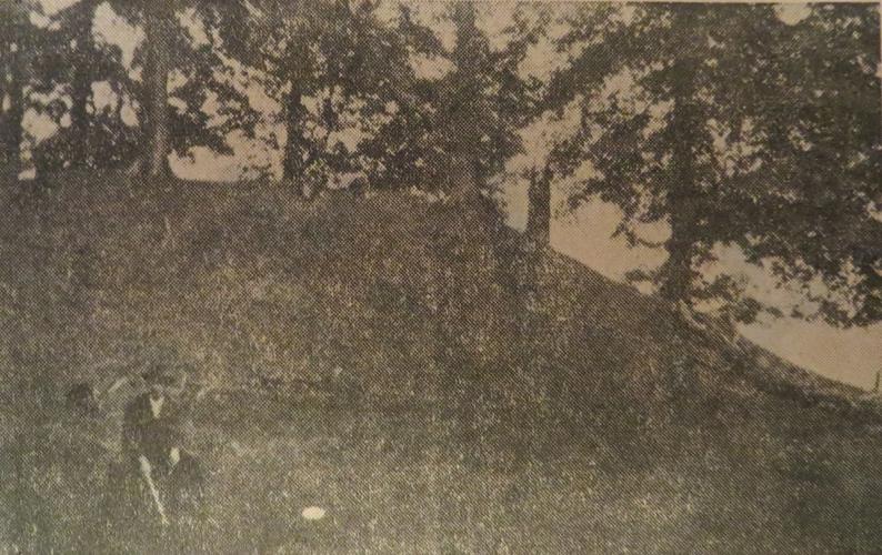
Braddock Mound submitted by stonetracker on 18th Feb 2023. Another old view of mound. Source same as above.
(View photo, vote or add a comment)
Bluff Great House
Date Added: 15th May 2025
Site Type: Ancient Village or Settlement
Country: United States (The Southwest)
Visited: Yes on 1st May 2025. My rating: Condition 2 Ambience 4 Access 4
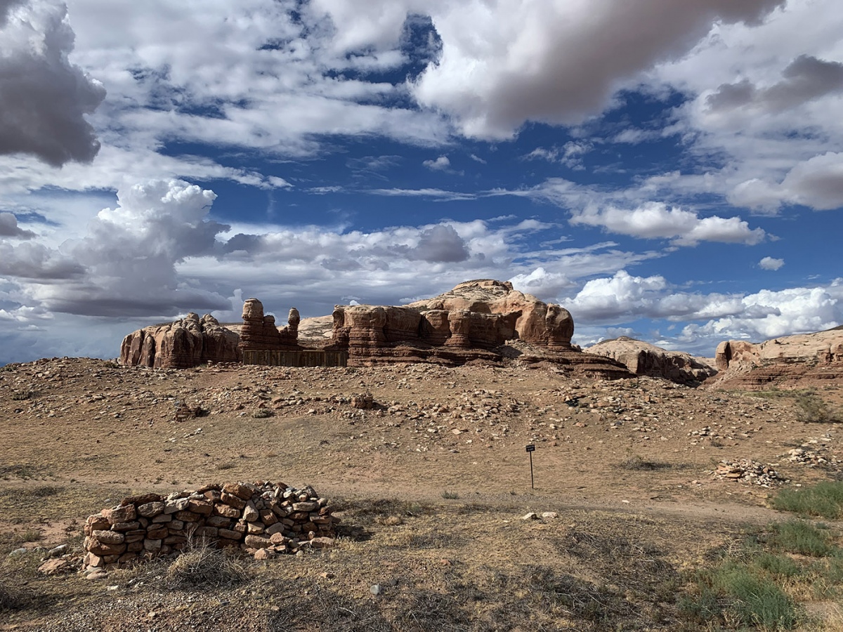
Bluff Great House submitted by KaiHofmann on 29th Sep 2022. Bluff Great House, the large mound with the wooden excavation hut.
(View photo, vote or add a comment)
Log Text: This is a so-called Chacoan outlier great house near the San Juan River, likely built during the Pueblo 2 period ca. 1100 CE. The site overlooks the town of Bluff UT on a high hill with a stunning backdrop of canyons to the north. It has been excavated in the past and subsequently backfilled to preserve the room blocks and kivas within.
There is an interpretive kiosk and parking loop just south of the main access road (N. Pioneer Drive). The buried great house and related structures are about 100-200 yds north of the kiosk via an easy foot trail.
To get to the parking area from Main St, take 3rd East St north to its end. Turn left onto Mulberry and follow it about 1000 ft until it turns right sharply onto N. Pioneer and heads up hill towards the Bluff Cemetery. The gravel parking lot is another 800-1000 ft on the right.
Bilgroix allée couverte
Date Added: 28th Nov 2024
Site Type: Passage Grave
Country: France (Bretagne:Morbihan (56))
Visited: Yes on 1st Sep 2024. My rating: Condition 3 Ambience 4 Access 5

Bilgroix allée couverte submitted by dt44 on 21st Mar 2010.
(View photo, vote or add a comment)
Log Text: This is an allee couverte just to the northwest of Arzon and close to the end of Boulevard de Bilgroix. It is in a small park nestled among local residences. You could probably park right next to it on the street (an option for mobility-impaired visitors), but I chose to park about 100 m farther in a big lot at the point and make the easy walk back to the site.
