Contributory members are able to log private notes and comments about each site
Sites Stonetracker has logged. View this log as a table or view the most recent logs from everyone
Poison Spider petroglyphs
Date Added: 30th May 2025
Site Type: Rock Art
Country: United States (The Southwest)
Visited: Yes on 1st May 2025. My rating: Condition 3 Ambience 5 Access 2
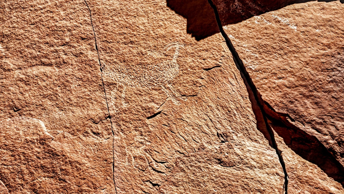
Poison Spider petroglyphs submitted by stonetracker on 1st Jun 2025. Good example of the pecking technique used to create many of these petroglyphs
(View photo, vote or add a comment)
Log Text: During my visit to the southwestern US, I wanted to visit a few rock art sites that took a little more physical effort to get to. A little more trail walking or elevation gain than normal. Theoretically these sites would be less prone to graffiti tagging or vandalism, which is an issue at some roadside locations. Poison Spider is one of these more remote sites and as a bonus it also features petrified dinosaur tracks. It is just one of a chain of rock art sites that line both sides of the Colorado River just south of Moab UT.
To get to Poison Spider, take Route 191 north from Moab for a few miles. When you cross the Colorado River, take a left onto Route 279 (also known as Potash Rd) and continue for 6 miles past a few roadside petroglyph sites. Exit right off the road at the sign for Poison Spider Dinosaur Tracks and continue up a steep hill for a few hundred yards, then take a sharp right into a large paved lot with an info kiosk and restrooms.
Take the Longbow Arch trailhead behind the kiosk down the hill for about 200 yds. At this point there is an unmarked primitive trail that veers off from Longbow to the right and ascends the rocky slope at a moderate angle. Head for the dinosaur tracks which look like white footprints on a large boulder below the cliff face ledge (binoculars are helpful to spot these).
After viewing the tracks, head slightly to the right and up slope on a faint trail until you get to a flat ledge and the cliff face. The petroglyphs extend all along the cliff face to the right and left. When finished, you can either head back the way you came or scramble down from the left edge of the petroglyphs until you link back up with the Longbow Arch Trail that leads to the parking lot.
The whole journey is about 1/2 mile RT.
Note: I would not recommend this climb to anyone with severe knee, joint, or balance problems, as there is some degree of scrambling around rocks to get up and down. You can see a fair amount of the petroglyphs from the parking lot with reasonably powerful optics.
Raleigh Mound
Date Added: 8th Feb 2023
Site Type: Artificial Mound
Country: United States (Great Lakes Midwest)
Visited: Would like to visit
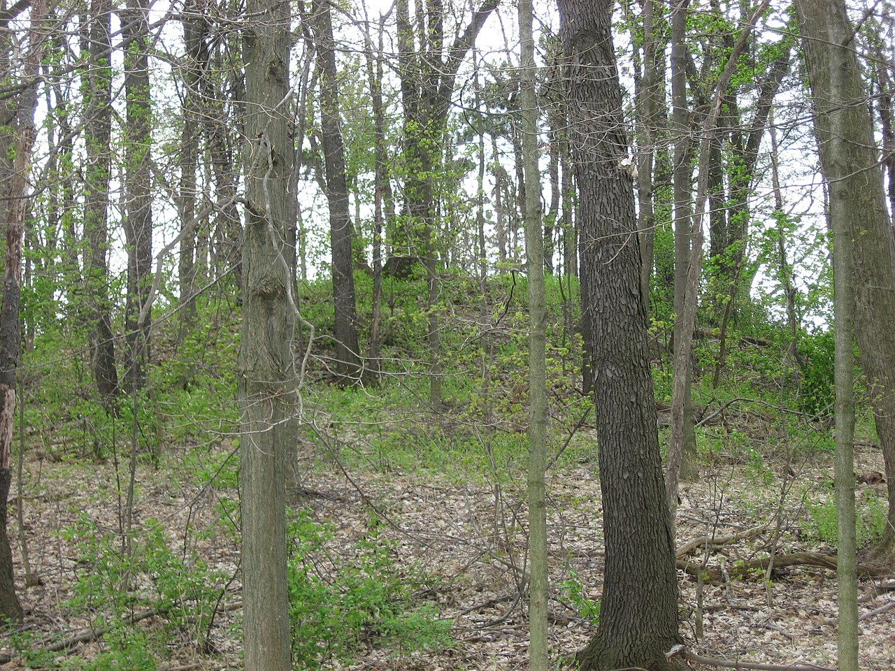
Raleigh Mound submitted by stonetracker on 7th Feb 2023. Creative Commons image of the northern side of the Raleigh Mound, located off W. Mound Street in Fredericktown OH.
(View photo, vote or add a comment)
Refuge Mounds
Date Added: 3rd Mar 2025
Site Type: Artificial Mound
Country: United States (The South)
Visited: Saw from a distance on 1st Feb 2025. My rating: Condition 3 Ambience 4
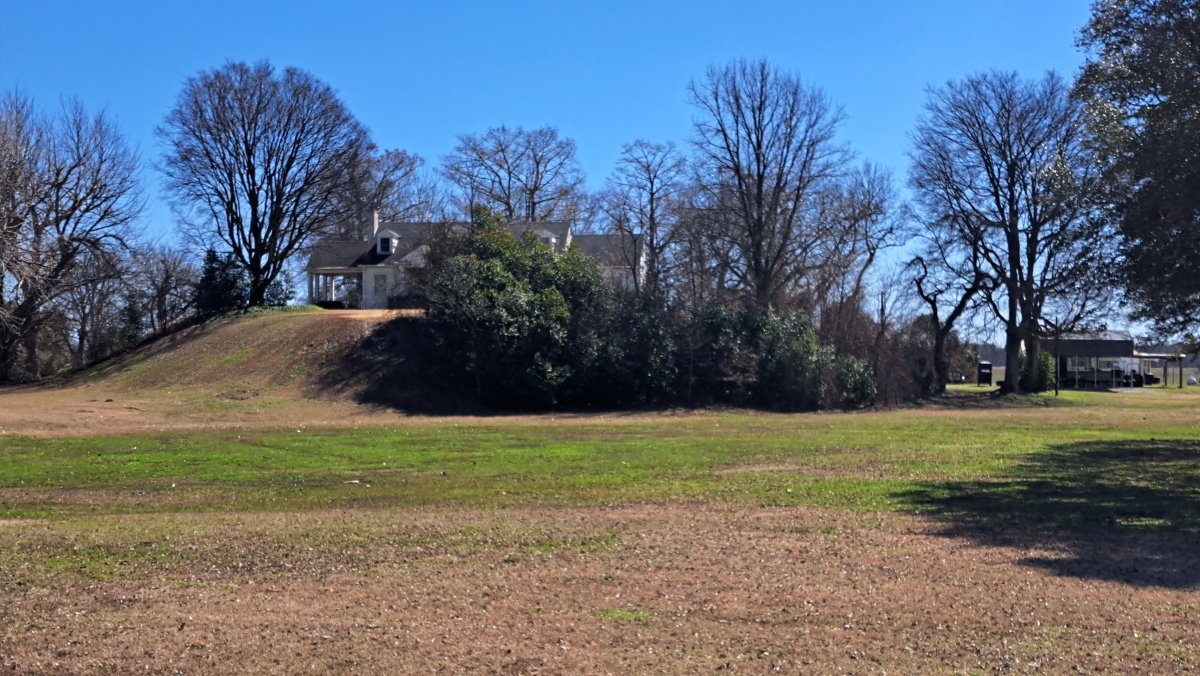
Refuge Mounds submitted by stonetracker on 2nd Mar 2025. The single remaining mound at Refuge, with a house on top.
(View photo, vote or add a comment)
Log Text: A much-studied Mississippian period mound site, but not on the official Mississippi Mound Trail. A house was built on the one remaining rectangular platform mound so the site is private. Unfortunately parking safely along busy Rte 454 is a challenge as there are no good pulloffs and a narrow shoulder. I found a somewhat wider section, parked there, and walked 100 yds to a point opposite the site for photos. The mound is 100-200 yds south of the modern road and close to the Mississippi River.
Reily Cemetery Mound
Date Added: 31st Oct 2023
Site Type: Artificial Mound
Country: United States (Great Lakes Midwest)
Visited: Yes. My rating: Condition 3 Ambience 4 Access 4
Reily Cemetery Mound submitted by bat400 on 9th Oct 2006. There seems to be no record on an excavation of this mound. With the Reily village cemetery created around it, it has been protected, at what is believed to have been its original size and height.
(View photo, vote or add a comment)
Log Text: Visited late Oct 2023. Site is located as described, still in good condition.
Rentschler Park Hilltop Enclosure
Date Added: 2nd Mar 2023
Site Type: Hillfort
Country: United States (Great Lakes Midwest)
Visited: Yes on 1st Apr 2021. My rating: Condition 2 Ambience 4 Access 2

Rentschler Park Hilltop Enclosure submitted by stonetracker on 1st Mar 2023. A colorized version of Squier and Davis's map. A detail of the southern gateway is shown on the left side of the image.
Image Credit: ScienceViews.com
(View photo, vote or add a comment)
Log Text: The site is in a park (Rentschler Forest MetroPark) and open to the public. There are two parking areas: one on the south side and one on the north side near the river. I opted to walk in from the south side. Parking is available in a lot at the end of a side street off of Rentschler Estates Drive. Signage refers to the site as "Line Hill Mound." The gateway is slightly over 0.5 mile away on a flat, easy trail (Mound Trail) which can get muddy so boots are advised in rainy weather. See picture post for a map of the trail system.
I did not check the northern entrance (Reigart Rd) and trail system, but it may be an easier way to explore those parts of the enclosure near the Great Miami River.
Richard's Bridge
Date Added: 19th Mar 2024
Site Type: Ancient Village or Settlement
Country: United States (The South)
Visited: Saw from a distance on 1st Feb 2024
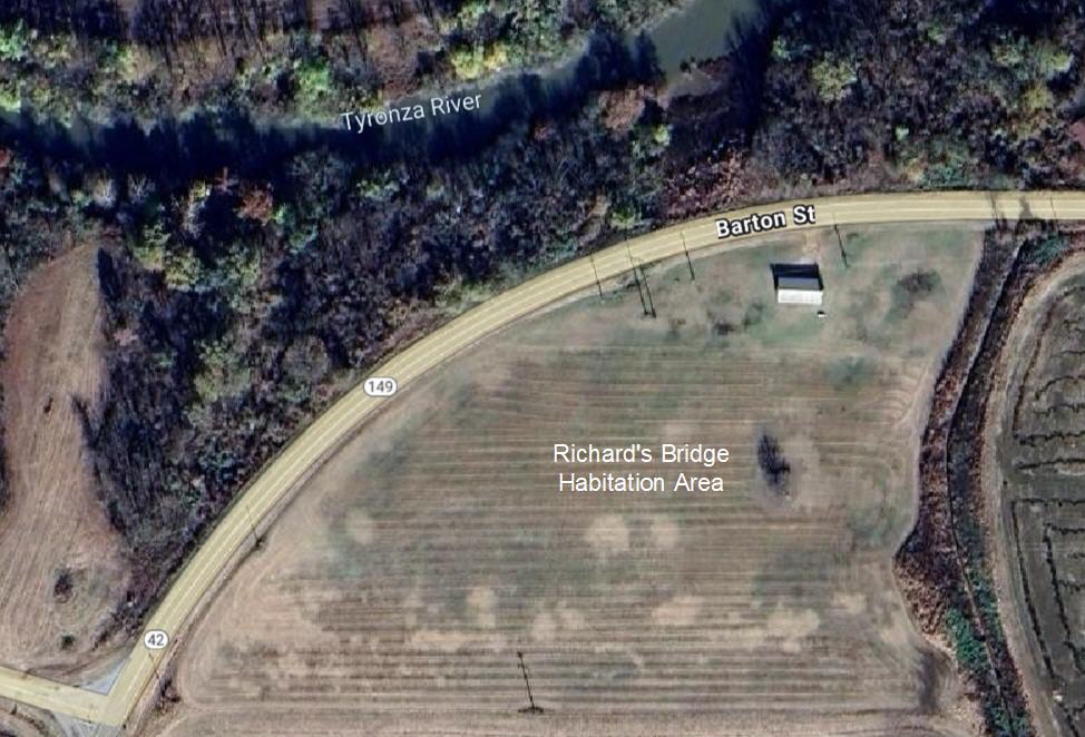
Richard's Bridge submitted by stonetracker on 19th Mar 2024. Aerial view of habitation site
(View photo, vote or add a comment)
Log Text: Saw from the road. The village is now in a cultivated field. The original mound was destroyed when the paved road was built.
River View Cemetery Mounds
Date Added: 31st Oct 2023
Site Type: Artificial Mound
Country: United States (Great Lakes Midwest)
Visited: Yes. My rating: Condition 3 Ambience 4 Access 5
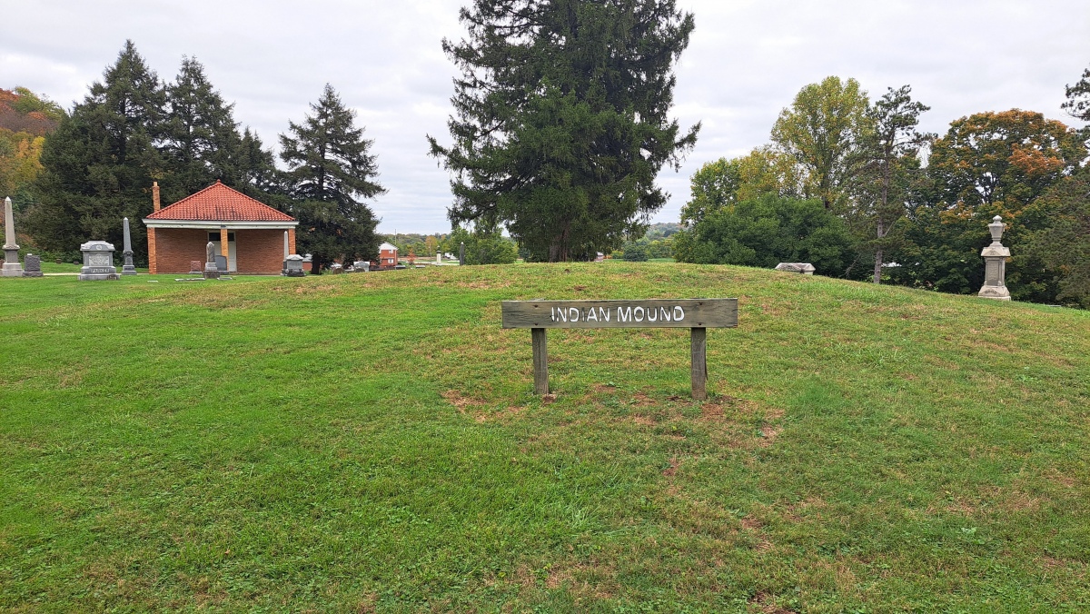
River View Cemetery Mounds submitted by stonetracker on 22nd Oct 2023. Main mound with signage.
(View photo, vote or add a comment)
Log Text: Visited late Oct 2023. Main mound easily accessible in a traffic circle about 200 yds past the cemetery entrance. I was unable to positively locate the other mound (Lochry Massacre Mound) although I did locate the monument commemorating that historical event.
Roadside Ruin
Date Added: 6th Jun 2025
Site Type: Ancient Village or Settlement
Country: United States (The Southwest)
Visited: Yes on 1st May 2025. My rating: Condition 4 Ambience 4 Access 4
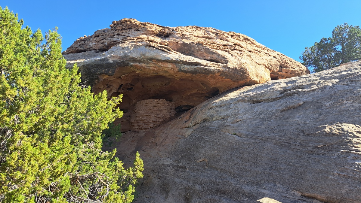
Roadside Ruin submitted by stonetracker on 6th Jun 2025. The granary, tucked in under the cliff overhang.
(View photo, vote or add a comment)
Log Text: This is a rather remote Pueblo 3 site but the road is paved all the way to the trailhead. To get there, drive south from Moab about 40 miles on Route 191 or north 14 miles from Monticello. Then turn west on Route 211 for another 35 miles to the Canyonlands National Park Needles District visitor center. The trailhead is less than a mile past the visitor center on the left. The trail is an easy flat loop to the granary. About 200-300 yds one way.
One plus of driving Route 211 to the site is access to the many petroglyph sites along Indian Creek plus Newspaper Rock. Not to mention beautiful scenery.
Rolling Fork Mounds
Date Added: 3rd Nov 2023
Site Type: Artificial Mound
Country: United States (The South)
Visited: Yes. My rating: Condition 2 Ambience 2
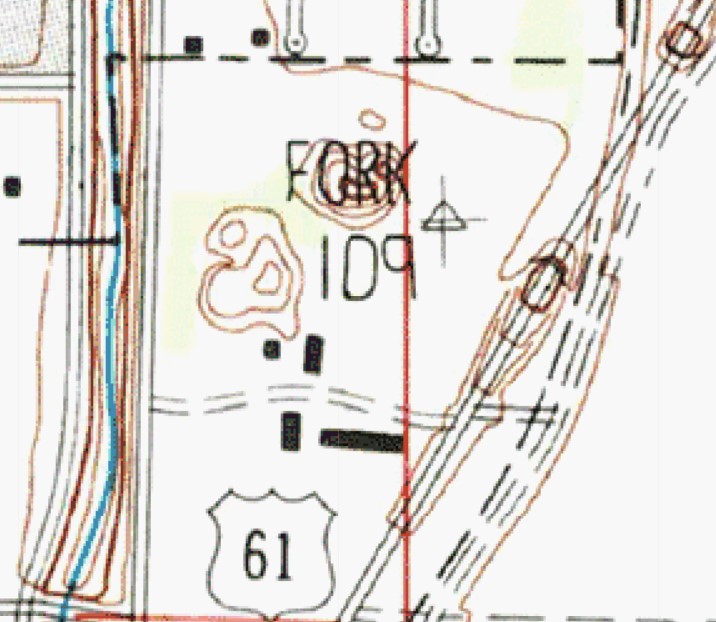
Rolling Fork Mounds submitted by stonetracker on 3rd Nov 2023. Topo contour map of the two extant mounds. Mound A, the taller one, is under the word "Fork" and Mound B is just to the lower left.
(View photo, vote or add a comment)
Log Text: In late Oct 2023, I attempted to find these mounds by walking west from a car pulloff on Rte 61 and also north from a field road next to two brick silos. I did not attempt to walk in east from Parkway Rd, which as Dr. Little's photos suggest, may provide easier access to Mound B. The entire area was extremely overgrown and nearly impassible, so I abandoned the search.
It may be easier in winter, once the vegetation dies back.
Rondossec Dolmens
Date Added: 9th Dec 2024
Site Type: Burial Chamber or Dolmen
Country: France (Bretagne:Morbihan (56))
Visited: Yes on 1st Sep 2024. My rating: Condition 3 Ambience 4 Access 4

Rondossec dolmens submitted by JJ on 9th Nov 2002. Rondossec dolmens
(View photo, vote or add a comment)
Log Text: This site is in a public park near the center of Plouharnel, shoehorned into a small residential neighborhood. These are three nearly contiguous passage graves. Two are in fair to good shape. The remaining one is partially buried, particularly at the chamber end.
Parking is on-street only (on either Rue Hoche or Rue Jean Pierre Calloch) and it can get a bit congested in the high tourist season. I had no problems in late Sept. There is a very short path from the street to the easternmost passage grave.
Runesto Dolmen
Date Added: 11th Dec 2024
Site Type: Burial Chamber or Dolmen
Country: France (Bretagne:Morbihan (56))
Visited: Yes on 1st Sep 2024. My rating: Condition 3 Ambience 4 Access 4

Runesto dolmen submitted by stollentroll on 14th Dec 2005. Dolmen Runesto
(View photo, vote or add a comment)
Log Text: This is a small passage grave mostly still within its mound, although all that's visible now is the chamber. Modern steps have been cut to provide access down into the chamber.
The site is located at the end of a cul de sac (Rue de Runesto), just past a residential subdivision near the edge of a field abutting the D768. For the mobility impaired, you can park quite close, within 100 ft of the chamber and with a clear view of it from the road without having to walk to it.
Saint-Michel tumulus
Date Added: 15th Oct 2024
Site Type: Chambered Cairn
Country: France (Bretagne:Morbihan (56))
Visited: Yes on 1st Sep 2024. My rating: Condition 4 Ambience 4 Access 4
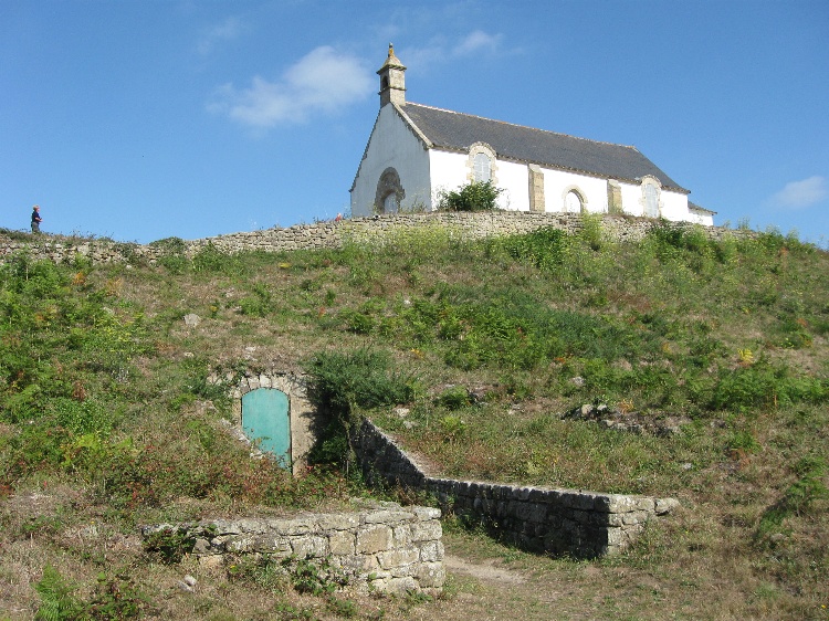
Saint-Michel tumulus submitted by DrewParsons on 7th Nov 2009. The locked south west entrance to the tumulus.
(View photo, vote or add a comment)
Log Text: This is one of a collection of very large manmade Carnacean mounds or tumuli and served as a tomb for elite individuals, accompanied by opulent and often non-local grave goods. It is on a high prominence overlooking the town of Carnac and surrounding areas. Popping the location coordinates into any online mapping tool should lead you directly to the site, which is at the end of a cul-de-sac adjacent to a hotel. There is a public parking area across from the hotel and next to the tumulus.
Sainte-Barbe alignement
Date Added: 10th Dec 2024
Site Type: Multiple Stone Rows / Avenue
Country: France (Bretagne:Morbihan (56))
Visited: Yes on 1st Sep 2024. My rating: Condition 2 Ambience 4 Access 4
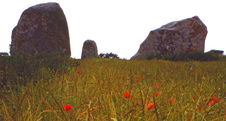
Sainte-Barbe alignement submitted by greywether on 30th Jun 2005.
(View photo, vote or add a comment)
Log Text: According to Burl, this was once an alignment of 8 rows of standing stones stretching over 400 m, with a possible cromlech nearby. Today, only two obvious 100-200 m rows remain, plus an "end cap" of 4 or 5 truly massive menhirs. A number of additional stones are either missing or buried underground or in hedgerows.
Very limited parking is available in a dirt pullout maybe 50 meters north of the site along Rue de Kerentrech. I parked there and walked back to a trail head leading south maybe another 50 meters to the large menhirs and alignments.
Salmon Ruins
Date Added: 10th May 2025
Site Type: Ancient Village or Settlement
Country: United States (The Southwest)
Visited: Yes on 1st Apr 2025. My rating: Condition 2 Ambience 4 Access 3
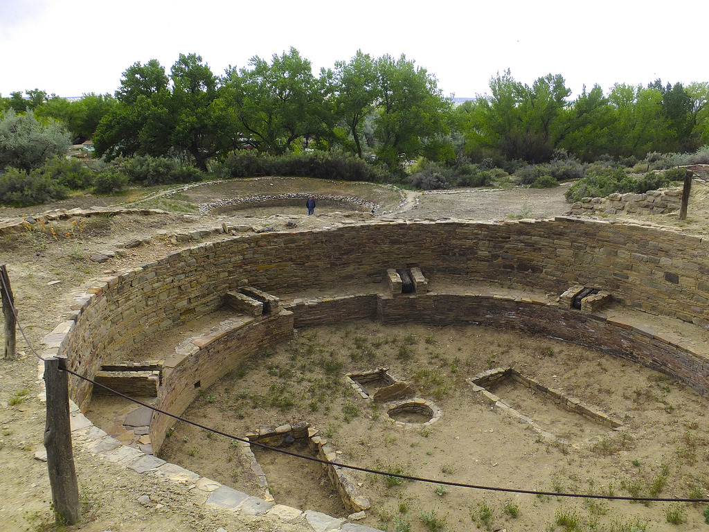
Salmon Ruins submitted by Flickr on 11th Jan 2019. Salmon Ruins, Bloomfield, New Mexico. View looking southward across the elevated kiva, with the detached Great Kiva behing the man standing at left center. Image copyright: Hiker Bob (Bob Cates), hosted on Flickr and displayed under the terms of their API.
(View photo, vote or add a comment)
Log Text: This an Ancestral Pueblo Chacoan outlier great house site located about 10 miles W of Aztec Ruins National Monument. It is similar in construction to the latter and was more than likely built by either immigrants from Chaco Canyon or by local cultures emulating Chaco-style great house complexes. It was built slightly earlier than Aztec Ruins.
The site consists of the ruins, a museum, and a heritage park with replicas of Native American dwellings such as hogans, wikiups, and pithouses. I only had time to visit the ruins in depth, although I checked the museum briefly.
The ruins are a steep walk about 200-300 yds down a paved walkway or driveway from the museum. I believe there is also some limited parking available at the heritage park at the bottom of the hill, which would allow closer access. A ruins guide is available to borrow from the museum, and as far as I know there are no print versions available for sale. It is very helpful and I would recommend referring to it during the visit. The entire site is owned and operated by San Juan County.
Salomon Mounds
Date Added: 11th Mar 2024
Site Type: Artificial Mound
Country: United States (The South)
Visited: Saw from a distance on 1st Feb 2024. My rating: Condition 3 Ambience 3
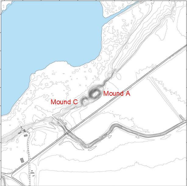
Salomon Mounds submitted by stonetracker on 11th Mar 2024. Contour map of site
(View photo, vote or add a comment)
Log Text: Site is mostly as described, in a private farm field. There is a parking pulloff and interpretive signage about 100-200 yds from Mound A, which is about as close as you can legally approach (No Trespassing signs make that clear!) . Mound C is just SW of Mound A. So close that past researchers have occasionally referred to it as a double-mound site.
Sand Island petroglyph Panel
Date Added: 18th May 2025
Site Type: Rock Art
Country: United States (The Southwest)
Visited: Yes on 1st May 2025. My rating: Condition 3 Ambience 4 Access 4
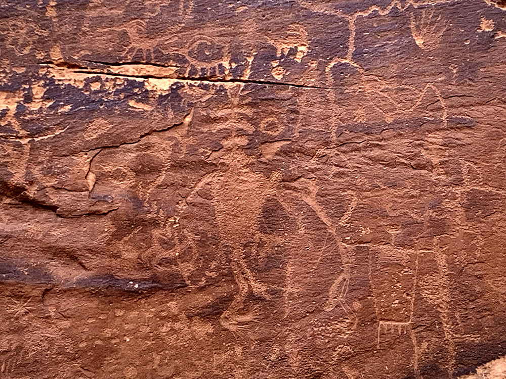
Sand Island petroglyph Panel submitted by KaiHofmann on 11th Sep 2022. Sand Island petroglyph Panel
(View photo, vote or add a comment)
Log Text: This is one of the better-known and most frequently visited rock art sites in southeastern Utah. The site is a very short walk (< 100 ft) up to the cliff face from a dirt parking pulloff with interpretive signage. The panels are in a relatively compact area, maybe 100 yds in total. And although they are protected by a fence and can only be viewed from a distance, you can still get fairly close for photography as long as the sun cooperates (it mostly did not for me). An overcast day or a low sun angle are preferred as full direct sunlight tends to wash out the images,
To get there, take Route 191 west out of Bluff UT for approximately 4 miles. Turn left onto a gravel road with signage that indicates the Sand Island Recreational Area and boat ramp. At the bottom of the hill, take your first right onto another gravel road. This road leads straight to a couple of parking pulloffs on the right in about 0.25 miles, plus some petroglyph signage. A short trail leads up to the cliff base and the panels. The panels are surrounded by a fence to discourage defacement and further damage.
Sayler Story Mound
Date Added: 21st Feb 2023
Site Type: Artificial Mound
Country: United States (Great Lakes Midwest)
Visited: Couldn't find on 1st Oct 2021
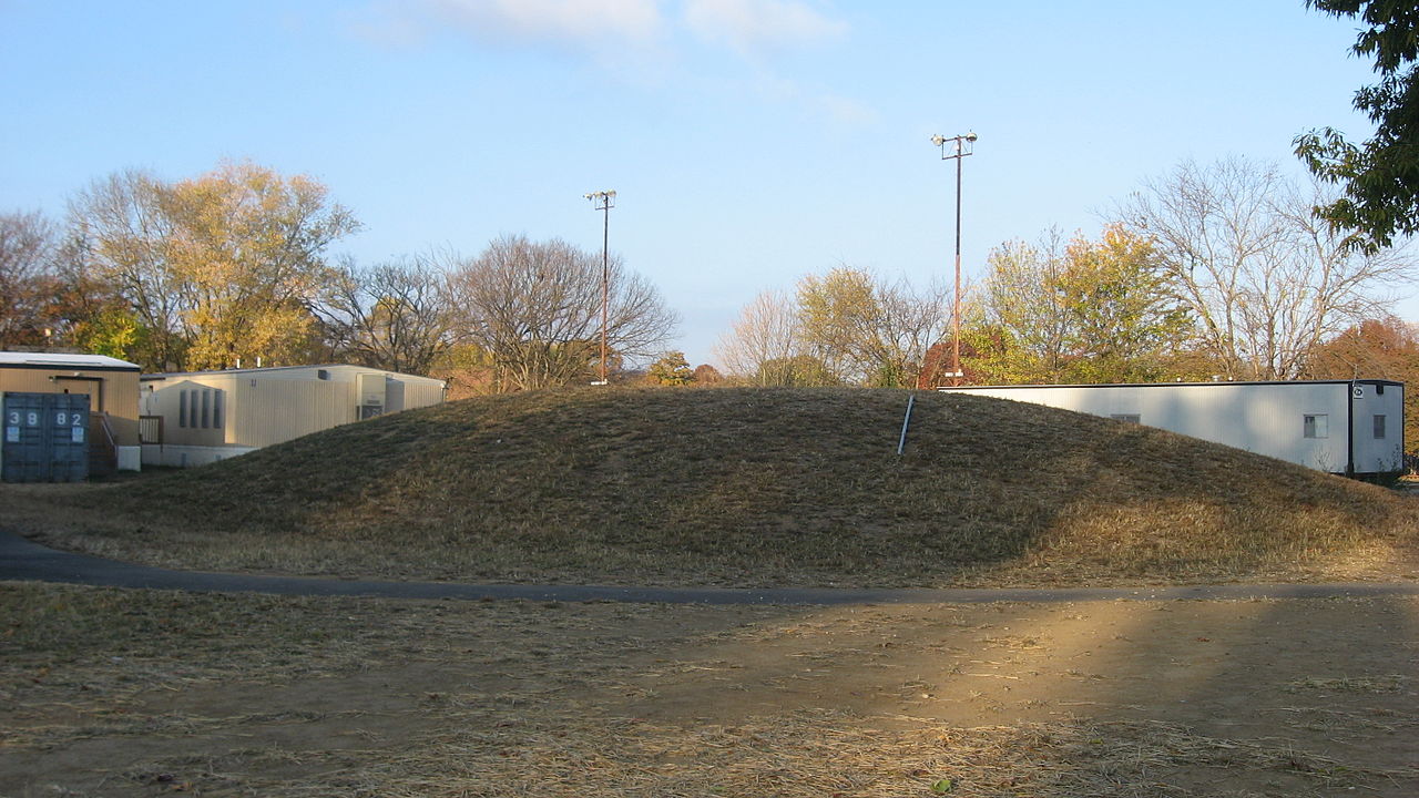
Sayler Story Mound submitted by stonetracker on 21st Feb 2023. The "mystery mound" as of 2010. As of 2021, I was able to find nothing resembling this at the location given. The above-ground level portion mound has either been destroyed or the location listed is incorrect. Photo: Wikipedia, Creative Commons
(View photo, vote or add a comment)
Log Text: Unclear whether the visible part of the mound was destroyed or the location taken from Wikipedia is wrong. But there was nothing visible.
Schicker Mound
Date Added: 9th Mar 2025
Site Type: Artificial Mound
Country: United States (The South)
Visited: Yes on 1st Feb 2025. My rating: Condition 3 Ambience 3 Access 5
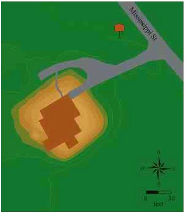
Schicker Mound submitted by stonetracker on 9th Mar 2025. Site layout, courtesy of the "Indian Mounds of Northeast Louisiana" web site.
(View photo, vote or add a comment)
Log Text: This site consists of a single platform mound. A house with cellar was built on it in 1926 and I believe what you see now is the original dwelling. It is currently occupied so the site is private and can only be viewed from 100 yds away. The location is in Tallulah, LA in a residential area on the west side of Mississippi St. I found it easier to park on Desoto St, a nearby side street, and walk across Mississippi St 100 ft to the site.
Sego Canyon Rock Art
Date Added: 5th Jun 2025
Site Type: Rock Art
Country: United States (The Southwest)
Visited: Yes on 1st May 2025. My rating: Condition 3 Ambience 5 Access 4
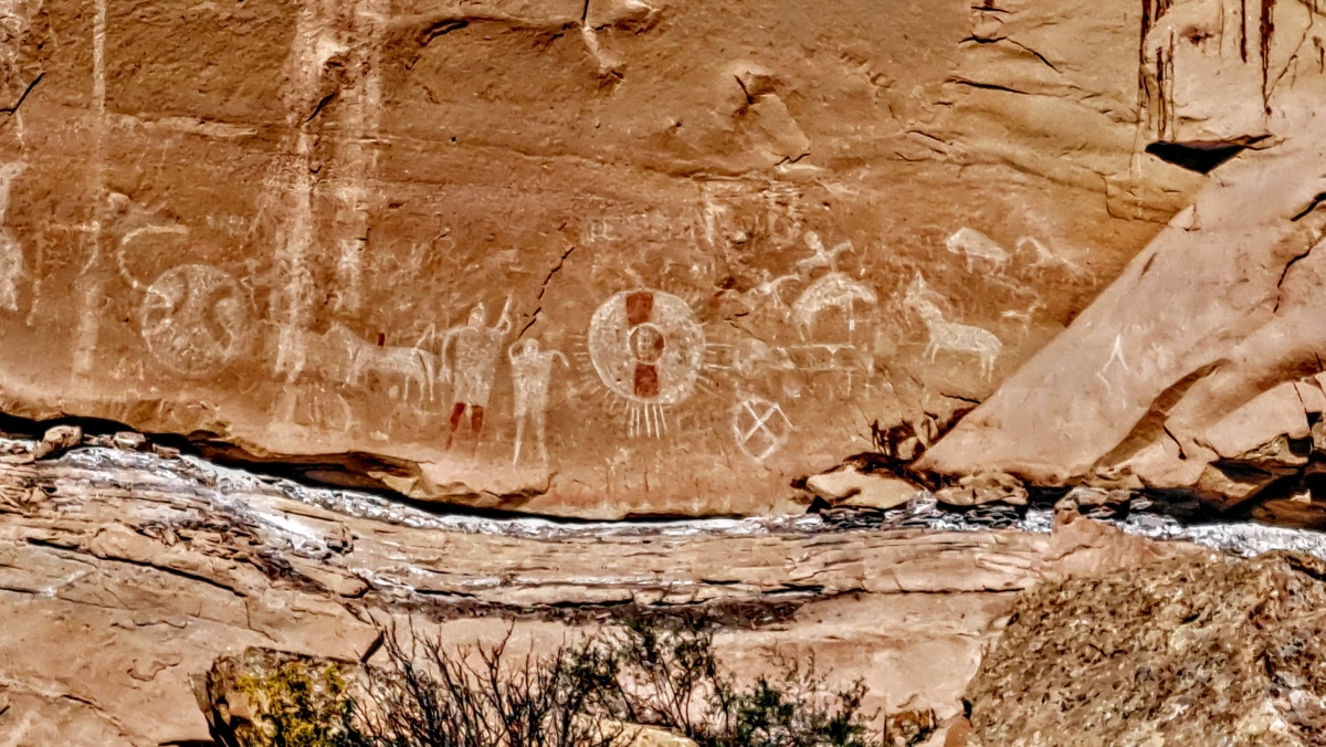
Sego Canyon Rock Art submitted by stonetracker on 29th May 2025. The Ute pictograph panel. Most if not all of these images are painted using white and red pigments.
Because of the presence of horses and riders in some cases, these images likely date from the 1700s.
The white and red disk probably represents a shield used in battle.
(View photo, vote or add a comment)
Log Text: A major prehistoric pictograph and petroglyph site with rock art ranging from Archaic to modern periods. The site is located in Thomspon Springs UT about 45 miles north of Moab UT. The route is 100% paved roads.
To get there, take Route 191 north from Moab for about 30-35 miles to Interstate Route I-70. Drive on I-70 east and take the first exit north to Thompson Springs. Continue on Thompson Canyon Rd for about 6 miles. There will be a parking lot on the left with signage and a restroom. There is a short trail from parking to the first set of panels.
Shay Canyon Rock Art
Date Added: 8th Jun 2025
Site Type: Rock Art
Country: United States (The Southwest)
Visited: Yes on 1st May 2025. My rating: Condition 3 Ambience 5 Access 2
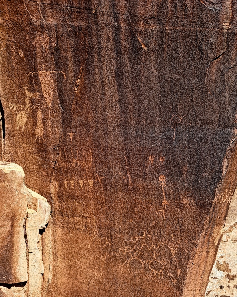
Shay Canyon Rock Art submitted by stonetracker on 6th Jun 2025. This is the first of many panels that extend into the canyon. Hard to date these, but the triangular bodies suggest Basketmaker to Ancestral Pueblo/Fremont. I'm guessing some of the more abstract images are older.
(View photo, vote or add a comment)
Log Text: This and Sego Canyon were probably my favorite rock art sites on this trip, offering the best combination of variety and close access to petroglyphs, once you hike to the site itself.
To get there, drive south for 40 miles from Moab or north 14 miles from Monticello on Route 191 and then head west on Route 211. Newspaper Rock is at the 12 mile mark where there are restrooms. From there, continue on Route 211 for another 1.9 miles to a small pulloff on the left. Park there.
The trail starts at the south end of the parking area and descends steeply to Indian Creek. The creek is quite small, but there is no bridge so you may have to walk upriver or down slightly to find a narrow enough point to get across via stepping stones.
Once across head down the dry wash area towards the canyon. In 200 ft there are trails off the the right that lead somewhat steeple to the cliff base where it comes to a point. The panels start there. Most of them are to the left and extend about 0.25 miles. There are one or two to the right.
The entire trail including the scramble along the cliff base is about 1 mile round trip. I say scramble because the path along the panels although mostly flat is quite rocky in places and requires good balance on the slight up and down sections.
