Contributory members are able to log private notes and comments about each site
Sites Stonetracker has logged. View this log as a table or view the most recent logs from everyone
Old Cahawba Archaeological Park
Date Added: 16th Feb 2023
Site Type: Misc. Earthwork
Country: United States (The South)
Visited: Would like to visit
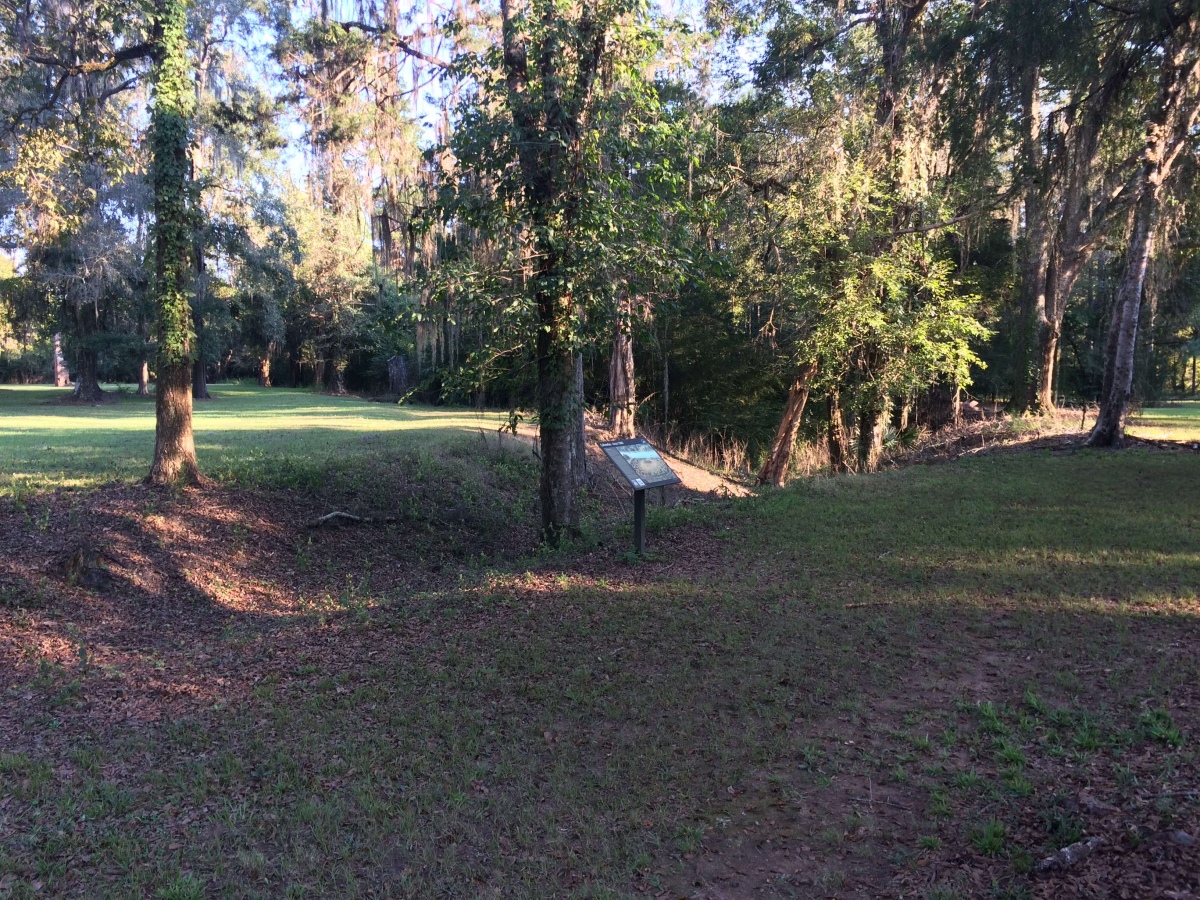
Old Cahawba Archaeological Park submitted by stonetracker on 16th Feb 2023. Portion of moat. Source: https://alabamamoundtrail.org/mound-site/old-cahawba/. Sponsor: University of Alabama.
(View photo, vote or add a comment)
Old King Barrows
Date Added: 19th Jan 2023
Site Type: Barrow Cemetery
Country: England (Wiltshire)
Visited: Would like to visit
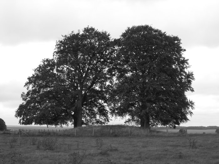
Old King Barrows submitted by TimPrevett on 10th Oct 2006. Old King Barrows are a more sparsely grouped cluster than the New, and as typical of most of them, either closed in by, or topped by Beech Trees.
(View photo, vote or add a comment)
Owl Creek
Date Added: 7th Dec 2024
Site Type: Artificial Mound
Country: United States (The South)
Visited: Yes on 1st Dec 2024. My rating: Condition 3 Ambience 4 Access 5
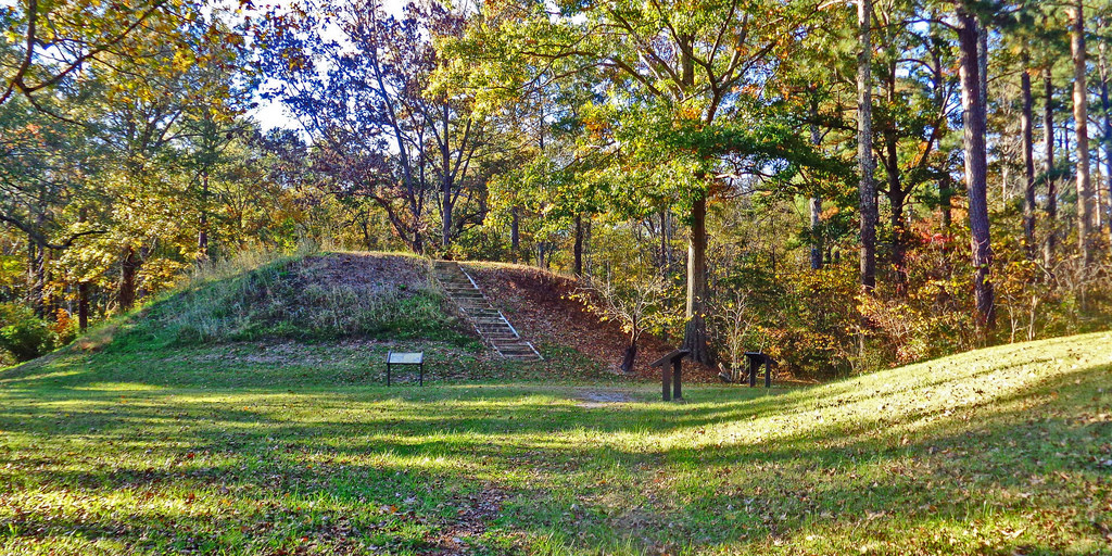
Owl Creek submitted by Creative Commons on 6th Jan 2019. Owl Creek Mounds The five Mississippian period platform mounds at this site were built between 1100 and 1200 A.D. The U.S. Forest Service owns two of the mounds including the largest 17-foot-high Mound I. Both are open to public visitation. Archeological excavations conducted at the site in 1991-1992 by Mississippi State University revealed the foundation remains of a ceremonial temple or elite residence that once stood atop Mound
www.nps.gov/nr/travel/mounds/owl.htm ...
(View photo, vote or add a comment)
Log Text: Site is as described. The portion managed by the Forest Service contains two extant mounds, including Mound 1 the largest in the group. Mound 1 is pretty close to its original rectangular platform shape. The adjacent Mound 2 looks like it has been damaged by plowing but still quite visible. I was unable to find any obvious evidence of the remaining 3 mounds across the street.
There is a parking lot right next to Mound 2 and Mound 1 is a very short distance away.
Parkin
Date Added: 15th Mar 2024
Site Type: Ancient Village or Settlement
Country: United States (The South)
Visited: Yes on 1st Feb 2024. My rating: Condition 4 Ambience 4 Access 5
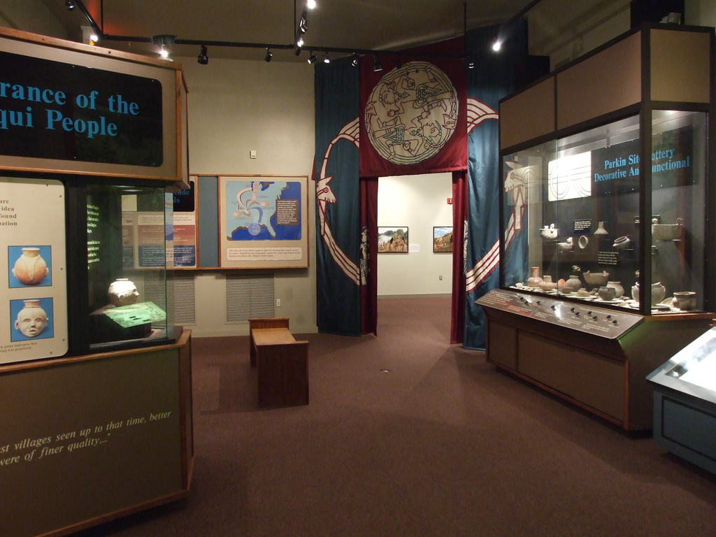
Parkin submitted by Flickr on 20th Sep 2015. Museum at the Parkin Archaelogical State Park in Parkin Arkansas. They are excavating the remains of a Native American village which is believed to have been visited by Hernando De Soto in 1541. Image copyright: mdsilverhawke, hosted on Flickr and displayed under the terms of their API.
(View photo, vote or add a comment)
Log Text: Well preserved Late Mississippian village and mound site with a nice museum. A paved trail provides good access to and interpretation of all cultural features at the site, including historic features. Appears to be fully accessible to disabled visitors.
Petit Mont
Date Added: 2nd Dec 2024
Site Type: Chambered Tomb
Country: France (Bretagne:Morbihan (56))
Visited: Yes on 1st Sep 2024. My rating: Condition 3 Ambience 4 Access 3
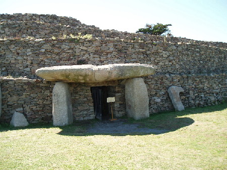
Petit Mont submitted by AlexHunger on 20th Dec 2004. Petit Mont in Arzon, dating to about 4600 BCE at the earliest, is one of the most significant Cairns in Britany, but unfortunately one of the most brutaly vandalized. In 1942, German troops built a bunker and Flak emplacement into the South East Corner of the cairn, which compeltely destroyed one of the chambers and caused the collapse of the second one pictured above, which has since been restored. The megalithic entrance is sought to be an addition from Gallo-Roman times. All pictures have be...
(View photo, vote or add a comment)
Log Text: An important Neolithic site with two extant passage graves in good condition and a large surrounding cairn. It has a complex construction and restoration history, and has suffered much use and abuse (particularly in WW2) over the millennia.
Entrance is via paid admission and guided tours are available in season but I was informed that they are only offered in French at the moment. However, unlike Gavrinis, I was allowed unescorted and unimpeded access to the bunker museum, the grounds, and the interior of both passage graves.
Parking and getting to the site was a little tricky, as construction was going on in the parking lot and there was no obvious signage pointing the way to the site from there. But there is a 300m trail in the back of the lot that leads to the ticket office and information kiosk. The parking area is located at the end of the Rue du Petit Mont.
Pharr Mounds
Date Added: 20th Dec 2024
Site Type: Artificial Mound
Country: United States (The South)
Visited: Yes on 1st Dec 2024. My rating: Condition 3 Ambience 5 Access 2

Pharr submitted by bat400 on 6th Sep 2012. Panorama of all the mounds visible from the ridge of the Natchez Trace, overlooking the site.
Photo by bat400, October 2011.
(View photo, vote or add a comment)
Log Text: This is a large Middle Woodland site of 8 conical or rounded mounds spread out over a 80-90 acre field. It is located at milepost 286 of the Natchez Trace in MS, on the north bound side of the highway. The mounds today range in height from 2 to 18 ft. Generally speaking, the tallest mounds are closest to the road. Four mounds were either partially or fully excavated in the 1960s by the NPS.
There is a large car park overlooking the site, complete with interpretation and rest rooms. Although 4-5 mounds can be seen from the lot, they are a considerable distance away so binoculars are helpful. Trails interconnect many of the mounds, but there is a fair amount of walking involved. A circuit of Mounds A-D, the four closest, was just under a mile including the return trip to the parking area. I did not visit the others.
Picnic Point Effigy Mounds
Date Added: 6th Aug 2024
Site Type: Artificial Mound
Country: United States (Great Lakes Midwest)
Visited: Yes on 1st Jul 2024. My rating: Ambience 3 Access 3
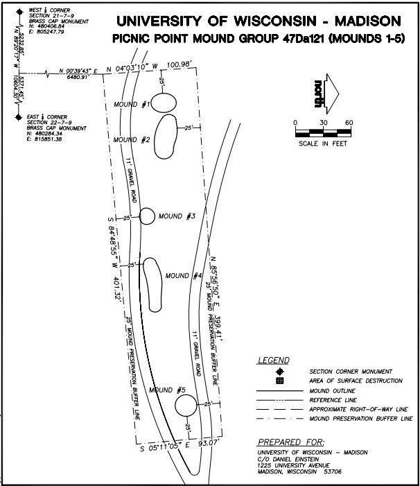
Picnic Point Effigy Mounds submitted by stonetracker on 6th Aug 2024. Map showing layout of the five-mound main group
(View photo, vote or add a comment)
Log Text: The mounds are on a peninsula in Lake Mendota on conservation land owned by the Univ of Wisc. They are accessible via the Lakeshore Trail. Parking is available at the trailhead for a fee. The first group of 5 mounds is about a 1/4 mile level walk from the lot, next to and just north of the trail. The last conical mound is another 600 ft east along the trail and just to its south.
Unfortunately site maintenance seems to be cyclical at best. I was unable to find or positively identify any of the mounds due to summer overgrowth, suggesting that non growing seasons may present better viewing opportunities. There was also no obvious interpretation signage. However, Andrew Khitsun (the owner of the Wisconsin Mounds site) has posted a few photos with most of the overgrowth and some trees removed from the mounds. They are undated but I assume they are at least post-2000.
Obviously they have been better maintained in the past than currently.
Pierres Plates (Locmariaquer)
Date Added: 20th Nov 2024
Site Type: Burial Chamber or Dolmen
Country: France (Bretagne:Morbihan (56))
Visited: Yes on 1st Sep 2024. My rating: Condition 3 Ambience 4 Access 4
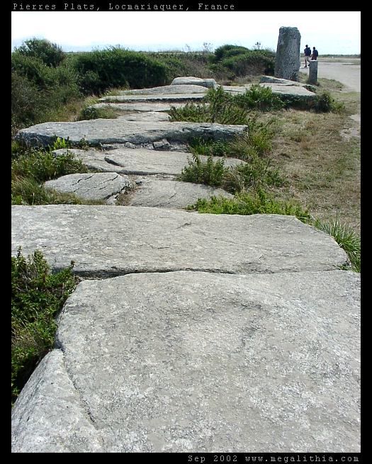
Pierres Plates (Locmariaquer) submitted by ermine on 27th Jun 2004. Les Pierres Plates
(View photo, vote or add a comment)
Log Text: This is an allee coudee (angled passage grave) with a number of unique decorated stones. It sits on a bluff overlooking the sea, which becomes an extensive shellfish flat when the tide goes out.
Sadly, nothing much has changed regarding interior access. A low rope and sign discourage interior access to the passage and chamber, although they don't outright forbid it. Moreover, this is a very popular beach and there are always people milling around even during the off season. Had there been less "people presence", I might have been tempted to sneak inside, but I behaved myself.
Parking is at a beach lot maybe 200-300 yds away. A trail leads from there to the bluff edge, and it is a short walk to the right to the site.
Pikes Peak State Park Effigy Mounds
Date Added: 1st Aug 2024
Site Type: Artificial Mound
Country: United States (Great Lakes Midwest)
Visited: Yes on 1st Jul 2024. My rating: Condition 3 Ambience 4 Access 3
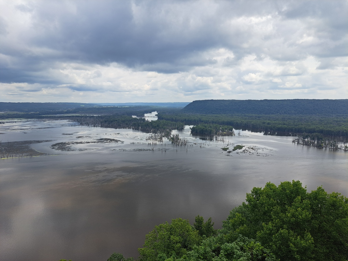
Pikes Peak State Park Effigy Mounds submitted by stonetracker on 31st Jul 2024. Closeup of the river confluence. The flat ridge to the right is the location of the Sentinel Ridge effigy mounds in Wyalusing State Park in Wisconsin.
(View photo, vote or add a comment)
Log Text: There are 5-6 clusters of effigy mounds scattered on ridges throughout the park.
Two of them are relatively short hikes from the main south entrance parking lot: Hickory Ridge (via Hickory Ridge Trail) and Deer Ridge (behind the campground or via the southern part of the Bridal Veil Trail). Additionally a bear mound and small conical are visible about 200 yds north of the park concession booth via a paved walkway. These are the only ones I was able to visit on this trip as the others are a longer hike.
Most of the mounds in the park are linear or conical. Unfortunately there is no official printed map showing mound locations. However, you can get a copy of a hand-marked map from the visitor center at Effigy Mounds NM.
Piketon Mounds
Date Added: 25th Jan 2023
Site Type: Artificial Mound
Country: United States (Great Lakes Midwest)
Visited: Yes on 1st Apr 2021. My rating: Condition 4 Ambience 4 Access 5
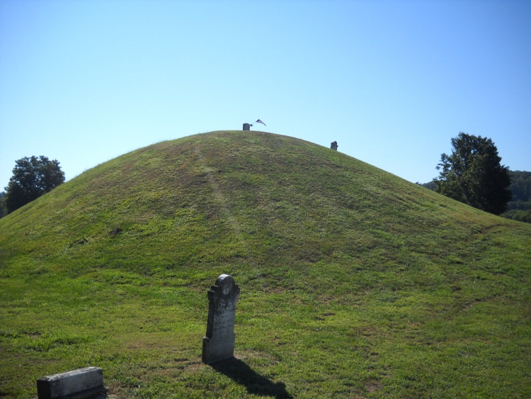
Piketon Mounds submitted by aluta on 29th Aug 2010. A view of the large mound, surmounted by a modern standing stone, otherwise known as a grave marker. No doubt it was thought to be an honour among later European-descended arrivals to be buried on the highest of the Indian mounds.
(View photo, vote or add a comment)
Log Text: Was able to locate what I believe are the 4 main mounds in the cemetery proper. The graded way is long gone as far as I can tell. See photos.
Pinson Mounds - Eastern Citadel
Date Added: 23rd Dec 2024
Site Type: Misc. Earthwork
Country: United States (The South)
Visited: Yes on 1st Dec 2024. My rating: Condition 3 Ambience 5 Access 2
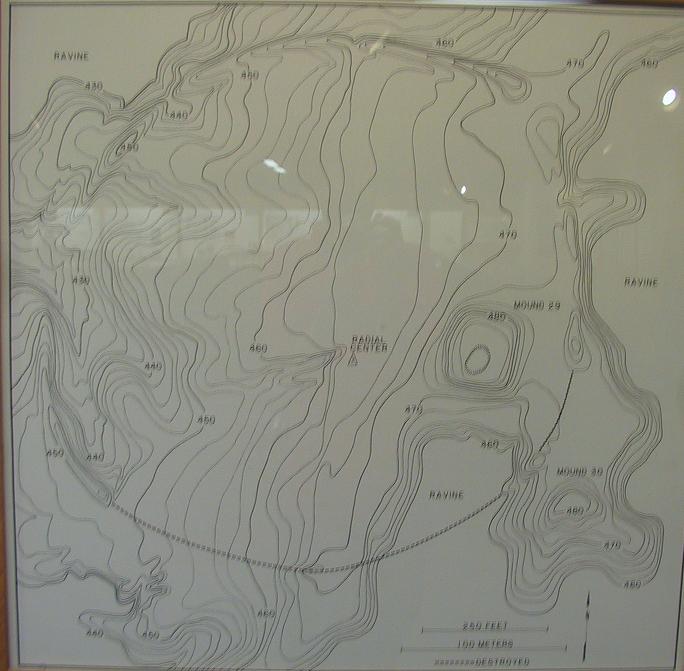
Pinson Mounds - Eastern Citadel submitted by symbionspacesuit on 3rd Mar 2010. William Myer's map of the Eastern Citadel.
(View photo, vote or add a comment)
Log Text: For parking and trailhead access, see Pinson Mounds - Mound 28.
This is a large (semi) circular earthen enclosure in the Eastern Section of Pinson. It surrounds Mound 29, and Mound 30 lies just outside of and SE of the enclosure. The diameter of the semi-circular enclosure is 366 m and it encompasses approximately 6 square km. The northern and western sides are largely intact, whereas the eastern and southern parts are eroded and fragmented.
To get to the northern section of the enclosure from Mound 28, follow the Outer Loop trail south for about 0.15 mile to a side trail on the left. The side trail leads to an obvious embankment and gap in about 500 ft.
Pinson Mounds - Mound 28
Date Added: 22nd Dec 2024
Site Type: Artificial Mound
Country: United States (The South)
Visited: Yes on 1st Dec 2024. My rating: Condition 4 Ambience 4 Access 4
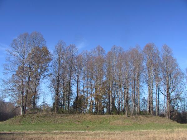
Pinson Mounds - Mound 28 submitted by symbionspacesuit on 14th Feb 2010. Mound 28
(View photo, vote or add a comment)
Log Text: Part of the Eastern Section of Pinson Mounds State Archaeological Park in Pinson TN. The state park hosts what is likely the largest Middle Woodland mound site in the US. An extensive trail system in the Eastern Section links Mounds 28, 29, 30 and the Eastern Citadel.
The easiest access point for this trail system is in the Group Lodge Area, which hosts a large parking lot with a trailhead and restroom facilities. The Group Lodge Area is on the left about 0.4 miles beyond the state park entrance gate. The Outer Loop trail heads east from there to Mound 28 and the other Eastern Section features.
Pinson Mounds - Mound 29
Date Added: 26th Dec 2024
Site Type: Artificial Mound
Country: United States (The South)
Visited: Yes on 1st Dec 2024. My rating: Condition 4 Ambience 4 Access 2
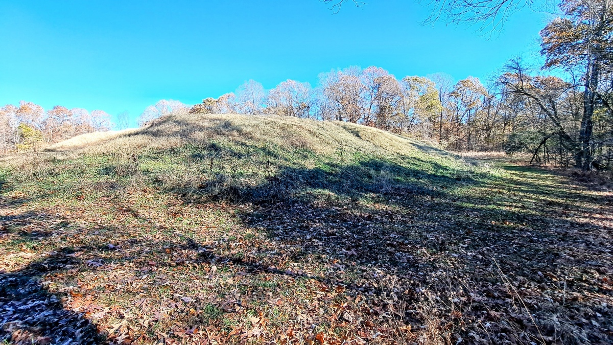
Pinson Mounds - Mound 29 submitted by stonetracker on 25th Dec 2024. Mound 29 from the SE side. The eastern edge of the circular enclosure is on the right side of the photo behind the tree line.
(View photo, vote or add a comment)
Log Text: A Middle Woodland rectangular platform mound in decent shape.
To get there, be prepared for a long-ish but mostly flat walk (from the Group Lodge parking area, it is about 1.5 miles round trip). First, see the visitor logs for trail access to Mound 28 and from there to the north wall of the Eastern Citadel. Once at the northern side of the enclosure, follow the wall about 300 ft east to an obvious gap with trail signage. Follow that trail south for 100-200 yds. Mound 29 will be directly ahead and obvious.
Pinson Mounds - Mound 30
Date Added: 24th Dec 2024
Site Type: Artificial Mound
Country: United States (The South)
Visited: Yes on 1st Dec 2024. My rating: Condition 3 Ambience 4 Access 2
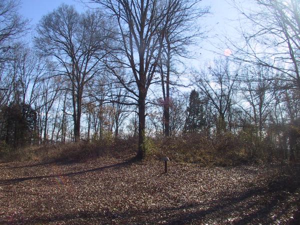
Pinson Mounds - Mound 30 submitted by symbionspacesuit on 3rd Mar 2010. Mound 30 from the north.
(View photo, vote or add a comment)
Log Text: This is classified as Middle Woodland rectangular platform mound lying just to the SE and outside of the Eastern Circular Enclosure. However, you would never know, as it has suffered much erosion over the centuries.
To get there, be prepared for a long-ish but mostly flat walk (from the Group Lodge parking area, it is about 1.6 miles round trip). First, see the visitor logs for trail access to Mound 28 and from there to the north wall of the Eastern Citadel. Once at the northern side of the enclosure, follow the wall about 300 ft east to an obvious gap with trail signage. Follow that trail into the enclosure south past Mound 29. Here the enclosure embankment is nearly flat and Mound 30 is visible about 300-400 ft SE of Mound 29.
Pinson Mounds - Other Sites
Date Added: 19th Apr 2024
Site Type: Artificial Mound
Country: United States (The South)
Visited: Yes on 1st Apr 2024. My rating: Condition 3 Ambience 4 Access 3
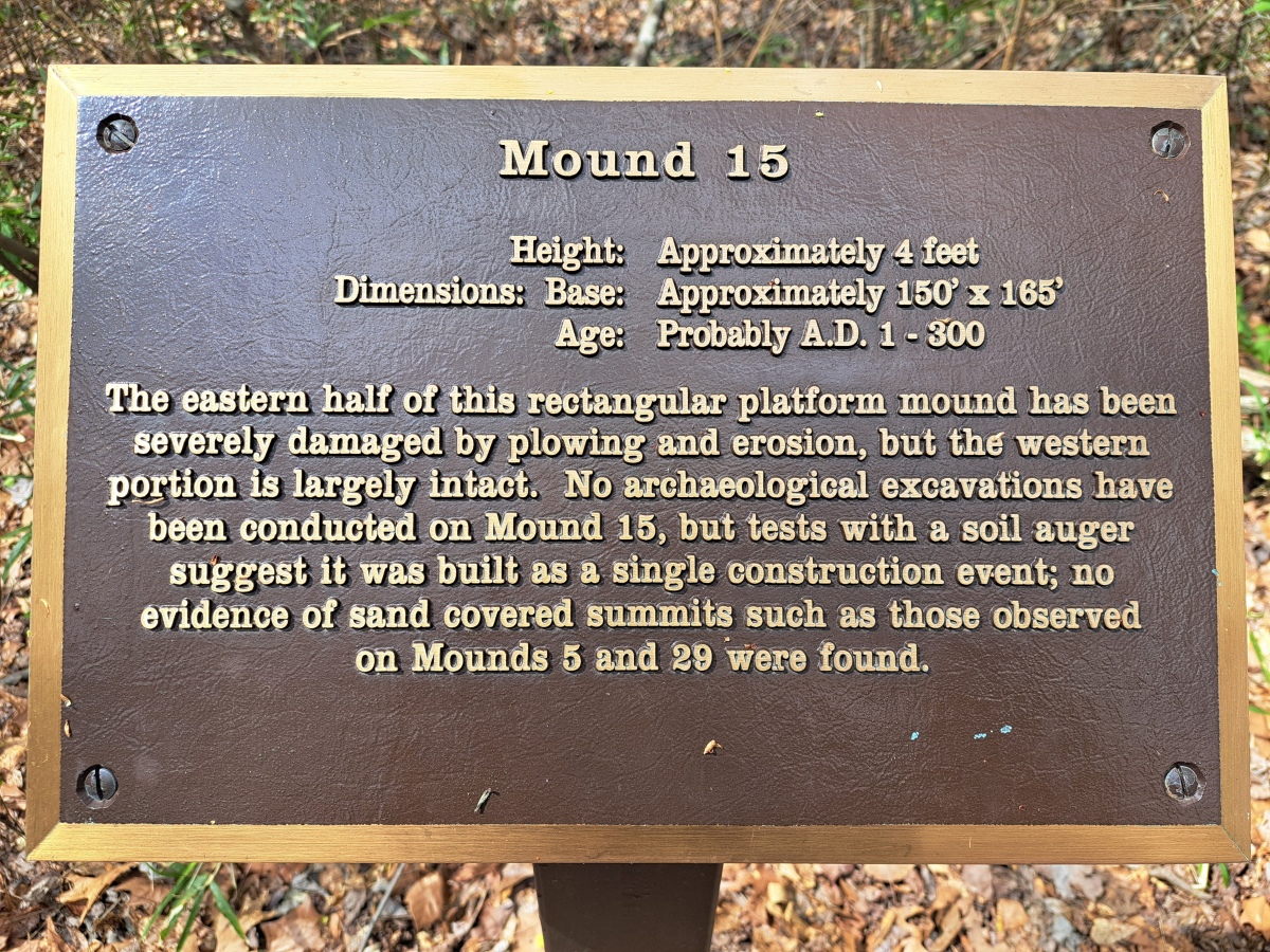
Pinson Mounds - Other Sites submitted by stonetracker on 24th Apr 2024. Mound 15 interpretation
(View photo, vote or add a comment)
Log Text: See Pinson Mounds main page for my visitor log comments.
Pinson Mounds - Ozier Mound
Date Added: 26th Dec 2024
Site Type: Artificial Mound
Country: United States (The South)
Visited: Yes on 1st Dec 2024. My rating: Condition 3 Ambience 4 Access 4
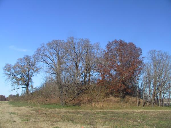
Pinson Mounds - Ozier Mound submitted by symbionspacesuit on 14th Feb 2010. Ozier (Mound 5)
(View photo, vote or add a comment)
Log Text: Ozier Mound (Mound 5) is one of several sites in the Western Section of the park. It is a rectangular platform mound, second in height only to Sauls' Mound.
Getting there is a bit obscure due to lack of signage. The easiest way is from Route 197 outside the park. Follow Route 197 east and look for the Pinson Reforestation Complex sign, which is about a mile west of the park entrance. Take a right and head south about a half mile to a dirt parking lot. There is a kiosk here with a trailhead that leads west in 100-200 yards to a very large, obvious Mound.
If you are within the park, follow the one way loop road nearly to the park exit. About 100 yds before the exit, take the dirt road on the left (unsigned and easy to miss) and follow it back about a mile south and west past a maintenance area to the dirt parking lot and trail head referenced above.
Pinson Mounds - Sauls Mound
Date Added: 12th Apr 2024
Site Type: Artificial Mound
Country: United States (The South)
Visited: Yes on 1st Apr 2024. My rating: Condition 4 Ambience 5 Access 3

Pinson Mounds - Sauls Mound submitted by symbionspacesuit on 14th Feb 2010. Sauls Mound (Mound 9)
(View photo, vote or add a comment)
Log Text: See main Pinson Mounds article for visit information
Pinson Mounds - Twin Mounds
Date Added: 29th Dec 2024
Site Type: Artificial Mound
Country: United States (The South)
Visited: Yes on 1st Dec 2024. My rating: Condition 3 Ambience 4 Access 3
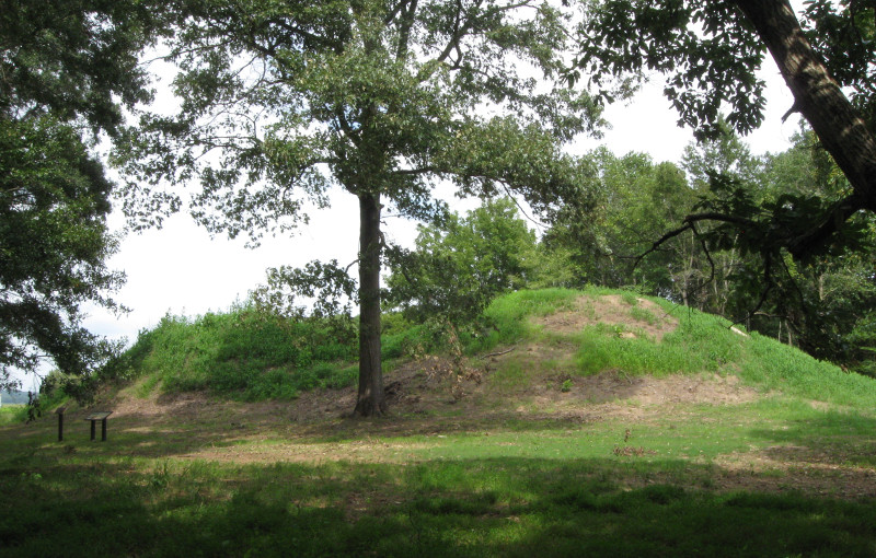
Pinson Mounds - Twin Mounds submitted by davidmorgan on 30th Aug 2017. The Pinson Twin Mounds.
(View photo, vote or add a comment)
Log Text: From archaeological standpoint, an important twin burial mound site at Pinson in the Western Section.
To get there, park at the lot for Ozier Mound (see that visitor log for directions). Walk west a short distance to the south side of Ozier where there is a trail junction. Take that trail approximately 300 yards south through a field to Twin Mounds, which lie at the edge of the woods.
Pinson Mounds State Archaeological Park
Date Added: 12th Apr 2024
Site Type: Artificial Mound
Country: United States (The South)
Visited: Yes on 1st Apr 2024. My rating: Condition 3 Ambience 5 Access 3

Pinson Mounds - Sauls Mound submitted by symbionspacesuit on 14th Feb 2010. Sauls Mound (Mound 9)
(View photo, vote or add a comment)
Log Text: Visited the Central or Inner section only. There's a lot to see here in this section alone if you include all of the mounds, habitation areas, other non-mound sites. It took me 3 hrs just to cover all of the Central area not including the museum. Most features with some exceptions are accessible via paved walkways so disabled access is good. Quite a bit of walking involved to see it all, and limited parking sites. The museum lot is the best base to start from for the Central area.
I will cover the western and eastern areas in a subsequent visit.
Pocahontas Mound A
Date Added: 14th Mar 2025
Site Type: Artificial Mound
Country: United States (The South)
Visited: Yes on 1st Feb 2025. My rating: Condition 4 Ambience 5 Access 4

Pocahontas Mound A submitted by Flickr on 1st Nov 2019. Pocahontas Mound Image copyright: dmott9 (DM), hosted on Flickr and displayed under the terms of their API.
(View photo, vote or add a comment)
Log Text: I had visited this site a few years ago as Mound A is in a convenient state roadside park area with bathroom facilities. It's also on the way to more northerly MS mound sites like Jaketown and Winterville.
Anyway I just stopped by to check out the latest improvements. The site's outdoor interpretive signage provided by Mississippi State Univ has always been great, but now they've added some replicas of ceramics found during excavations to an exhibit inside the visitor center. This plus more interpretation inside and improved signage outside. With many mound sites neglected and even derelict, it's good to see some serious effort put forth towards visitor education in an easily accessible and well-preserved site.
Note: There was a Mound B north of this site in a private neighborhood that I looked for some yrs ago with no access. I'll see if I can find more info.
