Contributory members are able to log private notes and comments about each site
Sites Stonetracker has logged. View this log as a table or view the most recent logs from everyone
Foxborough Prayer Seat (10)
Date Added: 24th Jan 2023
Site Type: Cairn
Country: United States
Visited: Yes on 1st Feb 2017. My rating: Condition 3 Ambience 4 Access 2
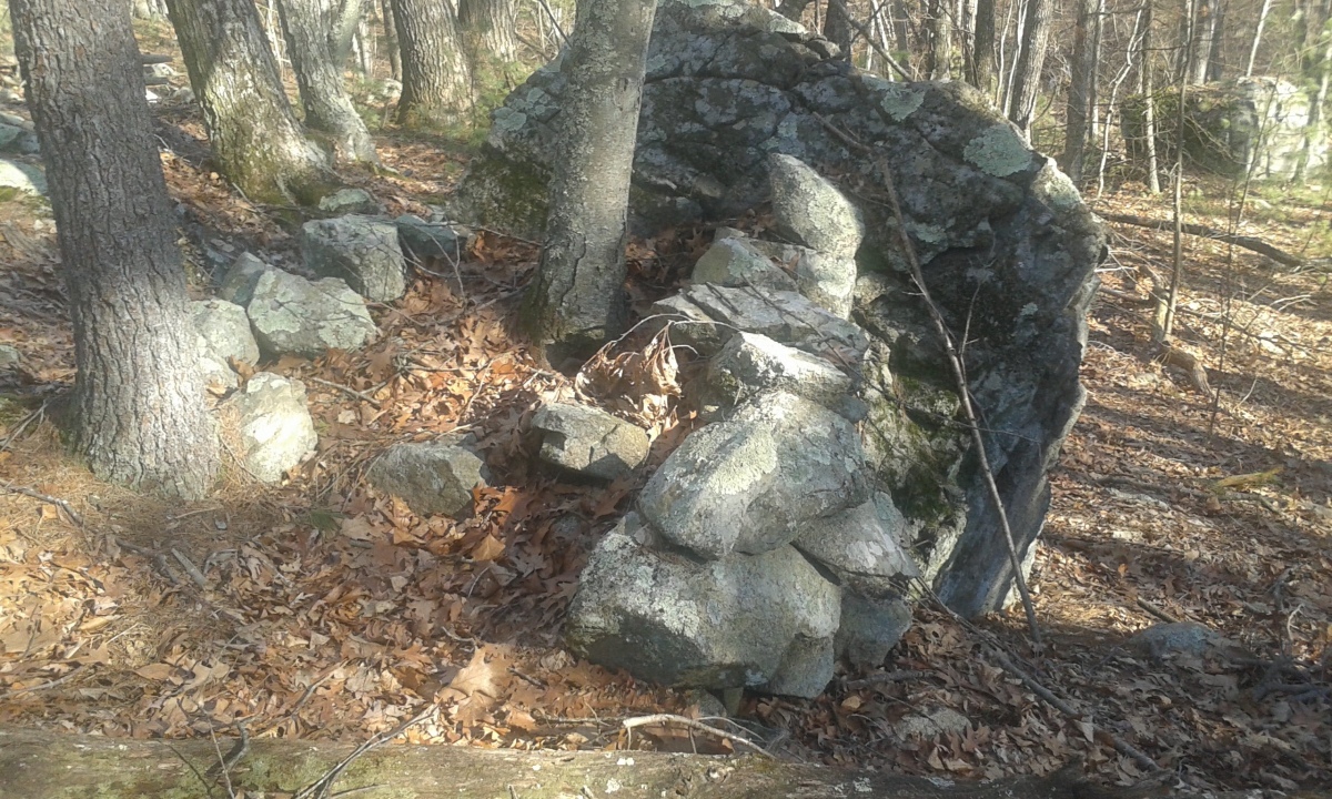
Foxborough Prayer Seat (10) submitted by stonetracker on 24th Jan 2023. This is a rather damaged U-shaped enclosure that utilizes an outcrop for its back wall. It is unclear whether the stones were placed by man or nature, but they do have what looks like a deliberate arrangement.
(View photo, vote or add a comment)
Log Text: Site Y on published map. Trail access and parking is the same as Foxborough Prayer Seat 3. The site is 400-500 ft SE of the latter, on an outcrop in relatively open woods. A bit difficult to spot.
Foxborough Prayer Seat (1)
Date Added: 15th Jan 2023
Site Type: Cairn
Country: United States (New England)
Visited: Yes on 1st Mar 2018. My rating: Condition 3 Ambience 3 Access 2
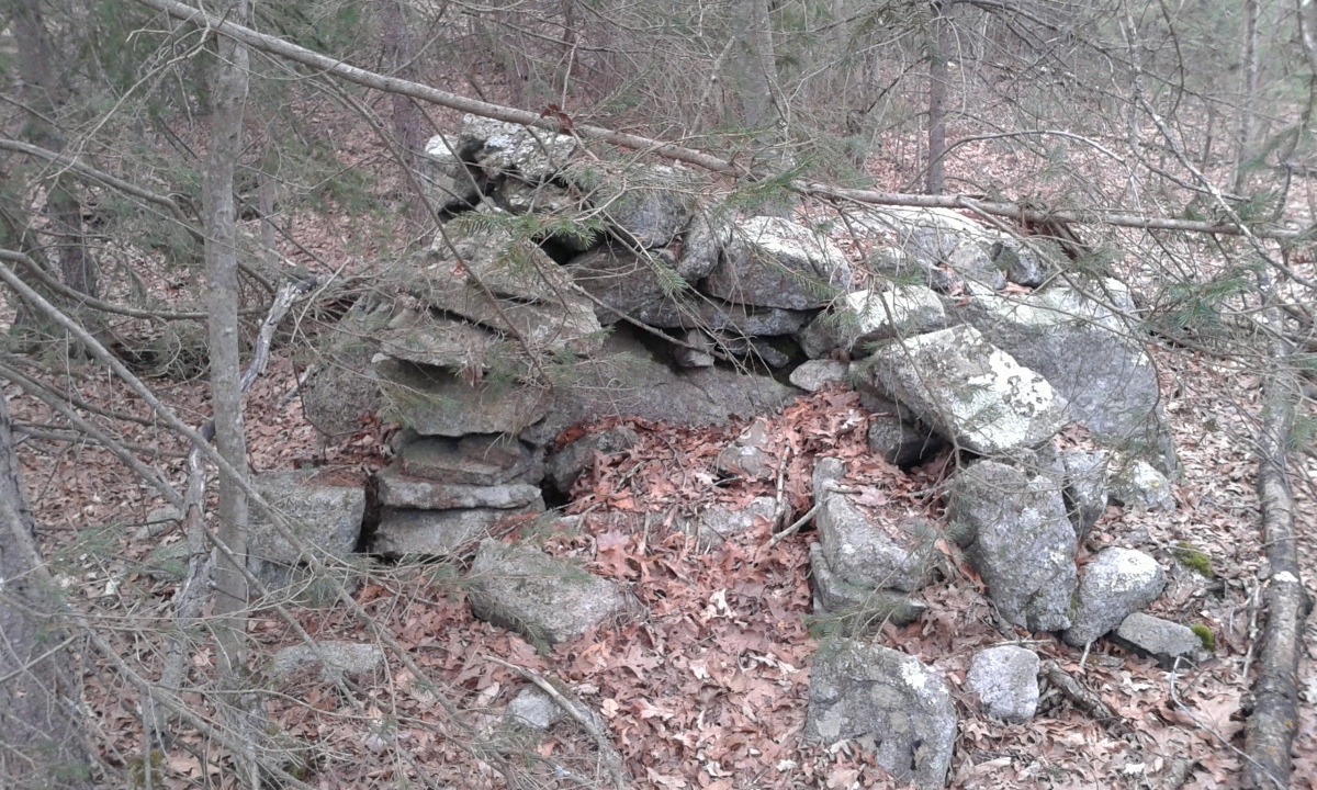
Foxborough Prayer Seat (1) submitted by stonetracker on 15th Jan 2023. A little more degraded than similar structures in the area. This is Site lowercase a on the archive.org map.
(View photo, vote or add a comment)
Log Text: Horseshoe or U-shaped structure. Possibly a "prayer seat." Not far off a side trail, but a long walk via main trails from any of the parking areas.
Foxborough Perched Boulder (6)
Date Added: 26th Jan 2023
Site Type: Natural Stone / Erratic / Other Natural Feature
Country: United States
Visited: Yes on 1st Jan 2023. My rating: Condition 5 Ambience 4 Access 3
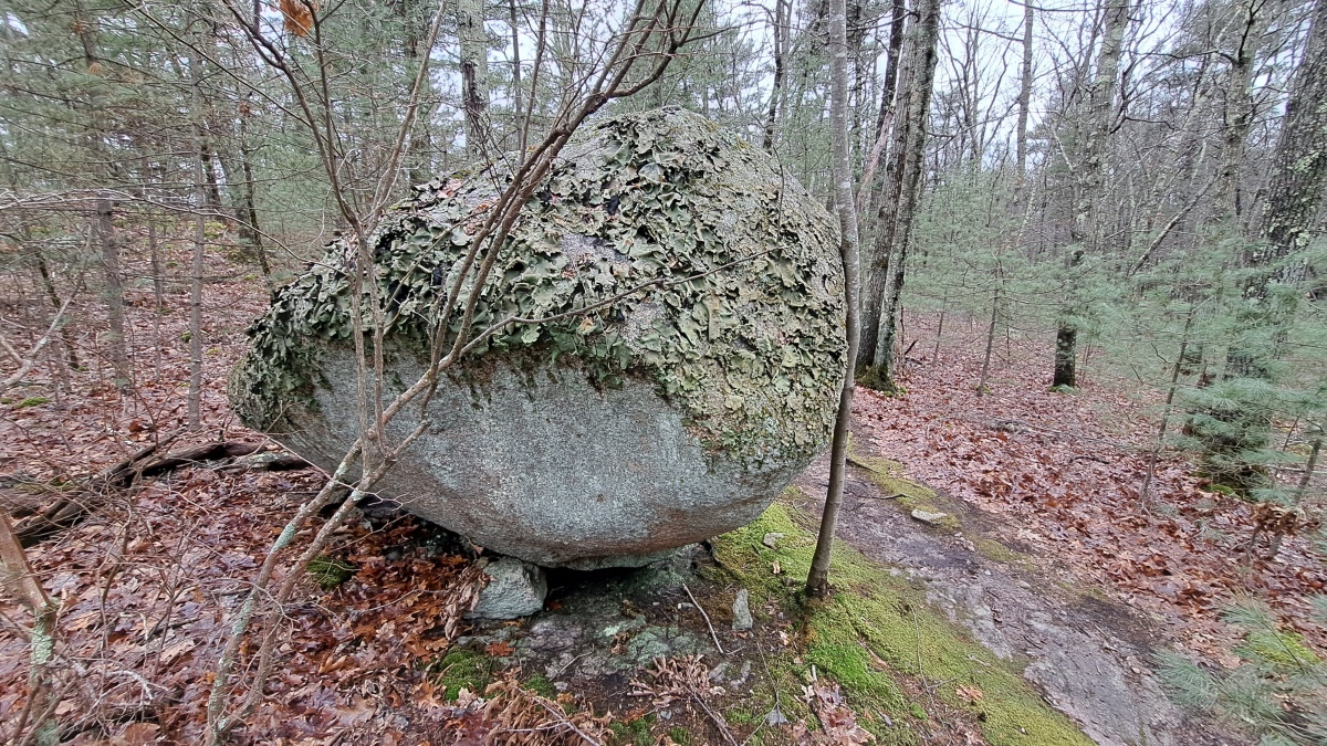
Foxborough Perched Boulder (6) submitted by stonetracker on 26th Jan 2023. Large boulder sitting on one prop stone. Could be an accident of nature except that the prop appears to have been inserted long after the boulder settled there.
(View photo, vote or add a comment)
Log Text: Site S on published map. Best accessed from the Thurston St parking lot. About 1/4 mile down a side trail that runs east from Megley Trail. Site is right next to the trail on the right.
Foxborough Perched Boulder (5)
Date Added: 23rd Jan 2023
Site Type: Natural Stone / Erratic / Other Natural Feature
Country: United States (New England)
Visited: Yes on 1st Mar 2018. My rating: Condition 5 Ambience 4 Access 3
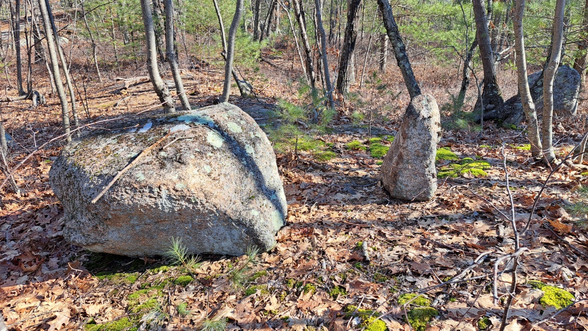
Foxborough Perched Boulder (5) submitted by stonetracker on 31st Jan 2023. An odd combination of perched boulder and standing stone no more than 10 ft from the propped boulder. The standing stone in particular looks put there by human hands, but who's to say.
(View photo, vote or add a comment)
Log Text: If this is the same structure as that on the published map, this was a short bushwhack north off the Megley Trail for me and not a 1/4 mile as described. Needs to be verified. Easiest to walk in via Megley from Thurston St lot.
Foxborough Perched Boulder (5)
Date Added: 31st Jan 2023
Site Type: Natural Stone / Erratic / Other Natural Feature
Country: United States (New England)
Visited: Yes on 1st Jan 2023
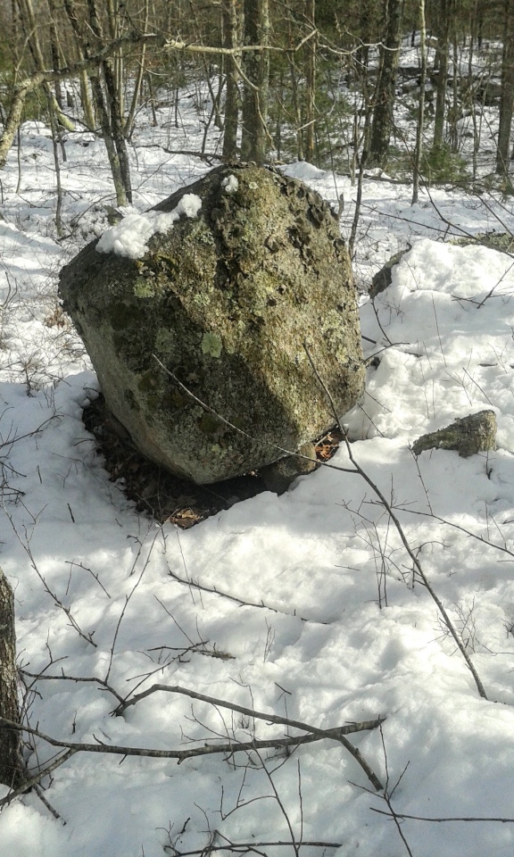
Foxborough Perched Boulder (5) submitted by stonetracker on 23rd Jan 2023. Round 3' x 4' boulder with a single prop stone. Appears to be deliberately placed and not natural.
(View photo, vote or add a comment)
Log Text: Another visit. No changes, but added a photo or two. I confirmed that this is a short 100 ft bushwhack north from the Megley Trail, which you can see from the site during winter.
An interesting ancillary site very close to the propped boulder, not on published map. See photo.
Foxborough Perched Boulder (4)
Date Added: 27th Jan 2023
Site Type: Natural Stone / Erratic / Other Natural Feature
Country: United States (New England)
Visited: Yes on 1st Jan 2023. My rating: Condition 5 Ambience 4 Access 2
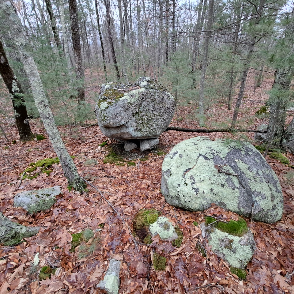
Foxborough Perched Boulder (4) submitted by stonetracker on 27th Jan 2023. Wider view.
(View photo, vote or add a comment)
Log Text: Site M on published map on small knoll. Access via same unnamed side trail off of Megley as Sites J, S, K, L and Y. After Site L, at the next trail jct, its about a100 yd bushwhack S or SE into the woods.
Foxborough Perched Boulder (3)
Date Added: 27th Jan 2023
Site Type: Natural Stone / Erratic / Other Natural Feature
Country: United States (New England)
Visited: Yes on 1st Jan 2023. My rating: Condition 5 Ambience 4 Access 2
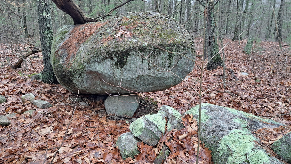
Foxborough Perched Boulder (3) submitted by stonetracker on 27th Jan 2023. Boulder with one prop stone. The short wall feature is directly in front of it.
(View photo, vote or add a comment)
Log Text: Site K on published map.Best accessed from Thurston St lot. About a 1/2 mile east on a side trail that runs off of Megley Trail, then a short 75 ft bushwhack into the woods. The same unnamed side trail goes right by Sites J, S, and L on published map.
Foxborough Perched Boulder (2)
Date Added: 14th Jan 2023
Site Type: Natural Stone / Erratic / Other Natural Feature
Country: United States
Visited: Yes on 1st Jan 2016. My rating: Condition 5 Ambience 4 Access 3
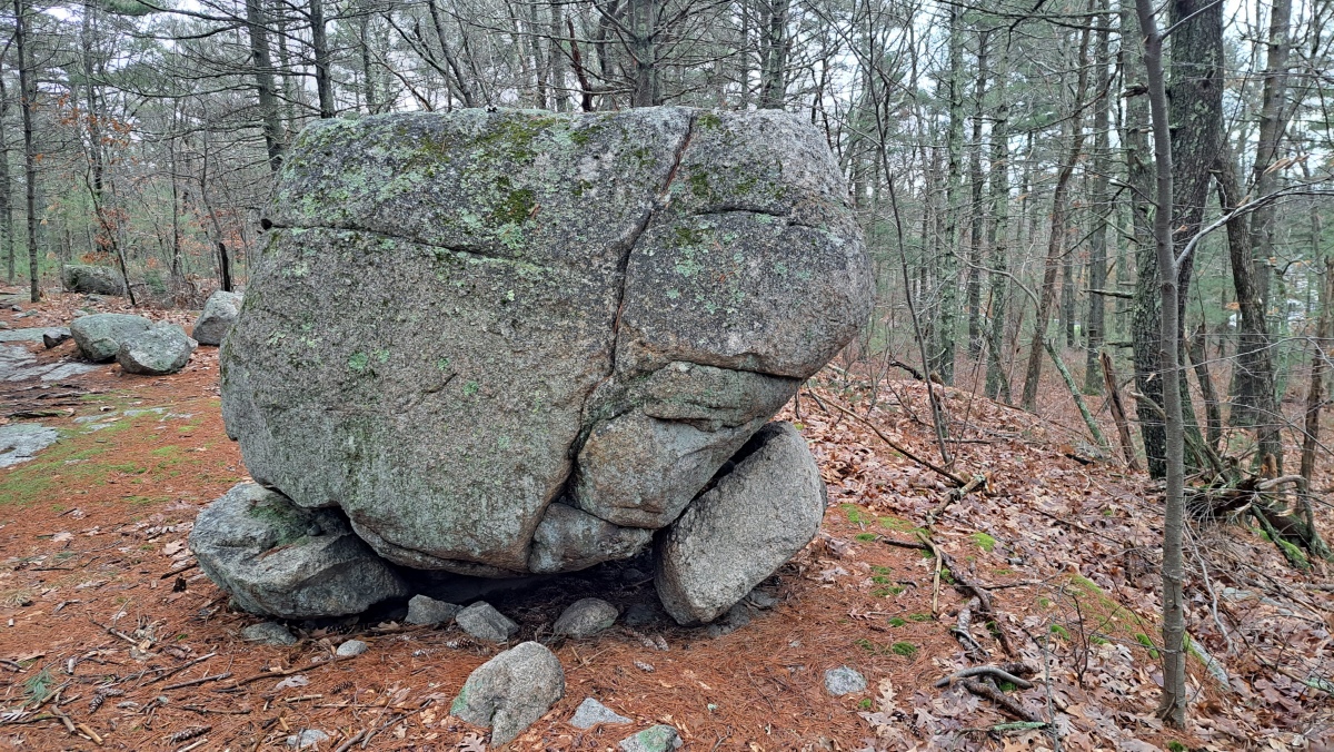
Foxborough Perched Boulder (2) submitted by stonetracker on 27th Jan 2023. Photo from 01/2023. There appear to be two prop stones for this boulder.
(View photo, vote or add a comment)
Log Text: On an unnamed side trail that runs east of Megley trail. Several structures are on this side trail.
Foxborough Perched Boulder (2)
Date Added: 26th Jan 2023
Site Type: Natural Stone / Erratic / Other Natural Feature
Country: United States
Visited: Yes on 1st Jan 2023. My rating: Condition 5 Ambience 4 Access 3
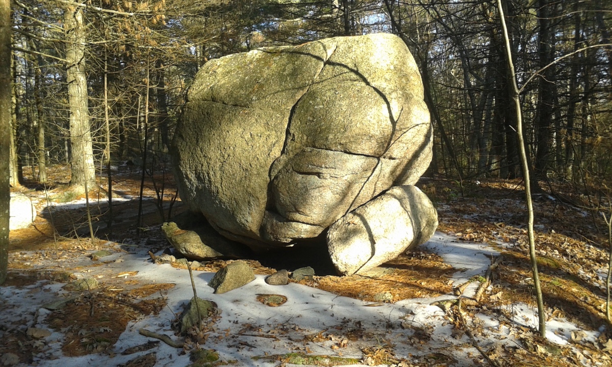
Foxborough Perched Boulder (2) submitted by stonetracker on 12th Jan 2023. Propped boulder on prominent ledge. Possibly just a geological/glacial feature but to.my eyes the props look deliberately placed.
(View photo, vote or add a comment)
Log Text: Visited again in 2023. No change.
Foxborough Perched Boulder (1)
Date Added: 12th Jan 2023
Site Type: Natural Stone / Erratic / Other Natural Feature
Country: United States
Visited: Yes on 1st Jan 2016. My rating: Condition 4 Ambience 4 Access 3

Foxborough Perched Boulder (1) submitted by stonetracker on 12th Jan 2023. Propped boulder on ledge. Site A on archive.org map.
(View photo, vote or add a comment)
Log Text: Right next to High Rock Trail but a bit of a walk from High Rk pkg area
Foxborough Marker Stone
Date Added: 15th Jan 2023
Site Type: Rock Outcrop
Country: United States (New England)
Visited: Yes on 1st Mar 2018. My rating: Condition 4 Ambience 3 Access 2
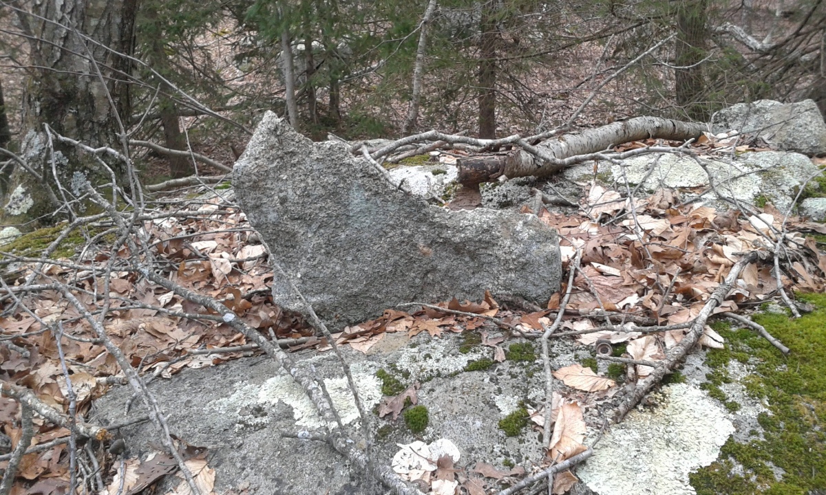
Foxborough Marker Stone submitted by stonetracker on 15th Jan 2023. Co-located with Foxborough Prayer Seat 1, at Site lowercase a on archive.org map. Thin 2x2 foot pointed rock sitting edgewise over a crack in outcrop. Unclear whether this is natural or deliberately placed.
(View photo, vote or add a comment)
Log Text: Either a deliberately placed marker rock or a chance placement of geology/glaciation. Co-located with Foxborough Prayer Seat 1 (see that site for access info).
Foxborough Dolmen
Date Added: 1st Feb 2023
Site Type: Marker Stone
Country: United States
Visited: Yes on 1st Jan 2023. My rating: Condition 4 Ambience 4 Access 2
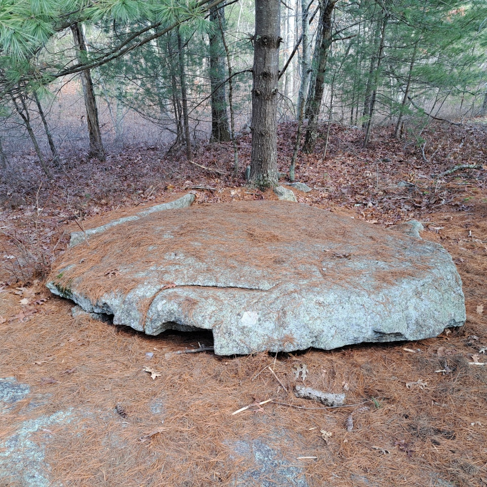
Foxborough Dolmen submitted by stonetracker on 1st Feb 2023. Overall view of dolmen or pedestaled slab, if you will. One of the small support stones is on the left.
(View photo, vote or add a comment)
Log Text: Site is equidistant from either the High Rock or Thurston St lots. From Thurston St, take Megley Trail about 3/4 of a mile. After you pass the side trail to Foxborough Standing Stone (2), take the next side trail for 50 ft east to the site which is on a flat ledge.
Foxborough Cairn
Date Added: 24th Jan 2023
Site Type: Cairn
Country: United States
Visited: Yes on 1st Feb 2016. My rating: Condition 1 Ambience 4 Access 3
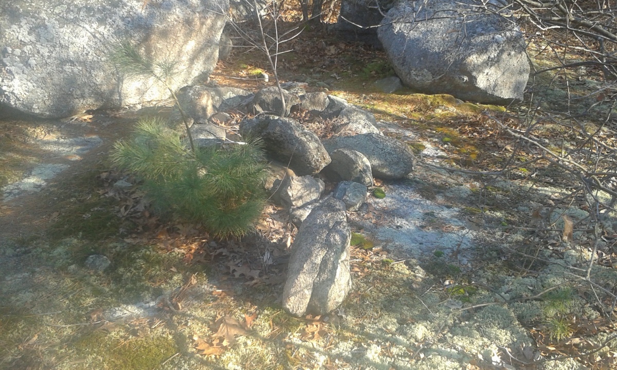
Foxborough Cairn submitted by stonetracker on 24th Jan 2023. The original published map showed a modern rock pile or cairn trail marker on a flat ledge. As of 2016, this was dismantled and re-built as a stone fire ring (shown in photo) with evidence of current use. So the original rock pile is gone.
(View photo, vote or add a comment)
Log Text: Park at Thurston St lot. This is on a high flat ledge on a side trail east of the Megley Trail.
Foster Mounds
Date Added: 4th Mar 2025
Site Type: Artificial Mound
Country: United States (The South)
Visited: Yes on 1st Feb 2025. My rating: Condition 3 Ambience 4 Access 3
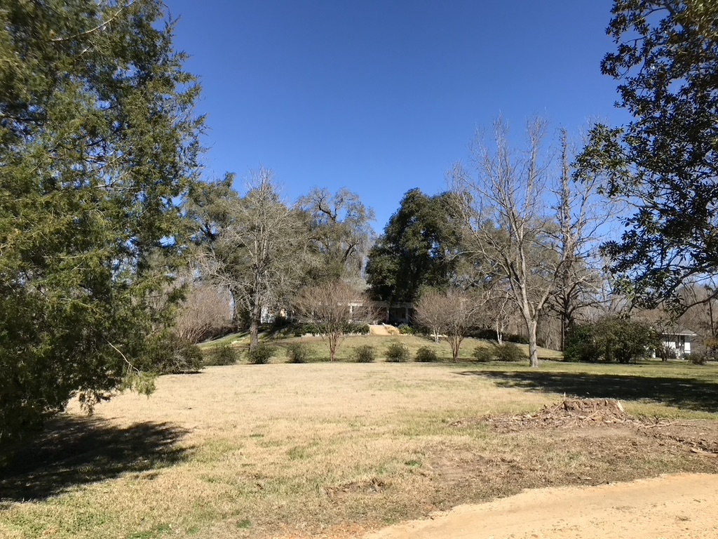
Foster Mounds submitted by AKFisher on 5th Aug 2023.
Foster Mounds in Mississippi. The largest platform mound at the site has a late 1800s home on its summit. The mound was lowered and altered to accommodate the house. Excavation of a second mound at the site showed that the site was a village area in 500 BC.
Photo courtesy Dr Greg Little, author of the Illustrated Encyclopedia of Native American Indian Mounds & Earthworks (2016).
(View photo, vote or add a comment)
Log Text: The site is largely as described and on private property in a residential area. I was lucky enough to bump into the landowner who said I could walk down his driveway to get a closer look at Mound A with his house on it. The mound is in very good condition. There is a flat area south of Mound A that obviously was part of the plaza.
Mound B is about a 200 yd walk south of and downhill from Mound A on the same side of Foster Mound Rd. It is fenced off but you can get within 100 yds of it. It is up on a bluff that borders St Catherine Creek and has suffered some erosion over the years. It is unclear at this point what the original shape of the mound was.
As for parking, there is no easy pulloff at Mound A, so I just parked in the Volunteer Fire Dept lot 100 yds north of Mound A and walked from there.
Fort Hill Sharpening Stone
Date Added: 2nd Apr 2024
Site Type: Polissoir
Country: United States (New England)
Visited: Yes. My rating: Condition 4 Ambience 4 Access 4
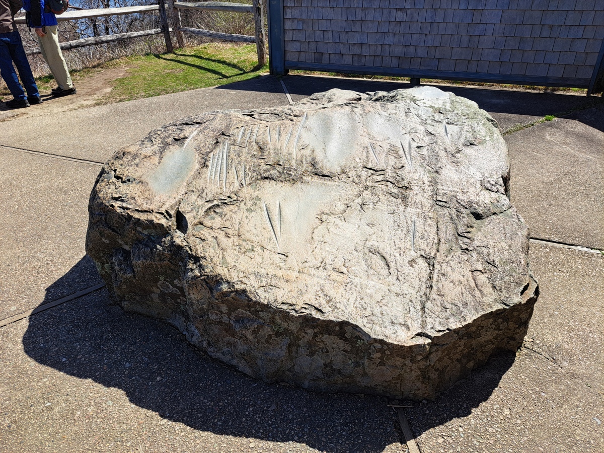
Fort Hill Sharpening Stone submitted by stonetracker on 1st Apr 2024. Sharpening stone
(View photo, vote or add a comment)
Log Text: Site is maintained by the Cape Cod National Seashore unit of the NPS and accessible by foot trail from either Hemenway Rd or the Fort Hill area. The trail from Hemenway is paved and therefore disabled access is possible. Rock and markings in very good condition.
Florence Mound
Date Added: 19th Dec 2024
Site Type: Artificial Mound
Country: United States (The South)
Visited: Yes on 1st Dec 2024. My rating: Condition 3 Ambience 4 Access 5
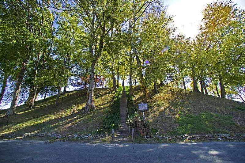
Florence Mound submitted by stonetracker on 16th Feb 2023. Florence Mound. Source: https://alabamamoundtrail.org/mound-site/florence/. Sponsor: University of Alabama.
(View photo, vote or add a comment)
Log Text: A very tall, steep Middle Woodland mound located in Florence AL near the north banks of the Tennessee River. Originally there was an 8 foot semi-circular embankment around the mound, but it was destroyed in the 19th or 20th century. The mound is now in a heavily developed industrial area within a fenced area. An adjacent city-owned museum provides a wealth of information on the site.
The mound is located a short distance east of Route 72 on a side street right after you cross over the Tennessee River from south to north. A paved driveway leads to a small parking area right after the museum.
Five Kiva Pueblo Ruins
Date Added: 19th Jun 2025
Site Type: Ancient Village or Settlement
Country: United States (The Southwest)
Visited: Yes on 1st May 2025. My rating: Condition 3 Ambience 5 Access 2
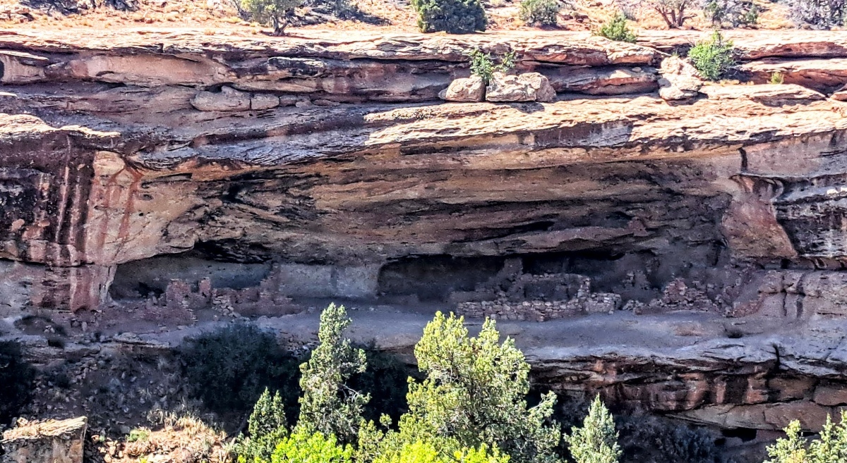
Five Kiva Pueblo Ruins submitted by stonetracker on 16th Jun 2025. View from the overlook of Five Kiva Pueblo on the other side of the canyon
(View photo, vote or add a comment)
Log Text: The site can be viewed remotely with binoculars or photo zoom from an overlook on the mesa top via a short path from the trail head. A number of web sites say that you can also hike an "easy" trail from this point down into the canyon floor and west up the other side to the alcove to get very close to the ruins. However if there was a single trail, it wasn't obvious to me. It was more of a steep scramble network of paths around boulders and ledges that I would rate as moderately difficult except maybe for a youngster ! In any case I didn't have the time and opted to stay at the overlook.
To get to the trail head from Blanding, take Route 191 from its junction with E 500 St south and take a right onto Ruins Rd. Follow Ruins Rd 1.7 miles to its unpaved dead end. There is a metal sign for the trailhead on the right with some rock steps and a pipe railing. The overlook is approximately 100 ft down the ledge.
Fitzhugh Mounds
Date Added: 12th Mar 2025
Site Type: Artificial Mound
Country: United States (The South)
Visited: Yes on 1st Feb 2025. My rating: Condition 2 Ambience 5 Access 5
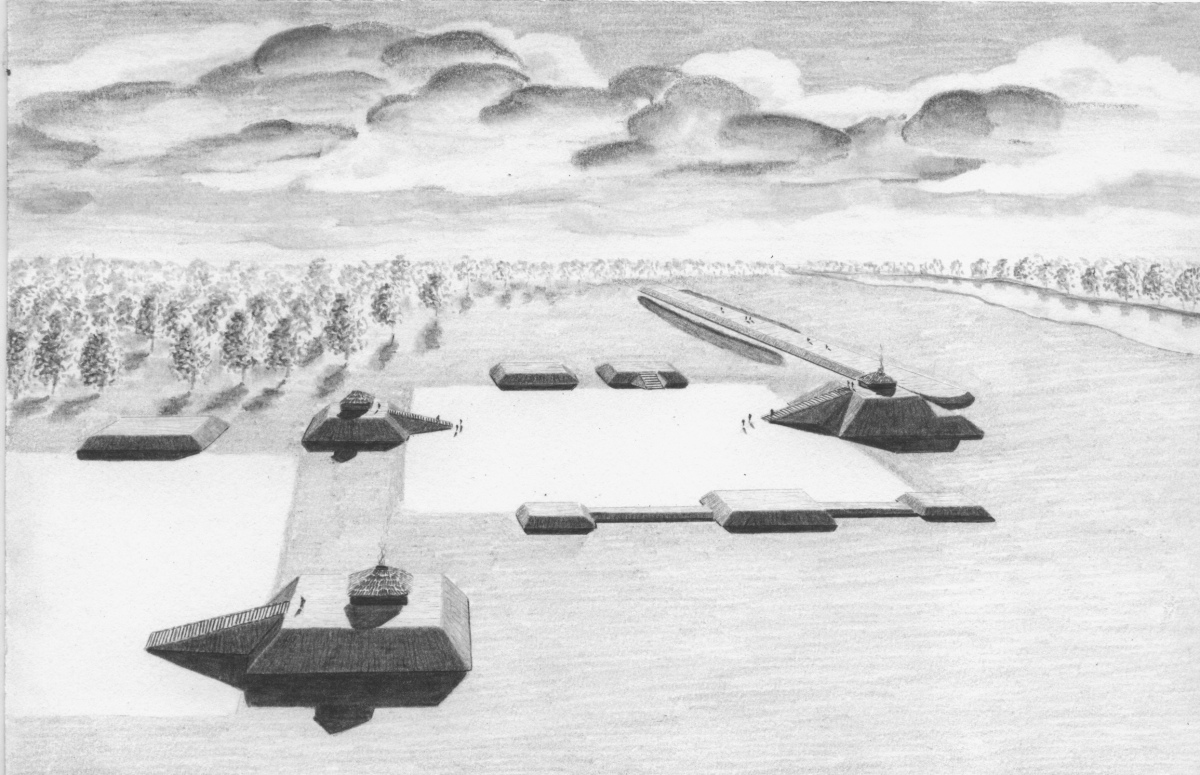
Fitzhugh Mounds submitted by AKFisher on 31st Jul 2023.
Archaeological reconstruction of the Fitzhugh Mound Complex in Louisiana from the mound encyclopedia. The elevated walkway (terrace) running from the right middle to the upper center was 2700-feet long and 75-feet wide. The large platform mound by it has a base of 250 x 160 feet and was 30-feet high. The site is dated to AD 1200 and only 2 mounds remain today.
Image courtesy Dr Greg Little, author of the Illustrated Encyclopedia of Native American Indian Mounds & Earthworks (2016).
(View photo, vote or add a comment)
Log Text: The site is very scenic, thus the Superb ambience rating. Unfortunately all that remains of the 7 mound site are two small mounds. The unusual elevated causeway is also long gone.
Mound D just so happens to now be the site of a still-used cemetery so I parked there. It is about 200 yds south of LA hwy 602 on a firm dirt road suitable for most vehicles. The interpretive signage is located a little farther south at the corner of Route 602 & Busby Rd.
False Kiva Rock Art
Date Added: 2nd Jun 2025
Site Type: Rock Art
Country: United States (The Southwest)
Visited: Yes on 1st May 2025. My rating: Condition 3 Ambience 5 Access 2
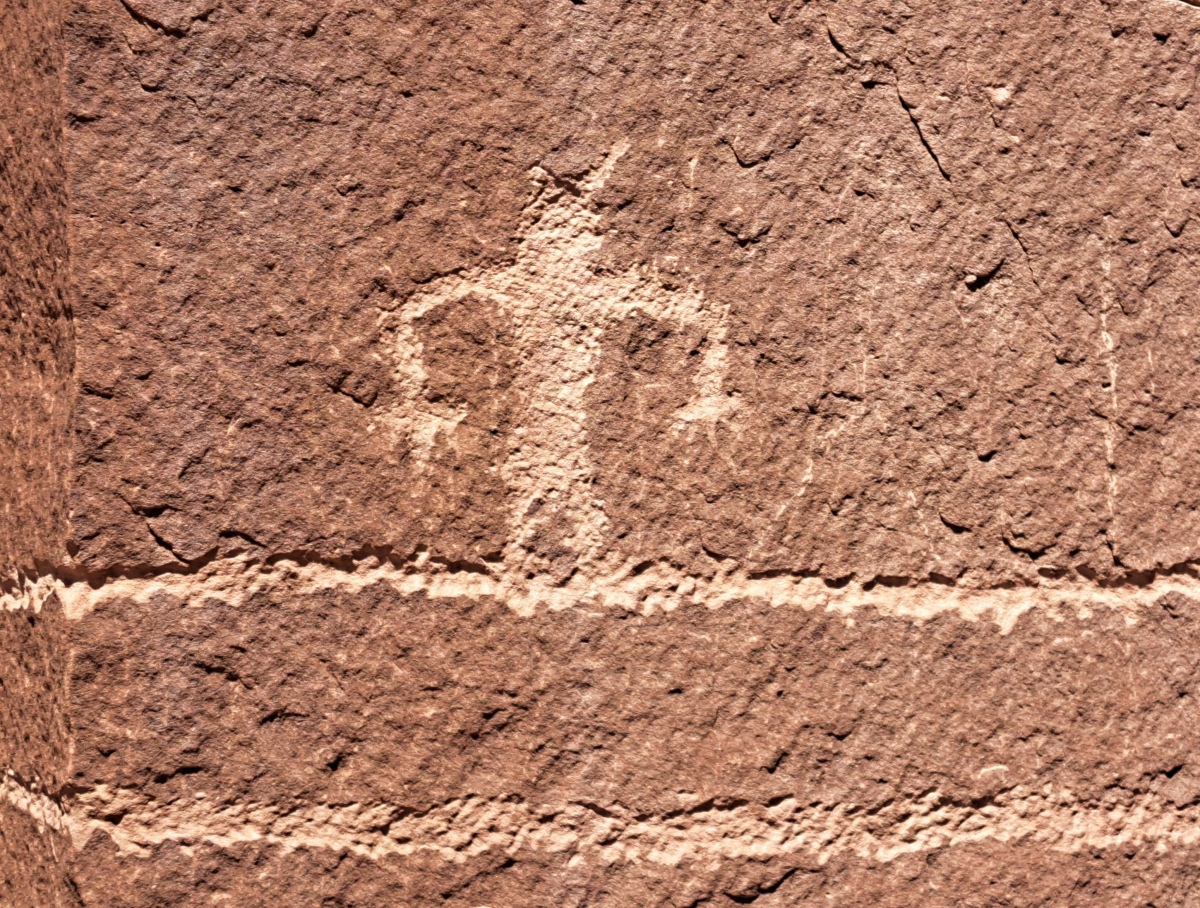
False Kiva Rock Art submitted by stonetracker on 2nd Jun 2025. A typical stick figure with splayed fingers, standing on a very long line.
(View photo, vote or add a comment)
Log Text: This site is a 1/4 mile one way hike up a rocky slope to the base of a cliff, with no more than 100 ft vertical gain.
The trail to False Kiva starts across the street from a large dirt parking lot variously known as the Amasa Back Trailhead, Hymasa Trailhead, or Capt Ahab area. The trailhead is unmarked and the trail often indistinct as it winds up the slope. See the Street View in comments for a photo of the route. Frankly it was easier just to pick my way around the rocks on the way up rather than try to find the specific trail. Your objective is the spot where the tallest cliff juts out to a point on the right. That is the location of False Kiva and petroglyphs.
To get to the Amasa Back Trailhead lot, follow Kane Creek/Kane Springs Blvd west out of Moab Center west and then southwest for about 5 miles total. For much of the way, you will be on the south side of the Colorado River, but eventually the road will turn to dirt and deviate southeast away from the river and then veer sharply southwest again. Amasa Back Trail lot is a large dirt parking area shortly after the southwest turn. The lot coordinates are 38.52829, -109.59634.
Evansville Mounds
Date Added: 9th Mar 2024
Site Type: Artificial Mound
Country: United States (The South)
Visited: Saw from a distance on 1st Feb 2024. My rating: Condition 3 Ambience 3

Evansville Mounds submitted by stonetracker on 10th Mar 2024. My futile attempt to inconspicuously approach Mound B from the back, close enough for a photo. At the end my progress was thwarted by a nettle-infested bayou. There are some things we won't cross !
The mound is currently only 2-3 ft high. A nearly 100 year old abandoned schoolhouse sits on top.
(View photo, vote or add a comment)
Log Text: Parking pulloff is on Austin Rd, which is 200-300 yds north of Mounds A and B, although B is at the closer end of the range. Entire site is on private farm property so viewing is from a distance. Unobstructed view of A if you walk down the street 200 ft, but trees obscure B and require bushwhacking on private property to see even partially. I was unable to spot Mound C, if it indeed still exists. Interpretive sign is intact.
