Contributory members are able to log private notes and comments about each site
Sites Stonetracker has logged. View this log as a table or view the most recent logs from everyone
Mound at Fort Toulouse - Fort Jackson Park
Date Added: 16th Feb 2023
Site Type: Artificial Mound
Country: United States (The South)
Visited: Would like to visit
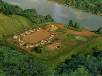
Mound at Fort Toulouse - Fort Jackson Park submitted by stonetracker on 17th Feb 2023. Artist's conception of site and village.
Source: Wikipedia Creative Commons.
(View photo, vote or add a comment)
Mounds (Indiana) - Circle Mound
Date Added: 31st Oct 2023
Site Type: Misc. Earthwork
Country: United States (Great Lakes Midwest)
Visited: Yes. My rating: Condition 4 Ambience 4 Access 4

Mounds (Indiana) - Circle Mound submitted by bat400 on 23rd Oct 2006. Mounds - Circle Mound Enclosure
A stitched photo. The viewer is standing before the entrance, looking due west, into the enclosure.
Photo: bat400 Oct 2006.
(View photo, vote or add a comment)
Log Text: Visited in late Oct 2023. There is parking nearby at the Woodland Shelter (see park map) and a short walk across a mowed field to the site.
Mounds (Indiana) - Earthwork B
Date Added: 31st Oct 2023
Site Type: Misc. Earthwork
Country: United States (Great Lakes Midwest)
Visited: Yes. My rating: Condition 2 Ambience 4 Access 3
Mounds (Indiana) - Earthwork B submitted by bat400 on 23rd Oct 2006. Mounds - Earthwork B.
The earthwork is oval, with an "entrance" on each end, and very small, only 8-9 feet long. It is in the immediate foreground, only an indentation. The Great Mound can be seen in the background, behind the rail fence.
Photo: bat400 Oct 2006.
(View photo, vote or add a comment)
Log Text: Visited in late Oct 2023. Just SE of the Great Mound and a 1/4 to 1/2 mile walk via paved trail from the visitor's center.
Mounds (Indiana) - Fiddleback Mound
Date Added: 31st Oct 2023
Site Type: Misc. Earthwork
Country: United States (Great Lakes Midwest)
Visited: Yes. My rating: Condition 3 Ambience 4 Access 3
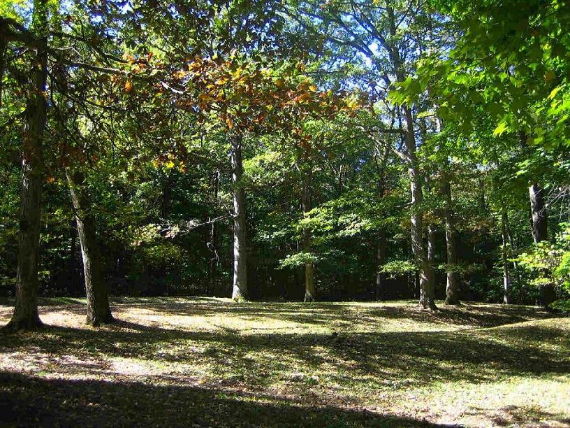
Mounds (Indiana) - Fiddleback Mound submitted by bat400 on 23rd Oct 2006. Mounds - Fiddleback Enclosure
The enclosure is oblong with a constricted middle; it's difficult to see from a single observation point on the ground. The summer solstice sunset falls beyond this enclosure when viewed from the center of the Great Mound.
Photo: bat400 Oct 2006.
(View photo, vote or add a comment)
Log Text: Visited in late Oct 2023. Ditch, embankment, and middle "pinch points" clearly visible. The earthwork is just to the west of the Great Mound and easily accessed via trail.
Mounds (Indiana) - Great Mound
Date Added: 31st Oct 2023
Site Type: Henge
Country: United States (Great Lakes Midwest)
Visited: Yes. My rating: Condition 4 Ambience 5 Access 3
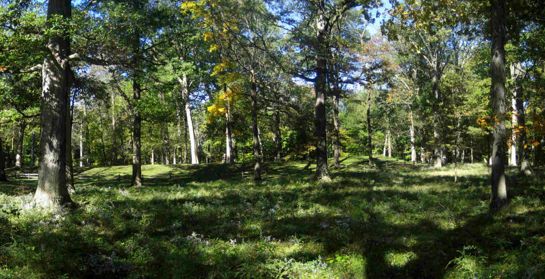
Mounds (Indiana) - Great Mound submitted by bat400 on 22nd Oct 2006. Mounds - The Great Mound.
View from the east with wild asters, the last flower of the season. The outer embankment wall prevents an outside viewer from seeing the central platform within. The exceptions are three dips in the embankment allowing a line of sight to the centers of three smaller earthwork enclosures surrounding the Great Mound.
Photo: bat400 Oct 2006.
(View photo, vote or add a comment)
Log Text: Visited late Oct 2023. This earthwork remains relatively unchanged since the original description was written. See my comments for changes that have taken place and some clarifications.
Mounds State Park (Indiana) - Earthwork D
Date Added: 31st Oct 2023
Site Type: Misc. Earthwork
Country: United States (Great Lakes Midwest)
Visited: Yes. My rating: Condition 3 Ambience 3 Access 3

Mounds (Indiana) - Earthwork D submitted by bat400 on 23rd Oct 2006. Mounds - Earthwork D.
"Lost" until 1988 when underbrush was removed from the site. Woods now block a clear view between the Great Mound and the center of this smaller, now shallow earthwork. The winter solstice sunset falls beyond the center of this enclosure when viewed from the center of the Great Mound. The forest debris slowly filled in the ditch within the outer embankment ring.
Photo: bat400 Oct 2006.
(View photo, vote or add a comment)
Log Text: Visited in late Oct 2023. This is ~ 150 yds or so southwest of the Great Mound, about 100 ft NE off of a side trail. Requires a bit more walking than the other earthworks closer to the Great Mound.
Moustoir tumulus
Date Added: 12th Dec 2024
Site Type: Chambered Tomb
Country: France (Bretagne:Morbihan (56))
Visited: Yes on 1st Sep 2024. My rating: Condition 3 Ambience 4 Access 4

Moustoir tumulus submitted by thecaptain on 10th Jun 2006. This massive great mound, 90 metres in length, 40 metres wide and 8 metres high, can be found just to the south of the hamlet of Moustoir, a few kilometres to the north of Carnac.
It has become terribly overgrown.
(View photo, vote or add a comment)
Log Text: One of the huge Carnacean tumuli, with a semi-megalithic burial chamber on the western end and at least two burial cists between the mid-point and eastern end of the tumulus. Currently there is no public access to any of these interior features - they are all blocked.
The tumulus lies just southwest of the village of Moustoir, which itself is a short distance off the D186 on the Quatre Chemins road. There is a large dirt parking lot directly opposite the tumulus, which is no more than 100-200 m away.
Nabers Mound Cemetery Site
Date Added: 16th Dec 2024
Site Type: Artificial Mound
Country: United States (The South)
Visited: Yes on 1st Dec 2024. My rating: Condition 4 Ambience 4 Access 4
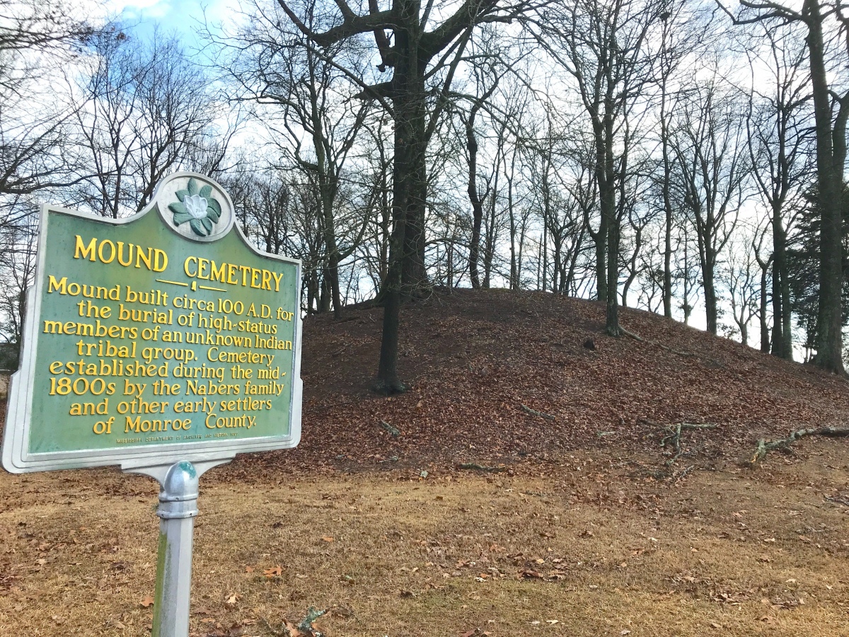
Nabers Mound Cemetery Site submitted by AKFisher on 25th Aug 2023. Obscure Mounds: "Nabors Mound Cemetery Mound" next to a golf course in Amory, Mississippi. Dated to AD 100.
Photo courtesy Dr Greg Little, author of the Illustrated Encyclopedia of Native American Indian Mounds & Earthworks (2016).
(View photo, vote or add a comment)
Log Text: A well-preserved Middle Woodland mound that was later used as a 19th to 20th century cemetery, no doubt benefiting its good condition. The property was acquired by the Archaeological Conservancy recently and it abuts a golf course development.
It's in a residential subdivision but on-street parking is not a problem and you can walk right up the mound. The mound is maybe 100 ft from the road, so the mobility-impaired can easily view it from a vehicle.
New Castle Complex
Date Added: 4th Dec 2023
Site Type: Henge
Country: United States (Great Lakes Midwest)
Visited: Yes. My rating: Condition 2 Ambience 2 Access 3
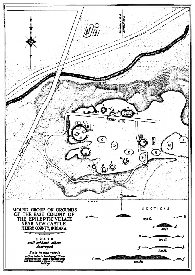
New Castle Complex submitted by AKFisher on 28th Aug 2023. 1937 survey of the New Castle Earthworks and mounds at New Castle, Indiana. There were 9 circular or C-shaped earthworks that had outer earthen walls with inner moats. There were 4 mounds and an odd ovoid earthwork enclosure with an inner moat with three large mounds inside the enclosure. Photo courtesy Dr Greg Little, author of the Illustrated Encyclopedia of Native American Indian Mounds & Earthworks (2016).
(View photo, vote or add a comment)
Log Text: Parking is in a lot on Route 103 south of the Little Blue River just across from the old paved hospital access road, now abandoned and gated, but open to hiking. The grounds comprising the complex are now owned by the Wilbur Wright Fish and Wildlife Area. The old paved hospital road leads to the section containing sites 1-4 and there is a side trail presumably leading south and east to what's left of the remaining sites which I did not try to explore.
In general, anything off of the hospital access road was extremely overgrown in October 2023. I was unable to find sites 2-4, and may only have found a part of the mound at site 1. The only time to find anything here may be in winter when the leaves are off the trees as there are no obvious trails and bushwhacking is required.
Newspaper Rock State Park
Date Added: 23rd May 2025
Site Type: Rock Art
Country: United States (The Southwest)
Visited: Yes on 1st May 2025. My rating: Condition 3 Ambience 4 Access 4
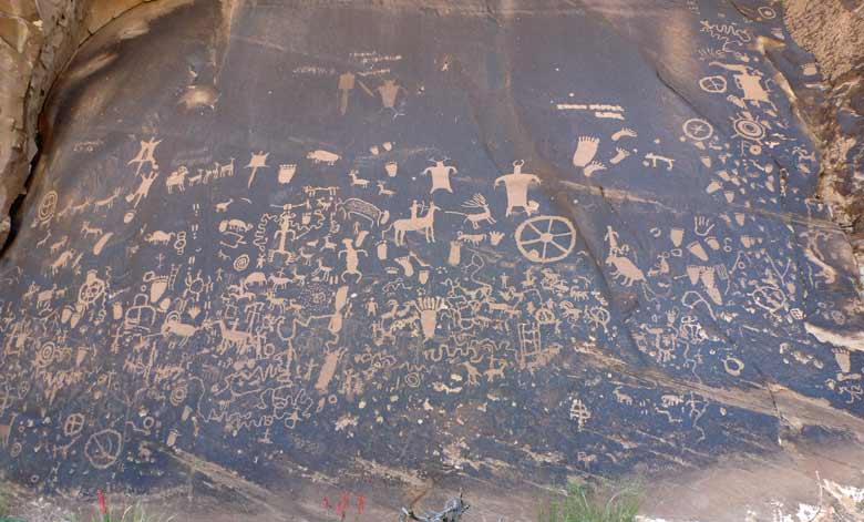
Newspaper Rock State Park submitted by baz on 5th Jun 2011. Newspaper Rock
(View photo, vote or add a comment)
Log Text: Probably the most accessible of all the petroglyph sites in SE Utah....once you get there. It is not near any towns of size so prepare accordingly.
To get there, either drive north 14 miles from Monticello or south 40 miles from Moab on Route 191. Then head west on Route 211 about 12 miles to the site. All the roads are paved and there is a restroom onsite.
From the paved parking area it is just steps away to the rock art panel on a flat dirt path. Might even be wheelchair accessible.
One plus: from that point on Route 211 to the Needles District of Canyonlands there are a lot of rock art sites...and the scenery is stunning !
Nitschke Mounds State Park
Date Added: 6th Aug 2024
Site Type: Artificial Mound
Country: United States (Great Lakes Midwest)
Visited: Yes on 1st Jul 2024. My rating: Condition 2 Ambience 4 Access 4
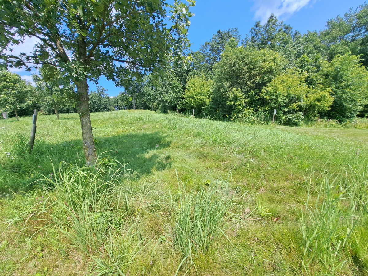
Nitschke Mounds State Park submitted by stonetracker on 7th Aug 2024. Mound 9 - Buffalo or Bear. The head and forelegs are in the foreground.
(View photo, vote or add a comment)
Log Text: The effigy mounds are in a county park just 200 yds north of the paved road. Ample parking in a dirt lot with a picnic shelter and interpretation kiosk.
Considering that the park is maintained mostly by volunteers, the condition of the site is surprisingly good. About 2/3rds of the mounds are at least somewhat visible and cleared of trees and shrubs. Native long grass has been left on the mounds to discourage walking over them. A short trail system weaves in and out among the mounds and is regularly maintained by mowing. The remaining 1/3 of the mounds still need to be cleared off and the trail system extended to include them. They are mostly in a wooded area at present. Interpretation and signage at each mound is sparse, so I assume this is a work in progress. There is a bit more information at the entrance kiosk.
Effigy mounds by their very nature tend to be low profile and hard to photograph. This is particularly the case at Nitschke where erosion has really taken its toll. So my photos and videos are limited to just a few of the biggest and most visible mounds.
Norwood Mound
Date Added: 31st Oct 2023
Site Type: Artificial Mound
Country: United States (Great Lakes Midwest)
Visited: Yes. My rating: Condition 4 Ambience 4 Access 5

Norwood Mound submitted by stonetracker on 23rd Feb 2023. Creative Commons photo of mound
(View photo, vote or add a comment)
Log Text: Visited late Oct 2023. In a city park and publicly accessible with some parking. Mound is in good condition.
Oakville Mounds
Date Added: 9th Feb 2023
Site Type: Artificial Mound
Country: United States (The South)
Visited: Would like to visit
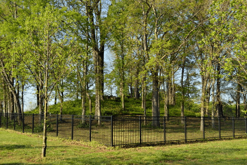
Oakville Mounds submitted by stonetracker on 16th Feb 2023. Burial mound. Source: https://alabamamoundtrail.org/mound-site/oakville-indian-mounds-park/. Sponsor: University of Alabama.
(View photo, vote or add a comment)
Old Cahawba Archaeological Park
Date Added: 16th Feb 2023
Site Type: Misc. Earthwork
Country: United States (The South)
Visited: Would like to visit
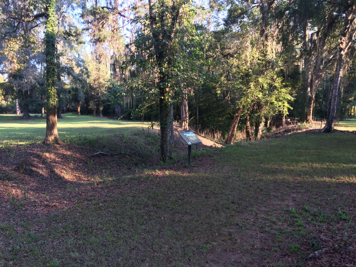
Old Cahawba Archaeological Park submitted by stonetracker on 16th Feb 2023. Portion of moat. Source: https://alabamamoundtrail.org/mound-site/old-cahawba/. Sponsor: University of Alabama.
(View photo, vote or add a comment)
Old King Barrows
Date Added: 19th Jan 2023
Site Type: Barrow Cemetery
Country: England (Wiltshire)
Visited: Would like to visit
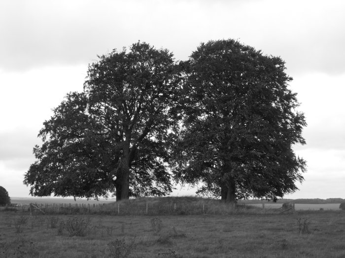
Old King Barrows submitted by TimPrevett on 10th Oct 2006. Old King Barrows are a more sparsely grouped cluster than the New, and as typical of most of them, either closed in by, or topped by Beech Trees.
(View photo, vote or add a comment)
Owl Creek
Date Added: 7th Dec 2024
Site Type: Artificial Mound
Country: United States (The South)
Visited: Yes on 1st Dec 2024. My rating: Condition 3 Ambience 4 Access 5
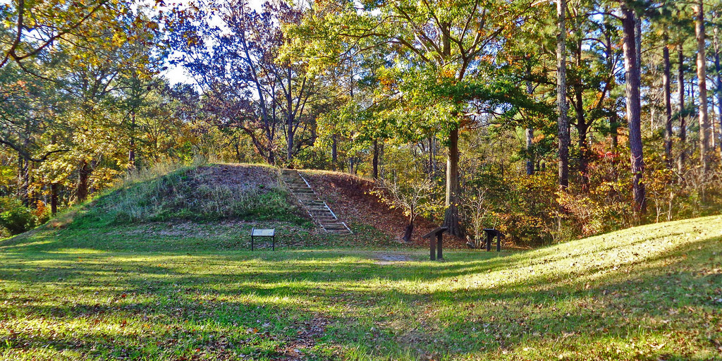
Owl Creek submitted by Creative Commons on 6th Jan 2019. Owl Creek Mounds The five Mississippian period platform mounds at this site were built between 1100 and 1200 A.D. The U.S. Forest Service owns two of the mounds including the largest 17-foot-high Mound I. Both are open to public visitation. Archeological excavations conducted at the site in 1991-1992 by Mississippi State University revealed the foundation remains of a ceremonial temple or elite residence that once stood atop Mound
www.nps.gov/nr/travel/mounds/owl.htm ...
(View photo, vote or add a comment)
Log Text: Site is as described. The portion managed by the Forest Service contains two extant mounds, including Mound 1 the largest in the group. Mound 1 is pretty close to its original rectangular platform shape. The adjacent Mound 2 looks like it has been damaged by plowing but still quite visible. I was unable to find any obvious evidence of the remaining 3 mounds across the street.
There is a parking lot right next to Mound 2 and Mound 1 is a very short distance away.
Parkin
Date Added: 15th Mar 2024
Site Type: Ancient Village or Settlement
Country: United States (The South)
Visited: Yes on 1st Feb 2024. My rating: Condition 4 Ambience 4 Access 5
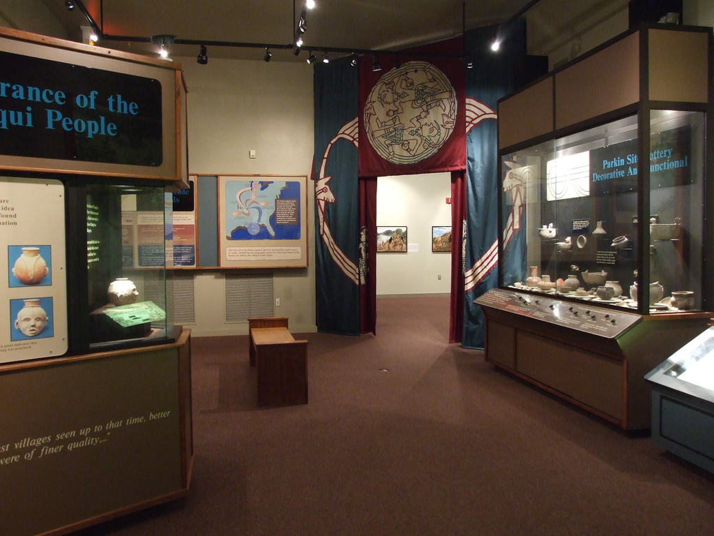
Parkin submitted by Flickr on 20th Sep 2015. Museum at the Parkin Archaelogical State Park in Parkin Arkansas. They are excavating the remains of a Native American village which is believed to have been visited by Hernando De Soto in 1541. Image copyright: mdsilverhawke, hosted on Flickr and displayed under the terms of their API.
(View photo, vote or add a comment)
Log Text: Well preserved Late Mississippian village and mound site with a nice museum. A paved trail provides good access to and interpretation of all cultural features at the site, including historic features. Appears to be fully accessible to disabled visitors.
Petit Mont
Date Added: 2nd Dec 2024
Site Type: Chambered Tomb
Country: France (Bretagne:Morbihan (56))
Visited: Yes on 1st Sep 2024. My rating: Condition 3 Ambience 4 Access 3
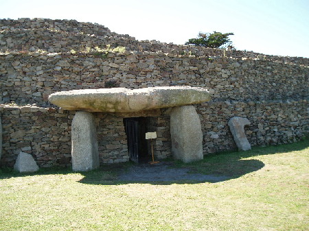
Petit Mont submitted by AlexHunger on 20th Dec 2004. Petit Mont in Arzon, dating to about 4600 BCE at the earliest, is one of the most significant Cairns in Britany, but unfortunately one of the most brutaly vandalized. In 1942, German troops built a bunker and Flak emplacement into the South East Corner of the cairn, which compeltely destroyed one of the chambers and caused the collapse of the second one pictured above, which has since been restored. The megalithic entrance is sought to be an addition from Gallo-Roman times. All pictures have be...
(View photo, vote or add a comment)
Log Text: An important Neolithic site with two extant passage graves in good condition and a large surrounding cairn. It has a complex construction and restoration history, and has suffered much use and abuse (particularly in WW2) over the millennia.
Entrance is via paid admission and guided tours are available in season but I was informed that they are only offered in French at the moment. However, unlike Gavrinis, I was allowed unescorted and unimpeded access to the bunker museum, the grounds, and the interior of both passage graves.
Parking and getting to the site was a little tricky, as construction was going on in the parking lot and there was no obvious signage pointing the way to the site from there. But there is a 300m trail in the back of the lot that leads to the ticket office and information kiosk. The parking area is located at the end of the Rue du Petit Mont.
Pharr Mounds
Date Added: 20th Dec 2024
Site Type: Artificial Mound
Country: United States (The South)
Visited: Yes on 1st Dec 2024. My rating: Condition 3 Ambience 5 Access 2

Pharr submitted by bat400 on 6th Sep 2012. Panorama of all the mounds visible from the ridge of the Natchez Trace, overlooking the site.
Photo by bat400, October 2011.
(View photo, vote or add a comment)
Log Text: This is a large Middle Woodland site of 8 conical or rounded mounds spread out over a 80-90 acre field. It is located at milepost 286 of the Natchez Trace in MS, on the north bound side of the highway. The mounds today range in height from 2 to 18 ft. Generally speaking, the tallest mounds are closest to the road. Four mounds were either partially or fully excavated in the 1960s by the NPS.
There is a large car park overlooking the site, complete with interpretation and rest rooms. Although 4-5 mounds can be seen from the lot, they are a considerable distance away so binoculars are helpful. Trails interconnect many of the mounds, but there is a fair amount of walking involved. A circuit of Mounds A-D, the four closest, was just under a mile including the return trip to the parking area. I did not visit the others.
Picnic Point Effigy Mounds
Date Added: 6th Aug 2024
Site Type: Artificial Mound
Country: United States (Great Lakes Midwest)
Visited: Yes on 1st Jul 2024. My rating: Ambience 3 Access 3
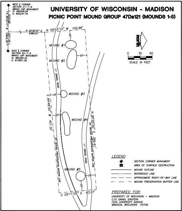
Picnic Point Effigy Mounds submitted by stonetracker on 6th Aug 2024. Map showing layout of the five-mound main group
(View photo, vote or add a comment)
Log Text: The mounds are on a peninsula in Lake Mendota on conservation land owned by the Univ of Wisc. They are accessible via the Lakeshore Trail. Parking is available at the trailhead for a fee. The first group of 5 mounds is about a 1/4 mile level walk from the lot, next to and just north of the trail. The last conical mound is another 600 ft east along the trail and just to its south.
Unfortunately site maintenance seems to be cyclical at best. I was unable to find or positively identify any of the mounds due to summer overgrowth, suggesting that non growing seasons may present better viewing opportunities. There was also no obvious interpretation signage. However, Andrew Khitsun (the owner of the Wisconsin Mounds site) has posted a few photos with most of the overgrowth and some trees removed from the mounds. They are undated but I assume they are at least post-2000.
Obviously they have been better maintained in the past than currently.
